19th Century Maps
to
1,667
2,202
74
2,279
71
9
9
4
2
2
1
1
2,969
2,279
474
3
290
34
10
126
10
37
9
2
5
4
3
3
2,241
70
32
13
11
358
175
108
105
102
2,279
2,279
2,279
104
23
9
8
7
Period: 19th Century
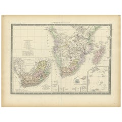
Antique Map of Southern Africa by Levasseur, 1875
Located in Langweer, NL
Antique map titled 'Afrique Méridionale'. Large map of Southern Africa. This map originates from 'Atlas de Géographie Moderne Physique et Politique' b...
Category
Antique 19th Century Maps
Materials
Paper
$382 Sale Price
20% Off
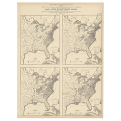
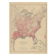
Pl. 16 Antique Chart of the US Population 1790-1820 by Walker, '1874'
Located in Langweer, NL
Antique chart titled 'The progress of the nation, 1790-1820. Maps showing in five degrees of density the distribution within the territory east of the 100th meridian of the populatio...
Category
Antique 19th Century Maps
Materials
Paper
$429 Sale Price
20% Off
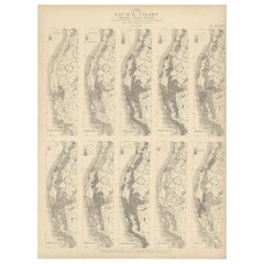
Antique Chart of the Pacific Coast '1874'
Located in Langweer, NL
Antique chart titled 'Maps of the Pacific Coast exhibiting various subjects. Compiled from the statistics of the eight and ninth census of the United Sta...
Category
Antique 19th Century Maps
Materials
Paper
$477 Sale Price
20% Off
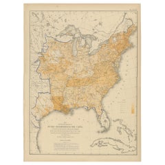
Pl. 34 Antique Chart of the US Public Indebtedness, 1874
Located in Langweer, NL
Antique chart titled 'Map showing the degree of public indebtedness per capita. Contracted by state, county or municipal authority, at the close of the fiscal year nearest the census...
Category
American Antique 19th Century Maps
Materials
Paper
$477 Sale Price
20% Off
Antique Chart of the US Malarial Deaths, '1874'
Located in Langweer, NL
Antique chart titled 'Map showing the proportion of deaths from malarial diseases to deaths from all causes. Compiled from the returns of mortality at th...
Category
Antique 19th Century Maps
Materials
Paper
$477 Sale Price
20% Off
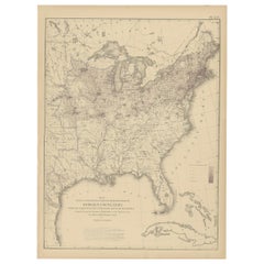
Pl. 25 Antique Chart of the US Foreign Population in 1870, '1874'
Located in Langweer, NL
Antique chart titled 'Map showing five degrees of density the distribution of the foreign population within the territory of the United States east of the 100th Meridian. Compiled fr...
Category
Antique 19th Century Maps
Materials
Paper
$429 Sale Price
20% Off
Pl. 9 Antique Hypsometric Sketch of the United States by Walker, 1874
Located in Langweer, NL
Antique chart titled 'Hypsometric sketch of the United States. The level curves of 400 and 800 feet of elevation constructed by A. Guyot. The level curves of 2000, 4000 and 8000 feet...
Category
Antique 19th Century Maps
Materials
Paper
$429 Sale Price
20% Off
Antique Map of the Coal Fields of the United States by Walker '1874'
Located in Langweer, NL
Antique map titled 'Map of the coal fields of the United States, compiled from state reports and data specially furnished by Prof. W.B. Rogers, E.T. Cox, A.H. Worthen, S.S. Lyon, Ric...
Category
Antique 19th Century Maps
Materials
Paper
Pl. 16A Antique Chart of the US Population 1830-1840 by Walker, 1874
Located in Langweer, NL
Antique chart titled 'Map showing, in five degrees of density, the distribution, within the territory east of the 100th Meridian, of the population of the United States, excluding In...
Category
Antique 19th Century Maps
Materials
Paper
$429 Sale Price
20% Off
Antique County Map, Norfolk, English, Framed Lithography, Cartography, Victorian
Located in Hele, Devon, GB
This is an antique lithography map of Norfolk. An English, framed atlas engraving of cartographic interest, dating to the mid 19th century and later.
Superb lithography of Norfolk a...
Category
British Victorian Antique 19th Century Maps
Materials
Glass, Wood
Antique Leicestershire Map, English, Framed Cartographic Interest, Victorian
Located in Hele, Devon, GB
This is an antique lithography map of Leicestershire. An English, framed atlas engraving of cartographic interest, dating to the mid 19th century and later.
Superb lithography of Le...
Category
British Victorian Antique 19th Century Maps
Materials
Wood
Antique Map of Calvados ‘France’ by V. Levasseur, 1854
Located in Langweer, NL
Antique map titled 'Dépt. du Calvados'. Map of the French department of Calvados, France. This area of France is known for its production of Calvados, the world's fines apple brandy....
Category
Antique 19th Century Maps
Materials
Paper
$191 Sale Price
20% Off
Antique Map of Mayenne ‘France’ by V. Levasseur, 1854
Located in Langweer, NL
Antique map titled 'Dépt. de la Mayenne'. Map of the French department of Mayenne, France. This area is part of the Loire Valley wine region. The map is surrounded by elaborate decor...
Category
Antique 19th Century Maps
Materials
Paper
$171 Sale Price
20% Off
Antique Map of Various Ports in France by Röder 'circa 1800'
Located in Langweer, NL
Antique print showing various ports in France. Including plans of St. Malo, Granville, Nantes, Dieppe, Bourdeauz, Gibraltar, Lorient, Boulogne sur Mer, Les Sables d'Olonne, Brest, Le Trèport, Antibes, La Ciotat...
Category
Antique 19th Century Maps
Materials
Paper
$1,766 Sale Price
20% Off
Antique Map of Western Europe by H. Kiepert, circa 1870
Located in Langweer, NL
Antique map titled 'Gallia, Britannia, Germania'. This map depicts a large part of Western Europe including countries like Germany, France, Great Britain, The Netherlands and more. T...
Category
German Antique 19th Century Maps
Materials
Paper
Antique Map of China and Japan by A.K. Johnston, 1865
Located in Langweer, NL
Antique map titled 'China and Japan'. Depicting Eastern China, the Islands of Japan and more. This map originates from the ‘Royal Atlas of Modern Geography’ by Alexander Keith Johnst...
Category
Antique 19th Century Maps
Materials
Paper
$286 Sale Price
20% Off
Denmark – Large Format Antique Map by Pinkerton, Fine English Engraving c.1814
By Pinkerton
Located in Langweer, NL
Denmark – Large Format Antique Map by Pinkerton, Fine English Engraving c.1814
This impressive antique map of Denmark originates from John Pinkerton’s celebrated Modern Atlas, publi...
Category
English Antique 19th Century Maps
Materials
Paper
$413 Sale Price
30% Off
Antique Map of the East Indies by Van der Aa '1849'
Located in Langweer, NL
Antique map titled 'Kaart van Nederlands OostIndie door A.J. van der Aa'. Old map of the Dutch East Indies. This map originates from 'Nederlands Oost-Indië, of beschrijving der Neder...
Category
Antique 19th Century Maps
Materials
Paper
$382 Sale Price
20% Off
Antique Map of Java and Batavia of nowadays Indonesia, '1818'
Located in Langweer, NL
Antique map titled 'Kaart van het Eiland Java'. A rare and attractive early 19th century Dutch map of Java with a large inset map of Batavia. One of 12 maps from 'Atlas van Overzeesc...
Category
Antique 19th Century Maps
Materials
Paper
$1,146 Sale Price
20% Off
Antique Map of South America by Dower, ‘circa 1845’
Located in Langweer, NL
Antique map titled 'South America'. Old map of South America. Published by Orr & Company, Amen Corner, Paternoster Row, London.
Category
Antique 19th Century Maps
Materials
Paper
$143 Sale Price
20% Off
Antique Map of Aude ‘France’ by V. Levasseur, 1854
Located in Langweer, NL
Antique map titled 'Dépt. de 'l'Aude'. Map of the French department of Aude, France. This area of France is famous for its wide variety of vineyards and wine production. In the east ...
Category
Antique 19th Century Maps
Materials
Paper
$171 Sale Price
20% Off
Antique Map of Indonesia by C.F. Beautemps-Beaupre, circa 1807
Located in Langweer, NL
Antique map titled 'Carte de la partie du grand archipel d'Asie'. Map of Indonesia showing tracks of Recherche and Esperance in 1792-1793. This map is...
Category
Antique 19th Century Maps
Materials
Paper
$715 Sale Price
20% Off
Antique Map of the Harbour of Taloo by J. Cook, 1803
By James Cook
Located in Langweer, NL
Antique map French Polynesia titled 'Schets van de Havenen aan de Noord Zijde van Eimeo'. Plan of the harbour of Taloo in the Island of Moorea, one of the Society Islands, French Polynesia. Originates from 'Reize rondom de Waereld door James Cook...
Category
Dutch Antique 19th Century Maps
Materials
Paper
Antique Map of Southeastern Australia by F. von Stülpnagel, 1850
Located in Langweer, NL
Antique map titled 'Süd-Östlichen Australien'. Map of southeastern Australia with inset maps of southwest Australia and Tasmania compiled by the military cartographer Friedrich von S...
Category
Antique 19th Century Maps
Materials
Paper
$170 Sale Price
35% Off
Antique Map of South-Western Germany by A.K. Johnston, 1865
Located in Langweer, NL
Antique map titled 'South-Western Germany'. This map originates from the ‘Royal Atlas of Modern Geography’ by Alexander Keith Johnston. Published by William Blackwood and Sons, Edinb...
Category
Antique 19th Century Maps
Materials
Paper
$238 Sale Price
20% Off
Antique Map of Loire Inferieure ‘France’ by V. Levasseur, 1854
Located in Langweer, NL
Antique map titled 'Dépt. de la Loire Inferieure'. Map of the French department of Loire Inferieure, France (currently known as Loire-Atlantique.) This area of France is part of the ...
Category
Antique 19th Century Maps
Materials
Paper
$191 Sale Price
20% Off
Antique Map of Creuse ‘France’ by V. Levasseur, 1854
Located in Langweer, NL
Antique map titled 'Dépt. de la Creuse'. Map of the French department of Creuse, France. This region is well known for its apple cider made from Limousin apples and its international...
Category
Antique 19th Century Maps
Materials
Paper
$171 Sale Price
20% Off
Antique Map of Tarn 'France' by V. Levasseur, 1854
Located in Langweer, NL
Antique map titled 'Dépt. du Tarn'. Map of the French department of Tarn, France. This area produces a variety of traditional wines, including Cahors, Mauzac, Loin de l'Oeil and Onde...
Category
Antique 19th Century Maps
Materials
Paper
$171 Sale Price
20% Off
Antique Map of North-Western and South Africa by A.K. Johnston, 1865
Located in Langweer, NL
Two maps on one sheet titled 'North-Western Africa' and 'Southern Africa'. Depicting Morocco, Algeria, Tunis, Cape Colony, Natal and more. This map originates from the ‘Royal Atlas o...
Category
Antique 19th Century Maps
Materials
Paper
$286 Sale Price
20% Off
Antique Map of Spain, Mauritia and Africa by H. Kiepert, circa 1870
Located in Langweer, NL
Antique map titled 'Hispania, Mauretania et Africa'. This map originates from 'Atlas Antiquus. Zwölf Karten zur Alten Geschichte' by H. Kiepert. Published in Berlin, circa 1870.
Category
Antique 19th Century Maps
Materials
Paper
$143 Sale Price
20% Off
Antique Map of Oise ‘France’ by V. Levasseur, 1854
Located in Langweer, NL
Antique map titled 'Dépt. de l'Oise'. Map of the French department of Oise, France. The map is surrounded by elaborate decorative engravings designed to illustrate both the natural b...
Category
Antique 19th Century Maps
Materials
Paper
$171 Sale Price
20% Off
Antique Map of Turkey in Asia by A.K. Johnston, 1865
Located in Langweer, NL
Antique map titled 'Turkey in Asia (Asia Minor) and Transcaucasia'. This map originates from the ‘Royal Atlas of Modern Geography’ by Alexander Keith Johnston. Published by William B...
Category
Antique 19th Century Maps
Materials
Paper
$262 Sale Price
20% Off
Antique Lithography Map, Buckinghamshire, English, Framed Cartography, Victorian
Located in Hele, Devon, GB
This is an antique lithography map of Buckinghamshire. An English, framed atlas engraving of cartographic interest, dating to the mid 19th century and later.
Superb lithography of B...
Category
British Victorian Antique 19th Century Maps
Materials
Wood, Paper
Antique Map of South Australia by A.K. Johnston, 1865
Located in Langweer, NL
Antique map titled 'South Australia, New South Wales, Victoria & Queensland'. This map originates from the ‘Royal Atlas of Modern Geography’ by Alexander Keith Johnston. Published by...
Category
Antique 19th Century Maps
Materials
Paper
$286 Sale Price
20% Off
Antique Map of Isère ‘France’ by V. Levasseur, 1854
Located in Langweer, NL
Antique map titled 'Dépt. de l'Isère'. Map of the French department Isere. It is presented with a statistic description, information about the territory, curiosities and famous peopl...
Category
Antique 19th Century Maps
Materials
Paper
$171 Sale Price
20% Off
Antique Map of Russia in Europe by J. Thomson, 1819
Located in Langweer, NL
Fine early-19th century map, precisely engraved with an impressive amount of detail. With inset view of equestrian statue of Peter the Great. Issued Edinburgh, 1819 by J. Thomson. Dr...
Category
Antique 19th Century Maps
Materials
Paper
Antique Map of Western Polynesia, 1849
Located in Langweer, NL
Antique map titled 'Ost-Polynesien'. Detailed map of the western Pacific extending from the Celebes to Samoa and including part of Australia. Insets of...
Category
Antique 19th Century Maps
Materials
Paper
$166 Sale Price
30% Off
Antique Map of Seine Inférieure, France by V. Levasseur, 1854
Located in Langweer, NL
Antique map titled 'Dépt. de la Seine Inférieure'. Map of the French department of Seine Inferieure, France. Centered around its capital of Rouen, this area is known for its producti...
Category
Antique 19th Century Maps
Materials
Paper
$191 Sale Price
20% Off
Antique Map of Cher in France, 1854
Located in Langweer, NL
Antique map titled 'Dépt. des Bses. Pyrénées'. Map of the French department of Basses Pyrenees, France. This department includes the Jurancon wine region, famous for its production d...
Category
Antique 19th Century Maps
Materials
Paper
$171 Sale Price
20% Off
Antique Map of Côtes du Nord ‘France’ by V. Levasseur, 1854
Located in Langweer, NL
Antique map titled 'Dépt. des Côtes du Nord'. Map of the French department of Cotes du Nord, a maritime region in Brittany, France. The whole is surrounded by elaborate decorative en...
Category
Antique 19th Century Maps
Materials
Paper
$191 Sale Price
20% Off
Antique Map of the Province of Canada 'East' by A.K. Johnston, 1865
Located in Langweer, NL
Antique map titled 'Province of Canada (Eastern Sheet)'. Depicting New Brunswick, Newfoundland, Cape Breton Island, Prince Edward Island, Nova Scotia and m...
Category
Antique 19th Century Maps
Materials
Paper
$248 Sale Price
20% Off
Antique Map of England and Wales by A.K. Johnston, 1865
Located in Langweer, NL
Antique map titled 'England and Wales (Southern Sheet)'. With an inset map of the Scilly Islands. This map originates from the ‘Royal Atlas of Modern Geography’ by Alexander Keith Jo...
Category
Antique 19th Century Maps
Materials
Paper
$262 Sale Price
20% Off
Antique Map of North East Borneo and North Sulawesi by P.M.G. Vandermaelen
Located in Langweer, NL
Contemporary colored lithographed map. Relief shown pictorially and by hachures. Covers North Eastern Borneo and part of Northern Sulawesi.
Category
Antique 19th Century Maps
Materials
Paper
$472 Sale Price
20% Off
Antique Lithography Map, Environs of Southampton, English, Framed, Victorian
Located in Hele, Devon, GB
This is an antique lithography map 'The Environs of Southampton'. An English, framed town engraving of cartographic interest by John James Dower, dating to the Victorian period and ...
Category
British Victorian Antique 19th Century Maps
Materials
Wood
Antique Map of the Islands of the Atlantic by J. Tallis
Located in Langweer, NL
A highly decorative and detailed mid-19th century map of the Islands of the Atlantic -- including the Azores, Madeira, Bermuda, the Canary Islands and the Cape Verde Islands -- which...
Category
Antique 19th Century Maps
Materials
Paper
$286 Sale Price
20% Off
Antique Map of Asia Minor by J. Tallis, circa 1851
Located in Langweer, NL
A highly decorative mid-19th century map of 'Asia Minor' (modern day Turkey) which was drawn and engraved by J. Rapkin and published in John Tallis's Illust...
Category
Antique 19th Century Maps
Materials
Paper
$262 Sale Price
20% Off
Antique Map of Russia 'in Europe' by W. & A.K. Johnston, circa 1850
Located in Langweer, NL
Antique Map: Russia in Europe by W. & A.K. Johnston, Circa 1850
This highly detailed antique map, titled *Russia in Europe,* was created by the esteemed Scottish cartographers W. ...
Category
Antique 19th Century Maps
Materials
Paper
$229 Sale Price
34% Off
1850 Old French Map Depicting the Entire Earth's Surface Divided into Two Parts
Located in Milan, IT
Geographical map depicting the entire earth’s surface divided into two parts that correspond to the two hemispheres or globes, the map deals with the latitudes and longitudes, the me...
Category
French Antique 19th Century Maps
Materials
Glass, Wood, Paper
Antique Lithography Map, Hertfordshire, English, Framed Engraving, Cartography
Located in Hele, Devon, GB
This is an antique lithography map of Hertfordshire. An English, framed atlas engraving of cartographic interest, dating to the mid 19th century an...
Category
British Victorian Antique 19th Century Maps
Materials
Wood
1864 Johnson's Map of the World on Mercator's Projection, Ric.B009
Located in Norton, MA
An 1864 Johnson's map of
the World on Mercator's Projection
Ric.b009
About this Item
"This antique map came from Johnson's New Illustrated (Steel Plate) Family Atlas, publ...
Category
Dutch Antique 19th Century Maps
Materials
Paper
Early 19th Century Hand Coloured Map of North America by Aaron Arrowsmith
By Aaron Arrowsmith
Located in Hamilton, Ontario
Hand coloured map in French by English cartographer Aaron Arrowsmith (1750–1823) titled "Amerique Septentionale" (North America).
Map size: 9.5" x 8"
Mat size: 20.5" x 14.25".
Category
English Antique 19th Century Maps
Materials
Paper
$795 Sale Price
36% Off
Antique County Map, Rutlandshire, English, Framed, Cartography, Victorian, 1860
Located in Hele, Devon, GB
This is an antique lithography map of Rutlandshire. An English, framed atlas engraving of cartographic interest, dating to the mid 19th century and later.
Superb lithography of Rutl...
Category
British Victorian Antique 19th Century Maps
Materials
Wood
Antique Lithography Map, Isle of Thanet, Kent, English, Cartography, Victorian
Located in Hele, Devon, GB
This is an antique lithography map of The Isle of Thanet in Kent. An English, framed atlas engraving of cartographic interest, dating to the mid 19th century and later.
Superb litho...
Category
British Victorian Antique 19th Century Maps
Materials
Wood
Antique Lithography Map, Black Sea, English, Framed, Cartography, Victorian
Located in Hele, Devon, GB
This is an antique lithography map of the Black Sea region. An English, framed atlas engraving of cartographic interest by John Rapkin, dating to the early Victorian period and later...
Category
British Early Victorian Antique 19th Century Maps
Materials
Wood
Antique Lithography Map, Worcestershire, English, Framed Engraving, Cartography
Located in Hele, Devon, GB
This is an antique lithography map of Worcestershire. An English, framed atlas engraving of cartographic interest, dating to the early 19th centur...
Category
British Regency Antique 19th Century Maps
Materials
Wood
1873 "Map of the States of California and Nevada" by Chas. Drayton Gibbes
Located in Colorado Springs, CO
Presented is Warren Holt and Charles Drayton Gibbes' 1873 “Map of California and Nevada.” This map is considered to be one of the finest large-scale ...
Category
American Antique 19th Century Maps
Materials
Paper
1830 Map of Northern England and Durham, Cumberland, Westmorland, Northumberland
Located in Langweer, NL
Title: Antique 1830 Map of Northern England with Durham, Cumberland, Westmorland, and Northumberland
Description: This 1830 German-language map, titled Britisches Reich – A. Kon...
Category
Antique 19th Century Maps
Materials
Paper
Antique Map of French Guiana and Cayenne – Circa 1835
Located in Langweer, NL
Antique Map of French Guiana and Cayenne – Circa 1835
This rare 19th-century map of French Guiana, published around 1835, provides a detailed overview of the region, including the...
Category
Antique 19th Century Maps
Materials
Paper
Large1852 Map "Russian Empire" Ric.r0011
Located in Norton, MA
Large
1852 map "Russian Empire"
George Phillips & Son 1852
Ric.r0011
Dimension: Paper: 67 cm W x 52 cm H ; Sight: 60cm W x 50 cm H
Condition: Good Condition with aged tonin...
Category
Unknown Antique 19th Century Maps
Materials
Paper
1832 Large Map "Russian & Poland" Ric. R0012
Located in Norton, MA
Large map 1832
"Russian & Poland"
Ric.r0012
Russia & Poland, by J. Arrowsmith. London, pubd. 15 Feby. 1832 by J. Arrowsmith, 35 Essex Street, Strand., ...
Category
Unknown Antique 19th Century Maps
Materials
Paper
