19th Century Maps
to
1,677
2,155
71
2,229
73
9
5
4
2
1
1
1
2,974
2,229
473
3
288
34
9
126
8
36
9
2
5
4
3
2
2,191
65
28
12
10
288
167
102
98
98
2,229
2,229
2,229
104
23
9
8
7
Period: 19th Century
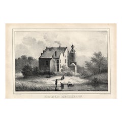
Het Huis Rechteren, Christ, 1846
Located in Langweer, NL
Het huis Rechteren.' (Rechteren Castle.) This Castle is situated in the province of Overijssel in Dalfsen. The castle was built in the 14th century by Herman van Voorst. Other well k...
Category
Antique 19th Century Maps
Materials
Paper
$73 Sale Price
20% Off
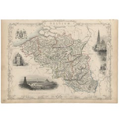
Antique Map of Belgium by J. Tallis, circa 1851
Located in Langweer, NL
A highly decorative and detailed mid-19th century map of Belgium which was drawn and engraved by J. Rapkin (vignettes by J. Marchant and J. B. Allen) an...
Category
Antique 19th Century Maps
Materials
Paper
$235 Sale Price
20% Off
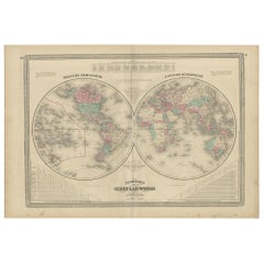
Antique Map of the World in Hemispheres by Johnson, '1872'
Located in Langweer, NL
Antique map titled 'Johnson's Globular World. Original world map depicting the Eastern Hemisphere and the Western Hemisphere. This map originates fr...
Category
Antique 19th Century Maps
Materials
Paper
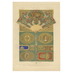
Pl. 88 Antique Print of Decorative Art in the 18th Century by Racinet, 1869
Located in Langweer, NL
Old print of decorative art in the 18th century. This print originates from 'L'Ornement polychrome'. A beautiful work containing about 2000 patterns of all the styles of Art old and ...
Category
Antique 19th Century Maps
Materials
Paper
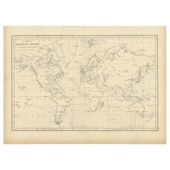
Antique Chart with Isomagnetic Lines by Black, 1854
Located in Langweer, NL
Antique map titled 'A Chart of Magnetic Curves of Equal Variation'. Chart with isomagnetic lines on continents, except for North America. This map orginates from 'General Atlas Of Th...
Category
Antique 19th Century Maps
Materials
Paper
$125 Sale Price
20% Off
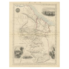
A Tallis Map of British Guiana with Colonial Vignettes and Other Landmarks, 1851
Located in Langweer, NL
This Tallis map of British Guiana (now known as Guyana) is a richly decorated document, much like other maps from the esteemed cartographic publisher John Tallis & Company. The firm,...
Category
Antique 19th Century Maps
Materials
Paper
$273 Sale Price
20% Off
Nice Antique Print of a Breton Cow, a French Cattle Breed from Brittany, 1862
Located in Langweer, NL
Antique print titled 'Vache Bretonne' - This rare plate shows a Breton Cow, a French cattle breed from Brittany. From: 'Les Races bovines au concours universel agricole de Paris en 1...
Category
Antique 19th Century Maps
Materials
Paper
$301 Sale Price
20% Off
Antique Map of North and Central Italy and the Island of Corsica, c.1860
Located in Langweer, NL
Antique map titled 'North & Central Italy and the Island of Corsica'.
Old map of North and Central Italy, and the island of Corsica. With an inset map of the region of Rome. Orig...
Category
Antique 19th Century Maps
Materials
Paper
$292 Sale Price
20% Off
Antique Map of the Northern Hemisphere by Lowry, '1852'
Located in Langweer, NL
Antique map titled 'Perspective Projection of the World on the horizon of London'. Original map of the northern hemisphere. This map originates fro...
Category
Antique 19th Century Maps
Materials
Paper
$141 Sale Price
20% Off
Old Hand-Colored Print with a View of Marseille, France, ca.1885
Located in Langweer, NL
Antique print titled 'Marseille aus der Vogelschau'.
Old print with a view of Marseille, France. This print originates from a German illustrated newsletter, published circa 1885.
...
Category
Antique 19th Century Maps
Materials
Paper
$339 Sale Price
20% Off
Colourful Antique Map of England and Wales Divided in Counties, 1854
Located in Langweer, NL
Antique map titled 'A Map Shewing the Places in England & Wales Sending Members to Parliament with the numbers returned, divisions of counties and population, places of county electi...
Category
Antique 19th Century Maps
Materials
Paper
$613 Sale Price
20% Off
Antique Map of Cook's Strait in New Zealand, 1803
Located in Langweer, NL
Antique map New Zealand titled 'Kaart van Cooks Straat in Nieuw Zeeland'. Antique map of Cook's Strait in New Zealand. Originates from 'Reizen ...
Category
Antique 19th Century Maps
Materials
Paper
$613 Sale Price
20% Off
Original Rare Antique Print of a Ruin in Peru, 1857
Located in Langweer, NL
Untitled print of a ruin in Peru. This print originates from 'Die Kunstwerke vom Alterthum bis auf die Gegenwart, oder, Wegweiser durch das ganze Gebiet der bildenden Kunst : enthalt...
Category
Antique 19th Century Maps
Materials
Paper
Print of a Fortified Mosque and of Nobility in Aceh, Sumatra, Indonesia, 1874
Located in Langweer, NL
Antique print Indonesia titled 'Een versterkte Missigit' and 'Atchineezen'. Antique print depicting two scenes in Indonesia. Originates from 'De Oorlog tusschen Nederland en Atchin' ...
Category
Antique 19th Century Maps
Materials
Paper
$245 Sale Price
20% Off
Pl. 81 Antique Print of Decorative Art in the 17th Century by Racinet, 1869
Located in Langweer, NL
Old print of decorative art in the 17th century. This print originates from 'L'Ornement polychrome'. A beautiful work containing about 2000 patterns of all the styles of Art old and ...
Category
Antique 19th Century Maps
Materials
Paper
Antique Map of The World in Hemispheres by W. G. Blackie, 1859
Located in Langweer, NL
Antique map titled 'The World in Hemispheres with other projections'. Original antique map of The World. This map originates from ‘The Imperial Atlas of Modern Geography’. Published ...
Category
Antique 19th Century Maps
Materials
Paper
$288 Sale Price
30% Off
Antique Map of the Region of Verona 'Italy' by Ortelius, circa 1584
Located in Langweer, NL
Antique map titled 'Veronae Urbis Terratorium'. Original antique map of the Verona region, Italy. Centered on Verona, and including Mantua, and Lago de Garda. Published by A. Orteliu...
Category
Antique 19th Century Maps
Materials
Paper
$849 Sale Price
20% Off
Antique Print of Oedidee, a Native from Bora Bora, 1803
Located in Langweer, NL
Antique print titled 'Oedidee Jongman van Bolabola'.
Antique print of Oedidee, a native from Bora Bora. Originates from 'Reizen Rondom de Waereld door James Cook (..)'.
Artis...
Category
Antique 19th Century Maps
Materials
Paper
$169 Sale Price
20% Off
Antique Map of Arabia by Tardieu '1843'
Located in Langweer, NL
Antique map titled 'Arabie'. Attractive small map of Arabia. This map originates from 'Dictionnaire Universel de Geographie Moderne' 4th Edition, by A.Pe...
Category
Antique 19th Century Maps
Materials
Paper
$188 Sale Price
20% Off
Old Map of the Oceans Around Australia, Indonesia and New Zealand, 1880
Located in Langweer, NL
Antique map titled 'Océanie'.
Old map of the oceans around Australia, Indonesia and New Zealand. With vignettes of people from Polynesia and the old monument Laparouse. This map ...
Category
Antique 19th Century Maps
Materials
Paper
$207 Sale Price
20% Off
1882 Original Antique Map of New Zealand with Inset of Auckland's Environs
Located in Langweer, NL
This 1882 map of New Zealand, published by Blackie and Son as part of the 'Comprehensive Atlas and Geography of the World,' provides a detailed representation of the North Island and...
Category
Antique 19th Century Maps
Materials
Paper
De Natsche – Ceremony for the King's Son, Tonga c.1795
Located in Langweer, NL
De Natsche – Ceremony for the King's Son, Tonga c.1795
This antique print depicts a grand ceremony held in honour of the son of the King of Tonga, known as the Natsche, in the villa...
Category
European Antique 19th Century Maps
Materials
Paper
$556 Sale Price
20% Off
Antique Map of the German Empire by Levasseur, '1875'
Located in Langweer, NL
Antique map titled 'Carte générale de l'Europe Centrale (..)'. Large map of the German Empire. This map originates from 'Atlas de Géographie Moderne Phys...
Category
Antique 19th Century Maps
Materials
Paper
$377 Sale Price
20% Off
Original Antique Print of a Castle in Madrid, Spain, 1833
Located in Langweer, NL
Antique print titled 'Schloss zu Madrid'.
Lithograph of a castle in Madrid, Spain. This print originates from 'Neuen Bildergalerie für die Jugend'.
Artists and Engravers: Ano...
Category
Antique 19th Century Maps
Materials
Paper
Antique Map of the Prussian Monarchy by Levasseur, '1875'
Located in Langweer, NL
Antique map titled 'Carte générale de la Monarchie Prussienne (..)'. Large map of the Prussian Monarchy. This map originates from 'Atlas de Géographie Moderne Physique et Politique' ...
Category
French Antique 19th Century Maps
Materials
Paper
$330 Sale Price
30% Off
Antique Map of Siberia by Levasseur '1875'
Located in Langweer, NL
Antique map titled 'Carte de la Russie d'Asie Sibérie'. Large map of Siberia. This map originates from 'Atlas de Géographie Moderne Physique et Politique' by A. Levasseur. Published ...
Category
Antique 19th Century Maps
Materials
Paper
$377 Sale Price
20% Off
Antique Map of Landes ‘France’ by V. Levasseur, 1854
Located in Langweer, NL
Antique map titled 'Dépt. des Landes'. Map of the French department Landes, France. This area is known for its production of Chalossais, a white cow cheese with a gentle, acidic edge...
Category
Antique 19th Century Maps
Materials
Paper
$169 Sale Price
20% Off
Pl. 67 Antique Print of Decorative Art in the Renaissance Period by Racinet, 186
Located in Langweer, NL
Old print of decorative art in the Renaissance period. This print originates from 'L'Ornement polychrome'. A beautiful work containing about 2000 patterns of all the styles of Art ol...
Category
Antique 19th Century Maps
Materials
Paper
Antique Map of the French Colony Guadeloupe by V. Levasseur, 1854
Located in Langweer, NL
Antique map titled 'Colonies Françaises (en Amerique). Detailed map of the island of Guadeloupe in the Caribbean Sea, with decorative frame containing views of the island. This map o...
Category
Antique 19th Century Maps
Materials
Paper
$188 Sale Price
20% Off
Antique Map of the Hautes Pyrenees 'France' by V. Levasseur, 1854
Located in Langweer, NL
Antique map titled 'Dépt. des Htes. Pyrénées'. Map of the French department of Hautes Pyrenees, France. This area is home to the wine producing region, Madiran. Madrian is best known...
Category
Antique 19th Century Maps
Materials
Paper
$188 Sale Price
20% Off
Antique Map of Côtes du Nord ‘France’ by V. Levasseur, 1854
Located in Langweer, NL
Antique map titled 'Dépt. des Côtes du Nord'. Map of the French department of Cotes du Nord, a maritime region in Brittany, France. The whole is surrounded by elaborate decorative en...
Category
Antique 19th Century Maps
Materials
Paper
$188 Sale Price
20% Off
Antique Map of Basses-Alpes ‘France’ by V. Levasseur, 1854
Located in Langweer, NL
Antique map titled 'Dépt. des Basses-Alpes'. Map of the French department of Basses-Alpes, France. The whole is surrounded by elaborate decorative engravings designed to illustrate b...
Category
Antique 19th Century Maps
Materials
Paper
$188 Sale Price
20% Off
Antique Nautical Portolano of Isle De Poro by Antoine Roux, France, 1844
By Antoine Roux
Located in Milan, IT
Antique portolano, nautical map of Isle De Poro engraved on a copper plate by Antoine Roux, Marseille France 1844, from his work Recueil des principaux plans des ports et de Rades de...
Category
French Antique 19th Century Maps
Materials
Paper
Sweden & Norway – Antique Map of Scandinavia with Stockholm Inset, 1865
Located in Langweer, NL
Sweden & Norway – Antique Map of Scandinavia with Stockholm Inset, 1865
This finely detailed antique map titled Sweden & Norway (Scandinavia) offers a comprehensive 19th-century vie...
Category
English Antique 19th Century Maps
Materials
Paper
$259 Sale Price
20% Off
Antique Map of Spain, Mauritia and Africa by H. Kiepert, circa 1870
Located in Langweer, NL
Antique map titled 'Hispania, Mauretania et Africa'. This map originates from 'Atlas Antiquus. Zwölf Karten zur Alten Geschichte' by H. Kiepert. Published in Berlin, circa 1870.
Category
Antique 19th Century Maps
Materials
Paper
$141 Sale Price
20% Off
Antique Map of Seine et Oise 'France' by V. Levasseur, 1854
Located in Langweer, NL
Antique map titled 'Dépt. de Seine et Oise'. Map of the French department of Seine-et-Oise. Centred on Versailles, its administrative centre, Seine-et-Oise extends from Espernon to M...
Category
Antique 19th Century Maps
Materials
Paper
$188 Sale Price
20% Off
Large and Extremely Rare Terrestrial Globe by Newton
By Newton Globes - Planer & Newton
Located in Lymington, Hampshire
A large and extremely rare 24-inch terrestrial globe by Newton
Our most magnificent and rare globes were a pair of 24-inch Newton globes.
These too were updated in 1852 (terre...
Category
English Antique 19th Century Maps
Materials
Mahogany
Oil Lamp with an Illuminating Globe Shade, circa 1885
Located in London, GB
A rare late 19th century oil lamp with a globe shade and base decorated with a castle set in a rural scene, circa 1885.
Northern Europe...
Category
European Antique 19th Century Maps
Materials
Glass
19th-Century Decorative Map of British America with Arctic and Pacific Vignettes
Located in Langweer, NL
19th-Century Decorative Map of British America with Arctic and Pacific Vignettes
This 19th-century map of British America, drawn and engraved by J. Rapkin and published by J & F T...
Category
Antique 19th Century Maps
Materials
Paper
1814 Map of "Russian Empire" Ric.r032
Located in Norton, MA
1814 Map of
"Russian Empire"
Ric.r032
Russian Empire. Description: This is an 1814 John Thomson map of the Russian Empire. The map depicts the region from the Baltic Sea, Prussia, and Sweden to the Aleutian Islands and from the Arctic Ocean to the Yellow River. Highly detailed, myriad cities, towns, and villages are labeled throughout, including St. Petersburg, Moscow, Minsk, Kiev, and Kharkov. Rivers and mountain ranges are also identified, as are islands and numerous locations along the coastlines. It is important to note that the long-disputed sea between Korea and Japan is identified as the 'Sea of Japan.
Historical Context:
In 1815, Tsarist Russia emerged from the Napoleonic Wars economically insolvent and politically fearful of the Revolutionary fervor that had just swept through Europe. In order to shore up Russia's economic position, the Tsars began an aggressive series of expansions into the Caucuses and Central Asia that would vastly increase the landmass of the Russian Empire.
Publication History
Thomson maps are known for their stunning color, awe inspiring size, and magnificent detail. Thomson's work, including this map, represents some of the finest cartographic art...
Category
Unknown Antique 19th Century Maps
Materials
Paper
Early 19th Century Original Framed Land Indenture, England, 1810
Located in Lambertville, NJ
A large hand written land indenture document England, 1810, framed. The beautifully hand written document mounted on board with a red velvet border and ...
Category
English Regency Antique 19th Century Maps
Materials
Glass, Giltwood, Parchment Paper
Antique Map of Cyprus (Cypern) from Meyer's Lexikon, Leipzig, circa 1890
Located in Langweer, NL
Antique Map of Cyprus (Cypern) from Meyer's Lexikon, Leipzig, circa 1890
This finely detailed antique map titled "Cypern" presents the island of Cyprus as it appeared in the late 19...
Category
Antique 19th Century Maps
Materials
Paper
Plan of Paris, France, by A. Vuillemin, Antique Map, 1845
Located in Colorado Springs, CO
This large and detailed plan of Paris was published by Alexandre Vuillemin in 1845. The map conveys a wonderful amount of information and is decorated throughout with pictorial vigne...
Category
American Antique 19th Century Maps
Materials
Paper
Terrestrial Table Globe by Félix Delamarche, Paris, 1821
By Félix Delamarche
Located in Milano, IT
Terrestrial table globe
Félix Delamarche
Paris, 1821
It measures 20.47 in height, Ø max 14.17 in; the sphere Ø 9.44 in (h 52 cm x Ø max 36.5 cm; the sphere Ø 24 cm)
Wood, printed...
Category
French Restauration Antique 19th Century Maps
Materials
Metal
Large U.S. Coast and Geodetic Survey Chart A of the Atlantic Coast, 1877
Located in Nantucket, MA
Large U.S. Coast and Geodetic Survey Chart A of the Atlantic Coast, 1877, re-issued in February 1881, a printed paper laid down on linen navigational chart of the U.S. Atlantic coast...
Category
American Other Antique 19th Century Maps
Materials
Linen
Map of Shropshire, 1844: Telford, Shrewsbury, Oswestry, Bridgnorth & Wellington
Located in Langweer, NL
Old Map of Shropshire by Samuel Lewis, 1844: Telford, Shrewsbury, Oswestry, Bridgnorth, and Wellington
This 1844 map of Shropshire is an antique engraving from Samuel Lewis' Topogr...
Category
Antique 19th Century Maps
Materials
Paper
$179 Sale Price
20% Off
Rare Victorian Mid-19th Century Gothic Revival Library Architects Plan Chest
Located in Worpswede / Bremen, DE
A neo-gothic mid-19th century library plan chest having an arrangement of eleven short and three long drawers to one side, the other side with three short drawers above gothic style linen fold panelling, centred with the carved monogram ‘HP’, further matching panelling to the sides. A stunning plan chest of good propartions and with a nice patina. Provenance: Sherborne School, an independent school in north-west Dorset, England, established in 1550. Among the ‘Old Shirburnians’ are for example the writer John Cowper Powys, the actors Jeremy Irons und Charlie Cox, Chris Martin, leadsinger of the band Coldplay as well as Sheikh Tamim bin Hamad Al Thani...
Category
English Gothic Revival Antique 19th Century Maps
Materials
Oak
Iran and Turan Map – Persia, Afghanistan, Baluchistan, Turkestan 1858
Located in Langweer, NL
Iran and Turan Map – Persia, Afghanistan, Baluchistan, Turkestan 1858
This impressive antique print shows “Iran und Turan (Persien, Afghanistan, Beludschistan, Turkestan),” meaning ...
Category
German Antique 19th Century Maps
Materials
Paper
Antique Map of California as an Island "The 5 Californias" by Robert de Vaugondy
Located in San Diego, CA
A very nice and rare antique map entitled "Carte de la Californie Suivant" (The 5 Californias), by Didier Robert de Vaugondy of Paris, circa 1772. The map itself measures 15.5" x 13...
Category
American Antique 19th Century Maps
Materials
Paper
Large Original Antique Map of Illinois, USA, 1894
Located in St Annes, Lancashire
Fabulous map of Illinois
Original color
By Rand, McNally & Co.
Published, 1894
Unframed
Free shipping.
Category
American Antique 19th Century Maps
Materials
Paper
Decorative Antique Print of Nice Near Mont Boron in France, c.1865
Located in Langweer, NL
Antique print titled 'Nice, vue prise de l'extremité du Mont Boron'. View of the city of Nice, near Mont Boron, France. This print originates from 'Nice Et Savoie, Sites Pittoreques,...
Category
Antique 19th Century Maps
Materials
Paper
$433 Sale Price
20% Off
1868 "Lloyd's Topographical Railway Map of North America..." Hanging Wall Map
Located in Colorado Springs, CO
Presented is “Lloyd's Topographical Railway Map of North-America, or the United States Continent in 1900.” This map was published by J. T. Lloyd, in New York, in 1868. A large, hangi...
Category
American Late Victorian Antique 19th Century Maps
Materials
Linen, Paper
1842 Wall Map of the United States by J. H. Young, Published by S. A. Mitchell
Located in Colorado Springs, CO
Presented is an 1842 hanging “Map of the United States,” engraved by J. H. Young and published by Samuel Augustus Mitchell, Philadelphia. This is a beautiful example of the rare 1842...
Category
American Antique 19th Century Maps
Materials
Paper
Fine French Antique 1856 Hand Watercolour Map of Dept Des Hautes Pyrenees
Located in West Sussex, Pulborough
We are delighted to offer for sale this stunning 1856 hand watercolour map of the Austrian Alps titled Dept Des Hautes Pyrenees taken from the Atlas Nat...
Category
French Early Victorian Antique 19th Century Maps
Materials
Paper
1847 Ornamental Map of the United States & Mexico by H. Phelps
Located in Colorado Springs, CO
Offered is an original 1847 ornamental map of the U.S. entitled "Ornamental Map of the United States & Mexico" by Humphrey Phelps. The map was issued as an act of Congress by Phelps on Fulton Street, New York. The broadside is elaborately hand-colored.
This is a very detailed and graphic propaganda map of the United States expressing U.S. dominance of the North American continent. The hand-colored map proclaims the Manifest Destiny, with the recent acquisition of Upper California and Texas at the conclusion of the Mexican-American War. The newly acquired land is boldly colored, standing in stark contrast to the rest of the U.S. The map details a potential route for a railroad running from New York City, to Buffalo, to Chicago, then west along the Oregon Trail to Oregon City. This route anticipates the construction of the transcontinental railroad by nearly 20 years.
The map includes elaborately detailed renderings of George Washington, Hernan Cortez, and Montezuma at top to represent European expansion to the Americas. At bottom are four inset designs with text showing the following: a chronological history of the U.S. beginning from settlement to the U.S. victory in the Mexican-American war; an illustration of General Zachary Taylor with details on the Oregon Territory; an illustration of the Aztec Temple of the Sun in Tenochtitlan and a chronology of the Conquest of the Aztec Empire under Cortez; a portrait of General Antonio Lopez de Santa Anna...
Category
American Antique 19th Century Maps
Materials
Paper
Large Antique County Map of Essex, England
Located in Langweer, NL
Antique map titled 'A Map of Essex from the best Authorities'. Original old county map of Essex, England. Engraved by John Cary. Originates from 'New Brit...
Category
Antique 19th Century Maps
Materials
Paper
$292 Sale Price
20% Off
Large Antique County Map of Somersetshire, England
Located in Langweer, NL
Antique map titled 'A Map of Somersetshire from the best Authorities'. Original old county map of Somersetshire, England. Engraved by John Cary. Originates from 'New British Atlas' b...
Category
Antique 19th Century Maps
Materials
Paper
$301 Sale Price
20% Off
Large Antique County Map of Ruthlandshire, England
Located in Langweer, NL
Antique map titled 'A Map of Ruthlandshire from the best Authorities'. Original old county map of Ruthlandshire, England. Engraved by John Cary. Originates from 'New British Atlas' b...
Category
Antique 19th Century Maps
Materials
Paper
$264 Sale Price
20% Off
Large Antique County Map of Northamptonshire, England
Located in Langweer, NL
Antique map titled 'A Map of Northamptonshire from the best Authorities'. Original old county map of Northamptonshire, England. Engraved by John Cary. Originates from 'New British At...
Category
Antique 19th Century Maps
Materials
Paper
$264 Sale Price
20% Off
Large Antique County Map of Cumberland, England
Located in Langweer, NL
Antique map titled 'A Map of Cumberland from the best Authorities'. Original old county map of Cumberland, England. Engraved by John Cary. Originates...
Category
Antique 19th Century Maps
Materials
Paper
$150 Sale Price
20% Off
