19th Century Maps
to
1,677
2,155
71
2,229
73
9
5
4
2
1
1
1
2,974
2,229
473
3
288
34
9
126
8
36
9
2
5
4
3
2
2,191
65
28
12
10
288
167
102
98
98
2,229
2,229
2,229
104
23
9
8
7
Period: 19th Century
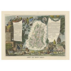
1852 Map of Haut-Rhin: An Illustrated Gateway to Alsace's Viticultural Splendors
Located in Langweer, NL
This original hand-colored map is from the "Atlas National Illustré," a work by Victor Levasseur, a French geographer and cartographer known for his richly illustrated maps.
The map...
Category
Antique 19th Century Maps
Materials
Paper
$320 Sale Price
20% Off
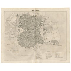
Antique Map of the City of Madrid by Balbi '1847'
Located in Langweer, NL
Antique map titled 'Madrid'. Original antique map of the city of Madrid, Spain. This map originates from 'Abrégé de Géographie (..)' by Adrien Balbi. Published 1847.
Category
Antique 19th Century Maps
Materials
Paper
$141 Sale Price
20% Off
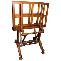
English Mahogany Wooden Folio Stand, Map and Document Holder, circa 1820
Located in Hamilton, Ontario
Regency era mahogany wood folio stand rack, map, poster, document holder used in a library, office or den, circa 1820. Folds out to six positions ...
Category
English Regency Antique 19th Century Maps
Materials
Wood
$5,200 Sale Price
20% Off
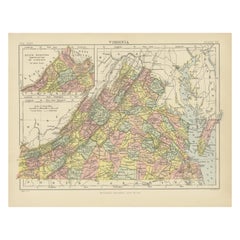
Antique Map of Virginia, with Inset Map of the South Western Continuation
Located in Langweer, NL
Antique map titled 'Virginia'. Original antique map of Virginia, United States. With inset map of the south western continuation of Virginia. T...
Category
Antique 19th Century Maps
Materials
Paper
$273 Sale Price
20% Off
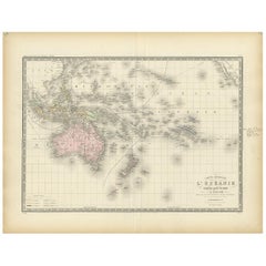
Antique Map of Oceania by Levasseur, '1875'
Located in Langweer, NL
Antique map titled 'Carte générale de l'Océanie'. Large map of Oceania. This map originates from 'Atlas de Géographie Moderne Physique et Politique' by A. Levasseur. Published 1875.
Category
Antique 19th Century Maps
Materials
Paper
$235 Sale Price
60% Off
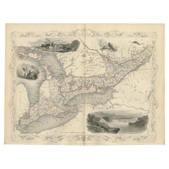
Antique Map of West Canada by Tallis 'c.1850'
Located in Langweer, NL
Antique map titled 'West Canada'. Original antique map of West Canada, with decorative vignettes titled Kingston and Falls of Niagara. This map originates from 'The History and Topog...
Category
Antique 19th Century Maps
Materials
Paper
$283 Sale Price
20% Off
Western & Eastern Hemisphere Maps – World Double Hemisphere Engravings 1857
Located in Langweer, NL
Western & Eastern Hemisphere Maps – World Double Hemisphere Engravings 1857
These beautiful antique prints show two complementary hemispheric maps titled “Westliche Halbkugel” (West...
Category
German Antique 19th Century Maps
Materials
Paper
Antique Map of Scotland With an Inset Map of the Shetland Islands, 1854
Located in Langweer, NL
Stunning Map of Scotland that will look beautiful in any setting framed on the wall.
Description: Large Antique map titled 'Scotland with its Islands, drawn from the Topographical surveys...
Category
Antique 19th Century Maps
Materials
Paper
$1,179 Sale Price
20% Off
Antique Map of South East Australia by Stieler, c.1848
Located in Langweer, NL
Antique map Australia titled 'Süd-Ost Australien'. Detailed map of South East Australia. Orginates from 'Stieler's Hand Atlas', published in Germ...
Category
Antique 19th Century Maps
Materials
Paper
$56 Sale Price
20% Off
Old Map of the Chinese Empire and Japan, 1882
Located in Langweer, NL
An original antique map titled "The Chinese Empire and Japan," dating from an 1882 atlas by Blackie & Son. It is a color map with geographical features such as mountain ranges, river...
Category
Antique 19th Century Maps
Materials
Paper
$311 Sale Price
20% Off
Pl. 40 Antique Print of Decorative Art in the Middle Ages by Racinet, 1869
Located in Langweer, NL
Old print of decorative art in the Middle Ages. This print originates from 'L'Ornement polychrome'. A beautiful work containing about...
Category
Antique 19th Century Maps
Materials
Paper
$68 Sale Price
20% Off
Antique Print of a House and Court in Greater Cairo in Egypt, 1835
Located in Langweer, NL
Antique print titled 'Open Court and House at Grand Cairo'. Old print of a court and house in Greater Cairo, Egypt. This print originates from 'One Hundred and Fifty Wood Cuts select...
Category
Antique 19th Century Maps
Materials
Paper
Antique Map of Australia and New Zealand, c.1860
Located in Langweer, NL
Antique map titled 'Australia and New Zealand'. Unusual edition of this map of Australia and New Zealand, on very thin paper and multiple folding lines. Source unknown, to be determi...
Category
Antique 19th Century Maps
Materials
Paper
$132 Sale Price
20% Off
Antique Map of the United States of North America, c.1882
Located in Langweer, NL
Antique map titled 'United States of North America'. Old map of the United States of North America. This map originates from 'The Royal Atlas of Modern Geography, Exhibiting, in a Se...
Category
Antique 19th Century Maps
Materials
Paper
$330 Sale Price
20% Off
Antique Map of Canada West and Part of Canada East by W. G. Blackie, 1859
Located in Langweer, NL
Antique map titled 'Canada West and Part of Canada East'. Original antique map of Canada West and Part of Canada East with inset map of Montreal. This ...
Category
Antique 19th Century Maps
Materials
Paper
$235 Sale Price
20% Off
Antique Map of Brazil Extending South to the Mouth of the Rio de la Plata
Located in Langweer, NL
Antique map titled 'Carte du Brésil'. ?Beautiful map of Brazil extending south to the mouth of the Rio de la Plata and Buenos-Aires in Argentina. Published by Tardieu, 1821.
Pier...
Category
Antique 19th Century Maps
Materials
Paper
$226 Sale Price
20% Off
Hand Colored Antique Map of the Department of Seine Et Marne, France
Located in Langweer, NL
Antique map titled 'Dépt. de Seine et Marne'. map of the French department of Seine Et Marne, France. This region produces a wide variety of wines and h...
Category
Antique 19th Century Maps
Materials
Paper
$320 Sale Price
20% Off
Original Antique Map of Africa
Located in Langweer, NL
Antique map titled 'Afrika'. Original antique map of Africa, drawn by Van Beusekom. Published by 'Seyffardt's Boekhandel' in Amsterdam, circa 1870.
Category
Antique 19th Century Maps
Materials
Paper
$320 Sale Price
20% Off
Antique Print of the State Bedroom of Warwick Castle, River Aron, England, c1850
Located in Langweer, NL
Antique print titled 'State Bedroom-Warwick Castle'.
Lithograph of the State Bedroom of the famous Warwick Castle in England.
Warwick Castle is a medieval castle developed fro...
Category
Antique 19th Century Maps
Materials
Paper
$528 Sale Price
20% Off
Antique Map of Switzerland by J. Tallis, circa 1851
Located in Langweer, NL
A decorative and detailed mid-19th century map of Switzerland which was drawn and engraved by J. Rapkin (vignettes by A. H. Wray & J. B. Allen) and published in John Tallis's Illustr...
Category
Antique 19th Century Maps
Materials
Paper
$259 Sale Price
20% Off
Pl. 87 Antique Print of Decorative Art in the 18th Century by Racinet, 1869
Located in Langweer, NL
Old print of decorative art in the 18th century. This print originates from 'L'Ornement polychrome'. A beautiful work containing about 2000 patterns of all the styles of Art old and ...
Category
Antique 19th Century Maps
Materials
Paper
Antique Map of South Australia by Tallis, 1851
Located in Langweer, NL
Antique map Australia titled 'Part of South Australia'. Decorative map of part of South Australia, surrounded by illustrations of Adelaide, natives on a catamaran, an Australian dog and a nymphicus bird illustrated. Originates from 'The Illustrated Atlas, And Modern History Of The World Geographical, Political, Commercial & Statistical, Edited By R. Montgomery Martin'. Published; John Tallis London, New York, Edinburgh & Dublin. 1851. Drawn and Engraved by J. Rapkin. Artists and Engravers: John Tallis (1817-1876) was a British map...
Category
Antique 19th Century Maps
Materials
Paper
$212 Sale Price
20% Off
Large Original Antique Map of North Dakota, USA, circa 1900
Located in St Annes, Lancashire
Fabulous map of North Dakota
Original color
Engraved and printed by the George F. Cram Company, Indianapolis.
Published, circa 1900
Unframed
Free shi...
Category
American Antique 19th Century Maps
Materials
Paper
Steel Engraved Map of Part of the Bengal Presidency 'India & Bangladesh', 1831
Located in Langweer, NL
Antique map titled 'India Bengal Presidency'. Old steel engraved map of part of the Bengal Presidency. The Bengal Presidency (1757–1912), later reorganized as the Bengal Province (19...
Category
Antique 19th Century Maps
Materials
Paper
$349 Sale Price
20% Off
Antique Map of the City of London by Balbi '1847'
Located in Langweer, NL
Antique map titled 'London'. Original antique map of the city of London. This map originates from 'Abrégé de Géographie (..)' by Adrien Balbi. Published 1847.
Category
Antique 19th Century Maps
Materials
Paper
$188 Sale Price
20% Off
Antique Map of Eastern Persia, 1852
Located in Langweer, NL
Antique map titled 'Eastern Persia'. Original map of Eastern Persia. This map originates from 'Lowry's Table Atlas constructed and engraved from the most recent Authorities' by J.W. ...
Category
Antique 19th Century Maps
Materials
Paper
$94 Sale Price
20% Off
Antique Map of the French Colonies in Senegal and Madagascar by V. Levasseur
Located in Langweer, NL
The antique map titled 'Colonies Françaises (en Afrique)' presents a decorative depiction of the French colonies located in Senegal and Madagascar within Africa. Surrounding the map ...
Category
Antique 19th Century Maps
Materials
Paper
$188 Sale Price
20% Off
Antique Lithography Map, Western Russia, English, Framed, Cartography, Victorian
Located in Hele, Devon, GB
This is an antique lithography map of Western Russia. An English, framed atlas engraving of cartographic interest by John Rapkin, dating to the early Victorian period and later, circ...
Category
British Early Victorian Antique 19th Century Maps
Materials
Wood
Antique Map of Britain in Roman Times
Located in Langweer, NL
Antique map titled 'Britannia Romana collected from Ptolemy (..)'. Map of Britain in Roman times drawn from several sources, including the works of Ptolemy and The Itinerary of the E...
Category
Antique 19th Century Maps
Materials
Paper
$462 Sale Price
20% Off
Large Antique County Map of Wiltshire, England, 1805
Located in Langweer, NL
Antique map titled 'A Map of Wiltshire from the best Authorities'. Original old county map of Wiltshire, England. Engraved by John Cary. Originates from 'New British Atlas' by John S...
Category
Antique 19th Century Maps
Materials
Paper
$216 Sale Price
20% Off
Large Antique County Map of Leicestershire, England, 1805
Located in Langweer, NL
Explore Leicestershire's Past: Antique Map by John Cary
Step into the history of Leicestershire, England, with this original old county map engraved by the renowned cartographer Joh...
Category
Antique 19th Century Maps
Materials
Paper
$216 Sale Price
20% Off
Large Antique County Map of Hertfordshire, England
Located in Langweer, NL
Antique map titled 'A Map of Hartfordshire from the best Authorities'. Original old county map of Hertfordshire, England. Engraved by John Cary. Originates from 'New British Atlas' b...
Category
Antique 19th Century Maps
Materials
Paper
$264 Sale Price
20% Off
Antique Map of Western States, Michigan, Wisconsin, Iowa by A & C. Black, 1870
Located in Langweer, NL
Antique map titled 'Western States, Michigan, Wisconsin, Minnesota, Iowa with portions of Illinois & Indiana'. Original antique map of Western States, Michigan, Wisconsin, Minnesota,...
Category
Antique 19th Century Maps
Materials
Paper
$165 Sale Price
20% Off
Set of 2 Antique Maps of the United States by W. G. Blackie, 1859
Located in Langweer, NL
Antique map titled 'The United States of North America, Atlantic States and Valley of the Mississippi'. Original antique map of the United States of North America, Atlantic States an...
Category
Antique 19th Century Maps
Materials
Paper
$377 Sale Price / set
20% Off
Large Antique County Map of the West Riding of Yorkshire 'South Part', England
Located in Langweer, NL
Antique map titled 'A Map of the South Part of the West Riding of Yorkshire from the best Authorities'. Original old county map of the south part of the West Riding of Yorkshire, Eng...
Category
Antique 19th Century Maps
Materials
Paper
$264 Sale Price
20% Off
Antique Map of Moldova to Thessaly and from the Adriatic to the Black Sea, 1880
Located in Langweer, NL
Antique map titled 'Turquie d'Europe'.
Map of the european parts of Turkey. The map covers from Moldova to Thessaly and from the Adriatic to the Black Sea. Greece and the island ...
Category
Antique 19th Century Maps
Materials
Paper
$132 Sale Price
20% Off
Large Original Antique Map of The Leeward Islands. 1894
Located in St Annes, Lancashire
Superb Antique map of The Leeward Islands
Published Edward Stanford, Charing Cross, London 1894
Original colour
Good condition
Unframed.
Free shipping
Category
English Antique 19th Century Maps
Materials
Paper
Antique Print of Moscow During the Fire of Moscow in Napoleon Wars, Russia, 1845
Located in Langweer, NL
Antique print titled 'Moscau am 20 September'. Original antique print of Moscow, during the Fire of Moscow, 1812. This print originates from 'Der Feldzug von 1812' by Friedrich Stege...
Category
Antique 19th Century Maps
Materials
Paper
$132 Sale Price
20% Off
Antique Map of China by Larousse, 1897
Located in Langweer, NL
Sheet: Front: 'Chine.' (China map). Verso: 'China.' (China views, nature, animals, costume). This rare early lithographic print originates from: 'Nouveau Lar...
Category
Antique 19th Century Maps
Materials
Paper
$50 Sale Price
50% Off
Large Antique County Map of Northumberland, England
Located in Langweer, NL
Antique map titled 'A Map of Northumberland from the best Authorities'. Original old county map of Northumberland, England. Engraved by John Cary. Originates from 'New British Atlas'...
Category
Antique 19th Century Maps
Materials
Paper
$226 Sale Price
20% Off
Large Antique County Map of Huntingdonshire, England
Located in Langweer, NL
Antique map titled 'A Map of Huntingdonshire from the best Authorities'. Original old county map of Huntingdonshire, England. Engraved by John Cary. Originates from 'New British Atla...
Category
Antique 19th Century Maps
Materials
Paper
$217 Sale Price
20% Off
Map of Eure-et-Loir France with Chartres Cathedral and Marceau Portrait, c.1850
Located in Langweer, NL
Map of Eure-et-Loir France with Chartres Cathedral and Marceau Portrait, 19th c
This detailed and elegantly illustrated 19th-century map of the Eure-et-Loir department in north-cent...
Category
French Antique 19th Century Maps
Materials
Paper
Detailed Map of New Zealand Showing the Route of Capt. Cook's First Voyage, 1803
Located in Langweer, NL
Antique map New Zealand titled 'De Rivier de Theems en Mercurius Baai in Nieuw Zeeland'. Detailed map of New Zealand showing the route of Capta...
Category
Antique 19th Century Maps
Materials
Paper
$613 Sale Price
20% Off
Antique Map of the Night Skies of the Northern and Southern Hemispheres, 1880
Located in Langweer, NL
Antique world map titled 'Planisphère en Céleste'.
This map depicts the night skies of both the northern and southern hemispheres. This map originates from 'Géographie Universell...
Category
Antique 19th Century Maps
Materials
Paper
$273 Sale Price
20% Off
Antique Map of Australia, New Zealand and Oceania by F. von Stülpnagel, 1850
Located in Langweer, NL
Antique map titled 'Australien und Polynesien in Mercators Projection'. A map of Australia, New Zealand and Oceania. This includes Fiji, Tahiti and several other island groups in the...
Category
Antique 19th Century Maps
Materials
Paper
$181 Sale Price
30% Off
Map of Australia, New Zealand, Part of China, Japan and Southeast Asia, 1857
Located in Langweer, NL
German Antique map titled 'Australien'. Map of Australia, New Zealand, part of China, Japan and Southeast Asia. In the upper right is a bit of the California coast by San Francisco. ...
Category
Antique 19th Century Maps
Materials
Paper
$660 Sale Price
20% Off
German Antique Map of Australia and New Zealand, 1857
Located in Langweer, NL
Antique map Australia titled 'Festland von Australien und benachbarte Inseln'. Detailed map of Australia and New Zealand, including excellent det...
Category
Antique 19th Century Maps
Materials
Paper
$235 Sale Price
20% Off
Large Antique County Map of Durham, England
Located in Langweer, NL
Antique map titled 'A Map of Durham from the best Authorities'. Original old county map of Durham, England. Engraved by John Cary. Originates from 'New ...
Category
Antique 19th Century Maps
Materials
Paper
$245 Sale Price
20% Off
Antique Map of Egypt with Detailed Inset of the Nile Delta, ca. 1799
Located in Langweer, NL
Antique Map of Egypt with Detailed Inset of the Nile Delta, ca. 1799
This finely engraved antique map titled Carte Physique et Politique de l’Égypte presents a detailed and scientif...
Category
French Antique 19th Century Maps
Materials
Paper
Antique Map of St. Louis and Chicago
Located in Langweer, NL
Antique map titled 'The City of St. Louis Missouri - The City of Chicago Illinois'. Dual map on single page showing St. Louis and Chicago. Finely produ...
Category
Antique 19th Century Maps
Materials
Paper
$141 Sale Price
20% Off
Large Antique County Map of Cambridgeshire, England
Located in Langweer, NL
Antique map titled 'A Map of Cambridgeshire from the best Authorities'. Original old county map of Cambridgeshire, England. Engraved by John Cary. Originates from 'New British Atlas'...
Category
Antique 19th Century Maps
Materials
Paper
$216 Sale Price
20% Off
Antique Map of England and Wales, with References to the Counties
Located in Langweer, NL
Antique map titled 'England and Wales'. Original antique map of England and Wales, with references to the counties. Source unknown, to be determined. Published circa 1820.
Category
Antique 19th Century Maps
Materials
Paper
$132 Sale Price
20% Off
Large Antique County Map of Lincolnshire, England
Located in Langweer, NL
Antique map titled 'A Map of Lincolnshire from the best Authorities'. Original old county map of Lincolnshire, England. Engraved by John Cary. Originates from 'New British Atlas' by ...
Category
Antique 19th Century Maps
Materials
Paper
$273 Sale Price
20% Off
Large Antique County Map of Worcestershire, England
Located in Langweer, NL
Antique map titled 'A Map of Worcestershire from the best Authorities'. Original old county map of Worcestershire, England. Engraved by John Cary. Originates from 'New British Atlas'...
Category
Antique 19th Century Maps
Materials
Paper
$216 Sale Price
20% Off
Large Antique County Map of Westmorland, England
Located in Langweer, NL
Antique map titled 'A Map of Westmoreland from the best Authorities'. Original old county map of Westmorland, England. Engraved by John Cary. Originates from 'New British Atlas' by J...
Category
Antique 19th Century Maps
Materials
Paper
$264 Sale Price
20% Off
Large Antique County Map of the West Riding of Yorkshire 'North Part', England
Located in Langweer, NL
Antique map titled 'A Map of the North Part of the West Riding of Yorkshire from the best Authorities'. Original old county map of the north part of the West Riding of Yorkshire, Eng...
Category
Antique 19th Century Maps
Materials
Paper
$264 Sale Price
20% Off
Original Antique Engraving of Otago by Cook, 1803
By James Cook
Located in Langweer, NL
Antique print titled 'Otago Bevelhebber van het Eiland Amsterdam'. Antique print depicting Otago, commander of the Island Amsterdam. Originates from 'Reizen Rondom de Waereld door James Cook...
Category
Antique 19th Century Maps
Materials
Paper
$226 Sale Price
20% Off
Antique Print of Villefranche in the Nice and Savoy Region of France, c.1865
Located in Langweer, NL
Antique print titled 'Villefranche près de Nice'. Original antique print of Villefranche near Nice, France. This print originates from 'Nice Et Savoie, Sites Pittoreques, Monuments, ...
Category
Antique 19th Century Maps
Materials
Paper
$433 Sale Price
20% Off
Rare Original Antique View in Old Colours of Villefranche in France, c.1860
Located in Langweer, NL
Antique print titled 'Villefranche'. View of Villefranche near Nice, France. Source unknown, to be determined.
Artists and Engravers: Published by Lemercier, Paris.
Condition: ...
Category
Antique 19th Century Maps
Materials
Paper
$301 Sale Price
20% Off
Antique Map of Independent Tartary by W. G. Blackie, 1859
Located in Langweer, NL
Antique map titled 'Turkestan or Independent Tartary'. Original antique map of Turkestan or Independent Tartary. This map originates from ‘The Imperial Atlas of Modern Geography’. Pu...
Category
Antique 19th Century Maps
Materials
Paper
$235 Sale Price
20% Off
