19th Century Maps
to
1,677
2,155
71
2,229
73
9
5
4
2
1
1
1
2,974
2,229
473
3
288
34
9
126
8
36
9
2
5
4
3
2
2,191
65
28
12
10
288
167
102
98
98
2,229
2,229
2,229
104
23
9
8
7
Period: 19th Century
Map of Côtes-du-Nord France with Saint-Brieuc and Brittany Coastline, c.1850
Located in Langweer, NL
Map of Côtes-du-Nord France with Saint-Brieuc and Brittany Coastline, 19th c
Description:
This elegant 19th-century map of Côtes-du-Nord, the historic name for what is now known as ...
Category
French Antique 19th Century Maps
Materials
Paper
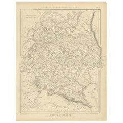
Old Original Map of Russia in Europe, 1849
Located in Langweer, NL
Antique map titled 'Russia in Europe'.
Old map of Russia in Europe. This map originates from 'Sharpe's Corresponding Atlas (..)' by J. Sharpe.
Artists and Engravers: Published by Chapman and Hall.
Category
Antique 19th Century Maps
Materials
Paper
$169 Sale Price
20% Off
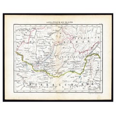
Antique Map of Russia in Asia by Kuyper, c.1880
Located in Langweer, NL
Antique map plate 48 : 'Aziatisch Rusland. Balkasj Meer en omstreken.' Original antique map of Russia in Asia, showing Lake Balkhash and surroundings. This l...
Category
Antique 19th Century Maps
Materials
Paper
$55 Sale Price
20% Off
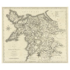
Large Antique County Map of North Wales, England
Located in Langweer, NL
Antique map titled 'A Map of North Wales from the best Authorities'. Original old county map of North Wales, England. Engraved by John Cary. Originates from 'New British Atlas' by Jo...
Category
Antique 19th Century Maps
Materials
Paper
$169 Sale Price
20% Off
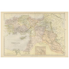
Empire's Crossroads: An 1882 Map of Turkey in Asia by Blackie & Son
Located in Langweer, NL
This map, titled "Turkey in Asia," is another detailed illustration from the 1882 atlas by Blackie & Son. It showcases the vastness of the Asian territories of the Ottoman Empire, sp...
Category
Antique 19th Century Maps
Materials
Paper
$233 Sale Price
40% Off
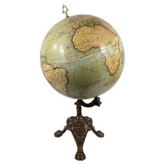
Terrestrial Globe in Lithographed Paper and Cast Iron, J.Lebègue & Cie – Late 19
By J. Lebegue & Cie
Located in HÉRIC, FR
19th-century globe by J. Lebègue & Cie. This globe features a sturdy mount and a cast iron tripod base decorated with mascarons and ending in claw feet. The sphere is covered with li...
Category
French Antique 19th Century Maps
Materials
Iron
Antique Map of Gelderland, Largest Province of The Netherlands, c.1870
Located in Langweer, NL
Antique map titled 'De Provincie Gelderland'.
Map of the province of Gelderland, the Netherlands. This map originates from 'F. C. Brugsma's Atlas van het Koninkrijk der Nederland...
Category
Antique 19th Century Maps
Materials
Paper
$103 Sale Price
20% Off
Old Map of Piton de la Fournaise, a Shield Volcano on Eastern Réunion Island
Located in Langweer, NL
Antique map titled 'Partie Orientale de l'Ile de Mascareigne'. This map shows the region of the Piton de la Fournaise, a Shield Volcano on Eastern Réunion Island...
Category
Antique 19th Century Maps
Materials
Paper
$613 Sale Price
20% Off
Large 19th Century Map of France
Located in Pease pottage, West Sussex
Large 19th Century Map of France.
Remarkable condition, with a pleasing age worn patina.
Recently framed.
France Circa 1874.
Category
French Antique 19th Century Maps
Materials
Linen, Paper
1889 Map of Italy in 3D Relief
Located in Weesp, NL
Introducing a true gem for collectors and history enthusiasts alike: this rare 1889 *"Italia in Rilievo"* map by L. Roux & Co. from Torino, a masterpiece of craftsmanship and cartogr...
Category
European Antique 19th Century Maps
Materials
Paper
Map of Drôme France with Valence and Rhône Valley Wine Region, 19th Century
Located in Langweer, NL
Map of Drôme France with Valence and Rhône Valley Wine Region, 19th Century
Description:
This beautifully engraved 19th-century map of the Drôme department in southeastern France wa...
Category
French Antique 19th Century Maps
Materials
Paper
Old Map of the Russian Empire, with English Language Text, Ca.1820
Located in Langweer, NL
Antique map titled 'Geographical, Statistical and Historical Map of Russia'.
Old map of the Russian Empire, encompassed on three sides by English language text. Originates from L...
Category
Antique 19th Century Maps
Materials
Paper
$509 Sale Price
20% Off
1865 Chart of the Islands of Madeira
Located in Norwell, MA
Rare James Imray chart from 1865 titled "Chart of the Islands of Madeira, Porto Santo and Dezerea" drawn from the survey made by Captain Ate Vidal Royal Navy, London. Published by Ja...
Category
European Antique 19th Century Maps
Materials
Paper
Antique 1830 Map of Leinster, Ireland with Dublin, Kilkenny, Wexford and Kildare
Located in Langweer, NL
Title: Antique 1830 Map of Leinster, Ireland with Dublin, Kilkenny, Wexford, and Kildare
Description: This 1830 German-language map, titled Britisches Reich – C. Kon: Ireland, f...
Category
Antique 19th Century Maps
Materials
Paper
Antique Map of North America by Johnston, 1882
Located in Langweer, NL
Antique map titled 'North America'.
Old map of North America. This map originates from 'The Royal Atlas of Modern Geography, Exhibiting, in a Series of Entirely Original and Authen...
Category
Antique 19th Century Maps
Materials
Paper
Antique Map of Russia and Surroundings by Stieler, 1874
Located in Langweer, NL
Antique map titled 'Nord- & Mittal-Asien, Ubersicht des Russischen Reiches.' A map of Russia in scale 1:20.000.000. The depicted area spans from Iran and Sweden in the left edge of t...
Category
Antique 19th Century Maps
Materials
Paper
$66 Sale Price
20% Off
Rare City View of London and Westminster, Showing Many Battles Ships, 1804
Located in Langweer, NL
Title: The Cities of London & Westminster, accurately copied from the table of the Camera Obscura in the Royal Observatory at Greenwich
This is a rare plate from a serie of 22 landmarks taken from Modern London, published in 1804 by Richard Phillips...
Category
Antique 19th Century Maps
Materials
Paper
$735 Sale Price
20% Off
Map of Ardennes France with Sedan and Military History by Vuillemin, c.1850
Located in Langweer, NL
Map of Ardennes France with Sedan and Military History by Vuillemin, 19th c
Description:
This detailed and decorative 19th-century map of the Ardennes department in northeastern Fra...
Category
French Antique 19th Century Maps
Materials
Paper
Map of Aude France with Carcassonne and Languedoc Vineyards, 19th Century
Located in Langweer, NL
Map of Aude France with Carcassonne and Languedoc Vineyards, 19th Century
Description:
This elegant 19th-century map of Aude, a department in southern France along the Mediterranean...
Category
French Antique 19th Century Maps
Materials
Paper
Map of Ariège France with Foix and Pyrenees Landscape by Vuillemin, 19th c
Located in Langweer, NL
Map of Ariège France with Foix and Pyrenees Landscape by Vuillemin, 19th c
Description:
This beautifully detailed 19th-century map of the Ariège department in southwestern France wa...
Category
French Antique 19th Century Maps
Materials
Paper
Map of Charente France with Cognac Region and Château de La Rochefoucauld, 1850
Located in Langweer, NL
Map of Charente France with Cognac Region and Château de La Rochefoucauld, 19th c
Description:
This richly illustrated 19th-century map of the Charente department in southwestern Fr...
Category
French Antique 19th Century Maps
Materials
Paper
Map of Eure France with Evreux, Poussin and Normandy Countryside, 19th Century
Located in Langweer, NL
Map of Eure France with Evreux, Poussin and Normandy Countryside, 19th Century
Description:
This 19th-century engraved map of the Eure department in the Normandy region of northern ...
Category
French Antique 19th Century Maps
Materials
Paper
Map of Hautes-Alpes France with Gap and Alpine Scenery by Vuillemin, c.1850
Located in Langweer, NL
Map of Hautes-Alpes France with Gap and Alpine Scenery by Vuillemin
Description:
This elegant 19th-century map of the Hautes-Alpes department in southeastern France was created by A...
Category
French Antique 19th Century Maps
Materials
Paper
Map of Aveyron France with Rodez, Millau and Wine Routes, 19th Century
Located in Langweer, NL
Map of Aveyron France with Rodez, Millau and Wine Routes, 19th Century
Description:
This detailed and decorative 19th-century map of Aveyron, a department in southern France, was dr...
Category
French Antique 19th Century Maps
Materials
Paper
Antique Map of British North America, The Dominion of of Canada, 1882
Located in Langweer, NL
This map is titled "British North America, Dominion of Canada," from the 1882 Blackie Atlas. It features the geographical area that comprises modern-day Canada, with notable features...
Category
Antique 19th Century Maps
Materials
Paper
$235 Sale Price
20% Off
Original Antique Map of the United Kingdom and Ireland, Published in 1875
Located in Langweer, NL
Antique map titled 'Iles Britanniques ou Royaume-Uni de la Grande Bretagne (..)'. Large map of the United Kingdom and Ireland. This map originates from...
Category
French Antique 19th Century Maps
Materials
Paper
$288 Sale Price
30% Off
Map of Turkish Dominions in Europe, Ottoman Balkan Territories 1813
Located in Langweer, NL
Map of Turkish Dominions in Europe, Ottoman Balkan Territories 1814
This antique map titled "Turkish Dominions in Europe" provides a detailed depiction of the Balkan Peninsula and a...
Category
Antique 19th Century Maps
Materials
Paper
Antique Print with Coastal Views of Islands Near The American Coast by Cook
Located in Langweer, NL
Antique print America titled 'Gezigten der Landen van de West-Kust van Amerika, ten westen van Cook's Voyage'. Coastal views of various islands of the American coast, near Cook's riv...
Category
Antique 19th Century Maps
Materials
Paper
$358 Sale Price
20% Off
Antique Map of the Netherlands in 1808 by Mees, 1857
Located in Langweer, NL
Antique map titled 'Noord-Nederland in 1808. Het Koningrijk Holland na het tractaat van Fontainebleau van 11 november 1807'. Map of the Netherlands in 1808. This map originates from ...
Category
Antique 19th Century Maps
Materials
Paper
$120 Sale Price
20% Off
Old Print of a Countrywoman of Upper Carniola, Slovenia, Eastern Europe, 1804
Located in Langweer, NL
Old print of a countrywoman of Upper Carniola, Slovenia.
This print originates from 'The Costume of the Hereditary States of the House of Austria' by William Miller.
Artists and engravers: Engraved by William Ellis.
Category
Antique 19th Century Maps
Materials
Paper
$264 Sale Price
20% Off
Original 1859 Map of Asia from W.G. Blackie's Imperial Atlas of Modern Geography
Located in Langweer, NL
Antique map titled 'Asia'. Original antique map of Asia. This map originates from ‘The Imperial Atlas of Modern Geography’. Published by W. G. Blackie, 1859.
The "Classic Cartograph...
Category
Antique 19th Century Maps
Materials
Paper
$235 Sale Price
20% Off
Antique Map of New Zealand by Arrowsmith '1844'
Located in Langweer, NL
Antique map titled 'Map of the colony of New Zealand from official documents'. A scarce map of New Zealand. First issued in the 1830s, this state sh...
Category
Antique 19th Century Maps
Materials
Paper
$1,548 Sale Price
24% Off
Old Colourful Decorative Map of Turkey in Europe, 1846
Located in Langweer, NL
Antique map titled 'Turkey in Europe'. Old map of Turkey in Europe.
This map originates from 'A New Universal Atlas Containing Maps of the various Em...
Category
Antique 19th Century Maps
Materials
Paper
$216 Sale Price
20% Off
Large Original Antique Map of The Bahamas. 1894
Located in St Annes, Lancashire
Superb Antique map of The Bahamas
Published Edward Stanford, Charing Cross, London 1894
Original colour
Good condition
Unframed.
Free shipping
Category
English Antique 19th Century Maps
Materials
Paper
Original Map of the Kingdom of Bohemia, with Silesia, Moravia and Lusatia, 1804
Located in Langweer, NL
Antique map titled 'The Kingdom of Bohemia with the Duchy of Silesia and the Marquisates of Moravia and Lusatia.'
Map of the Kingdom of Bohemia, with Silesia, Moravia and Lusatia...
Category
Antique 19th Century Maps
Materials
Paper
Antique Map of the World by Balbi '1847'
Located in Langweer, NL
Antique map titled 'Planisphère'. Original antique map of the world. This map originates from 'Abrégé de Géographie (..)' by Adrien Balbi. Pub...
Category
Antique 19th Century Maps
Materials
Paper
$235 Sale Price
20% Off
Rare 1864 Civil War Era Map of Arkansas, Mississippi, and Louisiana
Located in Langweer, NL
Title: Rare 1864 Civil War Era Map of Arkansas, Mississippi, and Louisiana
Description: This captivating antique map, titled "Johnson's Arkansas, Mississippi, and Louisiana," was pu...
Category
Antique 19th Century Maps
Materials
Paper
Extremely Large Hand-Drawn Manuscript Map of Surinam, 1830, History of Slavery
Located in Amsterdam, NL
A unique large hand-drawn map of Surinam by Albrecht Helmut Hiemcke (German, 1760-1839)
?
'Colonie Surinaame', 1830
A large hand-drawn and coloured map of the colony of Suri...
Category
Surinamer Antique 19th Century Maps
Materials
Paper
Antique 1882 Map of Venezuela, Colombia (New Granada), and Ecuador
Located in Langweer, NL
Title: 1882 Map of Venezuela, Colombia (New Granada), and Ecuador
This map from 1882 provides a detailed representation of Venezuela, the United States of Colombia (historically ref...
Category
Antique 19th Century Maps
Materials
Paper
1826 Antigo Impero Messicano Mexico Hand Colored Framed Map
Located in Stamford, CT
1826 Antigo Impero Messicano Mexico Hand Colored Framed Map. As found black wood frame.
Category
Mexican Spanish Colonial Antique 19th Century Maps
Materials
Glass, Wood, Paper
Original Old Composite of Several Maps of the Ancient World on One Sheet, 1880
Located in Langweer, NL
This original antique map is from Karl Spruner von Merz's "Atlas Antiquus", later edited by Theodorus Menke. The map is a detailed depiction of the ancient world. The atlas it comes ...
Category
Antique 19th Century Maps
Materials
Paper
$349 Sale Price
20% Off
Original Antique City Plan of Cleveland, Ohio, USA, circa 1900
Located in St Annes, Lancashire
Fabulous colorful map of Cleveland
Original color
By Rand, McNally & Co.
Published, circa 1900
Unframed
Free shipping.
Category
American Antique 19th Century Maps
Materials
Paper
Australia, New Zealand, and Neighbouring Islands Map 1858
Located in Langweer, NL
Australia and Neighbouring Islands Map 1858
This attractive antique print shows “Festland von Australien und benachbarte Inseln” meaning “Mainland Australia and neighbouring islands...
Category
German Antique 19th Century Maps
Materials
Paper
European Turkey Map – Detailed Balkan Ottoman Provinces 1858
Located in Langweer, NL
European Turkey and Greece Map – Balkans and Ionian Islands 1857
This detailed antique print shows “Die Europäische Türkei, Griechenland und die Ionischen Inseln” meaning “European ...
Category
German Antique 19th Century Maps
Materials
Paper
European Turkey and Greece Map – Balkans and Ionian Islands 1857
Located in Langweer, NL
European Turkey and Greece Map – Balkans and Ionian Islands 1857
This detailed antique print shows “Die Europäische Türkei, Griechenland und die Ionischen Inseln” meaning “European ...
Category
German Antique 19th Century Maps
Materials
Paper
Greece Map – Kingdom of Greece and Ionian Islands 1847
Located in Langweer, NL
Greece Map – Kingdom of Greece and Ionian Islands 1847
This elegant antique print shows the Kingdom of Greece titled “Königreich Griechenland und die Ionischen Inseln” meaning “King...
Category
German Antique 19th Century Maps
Materials
Paper
1802 German Map of Kashmir and Surrounding Regions by Weimar, Based on Gentil
Located in Langweer, NL
Title: 1802 German Map of Kashmir and Surrounding Regions by Weimar, Based on Gentil
Description: This rare and finely detailed antique map, titled Charte von Kaschemir, was pub...
Category
Antique 19th Century Maps
Materials
Paper
Antique Print of Decorative Art in the Renaissance Period, 1869
Located in Langweer, NL
Old print of decorative art in the Renaissance period. This print originates from 'L'Ornement polychrome'. A beautiful work containing about 2000 patterns of all the styles of Art ol...
Category
Antique 19th Century Maps
Materials
Paper
$169 Sale Price
20% Off
Europe Map – Political Divisions and Borders, Published in 1858
Located in Langweer, NL
Europe Map – Political Divisions and Borders 1858
This fine antique print shows Europe with its political divisions titled “Europa zur Übersicht der politischen Verhältnisse” meanin...
Category
German Antique 19th Century Maps
Materials
Paper
Europe Map – Rivers, Watersheds and Elevation, Published in 1857
Located in Langweer, NL
Europe Map – Rivers, Watersheds and Elevation 1857
This beautiful antique print shows Europe with its river systems and watershed regions, titled “Europa zur Übersicht der Flussgebi...
Category
German Antique 19th Century Maps
Materials
Paper
Mountain Elevation Profiles – Alps, Pyrenees, Andes & World Heights 1857
Located in Langweer, NL
Mountain Elevation Profiles – Alps, Pyrenees, Andes & World Heights 1857
This intriguing antique print shows comparative elevation profiles titled “Die bekannteren Höhen über der Me...
Category
German Antique 19th Century Maps
Materials
Paper
Arctic Polar Map – North Pole and Russian Empire Regions 1857
Located in Langweer, NL
Arctic Polar Map – North Pole and Russian Empire Regions 1857
This remarkable antique print shows the Arctic titled “Polar-Karte enthaltend die Länder und Meere am Nord-Pol” meaning...
Category
German Antique 19th Century Maps
Materials
Paper
World Map – Mercator Projection with Global Sea Routes, Published in 1857
Located in Langweer, NL
World Map – Mercator Projection with Global Sea Routes 1857
This attractive antique print shows a world map titled “Planiglob in Mercators Projection zur Übersicht der Erdfläche und...
Category
German Antique 19th Century Maps
Materials
Paper
Solar System Map – Planetary Orbits and Data Chart, Published in 1857
Located in Langweer, NL
Solar System Map – Planetary Orbits and Data Chart 1857
This antique print shows a detailed diagram of the solar system titled “Planeten-System der Sonne” meaning “Planetary System ...
Category
German Antique 19th Century Maps
Materials
Paper
Visible Side of the Moon Map – Detailed Lunar Crater Chart, Published in 1858
Located in Langweer, NL
Visible Side of the Moon Map – Detailed Lunar Crater Chart 1858
This fascinating antique print shows the visible side of the moon with incredible precision and detail. It depicts th...
Category
German Antique 19th Century Maps
Materials
Paper
Old Map of the French department of Creuse, France
Located in Langweer, NL
Antique map titled 'Dépt. de la Creuse'. Map of the French department of Creuse, France. This region is well known for its apple cider made from Limousin apples and its international...
Category
Antique 19th Century Maps
Materials
Paper
$320 Sale Price
20% Off
Civil War Era Map of Kentucky and Tennessee with Scenic Insets, Published 1864
Located in Langweer, NL
Rare 1864 Civil War Era Map of Kentucky and Tennessee with Scenic Insets
Description: This stunning antique map, titled "Johnson's Kentucky and Tennessee," was published in 1864 by ...
Category
Antique 19th Century Maps
Materials
Paper
Historic 1864 Civil War Map of Georgia and Alabama with Coastal Focus
Located in Langweer, NL
Title: Historic 1864 Civil War Map of Georgia and Alabama with Coastal Focus
Description: This intricately detailed antique map, titled "Johnson's Georgia and Alabama," was publishe...
Category
Antique 19th Century Maps
Materials
Paper
Antique Map of France in Ancient Roman Times, 1880
Located in Langweer, NL
Antique map titled 'Gaule indépendante et Romaine'.
Old map of Gaul or France in ancient Roman times. The map covers from the southern part of England (Britannia) to the north of S...
Category
Antique 19th Century Maps
Materials
Paper
$179 Sale Price
20% Off
Rare 1864 Civil War Era Map of Vermont, New Hampshire, and Southern New England
Located in Langweer, NL
Title: Rare 1864 Civil War Era Map of Vermont, New Hampshire, and Southern New England
Description: This finely detailed antique map, titled "Johnson's Vermont, New Hampshire, Massa...
Category
Antique 19th Century Maps
Materials
Paper

