Items Similar to Old Map of Piton de la Fournaise, a Shield Volcano on Eastern Réunion Island
Want more images or videos?
Request additional images or videos from the seller
1 of 7
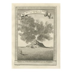
Old Map of Piton de la Fournaise, a Shield Volcano on Eastern Réunion Island
About the Item
Antique map titled 'Partie Orientale de l'Ile de Mascareigne'. This map shows the region of the Piton de la Fournaise, a Shield Volcano on Eastern Réunion Island. Originates from 'Atlas encyclopedique contenant les cartes et les planches relatives a la geographie physique (..)' by N. Desmarest. Published 1827.
- Dimensions:Height: 18.12 in (46 cm)Width: 11.82 in (30 cm)Depth: 0.02 in (0.5 mm)
- Materials and Techniques:
- Period:
- Date of Manufacture:1827
- Condition:Wear consistent with age and use. General age-related toning, minor wear. Later hand coloring, blank verso. Original folding line. Please study images carefully.
- Seller Location:Langweer, NL
- Reference Number:
About the Seller
5.0
Platinum Seller
These expertly vetted sellers are 1stDibs' most experienced sellers and are rated highest by our customers.
Established in 2009
1stDibs seller since 2017
1,946 sales on 1stDibs
Typical response time: <1 hour
- ShippingRetrieving quote...Ships From: Langweer, Netherlands
- Return PolicyA return for this item may be initiated within 14 days of delivery.
More From This SellerView All
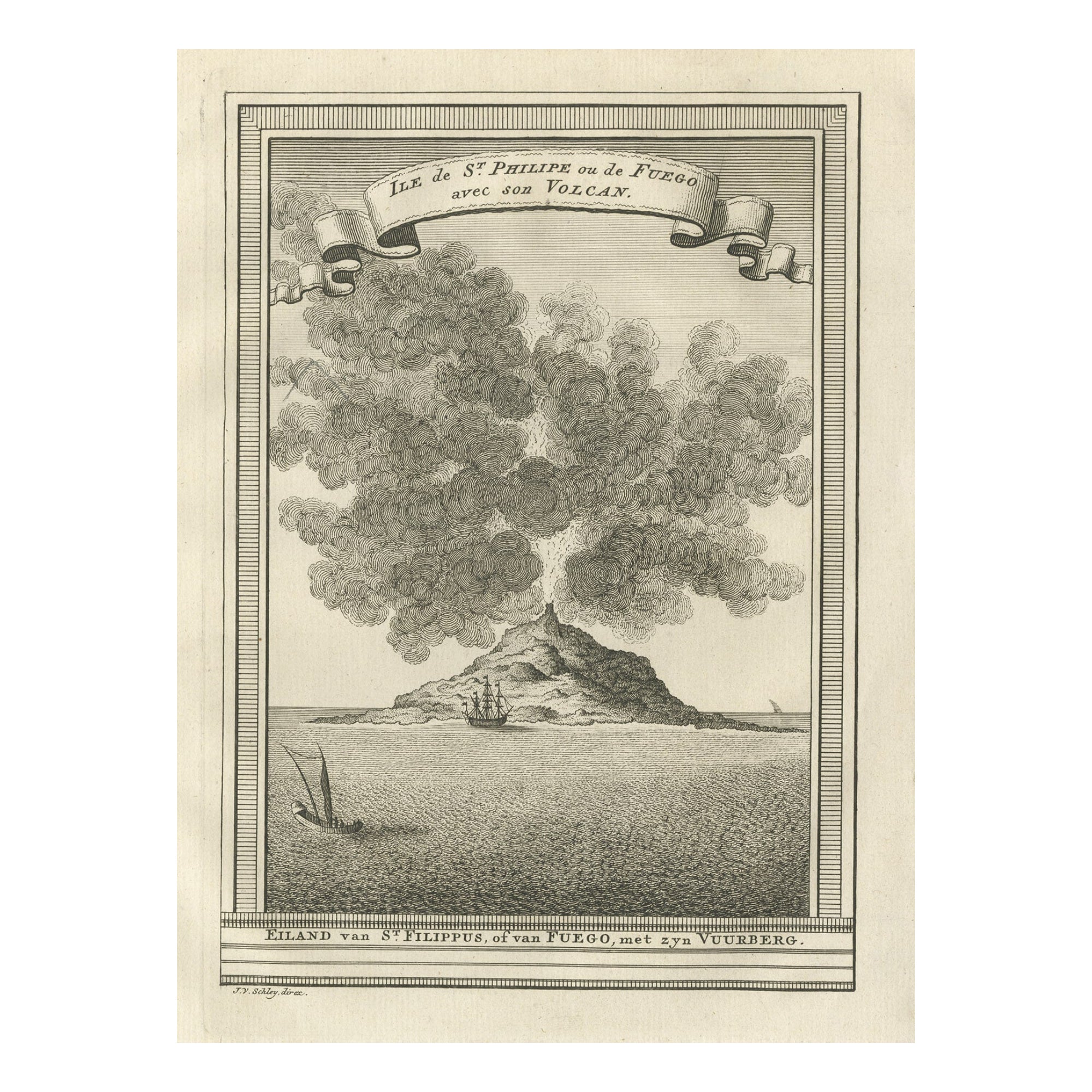
- Old Engraving of Volcano Piton de la Fournaise on Reunion Island, c.1750By Jakob van der SchleyLocated in Langweer, NLAntique print titled 'Eiland van St. Filippus, of van Fuego, met zyn vuurberg'. Old print of Piton de la Fournaise, a shield volcano on the eastern side of Reunion island...Category
Antique 18th Century Prints
MaterialsPaper
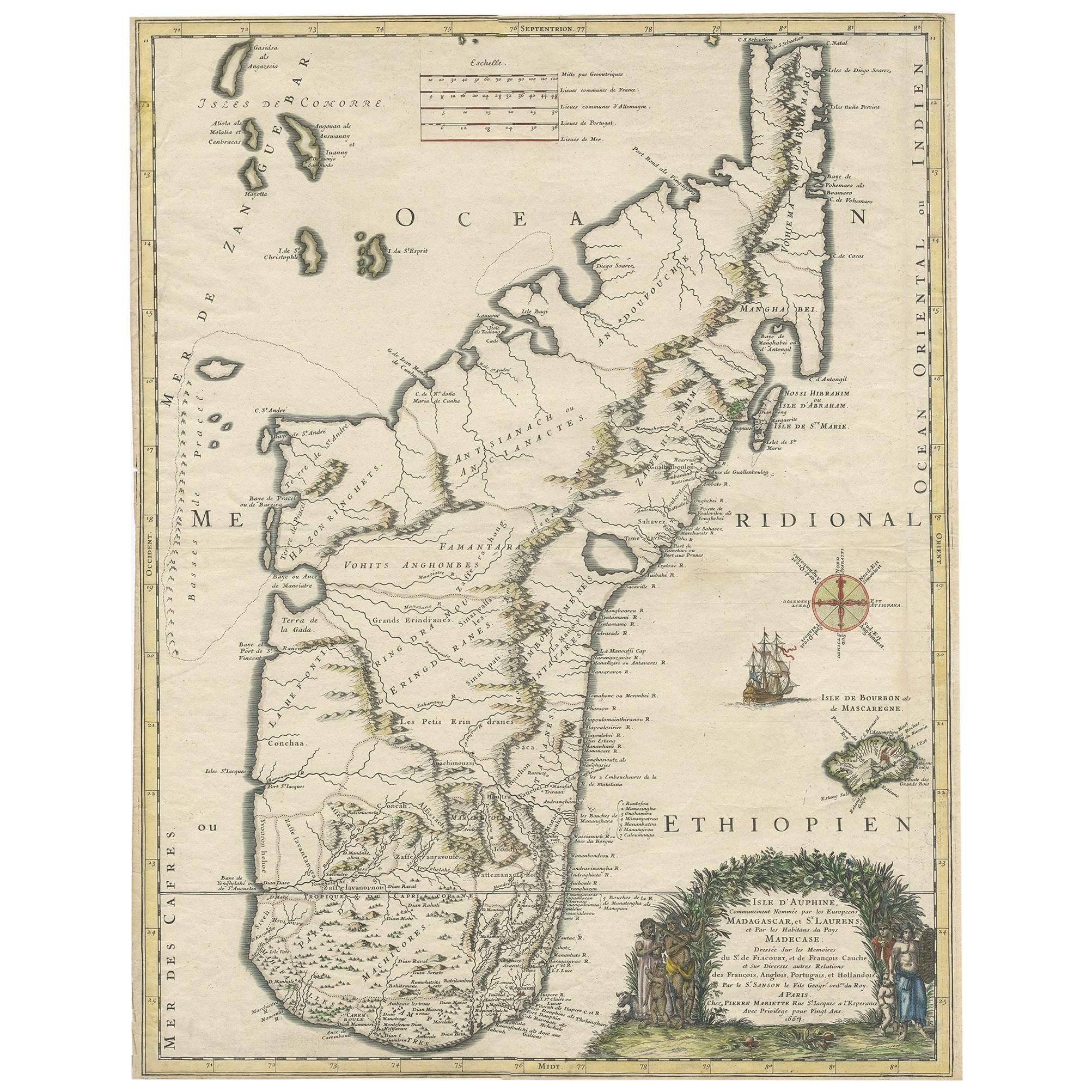
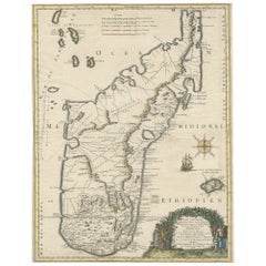
- Beautiful Antique Map of Madagascar, The Comoros Islands & Reunion Island, 1667Located in Langweer, NLAntique map titled 'Isle d'Auphine, communement Nommée par les Europeens Madagascar, et St. Laurens, et par les Habitans du pays Madecase'. Beautiful map of Madagascar...Category
Antique 1660s Maps
MaterialsPaper
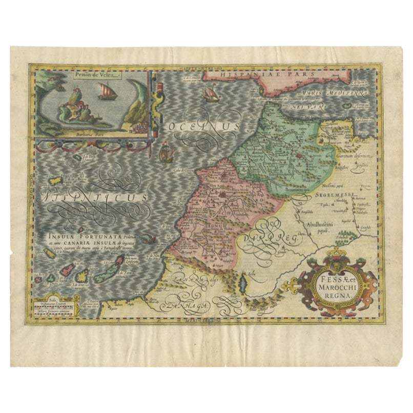
- Old Map of Morocco, The Canary Islands, Madeira, Inset of Penon de Velez, 1605Located in Langweer, NLAntique map titled 'Fessae et Marocchi Regna'. Original antique map of Morocco, extending south to Cape Bojador and , north to the Spanish Coast. Inset of Penon de Velez. Artists and...Category
Antique 17th Century Maps
MaterialsPaper
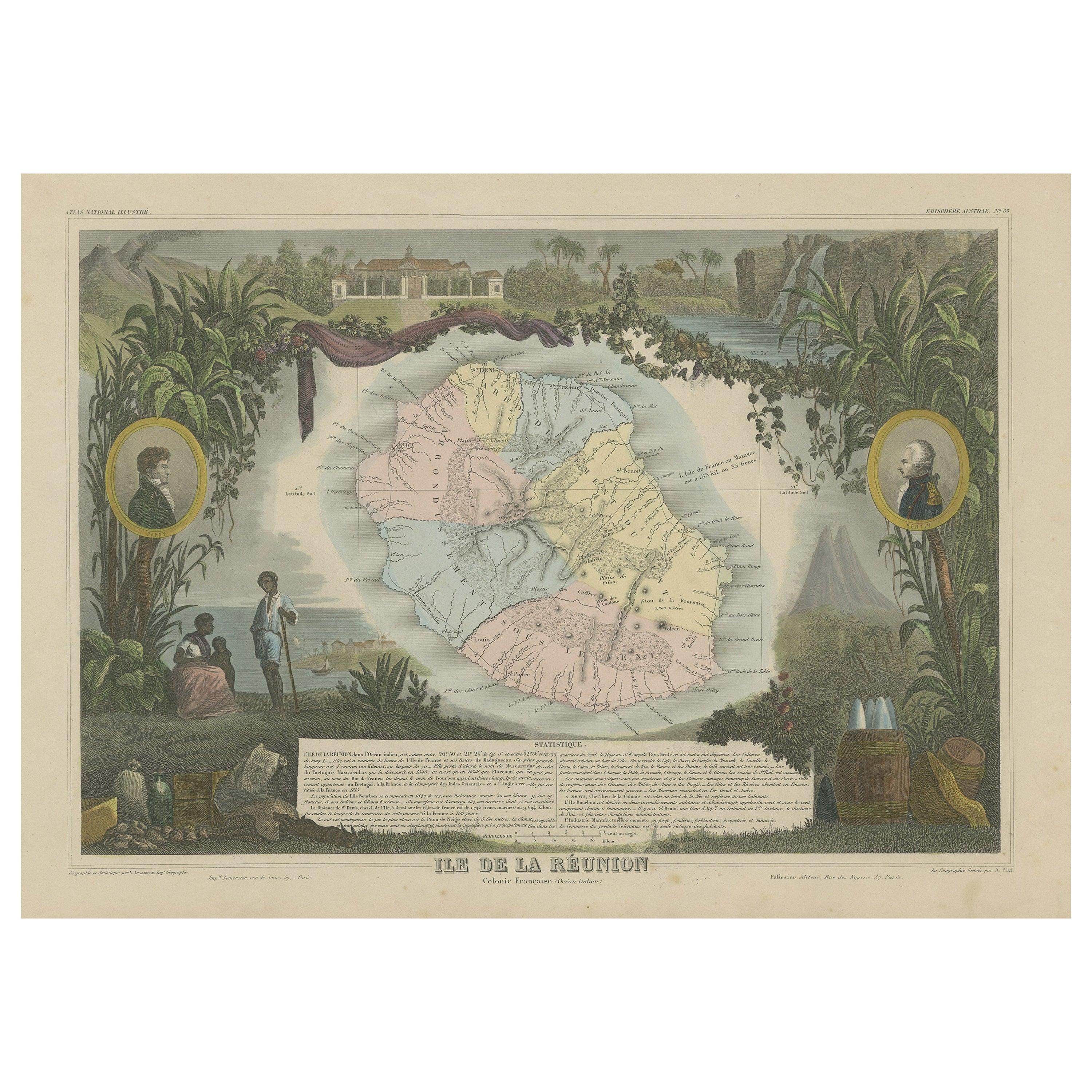
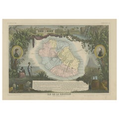
- Antique Map of Bourbon, or Reunion, Colony of FranceLocated in Langweer, NLOriginal antique map titled 'Ile de la Réunion'. This is a fascinating map of the French department of Ile. Bourbon or Reunion. Bourbon, or Reunion, is a volcanic island off the coas...Category
Antique Mid-19th Century Maps
MaterialsPaper
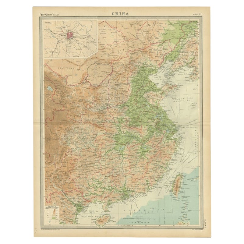
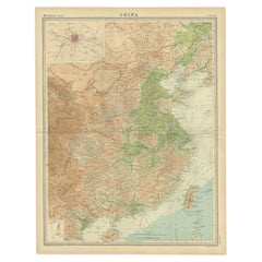
- Original Old Map of Eastern China, Also Depicting Taiwan 'Formosa', 1922Located in Langweer, NLLarge map of China titled 'China - Peking'. Old map of eastern China depicting Kiangsi, Chekiang, Fukien, Kwangtung, Taiwan (Formosa) and surroundings. With inset map of Peking. This...Category
20th Century Maps
MaterialsPaper
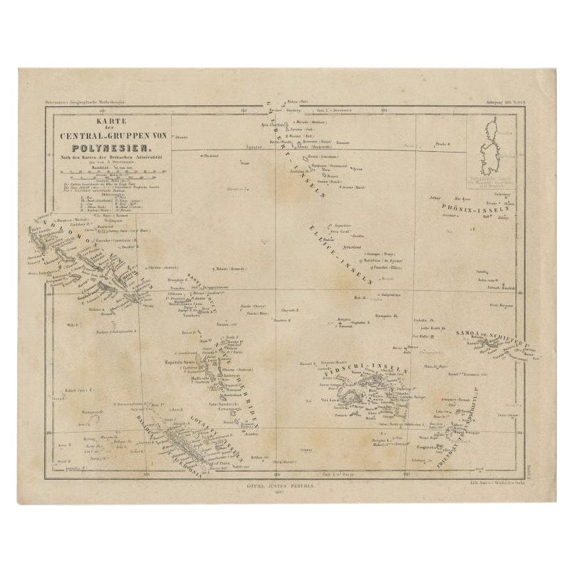
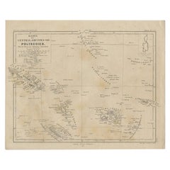
- Old German Map Depicting the Central Islands of Polynesia, 1857Located in Langweer, NLAntique map Polynesia titled 'Karte der Central-Gruppen von Polynesien'. Old map depicting the central islands of Polynesia. This map originates from 'Petermanns Geographische Mittei...Category
Antique 19th Century Maps
MaterialsPaper

You May Also Like
- Old Nautical Map of CorsicaLocated in Alessandria, PiemonteST/556/1 - Old map of Corsica isle, surveyed by Captain Hell, of the French Royal Navy in 1824, engraved and published on 1874, with additions and corre...Category
Antique Early 19th Century English Other Prints
MaterialsPaper
- Old Horizontal Map of EnglandBy TassoLocated in Alessandria, PiemonteST/520 - Old rare Italian map of England, dated 1826-1827 - by Girolamo Tasso, editor in Venise, for the atlas of M.r Le-Sage.Category
Antique Early 19th Century Italian Other Prints
MaterialsPaper
- Map of the Holy Land "Carte de la Syrie et de l'Egypte" by Pierre M. LapieBy Pierre M. LapieLocated in Alamo, CAAn early 19th century map of ancient Syria and Egypt entitled "Carte de la Syrie et de l'Egypte anciennes/dressée par M. Lapie, Colonel d'Etat Major, et...Category
Antique Early 19th Century French Maps
MaterialsPaper
- Scandinavia & Portions of Eastern Europe: 18th Century Hand-Colored Homann MapBy Johann Baptist HomannLocated in Alamo, CAAn early 18th century hand-colored copper-plate map entitled "Regni Sueciae in omnes suas Subjacentes Provincias accurate divisi Tabula Generalis" by Johann Baptist Homann (1663-1724...Category
Antique Early 18th Century German Maps
MaterialsPaper
- Southern & Eastern Europe: A Large 17th C. Hand-colored Map by Sanson & JaillotBy Nicolas SansonLocated in Alamo, CAThis large hand-colored map entitled "Estats de L'Empire des Turqs en Europe, ou sont les Beglerbeglicz our Gouvernements" was originally created by Nicholas Sanson d'Abbeville and t...Category
Antique 1690s French Maps
MaterialsPaper
- Antique Map of Paris, "Carte Routiere des Environs de Paris" 1841Located in Colorado Springs, COThis beautiful hand-colored road map of Paris was published in 1841. The map shows Paris and the surrounding area in a folding pocket map. Organized and detailed for travelers, this ...Category
Antique 1840s French Maps
MaterialsPaper


Recently Viewed
View AllMore Ways To Browse
Old Shield
Office Cart
Island Cart
Fournaise Antique
Antique Texas Collectables
Antique Furniture Alexandria
Victorian Fence
Alexandria Antique Furniture
Battle Maps
Antique Malaysia
Russian Antique Plates
Antique Railroad Collectables
Antique Railroad Collectibles
Floor Vase Wood
Antique Railroad Collectibles Collectibles
Map Print Set
Mariner Furniture
Antique World Globe Map