19th Century Maps
to
1,677
2,155
71
2,229
73
9
5
4
2
1
1
1
2,974
2,229
473
3
288
34
9
126
8
36
9
2
5
4
3
2
2,191
65
28
12
10
288
167
102
98
98
2,229
2,229
2,229
104
23
9
8
7
Period: 19th Century
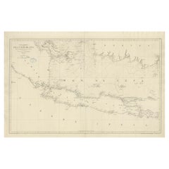
Large Chart of the island and sea of Java, Indonesia
Located in Langweer, NL
Antique map titled 'Carte Esférica de la Isla Y Mar de Java'. Large chart of the island and sea of Java, Indonesia. Beautiful nautical chart, published 1863 in Spain.
Category
Antique 19th Century Maps
Materials
Paper
$2,358 Sale Price
20% Off
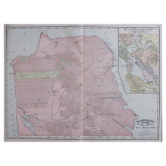
Large Original Antique City Plan of San Francisco, USA, 1894
Located in St Annes, Lancashire
Fabulous colorful map of San Francisco
Original color
By Rand, McNally & Co.
Published, 1894
Unframed
Free shipping.
Category
American Antique 19th Century Maps
Materials
Paper
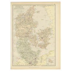
1882 Map of Denmark, Schleswig, and Holstein Highlighting Geographical Details
Located in Langweer, NL
This 1882 map of Denmark, Schleswig, and Holstein, published by Blackie and Son as part of the 'Comprehensive Atlas and Geography of the World,' provides a detailed representation of...
Category
Antique 19th Century Maps
Materials
Paper
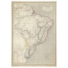
Antique Map of of Brazil, Paraguay and Uruguay
Located in Langweer, NL
Antique map titled 'Bresil Paraguay et Uruguay'. Fine steel engraved map of Brazil, Paraguay and Uruguay. Engraved by Leclercq and published by Armand Aubree in "Atlas Classique et U...
Category
Antique 19th Century Maps
Materials
Paper
$320 Sale Price
20% Off
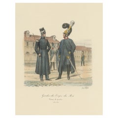
Old Hand-Colored Print of the Guards of the King of France, 1890
Located in Langweer, NL
Antique print titled 'Gardes-du-Crops du Roi'.
Old print of the Guards of the King of France. This print originates from 'Histoire de la maison militaire du roi de 1814 à 1830 : ...
Category
Antique 19th Century Maps
Materials
Paper
$179 Sale Price
20% Off
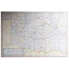
Large Original Antique Map of Oklahoma, USA, circa 1900
Located in St Annes, Lancashire
Fabulous map of Oklahoma
Original color
Engraved and printed by the George F. Cram Company, Indianapolis.
Published, circa 1900
Unframed
Repair to...
Category
American Antique 19th Century Maps
Materials
Paper
Print of Tenggarong in East-Kalimantan on The Island of Borneo, Indonesia, 1881
Located in Langweer, NL
Antique print with a view of Tenggarong, Indonesia. This print originates from 'Reis in Oost- en Zuid-Borneo van Koetei naar Banjermassin (..)' by Carl Bock....
Category
Antique 19th Century Maps
Materials
Paper
$226 Sale Price
20% Off
Colton's Map of Illinois, with an Inset of Chicago
Located in Langweer, NL
Antique map titled 'Colton's Illinois'. Antique map of Illinois, a state in the Midwestern United States. With an inset map of of Cook County &...
Category
Antique 19th Century Maps
Materials
Paper
$226 Sale Price
20% Off
Antique Woodblock Print Map of Japan 'circa 1860'
Located in Langweer, NL
Original Japanese woodblock print map of Japan. Very large and fascinating map, rebacking with Japanese paper. Published circa 1860.
Category
Antique 19th Century Maps
Materials
Paper
$2,211 Sale Price
25% Off
Large Original Antique Map of California, USA, circa 1900
Located in St Annes, Lancashire
Fabulous map of California
Original color
Engraved and printed by the George F. Cram Company, Indianapolis.
Published, circa 1900
Unframed
Free shipping.
Category
American Antique 19th Century Maps
Materials
Paper
Crossroads of Empires: A John Tallis Map of the Isthmus of Panama, 1851
Located in Langweer, NL
The Tallis map of the Isthmus of Panama is a beautifully detailed work, characteristic of the maps produced by John Tallis & Company, which was one of the last cartographic firms to ...
Category
Antique 19th Century Maps
Materials
Paper
$273 Sale Price
20% Off
Large Original Antique Map of Madagascar. 1894
Located in St Annes, Lancashire
Superb Antique map of Madagascar
Published Edward Stanford, Charing Cross, London 1894
Original colour
Good condition
Unframed.
Free shipping
Category
English Antique 19th Century Maps
Materials
Paper
Antique Map of North America by Johnson, '1872'
Located in Langweer, NL
Antique map titled 'Johnson's North America'. Original map of North America, with an inset map of the Hawaiian group or Sandwich Islands. This map originates from 'Johnson's New Illu...
Category
Antique 19th Century Maps
Materials
Paper
$377 Sale Price
20% Off
Antique Map of South America with Many Details, ca.1859
Located in Langweer, NL
Original antique map titled 'Süd-America'. Beautiful old map of South America, with many details and legend.
This map originates from Stielers Handatlas, published circa 1859. St...
Category
Antique 19th Century Maps
Materials
Paper
$547 Sale Price
20% Off
Antique Print of a Malayan Houses in Sumatra, Indonesia, 1881
Located in Langweer, NL
Antique print with a view of the place of the Sultan of Koetai and a Malayan house in Sumatra. This print originates from 'Reis in Oost- en Zuid-Borneo van Koetei naar Banjermassin (..)' by Carl Bock...
Category
Antique 19th Century Maps
Materials
Paper
$245 Sale Price
20% Off
Antique Map of the Region of Hokkaido, Island of Japan, 1812
Located in Langweer, NL
Antique map titled 'Karte von Jesso und Sagalien'. Old map of the region of the island of Yesso (Mororan, Hokkaido, Japan). This map originates from Volume 38 of 'Allgemeine geograph...
Category
Antique 19th Century Maps
Materials
Paper
Original Antique Print of Crimean Costumes, Russia & Ukraine, ca.1880
Located in Langweer, NL
Antique print titled 'Die Krim - Trachten'.
Original antique print of Crimean costumes. Source unknown, to be determined.
Artists and Engravers: Anonymous.
Category
Antique 19th Century Maps
Materials
Paper
$122 Sale Price
20% Off
Antique Folding Map of England and Wales
Located in Langweer, NL
Antique map titled 'England and Wales'. Original folding map of England and Wales. Publishes by A. & C. Black, circa 1890.
Category
Antique 19th Century Maps
Materials
Paper
$396 Sale Price
20% Off
Old Map of the French Department of Nièvre, France
Located in Langweer, NL
Antique map titled 'Dept. de la Nièvre'. Map of the French department of Nievre, France. Part of the prestiegous Burgundy or Bourgogne wine region this area is known for its producti...
Category
Antique 19th Century Maps
Materials
Paper
$320 Sale Price
20% Off
Large Original Antique Map of the The Windward Islands. 1894
Located in St Annes, Lancashire
Superb Antique map of The Windward Islands
Published Edward Stanford, Charing Cross, London 1894
Original colour
Good condition
Unframed.
Free shipping
Category
English Antique 19th Century Maps
Materials
Paper
Large Original Antique Map of The Greek Islands. 1894
Located in St Annes, Lancashire
Superb Antique map of The Greek Islands
Published Edward Stanford, Charing Cross, London 1894
Original colour
Good condition
Unframed.
Free shipping
Category
English Antique 19th Century Maps
Materials
Paper
Old German Antique Map of Iran and Arabia, 1866
Located in Langweer, NL
Antique map titled 'Vorder-Asien oder Iran, Turan, Arabien, Kleinasien und die Kaukasus Länder'. Large map centered on Iran. It shows the area from Turkey to Mumbai in India. Include...
Category
Antique 19th Century Maps
Materials
Paper
$235 Sale Price
20% Off
Antique Print of Jacobite Drinking Glasses by Gibb, 1890
Located in Langweer, NL
Antique print titled 'Three Jacobite drinking glasses'. Chromolithographic plate originating from 'The Royal House of Stuart. Illustrated By ...
Category
Antique 19th Century Maps
Materials
Paper
$80 Sale Price
20% Off
North & Central Africa & Arabia, Inset Map of Habesch 'Ethiopia & Eritrea', 1845
Located in Langweer, NL
Antique map titled 'Mittel- und Nord-Africa (östl. Theil) und Arabien'.
This map depicts North and Central Africa and Arabia with an inset map of Habesch (Ethiopia and Eritrea).
...
Category
Antique 19th Century Maps
Materials
Paper
$226 Sale Price
20% Off
Hand-Colored Print of Corporal Punishment with a Cangue (or Tcha), China, 1844
Located in Langweer, NL
Antique print titled 'Chine - Supplice du Tcha ou Kangue'.
View of corporal punishment with a cangue (or tcha). The cangue is a device that was...
Category
Antique 19th Century Maps
Materials
Paper
$169 Sale Price
20% Off
Antique Map of China and Japan, with Frame Style Border
Located in Langweer, NL
Antique map titled 'Empires Chinois et Japonnais'. Attractive map of China and Japan. This map originates from Maison Basset's 1852 edition of 'Atlas Illustre Destine a l'enseignemen...
Category
Antique 19th Century Maps
Materials
Paper
$160 Sale Price
20% Off
Antique Map of Asia by Wyld '1845'
Located in Langweer, NL
Antique map titled 'Asia'. Original antique map of Asia. This map originates from 'An Atlas of the World, Comprehending Separate Maps of its Variou...
Category
Antique 19th Century Maps
Materials
Paper
$188 Sale Price
20% Off
Carl Adami 13 inch terrestrial globe, Berlin, dated 1900.
Located in London, GB
Carl Adami 13 inch terrestrial globe, by Dietrich Reimer, Berlin, Germany, 1900.
“C. ADAMI’S ERDGLODUS neu bearbeitet und gezichnet von H. KIEPERT. Dietrich Reimer, Berlin. 1900 (E....
Category
German Antique 19th Century Maps
Materials
Brass
Antique Zoological Map, 1843
Located in Langweer, NL
Two antique world maps on one sheet. The upper map shows the distribution of animals over the world. The lower map shows the distribution of birds & reptiles over the world. Originat...
Category
Antique 19th Century Maps
Materials
Paper
$207 Sale Price
20% Off
Antique Plan of Turkey in Europe with Inset Map of the Bosporus, ca.1850
Located in Langweer, NL
Antique map titled 'Turkey in Europe'.
A map of European Turkey and the surrounding countries. With an inset map of the Bosporus. This includes Macedonia, Bulgaria, Croatia, Bosn...
Category
Antique 19th Century Maps
Materials
Paper
$207 Sale Price
20% Off
Early San Francisco View by Henry Firks Printed by W.H. Jones in 1849
Located in San Francisco, CA
A tinted lithographic view of San Francisco, made during the gold rush, showing a panoramic view of the bay's waterfront from the south along Montgomery Street to Telegraph Hill. The...
Category
American Victorian Antique 19th Century Maps
Materials
Paper
Large Original Antique Map of Maryland, Delaware & DC, USA, C.1900
Located in St Annes, Lancashire
Fabulous map of Maryland, Delaware And District of Columbia
Original color
Engraved and printed by the George F. Cram Company, Indianapolis.
Pu...
Category
American Antique 19th Century Maps
Materials
Paper
Antique Map of Basses Pyrénées ‘France’ by V. Levasseur, 1854
Located in Langweer, NL
Antique map titled 'Dépt. des Bses. Pyrénées'. Map of the French department of Basses Pyrenees, France. This department includes the Jurancon wine region, famous for its production d...
Category
Antique 19th Century Maps
Materials
Paper
$169 Sale Price
20% Off
Large Original Antique Map of Mississippi, USA, 1894
Located in St Annes, Lancashire
Fabulous map of Mississippi
Original color
By Rand, McNally & Co.
Published, 1894
Unframed
Free shipping.
Category
American Antique 19th Century Maps
Materials
Paper
Hand Colored Antique Map of the Department of Haute-Vienne, France
Located in Langweer, NL
Antique map titled 'Dépt. de l'Ariège'. Map of the French department of Haute-Vienne, France. Haute-Vienne is home to the commune of Limoge, which makes oak barrels used...
Category
Antique 19th Century Maps
Materials
Paper
$320 Sale Price
20% Off
Antique Map of Central Asia between the Caspian Sea and Lake Balkhash
Located in Langweer, NL
Antique map titled 'Independent Tartary'. Original steel engraved map of Central Asia. It covers the regions between the Caspian Sea and Lake Balkhash and between Russia and Afghanis...
Category
Antique 19th Century Maps
Materials
Paper
$547 Sale Price
20% Off
Original Antique Map of United States, Grattan and Gilbert, 1843
Located in St Annes, Lancashire
Great map of United States
Drawn and engraved by Archer
Published by Grattan and Gilbert. 1843
Original colour
Unframed.
Category
English Antique 19th Century Maps
Materials
Paper
Antique Print of a Jacobite Pincushion and a Silk Purse by Gibb, 1890
Located in Langweer, NL
Antique print titled 'Jacobite Pincushion - Silk Purse'. Chromolithographic plate originating from 'The Royal House of Stuart. Illustrated By a Series of Forty Plates in Colours Draw...
Category
Antique 19th Century Maps
Materials
Paper
$80 Sale Price
20% Off
Large Original Antique Map of Cyprus. 1894
Located in St Annes, Lancashire
Superb Antique map of Cyprus
Published Edward Stanford, Charing Cross, London 1894
Original colour
Good condition
Unframed.
Free shipping
Category
English Antique 19th Century Maps
Materials
Paper
Vue du Chateau d'Ouandipore, Prévost, 1802
Located in Langweer, NL
Vue du Chateau d'Ouandipore'. (View of the Castle of Wandipore in Tibet). This original antique print is taken from 'Histoire générale des voyages (?).', pu...
Category
Antique 19th Century Maps
Materials
Paper
$51 Sale Price
20% Off
Copenhagen (Kiöbenhaven) Map with City View – Antique German Atlas Print, 1844
Located in Langweer, NL
Copenhagen (Kiöbenhaven) Map with City View – Antique German Atlas Print, 1844
This finely detailed antique map titled 'Copenhagen (Kiöbenhaven)' presents a historical view of Denma...
Category
German Antique 19th Century Maps
Materials
Paper
Antique Map of Europe by W. G. Blackie, 1859
Located in Langweer, NL
Antique map titled 'Europe'. Original antique map of Europe. This map originates from ‘The Imperial Atlas of Modern Geography’. Published by W. G. Blackie, 1859.
Category
Antique 19th Century Maps
Materials
Paper
$235 Sale Price
20% Off
19th Century Lithograph Map of Lower Manhattan, New York
Located in Haddonfield, NJ
1859 hand colored map of Lower Manhattan or New Amsterdam by George H. Moore.
Category
English Folk Art Antique 19th Century Maps
Materials
Paper
$620 Sale Price
20% Off
Large Original Antique City Plan of Detroit, USA, 1894
Located in St Annes, Lancashire
Fabulous colorful map of Detroit
Original color
By Rand, McNally & Co.
Published, 1894
Unframed
Free shipping.
Category
American Antique 19th Century Maps
Materials
Paper
Hand Colored Antique Map of the Department of Haute Loire, France
Located in Langweer, NL
Antique map titled 'Dept. de la Haute Loire'. Map of the French department of Haute Loire, France. This area of France is part of the Loire Valley wine growing...
Category
Antique 19th Century Maps
Materials
Paper
$320 Sale Price
20% Off
Antique Map of The Province Noord-Holland in The Netherlands, 1864
Located in Langweer, NL
Antique map titled 'De Provincie Noord-Holland'. Map of the province of Noord-Holland, the Netherlands. This map originates from 'F. C. Brugsma's Atlas van het Koninkrijk der Nederla...
Category
Antique 19th Century Maps
Materials
Paper
$113 Sale Price
20% Off
1882 Map of Argentina, La Plata, Chile, Paraguay, Uruguay, and Patagonia
Located in Langweer, NL
This 1882 map, published as part of the 'Comprehensive Atlas and Geography of the World' by Blackie and Son, provides an intricate depiction of Argentina, La Plata, Chile, Paraguay, ...
Category
Antique 19th Century Maps
Materials
Paper
Rare Print of the 'Corps Des Guides' of the Belgium Army Regiment, 1833
Located in Langweer, NL
One nicely hand coloured print of an original serie of 23 plates, showing officers and soldiers resting near a village. published in 1833. Rare.
From a serie of beautiful lithographed plates with Belgian military...
Category
Antique 19th Century Maps
Materials
Paper
$301 Sale Price
20% Off
Antique Print of a Garden Building from Garden Architecture by Van Laar, 1802
Located in Langweer, NL
Untitled print of garden architecture. It shows garden buildings. This print originates from 'Magazijn van tuin-sieraden'. The book is compiled by Gijs...
Category
Antique 19th Century Maps
Materials
Paper
Map of the East Coast of Hanshu or Honshu & a View of the Japanese Coast, 1803
Located in Langweer, NL
Antique map titled 'Gedeelte van Japan of Nipon'.
Map of the east coast of Hanshu, with a view of the Japanese coast titled 'Gezigt van de Kust van Japan, wanneer wij haar voor h...
Category
Antique 19th Century Maps
Materials
Paper
$490 Sale Price
20% Off
Antique Map of Tunis and Tripoli in Northern Africa, circa 1880
By J. Migeon
Located in Langweer, NL
Antique map titled 'Tunis et Tripoli & Empire de Maroc'. Old map of Tunis and Tripoli and the Empire of Morocco. This map originates from 'Géographie Universelle Atlas-Migeon' by J. ...
Category
Antique 19th Century Maps
Materials
Paper
$150 Sale Price
20% Off
Antique Map of Part of the Bombay Presidency in India, 1831
Located in Langweer, NL
Antique map titled 'India III Bombay Presidency'. Old steel engraved map of part of the Bombay Presidency. The Bombay Presidency, also known as Bombay and Sind from 1843 to 1936 and ...
Category
Antique 19th Century Maps
Materials
Paper
$273 Sale Price
20% Off
Antique Map of the Netherlands by Brugsma, 1864
Located in Langweer, NL
Antique map titled 'Het Koningrijk der Nederlanden'. Map of the Netherlands. This map originates from 'F. C. Brugsma's Atlas van het Koninkrijk ...
Category
Antique 19th Century Maps
Materials
Paper
$93 Sale Price
20% Off
1882 Cartographic Views of Ireland's North and South Regions
Located in Langweer, NL
Title: 1882 Maps of Ireland: Northern and Southern Regions
These two maps provide a detailed representation of Ireland as it was in 1882, divided into the northern and southern regi...
Category
Antique 19th Century Maps
Materials
Paper
Antique Map of the World, Mercator Projection, by Wyld, '1845'
Located in Langweer, NL
Antique map titled 'The World'. Original antique world map, on Mercator's projection. This map originates from 'An Atlas of the World, Compr...
Category
Antique 19th Century Maps
Materials
Paper
$330 Sale Price
20% Off
Antique Map of Indiana by Johnson, 1872
Located in Langweer, NL
Antique map titled 'Johnson's Indiana'. Original map of Indiana. This map originates from 'Johnson's New Illustrated Family Atlas of the World' by A.J. ...
Category
Antique 19th Century Maps
Materials
Paper
$176 Sale Price
40% Off
1855 "New-York City & County Map" by Charles Magnus
By Charles Magnus
Located in Colorado Springs, CO
This is a beautiful hand-colored map titled “New York City & County Map with Vicinity entire Brooklyn, Williamsburgh, Jersey City &c.” The work was published in 1855 by Charles Magnu...
Category
American Antique 19th Century Maps
Materials
Paper
Antique Print of the Residence House in Serang, Java, Indonesia, 1844
Located in Langweer, NL
Antique print titled 'Het Residentie-Huis te Serang - Maison du Resident à Serang'. Old print with a view of the residence house in Serang. Originates from 'Gezigten uit Neerlands In...
Category
Antique 19th Century Maps
Materials
Paper
Neatly Framed Decorative Hand-Colored View of Zierikzee, the Netherlands, 1858
Located in Langweer, NL
Antique print titled 'Zierikzee'.
View of the city of Zierikzee, the Netherlands. This print originates from 'Het koningrijk der Nederlanden voorgesteld in eene reeks van 136 naa...
Category
Antique 19th Century Maps
Materials
Paper
$462 Sale Price
20% Off
Antique Map of the Arctic Regions by Lowry '1852'
Located in Langweer, NL
Antique map titled 'Arctic Regions'. Original map of the Arctic Regions. This map originates from 'Lowry's Table Atlas constructed and engraved from the most recent Authorities' by J...
Category
Antique 19th Century Maps
Materials
Paper
$94 Sale Price
20% Off
