19th Century Maps
to
1,677
2,155
71
2,229
73
9
5
4
2
1
1
1
2,974
2,229
473
3
288
34
9
126
8
36
9
2
5
4
3
2
2,191
65
28
12
10
288
167
102
98
98
2,229
2,229
2,229
104
23
9
8
7
Period: 19th Century
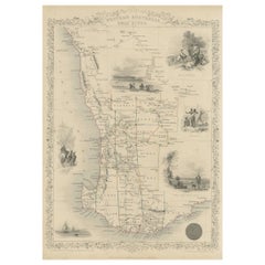
Map of Western Australia & Swan River, insets of Perth, Aboriginals, Sheep, 1851
Located in Langweer, NL
Antique map titled 'Western Australia, Swan River'. Map of Western Australia and Swan River, surrounded by illustrations of Perth, Aborigines and sheep shea...
Category
Antique 19th Century Maps
Materials
Paper
$301 Sale Price
20% Off
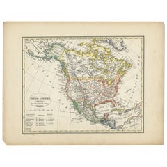
Antique Map of North America from an Old Dutch School Atlas, 1852
Located in Langweer, NL
Antique map titled 'Noord-Amerika'. Map of North America. This map originates from 'School-Atlas van alle deelen der Aarde' by Otto Petri. Artists and Engra...
Category
Antique 19th Century Maps
Materials
Paper
$207 Sale Price
20% Off
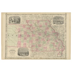
Historic Map of Missouri and Kansas Showing Railroads and Frontier Trails, 1864
Located in Langweer, NL
Antique 1864 Map of Missouri and Kansas by Johnson and Ward
Description:
This finely detailed and vibrantly hand-colored map of Missouri and Kansas, publ...
Category
Antique 19th Century Maps
Materials
Paper
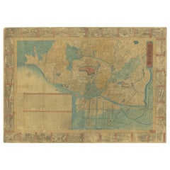
1885 Shinsen Tokyo Zenzu: Rare Meiji-Era Map of Tokyo by Sakai Kinzaburo
Located in Langweer, NL
Title: Detailed Edo Period Map of Tokyo (Edo), Featuring Neighborhoods and Landmarks
This beautifully detailed patina rich map, titled "Shinsen Tokyo Zenzu" (Newly Selected Complete...
Category
Antique 19th Century Maps
Materials
Paper
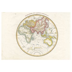
Antique Map of the Eastern Hemisphere by Lapie, France, circa 1830
Located in Langweer, NL
Antique Map of the Eastern Hemisphere by Lapie, France, circa 1830
This finely engraved and hand-colored antique map, titled Hémisphère de l'ancien continent (Eastern Hemisphere), w...
Category
Antique 19th Century Maps
Materials
Paper
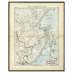
Antique Map of Eastern Russia in Asia by Kuyper, 1880
Located in Langweer, NL
Antique map titled 'Aziatisch Rusland. Oost'. Original antique map of Eastern Russia in Asia. This lithographed map originates from: 'Wereld-atlas voor ...
Category
Antique 19th Century Maps
Materials
Paper
$61 Sale Price
20% Off
1882 Antique Map of the Indian Archipelago Showing Southeast Asia in Detail
Located in Langweer, NL
This 1882 map of the Indian Archipelago, published by Blackie and Son as part of the 'Comprehensive Atlas and Geography of the World,' provides a detailed depiction of the maritime r...
Category
Antique 19th Century Maps
Materials
Paper
Antique Map of North America and the West Indies by Stieler, circa 1865
Located in Langweer, NL
Antique map titled 'Nord-America und West-Indien'. Old map of North America and the West Indies. This map originates from Stieler's 'Schul-Atlas'.
Category
Antique 19th Century Maps
Materials
Paper
$113 Sale Price
20% Off
1864 Map of North America, Antique Hand-Colored Map, by Adolphe Hippolyte Dufour
Located in Colorado Springs, CO
Offered is a map of North America entitled Amerique du Nord from 1864. This rare, separately published wall map was produced by Adolphe Hippolyte Dufour. This map includes vibrant an...
Category
French Antique 19th Century Maps
Materials
Paper
Antique Map Showing the Locations of Native American Tribes in 1899
Located in Langweer, NL
Antique map titled 'Map showing the Indian Reservations within the Limits of the United States'. Large folding map of the United States showing the Indian Reservations. The present m...
Category
Antique 19th Century Maps
Materials
Paper
$613 Sale Price
20% Off
Original Antique Map or City Plan of Istanbul, Turkey. Circa 1835
Located in St Annes, Lancashire
Nice map of Istanbul
Drawn and engraved by J.Dower
Published by Orr & Smith. C.1835
Unframed.
Free shipping
Category
English Antique 19th Century Maps
Materials
Paper
Antique Map of Asia by Ferrario '1815'
Located in Langweer, NL
Antique map titled 'Carta generale dell' Asia (..)'. Original antique map of Asia. This map originates from ' Le Costume Ancien et Moderne' by Jule...
Category
Antique 19th Century Maps
Materials
Paper
$896 Sale Price
20% Off
Antique Map of Vermont
Located in Langweer, NL
Antique map titled 'Vermont'. Original antique map of Vermont, United States. This print originates from 'Encyclopaedia Britannica', Ninth Edition. Publ...
Category
Antique 19th Century Maps
Materials
Paper
$273 Sale Price
20% Off
Map of Guyane (French Guiana) with Cayenne, circa 1826
Located in Langweer, NL
Map of Guyane (French Guiana) with Cayenne, circa 1826
This is an antique French map titled “Guyane” from *Petit Atlas National (Colonies françaises)* published by Blaisot around 18...
Category
French Antique 19th Century Maps
Materials
Paper
Old Hand-Colored Print of Officers and Horses of the Belgium Army, 1833
Located in Langweer, NL
One nicely hand coloured print of an original serie of 23 plates, showing officers and soldiers discussing matters. published in 1833. Rare.
From a serie of beautiful lithographed...
Category
Antique 19th Century Maps
Materials
Paper
$169 Sale Price
20% Off
Antique Map of The Dutch Smallingerland Township, 1861
Located in Langweer, NL
Antique map titled 'Gemeente Smallingerland'. Old map depicting the Smallingerland township including cities and villages like Eernewoude, Oudega, Boornbergum, Opeinde and Drachten. ...
Category
Antique 19th Century Maps
Materials
Paper
$94 Sale Price
20% Off
Original Antique Map of Munich, Germany by J. Stockdale, 1800
Located in Langweer, NL
Title: Vintage Map of Munich, Germany by J. Stockdale, 1800
This vintage map, titled "A Plan of the City of Munich," was published by J. Stockdale in Piccadilly, London, in 1800. Th...
Category
Antique 19th Century Maps
Materials
Paper
Antique Map of Spain and Portugal by Levasseur, '1875'
Located in Langweer, NL
Antique map titled 'Carte générale de l'Espagne et du Portugal (..)'. Large map of Spain and Portugal. This map originates from 'Atlas de Géographie Moder...
Category
Antique 19th Century Maps
Materials
Paper
$353 Sale Price
40% Off
Original Antique Map or City Plan of Madrid, Spain. Circa 1835
Located in St Annes, Lancashire
Nice map of Madrid
Drawn and engraved by J.Dower
Published by Orr & Smith. C.1835
Unframed.
Free shipping
Category
English Antique 19th Century Maps
Materials
Paper
Ancient Cartography of Britannia and Hibernia, Published in 1880
Located in Langweer, NL
This map depicts the geographical area of Great Britain and Ireland, labeled "BRITANNIA et HIBERNIA." It is a historical map, as indicated by the Latin titles and the classical names of regions and tribes.
In the main section of the map, Great Britain is depicted in fine detail, with topographical features such as mountains and rivers. The map is color-coded, to differentiate political or tribal boundaries. Various Roman place names are indicated, such as "Londinium" for London.
To the left of Great Britain is Ireland, referred to as "Hibernia," similarly detailed with its own topographical features and ancient...
Category
Antique 19th Century Maps
Materials
Paper
$349 Sale Price
20% Off
Large Original Antique Map of The Falkland Islands. 1894
Located in St Annes, Lancashire
Superb Antique map of The Falkland Islands
Published Edward Stanford, Charing Cross, London 1894
Original colour
Good condition
Unframed.
Free shipping
Category
English Antique 19th Century Maps
Materials
Paper
Central America Map – Johnson, Hand-Colored with Insets, c.1864
Located in Langweer, NL
Johnson’s Central America Map, USA c.1864 – Hand-Colored with Insets
This is a finely engraved and hand-colored map titled Johnson’s Central America, published by Johnson and Ward i...
Category
American Antique 19th Century Maps
Materials
Paper
Washington Oregon Idaho Map – Johnson, Hand-Colored, c.1864
Located in Langweer, NL
Johnson’s Washington Oregon Idaho Map, USA c.1864 – Hand-Colored
This is a finely engraved and hand-colored map titled Johnson’s Washington, Oregon, and Idaho, published by Johnson ...
Category
American Antique 19th Century Maps
Materials
Paper
Antique Map of the United States of America by Lapie '1842'
Located in Langweer, NL
Antique map titled 'Carte des États-Unis d'Amérique'. Map of the United States of America (USA). This map originates from 'Atlas universel...
Category
Antique 19th Century Maps
Materials
Paper
$566 Sale Price
20% Off
Genuine Antique Map of European Turkey by Pierre Antoine Tardieu (1784-1869)
Located in Langweer, NL
This is an original antique map titled "Carte de la Turquie d'Europe," which depicts the European territories of the Ottoman Empire. The map features detailed geographical and political boundaries, showcasing various regions, cities, rivers, and mountains within the Ottoman European territories. The map was created by Pierre Antoine Tardieu, a renowned French engraver, steel engraver, and cartographer known for his high-quality work.
Map Details:
- **Title**: Carte de la Turquie d'Europe
- **Creator**: Pierre Antoine Tardieu (1784-1869)
- **Publication Date**: Early 19th century
- **Dimensions**: Approximately 34.5 x 43.5 cm (13.5 x 17.25 inches)
- **Features**: The map includes a detailed representation of the European territories of the Ottoman Empire, with place names, rivers, mountains, and regions clearly marked. The title cartouche is located in the upper left corner, and the mile scale is presented in the lower left.
Around the year 1800, the region referred to as "European Turkey" or "Ottoman Europe" was a significant part of the Ottoman Empire, which was one of the most powerful empires in the world at the time. Here are some key aspects of European Turkey during this period:
### Geographic Scope
European Turkey included a large part of Southeastern Europe, encompassing modern-day:
- Greece
- Bulgaria
- Romania (specifically the regions of Dobruja and parts of Wallachia)
- Serbia
- Albania
- Montenegro
- Bosnia and Herzegovina
- Parts of Croatia, Macedonia, and Hungary
Political Structure
- **Ottoman Administration**: The region was governed by the Ottoman administrative system, which divided territories into provinces (vilayets) and smaller administrative units (sanjaks). Each province was overseen by a governor (pasha) appointed by the Sultan.
- **Autonomy and Vassal States**: Some areas within European Turkey had varying degrees of autonomy or were vassal states. For example, Wallachia and Moldavia (in modern-day Romania) were vassal principalities that retained local rulers under Ottoman suzerainty.
Society and Demographics
- **Ethnic Diversity**: The region was extremely diverse, home to numerous ethnic groups, including Turks, Greeks, Bulgarians, Serbs, Albanians, Vlachs (Romanians), and Jews, among others.
- **Religious Diversity**: There was significant religious diversity, with Islam being the dominant religion due to Ottoman rule, but large Christian (Eastern Orthodox, Roman Catholic) and Jewish populations coexisted.
Economy
- **Agriculture**: The economy was largely agrarian, with agriculture being the primary occupation. Key crops included grains, tobacco, and cotton.
- **Trade and Commerce**: European Turkey was strategically important for trade, connecting the Mediterranean with Central Europe and the Black Sea. Major cities like Constantinople (modern-day Istanbul), Thessaloniki, and Belgrade were key commercial hubs.
Culture
- **Cultural Influence**: The region was a melting pot of various cultures, influenced by Byzantine, Slavic, and Ottoman traditions. This mix was reflected in architecture, cuisine, music, and customs.
- **Education and Language**: The official language of administration was Ottoman Turkish, but many local languages were spoken. Education was often conducted in religious institutions, with different communities maintaining their own schools.
Challenges and Conflicts
- **Internal Strife**: The Ottoman Empire faced numerous internal challenges, including administrative inefficiency, corruption, and local uprisings.
- **External Threats**: The empire was also under pressure from external forces, particularly from the Habsburg Empire, Russia, and later from nationalist movements within the Balkans, which sought independence or autonomy from Ottoman rule.
Decline of Ottoman Power
By 1800, the Ottoman Empire was experiencing a gradual decline, which would intensify throughout the 19th century. This period saw increasing nationalist sentiments among various ethnic groups within European Turkey, leading to uprisings and eventual wars of independence, such as the Serbian Revolution (1804-1835) and the Greek War of Independence (1821-1829).
Overall, European Turkey around 1800 was a complex and diverse region under the Ottoman Empire's waning control, characterized by a rich tapestry of cultures, economic activities, and political structures.
Condition Overview:
1. **Paper Quality**: The map exhibits signs of aging, such as yellowing along the edges, which is typical for documents of this age. The paper remains in good condition without major tears or damage.
2. **Edges and Corners**: The edges are slightly worn, with minor fraying and a few small tears that do not significantly impact the map's readability or aesthetic value.
3. **Center Fold**: There is a visible center fold, common for maps that were folded for storage or publication. The fold is in good condition without significant wear but with splits on both sidess.
4. **Color and Print Quality**: The colors used to outline the boundaries remain vibrant and clear. The print quality is excellent, with sharp, legible text and detailed illustrations.
5. **Staining and Spots**: There are a few spots and stains, particularly near the edges and along the fold. These do not obscure any critical details of the map.
Historical and Artistic Value:
Pierre Antoine Tardieu was known for his meticulous craftsmanship and contributions to cartography. His work drew the attention of prominent figures such as Alexander von Humboldt...
Category
Antique 19th Century Maps
Materials
Paper
$367 Sale Price
20% Off
Large Original Antique Map of West Virginia, USA, C.1900
Located in St Annes, Lancashire
Fabulous map of West Virginia
Original color
Engraved and printed by the George F. Cram Company, Indianapolis.
Published, C.1900
Unframed
Free shipping.
Category
American Antique 19th Century Maps
Materials
Paper
Original Antique Map of The Eastern Hemisphere by Dower, circa 1835
Located in St Annes, Lancashire
Nice map of the Eastern Hemisphere
Drawn and engraved by J.Dower
Published by Orr & Smith. C.1835
Unframed.
Free shipping
Category
English Antique 19th Century Maps
Materials
Paper
Original Antique Map of The Western Hemisphere by Dower, circa 1835
Located in St Annes, Lancashire
Nice map of the Western Hemisphere
Drawn and engraved by J.Dower
Published by Orr & Smith. C.1835
Unframed.
Free shipping
Category
English Antique 19th Century Maps
Materials
Paper
Original Antique Map of Africa by Dower, circa 1835
Located in St Annes, Lancashire
Nice map of Africa
Drawn and engraved by J.Dower
Published by Orr & Smith. C.1835
Unframed.
Free shipping
Category
English Antique 19th Century Maps
Materials
Paper
Original Antique Map of Tasmania, Australia by Dower, circa 1835
Located in St Annes, Lancashire
Nice map of Tasmania
Drawn and engraved by J.Dower
Published by Orr & Smith. C.1835
Unframed.
Free shipping
Category
English Antique 19th Century Maps
Materials
Paper
Original Antique Map of India by Dower, circa 1835
Located in St Annes, Lancashire
Nice map of India
Drawn and engraved by J.Dower
Published by Orr & Smith. C.1835
Unframed.
Free shipping
Category
English Antique 19th Century Maps
Materials
Paper
Antique Map of Greece with Two Small Inset Maps of Athens, c.1870
Located in Langweer, NL
Antique map titled 'Graecia'. Old map of Greece with two small inset maps of Athens. This map originates from 'Atlas Antiquus, twaalf kaarten behoorende bij de Oude Geschiedenis'. Ar...
Category
Antique 19th Century Maps
Materials
Paper
Hindostan or British India Map – Johnson, Hand-Colored USA c.1864
Located in Langweer, NL
Johnson’s Hindostan or British India Map, USA c.1864 – Hand-Colored
This is a finely engraved and hand-colored map titled Johnson’s Hindostan or British India, published by Johnson ...
Category
American Antique 19th Century Maps
Materials
Paper
Johnson’s China Map with Canton Inset, USA Published c.1864 – Hand-Colored
Located in Langweer, NL
Johnson’s China Map with Canton Inset, USA Published c.1864 – Hand-Colored
This is a finely engraved and hand-colored map titled Johnson’s China, publis...
Category
American Antique 19th Century Maps
Materials
Paper
Antique Map of Asian Turkey, Levant, and Mesopotamia by Tardieu, circa 1802
Located in Langweer, NL
This is an original antique map titled "Carte de la Turquie Asiatique," depicting the Asian territories of the Ottoman Empire. Created by Pierre Antoine Tardieu, this map illustrates...
Category
Antique 19th Century Maps
Materials
Paper
$415 Sale Price
20% Off
Antique Map of Peru, Ecuador and Bolivia by Lapie, 1842
Located in Langweer, NL
Antique map titled 'Carte du Perou et du Haut Perou'. Map of Peru, Ecuador and Bolivia. This map originates from 'Atlas universel de géographie ancienne et...
Category
Antique 19th Century Maps
Materials
Paper
$225 Sale Price
20% Off
Original Antique City Plan of Buffalo, New York, USA, circa 1900
Located in St Annes, Lancashire
Fabulous colorful map of Buffalo
Original color
By Rand, McNally & Co.
Published, circa 1900
Unframed
Minor edge tears
Free shipping.
Category
American Antique 19th Century Maps
Materials
Paper
Antique Map of Arkansas, Mississippi and Louisiana by Johnson, 1872
Located in Langweer, NL
Antique map titled 'Johnson's Arkansas (..)'. Original map of Arkansas, Mississippi and Louisiana. This map originates from 'Johnson's New Illustrated ...
Category
Antique 19th Century Maps
Materials
Paper
$235 Sale Price
20% Off
Antique Map of the Israel Township of Ohio by Titus '1871'
Located in Langweer, NL
Antique map titled 'Israel'. Original antique map of Israel, Ohio. This map originates from 'Atlas of Preble County Ohio' by C.O. Titus. Published 1871.
Category
Antique 19th Century Maps
Materials
Paper
$235 Sale Price
20% Off
Antique Map of the Middle East by Smith, 1809
Located in Langweer, NL
Antique map titled 'Regiones inter Euphraten et Indum'. Old map of the Middle East showing the region between the Euphrates and Indus river. Ori...
Category
Antique 19th Century Maps
Materials
Paper
$127 Sale Price
20% Off
Antique World Map by Lesage, 1823
Located in Langweer, NL
Antique world map titled 'Mappe Monde Historique'. The map depicts both the Eastern and Western Hemispheres, with the hemispheres meeting in the midd...
Category
Antique 19th Century Maps
Materials
Paper
$283 Sale Price
20% Off
Map of Samoa or Schiffer-Inseln (Navigator Islands) - 19th Century German Map
Located in Langweer, NL
Map of Samoa or Schiffer-Inseln (Navigator Islands) - 19th Century German Map
This detailed 19th-century map of the Samoa Islands, also known as the Navigator Islands (Schiffer-In...
Category
Antique 19th Century Maps
Materials
Paper
$75 Sale Price
20% Off
Antique Map of the Region Near the Gulf of Zula, 1870
Located in Langweer, NL
Antique map titled 'Map of the Country between Annesley Bay and the Plain of Salt'. Lithographed map of the region near the Gulf of Zula, also known as Annesley Bay, Baia di Arafali ...
Category
Antique 19th Century Maps
Materials
Paper
$113 Sale Price
20% Off
Large Original Antique Map of Africa. C.1900
Located in St Annes, Lancashire
Fabulous map of Africa
Original color.
Engraved and printed by the George F. Cram Company, Indianapolis.
Published, C.1900.
Unframed.
Free shipping.
Category
American Antique 19th Century Maps
Materials
Paper
Antique Map of South America, c.1840
Located in Langweer, NL
Antique map titled 'South America'. Original, antique map depicting South America. With outline coloring. Source unknown, to be determined. Artists and Engravers: Anonymous.
Artist:...
Category
Antique 19th Century Maps
Materials
Paper
$68 Sale Price
20% Off
Antique Print of the Freiburg Minster by Knight, 1835
Located in Langweer, NL
Antique print titled 'Minster of Freiburg'. Old print of the Freiburg Minster, the cathedral of Freiburg im Breisgau, southwest Germany. This print originates from 'One Hundred and F...
Category
Antique 19th Century Maps
Materials
Paper
$74 Sale Price
20% Off
Antique County Map, Surrey, English, Framed Lithograph, Cartography, Victorian
Located in Hele, Devon, GB
This is an antique lithography map of Surrey. An English, framed atlas engraving of cartographic interest, dating to the mid 19th century and later.
Superb lithography of Surrey an...
Category
British Victorian Antique 19th Century Maps
Materials
Paper
Ancient Cartography of the Indian Subcontinent, Published in 1880
Located in Langweer, NL
This map is titled "INDIA," and it provides a detailed view of the Indian subcontinent with various inset maps that offer additional historical and geographical context.
The main ma...
Category
Antique 19th Century Maps
Materials
Paper
$349 Sale Price
20% Off
Antique Print of Garden Architecture showing a Garden Bridge by Van Laar, 1802
Located in Langweer, NL
Untitled print of garden architecture. It shows garden bridges. This print originates from 'Magazijn van tuin-sieraden'. The book is compiled by Gijsbert...
Category
Antique 19th Century Maps
Materials
Paper
Old Map of Radnorshire 1844 – Presteigne Rhayader Knighton Llandrindod Wells
Located in Langweer, NL
Old Map of Radnorshire by Samuel Lewis 1844 – Presteigne Rhayader Knighton Llandrindod Wells
Description: This original 1844 map of Radnorshire was engraved for Samuel Lewis’ Topographical Dictionary of Wales. It features key locations such as Presteigne, Rhayader, Knighton, Llandrindod Wells, and New Radnor. Hand-colored borders outline the county’s administrative divisions, and the map includes topographical shading, roads, rivers, and a decorative compass rose. A union reference key is clearly listed in the lower left.
Condition:
The map is in good condition with light toning and wide margins. The engraved lines remain crisp and the hand coloring is clear and unfaded. No tears or stains are present, with only minor age-related marks on the edges.
Framing suggestions:
Pair with an acid-free mat in cream or soft beige to match the aged tone of the paper. A dark wood or antique gold frame will enhance the historical feel. UV-protective glass is recommended. This piece is ideal for framing in a study, office, or heritage-themed space.
Keywords:
Radnorshire map 1844 Samuel Lewis antique...
Category
Antique 19th Century Maps
Materials
Paper
$226 Sale Price
20% Off
Original Antique Map of the American State of Pennsylvania, 1889
Located in St Annes, Lancashire
Great map of Pennsylvania
Drawn and Engraved by W. & A.K. Johnston
Published By A & C Black, Edinburgh.
Original colour
Unframed.
Repair to a minor tear on bottom edge.
Category
Scottish Victorian Antique 19th Century Maps
Materials
Paper
Map of Denmark Proper & Jutland: Early 19th Century from the 1802 Tardieu Atlas
Located in Langweer, NL
Antique Map with Title: "Royaume de Danemarck: Deuxieme Carte. Danemarck Propre, le Jutland et les Isles"
Publication Details:
- **Atlas Title:** Nouvel Atlas Universel de Géograp...
Category
Antique 19th Century Maps
Materials
Paper
$415 Sale Price
20% Off
1851 Tallis Map of China with Tibet, Formosa, and Burma – Engraved by J. Rapkin
Located in Langweer, NL
Title: 1851 Tallis Map of China with Tibet, Formosa, and Burma – Engraved by J. Rapkin
Description: This is a finely engraved and delicately hand-colored map of China, published a...
Category
Antique 19th Century Maps
Materials
Paper
$320 Sale Price
20% Off
Antique Map of Australia and Oceania – Physical Relief Map by Hachette, c.1883
Located in Langweer, NL
Antique Map of Australia and Oceania – Physical Relief Map by Hachette, c.1883
Description:
This antique map titled “Australie” was published circa 1883 by Hachette in Paris as part...
Category
French Antique 19th Century Maps
Materials
Paper
Relief Atlas Map of South America by Hachette – Antique French Map c.1883
Located in Langweer, NL
Antique Map of South America – Physical Relief Map by Hachette, c.1883
Description:
This antique map titled “Amérique du Sud” was published circa 1883 by Hachette in Paris as part o...
Category
French Antique 19th Century Maps
Materials
Paper
Relief Atlas Map of Europe by Hachette – Antique French Map c.1883
Located in Langweer, NL
Antique Map of Europe – Physical Relief Map by Hachette, circa 1883
Description:
This antique map titled “Europe Physique” was published by Hachette in Paris around 1883 and origina...
Category
French Antique 19th Century Maps
Materials
Paper
Relief Atlas Map of Africa by Hachette – Antique c.1883 French Map
Located in Langweer, NL
Antique Map of Africa – Relief Atlas Map by Hachette, circa 1880
Description:
This is an attractive antique map titled “Afrique,” published by Hachette...
Category
Antique 19th Century Maps
Materials
Paper
Map of Liverpool and Birkenhead by Bartholomew, circa 1880, with Key Buildings
Located in Langweer, NL
Map of Liverpool and Birkenhead by J. Bartholomew, circa 1880, with key buildings
Detailed city plan titled 'Liverpool and Birkenhead with the surrounding districts', drawn by J. Ba...
Category
Antique 19th Century Maps
Materials
Paper
$226 Sale Price
20% Off
Antique Lithography Map, South America, English, Framed, Cartography, Victorian
Located in Hele, Devon, GB
This is an antique lithography map of South America. An English, framed atlas engraving of cartographic interest by John Rapkin , dating to the early Victorian period and later, circ...
Category
British Early Victorian Antique 19th Century Maps
Materials
Wood
Antique Map of Europe by Johnson, '1872'
Located in Langweer, NL
Antique map titled 'Johnson's Europe'. Original map of Europe. This map originates from 'Johnson's New Illustrated Family Atlas of the World' by A.J. Johnson. Published 1872.
Category
Antique 19th Century Maps
Materials
Paper
$330 Sale Price
20% Off
