19th Century Maps
to
1,668
2,203
75
2,281
72
9
9
4
2
2
1
1
2,971
2,281
474
3
290
34
10
126
10
37
9
2
5
4
3
3
2,243
71
33
13
11
357
175
107
106
102
2,281
2,281
2,281
104
23
9
8
7
Period: 19th Century
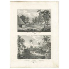
Antique Print of the Tomb of Mu-Muï in Tonga, c.1836
Located in Langweer, NL
Antique print titled 'Grab des Mu-Muï' and 'Wohnung der Tamaha im Dorfe Mua'. Old print with two views, the upper image depicts the tomb of Mu-Muï. The lower image depicts a residenc...
Category
Antique 19th Century Maps
Materials
Paper
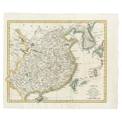
China with Hainan and Formosa Islands and the Kingdoms Corea and Tonkin, 1802
Located in Langweer, NL
Antique map titled 'China, Contains 15 Subject Provinces Including the 2 Islands of Hainan, Formosa and the Tributary Kingdoms of Korea, Tonkin'.
Old map depicting China, extendi...
Category
Antique 19th Century Maps
Materials
Paper
$276 Sale Price
20% Off
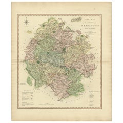
Original Hand-Colored Antique Map of the County of Hereford in England, 1804
Located in Langweer, NL
Antique county map of Herefordshire first published c.1800. Villages, towns, and cities illustrated Avenbury, Ashpurton, Kineton, and Bromyard.
...
Category
Antique 19th Century Maps
Materials
Paper
$309 Sale Price
20% Off
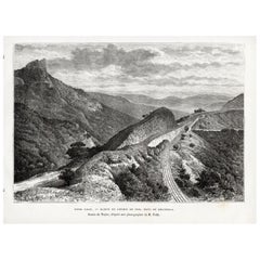
Bhor Ghat a Mountain Passage Between Karjat & Khandala, Maharashtra, India, 1883
Located in Langweer, NL
Plate: 'Bhor Ghat, 'Rampe du Chemin de fer, pres de Khandala'. This plate shows the Bhor Ghat a mountain passage located between Karjat and Khandala in Maharashtra, India. This plate...
Category
Antique 19th Century Maps
Materials
Paper
$114 Sale Price
20% Off
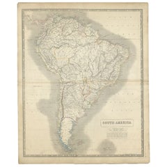
Antique Map of South America by Johnston, 1844
Located in Langweer, NL
Antitique map titled 'South America'. Beautiful original antique map of South America. This map originates from 'The National Atlas of His...
Category
Antique 19th Century Maps
Materials
Paper
$185 Sale Price
20% Off
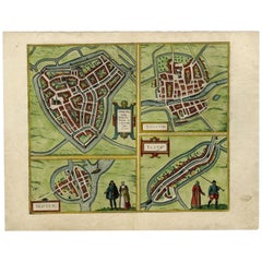
Antique Map of Sneek, Dokkum, Sloten and IJlst by Hogenberg, c.1572
Located in Langweer, NL
Antique map titled 'Provincie Friesland - Gemeente Sloten'. Map of the township of Sloten, Friesland. This map originates from 'Gemeente-Atlas van Nederland' by J. Kuyper. Artists an...
Category
Antique 19th Century Maps
Materials
Paper
Antique Map of Smallingerland by Kuyper, 1868
Located in Langweer, NL
Antique map titled 'Provincie Friesland - Gemeente Smallingerland'. Map of the township of Smallingerland including Drachten, Opeinde and many other villages. This map originates fro...
Category
Antique 19th Century Maps
Materials
Paper
$126 Sale Price
20% Off
Antique German Map of South America by Kiepert, c.1870
Located in Langweer, NL
Antique map titled 'Süd-America'. Old map of South America. This map originates from 'H. Kiepert's Kleiner Atlas der Neueren Geographie für Schule und Haus'. Artists and Engravers: K...
Category
Antique 19th Century Maps
Materials
Paper
$136 Sale Price
20% Off
Antique Map of Russia in Asia by Weller, c.1865
Located in Langweer, NL
Antique map titled 'Russia in Asia'. Old map of Russia originating from the 'Weekly Dispatch Atlas'. Artists and Engravers: Engraved by E. Weller.
Artist: Engraved by E. Weller.
...
Category
Antique 19th Century Maps
Materials
Paper
Antique Map of Russia in Europe by Migeon, 1880
Located in Langweer, NL
Antique map titled 'Russie d'Europe'. Old map of Russia in Europe. This map originates from 'Géographie Universelle Atlas-Migeon' by J. Migeon. Artists and Engravers: Published by J....
Category
Antique 19th Century Maps
Materials
Paper
$94 Sale Price
20% Off
Antique Map of the Region of Heusden by Craandijk, 1884
Located in Langweer, NL
Antique map titled 'Omstreken van Heusden'. Old map of the region of Heusden also including cities and villages like Elshout, Aalburg, Hedel and Vlijmen. This map orginates from 'Atl...
Category
Antique 19th Century Maps
Materials
Paper
$82 Sale Price
20% Off
Antique Map of the Region of Luik by Veelwaard, C.1840
Located in Langweer, NL
Antique map titled 'Kaart van Luik'. Original antique map of the region of Luik (Liege), Belgium. Source unkown, to be determined. Published circa 1840.
Artists and Engravers: E...
Category
Antique 19th Century Maps
Materials
Paper
$119 Sale Price
20% Off
Antique Map of the Region of Henegouwen by Veelwaard, C.1840
Located in Langweer, NL
Antique map titled 'Kaart van Henegouwen'. Original antique map of the region of Henegouwen (Hainaut), Belgium. Source unkown, to be determined. Published circa 1840.
Artists and...
Category
Antique 19th Century Maps
Materials
Paper
$119 Sale Price
20% Off
Antique Map of the Region of Diepenheim by Craandijk, 1884
Located in Langweer, NL
Antique map titled 'Omstreken van Diepenheim'. Old map of the region of Diepenheim also including cities and villages like Markelo, Goor and Gelselaar. This map orginates from 'Atlas...
Category
Antique 19th Century Maps
Materials
Paper
$82 Sale Price
20% Off
Antique Map of the Region of Wijhe-Diepenveen by Craandijk, 1884
Located in Langweer, NL
Antique map titled 'Omstreken van Wijhe - Diepenveen'. Old map of the region of Wijhe also including cities and villages like Olst, Welsum and Veessen. This map orginates from 'Atlas...
Category
Antique 19th Century Maps
Materials
Paper
$82 Sale Price
20% Off
Antique Map of the Region of 's-Graveland by Kuyper, c.1870
Located in Langweer, NL
Antique map titled 'Provincie Noord-Holland - Gemeente 's Graveland'. Original antique map of the region of 's-Graveland, the Netherlands. This map originates from the 'Gemeente-Atla...
Category
Antique 19th Century Maps
Materials
Paper
$76 Sale Price
20% Off
Antique Map of the Region of Zutphen by Craandijk, 1884
Located in Langweer, NL
Antique map titled 'Omstreken van Zutfen - Lochem Ruurlo'. Old map of the region of Zutphen also including cities and villages like Veldwijk, Vorden and Delden. This map orginates fr...
Category
Antique 19th Century Maps
Materials
Paper
$82 Sale Price
20% Off
Antique Map of the Region of Doetinchem by Craandijk, 1884
Located in Langweer, NL
Antique map titled 'Omstreken van Doetinchem - 's Heerenberg'. Old map of the region of Doetinchem also including cities and villages like Keppel, Wehl and Zeddam. This map orginates...
Category
Antique 19th Century Maps
Materials
Paper
$82 Sale Price
20% Off
Antique Map of the Region of Arnhem by Craandijk, 1884
Located in Langweer, NL
Antique map titled 'Omstreken van Arnhem - Dieren'. Old map of the region of Arnhem also including cities and villages like Rozendaal, Velp and Dieren. This map orginates from 'Atlas...
Category
Antique 19th Century Maps
Materials
Paper
$82 Sale Price
20% Off
Antique Map of the Region of Paterwolde and Assen by Craandijk, 1884
Located in Langweer, NL
"Antique map titled 'Omstreken van Paterwolde - Omstreken van Assen '. Two maps on one image. The upper map depicts the region of Paterwolde also including cities and villages like E...
Category
Antique 19th Century Maps
Materials
Paper
$82 Sale Price
20% Off
Antique Map of the Region of Breda by Craandijk, 1884
Located in Langweer, NL
Antique map titled 'Omstreken van Breda'. Old map of the region of Breda also including cities and villages like Beek, Bavel, Leur, and Teteringen. This map orginates from 'Atlas beh...
Category
Antique 19th Century Maps
Materials
Paper
$82 Sale Price
20% Off
Antique Map of the Region of Alkmaar by Craandijk, 1884
Located in Langweer, NL
Antique map titled 'Omstreken van Alkmaar'. Old map of the region of Alkmaar also including cities and villages like Castricum, Egmond, Oudorp and Den Helder. This map orginates from...
Category
Antique 19th Century Maps
Materials
Paper
$82 Sale Price
20% Off
Antique Map of the District of Boemi Agoeng by Stemler, c.1875
Located in Langweer, NL
Antique map titled 'Kaart van de Afdeling Boemi Agoeng.' This map shows the Indonesian district of Boemi Agoeng (Lampong districts). Originates from 'Tijdschrift Aardrijkskundig Geno...
Category
Antique 19th Century Maps
Materials
Paper
$74 Sale Price
20% Off
Antique Map of the Coast of Kerguelens Island by Cook, 1803
Located in Langweer, NL
Antique map Desolation Islands titled 'Van Kerguelens Land door Cook genaamd (..)'. Antique map of Kerguelens island coast, known today as the Desolation islands. Originates from 'Re...
Category
Antique 19th Century Maps
Materials
Paper
$292 Sale Price
20% Off
Antique Map of the Doniawerstal Township by Behrns, 1861
Located in Langweer, NL
Antique map titled 'Gemeente Doniawerstal'. Old map depicting the Doniawerstal township including cities and villages like Follega, Tjerkgaast, Legemeer, Idskenhuizen, St. Nicolaasga...
Category
Antique 19th Century Maps
Materials
Paper
$119 Sale Price
20% Off
Antique Map of the Netherlands in 1740 by Mees, 1857
Located in Langweer, NL
Antique map titled 'Noord-Nederland in 1740 met de Politieke veranderingen gedurende de 18e eeuw tot in 1795'. Map of the Netherlands in 1740. This map originates from 'Historische A...
Category
Antique 19th Century Maps
Materials
Paper
$122 Sale Price
20% Off
Antique Map of the Netherlands in 1811 by Mees, 1858
Located in Langweer, NL
Antique map titled 'Noord-Nederland in 1811. De inlijving bij het Fransche Keizerrijk'. Map of the Netherlands in 1811. This map originates from 'Historische Atlas van Noord-Nederlan...
Category
Antique 19th Century Maps
Materials
Paper
$122 Sale Price
20% Off
Antique Map of the Kollumerland Township by Behrns, 1861
Located in Langweer, NL
Antique map titled 'Gemeente Kollumerland en Nieuw Kruisland'. Old map depicting the Kollumerland township including cities and villages like Westergeest, Kollum, Kollumerzwaag and B...
Category
Antique 19th Century Maps
Materials
Paper
$84 Sale Price
20% Off
Antique Map of the Mountain Ranges of Asia and Europe by Berghaus, 1849
Located in Langweer, NL
Antique map titled 'Bergketten in Asien und Eüropa'. Original antique map showing the mountain ranges in Asia and Europe. In outline color with inset maps of Java, Luzon, and Reguain...
Category
Antique 19th Century Maps
Materials
Paper
$266 Sale Price
20% Off
Antique Map of the Oost-Stellingwerf Township by Behrns, 1861
Located in Langweer, NL
Antique map titled 'Gemeente Oost-Stellingwerf'. Old map depicting the Oost-Stellingwerf township including cities and villages like Oldeberkoop, Makkinga, Langedijk, Elsloo, Donkerb...
Category
Antique 19th Century Maps
Materials
Paper
$84 Sale Price
20% Off
Antique Map of the Friendly Islands by Cook, 1803
Located in Langweer, NL
Antique map Friendly Islands titled 'Kaart van de Vrienden-Eilanden'. Antique map of the Friendly Islands depicting Rotterdam or Anamocka, Middelburg or Eaoowe and Amsterdam or Tonga...
Category
Antique 19th Century Maps
Materials
Paper
$204 Sale Price
20% Off
Antique Map of the Netherlands in 1839 by Mees, 1860
Located in Langweer, NL
Antique map titled 'Noord-Nederland in 1839. De scheiding van België'. Map of the Netherlands in 1839. This map originates from 'Historische Atlas van Noord-Nederland'.
Artists a...
Category
Antique 19th Century Maps
Materials
Paper
$122 Sale Price
20% Off
Antique Map of the Netherlands in 1590 by Mees, 1854
Located in Langweer, NL
Antique map titled 'Noord-Nederland in 1590. De eerste tijden der Republiek'. Map of the Netherlands in 1590. This map originates from 'Historische Atlas van Noord-Nederland'.
Ar...
Category
Antique 19th Century Maps
Materials
Paper
$122 Sale Price
20% Off
Antique Map of the Ferwerderadeel Township by Behrns, 1861
Located in Langweer, NL
Antique map titled 'Ferwerderadeel'. Old map depicting the Ferwerderadeel township including cities and villages like Ferwerd, Marrum, Hallum, Wanswerd and Hijum. This map orginates ...
Category
Antique 19th Century Maps
Materials
Paper
$84 Sale Price
20% Off
Antique Map of the Hennaarderadeel Township by Behrns, 1861
Located in Langweer, NL
Antique map titled 'Gemeente Hennaarderadeel'. Old map depicting the Hennaarderadeel township including cities and villages like Kubaard, Wommels, Hennaard, Oosterend, Wierum, Tzum, ...
Category
Antique 19th Century Maps
Materials
Paper
$84 Sale Price
20% Off
Antique Map of the Menaldumadeel Township by Behrns, 1861
Located in Langweer, NL
Antique map titled 'Gemeente Menaldumadeel'. Old map depicting the Menaldumadeel township including cities and villages like Berlikum, Wier, Menaldum, Dronrijp, Marsum, Engelum, Dein...
Category
Antique 19th Century Maps
Materials
Paper
$84 Sale Price
20% Off
Antique Map of the Netherlands in 1859 by Mees, 1861
Located in Langweer, NL
Antique map titled 'Noord-Nederland in 1859. De Straat- en Spoorwegen met de jaartallen der vervaardiging'. Map of the Netherlands in 1859. This map originates from 'Historische Atla...
Category
Antique 19th Century Maps
Materials
Paper
$122 Sale Price
20% Off
Antique Print of the Mariners Temple in Shimoda by Hawks, 1856
Located in Langweer, NL
Antique print titled 'Mariners Temple at Simoda‘. View of the mariners temple in Shimoda, Japan. This print originates from 'Narrative of the expedition of an American squadron to th...
Category
Antique 19th Century Maps
Materials
Paper
Antique Colourful Map of the Dutch East Indies 'Indonesia', ca.1806
Located in Langweer, NL
Antique map titled 'Les Isles de la Sonde Moluques Philippines, Carolines et Marianes'. Old map of the East Indies, also showing a part of Australia.
Artists and Engravers: Publi...
Category
Antique 19th Century Maps
Materials
Paper
Antique Map of the Leeuwarderadeel Township by Behrns, 1861
Located in Langweer, NL
Antique map titled 'Gemeente Leeuwarderadeel'. Old map depicting the Leeuwarderadeel township including cities and villages like Finkum, Hijum, Stiens, Jelsum, Leeuwarden, Wirdum and...
Category
Antique 19th Century Maps
Materials
Paper
$84 Sale Price
20% Off
Antique Map of the North Pole by Johnston, 1882
Located in Langweer, NL
Antique map titled 'North Pole Chart'. Old map of the North Pole showing the various regions and political boundaries. This map originates from 'The Royal A...
Category
Antique 19th Century Maps
Materials
Paper
$123 Sale Price
20% Off
Antique Map of the Netherlands, Belgium and Luxembourg by Petri, c.1873
Located in Langweer, NL
Antique map titled 'De Nederlanden, Luxemburg en België'. Old map depicting the Netherlands, Luxembourg and Belgium. With an inset map of Amsterdam. T...
Category
Antique 19th Century Maps
Materials
Paper
$111 Sale Price
20% Off
Antique Map of the Lemsterland Township by Behrns, 1861
Located in Langweer, NL
Antique map titled 'Gemeente Lemsterland'. Old map depicting the Lemsterland township including cities and villages like Lemmer, Follega, Oosterzee en Echten. This map orginates from...
Category
Antique 19th Century Maps
Materials
Paper
$84 Sale Price
20% Off
Antique Map of the Harbors of Matavai by Cook, 1803
Located in Langweer, NL
Antique map Oceania titled 'Matavia Baai te Otahiti (..)'. Antique map depicting the harbors of Matavai on the north coast of Tahiti; Ohamaneno and Oopoa on Raiatea (Ulieta on the ch...
Category
Antique 19th Century Maps
Materials
Paper
$266 Sale Price
20% Off
Antique Map of the Oost-Dongeradeel Township by Behrns, 1861
Located in Langweer, NL
Antique map titled 'Gemeente Oost-Dongeradeel'. Old map depicting the Oost-Dongeradeel township including cities and villages like Nijkerk, Morra, Anjum, Metslawier, Aalsum and Engwi...
Category
Antique 19th Century Maps
Materials
Paper
$84 Sale Price
20% Off
Antique Map of the Netherlands in 1648 by Mees, 1855
Located in Langweer, NL
Antique map titled 'Noord-Nederland in 1648. De gevestigde Republiek der Vereenigde Nederlanden'. Map of the Netherlands in 1648. This map originates from 'Historische Atlas van Noor...
Category
Antique 19th Century Maps
Materials
Paper
$122 Sale Price
20% Off
Antique Map of the Netherlands in 1814 by Mees, 1858
Located in Langweer, NL
Antique map titled 'Noord-Nederland in 1814. De herstelling der onafhankelijkheid'. Map of the Netherlands in 1814. This map originates from 'Historische Atlas van Noord-Nederland'. ...
Category
Antique 19th Century Maps
Materials
Paper
$122 Sale Price
20% Off
Antique Map of the Gooi Region by Craandijk, 1884
Located in Langweer, NL
Antique map titled 'Het Gooi'. Old map of the region of Hilversum also including cities and villages like Naarden, Laren, Blaricum, Eemnes and Baarn. This map orginates from 'Atlas b...
Category
Antique 19th Century Maps
Materials
Paper
$82 Sale Price
20% Off
Antique Map of the Friendly Islands by Cook, 1803
Located in Langweer, NL
Antique map Friendly Islands titled 'Kaart van de Vrienden Eilanden'. Antique map of the Friendly Islands depicting Rotterdam or Anamocka, Middelburg or Eaoowe and Amsterdam or Tonga...
Category
Antique 19th Century Maps
Materials
Paper
$204 Sale Price
20% Off
Antique Map of the Low Countries by Brué, 1822
Located in Langweer, NL
Antique map titled 'Carte du Royaume des Pays-Bas'. Large format map of the Low Countries. This map originates from 'Atlas Universel', published 1822...
Category
Antique 19th Century Maps
Materials
Paper
$164 Sale Price
20% Off
Antique Print of the Royal Botanic Gardens of Melbourne, Australia, c.1890
Located in Langweer, NL
Antique print titled 'Melbourne, the Botanic Gardens'. Old print of the Royal Botanic Gardens Victoria, Australia. This print originates from 'The Aust...
Category
Antique 19th Century Maps
Materials
Paper
Antique Map of the Netherlands in 1860 by Mees, 1862
Located in Langweer, NL
Antique map titled 'Noord-Nederland in 1860. Kerkelijke verdeeling der Gereformeerden'. Map of the Netherlands in 1860. This map originates from 'Historische Atlas van Noord-Nederlan...
Category
Antique 19th Century Maps
Materials
Paper
$122 Sale Price
20% Off
Antique Map of the East Indies by Dower, 1832
Located in Langweer, NL
Antique map titled 'East India Isles'. Old map of the East Indies. This map originates from 'A General Descriptive Atlas Of The Earth (..)' by J. Dower.
Artists and Engravers: Dr...
Category
Antique 19th Century Maps
Materials
Paper
$157 Sale Price
20% Off
Antique Map of Part of South America by Archer, C.1860
Located in Langweer, NL
Antique map titled 'South America'. This antique map depicts the north-east of South America, including a large part of Brazil. Artists and Engravers: Drawn and engraved by J. Archer...
Category
Antique 19th Century Maps
Materials
Paper
$90 Sale Price
20% Off
Antique Map of Southern Sulawesi by Stemfoort, 1885
Located in Langweer, NL
"Antique map titled 'Kaart van Zuid West Celebes'. Old map of the southern tip of the southwestern part of Sulawesi. Includes a large inset map of the Makassar area, centered on Fort...
Category
Antique 19th Century Maps
Materials
Paper
$261 Sale Price
20% Off
Antique Map of Southwest Europe by Kiepert, c.1870
Located in Langweer, NL
"Antique map titled 'Romanisches Südwest-Europa'. Old map of Southwest Europe. This map originates from 'H. Kiepert's Kleiner Atlas der Neueren Geographie für Schule und Haus'. Artis...
Category
Antique 19th Century Maps
Materials
Paper
$128 Sale Price
20% Off
Antique Map of Southeast Asia and China by Kiepert, c.1870
Located in Langweer, NL
Antique map titled 'Ostindien und China'. Old map of Southeast Asia and China. This map originates from 'H. Kiepert's Kleiner Atlas der Neueren Geographie für Schule und Haus'. Artis...
Category
Antique 19th Century Maps
Materials
Paper
Antique Map of Southern Scotland by Johnston, 1882
Located in Langweer, NL
"Antique map titled 'Scotland'. Old map of Southern Scotland. This map originates from 'The Royal Atlas of Modern Geography, Exhibiting, in a Series of Entirely Original and Authenti...
Category
Antique 19th Century Maps
Materials
Paper
$128 Sale Price
20% Off
Antique Map of Northern India by Blackie & Son, 1860
Located in Langweer, NL
Antique map titled 'India'. Old map depicting northern India. This map originates from 'The Comprehensive Atlas & Geography of the World, Compiled and Engraved from the most Authenti...
Category
Antique 19th Century Maps
Materials
Paper
Antique Map of Southern Asia by Walker, c.1840
Located in Langweer, NL
"Original antique map of Southern Asia, the East Indies and the Indian Ocean. Also shows part of Australia. Published circa 1840. Artists and Engravers: ...
Category
Antique 19th Century Maps
Materials
Paper
$100 Sale Price
20% Off
