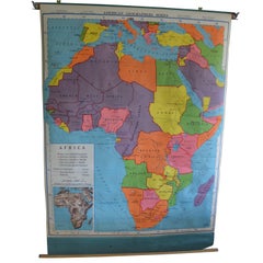
Schoolroom Geography Map of Africa, 1957 Edition
View Similar Items


1 of 10
Schoolroom Geography Map of Africa, 1957 Edition
$295List Price
About the Item
- Dimensions:Height: 72 in (182.88 cm)Width: 36 in (91.44 cm)Depth: 2 in (5.08 cm)
- Style:Schoolhouse (Of the Period)
- Materials and Techniques:
- Place of Origin:
- Period:
- Date of Manufacture:1957
- Condition:Wear consistent with age and use.
- Seller Location:Madison, WI
- Reference Number:1stDibs: LU923510986431
Authenticity Guarantee
In the unlikely event there’s an issue with an item’s authenticity, contact us within 1 year for a full refund. DetailsMoney-Back Guarantee
If your item is not as described, is damaged in transit, or does not arrive, contact us within 7 days for a full refund. Details24-Hour Cancellation
You have a 24-hour grace period in which to reconsider your purchase, with no questions asked.Vetted Professional Sellers
Our world-class sellers must adhere to strict standards for service and quality, maintaining the integrity of our listings.Price-Match Guarantee
If you find that a seller listed the same item for a lower price elsewhere, we’ll match it.Trusted Global Delivery
Our best-in-class carrier network provides specialized shipping options worldwide, including custom delivery.You May Also Like
Antique Map of Africa, Highlighting Colonial Divisions, Geographic Features 1903
Located in Langweer, NL
Title: Antique Map of Africa, 1903, Highlighting Colonial Divisions and Geographic Features
Description: This antique map, titled "Africa," was engraved and published in 1903 by W. ...
Category
Early 20th Century Maps
Materials
Paper

Geographical Antique Map of Principality of Monaco
By Bruno Santini
Located in Alessandria, Piemonte
ST/609 - Interesting antique color map of Monaco Principality in French language : "Carte qui contient le Principauté de Piémont, le Monferrat et la comté de...
Category
Antique Late 18th Century Italian Other Maps
Materials
Paper

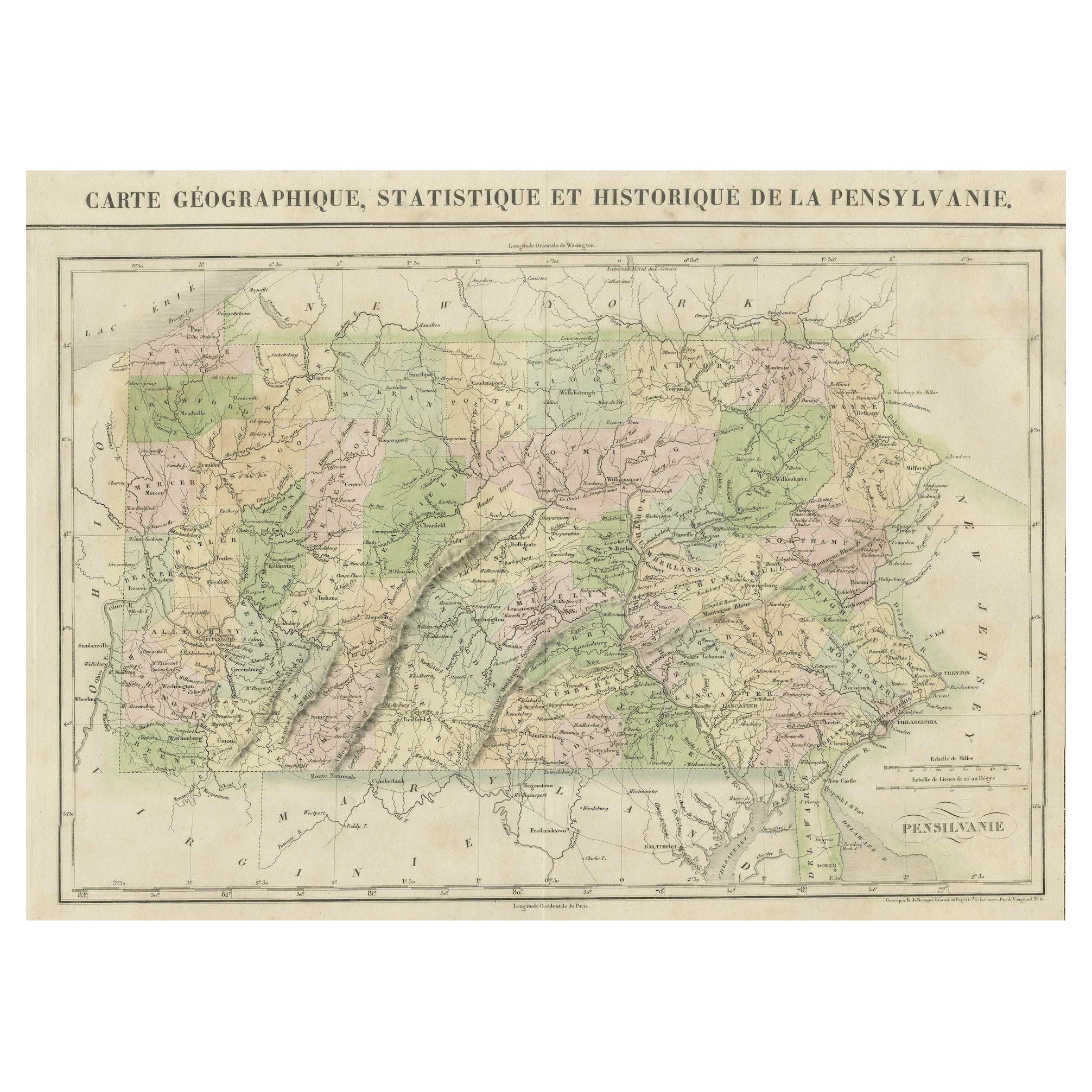
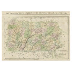
French Geographical, Statistical and Historical Map of Pensylvania, 1825
Located in Langweer, NL
Title: Carte geographique, statistique et historique de la Pensylvanie.
Beautiful Hand-Colored 1825 French Map of Pennsylvania, with a List of Prominent Rivers, Descriptions of Mountains, Climate and Government as well as a list of Colonial and post-American Revolution Governors
Produced by: J. Carez in Paris. (1825)
Hand colored engraved map. Relief shown by hachures. Text and tables at sides and bottom. Prime meridians: Washington and Paris.
A very interesting 1825 French hand-colored map of Pennsylvania from Lucas' 1822 map, which breaks down county populations by Whites and Free Blacks. "Carte Geographique, Statistique et Historique de la Pensylvanie" Originally published in 1822 by Carey and Lea and then revised and republished in 1825 by J. A. C. Buchon (1791-1846 ) in a French edition entitled Atlas Geographique des Deux Ameriques, printed by J. Carez. Fielding Lucas, Jr. (1781-1854), a Baltimore mapmaker and publisher, drew the map. original hand-coloring.
Shown on the map are parts of Maryland, Delaware, New York and New jersey. Printed on the same page as the map is geographical, statistical, and historical information about Pennsylvania, such as descriptions of the state's important rivers, a list of Governors since its founding as well as important French and Indian...
Category
Antique 1820s Maps
Materials
Paper
$453 Sale Price
20% Off
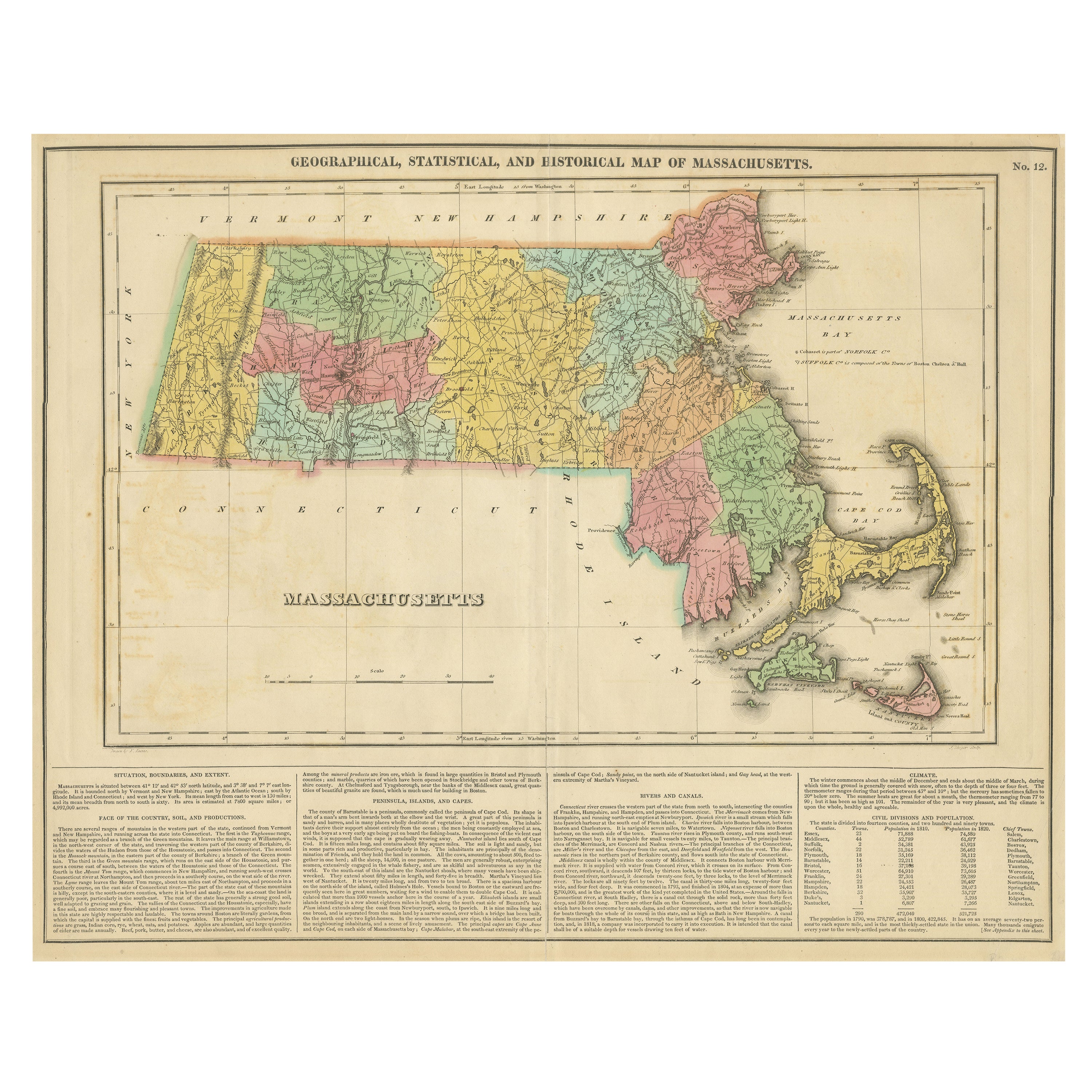
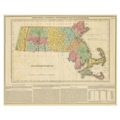
Antique Geographical, Historical and Statistical Map of Massachusetts, 1822
Located in Langweer, NL
This attractive map of Massachusetts presents a finely detailed overview of the state in the first quarter of the 19th century.
Transportation ...
Category
Antique 1820s Maps
Materials
Paper
$359 Sale Price
20% Off
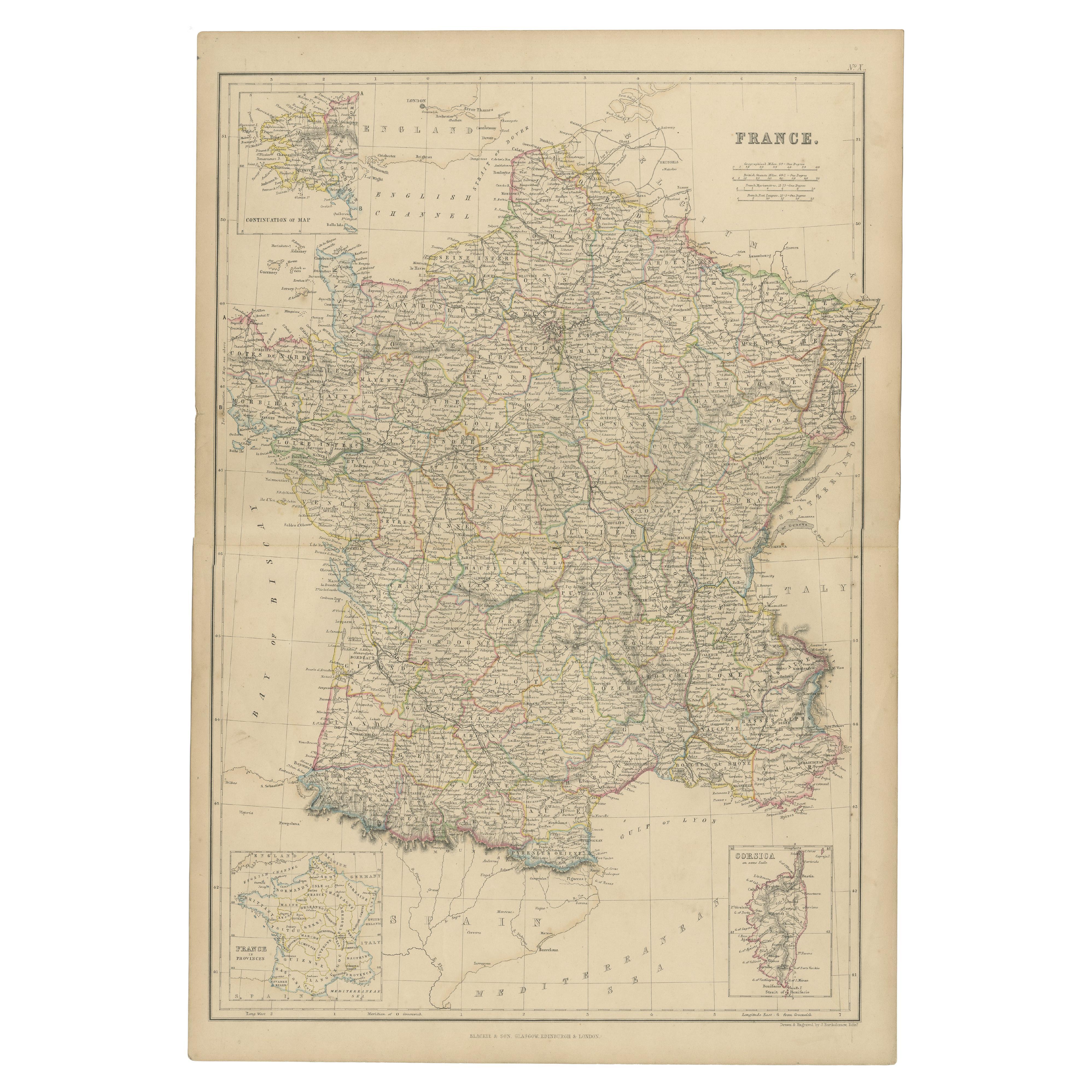
1859 Classic Map of France: Blackie's Imperial Geographic Masterpiece
Located in Langweer, NL
The "Antique Map of France" from 'The Imperial Atlas of Modern Geography', published in 1859 by W. G. Blackie, is a historically valuable cartographic work that offers a comprehensiv...
Category
Antique Mid-19th Century Maps
Materials
Paper

$221 Sale Price
25% Off
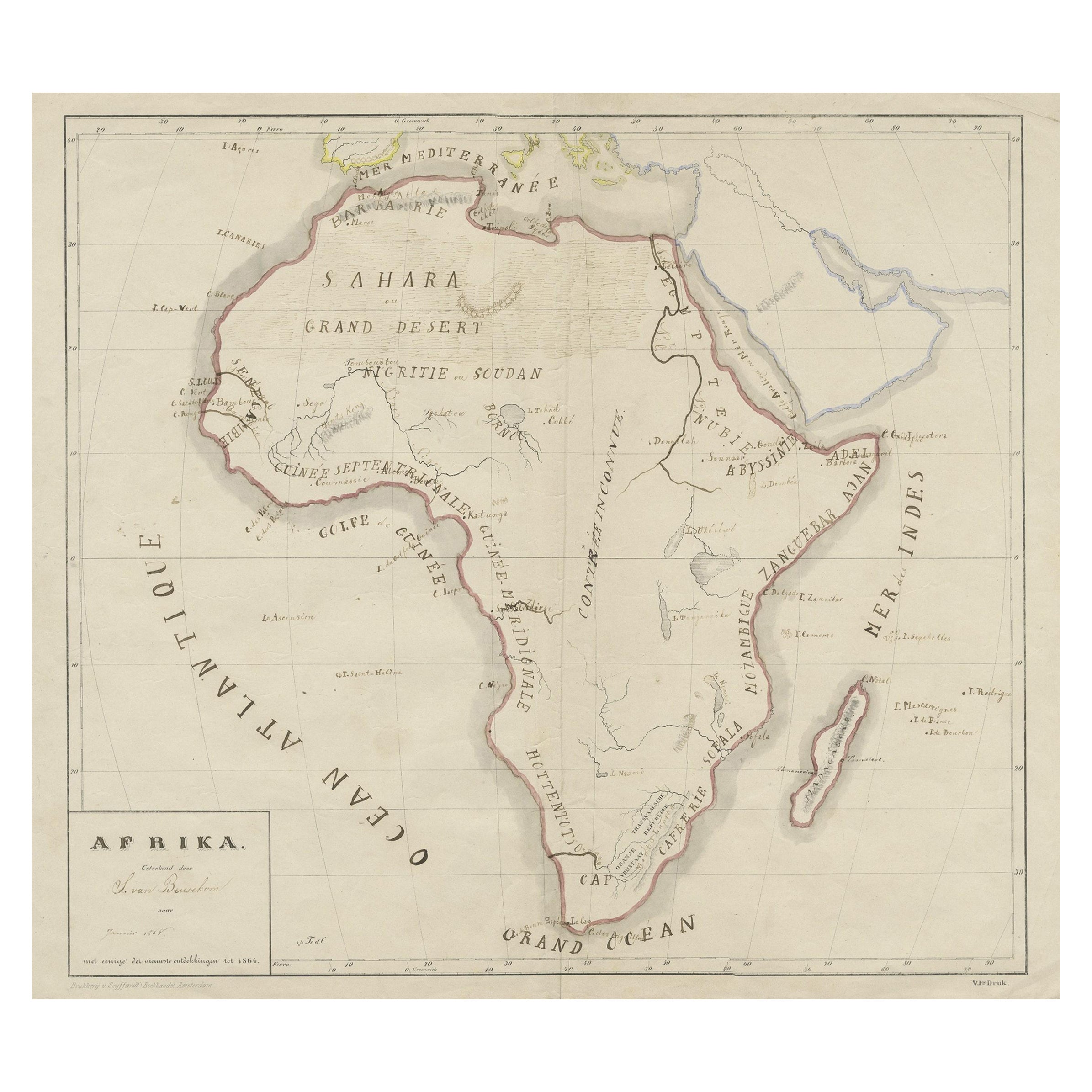
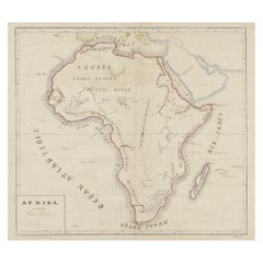
Original Antique Map of Africa
Located in Langweer, NL
Antique map titled 'Afrika'. Original antique map of Africa, drawn by Van Beusekom. Published by 'Seyffardt's Boekhandel' in Amsterdam, circa 1870.
Category
Antique Late 19th Century Maps
Materials
Paper
$321 Sale Price
20% Off
Recently Viewed
View AllMore Ways To Browse
Vintage Wooden Roller
Map Of Africa
London Antique Maps
Antique World Globes
Antique Map Of England
Antique Map Paris
Gold Maps
East India Company
China Map
17th Century World Map
Antique Maps Of Britain
Antique Furniture Edinburgh
Antique English Maps
Map Of India
British Empire Furniture
American West Antiques
Furniture Russian 18th Century
Antique Law Office Furniture