18th Century and Earlier Collectibles and Curiosities

to
2,707
3,891
557
4,483
216
93
41
35
30
14
10
7
4
2
2
2
1
1
1
6,816
13,510
2,735
3,520
4,715
3,084
513
298
603
745
483
907
906
906
659
593
3,383
601
526
139
127
1,363
277
266
224
185
4,483
4,483
4,483
58
21
14
13
12
Period: 18th Century and Earlier
Antique Map of Hertfordshire in England by Speed, 1627
Located in Langweer, NL
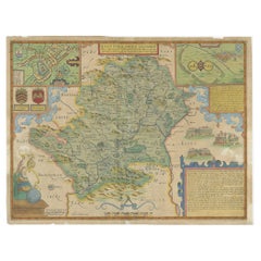
Antique map titled 'Hartfordshire described the sittuations of Hartford (..)'. Map of Hertfordshire, England. Includes inset maps of Hertford and the Roman settlement of Verolani...
Category

Antique 18th Century and Earlier Collectibles and Curiosities

Materials

Paper

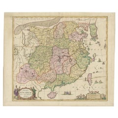
Antique Map of China and Korea incl Formosa and Hainan, by Janssonius, ca.1650
Located in Langweer, NL
Antique map titled 'Imperii Sinarum Nova Descriptio'. Beautiful map of China and Korea, much detail troughout the map. Including the Islands of Formosa (Taiwan) and Hainan. The Great...
Category

Antique 18th Century and Earlier Collectibles and Curiosities

Materials

Paper

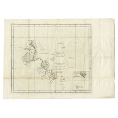
Antique Map of Kerguelens Island Coast by Cook, 1784
Located in Langweer, NL
Antique print titled 'Kerguelen's Land (..)'. Antique map of Kerguelens island coast, known today as the Desolation islands. Originates from 'A Voyage to the Pacific Ocean: Undertaken, by the Command of His Majesty, for Making Discoveries in the Northern Hemisphere (..)' published in Dublin. Artists and Engravers: James Cook...
Category

Antique 18th Century and Earlier Collectibles and Curiosities

Materials

Paper

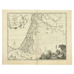
Antique Map of the Biblical Kingdom of Israel by Lindeman, c.1758
Located in Langweer, NL
Antique map titled 'De IVde Landkaart vertoonende het Koningryk Israels benevens deszelfs overheerde Landschappen (..).' Map of the biblical Kingdom of Israel under the Kings Saul, D...
Category

Antique 18th Century and Earlier Collectibles and Curiosities

Materials

Paper

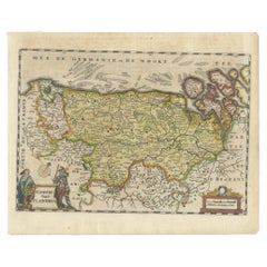
Antique Map of Flanders, Belgium, 1630
Located in Langweer, NL
Antique map titled 'Comitatus Flandria'. Original antique map of Flanders, Belgium. This map originates from 'Vyerige Colom verthonende de 17 Nederlandsche Provintien' published 1630...
Category

Antique 18th Century and Earlier Collectibles and Curiosities

Materials

Paper

Antique 17th Century Map of the Islands Near Ceylon or Sri Lanka, 1672
Located in Langweer, NL
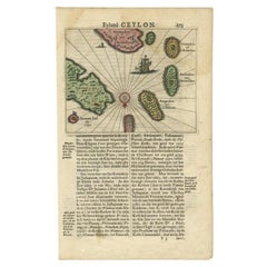
Antique map titled 'Eyland Ceylon.' Map of the islands near Ceylon or Sri Lanka. Dutch text on verso. Source unknown, to be determined. Artists and Engravers: Philip Baldaeus (1632-...
Category

Antique 18th Century and Earlier Collectibles and Curiosities

Materials

Paper

Antique Map of Asia and Australia with a Speculative Coastline, 1777
Located in Langweer, NL
Antique map titled 'A New & Accurate Map of Asia'. Detailed map of Asia and Australia, shows a still largely speculative Southern Australian coastline. Originates from Middleton's 'C...
Category

Antique 18th Century and Earlier Collectibles and Curiosities

Materials

Paper

Antique Map of Peloponnesus, Greece by Pierre Antoine Tardieu, 1797
Located in Langweer, NL
This antique map, titled "Carte Ancienne d'Allemagne," represents ancient Germany and surrounding regions. It was published by the well-known Parisian mapmakers and publishers Jean-Baptiste-Louis Clouet and Alexandre Aimé Vuillemin in the late 18th century, specifically in 1787. The map covers the extensive geographical area of ancient Germany, highlighting various tribes and regions known at the time. Key features include: 1. **Geographical Boundaries**: The map outlines the territorial extents of ancient Germany, bordered by Gallia (France) to the west, Sarmatia (parts of Eastern Europe) to the east, and the Italian regions to the south. The northern boundary reaches the Oceanus Germanicus (North Sea) and the Sarmatian Sea (Baltic Sea). 2. **Tribal Regions**: It details numerous ancient Germanic...
Category

Antique 18th Century and Earlier Collectibles and Curiosities

Materials

Paper

Antique Map of the Region of Batavia by Van Schley, c.1750
Located in Langweer, NL
Antique map titled 'Carte des environs de Batavia - Kaart van de Buitenstreken van Batavia'. Map of the Batavia area (Jakarta) in Indonesia. With cartouche, scale and compass rose. P...
Category

Antique 18th Century and Earlier Collectibles and Curiosities

Materials

Paper

Antique Map of the Eastern Part of the World by Tirion, 1755
Located in Langweer, NL
Antique map titled 'Nieuwe Kaart van het Oostelykste Deel der Weereld, dienende tot Aanwyzing van de Scheepstogten der Nederlanderen naar Oostindië'. Australia (Nieuw Holland) shown ...
Category

Dutch Antique 18th Century and Earlier Collectibles and Curiosities

Materials

Paper

Antique Map of the Region Around the Baltic Sea by Cordier, c.1670
Located in Langweer, NL
Antique map titled 'Illyricum Orientis: In quo Partes II Moesia et Thracia'. Engraved map of the area west of the Baltic Sea, present day Bulgaria, Romania, and Turkey. The map is ba...
Category

Antique 18th Century and Earlier Collectibles and Curiosities

Materials

Paper

A Portuguese Polychrome & Giltwood Presentoir, 18th Century
Located in Sheffield, MA
A Portuguese Baroque Polychrome & Giltwood Presentoir 18th Century With elaborate scroll and flower carved canopy and framework Height 30 in. Width 18 in. Depth 10 in. ...
Category

Portuguese Baroque Antique 18th Century and Earlier Collectibles and Curiosities

Antique Print of Hagley Hall in Worcestershire, England, ca.1770
Located in Langweer, NL
Antique print titled 'Principal Front of Hagley'. Main facade of Hagley Hall, Worcestershire. Hagley Hall is a Grade I listed 18th-century house in Hagley, Worcestershire, the ho...
Category

Antique 18th Century and Earlier Collectibles and Curiosities

Materials

Paper

Territorium Francofurtens – Moses Pitt’s 17th-Century Map of Frankfurt
Located in Langweer, NL
Title: Territorium Francofurtens – Moses Pitt’s 17th-Century Map of Frankfurt Description: This rare 17th-century map, titled Territorium Francofurtens, was published by Moses ...
Category

Antique 18th Century and Earlier Collectibles and Curiosities

Materials

Paper

Johannes Janssonius' 17th-Century Map of the Duchy of Bremen in Germany
Located in Langweer, NL
The map titled "Ducatus olim Episcopatus Bremensis et ostiorum Albis et Visurgis Fluviorum novissima Descriptio" by Johannes Janssonius provides a rich historical and geographical il...
Category

Antique 18th Century and Earlier Collectibles and Curiosities

Materials

Paper

Antique Map of the Kingdom of Hungary and Transylvania, circa 1780
Located in Langweer, NL
Antique Map of the Kingdom of Hungary and Surrounding Regions by S. Robert, circa 1780 This beautifully engraved map titled Royaume de Hongrie, Principauté de Transilvanie, Esclavon...
Category

French Antique 18th Century and Earlier Collectibles and Curiosities

Materials

Paper

1608 Hispaniae Novae Sive Magnae Vera Descriptio Framed Mexico Map
Located in Stamford, CT
1608 Hispaniae Novae Sive Magnae Vera Descriptio Framed Mexico Map. As found custom black wooden frame/ matting. This map is based on the work of Abraham Ortelius as is an example o...
Category

Mexican Spanish Colonial Antique 18th Century and Earlier Collectibles and Curiosities

Materials

Glass, Wood, Paper

18th Century Italian Inlaid Walnut Antique Kneeler
Located in Casale Monferrato, IT
Rare antique Italian kneeler, 1780s.V ery refined made of walnut wood with small geometric inlaid decorations. Equipped with two practical drawers. Place this elegant antique Arma Christi...
Category

Italian Antique 18th Century and Earlier Collectibles and Curiosities

Materials

Wood

Interesting Map of Great Britain and Northern Europe with various Illustrations
Located in Langweer, NL
Antique map titled 'Itinera Varia Auctoris'. Very interesting map of Great Britain and Northern Europe. The map shows Edwards' journeys between 1716-1730 to study his beloved birds a...
Category

Antique 18th Century and Earlier Collectibles and Curiosities

Materials

Paper

Old Map of the Kingdom of Tonga, Also Known as the Friendly Islands, ca.1780
Located in Langweer, NL
Antique print, titled: 'Carte des Isles des Amis.' Map of the Kingdom of Tonga, also known as the Friendly Islands, and one of the last hereditary monarchies. Cook named this gro...
Category

Antique 18th Century and Earlier Collectibles and Curiosities

Materials

Paper

Rare Antique Engraving of Microscopes, 1749
Located in Langweer, NL
Antique print titled 'A true Representation of sveral microscopes with some objects (..)'. Print of various microscopes, illustrating several microscope parts. This print originates ...
Category

Antique 18th Century and Earlier Collectibles and Curiosities

Materials

Paper

18th / Early 19th Century Miniature Painting
Located in Delft, NL
An 18th / early 19th century miniature painting An 18th / early 19th century miniature painting painted on glass and framed. The copper framed miniature painting in another copp...
Category

European Antique 18th Century and Earlier Collectibles and Curiosities

Materials

Copper

17th-Century Original Antique Map of Guangxi Province, China – Qvangsii by Blaeu
Located in Langweer, NL
Title: Antique 17th-Century Map of Guangxi Province, China – "Qvangsii" by Blaeu, Richly Illustrated and Colored Description: This fascinating 17th-century map of Guangxi Province, historically referred to as "Qvangsii," was crafted by Johannes Blaeu and published in 1655 as part of the *Novus Atlas Sinensis*. Blaeu’s atlas, created in collaboration with Jesuit missionary Martino Martini, introduced European audiences to the geography of China in an unprecedented way. Guangxi Province, known for its striking karst landscapes and important historical trade routes, is depicted here in remarkable detail. The map highlights the province’s topography, including mountain ranges, rivers, and towns, all meticulously engraved and labeled in Latin. It also captures key trade connections and cultural significance, as Guangxi historically served as a bridge between China and Southeast Asia. The decorative cartouche at the top left is adorned with figures in traditional Chinese costumes, symbolizing the cultural richness of the region and adding artistic elegance to the map. This map was engraved using the copperplate technique, known for its ability to produce fine, detailed lines. The hand-coloring further enhances the visual impact, clearly distinguishing territorial divisions and natural features. Blaeu’s reputation for both accuracy and artistry is evident in this piece, making it a collector’s item of historical and aesthetic significance. Guangxi Province, historically referred to as "Qvangsii," is renowned for its breathtaking natural beauty, unique karst landscapes, and cultural diversity. It is famous for its dramatic limestone formations, verdant hills, and picturesque rivers, making it one of the most visually striking regions in China. Guangxi has historically been a significant trade corridor between China and Southeast Asia, contributing to its cultural and economic importance. It is also home to various ethnic minority groups, including the Zhuang, Miao, and Dong, whose traditions and festivals enrich the region's cultural tapestry. Important places in Guangxi include Guilin, known for its iconic karst mountains and the Li River, which has inspired poets and artists for centuries. Yangshuo, a town near Guilin, is celebrated for its stunning natural scenery and outdoor activities. Nanning, the provincial capital, is an important economic and cultural hub. The Longji Rice Terraces, also known as the Dragon’s Backbone, are an engineering marvel and a popular tourist destination. Beihai, a coastal city, is known for its silver beaches and maritime trade history. Keywords for this map include 17th-century China map, Guangxi Province, Qvangsii map, antique Chinese maps...
Category

Antique 18th Century and Earlier Collectibles and Curiosities

Materials

Paper

Il pastor fido, tragicommedia pastorale - by G. B. Guarini - 1597
Located in Middletown, NY
Guarini, Giovanni Battista Il pastor fido; Tragicomedia pastorale Tours: Giametto Metaieri, 1592 12mo5 1/2 x 3 inches (140 x 76 mm); 146 pp. including a sonnet in French by R. Briss...
Category

European Antique 18th Century and Earlier Collectibles and Curiosities

Materials

Gold Leaf

Antique Bird's-Eye Plan of Tutecoryn (Tuticorin or Thoothukudi), India, 1672
Located in Langweer, NL
Antique map, titled: 'Tutecoryn.' Bird's-eye plan of map of Tutecoryn (Tuticorin or Thoothukudi), India. This map originates from 'Naauwkeurige Beschryvinge van Malabar en Choroman...
Category

Antique 18th Century and Earlier Collectibles and Curiosities

Materials

Paper

Antique Map of the Port of Zihuatanejo in Mexico, c.1740
Located in Langweer, NL
Antique map titled 'Plan du Port de Chequetan ou Seguataneo'. Map of the Mexican port of Zihuatanejo. This area was originally named Cihuatlán in Aztec, which means 'Place of Women,'...
Category

Antique 18th Century and Earlier Collectibles and Curiosities

Materials

Paper

Large Scale Map of Greece, Extending to Cythera with Inset of Macedonia, ca.1786
Located in Langweer, NL
Antique map titled 'Graeciae Antiquae'. Large scale map of Greece, extends south to the island of Cythera. Inset map shows details of Macedonia. Pu...
Category

Antique 18th Century and Earlier Collectibles and Curiosities

Materials

Paper

18thC Italian Oak & Polychrome Carved Bishop Statue
Located in Staffordshire, GB
Circa 1720 Large Early 18thC Italian Oak & Polychrome Carved Statue of a Bishop / Saint. Flat back with a secret panel which would have been used to hide gold. An exceptional exam...
Category

Italian Antique 18th Century and Earlier Collectibles and Curiosities

Materials

Oak, Paint

Île-de-France Map, including Paris - Hand-Colored Engraving by F. De Wit c. 1688
Located in Langweer, NL
Title: Hand-Colored 17th-Century Map of Île-de-France by Frederik De Wit c. 1688 Description: This striking map, "Le Gouvernement de l’Isle de France," showcases the Île-de-France r...
Category

Antique 18th Century and Earlier Collectibles and Curiosities

Materials

Paper

Original Drawing, Circle of Giovanni Battista Tiepolo 1696-1770 Venice, Italy
By Giovanni Battista Tiepolo
Located in Vero Beach, FL
Original Drawing, Circle of Giovanni Battista Tiepolo 1696-1770 Venice, Italy Although we offer this old master drawing as circle of Tiepolo, we are convinced, based on the composi...
Category

Italian Rococo Antique 18th Century and Earlier Collectibles and Curiosities

Materials

Paper

Antique Map of the Burgundy Region by Merian '1646'
Located in Langweer, NL
Antique map titled 'Utriusque Burgundiae tum Ducatus tum Comitatus descriptio'. Old map of the Burgundy (Bourgogne) region of France. This map originates from 'Neuwe Archontologia co...
Category

Antique 18th Century and Earlier Collectibles and Curiosities

Materials

Paper

Antique Map of the Indonesian and Philippine Archipelagos by R. de Vaugondy
Located in Langweer, NL
Striking and highly detailed map of the region from Sumatra and Malaca and Southern China to the Philipines, New Guinea and Northern Australia, centered on Borneo. Includes a large i...
Category

Antique 18th Century and Earlier Collectibles and Curiosities

Materials

Paper

Pair of 18th-century Roman-made obelisks in diaspor and portoro
Located in London, GB
This pair of obelisks is an elegant and fine example of decorative art. The pieces combine the use of fine materials such as jasper, portoro marble, and gilded bronze. This pair of o...
Category

Antique 18th Century and Earlier Collectibles and Curiosities

Materials

Marble, Bronze

Original Antique Map of the Region of Picardy, France, ca.1602
Located in Langweer, NL
Antique map titled 'Picardiae Belgicae regionis descriptio'. Original antique map of the region of Picardy, France. Superb example of the decorative style of Ortelius and filled ...
Category

Antique 18th Century and Earlier Collectibles and Curiosities

Materials

Paper

American Chippendale Rare Miniature Slant Front Desk w/ original Brasses c1780s
Located in Savannah, GA
This rare and important slant top desk is an exceptional example of a miniature piece of furniture. Bearing all the desirable features of a Chippendale, this desk has a dovetailed tw...
Category

American Chippendale Antique 18th Century and Earlier Collectibles and Curiosities

Materials

Brass

Antique Map of Paraguay by A. Montanus, circa 1671
Located in Langweer, NL
Antique map titled 'Paraquaria Vulgo Paraguay Cum adjacentibus'. Antique map extending from Rio de Janiero to the Rio de la Plata basin. The map include...
Category

Antique 18th Century and Earlier Collectibles and Curiosities

Materials

Paper

Cartographic Depiction of Flensburg and Surrounding Territories, Anno 1648
Located in Langweer, NL
Title: Landtcarte Vonn dem Ambte Flensborg, ohne Nordgoeßherde. Anno 1648. Description: This exquisitely detailed and old coloured map of Flensburg was crafted by the noted cartogr...
Category

German Antique 18th Century and Earlier Collectibles and Curiosities

Materials

Paper

Cartographic Elegance: The Art and Science of 17th-Century Asian Maps, ca.1681
Located in Langweer, NL
This original antique map is an artifact from a pivotal era in cartography, reflecting not only the geographical knowledge of its time but also the intertwining of art and science in...
Category

Antique 18th Century and Earlier Collectibles and Curiosities

Materials

Paper

Antique African Neolithic Era Marble Bracelet
Located in Katonah, NY
:: Antique handmade African Neolithic era marble bracelet. These marble bracelets were hand carved in North Africa and likely used for currency. This piece is a unique collectible, w...
Category

North African Prehistoric Antique 18th Century and Earlier Collectibles and Curiosities

Materials

Marble

Large Sea Chart of the Zuyder Zee & The Northsea with the Wadden Islands, 1773
Located in Langweer, NL
The copper engraving by Herman van Loon, published by Pieter Mortier in 'Le Neptune François' in Amsterdam, is a remarkable piece within the realm of seventeenth-century cartography....
Category

Antique 18th Century and Earlier Collectibles and Curiosities

Materials

Paper

Antique Map of Fortification of Bellingwolderschans, The Netherlands, 1673
Located in Langweer, NL
Antique map titled 'Bellingwolderschans'. Original map of the fortification of Bellingwolderschans, the Netherlands. This map originates from 'Teatro del Belgio', by G. Gualdo Priora...
Category

Antique 18th Century and Earlier Collectibles and Curiosities

Materials

Paper

Antique Map of the Mediterranean and the Persian Gulf by Danckerts, c.1718
Located in Langweer, NL
Antique map titled 'De Gelegentheyt Van't Paradys en 't Landt Canaan.' Dutch Bible map covering the region between the Mediterranean and the Persian Gulf, f...
Category

Antique 18th Century and Earlier Collectibles and Curiosities

Materials

Paper

Old Map of the Western Region of the Kingdom of Algiers, Algeria, 1773
Located in Langweer, NL
Antique map titled 'Kaart van het Westelyk Gedeelte van het Ryk van Algiers'. Old map of the western region of the Kingdom of Algiers, Algeria. Originates from the first Dutch ed...
Category

Antique 18th Century and Earlier Collectibles and Curiosities

Materials

Paper

1720 Maps of the Holy Land: Ancient and Modern by De Fer and Danet
Located in Langweer, NL
1720 Maps of the Holy Land: Ancient and Modern by De Fer and Danet This set of two 1720 maps, published by Nicolas de Fer and Danet in Paris, presents a unique juxtaposition of t...
Category

Antique 18th Century and Earlier Collectibles and Curiosities

Materials

Paper

Old Engraving of The Catching of Horses on Jafnapatnam, Ceylon 'Sri Lanka', 1672
Located in Langweer, NL
Antique print, titled: 'Paardevangst op Jafnapatnam' - This plate shows the catching of horses on Jafnapatnam. The province of Jaffna , and specially the fort at Jaffnapatnam were th...
Category

Antique 18th Century and Earlier Collectibles and Curiosities

Materials

Paper

Antique Map of the Arabian Peninsula by Bonne 'c.1780'
Located in Langweer, NL
Antique map titled 'Carte de l'Arabie, du Golfe Persique, et de la Mer Rouge (..)'. Original antique map of the Arabian Peninsula, including the horn...
Category

Antique 18th Century and Earlier Collectibles and Curiosities

Materials

Paper

Antique Original Engraving of Chinese Vessels in the 18th Century, 1765
Located in Langweer, NL
Description: Plate no.34: 'Vaisseaux chinois.' (Chinese vessels.) This original auhentic plate originates from: 'Reize rondom de werreld, Gedaan in de jaaren 1740 tot 1744, door den ...
Category

Antique 18th Century and Earlier Collectibles and Curiosities

Materials

Paper

Antique Map of Anjouan Island by Valentijn, 1726
Located in Langweer, NL
Antique map titled 'Anzuany'. This map depicts the island of Anjouan, one of the Comoros islands situated between Madagascar and Africa. The map is oriented with north to the left wi...
Category

Dutch Antique 18th Century and Earlier Collectibles and Curiosities

Antique Map of the Region of Sarlat in France by Janssonius, 1657
Located in Langweer, NL
Antique map of France titled 'Le Diocese de Sarlat dioccesis Sarlatensis'. Decorative map of the Sarlat region, part of the Dordogne department. This map originates from 'Atlas Novus...
Category

Antique 18th Century and Earlier Collectibles and Curiosities

Materials

Paper

Rare Hand-Colored Map of of the Wine Region Burgundy in France by De Wit, c.1688
Located in Langweer, NL
Title: New Description of the Duchy of Burgundy - Frederik De Wit c. 1688 Description: This exquisite map of the Duchy of Burgundy, published after 1688, is a fascinating example of...
Category

Antique 18th Century and Earlier Collectibles and Curiosities

Materials

Paper

Map of the Provence in Southern France, Original Old Engraving by De Wit c. 1688
Located in Langweer, NL
Title: Provence Map - Hand-Colored 17th-Century Engraving by Frederik De Wit c. 1688 Description: This captivating map, "Gouvernement de Provence," depicts the Provence region of so...
Category

Antique 18th Century and Earlier Collectibles and Curiosities

Materials

Paper

Antique Map of the Lemsterland Township 'Friesland' by Halma, 1718
Located in Langweer, NL
Antique map Friesland titled 'Lemsterland de Seste Grietenije der Zevenwolden (..)'. Old map of Friesland, the Netherlands. This map depicts the region of Lemsterland and includes ci...
Category

Antique 18th Century and Earlier Collectibles and Curiosities

Materials

Paper

Large Antique Map of the City of Bremen and Surroundings, Germany
Located in Langweer, NL
Original antique map titled 'Prospect und Grundris der Keiserl Freyen Reichs und Ansee Stadt Bremen (..)'. This is a superb chart of the city of Bremen and the surrounding small villages with particular emphasis on the many rivers and canals...
Category

Antique 18th Century and Earlier Collectibles and Curiosities

Materials

Paper

Small Detailed Antique Map of France, with Decorative Title Cartouche, 1754
Located in Langweer, NL
Antique map France titled 'An Accurate Map of France drawn from the best authorities'. Small, detailed map of France. With decorative title cartouche. ...
Category

Antique 18th Century and Earlier Collectibles and Curiosities

Materials

Paper

1720 Johann Baptist Homann Map of the Austrian Circle and Surrounding Regions
Located in Langweer, NL
"1720 Johann Baptist Homann Map of the Austrian Circle and Surrounding Regions" Description of the Map: This map, crafted by the renowned cartographer Johann Baptist Homann around...
Category

Antique 18th Century and Earlier Collectibles and Curiosities

Materials

Paper

Pair of marble and malachite obelisks, 18th century
Located in London, GB
Important pair of marble obelisks, malachite, white marble, old yellow marble, and gilded bronze decorations. They follow the taste of the Grand Tour, when miniatures of Roman remain...
Category

Antique 18th Century and Earlier Collectibles and Curiosities

Materials

Malachite, Marble, Bronze

Rare 18th-Century Hand-Colored Map of Southeast Asia and the East Indies, 1748
Located in Langweer, NL
1748 Homann Map of Southeast Asia and East Indies by Homann Heirs This original 1748 map, published by the renowned Homann Heirs, depicts Southeast Asia, the East Indies, and adjace...
Category

Antique 18th Century and Earlier Collectibles and Curiosities

Materials

Paper

Circa 1659 Johannes Blaeu Map: Ducatus Silesiae Ligniciensis, Legnica Region
Located in Langweer, NL
Circa 1659 Johannes Blaeu Map: Ducatus Silesiae Ligniciensis, Legnica Region This hand-colored map from circa 1659 by Johannes Blaeu, titled "Ducatus Silesiae Ligniciensis," depicts the region centered around Legnica (Lignitz) in southwestern Poland. It extends to include the cities of Lublin, Jawor, and Lwówek Śląski. The map features decorative elements such as a title cartouche adorned with a putto, garlands of fruit, and birds, and a distance scale cartouche that includes a hunter with his dogs. This map is dedicated to Georgius Rodulfus, the Duke of Silesia, by Ionas Scultetus, reflecting the map's historical context and noble patronage. It includes Spanish text on the verso, indicating publication between 1659 and 1672. Measuring 20.9 inches wide by 16.3 inches high, the map is in excellent condition with a sharp impression, full contemporary color, and a large watermark of the god Atlas. Minor details include a bit of printer's ink residue at the right and slight marginal soiling. Keywords: - Johannes Blaeu map - Silesia historical map - Legnica (Lignitz) map - 17th-century Poland map...
Category

Antique 18th Century and Earlier Collectibles and Curiosities

Materials

Paper

Antique Somerset Map, Thomas Kitchin, English, Cartographic Reference, Georgian
Located in Hele, Devon, GB
This is a fine antique Somerset map. An 18th century English cartographic county reference engraving by Thomas Kitchin (1718–1784), dating to the Georgian period, circa 1780. A beaut...
Category

British Georgian Antique 18th Century and Earlier Collectibles and Curiosities

Materials

Glass, Paper

Antique Map of the Coast of Guinea and the Cape Verde Islands
Located in Langweer, NL
Antique map titled 'Carte de la Guinée (..)'. This map was originally part of a 2 sheet larger map of Eastern Africa, showing the Cape Verde Islands and Senegal. This map originates ...
Category

Antique 18th Century and Earlier Collectibles and Curiosities

Materials

Paper

Read More

Medal-Worthy Memorabilia from Epic Past Olympic Games

Get into the games! These items celebrate the events, athletes, host countries and sporting spirit.

Ahoy! You’ve Never Seen a Collection of Sailor Art and Kitsch Quite Like This

French trendsetter and serial collector Daniel Rozensztroch tells us about his obsession with objects related to seafaring men.

Pamela Shamshiri Shares the Secrets behind Her First-Ever Book and Its Effortlessly Cool Interiors

The sought-after designer worked with the team at Hoffman Creative to produce a monograph that beautifully showcases some of Studio Shamshiri's most inspiring projects.

Moroccan Artworks and Objects Take Center Stage in an Extraordinary Villa in Tangier

Italian writer and collector Umberto Pasti opens the doors to his remarkable cave of wonders in North Africa.

Montecito Has Drawn Royalty and Celebrities, and These Homes Are Proof of Its Allure

Hollywood A-listers, ex-pat aristocrats and art collectors and style setters of all stripes appreciate the allure of the coastal California hamlet — much on our minds after recent winter floods.

Whaam! Blam! Pow! — a New Book on Pop Art Packs a Punch

Publishing house Assouline and writer Julie Belcove have teamed up to trace the history of the genre, from Roy Lichtenstein, Andy Warhol and Yayoi Kusama to Mickalene Thomas and Jeff Koons.

What Makes a Gem-Encrusted Chess Set Worth $4 Million?

The world’s most opulent chess set, weighing in at 513 carats, is literally fit for a king and queen.

Tauba Auerbach’s Geometric Pop-Up Book Is Mighty Rare, Thanks to a Hurricane

This sculptural art book has an epic backstory of its own.
Recently Viewed

View All