Mid-19th Century Collectibles and Curiosities

to
734
1,294
373
1,690
169
23
21
11
8
5
5
4
4
2
2
1
1
1
4,441
6,796
13,474
2,733
3,518
4,690
3,079
513
301
604
744
480
903
893
900
659
593
1,083
313
276
88
88
708
354
201
164
160
1,690
1,690
1,690
104
9
6
2
2
Period: Mid-19th Century
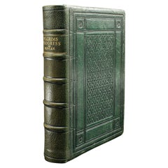
Antique Book, The Pilgrim's Progress, John Bunyan, English, Novel, Victorian
Located in Hele, Devon, GB
This is an antique book 'The Pilgrim's Progress' by John Bunyan. An English, bound and illustrated novel, dating to the Victorian period, circa 1860. A Christian allegory - and never out of print - The Pilgrim's Progress was written in the 17th century and is considered as the first novel written in English. Initially written when John Bunyan (1628 - 1688) was in prison for holding mass outside of the Church of England's purview, it was finished in two volumes and later translated into over 200 languages, including Dutch, German and Swedish. Victorian period reprint of the original 17th century volumes Displaying a desirable aged patina and in lightly time-worn, intact order Tastefully bound in dark green Morocco with gilt lettering and textured fore edge...
Category

British Victorian Antique Mid-19th Century Collectibles and Curiosities

Materials

Paper

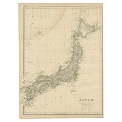
Antique Map of Japan by W. G. Blackie, 1859
Located in Langweer, NL
Antique map titled 'Japan'. Original antique map of Japan. This map originates from ‘The Imperial Atlas of Modern Geography’. Published by W. G. B...
Category

Antique Mid-19th Century Collectibles and Curiosities

Materials

Paper

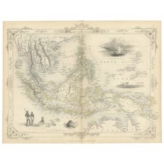
Antique Map of the Malay Archipelago with Images of Indigenous People, 1851
Located in Langweer, NL
John Tallis & Company, often simply known as Tallis, was renowned for the production of maps and illustrated geographical publications in the mid-19th century. Tallis maps, such as t...
Category

Antique Mid-19th Century Collectibles and Curiosities

Materials

Paper

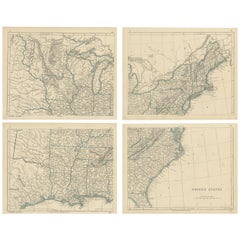
Antique Map of the United States by Lowry, '1852'
Located in Langweer, NL
Antique map titled 'United States'. Four individual sheets of the United States. This map originates from 'Lowry's Table Atlas constructed and engraved from the most recent Authoriti...
Category

Antique Mid-19th Century Collectibles and Curiosities

Materials

Paper

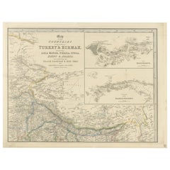
Antique Map Featuring Turkey, Persia, India, Egypt & Arabia by James Wyld, 1839
Located in Langweer, NL
The map titled "Map of the countries lying between Turkey & Birmah, comprising Asia Minor, Persia, India, Egypt & Arabia and including the Black, Caspian & Red Seas" is an antique ma...
Category

Antique Mid-19th Century Collectibles and Curiosities

Materials

Paper

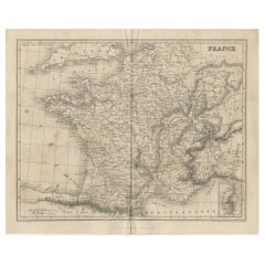
Antique Map of France by Balbi '1847'
Located in Langweer, NL
Antique map titled 'France'. Original antique map of France. This map originates from 'Abrégé de Géographie (..)' by Adrien Balbi. Published 1847.
Category

Antique Mid-19th Century Collectibles and Curiosities

Materials

Paper

Antique East Yorkshire Map, English, Framed Lithograph, Cartography, Victorian
Located in Hele, Devon, GB
This is an antique lithography map of East Yorkshire. An English, framed atlas engraving of cartographic interest, dating to the mid 19th century and later. Superb lithography of t...
Category

British Victorian Antique Mid-19th Century Collectibles and Curiosities

Materials

Paper

Antique Map of Eure ‘France’ by V. Levasseur, 1854
Located in Langweer, NL
Antique map titled 'Dépt. de l'Eure'. Map of the French department of Eure, France. This region of France is home to Giverny, where impressionist Claude Monet’s home and garden can b...
Category

Antique Mid-19th Century Collectibles and Curiosities

Materials

Paper

Decorative Print of the Belgium Army with Ambulance Troops in the Field, 1833
Located in Langweer, NL
One nicely hand coloured print of an original serie of 23 plates, published in 1833. Rare. From a serie of beautiful lithographed plates with Belgian military...
Category

Antique Mid-19th Century Collectibles and Curiosities

Materials

Paper

Antique Map of the British Isles with Outline Coloring
Located in Langweer, NL
Antique map titled 'Iles Britanniques'. Attractive map of the British Isles. Details England, Scotland and Ireland as well as parts of neighboring France. Upper right corner features...
Category

Antique Mid-19th Century Collectibles and Curiosities

Materials

Paper

Antique Map of Scandinavia by Lapie, 1842
Located in Langweer, NL
Antique map titled 'Carte de la Scandinavie comprenant les Royaumes de Suède de Norwege et de Danemark'. Map of Scandinavia including Sweden, Norway and Denma...
Category

Antique Mid-19th Century Collectibles and Curiosities

Materials

Paper

Antique Map of South Africa by Wyld '1845'
Located in Langweer, NL
Antique map titled 'South Africa'. Original antique map of South Africa. This decorative original old map originates from 'An Atlas of th...
Category

Antique Mid-19th Century Collectibles and Curiosities

Materials

Paper

Antique Map of Southern Syria by Fullarton & Co, circa 1860
Located in Langweer, NL
Antique map titled 'Syria south part'. Published by Fullarton & Co, Glasgow, circa 1860. - Title: Syria South Part - Publisher: Fullarton & Co, Glasgow - Date of Publication: Circa ...
Category

English Antique Mid-19th Century Collectibles and Curiosities

Materials

Paper

Antique County Map, Dorset, English, Framed Engraving, Cartography, Lithography
Located in Hele, Devon, GB
This is an antique lithography map of Dorset. An English, framed atlas engraving of cartographic interest, dating to the mid 19th century and later. Superb lithography of Dorsetshi...
Category

British Victorian Antique Mid-19th Century Collectibles and Curiosities

Materials

Glass, Wood, Paper

Old Original Map of Africa and Arabia, 1848
Located in Langweer, NL
Antique map titled 'Africa et Arabia'. Old map of Africa and Arabia originating from 'Orbis Terrarum Antiquus in usum Scholarum'. Artists and Engravers: Published by Justus P...
Category

Antique Mid-19th Century Collectibles and Curiosities

Materials

Paper

Antique Map of the Northern Part of South America by J. Tallis, circa 1851
Located in Langweer, NL
A decorative and detailed mid-19th century map of the northern part of South America (including modern day Venezuela, Colombia, Ecuador, Guyana, Suriname and French Guiana) which was drawn and engraved by J. Rapkin (vignettes by H. Winkles & W. Lacey) and published in John Tallis & Co.'s The Illustrated Atlas (London & New York: circa 1851). The Illustrated Atlas, published from 1849 onwards, was the last decorative world atlas. The 'Venezuela, New Granada...' map was typical of the many Fine ones which appeared in this work with its decorative border and attractive vignettes. Illustrated are views of Mount Chimborazo, Ecuador; the 'Fall of the Bagota' (Tequendama Falls, Colombia); Rheas and a prospect of Paramaribo Harbour (Dutch Guiana...
Category

Antique Mid-19th Century Collectibles and Curiosities

Materials

Paper

Hospitaler of the Order of the Holy Ghost, Roman Catholic Order, 1845
Located in Langweer, NL
Antique print titled 'Hospitalier du Saint-Esprit'. Print of a Hospitaler of the Order of the Holy Ghost, Hospitallers of the Holy Spirit, Roman Catholi...
Category

Antique Mid-19th Century Collectibles and Curiosities

Materials

Paper

Antique Map of North America by Lapie '1842'
Located in Langweer, NL
Antique map titled 'Carte de l'Amérique septentrionale'. Map of North America, with an inset map of the Aleutian Islands. This map originates from 'Atlas universel de géographie anci...
Category

Antique Mid-19th Century Collectibles and Curiosities

Materials

Paper

Original Antique English County Map, Leicestershire, J & C Walker, 1851
Located in St Annes, Lancashire
Great map of Leicestershire Original colour By J & C Walker Published by Longman, Rees, Orme, Brown & Co. 1851 Unframed.
Category

English Other Antique Mid-19th Century Collectibles and Curiosities

Materials

Paper

Steel Engraved Map of the United States with Inset Map of Florida
Located in Langweer, NL
Antique map titled 'United States'. Steel engraved map of the United States. With small inset map of the continuation of Florida. Source unknown, to be determined. Published circa 1843.
Category

Antique Mid-19th Century Collectibles and Curiosities

Materials

Paper

Dickens, Life and Adventures of Nicholas Nickleby, First Edition in 19 Parts
Located in Hillsborough, NJ
AUTHOR: DICKENS, Charles. TITLE: The Life and Adventures Of Nicholas Nickleby. (20 Parts in 19). PUBLISHER: London: Chapman and Hall, 1838. DESCRIPTION: FIRST EDITION IN TH...
Category

British Antique Mid-19th Century Collectibles and Curiosities

Materials

Paper

Antique Bronze Religious Art Sculpture / Statue Depicting Christ with Children
Located in Lisse, NL
19th century finest bronze group statue. This excellent quality and very refined sculpture of Christ with children is another one of our recent great finds. Anyone who knows what it takes to create a bronze sculpture from start to finish realizes how special these works of art really are. For us to have found this rare, antique specimen more than made our day. Firstly, because we love the subject matter and secondly, because antique bronzes always are the best when it comes to the details and the patina. Both the serenity in Jesus' face and the way His cloth is perfectly draped around His sitting body are details that never fail to impress. The angelic faces of the two children who are clearly enjoying to be in His presence, make this meaningful and striking sculpture even more pleasant to look at. This handcrafted and antique work of beauty simply warms your heart and it will look marvelous, no matter where you decide to have it on display. Our price for this work of religious art...
Category

French Gothic Revival Antique Mid-19th Century Collectibles and Curiosities

Materials

Bronze

Antique Map of Africa by Lapie, 1842
Located in Langweer, NL
Antique map titled 'Carte d'Afrique'. Map of Africa. This map originates from 'Atlas universel de géographie ancienne et moderne (..)' by Pierre M. Lapie...
Category

Antique Mid-19th Century Collectibles and Curiosities

Materials

Paper

Jenny Lind Rare Printed and Hand Painted Pot Lid Attributed to Ridgway
Located in Bishop's Stortford, Hertfordshire
An unusual and rare English potlid believed to depict Jenny Lind and attributed to Ridgway and dating from around 1850. The lid is printed with a lady seated in a garden landscape in a rather elegant white ball gown...
Category

English Early Victorian Antique Mid-19th Century Collectibles and Curiosities

Materials

Pottery

Large Original Antique Map of Australia by Sidney Hall, 1847
Located in St Annes, Lancashire
Great map of Australia Drawn and engraved by Sidney Hall Steel engraving Original colour outline Published by A & C Black. 1847 Unframed Free shipping.
Category

Scottish Antique Mid-19th Century Collectibles and Curiosities

Materials

Paper

19th Century French Polychrome Carved Wood Statue of Saint Roch
Located in Dallas, TX
Honor the legacy of a beloved French saint with this expressive antique polychrome wood sculpture of Saint Roch. Carved in France circa 1870 and standing an impressive four feet tall...
Category

French Antique Mid-19th Century Collectibles and Curiosities

Materials

Oak

Very Rare 19th Century Italian Trompe L'oeil Panels
Located in London, GB
19th century Italian trompe l'oeil panels We are proud to offer a spectacular pair of highly decorative 19th century Italian trompe l'oeil panels, each depicting an architectural b...
Category

Italian Early Victorian Antique Mid-19th Century Collectibles and Curiosities

Materials

Wrought Iron

Large Original Antique Map of Poland by Sidney Hall, 1847
Located in St Annes, Lancashire
Great map of Poland Drawn and engraved by Sidney Hall Steel engraving Original colour outline Published by A & C Black. 1847 Unframed ...
Category

Scottish Antique Mid-19th Century Collectibles and Curiosities

Materials

Paper

Antique Map Showing the Division and Distribution of Reptiles by Johnston '1850'
Located in Langweer, NL
Antique map titled 'Geographical division and distribution of reptilia and ophidia. Original antique map showing the geographical division and distribution of reptiles and serpents. ...
Category

Antique Mid-19th Century Collectibles and Curiosities

Materials

Paper

A Decorative Map of Nova Scotia and Newfoundland by John Tallis, 1851
Located in Langweer, NL
The map is part of the series created by John Tallis & Company, known for their mid-19th-century maps. This particular map illustrates the regions of Nova Scotia and Newfoundland and...
Category

English Antique Mid-19th Century Collectibles and Curiosities

Materials

Paper

Trial of John Fox, for the Murder of John Henry. New-Brunswick, N.J. 1856
Located in Hillsborough, NJ
AUTHOR: FOX, John. TITLE: Trial of John Fox, for the Murder of John Henry, at the Special Term of the Middlesex over and Terminer, at New-Brunswick, N.J., May, 1856, Containing the...
Category

American Antique Mid-19th Century Collectibles and Curiosities

Materials

Paper

Nice Decorative Black and White Small Antique Map of Europe, 'circa 1834'
Located in Langweer, NL
Antique French map titled 'Europe par A.H. Dufour'. Uncommon map of Europe. Published by or after A.H. Dufour, circa 1834. Source unknown, to be d...
Category

Antique Mid-19th Century Collectibles and Curiosities

Materials

Paper

Large Antique Map of New York State with Inset Maps
Located in Langweer, NL
Antique map titled 'Johnson's New York' Large map of New York State. With insets of Albany, Oswego, Buffalo, Rochester, Syracuse, Troy and NYC. Published by Johnson and Browning, 186...
Category

Antique Mid-19th Century Collectibles and Curiosities

Materials

Paper

Antique Map of the Islands in the Atlantic Ocean including Bermuda & Cape Verde
Located in Langweer, NL
Antique map titled 'Islands in the Atlantic'. Steel engraved map of the islands in the Atlantic Ocean. It shows 16 individual maps on one sheet. Covers the Azores or Western Isles, Faeroe Isles, Madeira Isles, Princes Island, Canary Islands, Fernando Po, Anno Bon, St. Thomas, Bermuda Isles, Trinidade Isles, Fernando Noronha, Cape Verde Isles, Ascension Island, St. Helena, Tristan d'Acunha Isles and the Falkland Isles. Engraved by J. & C. Walker. Published by George Cox...
Category

Antique Mid-19th Century Collectibles and Curiosities

Materials

Paper

Antique Map of Nièvre ‘France’ by V. Levasseur, 1854
Located in Langweer, NL
Antique map titled 'Dépt. de la Nièvre'. Map of the French department of Nievre, France. Part of the prestiegous Burgundy or Bourgogne wine region this area is known for its producti...
Category

Antique Mid-19th Century Collectibles and Curiosities

Materials

Paper

Detailed Antique Map of Britain, Wales and the Coast of Ireland
Located in Langweer, NL
Antique map titled 'Carta d'Inghilterra e del Principato di Galles'. Detailed map of Britain, Wales and the coast of Ireland with a list of counties. This map originates from 'Nuovo ...
Category

Antique Mid-19th Century Collectibles and Curiosities

Materials

Paper

Antique Religious Print, Absalom's Rebellion - Histoire Sainte, Ancien Testament
Located in Langweer, NL
The antique print titled ‘Histoire Sainte, Ancien Testament, Absalon’ depicts a scene from the Old Testament, specifically the story of Absalom. Absalom was a figure from the Bible, ...
Category

Antique Mid-19th Century Collectibles and Curiosities

Materials

Paper

Antique Map of the World by Ferrario '1831'
Located in Langweer, NL
Original antique map of the world. This print originates from 'Costume Antico e Moderno: Palestine, China, India, Oceania' by Ferrario. Publis...
Category

Antique Mid-19th Century Collectibles and Curiosities

Materials

Paper

Old Map of the French department of Ariège, France
Located in Langweer, NL
Antique map titled 'Dépt. de l'Ariège'. Map of the French department of Ariege, France. This area of France is known for its production of semi-soft and mild cheeses, such as Bethmal...
Category

Antique Mid-19th Century Collectibles and Curiosities

Materials

Paper

Large Antique Map of New England with decorative Vignettes
Located in Langweer, NL
Antique map titled 'Johnson's New England'. Large map of New England, comprising the states Connecticut, Maine, Massachusetts, New Hampshire, Rhode ...
Category

Antique Mid-19th Century Collectibles and Curiosities

Materials

Paper

Original Antique English County Map, Huntingdonshire, J & C Walker, 1851
Located in St Annes, Lancashire
Great map of Huntingdonshire Original colour By J & C Walker Published by Longman, Rees, Orme, Brown & Co. 1851 Unframed.
Category

English Other Antique Mid-19th Century Collectibles and Curiosities

Materials

Paper

Antique Map of Allier ‘France’ by V. Levasseur, 1854
Located in Langweer, NL
Antique map titled 'Dépt. de l'Allier'. Map of the French department of l'Allier, France. This area of France is known for its production of Saint-Pourçain wine. It is also one of th...
Category

Antique Mid-19th Century Collectibles and Curiosities

Materials

Paper

Antique Map of the Northern Part of Scotland by Black '1854'
Located in Langweer, NL
Antique map titled 'Scotland'. Original map of the northern part of Scotland. With an inset map of the Orkney Isles. This map originates from 'General Atlas Of The World: Containing ...
Category

Antique Mid-19th Century Collectibles and Curiosities

Materials

Paper

Rolfe's Angling Sketches, Fishing Picture, Not Long Caught.
Located in Oxfordshire, GB
Rolfe's Angling Sketches. An extremely rare colourful fishing lithograph after Henry Leonidas Rolfe (1823 - 1881) 'Rolfe's Angling Sketches, Not ...
Category

British Sporting Art Antique Mid-19th Century Collectibles and Curiosities

Materials

Paper

Nelson's Guide to the City of New York and its Neighbourhood, 1858
Located in Langweer, NL
"Nelson's Guide to the City of New York and its Neighbourhood," published in 1858 by T. Nelson in London and New York, serves as an invaluable resource for exploring the historical a...
Category

Antique Mid-19th Century Collectibles and Curiosities

Materials

Paper

Original Antique English County Map, Nottinghamshire, J & C Walker, 1851
Located in St Annes, Lancashire
Great map of Nottinghamshire Original colour By J & C Walker Published by Longman, Rees, Orme, Brown & Co. 1851 Unframed.
Category

English Other Antique Mid-19th Century Collectibles and Curiosities

Materials

Paper

Original Antique English County Map, Hertfordshire. J & C Walker, 1851
Located in St Annes, Lancashire
Great map of Hertfordshire Original colour By J & C Walker Published by Longman, Rees, Orme, Brown & Co. 1851 Unframed.
Category

English Other Antique Mid-19th Century Collectibles and Curiosities

Materials

Paper

Antique Map of Asia by Dufour, circa 1834
Located in Langweer, NL
Antique map titled 'Asie par A.H. Dufour'. Uncommon map of Asia. Published by or after A.H. Dufour, circa 1834. Source unknown, to be determined.
Category

Antique Mid-19th Century Collectibles and Curiosities

Materials

Paper

Swiss Splendor: Antique Map of Switzerland and Its Cantons, 1852
Located in Langweer, NL
The antique map titled 'Carte de la Suisse' is an attractive map of Switzerland. Here are the key details and features of the map: 1. **Geographic Coverage**: - The map provides comprehensive coverage of Switzerland, depicting the entire country. - It showcases the division of Switzerland by Cantons, including regions from Vaud to Grisons. - Additionally, the map includes parts of adjacent countries, such as France, Germany, and Italy, providing context for Switzerland's geographical location. 2. **Cartographic Details**: - The map offers detailed cartographic information, including the delineation of geographic features, rivers, mountains, and the names of Cantons and towns. - It presents a clear and informative representation of Switzerland's topography. 3. **Origin**: - This map originates from Maison Basset's 1852 edition of 'Atlas Illustre Destine a l'enseignement de la Geographie elementaire,' indicating its use for educational purposes, particularly in the teaching of geography. 4. **Educational Significance**: - As part of an educational atlas, the map likely played a role in instructing students about the geography of Switzerland and its political subdivisions. - It may have been employed as a visual aid to enhance students' understanding of Switzerland's Cantonal divisions. 5. **Aesthetic Appeal**: - The map is described as attractive, suggesting that it possesses not only educational value but also visual appeal. - Maps of this era often featured decorative elements that added to their aesthetic charm. 6. **Historical and Geopolitical Significance**: - Switzerland's unique position in Europe, as a country surrounded...
Category

Antique Mid-19th Century Collectibles and Curiosities

Materials

Paper

Antique Map of Côte d'Or ‘France’ by V. Levasseur, 1854
Located in Langweer, NL
Antique map titled 'Dépt. de la Côte d'Or'. Map of the French department of Cote D’Or, France. Part of France's Burgundy or Bourgogne wine region, a premier wine-growing region of Fr...
Category

Antique Mid-19th Century Collectibles and Curiosities

Materials

Paper

Small Antique County Map, Northamptonshire, English, Framed, Cartography, C.1850
Located in Hele, Devon, GB
This is a small antique county map of Northamptonshire. An English, framed atlas engraving of cartographic interest, dating to the mid 19th century and later. Superb lithography of...
Category

British Victorian Antique Mid-19th Century Collectibles and Curiosities

Materials

Paper

Handcolored Antique Print of Officers and Horses of the Belgium Army, 1833
Located in Langweer, NL
One nicely hand coloured print of an original serie of 23 plates, showing officers and soldiers discussing matters. published in 1833. Rare. From a serie of beautiful lithographed plates with Belgian military costumes after Madou and printed by Dero-Becker. Comes from a Belgian military costume album, dedicated to the Belgian King, and financed by subscribers, some 90 Belgian nobility and officers of the Belgian Army...
Category

Antique Mid-19th Century Collectibles and Curiosities

Materials

Paper

Hand Colored Antique Map of the Department of Eure-et-loir, France
Located in Langweer, NL
Antique map titled 'Dépt. d'Eure et Loir'. Map of the French department of Eure-et-Loir, France. This area is home to the famous Chartres Cathedral....
Category

Antique Mid-19th Century Collectibles and Curiosities

Materials

Paper

Original Antique English County Map - Monmouthshire. J & C Walker. 1851
Located in St Annes, Lancashire
Great map of Monmouthshire Original colour By J & C Walker Published by Longman, Rees, Orme, Brown & Co. 1851 Unframed.
Category

English Other Antique Mid-19th Century Collectibles and Curiosities

Materials

Paper

Original Antique English County Map, Herefordshire, J & C Walker, 1851
Located in St Annes, Lancashire
Great map of Herefordshire Original colour By J & C Walker Published by Longman, Rees, Orme, Brown & Co. 1851 Unframed.
Category

English Other Antique Mid-19th Century Collectibles and Curiosities

Materials

Paper

Original Antique English County Map, Staffordshire, J & C Walker, 1851
Located in St Annes, Lancashire
Great map of Staffordshire Original colour By J & C Walker Published by Longman, Rees, Orme, Brown & Co. 1851 Unframed.
Category

English Other Antique Mid-19th Century Collectibles and Curiosities

Materials

Paper

Large Italian Map of Islands of Oceania, incl Papua, Timor, Banda, Ceram, 1855
Located in Langweer, NL
Description: Antique map titled 'Carta di una parte dell'Oceania'. Beautiful large map of the (Spice) islands of Oceania. Depicting Papua, Timor, Ceram, Gilolo and many more. Source ...
Category

Antique Mid-19th Century Collectibles and Curiosities

Materials

Paper

Hand Colored Antique Map of the department of Ardennes, France
Located in Langweer, NL
Antique map titled 'Dépt. des Ardennes'. Map of the French department of Ardennes, France. Part of France's important Champagne producing region. The whole is surrounded by elaborate...
Category

Antique Mid-19th Century Collectibles and Curiosities

Materials

Paper

Antique Print of Tokyo Bay 'or Edo Bay', Located in Southern Kantō, Japan, 1856
Located in Langweer, NL
Antique print titled 'To-Ri-Ga-Sa-Ki, Yedo Bay'. View of Tokyo Bay (or Edo Bay), a bay located in the southern Kanto region of Japan, and spans the coasts of Tokyo, Kanagawa Prefectu...
Category

Antique Mid-19th Century Collectibles and Curiosities

Materials

Paper

Antique County Map, Hertfordshire, English, Framed Engraving, Cartography, Litho
Located in Hele, Devon, GB
This is an antique county map of Hertfordshire. An English, framed atlas engraving of cartographic interest, dating to the mid 19th century and later. Superb lithography of Hertfor...
Category

British Victorian Antique Mid-19th Century Collectibles and Curiosities

Materials

Glass, Wood, Paper

Read More

Medal-Worthy Memorabilia from Epic Past Olympic Games

Get into the games! These items celebrate the events, athletes, host countries and sporting spirit.

Ahoy! You’ve Never Seen a Collection of Sailor Art and Kitsch Quite Like This

French trendsetter and serial collector Daniel Rozensztroch tells us about his obsession with objects related to seafaring men.

Pamela Shamshiri Shares the Secrets behind Her First-Ever Book and Its Effortlessly Cool Interiors

The sought-after designer worked with the team at Hoffman Creative to produce a monograph that beautifully showcases some of Studio Shamshiri's most inspiring projects.

Moroccan Artworks and Objects Take Center Stage in an Extraordinary Villa in Tangier

Italian writer and collector Umberto Pasti opens the doors to his remarkable cave of wonders in North Africa.

Montecito Has Drawn Royalty and Celebrities, and These Homes Are Proof of Its Allure

Hollywood A-listers, ex-pat aristocrats and art collectors and style setters of all stripes appreciate the allure of the coastal California hamlet — much on our minds after recent winter floods.

Whaam! Blam! Pow! — a New Book on Pop Art Packs a Punch

Publishing house Assouline and writer Julie Belcove have teamed up to trace the history of the genre, from Roy Lichtenstein, Andy Warhol and Yayoi Kusama to Mickalene Thomas and Jeff Koons.

What Makes a Gem-Encrusted Chess Set Worth $4 Million?

The world’s most opulent chess set, weighing in at 513 carats, is literally fit for a king and queen.

Tauba Auerbach’s Geometric Pop-Up Book Is Mighty Rare, Thanks to a Hurricane

This sculptural art book has an epic backstory of its own.
Recently Viewed

View All