Mid-19th Century Collectibles and Curiosities

to
750
1,180
374
1,576
170
24
22
10
5
5
5
4
4
2
2
2
1
4,379
6,595
13,360
2,719
3,528
4,612
3,039
518
314
588
733
464
898
880
904
660
578
981
311
261
93
92
587
324
179
145
138
1,576
1,576
1,576
104
7
6
2
2
Period: Mid-19th Century
Antique Map of China and the East Indies by Lowry, 1852
Located in Langweer, NL
Antique map titled 'China & Indian Archipelago'. Two individual sheets of China and the East Indies. This map originates from 'Lowry's table Atlas constructed and engraved from the m...
Category

Antique Mid-19th Century Collectibles and Curiosities

Materials

Paper

Steel Engraving of Shimoda, a Port Located in Shizuoka Prefecture, Japan, C.1840
Located in Langweer, NL
Antique print titled 'Simoda in Japan'. Steel engraving of Shimoda, a city and port located in Shizuoka Prefecture, Japan. Originates from 'Meyers Univer...
Category

Antique Mid-19th Century Collectibles and Curiosities

Materials

Paper

Colourful Antique Map of Switzerland, 1846
Located in Langweer, NL
Antique map titled 'Switzerland'. Old map of Switzerland. This map originates from 'A New Universal Atlas Containing Maps of the various Empires...
Category

Antique Mid-19th Century Collectibles and Curiosities

Materials

Paper

Old Print of 'Beugelen', One of the Oldest Ball Sports in The Netherlands, 1857
Located in Langweer, NL
Antique print titled 'Plate IV 'De Beugelbaan - Le Jeu de Passe.' This plate shows a 19th century scene in Noord-Brabant, The Netherlands. Men are playing the Dutch game 'beugelen'. This original antique print was published in 1857 by Frans Buffa & Zonen Amsterdam as part of the publication 'Nederlandsche Kleederdrachten naar de natuur' (Dutch folk costume, illustrated using real-life models) by Valentyn Bing. 'Beugelen' is a popular sport in which a heavy sphere is moved with a wooden shovel...
Category

Antique Mid-19th Century Collectibles and Curiosities

Materials

Paper

Western Africa Antique Map by W. G. Blackie, 1859
Located in Langweer, NL
The antique map titled 'Western Africa' presents an original depiction of the region. Originating from 'The Imperial Atlas of Modern Geography,' this map was published by W. G. Black...
Category

Antique Mid-19th Century Collectibles and Curiosities

Materials

Paper

Antique Map of the Region Near the Gulf of Zula, 1870
Located in Langweer, NL
Antique map titled 'Map of the Country between Annesley Bay and the Plain of Salt'. Lithographed map of the region near the Gulf of Zula, also known as Annesley Bay, Baia di Arafali ...
Category

Antique Mid-19th Century Collectibles and Curiosities

Materials

Paper

Antique County Map, Dorset, English, Framed Engraving, Cartography, Lithography
Located in Hele, Devon, GB
This is an antique lithography map of Dorset. An English, framed atlas engraving of cartographic interest, dating to the mid 19th century and later. Superb lithography of Dorsetshi...
Category

British Victorian Antique Mid-19th Century Collectibles and Curiosities

Materials

Glass, Wood, Paper

Antique Map of Africa by Levasseur 'c.1840'
Located in Langweer, NL
Antique map titled 'Afrique'. Original antique map of Africa. Decorative map of the continent surrounded by allegorical vignettes. Engraved by Raimond Bonheur, father of the famous F...
Category

Antique Mid-19th Century Collectibles and Curiosities

Materials

Paper

Old Print of Entrance into Manchester Train Station across Water Street, ca.1832
Located in Langweer, NL
Antique print titled 'Entrada de Manchester por Water Street'. Antique print of the entrance into Manchester across Water Street. This print originates ...
Category

Antique Mid-19th Century Collectibles and Curiosities

Materials

Paper

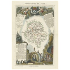
Hand Colored Antique Map of the department of Indre and Loire, France
Located in Langweer, NL
Antique map titled 'Dépt. d'Indre et Loire'. Map of the Department de L’Indre et Loire, France. This region is known for its fine wines, agriculture, distilled spirits, and cheese. T...
Category

Antique Mid-19th Century Collectibles and Curiosities

Materials

Paper

Old Map of Holstein with the Imperial Towns Hamburg & Lubeck, Germany, 1854
Located in Langweer, NL
Antique map titled 'Map of the Duchy of Holstein with the territories of the Imperial Towns Hamburg & Lubeck (..) Based on a map by Fischer.' Map of the Duchy of Holstein. From Jam...
Category

Antique Mid-19th Century Collectibles and Curiosities

Materials

Paper

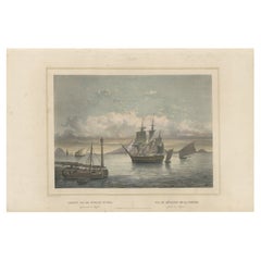
Old Print of Ships near Anyer & Krakatoa in the Sunda Straits, Indonesia, 1844
Located in Langweer, NL
Antique print titled 'Gezigt van de Straat Sunda - Vue du Détroit de la Sonde'. Old print with a view of the Sunda straits with ships as seen from Anjer / Anyer on the Island of ...
Category

Antique Mid-19th Century Collectibles and Curiosities

Materials

Paper

1850 Old French Map Depicting the Entire Earth's Surface Divided into Two Parts
Located in Milan, IT
Geographical map depicting the entire earth’s surface divided into two parts that correspond to the two hemispheres or globes, the map deals with the latitudes and longitudes, the me...
Category

French Antique Mid-19th Century Collectibles and Curiosities

Materials

Glass, Wood, Paper

Old Colourful View of the Tunnel Near Liverpool on the Manchester Railway, c1832
Located in Langweer, NL
Antique print titled 'Galeria subterranea'. Antique print of the inside of the tunnel built near Liverpool on the Liverpool and Manchester Railway. This print originates from 'Colo...
Category

Antique Mid-19th Century Collectibles and Curiosities

Materials

Paper

Antique Plan of Turkey in Europe with Inset Map of the Bosporus, ca.1850
Located in Langweer, NL
Antique map titled 'Turkey in Europe'. A map of European Turkey and the surrounding countries. With an inset map of the Bosporus. This includes Macedonia, Bulgaria, Croatia, Bosn...
Category

Antique Mid-19th Century Collectibles and Curiosities

Materials

Paper

Hand Colored Antique Map of the Department of Ardèche, France
Located in Langweer, NL
Antique map titled 'Dépt. de l'Ardèche'. Map of the Department of Ardèche, France. This region is known for its fine wines, agriculture, distilled spirits, and cheese. The capital ci...
Category

Antique Mid-19th Century Collectibles and Curiosities

Materials

Paper

Large Italian Map of Islands of Oceania, incl Papua, Timor, Banda, Ceram, 1855
Located in Langweer, NL
Description: Antique map titled 'Carta di una parte dell'Oceania'. Beautiful large map of the (Spice) islands of Oceania. Depicting Papua, Timor, Ceram, Gilolo and many more. Source ...
Category

Antique Mid-19th Century Collectibles and Curiosities

Materials

Paper

Hand-Colored Lithograph of an Armed Knight under the Reign of Louis XI, ca.1860
Located in Langweer, NL
Antique print titled 'Chevalier armé sous Louis XI'. Lithograph of an armed knight under the reign of Louis XI. Source unknown, to be determined. Artists and Engravers: Anonymous....
Category

Antique Mid-19th Century Collectibles and Curiosities

Materials

Paper

Hand Colored Antique Map of the department of Cantal, France
Located in Langweer, NL
Antique map titled 'Dépt. du Cantal'. Map of the French department of Cantal, France. This area of France is known for its production of Cantal, a firm cheese, named after the region...
Category

Antique Mid-19th Century Collectibles and Curiosities

Materials

Paper

Hand Colored Antique Map of the Department of Aude, France
Located in Langweer, NL
Antique map titled 'Dépt. de l'Aude'. Map of the French department of Aude, France. This area of France is famous for its wide variety of vineyards and wine production. In the east a...
Category

Antique Mid-19th Century Collectibles and Curiosities

Materials

Paper

Old Fish Print Named Opah, Cravo, Moonfish, Kingfish or Jerusalem Haddock, 1842
Located in Langweer, NL
Antique print, titled: 'Poissons Plate 10 - Le Lampris Tachete (Lampris guttatus).' - This rare plate shows the Lampris guttatus, commonly known as the opah, cravo, moonfish, kin...
Category

Antique Mid-19th Century Collectibles and Curiosities

Materials

Paper

Hand Colored Antique Map of the department of Hautes Alpes, France
Located in Langweer, NL
Antique map titled 'Dépt. des Hautes Alpes'. Map of the French department of Hautes Alpes, France. This area of France is known for its production of Cote...
Category

Antique Mid-19th Century Collectibles and Curiosities

Materials

Paper

Engraved Large Map of The Kingdom of Portugal Original Handcolored, 1854
Located in Langweer, NL
Antique map titled 'Mappa Corografica do Reino de Portugal - Chorographical map of the Kingdom of Portugal divided into its Grand Provinces.' Large map of...
Category

Antique Mid-19th Century Collectibles and Curiosities

Materials

Paper

Rare Map of the Bay of St. Vladimir 'Russia' Showing the Route of J. Ward, 1869
Located in Langweer, NL
Antique map titled 'Côte est de Tartarie Baie St. Vladimir'. Map of the Bay of St. Vladimir (Russia) showing the route of J. Ward. Including a coastal view. Source unknown, to be...
Category

Antique Mid-19th Century Collectibles and Curiosities

Materials

Paper

Antique Map Showing the Distribution of Plants by Johnston, '1850'
Located in Langweer, NL
Antique map titled 'Geographical Distribution of Plants'. Original antique map showing the distribution of plants. This map originates from 'The Physical Atlas of Natural Phenomena' ...
Category

Antique Mid-19th Century Collectibles and Curiosities

Materials

Paper

Rare Decorative Hand-coloured Antique Plate of The Gaimard's Ray Fish, 1842
Located in Langweer, NL
Antique print, titled: 'Poissons Plate 3 - La Raie de Gaimard (Raia gaimardi).' - This rare plate shows the Gaimard's ray. From: 'Voyage en Islande et au Groenland' by M. Paul Gaimar...
Category

Antique Mid-19th Century Collectibles and Curiosities

Materials

Paper

Old Map of the French department of l'Aisne, France
Located in Langweer, NL
Antique map titled 'Dépt. de l'Aisne'. Map of the French department of l'Aisne, France. The whole is surrounded by elaborate decorative engravings designed to illustrate both the nat...
Category

Antique Mid-19th Century Collectibles and Curiosities

Materials

Paper

Large Antique Map of the west coast of Celebes, Sulawesi, Indonesia
Located in Langweer, NL
Original antique map titled 'Kaart der Westkust van Celebes van Makasser tot Laijkan'. This large map shows the west coast of Celebes, Sulawesi, Indonesia. It covers the region of Makassar to Cikoang. Inset map of the coast of Selat (Strait) Makassar, also showing the Dutch Fort Rotterdam, to day Fort Ujung Pandang. With historical traces dating back to the Kingdom of Gowa from the 16th century to colonization by the Dutch, this Fort has silently witnessed many episodes in Makassar’s history, playing a most essential role in its development. Originally called Benteng or Fort Jumpandang or Ujung Pandang, the huge complex was first built in 1545 in the era of Imanrigau Daeng Bonto Karaeng Lakiung or Karaeng Tunipalangga Ulaweng, the tenth King of Gowa. Initially, the fort was made from a mixture of Stone and burnt clay, and took the shape of a typical square Portuguese architectural...
Category

Antique Mid-19th Century Collectibles and Curiosities

Materials

Paper

Hand Colored Antique Map of the department of Drôme, France
Located in Langweer, NL
Antique map titled 'Dépt. de la Drôme'. Map of the French department of Drôme, France. This area is known for its production of Picodon, a spicy goats-milk ch...
Category

Antique Mid-19th Century Collectibles and Curiosities

Materials

Paper

Old Map of the French department of Creuse, France
Located in Langweer, NL
Antique map titled 'Dépt. de la Creuse'. Map of the French department of Creuse, France. This region is well known for its apple cider made from Limousin apples and its international...
Category

Antique Mid-19th Century Collectibles and Curiosities

Materials

Paper

Original Antique Print of the Port of Calais, France, ca.1860
Located in Langweer, NL
Antique print titled 'Calais Entrée du Port'. Original antique print of the port of Calais, France. This print originates from 'France en miniature'. Published circa 1860. Art...
Category

Antique Mid-19th Century Collectibles and Curiosities

Materials

Paper

Hand Colored Antique Map of the Department of Ariège, France
Located in Langweer, NL
Antique map titled 'Dépt. de l'Ariège'. Map of the French department of Ariege, France. This area of France is known for its production of semi-soft and mild cheeses, such as Bethmal...
Category

Antique Mid-19th Century Collectibles and Curiosities

Materials

Paper

Hand Colored Antique Map of the Department of Creuse, France
Located in Langweer, NL
Antique map titled 'Dépt. de la Creuse'. Map of the French department of Creuse, France. This region is well known for its apple cider made from Limousin apples and its international...
Category

Antique Mid-19th Century Collectibles and Curiosities

Materials

Paper

The Divided Realms of Syria - North and South as Seen in 1859 by W. G. Blackie
Located in Langweer, NL
The "Antique Map of Syria, North and South Division" by W. G. Blackie, dated 1859, is a significant historical cartographic work. This map, originating fr...
Category

Antique Mid-19th Century Collectibles and Curiosities

Materials

Paper

Hand Colored Antique Map of the Department of Nièvre, France
Located in Langweer, NL
Antique map titled 'Dept. de la Nièvre'. Map of the French department of Nievre, France. Part of the prestiegous Burgundy or Bourgogne wine region this area is known for its producti...
Category

Antique Mid-19th Century Collectibles and Curiosities

Materials

Paper

Hand Colored Antique Map of the Department of Indre, France
Located in Langweer, NL
Antique map titled 'Dept. de l'Indre'. Map of the French department of Indre, France. Part of the Loire Valley wine region, this area is known for its production of Chinon wines, typically red, and production of Pouligny-Saint-Pierre, goats'-milk cheese. It is also the birthplace of the great philosopher Rene Descartes...
Category

Antique Mid-19th Century Collectibles and Curiosities

Materials

Paper

Hand Colored Antique Map of the department of Loir-et-Cher, France
Located in Langweer, NL
Antique map titled 'Dépt. de Loir et Cher'. Map of the French department Loir-et-Cher, France. This area is mainly known for its production of Selles-sur-Cher, a fine goats-milk chee...
Category

Antique Mid-19th Century Collectibles and Curiosities

Materials

Paper

Hand Colored Antique Map of the Department of Orne, France
Located in Langweer, NL
Antique map titled 'Dépt. de l'Orne'. Map of the French department of Orne, France. This area, part of Normandy, includes the village of Camembert, where the famous Camembert cheese ...
Category

Antique Mid-19th Century Collectibles and Curiosities

Materials

Paper

Antique Map of Russia in Europe by Lowry, 1852
Located in Langweer, NL
Antique map titled 'Russia in Europe'. Original map of Russia in Europe. This map originates from 'Lowry's Table Atlas constructed and engraved from the most recent Authorities' by J...
Category

Antique Mid-19th Century Collectibles and Curiosities

Materials

Paper

Antique Map of Spain and Portugal by Lowry, '1852'
Located in Langweer, NL
Antique map titled 'Spain and Portugal'. Original map of Spain and Portugal. This map originates from 'Lowry's Table Atlas constructed and engraved ...
Category

Antique Mid-19th Century Collectibles and Curiosities

Materials

Paper

1859 Denmark and Schleswig-Holstein Map: A Historical View from Blackie's Atlas
Located in Langweer, NL
The "Antique Map of Denmark with Schleswig & Holstein" from 'The Imperial Atlas of Modern Geography', published by W. G. Blackie in 1859, is a valuable historical document that provi...
Category

Antique Mid-19th Century Collectibles and Curiosities

Materials

Paper

Antique Map of the Burmese Empire by Wyld, '1845'
Located in Langweer, NL
Antique map titled 'Map of Burman Empire, Siam, Cochin China and Ton-King'. Original antique map of the Burmese Empire. This map originates from 'An Atlas of the World, Comprehending...
Category

Antique Mid-19th Century Collectibles and Curiosities

Materials

Paper

Antique Map of the Eastern United States with Only the Northern Part of Florida
Located in Langweer, NL
Antique map titled 'Verein-Staaten von Nord-America mit Ausnahme Florida's und der Westlichen Territorien'. This map extends as far west as Louisiana and only includes the northern p...
Category

Antique Mid-19th Century Collectibles and Curiosities

Materials

Paper

1859 Classic Map of France: Blackie's Imperial Geographic Masterpiece
Located in Langweer, NL
The "Antique Map of France" from 'The Imperial Atlas of Modern Geography', published in 1859 by W. G. Blackie, is a historically valuable cartographic work that offers a comprehensiv...
Category

Antique Mid-19th Century Collectibles and Curiosities

Materials

Paper

Antique Map of Sweden and Norway by Lowry, '1852'
Located in Langweer, NL
Antique map titled 'Sweden and Norway'. Two individual sheets of Sweden and Norway. This map originates from 'Lowry's Table Atlas constructed and engraved from the most recent Author...
Category

Antique Mid-19th Century Collectibles and Curiosities

Materials

Paper

Colton's Map of Illinois, with an Inset of Chicago
Located in Langweer, NL
Antique map titled 'Colton's Illinois'. Antique map of Illinois, a state in the Midwestern United States. With an inset map of of Cook County &...
Category

Antique Mid-19th Century Collectibles and Curiosities

Materials

Paper

Steel Engraved Map of the United States with Inset Map of Florida
Located in Langweer, NL
Antique map titled 'United States'. Steel engraved map of the United States. With small inset map of the continuation of Florida. Source unknown, to be determined. Published circa 1843.
Category

Antique Mid-19th Century Collectibles and Curiosities

Materials

Paper

Antique Map of the Crimean Peninsula and Sevastopol by W. G. Blackie, 1859
Located in Langweer, NL
Antique map titled 'The Crimea'. Original antique map of the Crimean Peninsula, Black Sea and Sevastopol. This map originates from ‘The Imperial Atlas of Modern Geography’. Published...
Category

Antique Mid-19th Century Collectibles and Curiosities

Materials

Paper

Antique Map of the Netherlands and Belgium by Hérisson, 1829
Located in Langweer, NL
Title: 'Carte Routière du Royaume des Pays-Bas comprenant la Hollande et la Belgique' **Publisher**: Eustache Hérisson **Publication Year**: 1829 This original antique map is a detailed depiction of the Netherlands and Belgium, dating back to 1829. As a 'Carte Routière', it focuses on the road networks of the region, providing valuable historical insights into the transportation and geographical understanding of the early 19th century. The map's delineation of the Kingdom of the Netherlands, including both Holland and Belgium, is particularly noteworthy as it represents the political geography of the period shortly before Belgium's independence in 1830. The map is sectionalised and laid on linen, a common practice in the 19th century for preserving and reinforcing maps, making them more durable and portable. This method of mounting also suggests that the map was intended for practical use, possibly by travelers or for educational purposes. **Artist and Publisher**: Eustache Hérisson, the publisher of this map, was a known figure in the cartographic and publishing world of the early 19th century. His work is characterized by attention to detail and accuracy, making this map not only a beautiful piece of art but also a reliable historical document. This map is a valuable historical artifact, offering insights into the geographical and political landscape of the Netherlands...
Category

Antique Mid-19th Century Collectibles and Curiosities

Materials

Paper

Antique Map of the Chinese Empire by W. G. Blackie, 1859
Located in Langweer, NL
Antique map titled 'The Chinese Empire'. Original antique map of the Chinese Empire. This map originates from ‘The Imperial Atlas of Modern Geography’. Published by W. G. Blackie, 1859.
Category

Antique Mid-19th Century Collectibles and Curiosities

Materials

Paper

1850 Old French Map Depicting the Entire Earth's Surface Divided into Two Parts
Located in Milan, IT
Geographical map depicting the entire earth's surface divided into two parts that correspond to the two hemispheres where the emerged lands are depicted which have been classified wi...
Category

French Antique Mid-19th Century Collectibles and Curiosities

Materials

Glass, Wood, Paper

Antique Planisphere with Constellations by Bion, 1751
Located in Langweer, NL
Antique map titled 'Planisphere Celeste'. Planisphere with various constellations. This map originates from 'L'Usage des globes célestes et terrestres et des sphères (..)' by N. Bion...
Category

Antique Mid-19th Century Collectibles and Curiosities

Materials

Paper

Antique County Map, Lancashire, English, Framed Lithography, Cartography, C.1860
Located in Hele, Devon, GB
This is an antique lithography map of Lancashire. An English, framed atlas engraving of cartographic interest, dating to the mid 19th century and later. Superb lithography of Lanca...
Category

British Victorian Antique Mid-19th Century Collectibles and Curiosities

Materials

Glass, Wood, Paper

Antique Map of the Island of Borneo by W. G. Blackie, 1859
Located in Langweer, NL
Antique map titled 'The Island of Borneo'. Original antique map of the Island of Borneo. This map originates from ‘The Imperial Atlas of Modern Geography’. Published by W. G. Blackie...
Category

Antique Mid-19th Century Collectibles and Curiosities

Materials

Paper

Antique Map of British America by Tallis 'c.1850'
Located in Langweer, NL
Antique map titled 'British America'. Decorative map of British America, with vignettes showing Whale Fishing, Montreal, Fury and Hecla ships asail. Thi...
Category

Antique Mid-19th Century Collectibles and Curiosities

Materials

Paper

Antique Map of Sumatra by W. G. Blackie, 1859
Located in Langweer, NL
Antique map titled 'Sumatra'. Original antique map of Sumatra with inset map of Java. This map originates from ‘The Imperial Atlas of Modern Geography’. Published by W. G. Blackie, 1...
Category

Antique Mid-19th Century Collectibles and Curiosities

Materials

Paper

Antique Map showing Isotherm Lines throughout the World by Johnston '1850'
Located in Langweer, NL
Antique map titled 'Humboldt's System of Isothermal Lines'. Original antique map showing isotherm lines throughout the world. This map originates from 'The Physical Atlas of Natural ...
Category

Antique Mid-19th Century Collectibles and Curiosities

Materials

Paper

Antique Map of Australia and New Zealand by W. G. Blackie, 1859
Located in Langweer, NL
Antique map titled 'Australia and New Zealand'. Original antique map of Australia and New Zealand with inset map of the Torres Strait. This map originates from ‘The Imperial Atlas of...
Category

Antique Mid-19th Century Collectibles and Curiosities

Materials

Paper

Read More

Medal-Worthy Memorabilia from Epic Past Olympic Games

Get into the games! These items celebrate the events, athletes, host countries and sporting spirit.

Ahoy! You’ve Never Seen a Collection of Sailor Art and Kitsch Quite Like This

French trendsetter and serial collector Daniel Rozensztroch tells us about his obsession with objects related to seafaring men.

Pamela Shamshiri Shares the Secrets behind Her First-Ever Book and Its Effortlessly Cool Interiors

The sought-after designer worked with the team at Hoffman Creative to produce a monograph that beautifully showcases some of Studio Shamshiri's most inspiring projects.

Moroccan Artworks and Objects Take Center Stage in an Extraordinary Villa in Tangier

Italian writer and collector Umberto Pasti opens the doors to his remarkable cave of wonders in North Africa.

Montecito Has Drawn Royalty and Celebrities, and These Homes Are Proof of Its Allure

Hollywood A-listers, ex-pat aristocrats and art collectors and style setters of all stripes appreciate the allure of the coastal California hamlet — much on our minds after recent winter floods.

Whaam! Blam! Pow! — a New Book on Pop Art Packs a Punch

Publishing house Assouline and writer Julie Belcove have teamed up to trace the history of the genre, from Roy Lichtenstein, Andy Warhol and Yayoi Kusama to Mickalene Thomas and Jeff Koons.

The Sparkling Legacy of Tiffany & Co. Explained, One Jewel at a Time

A gorgeous new book celebrates — and memorializes — the iconic jeweler’s rich heritage.

What Makes a Gem-Encrusted Chess Set Worth $4 Million?

The world’s most opulent chess set, weighing in at 513 carats, is literally fit for a king and queen.

Recently Viewed

View All