Mid-19th Century Collectibles and Curiosities

to
733
1,294
369
1,686
169
21
19
11
8
5
5
4
4
2
2
1
1
1
4,435
6,791
13,471
2,729
3,516
4,689
3,079
513
300
604
744
481
902
892
901
659
595
1,079
309
276
88
88
708
354
201
160
160
1,686
1,686
1,686
104
9
6
2
2
Period: Mid-19th Century
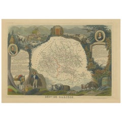
Hand Colored Antique Map of the Department of Ariège, France
Located in Langweer, NL
Antique map titled 'Dépt. de l'Ariège'. Map of the French department of Ariege, France. This area of France is known for its production of semi-soft and mild cheeses, such as Bethmal...
Category

Antique Mid-19th Century Collectibles and Curiosities

Materials

Paper

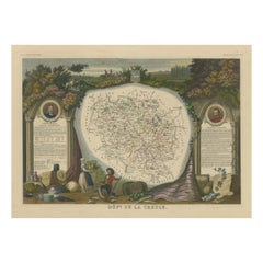
Hand Colored Antique Map of the Department of Creuse, France
Located in Langweer, NL
Antique map titled 'Dépt. de la Creuse'. Map of the French department of Creuse, France. This region is well known for its apple cider made from Limousin apples and its international...
Category

Antique Mid-19th Century Collectibles and Curiosities

Materials

Paper

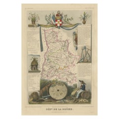
Hand Colored Antique Map of the department of Drôme, France
Located in Langweer, NL
Antique map titled 'Dépt. de la Drôme'. Map of the French department of Drôme, France. This area is known for its production of Picodon, a spicy goats-milk ch...
Category

Antique Mid-19th Century Collectibles and Curiosities

Materials

Paper

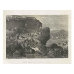
Rare Old Lithograph of the Assault of a Fort in Borneo, Indonesia, ca.1850
Located in Langweer, NL
Incredible action view of a rare German lithograph showing a massive assault on Fort Claurang in Borneo. Published by Hartwich, A. Hölzer and TH. Lemke in Berlin around 1850. ...
Category

Antique Mid-19th Century Collectibles and Curiosities

Materials

Paper

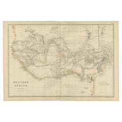
Western Africa Antique Map by W. G. Blackie, 1859
Located in Langweer, NL
The antique map titled 'Western Africa' presents an original depiction of the region. Originating from 'The Imperial Atlas of Modern Geography,' this map was published by W. G. Black...
Category

Antique Mid-19th Century Collectibles and Curiosities

Materials

Paper

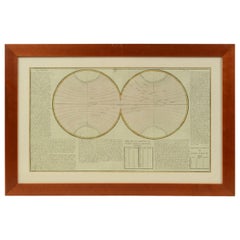
1850 Old French Map Depicting the Entire Earth's Surface Divided into Two Parts
Located in Milan, IT
Geographical map depicting the entire earth's surface divided into two parts that correspond to the two hemispheres divided into small climatic zones that depict the climatic trend f...
Category

French Antique Mid-19th Century Collectibles and Curiosities

Materials

Glass, Wood, Paper

Decorative Hand-Colored French Map of the English Channel, 1827
Located in Langweer, NL
Antique map titled 'Carte et Coupe du Canal de la Manche'. Original antique map of the English Channel. Relief shown by hachures; depths by isolines. Profile...
Category

Antique Mid-19th Century Collectibles and Curiosities

Materials

Paper

Set of 2 Antique Maps of Scotland by W. G. Blackie, 1859
Located in Langweer, NL
Antique map titled 'Scotland'. Original antique map of Scotland. This map originates from ‘The Imperial Atlas of Modern Geography’. Published by W. G. Blackie, 1859.
Category

Antique Mid-19th Century Collectibles and Curiosities

Materials

Paper

Map of West Germany Incl Regions Wurtemberg, Bavaria, Hanover, Etc, c.1850
Located in Langweer, NL
Antique map titled '(Deutschland) Germany, Western States'. Map of West Germany depicting many regions including Wurtemberg, Bavaria, Hanover and others. This map originates from...
Category

Antique Mid-19th Century Collectibles and Curiosities

Materials

Paper

French Mid-19th Century Lacquered Oak Reliquary Box
Located in Milano, MI
French 19th century lacquered rectangular shaped reliquary box, realized in oak, decorated with a dark brown/grey lacquering and a white scrolling and pa...
Category

French Antique Mid-19th Century Collectibles and Curiosities

Materials

Oak

Antique Map of the Crimean Peninsula and Sevastopol by W. G. Blackie, 1859
Located in Langweer, NL
Antique map titled 'The Crimea'. Original antique map of the Crimean Peninsula, Black Sea and Sevastopol. This map originates from ‘The Imperial Atlas of Modern Geography’. Published...
Category

Antique Mid-19th Century Collectibles and Curiosities

Materials

Paper

Antique Map of the Chinese Empire by W. G. Blackie, 1859
Located in Langweer, NL
Antique map titled 'The Chinese Empire'. Original antique map of the Chinese Empire. This map originates from ‘The Imperial Atlas of Modern Geography’. Published by W. G. Blackie, 1859.
Category

Antique Mid-19th Century Collectibles and Curiosities

Materials

Paper

Victorian Miniature Mahogany Centre Table
Located in Bedfordshire, GB
An Attractive And Charming Mid 19th Century Mahogany Miniature Centre Table, With Tilting Top Over Turned Central Support And Triform Base With Elegant Scrolling Feet. There is ofte...
Category

English Victorian Antique Mid-19th Century Collectibles and Curiosities

Materials

Mahogany

Antique Map of Corrèze ‘France’ by V. Levasseur, 1854
Located in Langweer, NL
Antique map titled 'Dépt. da la Corrèze'. Map of the French department of Correze, France. This area of France is known for its production of Straw Wine, a sweet red or white wine. T...
Category

Antique Mid-19th Century Collectibles and Curiosities

Materials

Paper

Painting Representing, French, 19th Century
Located in Labrit, Landes
French 19th century, painting of a boat fairing. This scene represents a boat fairing and sealing with tar by the sea. Today, as much as possible, boats are put in dry dock to carry...
Category

French Antique Mid-19th Century Collectibles and Curiosities

Materials

Paint, Paper

Antique Map of Australasia by Lowry, 1852
Located in Langweer, NL
Antique map titled 'Australasia'. Original map of Australasia. This map originates from 'Lowry's Table Atlas constructed and engraved from the most recent Authorities' by J.W. Lowry....
Category

Antique Mid-19th Century Collectibles and Curiosities

Materials

Paper

Antique Map of France by Lapie, 1842
Located in Langweer, NL
Antique map titled 'Carte de France'. Map of France. This map originates from 'Atlas universel de géographie ancienne et moderne (..)' by Pierre M. Lapie and Alexandre E. Lapie. Pier...
Category

Antique Mid-19th Century Collectibles and Curiosities

Materials

Paper

Old Lithograph of a Buddhist priest of Shimoda, Japan, 1856
Located in Langweer, NL
Antique print titled 'Budhist Priest at Simoda'. Lithograph of a Buddhist priest of Shimoda, Japan. This print originates from 'Narrative of the ex...
Category

Antique Mid-19th Century Collectibles and Curiosities

Materials

Paper

Old Map Depicting the Entire Earth's Surface Divided into Six Parts France 1850
Located in Milan, IT
Map depicting the entire earth's surface divided into six parts which depicts the position of peoples on Earth based on the assumption that it is impossible for each people to have t...
Category

French Antique Mid-19th Century Collectibles and Curiosities

Materials

Glass, Wood, Paper

Antique Map of Africa by Levasseur 'c.1840'
Located in Langweer, NL
Antique map titled 'Afrique'. Original antique map of Africa. Decorative map of the continent surrounded by allegorical vignettes. Engraved by Raimond Bonheur, father of the famous F...
Category

Antique Mid-19th Century Collectibles and Curiosities

Materials

Paper

Decorative Antique Print of Traditional Weapons of the Javanese, Indonesia, 1830
Located in Langweer, NL
Antique print titled 'Waffen der Javaner'. Uncommon engraving of weapons from Java, Indonesia. Shows; a: Gollok, b: Badeh; c: Kris; d: Kris of the Madurese; e: arrow from Java; f: ar...
Category

Antique Mid-19th Century Collectibles and Curiosities

Materials

Paper

Antique Map of Russia in Asia by Wyld, '1845'
Located in Langweer, NL
Antique map titled 'Russia in Asia'. Original antique map of Russia in Asia. This map originates from 'An Atlas of the World, Comprehending Separate Maps of its Various Countries, co...
Category

Antique Mid-19th Century Collectibles and Curiosities

Materials

Paper

Antique Map showing Isotherm Lines throughout the World by Johnston '1850'
Located in Langweer, NL
Antique map titled 'Humboldt's System of Isothermal Lines'. Original antique map showing isotherm lines throughout the world. This map originates from 'The Physical Atlas of Natural ...
Category

Antique Mid-19th Century Collectibles and Curiosities

Materials

Paper

Antique Tombstone from France, 19th Century
Located in Udenhout, NL
Beautiful recuperated antique tombstone from France. Recuperated from a cemetery near Paris.
Category

French Antique Mid-19th Century Collectibles and Curiosities

Materials

Sandstone

Vintage Geographic Splendor: 1859 Spain and Portugal
Located in Langweer, NL
The "Vintage Geographic Splendor: 1859 Spain and Portugal" map is an original antique piece from 'The Imperial Atlas of Modern Geography', published ...
Category

Antique Mid-19th Century Collectibles and Curiosities

Materials

Paper

Antique Map of Austria by Lowry, 1852
Located in Langweer, NL
Antique map titled 'Austria'. Original map of Austria. This map originates from 'Lowry's Table Atlas constructed and engraved from the most recent Autho...
Category

Antique Mid-19th Century Collectibles and Curiosities

Materials

Paper

Antique Map of the Burmese Empire by Wyld, '1845'
Located in Langweer, NL
Antique map titled 'Map of Burman Empire, Siam, Cochin China and Ton-King'. Original antique map of the Burmese Empire. This map originates from 'An Atlas of the World, Comprehending...
Category

Antique Mid-19th Century Collectibles and Curiosities

Materials

Paper

Original French Antique Map of the Russian Empire, 1837
Located in Langweer, NL
Antique map titled 'Tableau Historique et Géographique de L'Empire de Russie'. Original antique map of the Russian Empire will detailed written information about the chronology, ...
Category

Antique Mid-19th Century Collectibles and Curiosities

Materials

Paper

Antique Map of the Islands in the Pacific Ocean by Wyld, '1845'
Located in Langweer, NL
Antique map titled 'Islands in the Pacific Ocean'. Original antique map of the islands in the Pacific Ocean. This map originates from 'An Atlas of the World, Comprehending Separate M...
Category

Antique Mid-19th Century Collectibles and Curiosities

Materials

Paper

Antique Map of New South Wales and Victoria by W. G. Blackie, 1859
Located in Langweer, NL
Antique map titled 'New South Wales and Victoria'. Original antique map of New South Wales and Victoria. This map originates from ‘The Imperial Atlas of Modern Geography’. Published ...
Category

Antique Mid-19th Century Collectibles and Curiosities

Materials

Paper

Antique Map of the Netherlands and Belgium by Hérisson, 1829
Located in Langweer, NL
Title: 'Carte Routière du Royaume des Pays-Bas comprenant la Hollande et la Belgique' **Publisher**: Eustache Hérisson **Publication Year**: 1829 This original antique map is a detailed depiction of the Netherlands and Belgium, dating back to 1829. As a 'Carte Routière', it focuses on the road networks of the region, providing valuable historical insights into the transportation and geographical understanding of the early 19th century. The map's delineation of the Kingdom of the Netherlands, including both Holland and Belgium, is particularly noteworthy as it represents the political geography of the period shortly before Belgium's independence in 1830. The map is sectionalised and laid on linen, a common practice in the 19th century for preserving and reinforcing maps, making them more durable and portable. This method of mounting also suggests that the map was intended for practical use, possibly by travelers or for educational purposes. **Artist and Publisher**: Eustache Hérisson, the publisher of this map, was a known figure in the cartographic and publishing world of the early 19th century. His work is characterized by attention to detail and accuracy, making this map not only a beautiful piece of art but also a reliable historical document. This map is a valuable historical artifact, offering insights into the geographical and political landscape of the Netherlands...
Category

Antique Mid-19th Century Collectibles and Curiosities

Materials

Paper

Antique Map of the West Indies and Central America by W. G. Blackie, 1859
Located in Langweer, NL
Antique map titled 'The West India Island & Central America'. Original antique map of the West Indies and Central America, with inset map of Jamaica. Th...
Category

Antique Mid-19th Century Collectibles and Curiosities

Materials

Paper

Antique Surveyor's Circumcompendium Signed Brand Frères, 1850-1880
Located in Bilzen, BE
"Antique Surveyor's Circumcompendium Signed Brand Frères, 1850-1880" Description: Antique Surveying Circumferentor by Brand Frères Brand Frères, Optic...
Category

Belgian Other Antique Mid-19th Century Collectibles and Curiosities

Materials

Brass

1859 Vintage Map of Holland and Belgium: Blackie's Imperial Geographic Insight
Located in Langweer, NL
The "Antique Map of Holland and Belgium" from 'The Imperial Atlas of Modern Geography', published by W. G. Blackie in 1859, is a significant hi...
Category

Antique Mid-19th Century Collectibles and Curiosities

Materials

Paper

Antique County Map, Norfolk, English, Framed Lithography, Cartography, Victorian
Located in Hele, Devon, GB
This is an antique lithography map of Norfolk. An English, framed atlas engraving of cartographic interest, dating to the mid 19th century and later. Superb lithography of Norfolk a...
Category

British Victorian Antique Mid-19th Century Collectibles and Curiosities

Materials

Glass, Wood

Decorative Antique Print of Fully Uniformed Generals of the Belgium Army, 1833
Located in Langweer, NL
One nicely hand coloured print of an original serie of 23 plates, showing generals discussing matters. published in 1833. Rare. From a serie of beautiful lithographed plates with Belgian military costumes after Madou and printed by Dero-Becker. Comes from a Belgian military costume album, dedicated to the Belgian King, and financed by subscribers, some 90 Belgian nobility and officers of the Belgian Army...
Category

Antique Mid-19th Century Collectibles and Curiosities

Materials

Paper

Rare Hand-Colored Print of a Belgium Army Regiment Near a Windmill, 1833
Located in Langweer, NL
One nicely hand coloured print of an original serie of 23 plates, showing officers and soldiers resting. published in 1833. Rare. From a serie of beautiful lithographed plates with Belgian military...
Category

Antique Mid-19th Century Collectibles and Curiosities

Materials

Paper

Original Lithograph with a Scene of a Village and Harbour in New Guinea, c.1836
Located in Langweer, NL
Antique print titled 'Ansicht des Dorfes Kuauï'. Im Dory Hafen. Old print with a scene of a village and harbour in New Guinea. This print originates from 'Entdeckungs, Reise der Franzosischen Corvette Astrolabe Unternomen auf Befehl Konig Karls...
Category

Antique Mid-19th Century Collectibles and Curiosities

Materials

Paper

Antique Map of Canada, New Brunswick and Nova Scotia by Lowry, 1852
Located in Langweer, NL
Antique map titled 'Canada, New Brunswick & Nova Scotia'. Two individual sheets of Canada, New Brunswick and Nova Scotia. This map originates from 'Lowry...
Category

Antique Mid-19th Century Collectibles and Curiosities

Materials

Paper

Antique Map of Maine et Loire ‘France’ by V. Levasseur, 1854
Located in Langweer, NL
Antique map titled 'Dépt. de Maine et Loire'. Map of the French department of Maine et Loire, France. This area of France is part of the Loire Valley wine region, where nearly every ...
Category

Antique Mid-19th Century Collectibles and Curiosities

Materials

Paper

Antique Map of Europe by Lapie, 1842
Located in Langweer, NL
Antique map titled 'Carte de l'Europe'. Map of Europe. This map originates from 'Atlas universel de géographie ancienne et moderne (..)' by Pierre M. Lapie and Alexandre E. Lapie. Pi...
Category

Antique Mid-19th Century Collectibles and Curiosities

Materials

Paper

1850 Old French Map Depicting the Entire Earth's Surface Divided into Two Parts
Located in Milan, IT
Geographical map depicting the entire earth's surface divided into two parts that correspond to the two hemispheres where the emerged lands are depicted which have been classified wi...
Category

French Antique Mid-19th Century Collectibles and Curiosities

Materials

Glass, Wood, Paper

Historical Antique Map of Russia, Examining the History of Russia, 1838
Located in Langweer, NL
Antique map titled 'Sketch of the acquisitions of Russia since the Accession of Peter 1st to the Throne'. Historical map of Russia, examining the history o...
Category

Antique Mid-19th Century Collectibles and Curiosities

Materials

Paper

Important Confederate Field Map of Richmond VA 1864 with Provenance
Located in Dallas, TX
PRESENTING AN HISTORIC AND EXCEPTIONALLY RARE AND IMPORTANT American Civil War Collection consisting of: (1) ORIGINAL and FULLY AUTHENTIC Confederate Field Map of Richmond, VA 1864 belonging to Capt W.A. Obenchain C.S. Engineers, (2) ORIGINAL and FULLY AUTHENTIC Surrender/Parole Paper for Capt. W.A. Obenchain dated 1st May 1865 at Greensboro, NC (3) ORIGINAL and FULLY AUTHENTIC Pamphlet for Hillsborough Military Academy, NC with Major W.M. A. Obenchain listed as 'Military Staff'. These ALL belonged to Captain (later promoted to rank of Major) William Alexander Obenchain and the battlefield map was his 'personal' field map for the Battle of the Richmond Peninsula in 1864, at the end of the US Civil War...
Category

American American Classical Antique Mid-19th Century Collectibles and Curiosities

Materials

Canvas, Paper

Antique Leicestershire Map, English, Framed Cartographic Interest, Victorian
Located in Hele, Devon, GB
This is an antique lithography map of Leicestershire. An English, framed atlas engraving of cartographic interest, dating to the mid 19th century and later. Superb lithography of Le...
Category

British Victorian Antique Mid-19th Century Collectibles and Curiosities

Materials

Wood

Old Coloure Map of North & Central Italy & Corsica with an Inset of Rome, c.1860
Located in Langweer, NL
Antique map titled 'North & Central Italy and the Island of Corsica'. Old map of North and Central Italy, and the island of Corsica. With an inset map of the region of Rome. Orig...
Category

Antique Mid-19th Century Collectibles and Curiosities

Materials

Paper

Antique Lithography Map, Westmoreland, English, Framed, Cartography, Victorian
Located in Hele, Devon, GB
This is an antique lithography map of Westmoreland. An English, framed atlas engraving of cartographic interest, dating to the mid 19th century and later. Superb lithography of the ...
Category

British Victorian Antique Mid-19th Century Collectibles and Curiosities

Materials

Wood

Ice Skating Fun on the River Maas, Rotterdam, The Netherlands, 1855
Located in Langweer, NL
Antique print titled 'De Maas voor de fabriek te Fyenoord'. Old print depicting an ice skating scene in the Netherlands. This print originates from 'Het...
Category

Antique Mid-19th Century Collectibles and Curiosities

Materials

Paper

Musicians and Bajadere Dancers from Pondicherry, India, ca.1845
Located in Langweer, NL
Antique print titled 'Bajaderen von Pondichery, Bajadères de Pondichery'. This print depicts musicians from Pondicherry, India. Europeans referred to exotic Indian dancers as...
Category

Antique Mid-19th Century Collectibles and Curiosities

Materials

Paper

Old Hand-Colored Engraving of a Farmer's Wife from Fribourg, Switzerland, c.1860
Located in Langweer, NL
Antique costume print titled 'Fribourg'. This print depicts a farmer's wife from Fribourg, Switzerland. Source unknown, to be determined. Artists and Engravers: Anonymous.
Category

Antique Mid-19th Century Collectibles and Curiosities

Materials

Paper

Map of Russia with Vignettes of the Neoskoi Prospect, St. Petersburg, ca.1851
Located in Langweer, NL
Antique map titled 'Russia in Europe'. Map of European Russia. Showing vignettes of the Neoskoi Prospect, St. Petersburg, Polish Captives on their way to Siberia, a Russian Bear...
Category

Antique Mid-19th Century Collectibles and Curiosities

Materials

Paper

Antique Map of the Eastern Hemisphere by Wyld '1845'
Located in Langweer, NL
Antique map titled 'Eastern Hemisphere'. Original antique map of the eastern hemisphere. This map originates from 'An Atlas of the World, Comprehending Separate Maps of its...
Category

Antique Mid-19th Century Collectibles and Curiosities

Materials

Paper

Nicely Framed View of Muiden Castle, the Netherlands, 1858
Located in Langweer, NL
Antique print titled 'Muiden'. View of Muiden Castle, the Netherlands. This print originates from 'Het koningrijk der Nederlanden voorgesteld in eene reeks van 136 naar de natuur get...
Category

Antique Mid-19th Century Collectibles and Curiosities

Materials

Paper

Steel Engraving of Shimoda, a Port Located in Shizuoka Prefecture, Japan, C.1840
Located in Langweer, NL
Antique print titled 'Simoda in Japan'. Steel engraving of Shimoda, a city and port located in Shizuoka Prefecture, Japan. Originates from 'Meyers Univer...
Category

Antique Mid-19th Century Collectibles and Curiosities

Materials

Paper

Antique Map of Australia and surrounding Islands by F. von Stülpnagel, 1850
Located in Langweer, NL
Antique map titled 'Festland von Asutralien und benachbarte Inseln'. Map showing Australia, New Zealand, Southern New-Guinea and surrounding islands. This map originates from Stieler...
Category

Antique Mid-19th Century Collectibles and Curiosities

Materials

Paper

Antique Costume Print of an Arab 'Douran' with Weapons in Asia, 1843
Located in Langweer, NL
Antique costume print titled 'Douran (Asie)'. Original antique print of an Arabian man. This print originates from 'Moeurs, usages et costumes de tous ...
Category

Antique Mid-19th Century Collectibles and Curiosities

Materials

Paper

Old Map of Spain and Portugal, with an Inset Map of the Region of Madrid, 1846
Located in Langweer, NL
Antique map titled 'Kingdom of Spain and Portugal'. Old map of Spain and Portugal, with an inset map of the region of Madrid. This map originates from 'A New Universal Atlas Cont...
Category

Antique Mid-19th Century Collectibles and Curiosities

Materials

Paper

Antique Nautical Portolano of Port St. Antoine by Antoine Roux, France, 1844
Located in Milan, IT
Antique portolano, nautical map of Port St. Antoine engraved on a copper plate by Antoine Roux, Marseille, France, 1844, from his work Recueil des principaux plans des ports et de Ra...
Category

French Antique Mid-19th Century Collectibles and Curiosities

Materials

Paper

Antique Map of Greece by Lapie, 1842
Located in Langweer, NL
Antique map titled 'Carte de la Grèce Ancienne'. Map of Greece. This map originates from 'Atlas universel de géographie ancienne et moderne (..)' by Pier...
Category

Antique Mid-19th Century Collectibles and Curiosities

Materials

Paper

Antique Map of Switzerland by Lapie, 1842
Located in Langweer, NL
Antique map titled 'Carte de la Suisse ou Helvetie'. Map of Switzerland. This map originates from 'Atlas universel de géographie ancienne et moderne...
Category

Antique Mid-19th Century Collectibles and Curiosities

Materials

Paper

Read More

Medal-Worthy Memorabilia from Epic Past Olympic Games

Get into the games! These items celebrate the events, athletes, host countries and sporting spirit.

Ahoy! You’ve Never Seen a Collection of Sailor Art and Kitsch Quite Like This

French trendsetter and serial collector Daniel Rozensztroch tells us about his obsession with objects related to seafaring men.

Pamela Shamshiri Shares the Secrets behind Her First-Ever Book and Its Effortlessly Cool Interiors

The sought-after designer worked with the team at Hoffman Creative to produce a monograph that beautifully showcases some of Studio Shamshiri's most inspiring projects.

Moroccan Artworks and Objects Take Center Stage in an Extraordinary Villa in Tangier

Italian writer and collector Umberto Pasti opens the doors to his remarkable cave of wonders in North Africa.

Montecito Has Drawn Royalty and Celebrities, and These Homes Are Proof of Its Allure

Hollywood A-listers, ex-pat aristocrats and art collectors and style setters of all stripes appreciate the allure of the coastal California hamlet — much on our minds after recent winter floods.

Whaam! Blam! Pow! — a New Book on Pop Art Packs a Punch

Publishing house Assouline and writer Julie Belcove have teamed up to trace the history of the genre, from Roy Lichtenstein, Andy Warhol and Yayoi Kusama to Mickalene Thomas and Jeff Koons.

What Makes a Gem-Encrusted Chess Set Worth $4 Million?

The world’s most opulent chess set, weighing in at 513 carats, is literally fit for a king and queen.

Tauba Auerbach’s Geometric Pop-Up Book Is Mighty Rare, Thanks to a Hurricane

This sculptural art book has an epic backstory of its own.
Recently Viewed

View All