Mid-19th Century More Furniture and Collectibles

to
817
1,537
663
2,258
254
56
44
36
20
14
13
8
8
8
5
5
5
3
1
5,320
10,633
31,779
15,228
6,662
13,805
6,714
926
562
1,133
1,408
1,056
2,886
2,959
2,591
1,204
820
1,104
607
404
245
139
1,116
487
304
291
216
2,258
2,258
2,258
104
29
9
6
4
Period: Mid-19th Century
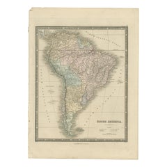
Antique Map of South America by Wyld, '1845'
Located in Langweer, NL
Antique map titled 'South America'. Original antique map of South America. This map originates from 'An Atlas of the World, Comprehending ...
Category

Antique Mid-19th Century More Furniture and Collectibles

Materials

Paper

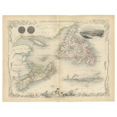
A Decorative Map of Nova Scotia and Newfoundland by John Tallis, 1851
Located in Langweer, NL
The map is part of the series created by John Tallis & Company, known for their mid-19th-century maps. This particular map illustrates the regions of Nova Scotia and Newfoundland and...
Category

English Antique Mid-19th Century More Furniture and Collectibles

Materials

Paper

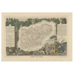
The Illustrated Map of the Var Department from the Atlas National Illustré, 1856
Located in Langweer, NL
This original hand-colored map is from the "Atlas National Illustré," a work by Victor Levasseur, a French geographer and cartographer known for his richly illustrated maps. The map...
Category

Antique Mid-19th Century More Furniture and Collectibles

Materials

Paper

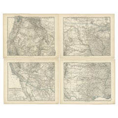
Set of 4 Antique Maps of part of the United States of America
Located in Langweer, NL
Set of four individual antique maps of part of the United States. Published as part of a set of six individual maps. These maps originate from Stielers Handatlas, published circa 1...
Category

Antique Mid-19th Century More Furniture and Collectibles

Materials

Paper

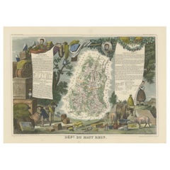
1852 Map of Haut-Rhin: An Illustrated Gateway to Alsace's Viticultural Splendors
Located in Langweer, NL
This original hand-colored map is from the "Atlas National Illustré," a work by Victor Levasseur, a French geographer and cartographer known for his richly illustrated maps. The map...
Category

Antique Mid-19th Century More Furniture and Collectibles

Materials

Paper

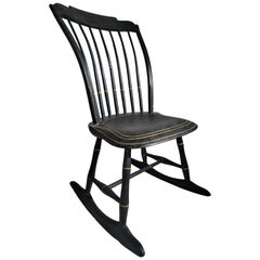
19th Century Original Black Painted Child's Windsor Rocker
Located in Los Angeles, CA
This fine 19th century Original black painted rocking chair & pin striped in mustard painted trim.This early New England rocking chair came f...
Category

American Adirondack Antique Mid-19th Century More Furniture and Collectibles

Materials

Wood

Italian Grand Tour Bronze Censer with Birds
Located in Bishop's Stortford, Hertfordshire
A very fine antique Italian attributed grand tour bronze lidded censer applied with birds dating from around 1860. The censer stands raised on a square ba...
Category

Italian Grand Tour Antique Mid-19th Century More Furniture and Collectibles

Materials

Bronze

Antique Lithography Map, Bedfordshire, English, Framed Engraving, Cartography
Located in Hele, Devon, GB
This is an antique lithography map of Bedfordshire. An English, framed atlas engraving of cartographic interest, dating to the mid 19th century and...
Category

British Victorian Antique Mid-19th Century More Furniture and Collectibles

Materials

Wood

Antique Map of European Turkey and Greece by Lowry '1852'
Located in Langweer, NL
Antique map titled 'European Turkey and Greece with the Ionian Islands'. Original map of European Turkey and Greece. This map originates from 'Lowry's table Atlas constructed and eng...
Category

Antique Mid-19th Century More Furniture and Collectibles

Materials

Paper

Antique Lithography Map, Cumberland, English, Framed, Cartography, Victorian
Located in Hele, Devon, GB
This is an antique lithography map of Cumberland. An English, framed atlas engraving of cartographic interest, dating to the mid 19th century and la...
Category

British Victorian Antique Mid-19th Century More Furniture and Collectibles

Materials

Wood

Antique Map of Aube ‘France’ by V. Levasseur, 1854
Located in Langweer, NL
Antique map titled 'Dépt. de l'Aube'. Map of the French department of Aube, France. This area of France is known for its production of Chaource, a soft and salted cheese. Aube is par...
Category

Antique Mid-19th Century More Furniture and Collectibles

Materials

Paper

Peter Hertz 1857 Denmark Vesta Cigar Cutter Lighter Box In .925 Sterling Silver
Located in Miami, FL
Multifunctional vesta lighter box designed by Peter Hertz (1811-1885). Beautiful antique vesta case, created in Copenhagen Denmark at the silversmiths workshop of Peter Hertz in 185...
Category

Danish Early Victorian Antique Mid-19th Century More Furniture and Collectibles

Materials

Silver, Sterling Silver

American Cast Brass Engraved Yachtsman's Speaking Trumpet, Circa 1830
Located in Charleston, SC
American hand held cast brass engraved Yachtsman's speaking trumpet with bell shaped soldered mouthpiece, coned-shaped column with original interior red paint, and terminating on a r...
Category

American American Empire Antique Mid-19th Century More Furniture and Collectibles

Materials

Brass

Antique Map of the Eastern United States with Inset Map of Texas
Located in Langweer, NL
Antique map titled 'Verein-Staaten von Nord-America mit Ausnahme Florida's und der Westlichen Territorien'. This map extends as far west as Louisiana and only includes the northern p...
Category

Antique Mid-19th Century More Furniture and Collectibles

Materials

Paper

Victorian Mahogany & Brass Port Folio Stand
By King & Sons
Located in Dereham, GB
Victorian Mahogany & Brass Port Folio Stand Mahogany Sides, with Brass pole hinges & supports. one side Other side folding leg support with brass catches Black leather inside on th...
Category

British Victorian Antique Mid-19th Century More Furniture and Collectibles

Materials

Brass

Decorative Dutch Antique Map of North and South America, 1841
Located in Langweer, NL
Description: Antique map titled 'Amerika'. Small map of North and South America. This map originates from the Dutch publication 'De Aarde, beschouwd in haren Natuurlijken Toestan...
Category

Antique Mid-19th Century More Furniture and Collectibles

Materials

Paper

Antique Map of Bourbon/Reunion 'France' by V. Levasseur, 1854
Located in Langweer, NL
Antique map titled 'Ile de la Réunion'. Map of the French department of Ile. Bourbon or Reunion. Bourbon, or Reunion, is a volcanic island off the coast of Africa. It is one of Franc...
Category

Antique Mid-19th Century More Furniture and Collectibles

Materials

Paper

Antique Map of Sweden and Norway by Lowry, '1852'
Located in Langweer, NL
Antique map titled 'Sweden and Norway'. Two individual sheets of Sweden and Norway. This map originates from 'Lowry's Table Atlas constructed and engraved from the most recent Author...
Category

Antique Mid-19th Century More Furniture and Collectibles

Materials

Paper

Large Original Antique Map of Australia by Sidney Hall, 1847
Located in St Annes, Lancashire
Great map of Australia Drawn and engraved by Sidney Hall Steel engraving Original colour outline Published by A & C Black. 1847 Unframed Free shipping.
Category

Scottish Antique Mid-19th Century More Furniture and Collectibles

Materials

Paper

Antique Map of Germany with the Empire of Austria by Wyld '1845'
Located in Langweer, NL
Antique map titled 'The Confederated States of Germany with the Empire of Austria, and The Kingdoms of Prussia and Poland'. Original antique map of ...
Category

Antique Mid-19th Century More Furniture and Collectibles

Materials

Paper

Antique Map of Gard ‘France’ by V. Levasseur, 1854
Located in Langweer, NL
Antique map titled 'Dépt. du Gard'. Map of the French department of Gard, France. This area of France is known mainly for its red wine and production of Bleu des Causses, a soft and ...
Category

Antique Mid-19th Century More Furniture and Collectibles

Materials

Paper

Large Antique Map of New York State with Inset Maps
Located in Langweer, NL
Antique map titled 'Johnson's New York' Large map of New York State. With insets of Albany, Oswego, Buffalo, Rochester, Syracuse, Troy and NYC. Published by Johnson and Browning, 186...
Category

Antique Mid-19th Century More Furniture and Collectibles

Materials

Paper

Important Confederate Field Map of Richmond VA 1864 with Provenance
Located in Dallas, TX
PRESENTING AN HISTORIC AND EXCEPTIONALLY RARE AND IMPORTANT American Civil War Collection consisting of: (1) ORIGINAL and FULLY AUTHENTIC Confederate Field Map of Richmond, VA 1864 belonging to Capt W.A. Obenchain C.S. Engineers, (2) ORIGINAL and FULLY AUTHENTIC Surrender/Parole Paper for Capt. W.A. Obenchain dated 1st May 1865 at Greensboro, NC (3) ORIGINAL and FULLY AUTHENTIC Pamphlet for Hillsborough Military Academy, NC with Major W.M. A. Obenchain listed as 'Military Staff'. These ALL belonged to Captain (later promoted to rank of Major) William Alexander Obenchain and the battlefield map was his 'personal' field map for the Battle of the Richmond Peninsula in 1864, at the end of the US Civil War...
Category

American American Classical Antique Mid-19th Century More Furniture and Collectibles

Materials

Canvas, Paper

Engraved Large Map of The Kingdom of Portugal Original Handcolored, 1854
Located in Langweer, NL
Antique map titled 'Mappa Corografica do Reino de Portugal - Chorographical map of the Kingdom of Portugal divided into its Grand Provinces.' Large map of...
Category

Antique Mid-19th Century More Furniture and Collectibles

Materials

Paper

Large Original Antique Map of Poland by Sidney Hall, 1847
Located in St Annes, Lancashire
Great map of Poland Drawn and engraved by Sidney Hall Steel engraving Original colour outline Published by A & C Black. 1847 Unframed ...
Category

Scottish Antique Mid-19th Century More Furniture and Collectibles

Materials

Paper

Nelson's Guide to the City of New York and its Neighbourhood, 1858
Located in Langweer, NL
"Nelson's Guide to the City of New York and its Neighbourhood," published in 1858 by T. Nelson in London and New York, serves as an invaluable resource for exploring the historical a...
Category

Antique Mid-19th Century More Furniture and Collectibles

Materials

Paper

Mid-19th Century Map of Australasia by Carl Flemming - 1855
Located in Langweer, NL
Title: "Mid-19th Century Map of Australasia by Carl Flemming - 1855" Description: This original 1855 antique map from the Sohr-Berghaus Atlas, created by Carl Flemming, is a detaile...
Category

Antique Mid-19th Century More Furniture and Collectibles

Materials

Paper

Antique Lithography Map, South America, English, Framed, Cartography, Victorian
Located in Hele, Devon, GB
This is an antique lithography map of South America. An English, framed atlas engraving of cartographic interest by John Rapkin , dating to the early Victorian period and later, circ...
Category

British Early Victorian Antique Mid-19th Century More Furniture and Collectibles

Materials

Wood

1st Edition of ‘Rural & Domestic Life of Germany’ by W Howitt -1842
Located in Dallas, TX
PRESENTING AN EXTREMELY RARE FIRST EDITION hardback copy of ‘The Rural and Domestic Life of Germany with Characteristic Sketches of its Cities and Scenery, Collected in a General To...
Category

English Country Antique Mid-19th Century More Furniture and Collectibles

Materials

Paper

Antique Bible Print of the Ten Virgins by Kronheim 'c.1860'
Located in Langweer, NL
Antique bible print titled 'The Ten Virgins'. This print most likely originates from an illustrated bible, published by J.M. Kronheim & Co, circa ...
Category

Antique Mid-19th Century More Furniture and Collectibles

Materials

Paper

Large Antique Map of New England with decorative Vignettes
Located in Langweer, NL
Antique map titled 'Johnson's New England'. Large map of New England, comprising the states Connecticut, Maine, Massachusetts, New Hampshire, Rhode ...
Category

Antique Mid-19th Century More Furniture and Collectibles

Materials

Paper

Print of An Ice Skating Scene on the River Maas, Rotterdam, Netherlands, 1855
Located in Langweer, NL
Antique print titled 'Gezicht van het Bolwerk op de Maas'. Old print depicting an ice skating scene in the Netherlands. This print originates from 'Het ijs vermaak op de Maas te ...
Category

Antique Mid-19th Century More Furniture and Collectibles

Materials

Paper

Decorative Print of the Belgium Army with Ambulance Troops in the Field, 1833
Located in Langweer, NL
One nicely hand coloured print of an original serie of 23 plates, published in 1833. Rare. From a serie of beautiful lithographed plates with Belgian military...
Category

Antique Mid-19th Century More Furniture and Collectibles

Materials

Paper

Antique Map of Finistère ‘France’ by V. Levasseur, 1854
Located in Langweer, NL
Antique map titled 'Dépt. du Finistère'. Map of the French department of Finistère, Brittany, France. This area of France is known for its cider production and excellent boar hunting...
Category

Antique Mid-19th Century More Furniture and Collectibles

Materials

Paper

Antique Map Showing the Religions Around the World by Johnston '1854'
Located in Langweer, NL
Antique map titled 'Moral & Statistical Chart showing the Geographical Distribution of Man According to Religious Belief'. Rare large-size thematic map on the distribution of religio...
Category

Antique Mid-19th Century More Furniture and Collectibles

Materials

Paper

Antique Map of Germany by Lapie, 1842
Located in Langweer, NL
Antique map titled 'Carte de la Germanie Ancienne'. Map of Germany. This map originates from 'Atlas universel de géographie ancienne et moderne (..)' by...
Category

Antique Mid-19th Century More Furniture and Collectibles

Materials

Paper

Antique Map of Japan by W. G. Blackie, 1859
Located in Langweer, NL
Antique map titled 'Japan'. Original antique map of Japan. This map originates from ‘The Imperial Atlas of Modern Geography’. Published by W. G. B...
Category

Antique Mid-19th Century More Furniture and Collectibles

Materials

Paper

19th Century Black Painted Leather French Primitive Fire Helmet Casque Pompier
Located in Haarlem, NL
19th century black painted leather French fire helmet with painted logo with what looks like a 'French Lily' and three hooked lines Made out of one...
Category

French Antique Mid-19th Century More Furniture and Collectibles

Materials

Leather

Map of Rhône: Culture and Commerce in Lyon's Silk and Wine Legacy, 1852
Located in Langweer, NL
This original hand-colored map is from the "Atlas National Illustré," a work by Victor Levasseur, a French geographer and cartographer known for his richly illustrated maps. The map...
Category

Antique Mid-19th Century More Furniture and Collectibles

Materials

Paper

Copenhagen (Kiöbenhaven) Map with City View – Antique German Atlas Print, 1844
Located in Langweer, NL
Copenhagen (Kiöbenhaven) Map with City View – Antique German Atlas Print, 1844 This finely detailed antique map titled 'Copenhagen (Kiöbenhaven)' presents a historical view of Denma...
Category

German Antique Mid-19th Century More Furniture and Collectibles

Materials

Paper

Old Original Map of Africa and Arabia, 1848
Located in Langweer, NL
Antique map titled 'Africa et Arabia'. Old map of Africa and Arabia originating from 'Orbis Terrarum Antiquus in usum Scholarum'. Artists and Engravers: Published by Justus P...
Category

Antique Mid-19th Century More Furniture and Collectibles

Materials

Paper

Hospitaler of the Order of the Holy Ghost, Roman Catholic Order, 1845
Located in Langweer, NL
Antique print titled 'Hospitalier du Saint-Esprit'. Print of a Hospitaler of the Order of the Holy Ghost, Hospitallers of the Holy Spirit, Roman Catholi...
Category

Antique Mid-19th Century More Furniture and Collectibles

Materials

Paper

Antique Map of the United States by Lowry, '1852'
Located in Langweer, NL
Antique map titled 'United States'. Four individual sheets of the United States. This map originates from 'Lowry's Table Atlas constructed and engraved from the most recent Authoriti...
Category

Antique Mid-19th Century More Furniture and Collectibles

Materials

Paper

Antique Map of Vienne 'France' by V. Levasseur, 1854
Located in Langweer, NL
Antique map titled 'Dépt. de la Vienne'. Decorative antique map of the French Department of Vienne, with its capital of Poitiers and small engraved vignette of the battle of Poitiers...
Category

Antique Mid-19th Century More Furniture and Collectibles

Materials

Paper

Antique Map of the Islands in the Atlantic Ocean including Bermuda & Cape Verde
Located in Langweer, NL
Antique map titled 'Islands in the Atlantic'. Steel engraved map of the islands in the Atlantic Ocean. It shows 16 individual maps on one sheet. Covers the Azores or Western Isles, Faeroe Isles, Madeira Isles, Princes Island, Canary Islands, Fernando Po, Anno Bon, St. Thomas, Bermuda Isles, Trinidade Isles, Fernando Noronha, Cape Verde Isles, Ascension Island, St. Helena, Tristan d'Acunha Isles and the Falkland Isles. Engraved by J. & C. Walker. Published by George Cox...
Category

Antique Mid-19th Century More Furniture and Collectibles

Materials

Paper

Antique Lithography Map, West Africa, English, Framed, Cartography, Victorian
Located in Hele, Devon, GB
This is an antique lithography map of Western Africa. An English, framed atlas engraving of cartographic interest by John Rapkin, dating to the early Victorian period and later, circ...
Category

British Early Victorian Antique Mid-19th Century More Furniture and Collectibles

Materials

Wood

Mapping History: The Decorative Cartography of Indre-et-Loire by Levasseur, 1856
Located in Langweer, NL
An original hand-colored map of the Département d'Indre-et-Loire created by Victor Levasseur in 1856. As an antique steel engraved map, it showcases the detailed craftsmanship and technology of mid-19th century map making. The method of steel engraving allowed for precise and intricate details to be captured, making this map not only a navigational tool but also a work of art. The addition of outline hand colouring is particularly noteworthy. This technique, where colours are applied by hand to the engraved map, was a common practice at the time to highlight certain features such as boundaries, rivers, and cities. The hand colouring on this map would have been done meticulously, adding vibrancy and clarity to the engraved lines and making it easier to differentiate various geographical and political demarcations. The map's wide margins are characteristic of the period's presentation style, offering space for additional annotations or simply serving to frame the map aesthetically when displayed. Such margins also suggest that the map was intended for a discerning audience, possibly for educational or decorative purposes in a library or study. Victor Levasseur was renowned for his decorative maps, often embellished with artistic elements that went beyond mere geographical information. These elements could include vignettes, allegorical figures, and detailed illustrations surrounding the map itself, reflecting the cultural, historical, and economic aspects of the depicted area. While the description does not detail these decorative aspects, it's common for Levasseur's works to feature such embellishments, making his maps highly prized among collectors and historians for both their artistic value and cartographic accuracy. This map of Département d'Indre-et-Loire, with its combination of technical precision in steel engraving and the beauty of hand colouring, represents a fascinating intersection of art and science in the 19th century. It is a testament to the era's dedication to detail, craftsmanship, and the aesthetic presentation of information. The Département d'Indre-et-Loire, located in the central part of France within the region known as the Centre-Val de Loire, is rich in historical and cultural significance, with numerous important places highlighted on a map from 1856 by Victor Levasseur. Based on the region's known historical sites and cities, the following places are likely to be featured or of importance: 1. **Tours**: As the capital city of the Département d'Indre-et-Loire, Tours is a central hub of history, culture, and architecture. It is known for its old town, the Place Plumereau, Tours Cathedral, and its proximity to the Loire River, making it a likely focal point on the map. 2. **Amboise**: This town is famous for the Château d'Amboise, which is closely linked to French royal history and offers panoramic views of the Loire River. Leonardo da Vinci is buried here in the Chapel of Saint-Hubert, associated with the château. 3. **Chinon**: Known for its medieval fortress, the Château de Chinon, this town has deep historical roots, including connections to Joan of Arc and King Charles VII. The fortress and town would be significant landmarks. 4. **Villandry**: The Château de Villandry is renowned for its beautiful Renaissance gardens, which are some of the most impressive in France. While the château might be less emphasized in an 1856 map compared to cities and towns, it's an important site in the region. 5. **Loches**: This town features the Château de Loches, a medieval castle, and the Royal Lodge, noted for its Renaissance architecture. The town's history and architectural landmarks make it a place of interest. 6. **Azay-le-Rideau**: The Château d'Azay-le-Rideau is set on an island in the middle of the Indre River, showcasing the French Renaissance architectural...
Category

Antique Mid-19th Century More Furniture and Collectibles

Materials

Paper

Original Antique English County Map, Huntingdonshire, J & C Walker, 1851
Located in St Annes, Lancashire
Great map of Huntingdonshire Original colour By J & C Walker Published by Longman, Rees, Orme, Brown & Co. 1851 Unframed.
Category

English Other Antique Mid-19th Century More Furniture and Collectibles

Materials

Paper

Old Map of the French department of Ariège, France
Located in Langweer, NL
Antique map titled 'Dépt. de l'Ariège'. Map of the French department of Ariege, France. This area of France is known for its production of semi-soft and mild cheeses, such as Bethmal...
Category

Antique Mid-19th Century More Furniture and Collectibles

Materials

Paper

Swiss Splendor: Antique Map of Switzerland and Its Cantons, 1852
Located in Langweer, NL
The antique map titled 'Carte de la Suisse' is an attractive map of Switzerland. Here are the key details and features of the map: 1. **Geographic Coverage**: - The map provides comprehensive coverage of Switzerland, depicting the entire country. - It showcases the division of Switzerland by Cantons, including regions from Vaud to Grisons. - Additionally, the map includes parts of adjacent countries, such as France, Germany, and Italy, providing context for Switzerland's geographical location. 2. **Cartographic Details**: - The map offers detailed cartographic information, including the delineation of geographic features, rivers, mountains, and the names of Cantons and towns. - It presents a clear and informative representation of Switzerland's topography. 3. **Origin**: - This map originates from Maison Basset's 1852 edition of 'Atlas Illustre Destine a l'enseignement de la Geographie elementaire,' indicating its use for educational purposes, particularly in the teaching of geography. 4. **Educational Significance**: - As part of an educational atlas, the map likely played a role in instructing students about the geography of Switzerland and its political subdivisions. - It may have been employed as a visual aid to enhance students' understanding of Switzerland's Cantonal divisions. 5. **Aesthetic Appeal**: - The map is described as attractive, suggesting that it possesses not only educational value but also visual appeal. - Maps of this era often featured decorative elements that added to their aesthetic charm. 6. **Historical and Geopolitical Significance**: - Switzerland's unique position in Europe, as a country surrounded...
Category

Antique Mid-19th Century More Furniture and Collectibles

Materials

Paper

Antique Gutta Percha Golf Ball, Mesh Pattern
Located in Oxfordshire, GB
Unnamed Mesh Pattern Gutty Golf Ball. A moulded solid square mesh patterned gutta percha golf ball in used condition. The 1890's Gutty ball still has the lots of the original white p...
Category

British Antique Mid-19th Century More Furniture and Collectibles

Materials

Rubber

Original Antique English County Map, Nottinghamshire, J & C Walker, 1851
Located in St Annes, Lancashire
Great map of Nottinghamshire Original colour By J & C Walker Published by Longman, Rees, Orme, Brown & Co. 1851 Unframed.
Category

English Other Antique Mid-19th Century More Furniture and Collectibles

Materials

Paper

Original Antique English County Map, Hertfordshire. J & C Walker, 1851
Located in St Annes, Lancashire
Great map of Hertfordshire Original colour By J & C Walker Published by Longman, Rees, Orme, Brown & Co. 1851 Unframed.
Category

English Other Antique Mid-19th Century More Furniture and Collectibles

Materials

Paper

Original Antique English County Map, Kent. J & C Walker, 1851
Located in St Annes, Lancashire
Great map of Kent Original colour By J & C Walker Published by Longman, Rees, Orme, Brown & Co. 1851 Unframed.
Category

English Other Antique Mid-19th Century More Furniture and Collectibles

Materials

Paper

Antique Map of North America by Lapie '1842'
Located in Langweer, NL
Antique map titled 'Carte de l'Amérique septentrionale'. Map of North America, with an inset map of the Aleutian Islands. This map originates from 'Atlas universel de géographie anci...
Category

Antique Mid-19th Century More Furniture and Collectibles

Materials

Paper

Original Antique English County Map, Leicestershire, J & C Walker, 1851
Located in St Annes, Lancashire
Great map of Leicestershire Original colour By J & C Walker Published by Longman, Rees, Orme, Brown & Co. 1851 Unframed.
Category

English Other Antique Mid-19th Century More Furniture and Collectibles

Materials

Paper

Antique Map of Eure ‘France’ by V. Levasseur, 1854
Located in Langweer, NL
Antique map titled 'Dépt. de l'Eure'. Map of the French department of Eure, France. This region of France is home to Giverny, where impressionist Claude Monet’s home and garden can b...
Category

Antique Mid-19th Century More Furniture and Collectibles

Materials

Paper

Antique Map Showing the Division and Distribution of Reptiles by Johnston '1850'
Located in Langweer, NL
Antique map titled 'Geographical division and distribution of reptilia and ophidia. Original antique map showing the geographical division and distribution of reptiles and serpents. ...
Category

Antique Mid-19th Century More Furniture and Collectibles

Materials

Paper

Antique Map of the Region near Cologne, Germany
Located in Langweer, NL
Antique map titled 'Carte de la Belgique d'après Ferraris'. Original antique map of the region near Cologne, Germany. Cologne is the largest city of the German western state of North...
Category

Antique Mid-19th Century More Furniture and Collectibles

Materials

Paper

Antique Map of Africa by Lapie, 1842
Located in Langweer, NL
Antique map titled 'Carte d'Afrique'. Map of Africa. This map originates from 'Atlas universel de géographie ancienne et moderne (..)' by Pierre M. Lapie...
Category

Antique Mid-19th Century More Furniture and Collectibles

Materials

Paper

Read More

Patchwork Quilts Are the Latest Nostalgic Design Trend

New or old, the coverlets add old-time charm to any space.

Medal-Worthy Memorabilia from Epic Past Olympic Games

Get into the games! These items celebrate the events, athletes, host countries and sporting spirit.

Ahoy! You’ve Never Seen a Collection of Sailor Art and Kitsch Quite Like This

French trendsetter and serial collector Daniel Rozensztroch tells us about his obsession with objects related to seafaring men.

39 Incredible Swimming Pools

It's hard to resist the allure of a beautiful pool. So, go ahead and daydream about whiling away your summer in paradise.

Pamela Shamshiri Shares the Secrets behind Her First-Ever Book and Its Effortlessly Cool Interiors

The sought-after designer worked with the team at Hoffman Creative to produce a monograph that beautifully showcases some of Studio Shamshiri's most inspiring projects.

Moroccan Artworks and Objects Take Center Stage in an Extraordinary Villa in Tangier

Italian writer and collector Umberto Pasti opens the doors to his remarkable cave of wonders in North Africa.

Montecito Has Drawn Royalty and Celebrities, and These Homes Are Proof of Its Allure

Hollywood A-listers, ex-pat aristocrats and art collectors and style setters of all stripes appreciate the allure of the coastal California hamlet — much on our minds after recent winter floods.

Whaam! Blam! Pow! — a New Book on Pop Art Packs a Punch

Publishing house Assouline and writer Julie Belcove have teamed up to trace the history of the genre, from Roy Lichtenstein, Andy Warhol and Yayoi Kusama to Mickalene Thomas and Jeff Koons.
Recently Viewed

View All