17th Century Prints
to
904
1,006
49
1,058
Height
to
Width
to
14
1
5,195
9,584
5,490
889
1,192
1,730
1,673
196
79
209
260
250
311
413
691
369
228
1,056
9
5
3
3
129
48
38
16
8
1,058
1,058
1,058
46
18
11
6
5
Period: 17th Century
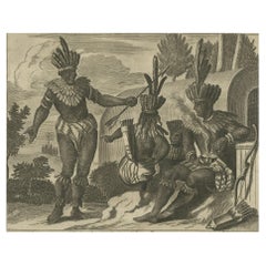
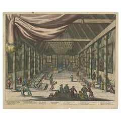
Engraving of a Ceremonial Gathering in New Spain in New Spain by Montanus, 1673
Located in Langweer, NL
This detailed copper engraving originates from Arnoldus Montanus' "Die Unbekannte Neue Welt oder Beschreibung des Welt-teils Amerika und des Sud-Landes", depicting a ceremonial gathering in New Spain...
Category
Dutch Antique 17th Century Prints
Materials
Paper
$377 Sale Price
30% Off
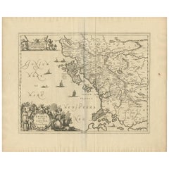
Antique Map of Epirus 'Albania, Greece' by J. Janssonius, circa 1650
Located in Langweer, NL
This map covers the northwestern coast of Greece and part of present-day Albania. The map was drawn by Johannes Wilhelm Laurenberg, a mathematician and historian who produced several...
Category
Antique 17th Century Prints
Materials
Paper
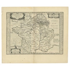
Antique Map of France by Janssonius, c.1650
Located in Langweer, NL
Antique map titled 'Gallia Vetus'. Beautiful map of France based on Caesar's De Bello Gallico. In the columns to the left and right important tribes and people are described.
Art...
Category
Antique 17th Century Prints
Materials
Paper
$503 Sale Price
20% Off
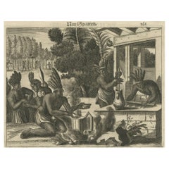
Copper Engraving of Daily Life in New Spain in The 17th Century, 1673
Located in Langweer, NL
This original copper engraving depicts a lively scene of daily life in New Spain from Arnoldus Montanus' "Die Unbekannte Neue Welt oder Beschreibung des Welt-teils Amerika und des Su...
Category
Antique 17th Century Prints
Materials
Paper
$425 Sale Price
20% Off
1670 Royal Banquet for Dutch Embassy in China - Antique Engraving by Dapper
Located in Langweer, NL
Antique print titled 'The Roÿall Banquet - t Koonincklyck Banket'. Original antique print of a feast for the Dutch embassy in the palace, China. This print originates from 'Gedenkwae...
Category
Antique 17th Century Prints
Materials
Paper
$359 Sale Price
20% Off
Rare Large 1650 Copper Engraving Depicting the Naval Battle of Gibraltar, 1607
Located in Langweer, NL
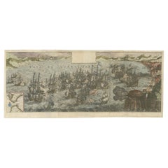
Title: Rare Large 1650 Copper Engraving Depicting the Naval Battle of Gibraltar, 1607
Description: This rare and exceptionally large copper engraving, measuring 32 x 85 cm, capture...
Category
Antique 17th Century Prints
Materials
Paper
Rare Antique Map of the Middle East, ca.1690
Located in Langweer, NL
Description: Antique print, untitled.
Two decorative maps on one sheet of the middle east in biblical times. Source unknown, to be determined.
Artists and Engravers: Anonymous...
Category
Antique 17th Century Prints
Materials
Paper
$340 Sale Price
20% Off
Original Antique Hand-colored World Map with or without Frame, '1696'
Located in Langweer, NL
Antique world map titled 'Mappe-Monde dressee sur les Observations de Mrs. de l'Academie Royale des Sciences (..)'. Beautiful original antique world map...
Category
Antique 17th Century Prints
Materials
Paper
$4,253 Sale Price
20% Off
North & South America: A 17th Century Hand-colored Map by Jansson & Goos
Located in Alamo, CA
A 17th century hand-colored map of North & South America entitled "Americae Descriptio" by the cartographer Johannes Jansson, published in Jansson's Atlas Minor in Amsterdam in 1628....
Category
Dutch Antique 17th Century Prints
Materials
Paper
Bird’s-Eye View of Genoa – Engraving by Matthäus Merian the Elder c.1650
Located in Langweer, NL
Bird’s-Eye View of Genoa – Engraving by Matthäus Merian the Elder c.1650
This finely detailed antique print titled Genua presents a sweeping bird’s-eye view of the historic Italian ...
Category
Swiss Antique 17th Century Prints
Materials
Paper
$746 Sale Price
20% Off
17th Century Flaemish Abraham Genoels II "Landscape with Rabbit" Etching
By Abraham Genoels II
Located in Cagliari, IT
Beautiful etching by Abraham Genoels II (Antwerp 1640-1723) from a painting by Adam Frans van der Meulen (Brussels 1844-Paris 1690).
Excellent state of conservation with wide margin...
Category
Belgian Antique 17th Century Prints
Materials
Copper
$926 Sale Price
20% Off
Daily Life in Brazil in the early 17th Century on a Copper Engraving by Montanus
Located in Langweer, NL
"Daily Life in Brazil"
This striking copper engraving, part of Arnoldus Montanus' "Die Unbekannte Neue Welt oder Beschreibung des Welt-teils Amerika und des Sud-Landes", presents a ...
Category
Antique 17th Century Prints
Materials
Paper
$399 Sale Price
24% Off
Old Genuine Antique Map of Tartary in the Russian Far East
Located in Langweer, NL
Original antique map titled 'Tartaria sive Magni Chami Imperium'. This great map of Tartary covers all of eastern Asia between the Caspian Sea and northern China and Manchuria. Being...
Category
Antique 17th Century Prints
Materials
Paper
$1,323 Sale Price
20% Off
Antique Map of Morocco Showing Towns of Marakesh, Taradant and Fez, 1636
Located in Langweer, NL
Antique map titled 'Fezzae et Marocchi regna Africae Celeberrima'. Map of Morocco, showing large fortified towns of Marakesh, Taradante and Fez, towns, mountains, rivers, lakes, etc....
Category
Antique 17th Century Prints
Materials
Paper
$1,181 Sale Price
20% Off
Antique Print of William Cavendish on the Winged Horse Pegasus
Located in Langweer, NL
Antique print titled 'Il Monte avec la Main, les Eperons, et Gaule (..)'. Plate 4 from "La Methode et Invention Nouvelle de Dresser les Chevaux" by William Cavendish. This engraving shows William Cavendish, first Duke of Newcastle...
Category
Antique 17th Century Prints
Materials
Paper
$1,571 Sale Price
30% Off
Antique Print of the Dardanelles, Turkey, 1677
Located in Langweer, NL
Antique print titled 'Divo Caesar Augusto L. Clunidius I. F. Cla: ponto'. Original antique print showing a view of the Dardanelles, Turkey, with ships. This print originates from 'Na...
Category
Antique 17th Century Prints
Materials
Paper
$510 Sale Price
20% Off
Antique Map of the Province Groningen in The Netherlands, c.1680
Located in Langweer, NL
Antique map titled 'Groningae et Omlandiae Dominium vulgo de Provincie van Stadt en Lande'.
Old map of the province of Groningen, the Netherlands. This map originates from 'Germani...
Category
Antique 17th Century Prints
Materials
Paper
$463 Sale Price
20% Off
Copper Engraving Depicting the High Quality of the Fashion Under Louis XIV, 1684
Located in Langweer, NL
Beautiful engraving of Jean Dieu de Saint-Jean with title 'Homme de qualité en Surtout'
(translated in English: Man of of a particular quality). This original copper engraving is ha...
Category
Antique 17th Century Prints
Materials
Paper
$330 Sale Price
20% Off
Antique Map of Zeeland 'The Netherlands' by N. Visscher, circa 1690
Located in Langweer, NL
Antique map titled 'Comitatus Zelandiae (..)'. Detailed chart of the province Zeeland, The Netherlands, with details shown pictorially. Published by N. Visscher.
Category
Antique 17th Century Prints
Materials
Paper
$623 Sale Price
20% Off
Rare Antique Map of the Americas with Island California by Danckerts, c.1680
Located in Langweer, NL
Rare Antique Map of the Americas with Island California by Justus Danckerts, ca. 1696
This exceptional antique map titled Novissima et Accuratissima Totius Americae Descriptio per I...
Category
Dutch Antique 17th Century Prints
Materials
Paper
Six Assorted Framed Botanicals By Besler
Located in Essex, MA
All by Basilius Besler { 1561-1629] Besler was an apothecary and botanist and managed the gardens of Bishop Johann Conrad of Eichstatt, Germany. Besler created 'Hortus Eystettensis a...
Category
German Antique 17th Century Prints
Materials
Glass, Giltwood, Paper
$17,500 / set
Set of Six Hand Colored Engravings of Northern France
Located in Essex, MA
All featuring the communes of northern France including Rethel, Dunkirk, Mouzon, Gravelines etc. Framed and matted. By C.N. Cochin. Uninspected out of frames. Likely 19th century.
Category
French Antique 17th Century Prints
Materials
Paper
Pair of Framed Hand Colored Engravings of Tulips by Basilius Besler
Located in Essex, MA
Each with crisp vivid colors of the most desirable tulip series.
Category
European Antique 17th Century Prints
Materials
Paper
Antique Print of Chinese Farmers by Nieuhof '1665'
Located in Langweer, NL
Antique print titled 'Sineesche Boeren en Boerinne'. Old print depicting Chinese farmers (male and female). This print originates from 'Het gezantschap der Nee^rlandtsche Oost-Indisc...
Category
Antique 17th Century Prints
Materials
Paper
$179 Sale Price
20% Off
Map of The East Indies with the Route of Capt. William Dampier's Voyage, 1698
Located in Langweer, NL
Antique map titled 'Kaart van Oost Indie'.
Old map of the East Indies. It shows the routes of Captain William Dampier's voyage throughout the regio...
Category
Antique 17th Century Prints
Materials
Paper
$689 Sale Price
20% Off
Copper Engraving of Hispaniola - Indigenous Life in America by Montanus, 1673
Located in Langweer, NL
This original copper engraving, extracted from the scarce German edition of Arnoldus Montanus' "Die Unbekante Neue Welt oder Beschreibung des Welt-teils Amerika und des Sud-Landes", ...
Category
Antique 17th Century Prints
Materials
Paper
$399 Sale Price
24% Off
Beautiful Rare Antique Map of the Holy Land, 1648
Located in Langweer, NL
Antique map Holy Land titled 'Perigrinatie ofte Veertich-Iarige Reyse, der kinderen Israels uyt Egipten, door de Roode-Zee; mitsgaders de Woestyne tot int Beloofde Landt Canaan, : met groote vlyt uyt verscheryden auctoren by een gestelt, uyt de H. Schrift gecorigeert, ende int licht gegeven'.
Beautiful and rare antique map of the Holy Land...
Category
Antique 17th Century Prints
Materials
Paper
$793 Sale Price
20% Off
Copper Engraving of Ceremonial Life in New Spain by Montanus, 1673
Located in Langweer, NL
This detailed copper engraving is from Arnoldus Montanus' "Die Unbekannte Neue Welt oder Beschreibung des Welt-teils Amerika und des Sud-Landes," which offers a glimpse into the cere...
Category
Antique 17th Century Prints
Materials
Paper
$431 Sale Price
20% Off
Cultural Encounter in New Mexico, Copper Engraving Published in 1673
Located in Langweer, NL
This original copper engraving hails from Arnoldus Montanus' seminal work, "Die Unbekannte Neue Welt oder Beschreibung des Welt-teils Amerika und des Sud-Landes," a comprehensive depiction of the Americas published in 1673.
It presents a vivid scene set in colonial New Mexico, showcasing a moment of interaction—possibly a ceremonial or everyday event—between indigenous people and European settlers or explorers. The detailed attire and adornments of the figures suggest a narrative rich in cultural exchange and complexity. This piece is not only a reflection of the artistic style and engraving techniques of the 17th century but also serves as a historical document capturing the early encounters between different worlds.
Published in Amsterdam by Jacob Meurs, this rare German edition offers a unique glimpse into the perceptions and imaginations of European society regarding the New World during the Age of...
Category
Antique 17th Century Prints
Materials
Paper
$399 Sale Price
24% Off
Antique Miniature Map of the Roman Province of Illyricum 'Dalmatia'
Located in Langweer, NL
Antique miniature map titled 'Illyricum'. Original small map of Illyricum. The Roman province of Illyricum stretched from the Drilon River (the Drin, in...
Category
Antique 17th Century Prints
Materials
Paper
$326 Sale Price
20% Off
Antique Print of a Japanese Pleasure or Galley Yacht (1669)
Located in Langweer, NL
Antique print titled 'Faifena een Japans jacht.' Old print of a galley yacht from Japan, here identified as Faifena, Fayfena. This print originates from 'Gedenkwaerdige Gesantschappe...
Category
Antique 17th Century Prints
Materials
Paper
$255 Sale Price
20% Off
Antique Portrait of Christian II of Denmark by Janszoon, 1615
Located in Langweer, NL
Antique portrait titled 'Christiernus II (..)'. Portrait of Christian II of Denmark. This print originates from 'Tooneel der keyseren ende coningen van christenryck sedert den onderg...
Category
Antique 17th Century Prints
Materials
Paper
$207 Sale Price
20% Off
Antique Map of Peru in South America by Blaeu, circa 1645
Located in Langweer, NL
Antique map titled 'Peru'. Original antique map of Peru. With cartouche, compass rose, ships and two sea-monsters. Published by W. Blaeu, circa 1645.
Category
Antique 17th Century Prints
Materials
Paper
$665 Sale Price
24% Off
Scenes from 17th Century Chile: A Glimpse of Early Indigenous Cultures, 1673
Located in Langweer, NL
The image is a historical copper engraving from 1673, taken from the German edition of Arnoldus Montanus' work, which is known for its depiction of the Americas and the Southern land...
Category
Antique 17th Century Prints
Materials
Paper
$425 Sale Price
20% Off
Pair of Road Maps of England by John Ogilby
Located in Essex, MA
The first road maps of England. London to Holyhead and London to Carlisle. Nicely framed and matted. These are plates removed from a book. These are fir...
Category
English Antique 17th Century Prints
Materials
Paper
$1,850 / set
The Sjö Castle and Gardens in the Swedish Countryside, 1696
Located in Langweer, NL
The engraving depicts a grand manor house surrounded by formal gardens. It is titled "Facies Splendidissimi Ornatißimique Palatii," which suggests it is an illustration of an opulent and ornate palace. The year noted for the engraving is 1696, and it was engraved by Swidde, referring to Willem Swidde, a Dutch artist known for his work in Sweden and his significant contributions to the collection "Suecia Antiqua et Hodierna" by Erik Dahlbergh...
Category
Antique 17th Century Prints
Materials
Paper
$226 Sale Price
20% Off
Capture of Spanish Ships by Dutch Fleet Near Cuba, 1628, Led by Pieter Ita
Located in Langweer, NL
Title: The Capture of Two Spanish Admiral Ships by the Fleet of the Dutch West India Company under Admiral Pieter Adriaensz Ita, 1628
Description: This mid-17th century engraving, c...
Category
Antique 17th Century Prints
Materials
Paper
$529 Sale Price
20% Off
Antique Portrait of Sultan Ibrahim I, The Ottoman Sultan
Located in Langweer, NL
Antique print titled 'Sultan Hibraim I (..)'. Portrait of Ottoman sultan Ibrahim I, bust-length directed to left; in oval.
Published by Balthasar Moncornet, circa 1660. Balthasar ...
Category
Antique 17th Century Prints
Materials
Paper
$274 Sale Price
20% Off
1632 Decorative Map of the Holy Land, Insets of Jerusalem and Biblical Artefacts
Located in Langweer, NL
Title: 1632 Decorative Map of the Holy Land with Insets of Jerusalem and Biblical Artefacts
Description: This richly detailed map of the Holy Land, published in 1632, offers a fa...
Category
Antique 17th Century Prints
Materials
Paper
$1,512 Sale Price
20% Off
Antique Print of the Hindu God Vishnu Incarnated as Krishna, 1672
Located in Langweer, NL
This original antique print shows the Hindu god Vishnu incarnated as Krishna. Dutch text on verso. From: 'Naauwkeurige Beschryvinge van Malabar en Choromande...
Category
Antique 17th Century Prints
Materials
Paper
$226 Sale Price
20% Off
Gorgeous Antique World Map by the Dutch Mapmaker Visscher, published circa 1679
Located in Langweer, NL
Antique map titled 'Novissima Totius Terrarum Orbis Tabula, Auctore Nicolao Visscher'. Gorgeous example of Nicholas Visscher's World map, which appeared...
Category
Dutch Antique 17th Century Prints
Materials
Paper
Panoramic View of Isfahan in 17th Century Persia by J.C. Haffner, ca.1690
Located in Langweer, NL
Panoramic View of Isfahan in the Late 17th Century by J.C. Haffner
The translation of the German text on the engraving:
"A. The Meidan or Great Market and Promenade Square in front...
Category
Antique 17th Century Prints
Materials
Paper
$1,323 Sale Price
20% Off
17th Century Engraving of the Royal City of Arakan (Burma) by Arnoldus Montanus
Located in Langweer, NL
Lovely detailled engraving of the old city of Arakan in Myanmar, in good condition. This illustration is from "De Oost-Indische Voyagie van Wouter Schouten", published by Jacob Meurs...
Category
Antique 17th Century Prints
Materials
Paper
$283 Sale Price
20% Off
Rare Antique Print of A Cupid being Eaten by A Crocodile, ca. 1608
Located in Langweer, NL
Antique print of Cupid and a crocodile.
This print originates from 'Amorum Emblemata', this work includes engravings of Cupids encountering the various trials of Love. The emblematic illustrations include verses in Latin, Dutch and French. The verse of this print would translate to 'Love is the opposite of a crocodile. They say the crocodile has such a nature, that he cries when he is killing and devouring men. But Amor has an opposite nature, for he laughs when he makes lovers perish'.
Artists and Engravers: Otto van Veen...
Category
Antique 17th Century Prints
Materials
Paper
$174 Sale Price
20% Off
Antique Map of Greece by Allard (c.1698)
Located in Langweer, NL
Antique map titled 'Hellas seu Graecia Universa' Detailed map of Greece, with Crete, the Aegean Islands, and part of Turkey. With two cartouches, compass rose and scale. Carolus Alla...
Category
Antique 17th Century Prints
Materials
Paper
$926 Sale Price
20% Off
Historic View of Sugar Milling in 17th Century America, published in 1673
Located in Langweer, NL
The print titled "AMERIKENS ENTDECKER" is a striking antique copper engraving, crafted in 1673 during the 17th century as part of the German edition of Arnoldus Montanus' influential work, "Die Unbekante Neue Welt" ("The New and Unknown World"). The engraving was executed by Jacob van Meurs, a renowned Dutch engraver and publisher known for his detailed works on geography and history, and it was published in Amsterdam.
Description of the Print:
The engraving measures 17 x 13 cm (approximately 6.6 x 4.7 inches) and is set on a page that is 31 x 19.5 cm (about 12.2 x 7.4 inches). It depicts a vivid scene that illustrates the discovery of America...
Category
Dutch Antique 17th Century Prints
Materials
Paper
$359 Sale Price
20% Off
Engraving of Rituals and Cremation Ceremonies in New Spain by Montanus, 1673
Located in Langweer, NL
Title: "Rituals and Ceremonies in New Spain"
Description: This striking copper engraving is extracted from Arnoldus Montanus' seminal work, "Die Unbekannte Neue Welt oder Beschreibu...
Category
Antique 17th Century Prints
Materials
Paper
$425 Sale Price
20% Off
Antique Map of Warwickshire in England by Speed, c.1614
Located in Langweer, NL
Antique map titled 'The Counti of Warwick the Shire Towne and Citie of Coventre described'. Map of Warwickshire, England. Includes inset town plans of Warwic...
Category
Antique 17th Century Prints
Materials
Paper
$718 Sale Price
20% Off
Antique Portrait of Christian IV, King of Denmark, by Janszoon, 1615
Located in Langweer, NL
Antique portrait titled 'Christianus IV (..)'. Portrait of Christian IV, King of Denmark. This print originates from 'Tooneel der keyseren ende coninge...
Category
Antique 17th Century Prints
Materials
Paper
$207 Sale Price
20% Off
Vibyholm Castle in Sweden: A Baroque Gem in Dahlbergh's Collection, ca.1675
Located in Langweer, NL
Title: "Vibyholm Castle: A Baroque Gem in Dahlbergh's Collection"
Description: This splendid hand-colored engraving from the 1670s features Vibyholm Castle, a notable example of Swe...
Category
Antique 17th Century Prints
Materials
Paper
$463 Sale Price
20% Off
Antique Portrait of Maarten Harpersz. Tromp by De Passe, 1639
Located in Langweer, NL
Antique master print titled 'D. Martini Herpert Trompii'. Antique portrait of the admiral Maarten Harpersz. Tromp.
Artists and Engravers: Engraved by Crispin van de Passe.
Cond...
Category
Antique 17th Century Prints
Materials
Paper
$444 Sale Price
20% Off
Original Antique Map of the Northern Part of Scotland, circa 1640
Located in Langweer, NL
The antique map, titled 'Scotiae pars septentrionalis,' depicts the northern part of Scotland. Crafted by Hondius around 1640, this map is a historical treasure showcasing the geogra...
Category
Antique 17th Century Prints
Materials
Paper
$831 Sale Price
20% Off
Antique Map of Central Sweden by J. Blaeu, 1662
Located in Langweer, NL
A striking, rare map with a cartouche dedicated to Gabriel Bengtsson Oxenstierna. Published by J. Bleau, Amsterdam, 1662. Contemporary coloring.
Category
Antique 17th Century Prints
Materials
Paper
$864 Sale Price
20% Off
Antique Map of Denmark by F. de Wit, 1680
Located in Langweer, NL
Antique map titled 'Dania Regnum'. Large, attractive map of Denmark, Sleschwig-Holstein and southern Sweden. Good detail throughout. Embellished with a title cartouche with the Danis...
Category
Antique 17th Century Prints
Materials
Paper
$912 Sale Price
20% Off
Baroque Majesty: A Vibrant Assembly at Svartsjö Castle in Sweden, 1693
Located in Langweer, NL
An handcolored original antique print of Svartsjö Castle, located on the island of Färingsö in Ekerö Municipality, Sweden. The castle has a rich history, with the current building da...
Category
Antique 17th Century Prints
Materials
Paper
$661 Sale Price
20% Off
Large Antique Map of France by De Wit, c.1680
Located in Langweer, NL
Antique map titled 'Accuratissima Galliae Tabula vulgo Royaume de France'. Detailed map of France. Shows provinces, cities, rivers etc.
Artists and Engravers: Frederick de Wit (1...
Category
Antique 17th Century Prints
Materials
Paper
$614 Sale Price
20% Off
Antique Portrait of James IV, King of Scotland by Janszoon, 1615
Located in Langweer, NL
Antique portrait titled 'Iacobus IIII dei Gratia Scotorum Rex'. Portrait of James IV of Scotland. This print originates from 'Tooneel der keyseren ende coningen van christenryck sede...
Category
Antique 17th Century Prints
Materials
Paper
$226 Sale Price
20% Off
Original Antique Map of the Northern Baltic Region
Located in Langweer, NL
Title: "Livonia: Antique Map of the Northern Baltic Region"
Description: This antique map, titled "Livonia," is a detailed representation of the northern Baltic region. Centered on ...
Category
Antique 17th Century Prints
Materials
Paper
$935 Sale Price
20% Off
Antique Print of Cairo in Egypt, 1698
Located in Langweer, NL
Untitled antique print with two views of Cairo, Egypt. 78: Palace of Sultan Gori. 79. Tower and aqueduct. This print originates from 'Reizen van Cornelis de Bruyn, door de vermaardst...
Category
Antique 17th Century Prints
Materials
Paper
$274 Sale Price
20% Off
Venngarn Castle, Uppland in Sweden: A Dahlbergh and Swidde Masterpiece, c. 1695
Located in Langweer, NL
Title: "Venngarn Castle, Uppland: A Dahlbergh and Swidde Masterpiece, c. 1695"
Description: This enchanting hand-colored copper engraving from circa 1695 captures the grand Venngarn...
Category
Antique 17th Century Prints
Materials
Paper
$453 Sale Price
20% Off
Recently Viewed
View AllMore Ways To Browse
Antique Enamel Coffee Pot
Antique Glass Sugar Shakers
Antique Hand Painted Nippon
Antique Hunting Flasks
Antique India Sword
Antique Jacobean Chest
Antique Japanese Satsuma Tea Sets
Antique Japanese Shibayama
Antique Military Saddles
Antique Milk Glass Vase
Antique Nantucket Signs
Antique Oak Card Cabinet
Antique Pegasus
Antique Peugeot
Antique Red Transferware
Antique Salt Dishes
Antique Silver Grape Scissors
Antique Smiths Clocks
