Mid-17th Century Prints
to
268
295
4
299
Height
to
Width
to
1
1
5,276
9,781
5,515
874
1,209
1,729
1,683
199
80
206
257
248
311
414
704
366
226
299
3
1
1
1
36
13
7
6
3
299
299
299
28
1
1
1
1
Period: Mid-17th Century
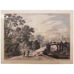
17th Century Gabriel Perelle "Landscape" Etching, France, circa 1660
By Gabriel Perelle
Located in Cagliari, IT
A French landscape by Gabriel Perelle. With a modern walnut frame
Gabriel Perelle (Vernon, 1604 - Paris, 1677) was a French engraver, draftsman and printer of topographic views and landscapes.
A pupil of Simon Vouet, Perelle specialized in landscapes with a classical setting, not unlike those of Francisque Millet, although with clearly decorative pretensions. He founded an etching lab, with the collaboration of his sons Nicolas and Adam.
Perelle was also a pupil of Daniel Rabel and produced hundreds of engravings from his drawings, as well as compositions by fellow antagonists such as Israël Silvestre, Paul Bril, Jacques Callot, Michel Corneille the Elder, Jan Asselijn...
Category
French Baroque Antique Mid-17th Century Prints
Materials
Paper
$554 Sale Price
20% Off
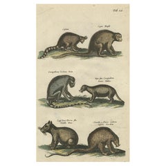
Antique Print of various Mammals Porcupine, Capybara, Otter, Monkey etc., 1657
Located in Langweer, NL
Antique print of various mammals; porcupine, capybara, otter, monkey etc. This print originates from 'Historiae Naturalis De Piscibus Et Cetis Libri V' by John Johnston, published by Matthias Merian in 1657.
Artists and Engravers: John Johnston (or Johnstone, 1603-1675) was a descendant of a Scottish family...
Category
Antique Mid-17th Century Prints
Materials
Paper
$229 Sale Price
20% Off
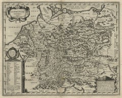
Original Rare Antique Map of the Ancient German Empire in Northern Europe, c1650
Located in Langweer, NL
Antique map titled 'Germaniae Veteris typus.'
Map of the ancient German Empire in Northern Europe, based upon an earlier map by Ortelius. Extends fr...
Category
Antique Mid-17th Century Prints
Materials
Paper
$631 Sale Price
20% Off
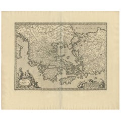
Antique Map of Greece by J. Jansson, circa 1653
Located in Langweer, NL
This is an authentic antique map of the Greece by Jan Jansson. The map was published in Amsterdam, circa 1653. This striking 17th century map of Greece was based on “Totius Graeciae ...
Category
Antique Mid-17th Century Prints
Materials
Paper
$841 Sale Price
20% Off
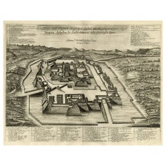
Original Antique Engraving of the Mighty Imperial Osaka Castle in Japan, 1669
Located in Langweer, NL
Antique print, titled: 'Afbeeldinge vant Maghtich Keyserlyck Casteel Osacca geleegen int groot Ryck Jappan besuyden de Stadt Osacce inde provinsie Qioo.' - ('Image of the Mighty Imperial Castle Osaka').
A bird's eye view of Osaka Castle, Japan. Arnoldus Montanus' "Gedenkwaerdige Gesantschappen der Oost-Indische Maatschappy in 't Vereenigde Nederland aan de Kaisaren van Japan […]. Amsterdam: Jacob Meurs, 1669.
Artists and Engravers: Made by an anonymous engraver after 'Arnoldus Montanus'.
Condition: Very good, given age. Original middle fold, as issued. Some faint browning of the margin edges. A few small spots in the margins (from paper making...
Category
Antique Mid-17th Century Prints
Materials
Paper
$908 Sale Price
20% Off
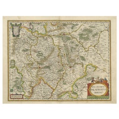
Antique Map of the Rhine-Palatinate by Janssonius, circa 1630
Located in Langweer, NL
Antique map titled 'Nova Descriptio Palatinatus Rheni'. Detailed map of the Rhine-Palatinate, a state of Germany located in the west of the country. The map tracks the course of the ...
Category
Antique Mid-17th Century Prints
Materials
Paper
$478 Sale Price
20% Off
Antique Map of the Region of Le Mans 'France' by Blaeu, circa 1640
By Willem Blaeu
Located in Langweer, NL
Antique Map: Cenomanorum Galliae regionis typus vulgo le Mans – Blaeu, circa 1640
This beautifully engraved and hand-colored map depicts the historical province of Maine in northw...
Category
Antique Mid-17th Century Prints
Materials
Paper
$478 Sale Price
20% Off
Orignal Hand-Colored Antique Map of Chili by W. Blaeu, 1658
By Willem Blaeu
Located in Langweer, NL
Very decorative antique map of Chili published by W. Blaeu, 1658. This map depicts Chile from Copiapo southward to the island of Chiloé with ships and sea monsters adorning the sea. ...
Category
Antique Mid-17th Century Prints
Materials
Paper
$884 Sale Price
20% Off
Original Map of the Military Situation After the Dutch Blockade of Antwerp, 1648
Located in Langweer, NL
Antique map titled 'Tabula Castelli ad Sandflitam (..)'.
This map depicts the complex military situation that had developed after the Dutch blockade of Antwerp. All entrenchment'...
Category
Antique Mid-17th Century Prints
Materials
Paper
$641 Sale Price
20% Off
Original Antique Map of the Northern Part of Scotland, circa 1640
Located in Langweer, NL
The antique map, titled 'Scotiae pars septentrionalis,' depicts the northern part of Scotland. Crafted by Hondius around 1640, this map is a historical treasure showcasing the geogra...
Category
Antique Mid-17th Century Prints
Materials
Paper
$841 Sale Price
20% Off
Capture of Spanish Ships by Dutch Fleet Near Cuba, 1628, Led by Pieter Ita
Located in Langweer, NL
Title: The Capture of Two Spanish Admiral Ships by the Fleet of the Dutch West India Company under Admiral Pieter Adriaensz Ita, 1628
Description: This mid-17th century engraving, c...
Category
Antique Mid-17th Century Prints
Materials
Paper
$529 Sale Price
20% Off
Detailed Regional Antique Map of Northwestern France and Catholic Belgium, 1648
Located in Langweer, NL
Antique map titled 'Picardie et les Pays Bas Catholiques (..)'.
Detailed regional map of Northwestern France and Catholic Belgium, from an early edition of Sanson's Atlas.
Art...
Category
Antique Mid-17th Century Prints
Materials
Paper
$631 Sale Price
20% Off
Antique Portrait of Michael I of Russia
Located in Langweer, NL
Antique print titled 'Michel Phedorwitz Grand Duc (..)'. Portrait of Michael of Russia (Mikhail Fyodorovich Romanov), bust-length directed to left; in oval.
Published by Balthasar...
Category
Antique Mid-17th Century Prints
Materials
Paper
$220 Sale Price
20% Off
Siege and Struggle: The Kauwensteinse Dike in the Eighty Years' War, 1647
Located in Langweer, NL
Battle on the Kauwensteinse dike, 26 mai 1585, attack from the Staten army and ships from Sealand on the dike against the Spanish in the Eighty Years' War.
An original historical ar...
Category
Antique Mid-17th Century Prints
Materials
Paper
$803 Sale Price
20% Off
Antique Portrait of Sultan Ibrahim I, The Ottoman Sultan, ca.1660
Located in Langweer, NL
Antique print titled 'Sultan Hibraim I (..)'. Portrait of Ottoman sultan Ibrahim I, bust-length directed to left; in oval.
Published by Balthasar Moncornet, circa 1660. Balthasar ...
Category
French Antique Mid-17th Century Prints
Materials
Paper
$277 Sale Price
20% Off
Antique Map of the Region of Charolais by Janssonius, 1657
Located in Langweer, NL
Antique map 'Les environs de L'Estang de Longpendu, comprenant une grande partie du Comté de Charolois'. Decorative map of the Charolais region. This map originates from 'Atlas Novus...
Category
Antique Mid-17th Century Prints
Materials
Paper
$502 Sale Price
20% Off
Antique Map of the Ancient British Isles by Janssonius 'circa 1640'
Located in Langweer, NL
Antique map titled 'Insularum Britannicarum Acurata Delineatio'. Original antique map of the ancient British Isles. England and Wales are labelled as B...
Category
Antique Mid-17th Century Prints
Materials
Paper
$908 Sale Price
20% Off
Antique Map of the Region of Maine by Janssonius, circa 1650
Located in Langweer, NL
Antique map of France titled 'Diocese du Mans vulgo le Mains'. Decorative map of the region of Maine, France. Published by J. Janssonius.
Category
Antique Mid-17th Century Prints
Materials
Paper
$430 Sale Price
20% Off
Antique Map of Holstein, Germany
Located in Langweer, NL
Antique map titled 'Holsatia Ducatus'. Original old map of Holstein, Germany. By Petrus Kaerius, published circa 1650. Pieter van den Keere (Latin: Petrus Kaerius 1571 – circa 1646) ...
Category
Antique Mid-17th Century Prints
Materials
Paper
$363 Sale Price
20% Off
Gerard van Honthorst – Striking 17th Century Portrait Engraving after Van Dyck
Located in Langweer, NL
Title: Gerard van Honthorst – Antique Portrait Engraving by Paulus Pontius after Van Dyck, circa 1630-1641
Description:
This is an impressive and finely executed 17th-century engrav...
Category
European Antique Mid-17th Century Prints
Materials
Paper
Prophet Muhammad (Mahomet) – 18th Century Paris Engraving by Daumont, c.1770
Located in Langweer, NL
18th Century Engraving of Mahomet (Prophet Muhammad), Published by Daumont Paris
Description:
This antique French engraving depicts Mahomet (Muhammad), described here as the founder...
Category
French Antique Mid-17th Century Prints
Materials
Paper
Antique Decorative Frontispiece of Putti and Birds, 1660
Located in Langweer, NL
Antique print titled 'Dr. J. Jonstons Beschrijving van de Natuur der Vogelen (..)'.
Frontispiece of the Dutch edition of 'Historiae Naturalis de Avibus' by John Johnston. Transla...
Category
Antique Mid-17th Century Prints
Materials
Paper
$344 Sale Price
20% Off
Antique Print of Tomumbey, the Last Sultan of Egypt, 1667
Located in Langweer, NL
Antique portrait titled 'Tomumbey Lesten Sultaen van Egypten'. Antique print of Tomumbey, the last Sultan of Egypt. This print originates from 'Kerckelijke H...
Category
Antique Mid-17th Century Prints
Materials
Paper
$181 Sale Price
20% Off
View of the Chinese City of Nanjing with Its Ramparts, 1665
Located in Langweer, NL
Antique print, titled: 'Namkun of Nankang'
View of the Chinese city of Nanjing with its ramparts. Behind the city wall a pagoda can be seen. On the fore...
Category
Antique Mid-17th Century Prints
Materials
Paper
$459 Sale Price
20% Off
Original Antique Map of the English counties Cornwall, Devon, Dorset, etc, 1633
Located in Langweer, NL
Antique map titled 'Cornubia, Devonia, Somersetus, Dorcestria, Wiltonia, Glocestria, Monumetha, Glamorgan, Caermarden, Penbrok, Cardigan, Radnor, Breknoke et Herfordia'.
Old map of the English counties of Cornwall, Devon, Somerset, Dorset, Wiltshire, Gloucestershire, Herefordshire, Worcestershire etc. Originates from the 1633 German edition of the Mercator-Hondius Atlas Major, published by Henricus Hondius and Jan Jansson under the title: 'Atlas: das ist Abbildung der gantzen Welt, mit allen darin begriffenen Laendern und Provintzen: sonderlich von Teutschland, Franckreich, Niderland, Ost und West Indien: mit Beschreibung der selben.'
Artists and Engravers: Gerard Mercator (1512 - 1594) originally a student of philosophy was one of the most renowned cosmographers and geographers of the 16th century, as well as an accomplished scientific instrument maker. He is most famous for introducing Mercators Projection, a system which allowed navigators to plot the same constant compass bearing on a flat...
Category
Antique Mid-17th Century Prints
Materials
Paper
$1,100 Sale Price
20% Off
Antique Map of the Siege of Syracuse by the Athenians, 1648 – Thucydides
Located in Langweer, NL
Antique Map of the Siege of Syracuse by the Athenians, 1648 – Thucydides
This finely engraved plan depicts the Siege of Syracuse, one of the most dramatic episodes of the Peloponnes...
Category
English Antique Mid-17th Century Prints
Materials
Paper
$707 Sale Price
20% Off
Antique Map of Catalonia by Blaeu, circa 1650
Located in Langweer, NL
Antique map titled 'Catalonia'. Antique map of Catalonia, extending from C. De Romani on the Northern Coast to Alfachs and Panicola in Valencia on the southern end of the coast and s...
Category
Antique Mid-17th Century Prints
Materials
Paper
$861 Sale Price
20% Off
Great Antique Bird's-Eye View Plan of Brielle by Blaeu in The Netherlands, 1649
Located in Langweer, NL
Antique print, titled: 'Briela.'
Bird's-eye view plan of Brielle in The Netherlands. With key to locations and coats of arms. Text in Dutch on verso. This plan originates from the famous city Atlas: 'Toneel der Steeden' published by Joan Blaeu...
Category
Antique Mid-17th Century Prints
Materials
Paper
$1,195 Sale Price
20% Off
Original Old Map of Leeuwarden, European Cultural Capital 2018, Holland, 1649
Located in Langweer, NL
Antique print, titled: 'Leoverdia.'
This map shows Leoverdia (Leeuwarden). Bird's-eye view plan of Leeuwarden in The Netherlands, with key to locations and coats of arms. Text in...
Category
Antique Mid-17th Century Prints
Materials
Paper
$1,291 Sale Price
20% Off
Antique Engraving Showing Animals of the Guenon & Armadillo Species, 1657
Located in Langweer, NL
Antique print of various animals; Cercopithecus Sagovin Clusy (Guenon species) - Mapach (Racoon) - Cercopithecus Barbatus Clusy (Guenon species) - Iguavu sive Haut clusy - Armadillo ...
Category
Antique Mid-17th Century Prints
Materials
Paper
$344 Sale Price
20% Off
Original Antique Print of the Benedictine Abbey of Gembloux, Belgium, ca.1660
Located in Langweer, NL
Antique print titled 'Celebrrima et Antiquissima Cemblacensis Oppidi Abbatia Ordinis S. Benedicti in Gallo-Brabantia'.
Original antique print of the Benedictine Abbey of Gembloux...
Category
Antique Mid-17th Century Prints
Materials
Paper
$727 Sale Price
20% Off
Original Old Bird's-Eye View Plan of Sint-Winoksbergen or Bergen in France, 1649
Located in Langweer, NL
Antique map titled 'Berga Sti Winoci.' - Bird's-eye view plan of Sint-Winoksbergen in France, with key to locations and coats of arms. Text in Dutch on verso. This plan originates from the famous city Atlas: 'Toneel der Steeden' published by Joan Blaeu...
Category
Antique Mid-17th Century Prints
Materials
Paper
$1,387 Sale Price
20% Off
Antique Map of the Region of Vermandois and Cappelle by Janssonius, circa 1650
Located in Langweer, NL
Antique map of France titled 'Descriptio Veromanduorum - Gouvernement de la Cappelle'. Two detailed maps of France on one sheet. The Vermandois map is centered on the Oyse and Somme ...
Category
Antique Mid-17th Century Prints
Materials
Paper
$382 Sale Price
20% Off
Antique Map of the Province of Overijssel, the Netherlands
Located in Langweer, NL
Original antique map titled 'Ditio Trans-Isulana'. Original old map of the province of Overijssel, the Netherlands. With coat of arms and two decorative cartouches. Published by J. J...
Category
Antique Mid-17th Century Prints
Materials
Paper
$468 Sale Price
20% Off
Antique Print of the French King Louis XIII with Other Figures and a Horse
Located in Langweer, NL
Figure 10 of first part: The French king Louis XIII (aged sixteen) standing at left, with Messieurs de Pluvinel and le Grand, a horse tethered b...
Category
Antique Mid-17th Century Prints
Materials
Paper
$440 Sale Price
20% Off
Antique Print of Dromedary by J. Jonston, 1657
Located in Langweer, NL
Tab. XLI: This print shows various Dromedary. This print originates from: 'Historiae Naturalis De Quadrupetibus Libri I' by John Johnston, published by Matthias Merian in 1657.
Category
Antique Mid-17th Century Prints
Materials
Paper
$172 Sale Price
20% Off
Antique Map of the Burgundy Region by Merian '1646'
Located in Langweer, NL
Antique map titled 'Utriusque Burgundiae tum Ducatus tum Comitatus descriptio'. Old map of the Burgundy (Bourgogne) region of France. This map originates from 'Neuwe Archontologia co...
Category
Antique Mid-17th Century Prints
Materials
Paper
$239 Sale Price
20% Off
Set of 3 Antique Prints of Mythological Scenes on Lemon Varieties by Ferrari
Located in Langweer, NL
Set of three antique prints depicting:
1) Leonilla turns into an orange tree.
2) Harmonillus turns into a lemon tree.
3) Tirsenia turns into a lemon tree.
These prints originate from 'Hesperides, sive, De malorvm avreorvm cvltura et vsv libri quatuor' by Giovanni Battista Ferrari, published in 1646. The prints are an illustration for the introduction by G.B. Ferraris book...
Category
Antique Mid-17th Century Prints
Materials
Paper
$1,004 Sale Price / set
30% Off
Original Antique Engraving of a Horse Race at a Japanese Racing Track, 1669
Located in Langweer, NL
Description: Antique print, titled: 'Japansche Ren-baanen.' -
View of a race at a Japanese (horse) racing track. A man runs beside a horse (the horse's rein in his hand). A man w...
Category
Antique Mid-17th Century Prints
Materials
Paper
$430 Sale Price
20% Off
Engraving of Saint Willibrord by Robert Lommelin – Apostle to the Frisians, 1667
Located in Langweer, NL
This engraving depicts Saint Willibrord (ca. 658–739), a prominent missionary and the first Archbishop of Utrecht, often regarded as the "Apostle to the Frisians." He played a key ro...
Category
Antique Mid-17th Century Prints
Materials
Paper
$468 Sale Price
20% Off
Antique Print of the Dayro's court in Miaco or Miyako in Honshu, Japan
Located in Langweer, NL
Antique print titled 'Des Schlos des dairo zu Miaco - t Hof van den Dayro te Miako'. View of the Dayro's court in Miaco or Miyako in Honshu, Japan. This print originates from 'Denckw...
Category
Antique Mid-17th Century Prints
Materials
Paper
$325 Sale Price
20% Off
The Duke of Parma's Pontoon Bridge in The Siege of Antwerp, 1632
Located in Langweer, NL
Rare original engraving of the Pontoon Bridge Constructed by the Duke of Parma in 1585, depicting the famous pontoon bridge over the Scheldt River.
This engineering feat was accomp...
Category
Antique Mid-17th Century Prints
Materials
Paper
$803 Sale Price
20% Off
Original Antique Map of the Dutch Provinces of Overijssel and Drenthe, 1635
Located in Langweer, NL
Antique map titled 'Transiselania Dominium vernacule Over-Yssel.' - Map of the Dutch Provinces of Overijssel and Drenthe. Dedicated to Mr. Bartold Wich...
Category
Antique Mid-17th Century Prints
Materials
Paper
$459 Sale Price
20% Off
Original Engraving of Japanese Musicians Playing Native Music Instruments, 1669
Located in Langweer, NL
Antique print, titled: 'Japansche kamerspeelders.' - ('Japanese musicians').
Four chamber musicians are playing on native instruments outside. Arnol...
Category
Antique Mid-17th Century Prints
Materials
Paper
$430 Sale Price
20% Off
Old Handcolored Antique Map of Pays De Caux in Normandy, France, ca.1640
Located in Langweer, NL
Antique map titled 'Le Pais de Caux'.
Old map of Pays de Caux, France. Pays de Caux is an area in Normandy occupying the greater part of the French département of Seine Maritime ...
Category
Antique Mid-17th Century Prints
Materials
Paper
$1,291 Sale Price
20% Off
Antique Map of the Region of Pays de Caux by Janssonius, 1657
Located in Langweer, NL
Antique map 'Le Pais de Caux'. Decorative map of the region of Pays de Caux, France. This map originates from 'Atlas Novus, Sive Theatrum Orbis Orbis Terrarum: In quo Galliae, Helvet...
Category
Antique Mid-17th Century Prints
Materials
Paper
$526 Sale Price
20% Off
Striking Antique View of Kozhikode, also known as Calicut, in Kerala, India
Located in Langweer, NL
Antique print titled 'Calechut'. Wonderful, miniature copper engraving depicting Arion riding on a very cheerful looking sea monster in the important tradi...
Category
Antique Mid-17th Century Prints
Materials
Paper
$420 Sale Price
20% Off
Original Antique Map showing Southern India, Northern Sri Lanka & Malabar, 1652
Located in Langweer, NL
Antique map titled 'Presqu'Isle de l'Inde deca le Gange (..)'.
Old map showing the southern part of India, including the northern part of Sri Lanka. With inset map of Southern India (Malabar). This map covers the subcontinent from the Bay of Bengal and the Gulf of Cambay to Ceylon. The Mogul Empire can be found in the north. Further south...
Category
Antique Mid-17th Century Prints
Materials
Paper
$631 Sale Price
20% Off
Old Map by Blaeu of the City of Franeker, Friesland, The Netherlands, 1649
Located in Langweer, NL
Antique map titled 'Franekera'.
Old map of the city of Franeker, Friesland. Also shows two cartouches, coats of arms and legend. This map originates from a Latin edition of the t...
Category
Antique Mid-17th Century Prints
Materials
Paper
$1,100 Sale Price
20% Off
Old Portrait of Peter Canisius, a Renowned Dutch Jesuit Catholic Priest, Ca.1650
Located in Langweer, NL
Antique portrait titled 'R.Petrus Canisius Societatis Iesv'.
Old portrait of Peter Canisius, a renowned Dutch Jesuit Catholic priest. He became kno...
Category
Antique Mid-17th Century Prints
Materials
Paper
$181 Sale Price
20% Off
Antique Print of the City of Tiencienwey ‘Tientsin, China’ by J. Nieuhof, 1666
Located in Langweer, NL
Antique print titled 'Tiencienwey'. This plate shows a view on the Chinese city of Tiencienwey or Tientsin. Also depicted are many ships. This print originates from a German edition ...
Category
Antique Mid-17th Century Prints
Materials
Paper
$248 Sale Price
20% Off
Antique Map of the Region of Île-de-France by Hondius, circa 1630
Located in Langweer, NL
Antique map titled Gouvernement de l'Isle de France'. Old map of the region of Île-de-France, France. It is located in the north-central part of the country and often called the régi...
Category
Antique Mid-17th Century Prints
Materials
Paper
$526 Sale Price
20% Off
Antique Portrait of Léon Bouthillier by Boissevin, '1652'
Located in Langweer, NL
Antique print titled 'Leonbouthillier Comte de Chavigny (..)'. Original antique portrait of Léon Bouthillier, a Foreign Minister of France to Louis XIII. Published by Louis Boissevin...
Category
Antique Mid-17th Century Prints
Materials
Paper
$143 Sale Price
20% Off
Antique Map of the Region of Bresse by Hondius, circa 1630
Located in Langweer, NL
Antique map titled 'Bresse'. Old map of the former region of Bresse, France. It is located in the regions of Auvergne-Rhône-Alpes and Bourgogne-Franche-Comté of eastern France. This ...
Category
Antique Mid-17th Century Prints
Materials
Paper
$526 Sale Price
20% Off
Map of Japanese Coast from Osaka to Tokyo & the Kyushu and Shikoku Islands, 1669
Located in Langweer, NL
Antique map titled 'De Land Reyse van Osacca to Iedo. De Water eyse van Nangasacqui tot Osacca.'
Two maps on one sheet. The top map shows the Japanese coast from Osaka to Tokyo (Jedo). The lower map shows the strait between mainland Japan and the two large islands...
Category
Antique Mid-17th Century Prints
Materials
Paper
$1,387 Sale Price
20% Off
Print of a Muse, Inspirational Goddesses of Literature, Science and Arts, 1660
Located in Langweer, NL
Description: Antique print, titled: 'Musa in Aedibus Ducis Altaempsy.' - Statue of a Muse in Rome. The Muses are the inspirational goddesses of literature, science, and the arts in Greek mythology.
From the 1660 Dutch edition of 'Icones et Segmenta Nobil. Signorum et Statuarum quae Romae extant' by Francois Perrier. This first Dutch edition was published by Nicolaas Visscher, printed in 1660 (Amsterdam). Although Perrier was French, he fell in love with Rome when he traveled there first in 1628 and then returning in 1635 and remaining for 10 years. While there, he completed this series of 100 views of Roman statuary in the various palaces and gardens, including the Medici and Vatican gardens and the Palazzo Farnese.
Artists and Engravers: Made by 'Cornelis van Dalen...
Category
Antique Mid-17th Century Prints
Materials
Paper
$229 Sale Price
20% Off
Original Antique Map of Brecknockshire, Wales
Located in Langweer, NL
Antique map titled 'Brecknoc comitaus pars olim silurum'. Original old map of Brecknockshire, Wales. Engraved by R. Vaughan after Christopher Saxton. Published circa 1640.
Category
Antique Mid-17th Century Prints
Materials
Paper
$420 Sale Price
20% Off
Antique Plan of Fort Mardyck Mardijk, France by S. Beaulieu, 1649
Located in Langweer, NL
Plan of Fort Mardyck (Fort Mardijk) and surroundings by Sébastian de Pontault Beaulieu. Mardyck is a former commune in the Nord department in northern France. It is an associated com...
Category
Antique Mid-17th Century Prints
Materials
Paper
$511 Sale Price
20% Off
Antique Map of Northern Germany, Including Schleswig-Holstein and Hamburg
Located in Langweer, NL
Antique map titled 'Basse Partie de la Basse Saxe ou sont les Duchés de Sleswick, Holsace, Meckelenbourg et Lauvenbourg (..)'. Original old map of northern Germany, including Schlesw...
Category
Antique Mid-17th Century Prints
Materials
Paper
$516 Sale Price
20% Off
Original Antique Map of Prussia, ca.1630
Located in Langweer, NL
Antique map titled 'Prussia - Preussen'. Original map of Prussia, a historically prominent German state that originated in 1525 with a duchy centered on...
Category
Antique Mid-17th Century Prints
Materials
Paper
$650 Sale Price
20% Off
Recently Viewed
View AllMore Ways To Browse
Antique Japanese Satsuma Tea Sets
Antique Japanese Shibayama
Antique Military Saddles
Antique Nantucket Signs
Antique Oak Card Cabinet
Antique Pegasus
Antique Peugeot
Antique Red Transferware
Antique Salt Dishes
Antique Silver Grape Scissors
Antique Smiths Clocks
Antique Sterling Silver Toast Rack
Antique Stoneware Teapot
Antique Sun Dial
Antique Welsh Oak Cabinet
Antique Wine Server
Architect File Cabinet
Art Deco Bronze Antelope
