Benelux - Collectibles and Curiosities

to
4,924
6,562
14,780
11,477
6,508
40
14
116
30
30
25
21
18
16
13
13
6
5
4
4
4
2
1
3,132
2,461
915
54
378
199
63
83
18
9
17
7
31
41
28
12
6
5,599
489
332
103
97
845
189
165
83
77
6,562
6,561
6,561
104
59
20
14
14
Item Ships From: Benelux
Antique Engraving of Persepolis, a City Sacked by Alexander the Great, 1726
Located in Langweer, NL
Antique print titled 'Ruinen van 't Paleis van Darius, gelegen in 't oude Persepolis, door last van Alexander de Groote verbrandt (..)'. Persepolis was sacked by the troops of Al...
Category

1720s Antique Benelux - Collectibles and Curiosities

Materials

Paper

Mid century modern Wicker and Bamboo Rocking Horse
By Rohe Noordwolde
Located in Weesp, NL
Bamboo and wicker mid century modern rocking horse Adorable rocking horse in great condition produced by Rohe Noordwolde, the Netherlands in the 1960s. Measurements: H 74 x W 40 x L...
Category

1960s Dutch Mid-Century Modern Vintage Benelux - Collectibles and Curiosities

Materials

Bamboo, Wicker

Antique Map of North America by Lowry '1852'
Located in Langweer, NL
Antique map titled 'North America'. Original map of North America. This map originates from 'Lowry's Table Atlas constructed and engraved from the...
Category

Mid-19th Century Antique Benelux - Collectibles and Curiosities

Materials

Paper

Detailed Antique Map of the Lower Rhine region, Germany
Located in Langweer, NL
Antique map titled 'S.R.I. Circulus Rhanus Inferior sive Electorum Rheni (..)'. Detailed map of the Lower Rhine region, Germany. The title cartouche in the upper left quadrant featur...
Category

Mid-18th Century Antique Benelux - Collectibles and Curiosities

Materials

Paper

Les Ateliers L&M Bordeaux Barometer stich leather 1960s France
Located in Den Haag, NL
Les Ateliers L&M Bordeaux Barometer Green Stich Leather, Savannah made in France. Ship decor .Works perfect .
Category

1960s French Mid-Century Modern Vintage Benelux - Collectibles and Curiosities

Materials

Leather

Piano Sponnagel Circa 1900 With Its Seat
Located in Brussels, Brussels
Sponnagel piano circa 1900 with its seat Very beautiful work of sculpture and beautiful work of wooden marquetry Very beautiful patina and in very good condition The piano is in wo...
Category

Late 19th Century Polish Aesthetic Movement Antique Benelux - Collectibles and Curiosities

Materials

Wood

Antique Copper Engraving with a Panoramic View of Mexico City, ca.1760
Located in Langweer, NL
Description: Antique print titled 'Nouveau Mexico'. Copper engraving with a panoramic view of Mexico city. Source unknown, to be determined. Artists and Engravers: Engraved after ...
Category

1760s Antique Benelux - Collectibles and Curiosities

Materials

Paper

Antique Print of the Interior of Lund Cathedral by Sandberg, c.1864
Located in Langweer, NL
Antique print titled 'Choret I Lunds Domkyrka'. View of the interior of Lund Cathedral (Swedish: Lunds domkyrka), a cathedral of the Lutheran Church of Sweden in Lund, Scania, Sweden...
Category

19th Century Antique Benelux - Collectibles and Curiosities

Materials

Paper

Antique Map of America by Vaugondy, 1778
Located in Langweer, NL
Antique map titled 'Amerique ou Indes Occidentales (..)'. Vaugondy's map of America, pre-dating information from any of the Cook Voyages. The NW Coast of Amer...
Category

Late 18th Century Antique Benelux - Collectibles and Curiosities

Materials

Paper

Antique Map of the Coast of Southern France, 1793
Located in Langweer, NL
Antique map titled '14th Chart of the Coast of France, from Port Vendres to the Petit Rhône'. Original map with later hand coroling of the coast of Southern France. The "14th Chart of the Coast of France, from Port Vendres to the Petit Rhône" is an antique map that offers a detailed depiction of the southern coast of France, specifically highlighting the Mediterranean coastline. This map, which dates back to 1793, was originally part of "Le Petit Neptune Français; Or, French Coasting Pilot," a publication designed for maritime navigation along the French coastlines. Key Features of the Map: 1. **Geographic Coverage**: - The map covers the southern French coastline from Port Vendres in the west to the Petit Rhône in the east. - It includes notable regions such as Languedoc, the Gulf of Lyon, and parts of Catalonia (Spain). 2. **Notable Places**: - **Montpellier**: A major city in the Diocese of Montpellier, an important cultural and economic center. - **Narbonne**: Located in the Diocese of Narbonne, a historical city with Roman heritage. - **Agde**: Situated in the Diocese of Agde, known for its ancient Greek colony origins. - **Béziers**: Part of the Diocese of Béziers, another city with deep historical roots dating back to Roman times. - **Port Vendres**: A critical port near the Spanish border. - **Catalonia**: Including parts of northeastern Spain, emphasizing the coastal connection between France and Spain. 3. **Dioceses and Regions**: - The map is marked with various dioceses such as Montpellier, Agde, Narbonne, and Béziers, indicating ecclesiastical boundaries. - It highlights the broader region of Languedoc, a historical province known for its wine production and medieval history. 4. **Navigational Aids**: - The map features a compass rose with radiating lines, a common navigational aid in maritime maps...
Category

Late 18th Century Antique Benelux - Collectibles and Curiosities

Materials

Paper

Antique Map of the Dusky Bay or Dusky Sound of New Zealand by Captain Cook, 1803
Located in Langweer, NL
Antique map New Zealand titled 'Schets van de Donkere Baai in Nieuw Zeeland 1773'. Antique map of the Dusky Bay/Dusky Sound of New Zealand....
Category

Early 1800s Antique Benelux - Collectibles and Curiosities

Materials

Paper

Map of Southern Spain Depicting Castile, Andalusia, Granada, Murcia and Valencia
Located in Langweer, NL
Antique map titled 'Partie Meridionale Des Etats de Castille (..)'. Decorative and highly detailed map of the southern part of Castile, Spain, including a decorative cartouche. Publi...
Category

Mid-18th Century Antique Benelux - Collectibles and Curiosities

Materials

Paper

A 19th-Century Map of West Canada with Niagara Falls and Indigenous Scenes
Located in Langweer, NL
Decorative 19th-Century Map of West Canada with Niagara Falls and Indigenous Scenes This detailed 19th-century map of West Canada, drawn and engraved by J. Rapkin and published by...
Category

1850s Antique Benelux - Collectibles and Curiosities

Materials

Paper

The Principality of Dombes: A 17th-Century Cartographic Jewel by Jan Jansson
Located in Langweer, NL
The text on the map "La principaute de Dombes; J. van den Eynde sculpit.; La Principavte de Dombes" indicates that it is a map of the principality of Dombes, engraved by J. van den E...
Category

1630s Antique Benelux - Collectibles and Curiosities

Materials

Paper

László Jurcsák for Hollohaza Large Porcelain Vase
Located in Delft, NL
László Jurcsák for hollohaza large porcelain vase, Hungary 1982-1992 A Hungarian porcelain vase of 24 cm high. White porcelain with black pain...
Category

20th Century Hungarian Benelux - Collectibles and Curiosities

Materials

Porcelain

1930s Deluxe Leather Suitcase or Business Case with Realistic Alligator Pattern
Located in Lisse, NL
Practical size and fine looking briefcase for the urban professionals. This wonderful and slim design vintage briefcase is in very good condition. All hinges, clasps and also the lo...
Category

Mid-20th Century German Benelux - Collectibles and Curiosities

Materials

Metal

1802 Map of Australasia and the South Pacific - European Exploration Routes
Located in Langweer, NL
1802 Johann Walch Map of Australasia and the South Pacific - European Exploration Routes This 1802 map by Johann Walch provides a highly detailed view of Australasia and the South P...
Category

Early 1800s Antique Benelux - Collectibles and Curiosities

Materials

Paper

Antique Dutch silver bracket with embroidered sac, 1820
Located in Delft, NL
Antique Dutch silver bracket with embroidered sac, 1820 A Dutch silver bracket made in 1820 with an embroidered sac. The silver is Dutch silver hallmarked with the "Lion 2" for 833/...
Category

Early 19th Century Dutch Antique Benelux - Collectibles and Curiosities

Materials

Silver

Ornate 1850s Map of South America: A Masterpiece of Exploration & Art by Rapkin
Located in Langweer, NL
Decorative 19th-Century Map of South America by J. Rapkin, Published by J & F Tallis Description: This beautifully detailed map of South America, drawn and engraved by J. Rapkin a...
Category

1850s Antique Benelux - Collectibles and Curiosities

Materials

Paper

Antique Print of Majorinus Numida, a Bishop of Carthage in Dispute, 1701
By Romeyn de Hooghe
Located in Langweer, NL
Antique portrait titled 'Majorinus Numida'. Portrait of Majorinus, a bishop of Carthage in dispute with Ceacilianus. He favored the so-called Donatist sect. He died ca. 329 AD. This print originates from 'Historie der kerken en ketteren van den beginne des Nieuwen Testaments tot aan het jaar onses Heeren 1688 ... In het Neederduyts vertaald' by G. Arnold. Artists and Engravers: Gottfried Arnold (1666 – 1714) was a German Lutheran...
Category

18th Century Antique Benelux - Collectibles and Curiosities

Materials

Paper

Antique Terracotta Bust Sculpture of G. Gabrieli Italian Composer of O Jesu Mi
Located in Lisse, NL
Rare and stunning Italian sculpture of a composer of famous religious music. With pride we offer you this antique and incredibly well crafted bust of 16th century, Venetian composer...
Category

Mid-19th Century Italian Renaissance Revival Antique Benelux - Collectibles and Curiosities

Materials

Terracotta

19th-Century Decorative Map of British America with Arctic and Pacific Vignettes
Located in Langweer, NL
19th-Century Decorative Map of British America with Arctic and Pacific Vignettes This 19th-century map of British America, drawn and engraved by J. Rapkin and published by J & F T...
Category

1850s Antique Benelux - Collectibles and Curiosities

Materials

Paper

Original Antique Map of Dresden, Germany by J. Stockdale, 1800
Located in Langweer, NL
Vintage Map of Dresden, Germany by J. Stockdale, 1800 This vintage map titled "A Plan of the City of Dresden" was published by J. Stockdale in Piccadilly, London, in 1800. It provid...
Category

Early 1800s Antique Benelux - Collectibles and Curiosities

Materials

Paper

An Original Antique Mid-17th Century Blaeu Map of Styria in Southeastern Austria
Located in Langweer, NL
This is an antique map of Styria (referred to as “Stiria” or “Steyrmarck”), published by the renowned Dutch cartographer Willem Janszoon Blaeu (often simply “Blaeu”). The first editi...
Category

1640s Antique Benelux - Collectibles and Curiosities

Materials

Paper

18th Century Polynesian Hardwood Ula Tavatava or Throwing War Club from Fiji
Located in Amsterdam, NL
A Polynesian hardwood Ula tavatava or throwing war club Fiji, probably 18th century All-over decorated in incised pattern, the bulbous top seems to have a stone grown into it. H. 42 cm Including museum-quality powder-coated stand. Provenance: Private collection, France Polynesian culture is traditionally a culture of power and prestige, and there was a fine line between battle and ceremony. Warrior people par excellence, the Fijians had at their disposal a large panoply of weapons, each for a specific use. The elegant Gata are called gun-sticks by Europeans due to the recognizable form. However, they are designed after a snake, gata in Fijian language. The Ula throwing clubs...
Category

18th Century Fijian Antique Benelux - Collectibles and Curiosities

Materials

Hardwood

God Lamp / Church Chandelier Brass Early 20th Century Sanctuary Lamp Art Nouveau
Located in Ijzendijke, NL
God's Lamp/Church Chandelier brass early 20th century Sanctuary lamp Art Nouveau style Beautiful authentic brass Church chandelier/God's lam...
Category

Early 20th Century French Gothic Revival Benelux - Collectibles and Curiosities

Materials

Brass

Antique Map of Northern Germany, Including Schleswig-Holstein and Hamburg
Located in Langweer, NL
Antique map titled 'Basse Partie de la Basse Saxe ou sont les Duchés de Sleswick, Holsace, Meckelenbourg et Lauvenbourg (..)'. Original old map of northern Germany, including Schlesw...
Category

Mid-17th Century Antique Benelux - Collectibles and Curiosities

Materials

Paper

Dutch Meerschaum Pipe with Silver Mounts, 1840-1870
Located in Delft, NL
A Dutch meerschaum pipe with silver mounts, 1840-1870 According to common usage in the 19th century, the pipe bowl has a silver valve cover. The lid has a the pattern of a shell t...
Category

Mid-19th Century Dutch Antique Benelux - Collectibles and Curiosities

Materials

Silver

Antique Print of Swedish Weapons and Utensils, c.1880
Located in Langweer, NL
Antique print titled 'Suede - Waffen und Gerätschaften'. Original antique print of Swedish weapons and utensils. Source unknown, to be determined. Artists and Engravers: Anonymous. ...
Category

19th Century Antique Benelux - Collectibles and Curiosities

Materials

Paper

Antique Map of Persia with Dedication Cartouche
Located in Langweer, NL
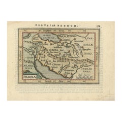
Antique map titled 'Persia sive Sophorum Regnum'. Original old map of Persia. The map extends from the Eastern Mediteranian to Tacalistan and the Indus River and the Dalanguer Mounta...
Category

Mid-17th Century Antique Benelux - Collectibles and Curiosities

Materials

Paper

Modernist Architectural Model in Stained Plywood 1950s
Located in Meer, VAN
Modernist Architectural Model in Stained Plywood, presumably Dutch, 1950s. This highly tasteful 1950s Modernist architectural model is well crafted in stained plywood and solid wood...
Category

Mid-20th Century European Mid-Century Modern Benelux - Collectibles and Curiosities

Materials

Wood

Antique Map of Venezuela by Montanus, 1671
By Arnoldus Montanus
Located in Langweer, NL
Antique map titled 'Venezuela cum parte Australi Novae Andalusiae'. The map extends from Coquibocoa to the Orinoque River, centered on Bariquicemento and Cape de Curiacao. Large cart...
Category

Mid-17th Century English Antique Benelux - Collectibles and Curiosities

Materials

Paper

Grossé Silver bracelet, 1973
By Grosse
Located in Delft, NL
Grossé Silver bracelet, 1973 A Grossé bracelet with lock chain pattern. 1 charm lock between the closure of the bracelet. If you look at the pattern "lock" you will see the letter...
Category

20th Century German Benelux - Collectibles and Curiosities

Materials

Silver

Antique Map of the Turkish Empire and Persia, circa 1890
By J. Migeon
Located in Langweer, NL
Antique map Turkish Emprie titled 'Turquie d'Asie et Perse'. Beautiful map depicting the Turkish Empire and Persia. With vignette depicting Damascus. This map originates from 'Nouvel...
Category

19th Century Antique Benelux - Collectibles and Curiosities

Materials

Paper

1908 Burlington Arts Club Catalogue: Faience of Persia & Near East, 27 Plates
Located in Langweer, NL
Burlington Fine Arts Club: Exhibition of the Faience of Persia and the Nearer East. Published: London, 1908 Printed by Chiswick Press This exquisite and rare folio volume showca...
Category

Early 1900s Antique Benelux - Collectibles and Curiosities

Materials

Paper

Large Antique Map of Guadeloupe and Antigua with Adjacent Isles, 19th Century
Located in Langweer, NL
Title: "Antique Map of Guadeloupe and Antigua with Adjacent Isles, 19th Century" Source: New General Atlas (circa 1817), published in Edinburgh Description: This detailed antique m...
Category

Early 19th Century Antique Benelux - Collectibles and Curiosities

Materials

Paper

Pl. 89 Antique Print of Decorative Art in the 18th Century by Racinet, 1869
Located in Langweer, NL
Old print of decorative art in the 18th century. This print originates from 'L'Ornement polychrome'. A beautiful work containing about 2000 patterns of all the styles of Art old and ...
Category

19th Century Antique Benelux - Collectibles and Curiosities

Materials

Paper

Mapping the Heart of France: Willem Blaeu's 17th Century Île-de-France, ca.1650
Located in Langweer, NL
This original antique map titled "Le Gouvernement de l'Isle de France" represents the Île-de-France region, which historically was one of the provinces of France and contained the ci...
Category

1650s Antique Benelux - Collectibles and Curiosities

Materials

Paper

Antique Print of Egyptian Objects, 1773
Located in Langweer, NL
Untitled print depicting various Egyptian objects including statues. Originates from the first Dutch editon of an interesting travel account of Northern Africa titled 'Reizen en Aanm...
Category

18th Century Antique Benelux - Collectibles and Curiosities

Materials

Paper

Religious icon with three chosen Saints, ca. 1700
Located in Gorssel, GE
Rare icon with three chosen Saints most likely the patron saints of a family consisting of a father, a mother and a son. The inscriptions which could identify the saints are gone but most likely the depicted saints from left to right are: Saint George, Saint Dimitri and Saint Paraskeva. In the background we see the icon of the Old Testament Trinity; the three angels visiting Abraham and Sarah...
Category

Late 17th Century Russian Antique Benelux - Collectibles and Curiosities

Materials

Wood

Antique Print with Coastal Views of Kamchatka in The Russian Far East, c.1784
Located in Langweer, NL
Antique print titled 'Views of the Coast of Kamtschatka (..)'. Print with coastal views of Kamchatka including volcanoes. Originates from an edition of Cook's Voyages. Artists and ...
Category

18th Century Antique Benelux - Collectibles and Curiosities

Materials

Paper

Tobacco/Snuff Box In Carved Boxwood, 18th Century
Located in Bilzen, BE
Carved boxwood snuffbox Very beautiful old patina. Finely carved with religious scene Period 18th century. 5 x 9.3 cm, height 2.7 cm
Category

18th Century French Folk Art Antique Benelux - Collectibles and Curiosities

Materials

Boxwood

Map of The East Indies with the Route of Capt. William Dampier's Voyage, 1698
Located in Langweer, NL
Antique map titled 'Kaart van Oost Indie'. Old map of the East Indies. It shows the routes of Captain William Dampier's voyage throughout the regio...
Category

1690s Antique Benelux - Collectibles and Curiosities

Materials

Paper

Antique Map of Warwickshire in England by Speed, c.1614
Located in Langweer, NL
Antique map titled 'The Counti of Warwick the Shire Towne and Citie of Coventre described'. Map of Warwickshire, England. Includes inset town plans of Warwic...
Category

17th Century Antique Benelux - Collectibles and Curiosities

Materials

Paper

Set of Two Early 20th Century Large Dutch Marine Red White and Blue Metal Buoys
Located in Haarlem, NL
Set of two very decorative handmade and hand painted antique large early 1920s Dutch marine metal buoys. They are diamond or biconical shaped, and painted i...
Category

Early 20th Century Dutch Benelux - Collectibles and Curiosities

Materials

Iron, Metal

Old Print of Ascension Island with Ships, a Whale and Flying Fish, 1601
Located in Langweer, NL
Antique print, titled: 'Vera effigies et delineato Insulae Ascenstio …' - Bird's eye view of Ascension Island. Five large sailing ships in the background and flying fish and waterfowl in the foreground. On the rear an image of four ships sailing towards a whale, accompanied by fowl, flying fish and dolphins. From 'Indiae Orientalis', 1598-1604. Artists and Engravers: Made by an anonymous engraver after 'Jean Theodore de Bry...
Category

Early 1600s Antique Benelux - Collectibles and Curiosities

Materials

Paper

Bible, Biblia Sacra, Utrecht, Cornelius Guillielmus Le Febvre, 1732
Located in Delft, NL
Bible,, Biblia Sacra, dat is, de H. Schriftuer van het Oude, en het Nieuwe Testament, Naar de laetste Roomsche Keure der gemeine Latijnsche Overzettinge, in nederduitsch Vertaeld, me...
Category

18th Century Dutch Antique Benelux - Collectibles and Curiosities

Materials

Leather, Paper

Art Deco Bronze Religious Art Wall Plaque in Relief Depicts Suffering of Christ
By Sylvain Norga
Located in Lisse, NL
Impressive bronze plaque with a marvelous patina, by S. Norga. Most (young) people won't realize, but in order to spiritually and mentally grow in life, some hardship is actually...
Category

1910s Belgian Art Deco Vintage Benelux - Collectibles and Curiosities

Materials

Bronze

Moullart-Sanson Map of the Holy Land and Sacred Geography of the Old Testament
Located in Langweer, NL
"1716 Moullart-Sanson Map of the Holy Land and Sacred Geography of the Old Testament" This engraved map, created by Pierre Moullart-Sanson and reissued by Robert de Vaugondy in 1740...
Category

1710s Antique Benelux - Collectibles and Curiosities

Materials

Paper

Early Woodcut Bird's Eye View of Rouffach, France, by Sebastian Münster, 1554
Located in Langweer, NL
Early Woodcut Bird's Eye View of Rouffach, France, by Sebastian Münster, 1554 Description: This rare 1554 woodcut is a bird's eye view of Rouffach, a town in the Haut-Rhin departmen...
Category

16th Century Antique Benelux - Collectibles and Curiosities

Materials

Paper

Barbados Island at the Height of the Plantation Economy, Circa 1759
Located in Langweer, NL
Carte de l'Isle de la Barbade by Jacques-Nicolas Bellin (1703–1772), Circa 1759 This rare antique map of Barbados, titled Carte de l'Isle de la Barbad...
Category

1750s Antique Benelux - Collectibles and Curiosities

Materials

Paper

Hand-Colored Map of West India Islands: St. Christopher's, St. Lucia and Nevis
Located in Langweer, NL
This map, titled "West India Islands," was published by John Thomson & Co. in 1821 as part of *Thomson's New General Atlas.* The map offers detailed depictions of three key islands i...
Category

1820s Antique Benelux - Collectibles and Curiosities

Materials

Paper

Large 1695 Hand-Colored Engraved Map of Gascony (Gascogna), France
Located in Langweer, NL
This map, created by Giacomo Cantelli da Vignola in 1695, represents the "General Government of Guyenne and Gascony" in southwest France. Cantelli da Vignola was a renowned Italian c...
Category

1690s Antique Benelux - Collectibles and Curiosities

Materials

Paper

Rare 1681 Map of Batavia: Detailed Dutch Colonial Era Cartography, 1681
Located in Langweer, NL
The map of Batavia (modern-day Jakarta) from 1681, attributed to Frederick de Wit holds significant historical importance for several reasons: Historical Context 1. Colonial Era: This map dates back to the Dutch colonial era when Batavia served as the administrative and commercial hub of the Dutch East India Company (VOC). The VOC was a powerful trading entity that played a crucial role in the global spice trade and colonization in Southeast Asia. 2. Strategic Importance: Batavia was strategically located on the northwestern coast of Java, providing the Dutch with a critical base for their maritime operations. The city became the center of Dutch political and military control in the region. Cartographic Significance 1. Detailed Urban Layout: The map meticulously details the layout of Batavia, including its fortifications, canals, streets, and significant buildings. This level of detail provides insights into the urban planning and architectural styles of the period. 2. Military Engineering: The fortifications shown on the map illustrate the advanced military engineering techniques used by the Dutch to protect their valuable colony. The walls, bastions, and moats indicate the strategic considerations taken to defend against potential invasions. 3. Maritime Activity: The depiction of ships in the harbor highlights Batavia's role as a major maritime center. The VOC's fleets were essential for trade routes connecting Europe, Africa, and Asia, making Batavia a crucial node in global commerce. Artistic and Cultural Value 1. Artistic Elements: The decorative elements, such as the lion holding a shield and the intricate cartouches, reflect the artistic trends of Dutch Golden Age cartography. These embellishments were not only informative but also served to display the cartographer's skill and the map's prestige. 2. Cultural Exchange: Maps like this one provide evidence of cultural exchange between the Dutch and the indigenous populations of Java. The blending of Dutch and local influences can be seen in various aspects of the map and the architecture of the city. Rarity and Preservation 1. Rarity: Maps from the 17th century, especially those in good condition, are relatively rare and highly valued by collectors and historians. Each map provides a unique snapshot of historical geography and urban development. 2. Preservation of History: This map serves as a historical document, preserving knowledge about Batavia's cityscape, infrastructure, and colonial governance. It helps historians and scholars understand the socio-economic and political dynamics of the period. Conclusion The map of Batavia from 1681 is special due to its detailed depiction of one of the most important colonial cities in Southeast Asia during the Dutch Golden Age. It reflects the strategic, economic, and cultural significance of Batavia, serving as a valuable resource for understanding the history of Dutch colonialism and its global impact. The map's artistry and precision make it an important artifact in the history of cartography. --------------- The map is an original and historical map of Batavia (present-day Jakarta) on the island of Java, dated 1681. There are several details to consider when evaluating its origins and possible authorship: 1. **Style and Detail**: The intricate details and style are reminiscent of maps created by Frederick de Wit, a prominent Dutch cartographer and engraver of the 17th century. He was known for his detailed city maps and sea charts. 2. **Lack of Signature**: The absence of "F. de Wit, Excudit" could indicate either an omission or a different engraver. However, it is essential to note that some maps from that period were reproduced or copied by other engravers and cartographers. This was not uncommon, as map-making was a collaborative effort, and copies of popular maps were frequently made. 3. **Map Characteristics**: - The depiction of ships and the detailed fortifications are typical of Dutch cartography in the late 17th century. - The decorative elements, such as the lion holding a shield, are also characteristic of Dutch map engravers. 4. **Other Possible Engravers**: While Frederick de Wit is a strong candidate, other notable Dutch engravers from that period include Joan Blaeu and Willem Janszoon Blaeu. They also produced highly detailed maps and could potentially be the creators or inspirers of this map. To determine the precise authorship, you might consider: - **Comparing** this map with other confirmed works of Frederick de Wit and his contemporaries to identify stylistic similarities and differences. - **Historical Records**: Consulting historical records or publications related to Dutch cartography in the 17th century might provide more context or even direct references to this particular map. If you have access to additional details or higher-resolution images of specific sections, it might help further pinpoint the map's origin and authorship. ------------- Frederick de Wit (1629–1706) was a prominent Dutch cartographer, engraver, and publisher known for his detailed and decorative maps, atlases, and globes. He played a significant role in the Dutch Golden Age of cartography, contributing to the wealth of geographic knowledge and artistic achievement during this period. Here are key aspects of his life and work: ### Biography - **Early Life**: Frederick de Wit was born in Gouda, Netherlands, in 1629. Little is known about his early years, but he moved to Amsterdam, the epicenter of Dutch cartography, in the mid-17th century. - **Career Beginnings**: De Wit began his career as an engraver and publisher, initially producing maps that were reissues of earlier works by other cartographers, such as Joan Blaeu and Willem Janszoon Blaeu. ### Contributions to Cartography - **Mapmaking**: De Wit was known for his meticulous attention to detail and artistic flair. He produced a wide range of maps, including world maps, regional maps, city plans, and maritime charts...
Category

1680s Antique Benelux - Collectibles and Curiosities

Materials

Paper

Art Deco small vanity guilloche dressing table set, 1920
Located in Delft, NL
Art Deco small vanity guilloche dressing table set, 1920 A fantastic collector's item, possible for doll enthusiasts from the early period of the 20th century. An Art Deco vanity set...
Category

Early 20th Century European Benelux - Collectibles and Curiosities

Materials

Silver Plate

Antique Map of the City of Madrid by Balbi '1847'
Located in Langweer, NL
Antique map titled 'Madrid'. Original antique map of the city of Madrid, Spain. This map originates from 'Abrégé de Géographie (..)' by Adrien Balbi. Published 1847.
Category

Mid-19th Century Antique Benelux - Collectibles and Curiosities

Materials

Paper

Antique French Map of Hungary with Decorative Title Cartouche, c.1730
Located in Langweer, NL
Antique map titled 'La Hongrie suivant les Nouvelles Observations (..)'. Antique map of Hungary with decorative title cartouche. Artists and Engravers: ...
Category

18th Century Antique Benelux - Collectibles and Curiosities

Materials

Paper

Antique 18th Century Diptych Portable Sundial And Compass by Beringer
By David Beringer
Located in Bilzen, BE
Antique 18th Century Diptych Sundial and Compass a portable wooden sundial with compass, of German origin, by David Beringer, Nuremberg, dating back to the 1780 circa, in good age re...
Category

Late 18th Century German Louis XVI Antique Benelux - Collectibles and Curiosities

Materials

Metal

Read More

Medal-Worthy Memorabilia from Epic Past Olympic Games

Get into the games! These items celebrate the events, athletes, host countries and sporting spirit.

Ahoy! You’ve Never Seen a Collection of Sailor Art and Kitsch Quite Like This

French trendsetter and serial collector Daniel Rozensztroch tells us about his obsession with objects related to seafaring men.

Pamela Shamshiri Shares the Secrets behind Her First-Ever Book and Its Effortlessly Cool Interiors

The sought-after designer worked with the team at Hoffman Creative to produce a monograph that beautifully showcases some of Studio Shamshiri's most inspiring projects.

Moroccan Artworks and Objects Take Center Stage in an Extraordinary Villa in Tangier

Italian writer and collector Umberto Pasti opens the doors to his remarkable cave of wonders in North Africa.

Montecito Has Drawn Royalty and Celebrities, and These Homes Are Proof of Its Allure

Hollywood A-listers, ex-pat aristocrats and art collectors and style setters of all stripes appreciate the allure of the coastal California hamlet — much on our minds after recent winter floods.

Whaam! Blam! Pow! — a New Book on Pop Art Packs a Punch

Publishing house Assouline and writer Julie Belcove have teamed up to trace the history of the genre, from Roy Lichtenstein, Andy Warhol and Yayoi Kusama to Mickalene Thomas and Jeff Koons.

The Sparkling Legacy of Tiffany & Co. Explained, One Jewel at a Time

A gorgeous new book celebrates — and memorializes — the iconic jeweler’s rich heritage.

What Makes a Gem-Encrusted Chess Set Worth $4 Million?

The world’s most opulent chess set, weighing in at 513 carats, is literally fit for a king and queen.
Recently Viewed

View All