Benelux Maps
to
4,195
5,133
5,518
200
5,132
1
1
2,838
1,982
312
1
180
8
68
3
3
3
1
2
5,123
10
8
2
2
440
178
92
79
51
5,133
5,133
5,133
104
58
20
14
13
Item Ships From: Benelux
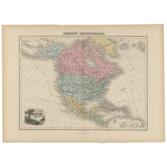
Antique Map of North and Central America by Migeon '1880'
By J. Migeon
Located in Langweer, NL
Antique map titled 'Amérique Septentrionale'. Old map of North and Central America. With a decorative vignette of the Niagara Falls. This map originates from 'Géographie Universelle ...
Category
Late 19th Century French Antique Benelux Maps
Materials
Paper
$142 Sale Price
20% Off
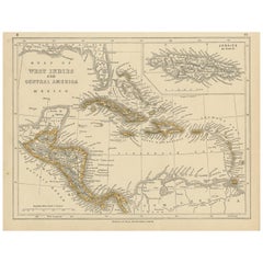
Antique Map of the West Indies and Central America by Lowry '1852'
Located in Langweer, NL
Antique map titled 'West Indies and Central America'. Original map of the West Indies and Central America. This map originates from 'Lowry's Table Atlas constructed and engraved from...
Category
Mid-19th Century Antique Benelux Maps
Materials
Paper
$95 Sale Price
20% Off
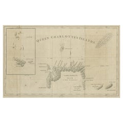
Map of Queen Charlotte's, Carteret's, Simson's and Gower's Islands, Canada, 1773
Located in Langweer, NL
Antique map Canada titled 'Queen Charlotte's Islands'.
Old map of Queen Charlotte's Islands, Canada. With an inset map of Carteret's, Simson's a...
Category
1770s Antique Benelux Maps
Materials
Paper
$323 Sale Price
20% Off
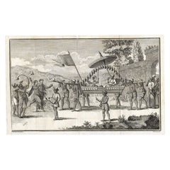
Old Print of an Indian Nobleman and Noblewoman in a Sedan Chair, 1782
Located in Langweer, NL
Untitled print of an Indian nobleman and noblewoman in a sedan chair. This print originates from: 'Voyage aux Indes Orientales et a la Chine (..)', by Pierre Sonnerat, published in Paris in 1782.
Artists and Engravers: Pierre M. Sonnerat (1745-1814) was a French naturalist...
Category
1780s Antique Benelux Maps
Materials
Paper
$304 Sale Price
20% Off
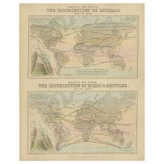
Antique Zoological Map, 1843
Located in Langweer, NL
Two antique world maps on one sheet. The upper map shows the distribution of animals over the world. The lower map shows the distribution of birds & reptiles over the world. Originat...
Category
19th Century Antique Benelux Maps
Materials
Paper
$209 Sale Price
20% Off
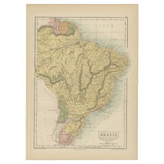
Antique Map of Brazil, Uruguay, Paraguay and Guyana by A & C. Black, 1870
Located in Langweer, NL
Antique map titled 'Brazil'. Original antique map of Brazil, Uruguay, Paraguay and Guyana. This map originates from ‘Black's General Atlas of The...
Category
Late 19th Century Antique Benelux Maps
Materials
Paper
$166 Sale Price
20% Off
Antique Woodblock Print Map of Japan 'circa 1860'
Located in Langweer, NL
Original Japanese woodblock print map of Japan. Very large and fascinating map, rebacking with Japanese paper. Published circa 1860.
Category
Late 19th Century Antique Benelux Maps
Materials
Paper
$2,229 Sale Price
25% Off
Original Antique Map of Tartary 'Northern China & Far Eastern Russia', 1757
Located in Langweer, NL
Antique map titled 'Carte de la Tartarie Orientale (..)'.
Original antique map of what is present day northern China and far eastern Russia. Centere...
Category
1750s Antique Benelux Maps
Materials
Paper
$275 Sale Price
20% Off
Map of Avenches Region Switzerland by Mercator, Original 1585 Engraving
Located in Langweer, NL
Map of Wiflispurgergov by Gerardus Mercator, Avenches Region, 1585
This rare and finely engraved map, titled *Das Wiflispurgergov*, was produced by Gerardus Mercator and published i...
Category
16th Century Dutch Antique Benelux Maps
Materials
Paper
Antique Print of the Main Facade of Castle Hill, Dorsetshire, England c.1770
Located in Langweer, NL
Antique print titled 'Principal Front of Castle Hill in Dorsetshire (..)'.
Lambert's Castle Hill (258 metres, 846 feet high) rises between the villages...
Category
18th Century Antique Benelux Maps
Materials
Paper
$532 Sale Price
20% Off
1738 Map of the Philippines & Eastern Indonesia: Spice Islands by Tirion
Located in Langweer, NL
1738 Map of the Philippines & Eastern Indonesia: Spice Islands by Tirion/Albrizzi
This beautifully hand-colored map from circa 1738, created by Tirion and Albrizzi, showcases the Philippines and the eastern part of Indonesia, reflecting the Dutch colonial interests in the region.
The map features a detailed representation of the numerous islands, including the renowned Spice or Banda Islands, pivotal to the Dutch spice trade.
Key regions include the Philippines (Isole Filippine), the Mariana Islands (Ladrones), with Guam, the Caroline and Palau Islands (Nieuwe Fillippynsche Eilenden), the Moluccas (Moluccos) known as the Spice Islands, the eastern tip of Java and Borneo, and a portion of Papua New Guinea.
Measuring 12.8 inches wide by 11.1 inches high, the map is in excellent condition with a crisp impression, slight foxing, and minor printer's creases, printed on a bright sheet with a lion watermark.
Keywords:
- Philippines historical map
- Eastern Indonesia map...
Category
1730s Antique Benelux Maps
Materials
Paper
Antique Map of the Region of Languedoc, Foix, Roussillon and Rouergue by Zatta
By Antonio Zatta
Located in Langweer, NL
Antique map titled 'Li Governi di Linguadoca, di Foix e di Rossiglione con il Rouergue'. Old map of France showing the regions of Languedoc, Foix, Roussillon and Rouergue. This map o...
Category
18th Century Antique Benelux Maps
Materials
Paper
Antique Hand-Colored County Map of Rutland, England, 1804
Located in Langweer, NL
Antique county map of Rutland first published c.1800. Villages, towns, and cities illustrated include Oakham, Uppingham, and Normanton.
Charles ...
Category
Early 1800s Antique Benelux Maps
Materials
Paper
$309 Sale Price
20% Off
Map of French Guiana: 19th Century Atlas National Depiction of Guyane Française
Located in Langweer, NL
The map is titled "Guyane Française" (French Guiana) and is part of the Atlas National series. Here are the key details:
Features:
- The map focuses on French Guiana, a French overs...
Category
1890s Antique Benelux Maps
Materials
Paper
$114 Sale Price
20% Off
Antique Map of North America by Johnson, '1872'
Located in Langweer, NL
Antique map titled 'Johnson's North America'. Original map of North America, with an inset map of the Hawaiian group or Sandwich Islands. This map originates from 'Johnson's New Illu...
Category
Late 19th Century Antique Benelux Maps
Materials
Paper
$380 Sale Price
20% Off
Antique Print of a Greece Island, Most Likely Gavdopoula South of Crete, 1688
Located in Langweer, NL
Description: Untitled print of one of the islands of Greece, most likely Gavdopoula (located south of Crete).
Gavdopoula is an islet located north-west of its larger neighbour, G...
Category
1680s Antique Benelux Maps
Materials
Paper
$333 Sale Price
20% Off
Antique Miniature Map of Java by Bertius/Hondius '1618'
Located in Langweer, NL
Rare antique miniature map titled 'Iava Maior'. This map shows the northern coastline of Java (Indonesia) with numerous place names, but the southern coa...
Category
Early 17th Century Antique Benelux Maps
Materials
Paper
$523 Sale Price
20% Off
Old Map of the French Department of Eure-et-loir, France
By Victor Levasseur
Located in Langweer, NL
Antique map titled 'Dépt. d'Eure et Loir'. Map of the French department of Eure-et-Loir, France. This area is home to the famous Chartres Cathedral....
Category
Mid-19th Century Antique Benelux Maps
Materials
Paper
$323 Sale Price
20% Off
Antique Map of the Philippines, Taiwan and Surroundings by Bonne '1780'
Located in Langweer, NL
Antique map titled 'Les Isles Philippines, celle de Formose, le Sud de la Chine, les Royaumes de Tunkin, de Cochinchine, de Cambode, de Siam des Laos, avec partie de Pegu et D'Ava'. ...
Category
Late 18th Century Antique Benelux Maps
Materials
Paper
$428 Sale Price
20% Off
Antique Map of France at the end of the Reign of Louis the Great by Zannoni 1765
By G. A. Rizzi-zannoni
Located in Langweer, NL
Antique map France titled 'Etat de la France à la fin du Règne de Louis le Grand (..)'. Beautiful old map of France. This map originates from 'Atlas Historique de la France Ancienne ...
Category
18th Century Antique Benelux Maps
Materials
Paper
$171 Sale Price
20% Off
Antique Map of the Province of Groningen in the Netherlands, c.1700
Located in Langweer, NL
Antique map titled 'Groningae et Omlandiae Dominium vulgo de Provincie van Stadt en Lande'.
Old map of the province of Groningen, the Netherlands. This map originates from 'Atlas C...
Category
18th Century Antique Benelux Maps
Materials
Paper
$808 Sale Price
20% Off
Antique Map of London Showing the Area from Essex to Surrey, England, 1741
Located in Langweer, NL
Antique map titled 'Regionis quae est circa Londinum specialis repraesentatio (..)'
Very detailed map showing the area from Essex to Surrey and shows a lovely view of London with a high level of detail, stretching from Old London Bridge...
Category
18th Century Antique Benelux Maps
Materials
Paper
$1,379 Sale Price
20% Off
Atlantic Eden: The Azores and Madeira Archipelagos in 1903
Located in Langweer, NL
This original antique print is a historical map titled "PORTUGAL INSULAR," which translates to "Insular Portugal." It shows the Portuguese archipelagos of the Azores and Madeira, wit...
Category
Early 1900s Antique Benelux Maps
Materials
Paper
$323 Sale Price
20% Off
Antique Map of Asia by Wyld '1845'
Located in Langweer, NL
Antique map titled 'Asia'. Original antique map of Asia. This map originates from 'An Atlas of the World, Comprehending Separate Maps of its Variou...
Category
Mid-19th Century Antique Benelux Maps
Materials
Paper
$190 Sale Price
20% Off
Map of Tartary by Isaak Tirion: Detailed Cartography of Northern Asia, ca.1740
Located in Langweer, NL
This is an antique map titled "Nieuwe Kaart van Tartarie," which translates to "New Map of Tartary." The map was created by Isaak Tirion, a prominent Dutch cartographer and publisher...
Category
1740s Antique Benelux Maps
Materials
Paper
$627 Sale Price
20% Off
Mercator's Ptolemaic map of Taprobana, (Ceylon) Sri Lanka
Located in Langweer, NL
Antique map titled 'Asiae XII Tab'. Mercator's Ptolemaic map of Taprobana. The map shows Ptolemy's erroneous location of the island of Sri Lanka near the equator, with a bit of India...
Category
16th Century Antique Benelux Maps
Materials
Paper
$551 Sale Price
20% Off
Antique Map of the Maluku Islands by Blaeu, c.1640
Located in Langweer, NL
Antique map titled 'Moluccae Insulae Celeberrimae'. Decorative map of the Maluku Islands, also known as the Moluccas or the Spice Islands. Inset of the island of Bachian (Batjan) in ...
Category
17th Century Antique Benelux Maps
Materials
Paper
$1,284 Sale Price
20% Off
Map of Ireland: Early 19th Century - from the 1802 Tardieu Atlas
Located in Langweer, NL
Antique Map Description
**Title:** Carte d'Irlande
**Publication Details:**
- **Atlas Title:** Nouvel Atlas Universel de Géographie Ancienne et Moderne
- **Purpose:** For the Nouve...
Category
Early 1800s Antique Benelux Maps
Materials
Paper
$418 Sale Price
20% Off
Antique Print of a Garden Building from Garden Architecture by Van Laar, 1802
Located in Langweer, NL
Untitled print of garden architecture. It shows garden buildings. This print originates from 'Magazijn van tuin-sieraden'. The book is compiled by Gijs...
Category
19th Century Antique Benelux Maps
Materials
Paper
Territories of Antiquity: The Northern Division of Syria, A Detailed 1882 Map
Located in Langweer, NL
This 19th-century map from the atlas published by Blackie and Son in 1882 is titled "SYRIA (NORTH DIVISION)" and covers the northern part of Syria, capturing its geographical and adm...
Category
1880s English Antique Benelux Maps
Materials
Paper
$266 Sale Price
20% Off
Antique Map of Haut-Rhin, France by V. Levasseur, 1854
By Victor Levasseur
Located in Langweer, NL
Antique map titled 'Dépt. du Haut Rhin'. Map of the French department of Haut-Rhin, France. This mountainous area is part of the Alsace wine region and is known for its production of...
Category
Mid-19th Century Antique Benelux Maps
Materials
Paper
$142 Sale Price
20% Off
Rare Antique Map of the Middle East, ca.1690
Located in Langweer, NL
Description: Antique print, untitled.
Two decorative maps on one sheet of the middle east in biblical times. Source unknown, to be determined.
Artists and Engravers: Anonymous...
Category
1690s Antique Benelux Maps
Materials
Paper
$342 Sale Price
20% Off
Map of South America 1792 by Elwe – Hand-Colored Antique Dutch Engraving
By J.B. Elwe
Located in Langweer, NL
Map of South America 1792 by Elwe – Hand-Colored Antique Dutch Engraving
This striking antique map of South America, titled "L'Amerique Meridionale," was published in 1792 by the Du...
Category
Late 18th Century European Antique Benelux Maps
Materials
Paper
18th Century Cartographic Depiction of Upper India and Ceylon, 1835
Located in Langweer, NL
An exquisite set of two maps, 'Carte de la Partie Superieure De L'Inde en de Cadu Gange,' masterfully crafted by the renowned 18th-century French cartographer, Charles Marie Rigobert...
Category
1830s Antique Benelux Maps
Materials
Paper
$418 Sale Price
20% Off
Antique Map of the Holy Land Described in the Old and New Testament, ca.1660
Located in Langweer, NL
Antique map titled 'Geographiae Sacrae ex Veteri et Novo Testamento Desumptae Tabula Prima quae Totius Orbis Partes Continet.'
Map of the lands described in the Old and New Testame...
Category
1660s Antique Benelux Maps
Materials
Paper
$808 Sale Price
20% Off
Original Antique Map of the Cape Verde Islands, 1746
Located in Langweer, NL
Antique map titled 'Carte Des Isles Du Cap Verd.' Original antique map of the Cape Verde Islands. Decorative cartouche and compass rose. Extends from Isle d...
Category
18th Century Antique Benelux Maps
Materials
Paper
$161 Sale Price
20% Off
Extremely Scarce Antique Map of The Island of Borneo, Indonesia, c. 1725
Located in Langweer, NL
Antique map titled 'L'Ile de Borneo Suivant les memoires des plus Celebres Navigateurs.'
A detailed map of the island Borneo, with a small part of Celebes visible. This plate origi...
Category
18th Century Antique Benelux Maps
Materials
Paper
$808 Sale Price
20% Off
Wainflete’s School and Tomb of Richard Patten – Antique Engraving, 1790
Located in Langweer, NL
Wainflete’s School and Tomb of Richard Patten – Antique Engraving, 1790
This detailed antique engraving presents architectural and commemorative elements associated with William of ...
Category
18th Century English Antique Benelux Maps
Materials
Paper
Antique Map of the Kingdom of Poland by Keizer & de Lat, 1788
Located in Langweer, NL
Antique map titled 't Koninkryk Polen (..)'. Uncommon original antique map of the Kingdom of Poland. This map originates from 'Nieuwe Natuur- Geschied- en Handelkundige Zak- en Reisa...
Category
Late 18th Century Antique Benelux Maps
Materials
Paper
$333 Sale Price
20% Off
Antique Map of Khwarezm, Turkestan and Great Bukhara by Bellin, '1749'
Located in Langweer, NL
Antique map titled 'Carte de Karazm, Turkestan, et Grande Bukarie'. Original antique map of Khwarezm, Turkestan and Great Bukhara. Engraved by J.N. Bellin for 'Histoire Générale des ...
Category
Mid-18th Century Antique Benelux Maps
Materials
Paper
$190 Sale Price
20% Off
Architectural Building Design Print of Lycée Lakanal in France, Chabat, c.1900
Located in Langweer, NL
Antique print titled 'Lycée Lakanal a Sceaux (Seine) Mr. A. de Baudot Architecte'. This print depicts the design of a school in France. Originates from 'La Brique et La Terre Cuite' ...
Category
20th Century Benelux Maps
Materials
Paper
Colton's Map of Illinois, with an Inset of Chicago
Located in Langweer, NL
Antique map titled 'Colton's Illinois'. Antique map of Illinois, a state in the Midwestern United States. With an inset map of of Cook County &...
Category
Mid-19th Century Antique Benelux Maps
Materials
Paper
$228 Sale Price
20% Off
Antique Map of Germany During the Mid-18th Century, Published in 1747
Located in Langweer, NL
Antique map Germany titled 'A New & Accurate Map of Germany'. It covers Germany during the mid-18th century, which included all of modern day Germany, Austria, Switzerland, Czech Rep...
Category
18th Century Antique Benelux Maps
Materials
Paper
$199 Sale Price
20% Off
Detailed Map of New South Wales, Australia from 1833 by SDUK
Located in Langweer, NL
Detailed Map of New South Wales, Australia from 1833 by SDUK
This historical map of New South Wales, Australia, published in 1833 by the Society for the Diffusion of Useful Knowledg...
Category
1830s Antique Benelux Maps
Materials
Paper
$532 Sale Price
20% Off
Map of the East Coast of Hanshu or Honshu & a View of the Japanese Coast, 1803
Located in Langweer, NL
Antique map titled 'Gedeelte van Japan of Nipon'.
Map of the east coast of Hanshu, with a view of the Japanese coast titled 'Gezigt van de Kust van Japan, wanneer wij haar voor h...
Category
Early 1800s Antique Benelux Maps
Materials
Paper
$494 Sale Price
20% Off
Old Genealogy Chart of the Rulers of Margraviate Brandenburg in Germany, 1732
Located in Langweer, NL
Antique print titled 'Genealogie de la Maison de Brandebourg (..)'. Genealogy of the rulers of the Margraviate Brandenburg. This print orginates from 'Atlas Historique'.
The Margraviate of Brandenburg (German: Markgrafschaft Brandenburg) was a major principality of the Holy Roman Empire from 1157 to 1806 that played a pivotal role in the history of Germany and Central Europe. Brandenburg developed out of the Northern March founded in the territory of the Slavic Wends. It derived one of its names from this inheritance, the March of Brandenburg (Mark Brandenburg). Its ruling margraves were established as prestigious prince-electors in the Golden Bull...
Category
18th Century Antique Benelux Maps
Materials
Paper
$228 Sale Price
20% Off
Antique Map of Eastern Turkey, Caucasus, Israel through Iraq and part of Arabia
Located in Langweer, NL
Antique map titled 'Nieuwe Kaart van Irak Arabia, Kurdistan, Diarbek, Turkomannia, Syrie en het Heilige Land'. Beautiful map including eastern Turkey, the Caucasus, Israel through Ir...
Category
Mid-18th Century Antique Benelux Maps
Materials
Paper
$437 Sale Price
20% Off
Antique Map of The Province Noord-Holland in The Netherlands, 1864
Located in Langweer, NL
Antique map titled 'De Provincie Noord-Holland'. Map of the province of Noord-Holland, the Netherlands. This map originates from 'F. C. Brugsma's Atlas van het Koninkrijk der Nederla...
Category
19th Century Antique Benelux Maps
Materials
Paper
$114 Sale Price
20% Off
18th Century Map of Upper Guinea: Kingdoms and Coastal Regions of West Africa
Located in Langweer, NL
This is an antique map depicting the coastal regions of West Africa, specifically the Gulf of Guinea and surrounding areas, including parts of what is now Senegal, Guinea, Sierra Leo...
Category
1780s Antique Benelux Maps
Materials
Paper
$228 Sale Price
20% Off
Antique Map of Europe by W. G. Blackie, 1859
Located in Langweer, NL
Antique map titled 'Europe'. Original antique map of Europe. This map originates from ‘The Imperial Atlas of Modern Geography’. Published by W. G. Blackie, 1859.
Category
Mid-19th Century Antique Benelux Maps
Materials
Paper
$237 Sale Price
20% Off
Circa 1659 Willem Blaeu Map: Southwestern Switzerland with Geneva & Lakes
Located in Langweer, NL
Circa 1659 Willem Blaeu Map: Southwestern Switzerland with Geneva & Lakes
This detailed map from circa 1659 by Willem Blaeu, titled "Das Wiflispurgergow," highlights the southwestern region of Switzerland.
It features significant landmarks such as Geneva, Lake Geneva (Lacus Lemannus), Lake Neuchatel, Lake Biel, Bern, Freiburg, and Lake Thuner.
Based on the work of Gerard Mercator, this map is published with Spanish text on the verso, dating from the period between 1659 and 1672.
Measuring 19.9 inches wide by 15.1 inches high, the map is rendered in full contemporary color on a bright sheet that bears a large watermark of the god Atlas.
The condition is excellent, with a sharp impression, short centerfold separations at the top and bottom margins, and an archivally repaired tear in the right margin.
Keywords:
- Willem Blaeu map
- Gerard Mercator
- 17th-century Switzerland map...
Category
1650s Antique Benelux Maps
Materials
Paper
$1,179 Sale Price
20% Off
Chancel of Chartham Church, Kent – Gothic Architecture Engraving, 1790
Located in Langweer, NL
Chancel of Chartham Church, Kent – Gothic Architecture Engraving, 1790
This antique print presents a finely detailed architectural study of the chancel of Chartham Church in Kent, a...
Category
18th Century English Antique Benelux Maps
Materials
Paper
Antique Map of Douai 'France' by Braun & Hogenberg, circa 1575
Located in Langweer, NL
Beautiful map in excellent condition. This map depicts the city of Douai (France) and originates from 'Civitates Orbis Terrarum'.
Category
16th Century Antique Benelux Maps
Materials
Paper
Antique Map of Port Pallisers & Kersmis by Cook, c.1781
Located in Langweer, NL
Antique map Kerguelen titled 'Sketch of Port Palliser on Kerguelen's Land (..)'. Antique map of Port Pallisers & Kersmis, Kerguelen or Desolation Islands. Originates from an edition ...
Category
18th Century Antique Benelux Maps
Materials
Paper
$218 Sale Price
20% Off
Antique Map of Prussia by Janssonius, 1628
Located in Langweer, NL
Antique map titled 'Prussia'. Original antique map of Prussia, a historically prominent German state that originated in 1525 with a duchy centered on th...
Category
Mid-17th Century Antique Benelux Maps
Materials
Paper
$190 Sale Price
20% Off
Antique Map of the Region of Beauce in France by Janssonius, c.1650
Located in Langweer, NL
Antique map of France titled 'La Beauce'. Decorative map of the region of Beauce, a natural region in northern France, located between the Seine and Loire ri...
Category
17th Century Antique Benelux Maps
Materials
Paper
$390 Sale Price
20% Off
Antique Map of Tunis and Tripoli in Northern Africa, circa 1880
By J. Migeon
Located in Langweer, NL
Antique map titled 'Tunis et Tripoli & Empire de Maroc'. Old map of Tunis and Tripoli and the Empire of Morocco. This map originates from 'Géographie Universelle Atlas-Migeon' by J. ...
Category
19th Century Antique Benelux Maps
Materials
Paper
$152 Sale Price
20% Off
Antique Map of the Region of Paris by Homann Heirs, c.1720
By Homann Heirs
Located in Langweer, NL
Antique map titled 'Agri Parisiensis Tabula particularis, qua maxima Pars Insulae Franciae (..).' Incredibly detailed map showing everything from tiny villages to forests, farmland, ...
Category
18th Century Antique Benelux Maps
Materials
Paper
$190 Sale Price
20% Off
Neatly Framed Decorative Hand-Colored View of Zierikzee, the Netherlands, 1858
Located in Langweer, NL
Antique print titled 'Zierikzee'.
View of the city of Zierikzee, the Netherlands. This print originates from 'Het koningrijk der Nederlanden voorgesteld in eene reeks van 136 naa...
Category
1850s Antique Benelux Maps
Materials
Paper
$466 Sale Price
20% Off
Map of Tasmania with Illustrations of Local Fauna and Colonial Landmarks, 1851
Located in Langweer, NL
John Tallis & Company was renowned for their detailed and ornate maps during the 19th century. Their maps are distinguished by the intricate borders and vignettes that are as informa...
Category
1850s Antique Benelux Maps
Materials
Paper
$275 Sale Price
20% Off
Recently Viewed
View AllMore Ways To Browse
Greek Key Dresser
Green Glass Bud Vase Vintage
Gucci Tray
Half Moon Shelves
Handblown Glass Decanter
Heart Shaped Glass Dish
Hepplewhite Drop Leaf Table
Herend Cup
Hermes Dish
Horse Head Barware
Horse Mantel Clock
Large Limoges Platter
Michelangelo David Statue
Michelin Guide
Persian Khatam
Royal Worcester Aesthetic
Russell Woodard Aluminum
Russian Silver Niello
