Items Similar to Antique Map of the Region of Languedoc, Foix, Roussillon and Rouergue by Zatta
Want more images or videos?
Request additional images or videos from the seller
1 of 5
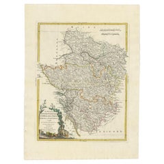
Antique Map of the Region of Languedoc, Foix, Roussillon and Rouergue by Zatta
About the Item
Antique map titled 'Li Governi di Linguadoca, di Foix e di Rossiglione con il Rouergue'. Old map of France showing the regions of Languedoc, Foix, Roussillon and Rouergue. This map originates from 'Atlante Novissimo, illustrato ed accresciuto sulle osservazioni, e scoperte fatte dai piu' celebri e piu' recenti geografi' by A. Zatta.
Artists and Engravers: Antonio Zatta (active 1757-1797) was the most prominent Italian map publisher of the late 18th and early 19th century. His firm, based in Venice, produced maps that mark an important transition from 18th to 19th century cartographic styles.
Condition: Very good, general age-related toning. Original/contemporary hand coloring. Please study image carefully.
Date: 1779
Overall size: 38 x 52.5 cm.
Image size: 32 x 40 cm.
We sell original antique maps to collectors, historians, educators and interior decorators all over the world. Our collection includes a wide range of authentic antique maps from the 16th to the 20th centuries. Buying and collecting antique maps is a tradition that goes back hundreds of years. Antique maps have proved a richly rewarding investment over the past decade, thanks to a growing appreciation of their unique historical appeal. Today the decorative qualities of antique maps are widely recognized by interior designers who appreciate their beauty and design flexibility. Depending on the individual map, presentation, and context, a rare or antique map can be modern, traditional, abstract, figurative, serious or whimsical. We offer a wide range of authentic antique maps for any budget.
- Creator:Antonio Zatta (Artist)
- Dimensions:Height: 20.67 in (52.5 cm)Width: 14.97 in (38 cm)Depth: 0 in (0.01 mm)
- Materials and Techniques:
- Period:
- Date of Manufacture:1779
- Condition:Condition: Very good, general age-related toning. Original/contemporary hand coloring. Please study image carefully.
- Seller Location:Langweer, NL
- Reference Number:
About the Seller
5.0
Platinum Seller
These expertly vetted sellers are 1stDibs' most experienced sellers and are rated highest by our customers.
Established in 2009
1stDibs seller since 2017
1,932 sales on 1stDibs
Typical response time: <1 hour
- ShippingRetrieving quote...Ships From: Langweer, Netherlands
- Return PolicyA return for this item may be initiated within 14 days of delivery.
More From This SellerView All
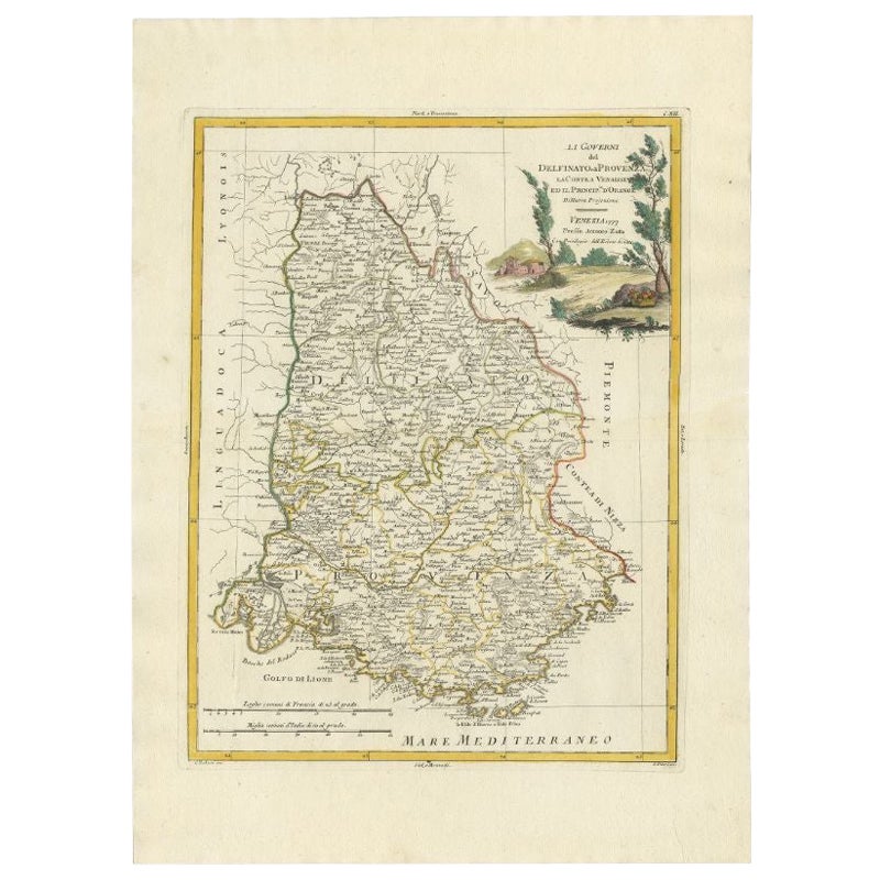
- Antique Map of the Region of Dauphiné by Zatta, 1779Located in Langweer, NLAntique map titled 'Li Governi del Delfinato e di Provenza la Contea Venaissin ed il Princie d'Orange'. Old map of France showing the province of Dauphiné. This map originates from '...Category
Antique 18th Century Maps
MaterialsPaper
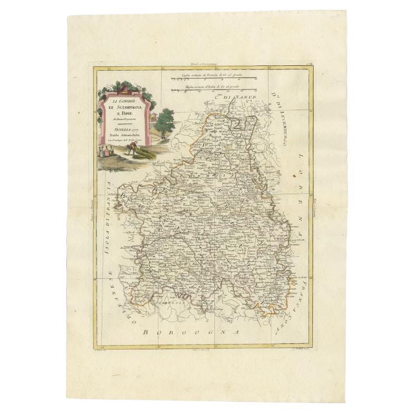
- Antique Map of the Region of Brie and Champagne by Zatta, 1779Located in Langweer, NLAntique map titled 'Li Governi di Sciampagna e Brie'. Old map of France showing the provinces of Brie and Champagne. This map originates from 'Atlante Novissimo, illustrato ed accres...Category
Antique 18th Century Maps
MaterialsPaper
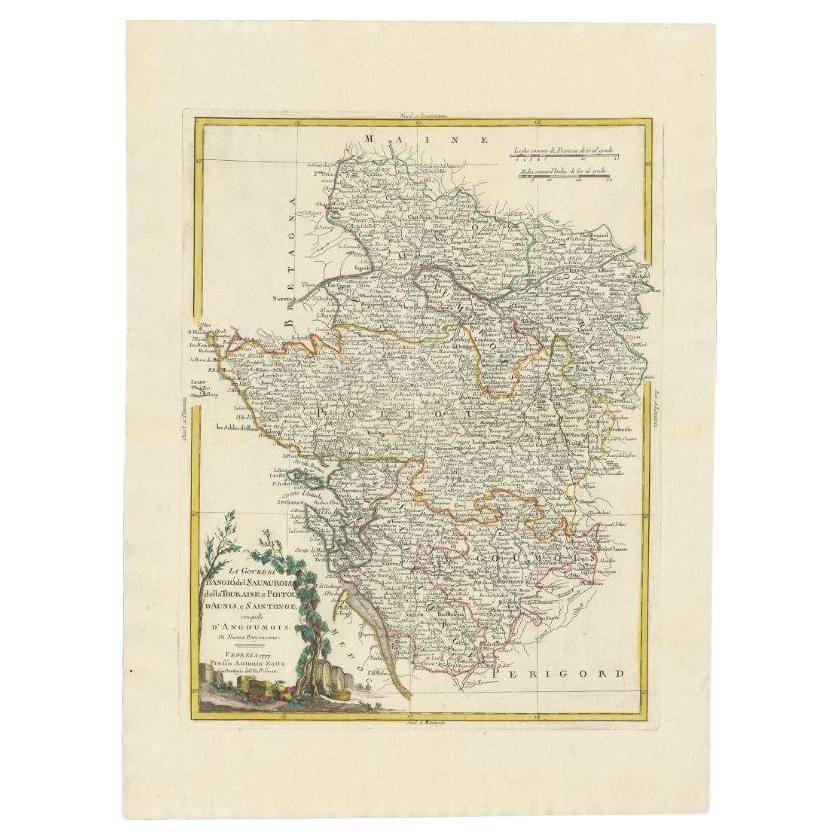
- Antique Map of the Region of Poitou and Saintonge by Zatta (1779)Located in Langweer, NLAntique map titled 'Li Governi d'Angio del Saumurois, della Touraine et Poitou d'Aunis et Saintonge'. Old map of France showing the provinces of Poitou and Saintonge with their adjac...Category
Antique 18th Century Maps
MaterialsPaper
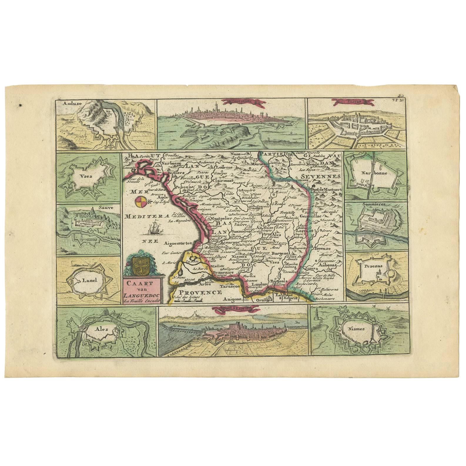
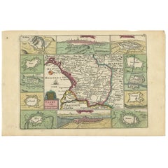
- Antique Map of the Languedoc Region 'France' by D. Weege, 1753Located in Langweer, NLAntique map titled 'Caart van Languedoc'. Map of the Languedoc-Rousillion region in Southern France. Flanked by miniature plans and views of cities of the region like Montpellier, N...Category
Antique Mid-18th Century Maps
MaterialsPaper
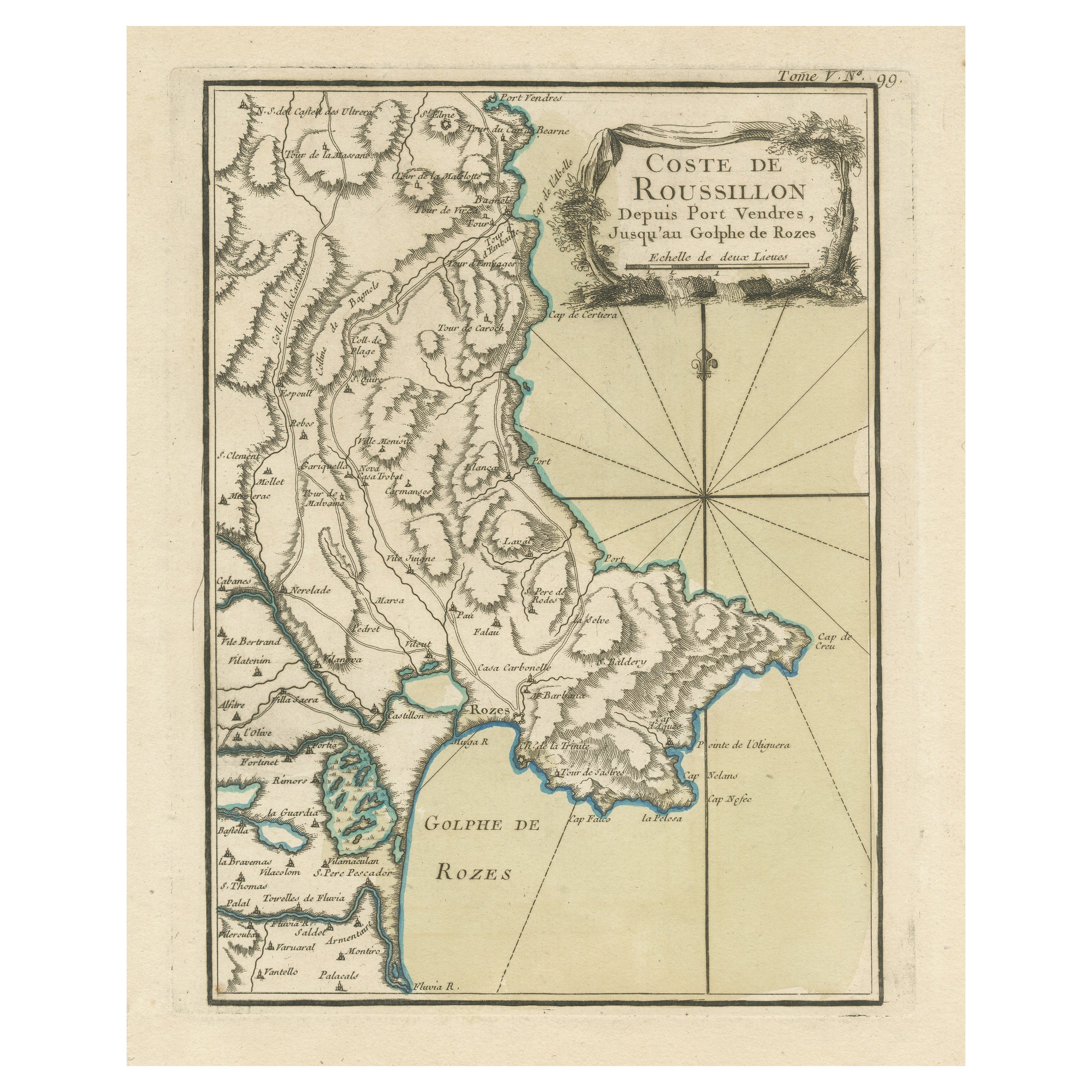
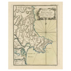
- Antique Map of the Coast of Roussillon, FranceLocated in Langweer, NLAntique map titled 'Coste de Roussillon depuis Port Vendres, jusqu'au golphe de Rozes'. Original map of the coast of Roussillon, France. This map originates from 'Le Petit Atlas Mari...Category
Antique Mid-18th Century Maps
MaterialsPaper
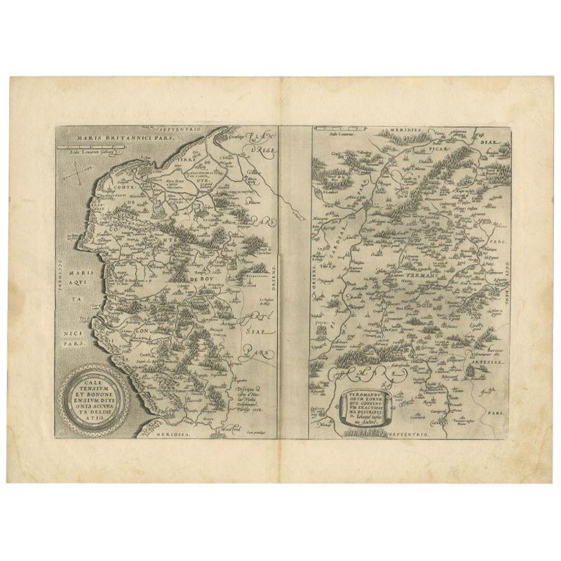
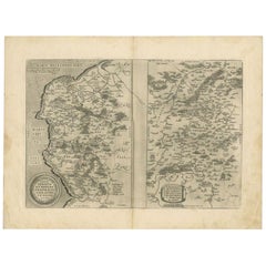
- Antique Map of the Region of Calais and The Vermandois Region by OrteliusLocated in Langweer, NLAntique map titled 'Caletensium et Bononiensium (..) - Veromandorum eorum que confinium (..)'. Two detailed regional maps by Ortelius. The first map shows Belgian and French Coastal ...Category
Antique 17th Century Maps
MaterialsPaper
You May Also Like
- The Normandy Region of France: A 17th C. Hand-colored Map by Sanson and JaillotBy Nicolas SansonLocated in Alamo, CAThis large hand-colored map entitled "Le Duché et Gouvernement de Normandie divisée en Haute et Basse Normandie en divers Pays; et par evêchez, avec le Gouvernement General du Havre ...Category
Antique 1690s French Maps
MaterialsPaper
- 1861 Topographical Map of the District of Columbia, by Boschke, Antique MapLocated in Colorado Springs, COPresented is an original map of Albert Boschke's extremely sought-after "Topographical Map of the District of Columbia Surveyed in the Years 1856 ...Category
Antique 1860s American Historical Memorabilia
MaterialsPaper
- 1594 Maurice Bouguereau Map of the Region Limoges, France, Ric0015Located in Norton, MA1594 Maurice Bouguereau map of the region Limoges, France, entitled "Totivs Lemovici et Confinium Pro Uinciarum Quantum ad Dioecefin Lemo Uicenfen Fpectant," Hand Colored Ric0015 Jean IV Le Clerc...Category
Antique 16th Century Dutch Maps
MaterialsPaper
- 17th Century Hand Colored Map of the Liege Region in Belgium by VisscherBy Nicolaes Visscher IILocated in Alamo, CAAn original 17th century map entitled "Leodiensis Episcopatus in omnes Subjacentes Provincias distincté divisusVisscher, Leodiensis Episcopatus" by Nicolaes Visscher II, published in Amsterdam in 1688. The map is centered on Liege, Belgium, includes the area between Antwerp, Turnhout, Roermond, Cologne, Trier and Dinant. This attractive map is presented in a cream-colored mat measuring 30" wide x 27.5" high. There is a central fold, as issued. There is minimal spotting in the upper margin and a tiny spot in the right lower margin, which are under the mat. The map is otherwise in excellent condition. The Visscher family were one of the great cartographic families of the 17th century. Begun by Claes Jansz Visscher...Category
Antique Late 17th Century Dutch Maps
MaterialsPaper
- 17th Century Hand-Colored Map of a Region in West Germany by JanssoniusBy Johannes JanssoniusLocated in Alamo, CAThis attractive highly detailed 17th century original hand-colored map is entitled "Archiepiscopatus Maghdeburgensis et Anhaltinus Ducatus cum terris adjacentibus". It was published ...Category
Antique Mid-17th Century Dutch Maps
MaterialsPaper
- 1907 Map of Colorado, Antique Topographical Map, by Louis NellLocated in Colorado Springs, COThis highly detailed pocket map is a topographical map of the state of Colorado by Louis Nell from 1907. The map "has been complied from all availabl...Category
Antique Early 1900s American Maps
MaterialsPaper


Recently Viewed
View AllMore Ways To Browse
Piu Piu
Pius X
Dai Design
Antique Style Map Of The World
World Map Antique Style
World Maps Antique Style
Antique Map Venice
Antique Maps Venice
Antique Venice Map
Antique Map Of Venice
Antique Maps Of Venice Italy
Antique Prints Of A Cross
Portuguese 16th
Pirate Furniture
Antique In Philippines
Victorian Book Ends
Denmark Map
18th Century Maps America