Benelux Maps
to
4,199
5,135
5,520
198
5,134
1
1
2,839
1,984
311
1
179
8
68
3
3
3
1
2
5,125
10
8
2
2
431
175
89
79
48
5,135
5,135
5,135
104
58
20
14
13
Item Ships From: Benelux
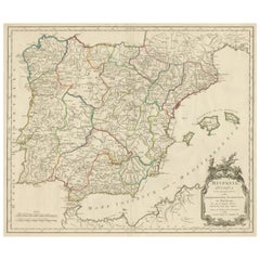
Large Antique Map of Ancient Spain and Portugal, Published in circa 1760
Located in Langweer, NL
Antique map titled 'Hispania Antiqua (..)'. Map of ancient Spain and Portugal. Engraved by G. Delahaye. Published circa 1760, by or after Sanson & Vaugondy.
Category
Mid-18th Century Antique Benelux Maps
Materials
Paper
$419 Sale Price
20% Off
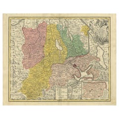
Antique Map of the Kanton Luzerne 'Switzerland' by Homann Heirs, 1763
Located in Langweer, NL
Antique map titled 'Canton Lucern (..)'. Fine decorative copper plate engraved antique map of the Canton of Lucerne in Central Switzerland with pictorial cartouche in top right corne...
Category
Mid-18th Century Antique Benelux Maps
Materials
Paper
$467 Sale Price
20% Off
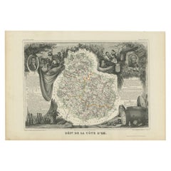
Antique Map of Côte d'Or ‘France’ by V. Levasseur, 1854
By Victor Levasseur
Located in Langweer, NL
Antique map titled 'Dépt. de la Côte d'Or'. Map of the French department of Cote D’Or, France. Part of France's Burgundy or Bourgogne wine region, a premier wine-growing region of Fr...
Category
Mid-19th Century Antique Benelux Maps
Materials
Paper
$143 Sale Price
20% Off
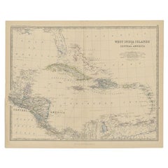
Antique Map of Central America and the West Indies, 1882
Located in Langweer, NL
Antique map titled 'West India Islands and Central America'. Old map of Central America and the West Indies. This map originates from 'The Royal Atlas of Modern Geography, Exhibiting...
Category
19th Century Antique Benelux Maps
Materials
Paper
$171 Sale Price
20% Off
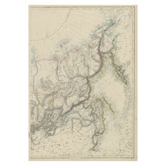
Old Map of Russia Originating from the 'Weekly Dispatch Atlas', ca.1865
Located in Langweer, NL
Antique map titled 'Russia in Asia, E Sheet'.
Old map of Russia originating from the 'Weekly Dispatch Atlas'.
Artists and Engravers: Engraved by J.W. Lowry.
Category
1860s Antique Benelux Maps
Materials
Paper
$171 Sale Price
20% Off
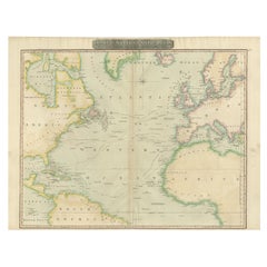
Interesting Map of the Atlantic Showing Nelson's and Trade Routes, 1817
By John Thomson
Located in Langweer, NL
Antique map titled 'Chart of the North Atlantic Ocean with Tracks of the Shipping to West Indies, North America, &cc'. Large map of the Atlantic, showing the tracks of the ships trad...
Category
19th Century Antique Benelux Maps
Materials
Paper
$524 Sale Price
20% Off
Antique Map of Northern Italy by Levasseur, 1875
Located in Langweer, NL
Antique map titled 'Carte l'Italie (..)'. Large map of Northern Italy. This map originates from 'Atlas de Géographie Moderne Physique et Politique' by A. Levasseur. Published 1875.
Category
Late 19th Century Antique Benelux Maps
Materials
Paper
$381 Sale Price
20% Off
Antique Map of the region of Trier, Mainz and Cologne, Germany
Located in Langweer, NL
Antique map titled 'Synopsis Circuli Rhenani Inferioris sive Electorum Rheni (..)'. Original antique map of the region of Trier, Mainz and Cologne, Germany. Published by T.C. Lotter,...
Category
Late 18th Century Antique Benelux Maps
Materials
Paper
$457 Sale Price
20% Off
Antique Print of the West Front of Rolls House by Campbell, 1725
Located in Langweer, NL
Antique print titled 'The West Front of the Rolls in Chancery Lane (..)'. Print of the west front of Rolls House, Chancery Lane, London. This print originates from 'Vitruvius Britann...
Category
18th Century Antique Benelux Maps
Materials
Paper
Antique Political Map of France, 1880
By J. Migeon
Located in Langweer, NL
Antique map titled 'France Féodale'. Old map of France with a decorative vignette of Castle de Pierrefonds. This map originates from 'Géographie Universelle Atlas-Migeon' by J. Migeo...
Category
19th Century Antique Benelux Maps
Materials
Paper
$114 Sale Price
20% Off
Antique Map of the Region of Delhi in India, 1833
Located in Langweer, NL
Antique map titled 'India IX'. Old steel engraved map of the region of Delhi, with great detail.
Artists and Engravers: Engraved by J. & C. Walker. Published under the superinten...
Category
19th Century Antique Benelux Maps
Materials
Paper
$381 Sale Price
20% Off
Antique Map of Bonthain Bay, Sulawesi, Celebes
Located in Langweer, NL
Antique map titled 'Vue de la Baye de Bonthain (..)'. Map of the island Sulawesi (Celebes), Indonesia that Philip Carteret rested his crew and made repairs to his ship the Swallow fo...
Category
Late 18th Century Antique Benelux Maps
Materials
Paper
$209 Sale Price
20% Off
Old Detailed Trade Route and Shipping Map from Italy to the Low Countries, c1671
Located in Langweer, NL
Antique map of Italy titled 'Carta Nova accurata del Passagio et strada dalli Peis Bassi per via de Allemgna per Italia et per via di Pesi Suizeri a Geenea, Lione et Roma (..)'. Detailed trade route and shipping map...
Category
17th Century Antique Benelux Maps
Materials
Paper
$1,144 Sale Price
20% Off
Original Antique Map of the Township of Beilen in the Netherlands, 1865
Located in Langweer, NL
Drenthe - Gemeente Beilen. Hijken, Beilen, Spier, Wijsthoorn. These scarse detailed maps of Dutch Towns originate from the 'Gemeente-atlas' of Jacob Kuyper. This atlas of all towns i...
Category
19th Century Antique Benelux Maps
Materials
Paper
$181 Sale Price
20% Off
Antique Map of the Cape of Good Hope by W. G. Blackie, 1859
Located in Langweer, NL
Antique map titled 'Cape of Good Hope'. Original antique map of the Cape of Good Hope. This map originates from ‘The Imperial Atlas of Modern Geography’. Published by W. G. Blackie, ...
Category
Mid-19th Century Antique Benelux Maps
Materials
Paper
$238 Sale Price
20% Off
Antique Map of Asia including Arabia, 1806
Located in Langweer, NL
Antique map titled 'Asia'. Original antique map of the Asian continent engraved by E. Jones.
Artists and Engravers: Drawn under the direction of Mr. Arrowsmith. Published in 1806...
Category
19th Century Antique Benelux Maps
Materials
Paper
$286 Sale Price
20% Off
Antique Map of Asia by Dussy, 1778
Located in Langweer, NL
Antique map of Asia titled 'Indostan presqu'isles de l'Inde, Chine, Tartarie Independante'. Depicting South-East Asia including Hindustan, India an...
Category
Late 18th Century French Antique Benelux Maps
Materials
Paper
$209 Sale Price
20% Off
Pl. 8 Antique Print of Garden Pavilions by Le Rouge, c.1785
Located in Langweer, NL
Antique print titled 'Pavillon pour les jardins (..)'. Copper engraving showing the pavilions of knight Worsley of Hovingham and knight Willoughby. This print originates from 'Jardin...
Category
18th Century Antique Benelux Maps
Materials
Paper
Antique Plan of the City of Damietta Egypt by C. Niebuhr, 1774
Located in Langweer, NL
Antique print titled 'Grundris der Stadt Damiât'. This print originates from 'Reisebeschreibung nach Arabien und andern umliegenden Ländern' by C. Niebuhr, 1774.
Category
Late 18th Century Antique Benelux Maps
Materials
Paper
$171 Sale Price
20% Off
Antique Print of the Melville House in Fife, Scotland, 1725
Located in Langweer, NL
Antique print titled 'The Elevation of Melvin House in the Shire of Fyfe (..)'.
Old engraving of Melville House in Fife, Scotland. This print originates from 'Vitruvius Britannic...
Category
18th Century Antique Benelux Maps
Materials
Paper
$524 Sale Price
20% Off
Antique Map of Asia with the Porcelain Tower at Nanjing, China, 1884
Located in Langweer, NL
Antique map titled 'Asie'. Map of the Asian continent, with an illustration of the porcelain tower at Nanjing, China. Migeon's Geographie Universelle, ...
Category
19th Century Antique Benelux Maps
Materials
Paper
$209 Sale Price
20% Off
Antique Map of the Gambia River by J. Van Schley, circa 1750
Located in Langweer, NL
"Carte de la Riviere de Gambra ou Gambie. Depuis son Embouchure Jusqu a Eropina". Orig. copper-engraving after Capt. J. Leach's map of the region from 1732. With ornamental title cartouche and Dutch...
Category
Mid-18th Century Antique Benelux Maps
Materials
Paper
$347 Sale Price
20% Off
Colorful Detailed Antique Map of The British Islands and `The North Sea, 1882
Located in Langweer, NL
Discover 'The British Islands and The North Sea' Map with Insets of Orkney, Shetland, and Channel Islands! This captivating original antique map offers a detailed view of the British...
Category
1880s Antique Benelux Maps
Materials
Paper
$181 Sale Price
20% Off
Antique Map of the Area Around Venice in Italy by H. Hondius, circa 1606
By Gerard Mercator, Jodocus Hondius
Located in Langweer, NL
Attractive and early map of the area around Venice, Italy. With South-Tirol in the North, areas of Krain (Slovenia), Croatia, Ferrara, Modena and Piacenza. In the east with areas aro...
Category
Early 17th Century Dutch Antique Benelux Maps
Materials
Paper
Antique Print of Various Apples by Knoop, 1758
Located in Langweer, NL
Antique print depicting apple variaties including the Framboos-Appel, Herfst Bloem-Soete, Somer-Parmain, Peer-Soete, Soete Dolphyn, Roode Herfst-Striepeling, Witte Soete Silverling, ...
Category
18th Century Antique Benelux Maps
Materials
Paper
$305 Sale Price
20% Off
Antique Map of the City of Kolkata by Balbi '1847'
Located in Langweer, NL
Antique map titled 'Calcutta'. Original antique map of the city of Kolkata, India. This map originates from 'Abrégé de Géographie (..)' by Adrien Balbi. Published 1847.
Category
Mid-19th Century Antique Benelux Maps
Materials
Paper
$143 Sale Price
20% Off
1819 Antique Map of Asia - 'Asien' by Simon Schropp et Comp, Berlin
Located in Langweer, NL
Antique map titled 'Asien'. Original old map of Asia. Published in Berlin by Simon Schropp et Comp, 1819.
"1819 Antique Map of Asia - 'Asien' by Simon Sch...
Category
Early 19th Century Antique Benelux Maps
Materials
Paper
$1,811 Sale Price
20% Off
Original Detailed Antique Map of the East Coast of Africa, 1747
Located in Langweer, NL
Antique map titled 'Carte de la coste Orientale d'Afrique - Kaart van de Oostkust van Afrika'.
Original antique map of the east coast of Africa. Reaches from Cape of Good Hope an...
Category
1740s Antique Benelux Maps
Materials
Paper
$181 Sale Price
20% Off
Map & Views of the Cape Verde Islands, in the Atlantic Ocean, West-Africa, 1775
Located in Langweer, NL
Various maps and views on one plate titled 'Praya Bay (..)', 'The Cape Verd Islands (..)' and 'A view of Praya Bay (..)'.
Map and views of the Cape Verde islands, in the Atlantic Ocean west of Africa. Printed from two copper plates, published for Robert Sayer...
Category
1770s Antique Benelux Maps
Materials
Paper
$600 Sale Price
20% Off
Original Antique Map of The Austrian Empire, 1882
Located in Langweer, NL
Step into the past with an original Antique Map of The Austrian Empire from the esteemed 'Comprehensive Atlas and Geography of the World,' meticulously crafted in 1882. This intricat...
Category
1880s Antique Benelux Maps
Materials
Paper
$200 Sale Price
20% Off
Original Antique Map of Russia in Europe, 1882
Located in Langweer, NL
Embark on an enthralling journey with an original Antique Map of European Russia from the esteemed 'Comprehensive Atlas and Geography of the World,' meticulously crafted in 1882. Thi...
Category
1880s Antique Benelux Maps
Materials
Paper
$181 Sale Price
20% Off
Antique Map of Southeast Asia with Decorative Allegorical Cartouche
Located in Langweer, NL
Antique map titled 'Les Indes Orientales et leur Archipel'. Old map of Southeast Asia, the Straits of Malaca, Philippines, Sumatra, Java, India etc., extending north to Canton and Ma...
Category
Mid-18th Century Antique Benelux Maps
Materials
Paper
$896 Sale Price
20% Off
Original Antique Map of Spain and Portugal, 1882
Located in Langweer, NL
Embark on a historical voyage with an original Antique Map of Spain and Portugal from the esteemed 'Comprehensive Atlas and Geography of the World,' meticulously crafted in 1882. Thi...
Category
1880s Antique Benelux Maps
Materials
Paper
$162 Sale Price
20% Off
Rare Antique Map of Calcutta 'Kolkata' in India, 1893
Located in Langweer, NL
Antique map titled 'Calcutta (India)'. Old map of Calcutta/Kolkata, India. On verso, a map of Egypt, Arabia, Upper Nubia and Abyssinia. Originates from 'The Columbian World's Fair at...
Category
19th Century Antique Benelux Maps
Materials
Paper
$247 Sale Price
20% Off
Antique Map of the Eastern Mediterranean and the Balkans
Located in Langweer, NL
Antique map titled 'La Turquie d'Europe et celle d'Asie'. Attractive double page map of the Eastern Mediterranean and the Balkans by R. Bonne. Originates from 'Atlas de Toutes les Pa...
Category
Late 18th Century Antique Benelux Maps
Materials
Paper
$514 Sale Price
20% Off
Antique Map of the Archdiocese of Cologne, Germany
Located in Langweer, NL
Antique map titled 'Archevesche et Eslectorat de Cologne avec ses Enclaves'. Original old map of the Archdiocese of Cologne with the course of the Rhine from Andernach to Wesel with ...
Category
Late 17th Century Antique Benelux Maps
Materials
Paper
$409 Sale Price
20% Off
Detailed Antique Map of the Southern Part of European Russia and Ukraine, 1752
Located in Langweer, NL
Antique map titled 'Partie meridionale de la Russie Européenne'.
Detailed map of the southern part of European Russia by Robert de Vaugondy. It covers from Moscow south to Georgia and from Poland east to the Volga River, including Crimea and Ukraine.
Artists and engravers: Gilles Robert de Vaugondy (1688-1766) was the head of a leading family of geographers in eighteenth century France. Gilles got his start when he jointly inherited the shop of Pierre-Moullart Sanson, grandson of the famous geographer Nicholas Sanson. The inheritance included the business, its stock of plates, and a roller press...
Category
1750s Antique Benelux Maps
Materials
Paper
$724 Sale Price
20% Off
Antique Map of the Township of Coevorden in The Netherlands, 1865
Located in Langweer, NL
Drenthe - Gemeente Coevorden, Padhuis, Wijnhars. These scarse detailed maps of Dutch Towns originate from the 'Gemeente-atlas' of Jacob Kuyper. This atlas of all towns in the Netherl...
Category
19th Century Antique Benelux Maps
Materials
Paper
$143 Sale Price
20% Off
Antique Map of the Region involved in the Conquest of Cyrus the Great
Located in Langweer, NL
Antique map titled 'Tabula Itineris Decies Mille (..)'. This historical map illustrates the region involved in the conquest of Cyrus the Great (558-528 BC), the founder of the Persia...
Category
Mid-17th Century Antique Benelux Maps
Materials
Paper
$657 Sale Price
20% Off
Detailed Antique Map of the Western Sumatra, Indonesia, circa 1825
Located in Langweer, NL
Antique map titled 'Partie de l'Ile de Sumatra'. Chart showing the western part of Sumatra. Originates from 'Atlas Universel' by P.M. Vandermaelen.
Artists and Engravers: Philipp...
Category
19th Century Antique Benelux Maps
Materials
Paper
$400 Sale Price
20% Off
Antique Map of the Eastern Part of the World
Located in Langweer, NL
Antique map titled 'Nieuwe Kaart van het Oostelykste Deel der Weereld, diendende tot aanwyzing van de Scheepstogten der Nederlanderen Naar Oostindie'. This finely engraved map of the...
Category
Mid-18th Century Antique Benelux Maps
Materials
Paper
$629 Sale Price
20% Off
Antique Map of New Jersey, Delaware and Maryland by Johnson, 1872
Located in Langweer, NL
Antique map titled 'Johnson's New Jersey (..). Two maps on one sheet showing New Jersey, Delaware and Maryland. With inset map of the district of Columbia...
Category
Late 19th Century Antique Benelux Maps
Materials
Paper
$286 Sale Price
20% Off
Antique Map of Manipa, Nusa-Laut, Saparua & Haruku 'Indonesia' by F. Valentijn
Located in Langweer, NL
Four maps of islands and two figures in native dress. The islands are: Manipa, Nusa-Laut (Noessa-Laoet), Saparua (Honimoa) and Haruku (Oma). These islands...
Category
Early 18th Century Antique Benelux Maps
Materials
Paper
$810 Sale Price
20% Off
Antique Map of France Divided into Departments, with Original Hand Coloring
Located in Langweer, NL
Antique map titled 'A New Map of France (..)'. Original old map of France, divided into departments. With original/contemporary hand coloring. Published by John Cary, 1799. John Cary was an important and prolific London map seller...
Category
Late 18th Century Antique Benelux Maps
Materials
Paper
$419 Sale Price
20% Off
Decorative Antique Map of the Southern Part of Africa, 1806
Located in Langweer, NL
Antique map titled 'Congo, Cafrerie.'
Decorative map of the southern part of Africa by Robert de Vaugondy, revised and published by Delamarche. Source unknown, to be determined.
Artists and Engravers: Charles Francois Delamarche (1740-1817) founded the important and prolific Paris based Maison Delamarche map publishing firm in the late 18th century. A lawyer by trade Delamarche entered the map business with the acquisition from Jean-Baptiste Fortin of Robert de Vaugondy's map plates...
Category
Early 1800s Antique Benelux Maps
Materials
Paper
$533 Sale Price
20% Off
Original Antique Map of the Middle East, Published in Germany, c.1870
Located in Langweer, NL
Antique map titled 'Asia Citerior'. Old map of the Middle East. This map originates from 'Atlas Antiquus, twaalf kaarten behoorende bij de Oude ...
Category
19th Century Antique Benelux Maps
Materials
Paper
Antique Map of the Township of Dwingelo in The Netherlands, 1865
Located in Langweer, NL
Drenthe: Gemeente Dwingelo, Eemster, Lhee. These scarse detailed maps of Dutch Towns originate from the 'Gemeente-atlas' of Jacob Kuyper. This atlas of all towns in the Netherlands w...
Category
19th Century Antique Benelux Maps
Materials
Paper
$162 Sale Price
20% Off
Antique Map of the City of Leeuwarden by Leti, 1690
Located in Langweer, NL
Antique map titled 'Leovardia.' A plan of Leeuwarden in Friesland, the Netherlands. With two coats of arms, the title in a scroll and an index of 30 buildings in the lower right. Fro...
Category
17th Century Antique Benelux Maps
Materials
Paper
$636 Sale Price
20% Off
Pl. 5 Antique Architecture Print of Various Vases and Other Ornaments by Neuffor
Located in Langweer, NL
Antique print titled 'Pour l'Usage des Poëles'. Old print showing the design of various vases and other ornaments. This print originates from 'Recueil Élémentaire d?Architecture' by ...
Category
18th Century Antique Benelux Maps
Materials
Paper
Hand Colored Antique Map of the Department of Eure, France
By Victor Levasseur
Located in Langweer, NL
Antique map titled 'Dépt. de l'Eure'. Map of the French department of Eure, France. This region of France is home to Giverny, where impressionist Claude Monet’s home and garden can...
Category
Mid-19th Century Antique Benelux Maps
Materials
Paper
$324 Sale Price
20% Off
Antique Map of Seine et Marne 'France' by V. Levasseur, 1854
By Victor Levasseur
Located in Langweer, NL
Antique map titled 'Dépt. de Seine et Marne'. Map of the French department of Seine Et Marne, France. This region produces a wide variety of wines and h...
Category
Mid-19th Century Antique Benelux Maps
Materials
Paper
$190 Sale Price
20% Off
Antique Map of Southern Mindanao, Sulawesi and Gilolo 'Halmahera', Indonesia
Located in Langweer, NL
Antique lithograph, with a text vignette on Borneo. This important map for the Philippines shows Southern Mindanao, and the area between Sulawesi, Mindanao and Gilolo (today: Halmahe...
Category
Early 19th Century Antique Benelux Maps
Materials
Paper
$538 Sale Price
20% Off
Antique Plan of Grave, The Netherlands, Showing the Siege of Grave in 1602
Located in Langweer, NL
Antique map titled 'Die Stat Grave' Bird's eye view plan of Grave, The Netherlands, Holland. Showing the siege of Grave in the year 1602 by Prince Maurits of The Netherlands. Source ...
Category
16th Century Antique Benelux Maps
Materials
Paper
$419 Sale Price
20% Off
Antique Map of Denmark by Münster '1588'
Located in Langweer, NL
Antique map titled 'Beschreibung des Königreichs Dennmarck (..)'. Early map of Denmark. This map originates from 'Cosmographey Oder beschreibung Aller Länder (..)' by Sebastian Münster.
Category
16th Century Antique Benelux Maps
Materials
Paper
$262 Sale Price
20% Off
Antique Map of the Cities of the Qing Dynasty Provinces in China, 1738
Located in Langweer, NL
Antique print titled 'Cities of the Province of Kyang-si, Fo-kyen, Shan-Si & Yun-nan'. Old map depicting four walled cities of the Chinese Qing dynasty provinces Yunnan, Shanxi, Fuji...
Category
18th Century Antique Benelux Maps
Materials
Paper
$247 Sale Price
20% Off
Old Architectural Design Print of Villa Boulevard de Boulogne, Chabat, c.1900
Located in Langweer, NL
Antique print titled 'Villa Boulevard de Boulogne (Seine) Mr. L. Magne, Architecte'. This print depicts the design of a villa in France. Originates from 'La Brique et La Terre Cuite'...
Category
20th Century Benelux Maps
Materials
Paper
$119 Sale Price
20% Off
Antique Map of Continental Asia, with Japan, Arabia, India, Russia, etc c.1702
Located in Langweer, NL
Antique map titled 'Totius Asiae Continens (..).' On this map of continental Asia and the adjacent islands Japan is shown with an oversized Terra Iedso (Hokkaido) connected with Honshu via a narrow isthmus. The Compagnie Land of the de Vries expedition is shown above, separated by a narrow strait named after the explorer. Nova Zembla is depicted correctly as an island, but the northeastern part of Siberia, the Chukchi peninsula and Kamchatka are missing. A portion of Australia is shown as Nova Hollandia...
Category
18th Century Antique Benelux Maps
Materials
Paper
Antique Map of Spain and Portugal by Mitchell, 1846
Located in Langweer, NL
Antique map titled 'Kingdom of Spain and Portugal'. Old map of Spain and Portugal, with an inset map of the region of Madrid. This map originates from 'A New Universal Atlas Containi...
Category
19th Century Antique Benelux Maps
Materials
Paper
$122 Sale Price
20% Off
Antique Political Map of the Japanese Empire, 1922
Located in Langweer, NL
Antique map of Japan titled 'Japanese Empire - Political Map'. Old map of Japan depicting Japan, Korea and surroundings. This map originates from 'The Ti...
Category
20th Century Benelux Maps
Materials
Paper
Genuine Antique Engraved Map of Helvetia or Switzerland, 1729
Located in Langweer, NL
Decorative early 18th century engraved map of Switzerland.
Title: Helvetia Conterminarumq terra rum antiqua.
Translated from Latin: Switzerland is an ancient land
Description: Switzerland, antique copperplate engraved map with hand coloring and a decorative title cartouche. Two figures greatly enhances visual appeal.
Author: Phillip Cluver, or Philip Cluverius, Philipp Clüver, Latinized as Philippus Cluverius studied law in Leiden and settled over there in 1615.
We only sell Guaranteed Absolutely Original authentic Maps and Prints.
A Certificate of Authenticity ( COA ) will be supplied on request.
We ship our antique maps and prints...
Category
1720s Antique Benelux Maps
Materials
Paper
$371 Sale Price
20% Off
Recently Viewed
View AllMore Ways To Browse
Greek Key Dresser
Green Glass Bud Vase Vintage
Gucci Tray
Half Moon Shelves
Handblown Glass Decanter
Heart Shaped Glass Dish
Hepplewhite Drop Leaf Table
Herend Cup
Hermes Dish
Horse Head Barware
Horse Mantel Clock
Large Limoges Platter
Michelangelo David Statue
Michelin Guide
Persian Khatam
Royal Worcester Aesthetic
Russell Woodard Aluminum
Russian Silver Niello
