Items Similar to Antique Map of Asia with the Porcelain Tower at Nanjing, China, 1884


Want more images or videos?
Request additional images or videos from the seller
1 of 6
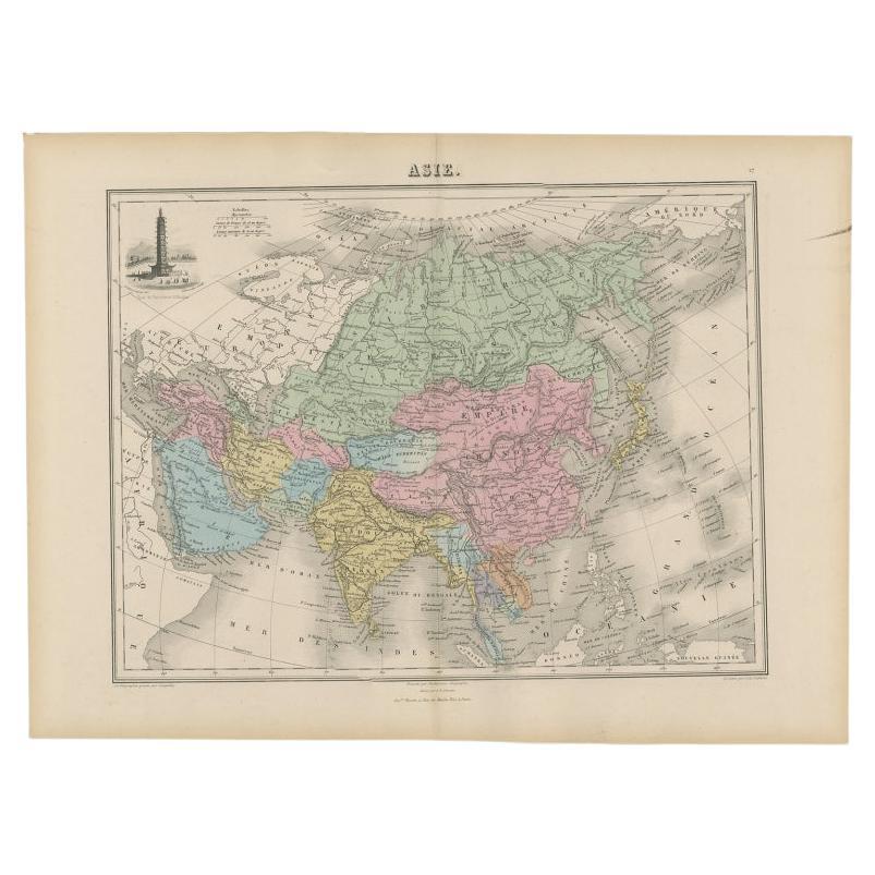
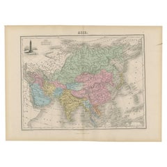
Antique Map of Asia with the Porcelain Tower at Nanjing, China, 1884
About the Item
Antique map titled 'Asie'. Map of the Asian continent, with an illustration of the porcelain tower at Nanjing, China. Migeon's Geographie Universelle, published in Paris, is one of the last great decorative atlases of the 19th century. It contains many stylistic elements of early 19th century cartography such as full hand coloring, numerous decorative vignettes, and high quality paper.
Artists and Engravers: J. Migeon (fl. c. 1855 - 1899) was a late 19th century map publisher based in Paris, France. His most prominent publications are the Geographie Universal in 1854 (updated through 1874) and the Nouvel Atlas Illustré de Géographie Universelle in 1891. Little is known of Migeon's life and even his first name is uncertain.
Condition: Very good, general age-related toning. Please study image carefully.
Date: 1884
Overall size: 49 x 35 cm.
Image size: 37 x 28 cm.
We sell original antique maps to collectors, historians, educators and interior decorators all over the world. Our collection includes a wide range of authentic antique maps from the 16th to the 20th centuries. Buying and collecting antique maps is a tradition that goes back hundreds of years. Antique maps have proved a richly rewarding investment over the past decade, thanks to a growing appreciation of their unique historical appeal. Today the decorative qualities of antique maps are widely recognized by interior designers who appreciate their beauty and design flexibility. Depending on the individual map, presentation, and context, a rare or antique map can be modern, traditional, abstract, figurative, serious or whimsical. We offer a wide range of authentic antique maps for any budget.
- Dimensions:Height: 13.78 in (35 cm)Width: 19.3 in (49 cm)Depth: 0 in (0.01 mm)
- Materials and Techniques:
- Period:
- Date of Manufacture:1884
- Condition:Condition: Very good, general age-related toning. Please study image carefully.
- Seller Location:Langweer, NL
- Reference Number:
About the Seller
5.0
Platinum Seller
These expertly vetted sellers are 1stDibs' most experienced sellers and are rated highest by our customers.
Established in 2009
1stDibs seller since 2017
1,928 sales on 1stDibs
Typical response time: <1 hour
- ShippingRetrieving quote...Ships From: Langweer, Netherlands
- Return PolicyA return for this item may be initiated within 14 days of delivery.
More From This SellerView All
- Antique Map of Asia with an Illustration of the Porcelain Tower at Nanjing, 1880Located in Langweer, NLAntique map titled 'Asie'. Map of the Asian continent, with an illustration of the porcelain tower at Nanjing, China. This map originates from 'Géograp...Category
Antique 19th Century Maps
MaterialsPaper
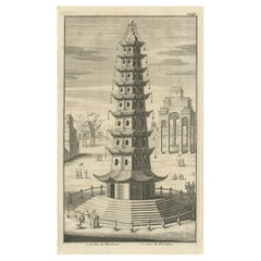
- Antique Print of the Porcelain Pagoda in Nanjing, China, 1736Located in Langweer, NLAntique print titled 'La Tour de Porcelaine, Arc de Triomphe'. Old print depicting the Porcelain Pagoda in the Chinese city of Nanjing. It no longer ...Category
Antique 18th Century Prints
MaterialsPaper
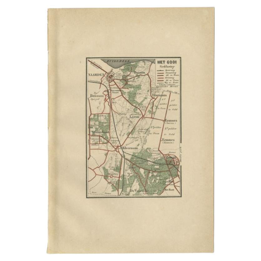
- Antique Map of the Gooi Region by Craandijk, 1884Located in Langweer, NLAntique map titled 'Het Gooi'. Old map of the region of Hilversum also including cities and villages like Naarden, Laren, Blaricum, Eemnes and Baarn. This map orginates from 'Atlas b...Category
Antique 19th Century Maps
MaterialsPaper
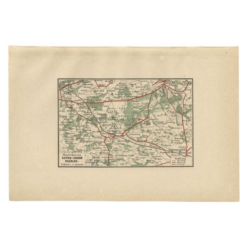
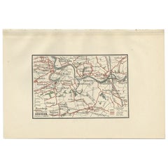
- Antique Map of the Region of Zutphen by Craandijk, 1884Located in Langweer, NLAntique map titled 'Omstreken van Zutfen - Lochem Ruurlo'. Old map of the region of Zutphen also including cities and villages like Veldwijk, Vorden and Delden. This map orginates fr...Category
Antique 19th Century Maps
MaterialsPaper
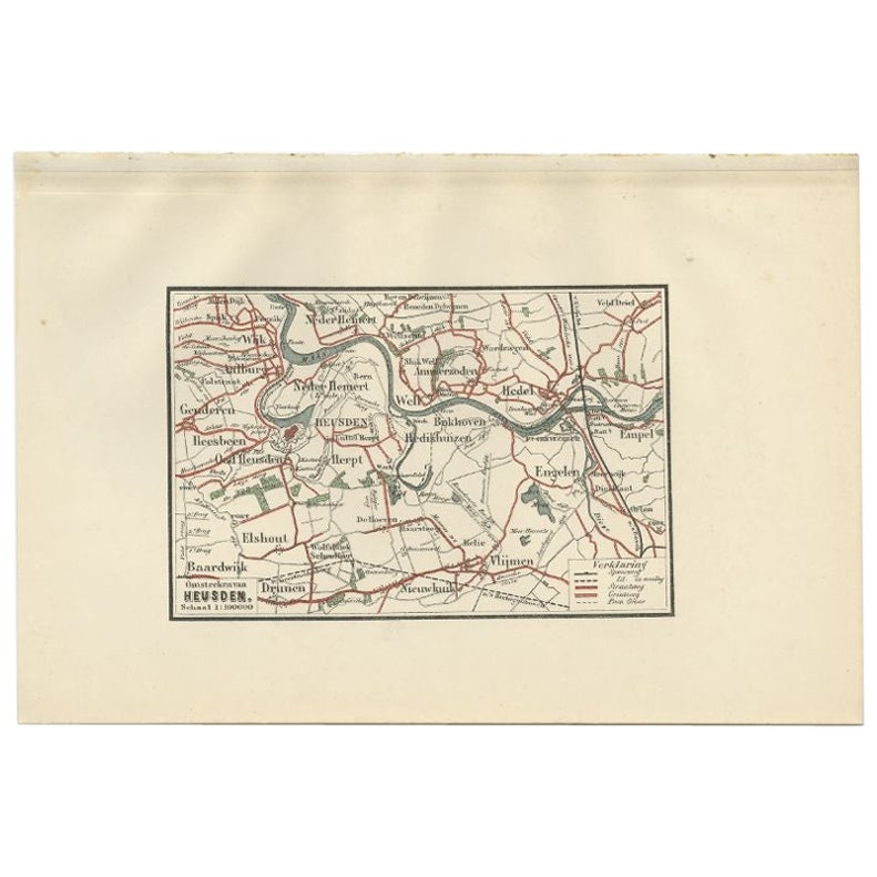
- Antique Map of the Region of Heusden by Craandijk, 1884Located in Langweer, NLAntique map titled 'Omstreken van Heusden'. Old map of the region of Heusden also including cities and villages like Elshout, Aalburg, Hedel and Vlijmen. This map orginates from 'Atl...Category
Antique 19th Century Maps
MaterialsPaper
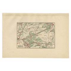
- Antique Map of the Region of Amersfoort by Craandijk, 1884Located in Langweer, NLAntique map titled 'Omstreken van Amersfoort'. Old map of the region of Amersfoort also including cities and villages like De Bilt, Zeist and Leusden. This map orginates from 'Atlas ...Category
Antique 19th Century Maps
MaterialsPaper
You May Also Like
- Antique 1803 Italian Map of Asia Including China Indoneseia IndiaLocated in Amsterdam, Noord HollandAntique 1803 Italian Map of Asia Including China Indoneseia India Very nice map of Asia. 1803. Additional information: Type: Map Country of Manufacturing: Europe Period: 19th centu...Category
Antique 19th Century European Maps
MaterialsPaper
- Antique French Map of Asia Including China Indoneseia India, 1783Located in Amsterdam, Noord HollandVery nice map of Asia. 1783 Dedie au Roy. Additional information: Country of Manufacturing: Europe Period: 18th century Qing (1661 - 1912) Condition: Overall Condition B (Good Used)...Category
Antique 18th Century European Maps
MaterialsPaper
- Original Antique Map of Asia. C.1780Located in St Annes, LancashireGreat map of Asia Copper-plate engraving Published C.1780 Two small worm holes to right side of map Unframed.Category
Antique Early 1800s English Georgian Maps
MaterialsPaper

- Antique Carte de L'Inde Myanmar, Malaysia Vietnam Map of Asia the Chinese EmpireLocated in Amsterdam, Noord HollandAntique Carte de L'Inde Myanmar, Malaysia Vietnam Map of Asia the Chinese Empire Very nice map of Asia. Additional information: Type: Map Country of Man...Category
Antique 18th Century European Maps
MaterialsPaper
- Original Antique Map of South East Asia, Arrowsmith, 1820Located in St Annes, LancashireGreat map of South East Asia Drawn under the direction of Arrowsmith Copper-plate engraving Published by Longman, Hurst, Rees, Orme and Brown, 1820 Unframed.Category
Antique 1820s English Maps
MaterialsPaper
- Original Antique Map of China, Arrowsmith, 1820Located in St Annes, LancashireGreat map of China Drawn under the direction of Arrowsmith Copper-plate engraving Published by Longman, Hurst, Rees, Orme and Brown, 1820 Unfr...Category
Antique 1820s English Maps
MaterialsPaper


Recently Viewed
View AllMore Ways To Browse
Antique Handcrafted Model Sailboat
Miles Johnston
Toledo Scale Company Antique
Charente Map
F Colton
Ian Maguire
Ithaca Antique Map
Pakistan Antique Map
Antique Map Copenhagen
Antique Map Nova Scotia
Antique Maps Of Ukraine
Armenia Map
Armenian Map
Ecuador Antique Map
Serbia Antique Map
Ukraine Antique Map
Vintage Bartholomew Maps
Albania Map