Continental Europe Maps
to
4,203
5,136
5,489
200
5,135
1
2
2
2
1
2,810
2,007
318
1
179
12
1
68
3
3
3
2
3
1
5,117
17
11
10
8
408
147
81
80
52
5,136
5,136
5,136
104
59
20
14
13
Item Ships From: Continental Europe
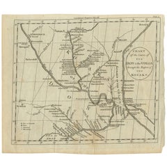
Antique Map of the course of the Don & Voga rivers
Located in Langweer, NL
Antique map titled 'Chart of the Course of The Don & the Volga through the Region of The Kosaks'. SW Russia & Ukraine: interesting map showing the course of th...
Category
Late 18th Century Antique Continental Europe Maps
Materials
Paper
$137 Sale Price
20% Off
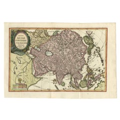
Antique Map of Continental Asia, with Japan, Arabia, India, Russia, etc c.1702
Located in Langweer, NL
Antique map titled 'Totius Asiae Continens (..).' On this map of continental Asia and the adjacent islands Japan is shown with an oversized Terra Iedso (Hokkaido) connected with Honshu via a narrow isthmus. The Compagnie Land of the de Vries expedition is shown above, separated by a narrow strait named after the explorer. Nova Zembla is depicted correctly as an island, but the northeastern part of Siberia, the Chukchi peninsula and Kamchatka are missing. A portion of Australia is shown as Nova Hollandia...
Category
18th Century Antique Continental Europe Maps
Materials
Paper
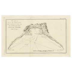
Antique Map of Bonthain Bay, Sulawesi, Celebes
Located in Langweer, NL
Antique map titled 'Vue de la Baye de Bonthain (..)'. Map of the island Sulawesi (Celebes), Indonesia that Philip Carteret rested his crew and made repairs to his ship the Swallow fo...
Category
Late 18th Century Antique Continental Europe Maps
Materials
Paper
$209 Sale Price
20% Off
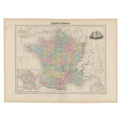
Antique Political Map of France, 1880
By J. Migeon
Located in Langweer, NL
Antique map titled 'France Féodale'. Old map of France with a decorative vignette of Castle de Pierrefonds. This map originates from 'Géographie Universelle Atlas-Migeon' by J. Migeo...
Category
19th Century Antique Continental Europe Maps
Materials
Paper
$114 Sale Price
20% Off
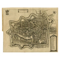
Antique Map of the City of Leeuwarden by Leti, 1690
Located in Langweer, NL
Antique map titled 'Leovardia.' A plan of Leeuwarden in Friesland, the Netherlands. With two coats of arms, the title in a scroll and an index of 30 buildings in the lower right. Fro...
Category
17th Century Antique Continental Europe Maps
Materials
Paper
$634 Sale Price
20% Off
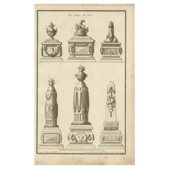
Pl. 5 Antique Architecture Print of Various Vases and Other Ornaments by Neuffor
Located in Langweer, NL
Antique print titled 'Pour l'Usage des Poëles'. Old print showing the design of various vases and other ornaments. This print originates from 'Recueil Élémentaire d?Architecture' by ...
Category
18th Century Antique Continental Europe Maps
Materials
Paper
Antique Map of the Region of Delhi in India, 1833
Located in Langweer, NL
Antique map titled 'India IX'. Old steel engraved map of the region of Delhi, with great detail.
Artists and Engravers: Engraved by J. & C. Walker. Published under the superinten...
Category
19th Century Antique Continental Europe Maps
Materials
Paper
$380 Sale Price
20% Off
Antique Map of the region of Trier, Mainz and Cologne, Germany
Located in Langweer, NL
Antique map titled 'Synopsis Circuli Rhenani Inferioris sive Electorum Rheni (..)'. Original antique map of the region of Trier, Mainz and Cologne, Germany. Published by T.C. Lotter,...
Category
Late 18th Century Antique Continental Europe Maps
Materials
Paper
$456 Sale Price
20% Off
Antique Map of New South Wales by Johnston, '1909'
Located in Langweer, NL
Antique map titled 'South Australia, New South Wales, Victoria and Queensland'. Original antique map of New South Wales. With inset map of Cape York Pe...
Category
Early 20th Century Continental Europe Maps
Materials
Paper
$237 Sale Price
20% Off
Antique Map of Russia in Asia from An Old German Atlas, 1845
By Meyer
Located in Langweer, NL
Antique map titled 'Asiatisches Russland'. This map depicts Russia in Asia and originates from 'Meyers Handatlas'.
Artists and Engravers: Engraved and published by 'Bibliographis...
Category
19th Century Antique Continental Europe Maps
Materials
Paper
$85 Sale Price
20% Off
Old Architectural Design Print of Villa Boulevard de Boulogne, Chabat, c.1900
Located in Langweer, NL
Antique print titled 'Villa Boulevard de Boulogne (Seine) Mr. L. Magne, Architecte'. This print depicts the design of a villa in France. Originates from 'La Brique et La Terre Cuite'...
Category
20th Century Continental Europe Maps
Materials
Paper
$118 Sale Price
20% Off
Rare Engravings of Council of War in Bantam and Javanese Local Traders, 1614
Located in Langweer, NL
One leaf with an engraving on each site and text in old Dutch. One side shows the War Council of the locals in Bantam and the other side show some vegetables traders of Bantam.
B...
Category
Early 17th Century Antique Continental Europe Maps
Materials
Paper
$427 Sale Price
20% Off
Antique Map of the Cities of the Qing Dynasty Provinces in China, 1738
Located in Langweer, NL
Antique print titled 'Cities of the Province of Kyang-si, Fo-kyen, Shan-Si & Yun-nan'. Old map depicting four walled cities of the Chinese Qing dynasty provinces Yunnan, Shanxi, Fuji...
Category
18th Century Antique Continental Europe Maps
Materials
Paper
$247 Sale Price
20% Off
Old German Map of the Austrian Empire, ca.1870
Located in Langweer, NL
Antique map titled 'Kaiserthum Österreich'.
Old map of the Austrian Empire. This map originates from 'H. Kiepert's Kleiner Atlas der Neueren Geographie für Schule und Haus'.
Arti...
Category
1870s Antique Continental Europe Maps
Materials
Paper
$275 Sale Price
20% Off
Antique Map of Spain and Portugal by Mitchell, 1846
Located in Langweer, NL
Antique map titled 'Kingdom of Spain and Portugal'. Old map of Spain and Portugal, with an inset map of the region of Madrid. This map originates from 'A New Universal Atlas Containi...
Category
19th Century Antique Continental Europe Maps
Materials
Paper
$122 Sale Price
20% Off
1819 Antique Map of Asia - 'Asien' by Simon Schropp et Comp, Berlin
Located in Langweer, NL
Antique map titled 'Asien'. Original old map of Asia. Published in Berlin by Simon Schropp et Comp, 1819.
"1819 Antique Map of Asia - 'Asien' by Simon Sch...
Category
Early 19th Century Antique Continental Europe Maps
Materials
Paper
$1,805 Sale Price
20% Off
Antique Map of Asia with the Porcelain Tower at Nanjing, China, 1884
Located in Langweer, NL
Antique map titled 'Asie'. Map of the Asian continent, with an illustration of the porcelain tower at Nanjing, China. Migeon's Geographie Universelle, ...
Category
19th Century Antique Continental Europe Maps
Materials
Paper
$209 Sale Price
20% Off
Antique Print of Various Apples by Knoop, 1758
Located in Langweer, NL
Antique print depicting apple variaties including the Framboos-Appel, Herfst Bloem-Soete, Somer-Parmain, Peer-Soete, Soete Dolphyn, Roode Herfst-Striepeling, Witte Soete Silverling, ...
Category
18th Century Antique Continental Europe Maps
Materials
Paper
$304 Sale Price
20% Off
Antique Map of Korea and Southern China by Bonne '1771'
Located in Langweer, NL
Antique map titled 'Carte de la Tartarie Chinoise'. Original antique map of Korea and Southern China. Covers from the Lop Nor region eastward to K...
Category
Mid-18th Century Antique Continental Europe Maps
Materials
Paper
$546 Sale Price
20% Off
Antique Map of Northern China and Far Eastern Russia Around the Amur River, 1754
Located in Langweer, NL
Antique map titled 'Carte De La Tartarie Orientale (..)'. A map for this far eastern portion of what is present day northern China and far eastern Russia...
Category
1750s Antique Continental Europe Maps
Materials
Paper
$475 Sale Price
20% Off
Antique Map of North and West Africa by J.B. Elwe, 1792
Located in Langweer, NL
Beautiful richly engraved map of North and West Africa, based upon the earlier maps of De L'Isle. Richly annotated throughout and with excellent regional detail. Too much detail to d...
Category
Late 19th Century Antique Continental Europe Maps
Materials
Paper
$945 Sale Price
20% Off
Antique Map of Southern England and Wales by Zatta, 1784
Located in Langweer, NL
"Antique map titled 'Parte Meridionale dell' Inghilterra e del Pricipato di Galles'. Engraved map of the southern part of England and Wales, with title cartouche. Shows political and...
Category
18th Century Antique Continental Europe Maps
Materials
Paper
$202 Sale Price
20% Off
Antique Map of Southeast Asia with Decorative Allegorical Cartouche
Located in Langweer, NL
Antique map titled 'Les Indes Orientales et leur Archipel'. Old map of Southeast Asia, the Straits of Malaca, Philippines, Sumatra, Java, India etc., extending north to Canton and Ma...
Category
Mid-18th Century Antique Continental Europe Maps
Materials
Paper
$893 Sale Price
20% Off
Antique Map of Asia by Delamarche, 1826
Located in Langweer, NL
Vaugondy's map plates and copyrights and later addes many plates from other sources as well. Charles Delamarche eventually passed control of the firm to his son Felix Delamarche (18t...
Category
19th Century Antique Continental Europe Maps
Materials
Paper
$228 Sale Price
20% Off
Hand Colored Antique Map of the Department of Eure, France
By Victor Levasseur
Located in Langweer, NL
Antique map titled 'Dépt. de l'Eure'. Map of the French department of Eure, France. This region of France is home to Giverny, where impressionist Claude Monet’s home and garden can...
Category
Mid-19th Century Antique Continental Europe Maps
Materials
Paper
$323 Sale Price
20% Off
Antique Map of North Africa by Lowry '1852'
Located in Langweer, NL
Antique map titled 'North Africa Marocco Algiers & Tunis'. Two individual sheets of North Africa. This map originates from 'Lowry's Table Atlas constructed and engraved from the most...
Category
Mid-19th Century Antique Continental Europe Maps
Materials
Paper
$142 Sale Price / set
20% Off
Antique Map of Suffren Island by Cook, 1803
Located in Langweer, NL
Antique map Australia titled 'Gezigt van het Eil. Suffren'. Antique map of Suffren Island. Originates from 'Reizen Rondom de Waereld door James C...
Category
19th Century Antique Continental Europe Maps
Materials
Paper
$171 Sale Price
20% Off
Antique Map of Switzerland by A & C. Black, 1870
Located in Langweer, NL
Antique map titled 'Switzerland'. Original antique map of Switzerland. This map originates from ‘Black's General Atlas of The World’. Published by A & C. Black, 1870.
Category
Late 19th Century Antique Continental Europe Maps
Materials
Paper
$166 Sale Price
20% Off
Antique Map of Virginia, Delaware, Maryland & West Virginia by Johnson, 1872
Located in Langweer, NL
Antique map titled 'Johnson's Viriginia (..). Original map of Virginia, Delaware, Maryland and West Virginia. This map originates from 'Johnson's New I...
Category
Late 19th Century Antique Continental Europe Maps
Materials
Paper
$237 Sale Price
20% Off
Original Antique Map of The Austrian Empire, 1882
Located in Langweer, NL
Step into the past with an original Antique Map of The Austrian Empire from the esteemed 'Comprehensive Atlas and Geography of the World,' meticulously crafted in 1882. This intricat...
Category
1880s Antique Continental Europe Maps
Materials
Paper
$199 Sale Price
20% Off
Original Antique Map of Russia in Europe, 1882
Located in Langweer, NL
Embark on an enthralling journey with an original Antique Map of European Russia from the esteemed 'Comprehensive Atlas and Geography of the World,' meticulously crafted in 1882. Thi...
Category
1880s Antique Continental Europe Maps
Materials
Paper
$180 Sale Price
20% Off
American Election Map and 1960 Presidential Fact Sheet, Published 1960
Located in Langweer, NL
Title: “The 50 United States of America”
Subject: United States, Presidential Elections
Date: 1960 (dated)
Color: Printed Color
Size: 24.9 x 17.9 inches (63.2 x 45.5 cm)
This colorful map of the United States was drawn by Lorin Thompson and published by the General Foods Corporation. The map has an unusual coloring style with symbols of American history including past presidents, Native Americans, important buildings (White House, Statue of Liberty, Alamo), agriculture, industry, and more. Includes inset maps of Hawaii and Alaska with small American flags...
Category
1960s Vintage Continental Europe Maps
Materials
Paper
$570 Sale Price
20% Off
Antique Map of the Eastern Part of the World
Located in Langweer, NL
Antique map titled 'Nieuwe Kaart van het Oostelykste Deel der Weereld, diendende tot aanwyzing van de Scheepstogten der Nederlanderen Naar Oostindie'. This finely engraved map of the...
Category
Mid-18th Century Antique Continental Europe Maps
Materials
Paper
$627 Sale Price
20% Off
Intriguing Antique Map of Europe, Asia and Africa by Scherer, c.1703
Located in Langweer, NL
Two maps on a single sheet showing Europe, Asia and Africa, each depicting nearly the same area. On close examination there are slight differences. Major cities are located. Printed ...
Category
18th Century Antique Continental Europe Maps
Materials
Paper
$285 Sale Price
20% Off
Antique Map of the Eastern Mediterranean and the Balkans
Located in Langweer, NL
Antique map titled 'La Turquie d'Europe et celle d'Asie'. Attractive double page map of the Eastern Mediterranean and the Balkans by R. Bonne. Originates from 'Atlas de Toutes les Pa...
Category
Late 18th Century Antique Continental Europe Maps
Materials
Paper
$513 Sale Price
20% Off
Original Antique Map of Spain and Portugal, 1882
Located in Langweer, NL
Embark on a historical voyage with an original Antique Map of Spain and Portugal from the esteemed 'Comprehensive Atlas and Geography of the World,' meticulously crafted in 1882. Thi...
Category
1880s Antique Continental Europe Maps
Materials
Paper
$161 Sale Price
20% Off
Original Antique Engraving of Kannur 'or Cannanore', Kerala, India, 1726
Located in Langweer, NL
Antique print, titled: 'Cananor' - This is a print of a view of Kannur (or Cannanore), Kerala, India. From the monumental: "Oud en Nieuw Oost-Indiën ..." ...
Category
1720s Antique Continental Europe Maps
Materials
Paper
$522 Sale Price
20% Off
Genuine Antique Engraved Map of Helvetia or Switzerland, 1729
Located in Langweer, NL
Decorative early 18th century engraved map of Switzerland.
Title: Helvetia Conterminarumq terra rum antiqua.
Translated from Latin: Switzerland is an ancient land
Description: Switzerland, antique copperplate engraved map with hand coloring and a decorative title cartouche. Two figures greatly enhances visual appeal.
Author: Phillip Cluver, or Philip Cluverius, Philipp Clüver, Latinized as Philippus Cluverius studied law in Leiden and settled over there in 1615.
We only sell Guaranteed Absolutely Original authentic Maps and Prints.
A Certificate of Authenticity ( COA ) will be supplied on request.
We ship our antique maps and prints...
Category
1720s Antique Continental Europe Maps
Materials
Paper
$370 Sale Price
20% Off
Antique Map of France Divided into Departments, with Original Hand Coloring
Located in Langweer, NL
Antique map titled 'A New Map of France (..)'. Original old map of France, divided into departments. With original/contemporary hand coloring. Published by John Cary, 1799. John Cary was an important and prolific London map seller...
Category
Late 18th Century Antique Continental Europe Maps
Materials
Paper
$418 Sale Price
20% Off
Antique Map of the Archdiocese of Cologne, Germany
Located in Langweer, NL
Antique map titled 'Archevesche et Eslectorat de Cologne avec ses Enclaves'. Original old map of the Archdiocese of Cologne with the course of the Rhine from Andernach to Wesel with ...
Category
Late 17th Century Antique Continental Europe Maps
Materials
Paper
$408 Sale Price
20% Off
Antique Map of the Region of Valois by Hondius, circa 1630
Located in Langweer, NL
Antique map titled 'Le Pais de Valois'. Old map of the historic region of Valois, France. It corresponds to the southeastern quarter of the modern département of Oise, with an adjace...
Category
Mid-17th Century Antique Continental Europe Maps
Materials
Paper
$475 Sale Price
20% Off
Detailed Antique Map of the Western Sumatra, Indonesia, circa 1825
Located in Langweer, NL
Antique map titled 'Partie de l'Ile de Sumatra'. Chart showing the western part of Sumatra. Originates from 'Atlas Universel' by P.M. Vandermaelen.
Artists and Engravers: Philipp...
Category
19th Century Antique Continental Europe Maps
Materials
Paper
$399 Sale Price
20% Off
Antique Map of the Township of Coevorden in The Netherlands, 1865
Located in Langweer, NL
Drenthe - Gemeente Coevorden, Padhuis, Wijnhars. These scarse detailed maps of Dutch Towns originate from the 'Gemeente-atlas' of Jacob Kuyper. This atlas of all towns in the Netherl...
Category
19th Century Antique Continental Europe Maps
Materials
Paper
$142 Sale Price
20% Off
Antique Map of the Region involved in the Conquest of Cyrus the Great
Located in Langweer, NL
Antique map titled 'Tabula Itineris Decies Mille (..)'. This historical map illustrates the region involved in the conquest of Cyrus the Great (558-528 BC), the founder of the Persia...
Category
Mid-17th Century Antique Continental Europe Maps
Materials
Paper
$655 Sale Price
20% Off
Antique Map of the Turkish Empire by Tirion 'c.1760'
Located in Langweer, NL
Antique map titled 'Nieuwe Kaart van het Turksche Ryk gelegen in Europa, Asia en Africa'. Original antique map of the Turkish Empire. The map is centered on the Mediterranean Sea but...
Category
Mid-18th Century Antique Continental Europe Maps
Materials
Paper
$1,330 Sale Price
20% Off
Antique Map Dedicated to British Merchants Trading to North America, ca.1746
Located in Langweer, NL
Description: Antique map titled 'A New Chart of the Coast of New England, Nova Scotia, New France or Canada, with the islands of Newfoundland, Capte Breton, St John's (..)'. Map stre...
Category
1740s Antique Continental Europe Maps
Materials
Paper
$807 Sale Price
20% Off
Antique Print of Batavia, Capital of the Dutch East Indies or Indonesia, '1726'
Located in Langweer, NL
Antique print Indonesia titled 'Batavia in 't Verschiet'. Large panoramic view on Batavia, present day Jakarta, Indonesia. Originates from 'Oud en Nieuw Oost-Indiën (..)' by François...
Category
18th Century Antique Continental Europe Maps
Materials
Paper
$1,187 Sale Price
20% Off
Bay of Arguin, West Coast of Africa from Cape Blanco to Tanit, Africa, 1747
Located in Langweer, NL
Antique map titled 'Carte De La Coste Occidentale D'Afrique (..)
Kaart van de Westkust van Afrika (..)'. Original antique map of the western coast of Africa. Shows the area aroun...
Category
1740s Antique Continental Europe Maps
Materials
Paper
$275 Sale Price
20% Off
Antique Map of the Township of Dwingelo in The Netherlands, 1865
Located in Langweer, NL
Drenthe: Gemeente Dwingelo, Eemster, Lhee. These scarse detailed maps of Dutch Towns originate from the 'Gemeente-atlas' of Jacob Kuyper. This atlas of all towns in the Netherlands w...
Category
19th Century Antique Continental Europe Maps
Materials
Paper
$161 Sale Price
20% Off
Antique Map extending from the Spice Islands to the west of Papua New Guinea
Located in Langweer, NL
Antique map titled 'Kaart van de Papoasche Eilanden'. Beautiful original old map extending from the Spice Islands (Sallawatty, Patenta, Gammen, Land van Waigeeuw, Popo, Misool, and part of Seram) to the western end of Papua New Guinea. Many smaller islands are detailed, and depth soundings are shown near Seram and to the east of Misool. This map originates from 'Nieuwe en Beknopte Hand-Atlas, bestaande in eene Verzameling van eenige der algemeenste en nodigste Landkaarten' by I. Tirion. Published circa 1770.
Tirion was born in Utrecht in 1705. He moved to Amsterdam in 1725 and set up shop on Damrak as a book publisher. Tirion quick rose in prominence by publishing pamphlets, historical works, and, most importantly...
Category
Late 18th Century Antique Continental Europe Maps
Materials
Paper
$465 Sale Price
20% Off
Antique Map of the Region of Utingeradeel by Meijer & Schaafsma, 1906
Located in Langweer, NL
Antique map titled 'Gemeente Friesland. Gemeente Utingeradeel'. This map illustrates part of Friesland (The Netherlands) depicting Akkrum, Terkaple, Lekkerterp, Oldeboorn and more. Published by Tresling & Co, Amsterdam.
Artists and Engravers: Tresling and Co., Dutch Lithographers...
Category
20th Century Continental Europe Maps
Materials
Paper
$82 Sale Price
20% Off
Antique Plan of Grave, The Netherlands, Showing the Siege of Grave in 1602
Located in Langweer, NL
Antique map titled 'Die Stat Grave' Bird's eye view plan of Grave, The Netherlands, Holland. Showing the siege of Grave in the year 1602 by Prince Maurits of The Netherlands. Source ...
Category
16th Century Antique Continental Europe Maps
Materials
Paper
$418 Sale Price
20% Off
Antique Map of Kerguelens Island Coast by Cook, 1784
By James Cook
Located in Langweer, NL
Antique print titled 'Kerguelen's Land (..)'. Antique map of Kerguelens island coast, known today as the Desolation islands. Originates from 'A Voyage to the Pacific Ocean: Undertaken, by the Command of His Majesty, for Making Discoveries in the Northern Hemisphere (..)' published in Dublin.
Artists and Engravers: James Cook...
Category
18th Century Antique Continental Europe Maps
Materials
Paper
$320 Sale Price
25% Off
Antique Miniature Map of Java by Bertius '1618'
Located in Langweer, NL
Antique miniature map titled 'Iava Maior'. Rare miniature map of Java, Indonesia. This map originates from 'Tabularum Geographicarum Contractarum Libri s...
Category
Early 17th Century Antique Continental Europe Maps
Materials
Paper
$617 Sale Price
20% Off
Detailed Antique Map of Santa Domingo, Puerto Rico, Eastern Bahamas, ca. 1780
Located in Langweer, NL
Description: Antique map titled 'L'Isle De St. Domingue, et celle De Porto-Rico.'
Detailed map of Santa Domingo, Puerto Rico, etc. Includes substanti...
Category
1780s Antique Continental Europe Maps
Materials
Paper
$665 Sale Price
20% Off
Antique Political Map of the Japanese Empire, 1922
Located in Langweer, NL
Antique map of Japan titled 'Japanese Empire - Political Map'. Old map of Japan depicting Japan, Korea and surroundings. This map originates from 'The Ti...
Category
20th Century Continental Europe Maps
Materials
Paper
Antique Map of Turkey and Greece, 1852
Located in Langweer, NL
Antique map titled 'Europisch Turkije en Griekenland'. Map of Turkey in Europe and Greece. This map originates from 'School-Atlas van alle deelen der Aar...
Category
19th Century Antique Continental Europe Maps
Materials
Paper
$114 Sale Price
20% Off
Antique Print of Zeus at Olympia by Knight, 1835
Located in Langweer, NL
Antique print titled 'The Jupiter of Phidias'. Old print of a statue of Zeus at Olympia by Phidias, as imagined by engraver John Jackson. This print ori...
Category
19th Century Antique Continental Europe Maps
Materials
Paper
$69 Sale Price
20% Off
Antique Map of the Rhineland and Alsace Region with Original Hand Coloring
Located in Langweer, NL
Antique map titled 'Palitinat du Rhein, Alsace, et partie de Souabe de Franconie (..)'. Double-page engraved map of the Rhineland and Alsace with original/contemporary hand coloring....
Category
Mid-17th Century Antique Continental Europe Maps
Materials
Paper
$294 Sale Price
20% Off
Antique Map of Guadelupe in the Caribbean, 1759
By Jacques-Nicolas Bellin
Located in Langweer, NL
Antique map titled 'Carte De L'Isle De La Guadeloupe'. Detailed map of Guadalupe, Mari-Galante and the Isles de Saintes. Produced by Nichlas Bellin for Prevost d'Exiles influential t...
Category
Mid-18th Century French Antique Continental Europe Maps
Materials
Paper
Recently Viewed
View AllMore Ways To Browse
Vintage Industrial Bins
Vintage Liquor Labels
Vintage Utensil Holders
Vintage Wicker Wine Bottles
Vintage Wrought Iron Fire Screen
Viso Porcelain
Wall Mount Water Fountains
Wedding Cabinets and Armoires
Wedgwood Green Jasperware
Wedgwood Portrait
West German Pot
White Ceramic Garden Stool
White Ironstone China
White Lacquer Bar Cart
Woman With Water Jug
Wooden Chest 1800
Wooden Tea Cart
Worcester Jug
