Europe Maps
to
4,227
5,436
241
5,435
1
68
33
9
8
3
2
1
1
1
2,863
2,156
416
1
268
14
3
120
4
30
3
3
3
1
5,374
74
35
21
16
589
310
197
110
79
5,436
5,436
5,436
104
59
28
20
15
Item Ships From: Europe
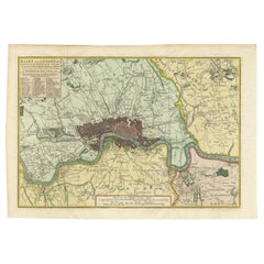
Antique Map of London by Tirion '1754'
Located in Langweer, NL
Antique map titled 'Kaart van Londen enz. en van het naby gelegen land ruim een Uur gaans rondsom dezelve Stad; getrokken uit de groote gemeeten Kaart van Hr. John Rocque'. In the se...
Category
Mid-18th Century Antique Europe Maps
Materials
Paper
$754 Sale Price
20% Off
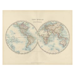
Antique World Map in Hemispheres with Delicate Pastel Coloring, 1903
Located in Langweer, NL
Title: Antique World Map in Hemispheres with Delicate Pastel Coloring, 1903
Description:
This stunning antique map, titled "The World in Hemispheres," dates back to 1903 and offers ...
Category
Early 20th Century Europe Maps
Materials
Paper
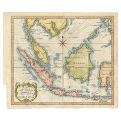
Java, Sumatra & Borneo Map – Bellin & van Schley Decorative Chart, 1750s
Located in Langweer, NL
Carte des Isles de Java, Sumatra, Borneo – Decorative Map by Bellin & van Schley, 1750s
This richly detailed and decorative map titled Carte des Isles de Java Sumatra Borneo & les d...
Category
Mid-18th Century European Antique Europe Maps
Materials
Paper
$613 Sale Price
20% Off
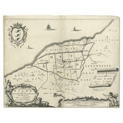
Antique Map of the Bildt Region by Schotanus, 1664
Located in Langweer, NL
Antique map titled 'De Grietenije van der Bildt (..)' Map of the Grietenij of Het Bildt, Friesland, The Netherlands. Multiple cartouches, key and coat of arms. Originates from ""Besc...
Category
17th Century Antique Europe Maps
Materials
Paper
17th Century Nautical Chart of Skagerrak and Øresund by Johannes van Keulen
Located in Langweer, NL
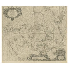
This map titled *Pascaret van Schager-Rack de Bælt en de Sondt* was created by the prominent Dutch cartographer Johannes van Keulen and published in Amsterd...
Category
Late 17th Century Antique Europe Maps
Materials
Paper
$905 Sale Price
20% Off
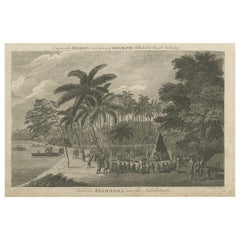
Antique Print of the Marketplace in Anamooka, Tonga Islands, c.1790
Located in Langweer, NL
Antique print titled 'View in Anamooka and the Inhabitants'. Depicts the marketplace that was established in a ring in front of the main house in Anamooka, Tonga - named the Friendly Islands because of his reception when James Cook's third Pacific voyage arrived there in May 1777.
Artists and Engravers: Engraved for Bankes's 'New System of Geography'. Published by Royal Authority.
Condition: Good, age-related toning. Please study image carefully.
Date: c.1790
Overall size: 38.6 x 23.2 cm.
Image size: 30.6 x 21.5 cm.
A View at Anamooka
This engraving after a drawing comes from the official account of Cook's third voyage, 'A voyage to the Pacific Ocean'.
Captain James Cook (1728-1779) made three separate voyages to the Pacific (with the ships Endeavour, Resolution, Adventure, and Discovery) and did more than any other voyager to explore the Pacific and Southern Ocean. Cook not only encountered Pacific cultures for the first time, but also assembled the first large-scale collections of Pacific objects to be brought back to Europe. He was killed in Hawaii in 1779.
Cook was in Nomuka (Annamooka), Tonga or Friendly Isles from May 1-14, 1777.
"On May 2 1777 the expedition reached Nomuka and anchored in the harbour on the north side of the island, which Cook had already used in June 1774. Both ships were in want of refreshments. A camp was erected on shore both as a trading post and a workshop for repairs. Watering, cutting wood...
Category
18th Century Antique Europe Maps
Materials
Paper
$226 Sale Price
20% Off
Original Antique Map of the American State of Maine, 1903
Located in St Annes, Lancashire
Antique map of Maine
Published By A & C Black. 1903
Original colour
Good condition
Unframed.
Free shipping
Category
Early 1900s English Antique Europe Maps
Materials
Paper
Map of Charente-Inférieure France with La Rochelle and Coastal Vineyards, c.1850
Located in Langweer, NL
Map of Charente-Inférieure France with La Rochelle and Coastal Vineyards, 19th c
Description:
This decorative 19th-century map of the former department of Charente-Inférieure, now k...
Category
Mid-19th Century French Antique Europe Maps
Materials
Paper
Antique Map of Zeeland 'The Netherlands' by N. Visscher, circa 1690
Located in Langweer, NL
Antique map titled 'Comitatus Zelandiae (..)'. Detailed chart of the province Zeeland, The Netherlands, with details shown pictorially. Published by N. Visscher.
Category
Late 17th Century Antique Europe Maps
Materials
Paper
$622 Sale Price
20% Off
Biblical Map and Family Trees of the Holy Land by Chatelain, ca. 1720
Located in Langweer, NL
Title: 1720 Chatelain Map of the Holy Land with Biblical Family Trees and Chronology
Description:
This fascinating 18th-century folio map by Henry Abraham Chatelain combines geo...
Category
1710s Antique Europe Maps
Materials
Paper
1584 Abraham Ortelius Map of Lower Burgundy, France
Located in Langweer, NL
1584 Abraham Ortelius Map of Lower Burgundy, France
Description of the Map:
This antique map by Abraham Ortelius, titled "Bvrgvndiae Inferioris Qvae Dvcatvs Nomine Censetur Des," w...
Category
16th Century Antique Europe Maps
Materials
Paper
$1,198 Sale Price
20% Off
Original Antique Map of the American State of North Carolina, 1903
Located in St Annes, Lancashire
Antique map of North Carolina
Published By A & C Black. 1903
Original colour
Good condition
Unframed.
Free shipping
Category
Early 1900s English Antique Europe Maps
Materials
Paper
Rare Hand-Colored Map of Lorraine and Barrois, France by Frederik De Wit c. 1688
Located in Langweer, NL
Title: Rare Hand-Colored Map of Lorraine and Barrois by Frederik De Wit c. 1688
Description: This remarkable 17th-century map, titled "Generalis Lotharingiae Ducatus," offers a deta...
Category
1680s Antique Europe Maps
Materials
Paper
1874 Map of Western United States – Detailed Atlas by Keith Johnston
Located in Langweer, NL
1874 Map of Western United States by Keith Johnston – Detailed Atlas
This is an original antique map titled “United States of North America (Western States)” by Alexander Keith John...
Category
1870s Scottish Antique Europe Maps
Materials
Paper
Original Antique Map of Normandy, France
Located in Langweer, NL
Antique map titled 'Carte de Normandie (..)'. Attractive map of Normandy, France. it depicts the former French Duchy of Normandy, covers the region fro...
Category
Mid-18th Century Antique Europe Maps
Materials
Paper
$745 Sale Price
20% Off
Old Genuine Antique Map of Tartary in the Russian Far East
Located in Langweer, NL
Original antique map titled 'Tartaria sive Magni Chami Imperium'. This great map of Tartary covers all of eastern Asia between the Caspian Sea and northern China and Manchuria. Being...
Category
Mid-17th Century Antique Europe Maps
Materials
Paper
$1,320 Sale Price
20% Off
Antique Print of Decorative Art in the 16th and 17th Century, 1869
Located in Langweer, NL
Old print of decorative art in the 16th and 17th century. This print originates from 'L'Ornement polychrome'. A beautiful work containing about 2000 patterns of all the styles of Art...
Category
19th Century Antique Europe Maps
Materials
Paper
$141 Sale Price
20% Off
Antique Map of Pennsylvania and New Jersey by Johnson, 1872
Located in Langweer, NL
Antique map titled 'Johnson's Pennsylvania and New Jersey'. Original map showing Pennsylvania and New Jersey. This map originates from 'Johnson's New Illustrated Family Atlas of the ...
Category
Late 19th Century Antique Europe Maps
Materials
Paper
$235 Sale Price
20% Off
Nautical Chart of Cape Verde Islands by J.W. Norie, 1824 Coastal Map
Located in Langweer, NL
Nautical Chart of Cape Verde Islands by J.W. Norie, 1824 Coastal Map
This beautifully engraved nautical chart, titled “A New Chart of the Cape Verde Islands,” was drawn by J.W. Nori...
Category
Early 19th Century English Antique Europe Maps
Materials
Paper
Rare 1681 Map of Batavia: Detailed Dutch Colonial Era Cartography, 1681
Located in Langweer, NL
The map of Batavia (modern-day Jakarta) from 1681, attributed to Frederick de Wit holds significant historical importance for several reasons:
Historical Context
1. Colonial Era: This map dates back to the Dutch colonial era when Batavia served as the administrative and commercial hub of the Dutch East India Company (VOC). The VOC was a powerful trading entity that played a crucial role in the global spice trade and colonization in Southeast Asia.
2. Strategic Importance: Batavia was strategically located on the northwestern coast of Java, providing the Dutch with a critical base for their maritime operations. The city became the center of Dutch political and military control in the region.
Cartographic Significance
1. Detailed Urban Layout: The map meticulously details the layout of Batavia, including its fortifications, canals, streets, and significant buildings. This level of detail provides insights into the urban planning and architectural styles of the period.
2. Military Engineering: The fortifications shown on the map illustrate the advanced military engineering techniques used by the Dutch to protect their valuable colony. The walls, bastions, and moats indicate the strategic considerations taken to defend against potential invasions.
3. Maritime Activity: The depiction of ships in the harbor highlights Batavia's role as a major maritime center. The VOC's fleets were essential for trade routes connecting Europe, Africa, and Asia, making Batavia a crucial node in global commerce.
Artistic and Cultural Value
1. Artistic Elements: The decorative elements, such as the lion holding a shield and the intricate cartouches, reflect the artistic trends of Dutch Golden Age cartography. These embellishments were not only informative but also served to display the cartographer's skill and the map's prestige.
2. Cultural Exchange: Maps like this one provide evidence of cultural exchange between the Dutch and the indigenous populations of Java. The blending of Dutch and local influences can be seen in various aspects of the map and the architecture of the city.
Rarity and Preservation
1. Rarity: Maps from the 17th century, especially those in good condition, are relatively rare and highly valued by collectors and historians. Each map provides a unique snapshot of historical geography and urban development.
2. Preservation of History: This map serves as a historical document, preserving knowledge about Batavia's cityscape, infrastructure, and colonial governance. It helps historians and scholars understand the socio-economic and political dynamics of the period.
Conclusion
The map of Batavia from 1681 is special due to its detailed depiction of one of the most important colonial cities in Southeast Asia during the Dutch Golden Age. It reflects the strategic, economic, and cultural significance of Batavia, serving as a valuable resource for understanding the history of Dutch colonialism and its global impact. The map's artistry and precision make it an important artifact in the history of cartography.
---------------
The map is an original and historical map of Batavia (present-day Jakarta) on the island of Java, dated 1681. There are several details to consider when evaluating its origins and possible authorship:
1. **Style and Detail**: The intricate details and style are reminiscent of maps created by Frederick de Wit, a prominent Dutch cartographer and engraver of the 17th century. He was known for his detailed city maps and sea charts.
2. **Lack of Signature**: The absence of "F. de Wit, Excudit" could indicate either an omission or a different engraver. However, it is essential to note that some maps from that period were reproduced or copied by other engravers and cartographers. This was not uncommon, as map-making was a collaborative effort, and copies of popular maps were frequently made.
3. **Map Characteristics**:
- The depiction of ships and the detailed fortifications are typical of Dutch cartography in the late 17th century.
- The decorative elements, such as the lion holding a shield, are also characteristic of Dutch map engravers.
4. **Other Possible Engravers**: While Frederick de Wit is a strong candidate, other notable Dutch engravers from that period include Joan Blaeu and Willem Janszoon Blaeu. They also produced highly detailed maps and could potentially be the creators or inspirers of this map.
To determine the precise authorship, you might consider:
- **Comparing** this map with other confirmed works of Frederick de Wit and his contemporaries to identify stylistic similarities and differences.
- **Historical Records**: Consulting historical records or publications related to Dutch cartography in the 17th century might provide more context or even direct references to this particular map.
If you have access to additional details or higher-resolution images of specific sections, it might help further pinpoint the map's origin and authorship.
-------------
Frederick de Wit (1629–1706) was a prominent Dutch cartographer, engraver, and publisher known for his detailed and decorative maps, atlases, and globes. He played a significant role in the Dutch Golden Age of cartography, contributing to the wealth of geographic knowledge and artistic achievement during this period. Here are key aspects of his life and work:
### Biography
- **Early Life**: Frederick de Wit was born in Gouda, Netherlands, in 1629. Little is known about his early years, but he moved to Amsterdam, the epicenter of Dutch cartography, in the mid-17th century.
- **Career Beginnings**: De Wit began his career as an engraver and publisher, initially producing maps that were reissues of earlier works by other cartographers, such as Joan Blaeu and Willem Janszoon Blaeu.
### Contributions to Cartography
- **Mapmaking**: De Wit was known for his meticulous attention to detail and artistic flair. He produced a wide range of maps, including world maps, regional maps, city plans, and maritime charts...
Category
1680s Antique Europe Maps
Materials
Paper
$5,566 Sale Price
20% Off
France Map 1757 – Southern Provinces by Isaak Tirion in Dutch Engraving
Located in Langweer, NL
France Map 1757 – Southern Provinces by Isaak Tirion in Dutch Engraving
This original copperplate engraving published in 1757 by Isaak Tirion in Amsterdam presents a highly detailed...
Category
Mid-18th Century Dutch Antique Europe Maps
Materials
Paper
1705 Sanson Map of Southern India and Malabar with an Inset Map
Located in Langweer, NL
Title: 1705 Sanson Map of Southern India and Malabar with an Inset Map
Description: This finely engraved and beautifully hand-colored antique map, published in 1705, depicts south...
Category
Early 1700s Antique Europe Maps
Materials
Paper
$726 Sale Price
20% Off
Antique 1683 Map of Hispaniola and Puerto Rico in the Caribbean by Mallet
Located in Langweer, NL
Title: 17th Century Map of Hispaniola and Puerto Rico by Mallet (1683)
This exquisite 17th-century map by Mallet, titled "I. d'Hispaniola et P.to Rico," showcases the islands of Hispaniola and Puerto Rico with remarkable detail. Published in Paris in 1683 as part of Mallet's monumental "Description de l'Univers," this map is a prime example of historical cartography from the era.
Map Features:
- Detailed depiction of Hispaniola and Puerto Rico
- Nearby islands: Inagua islands, Mayaguana, Île-à-Vache, Saona, and Mona
- Three illustrated naval battles surrounding the islands
- Hand-colored illustrations typical of the period
- Published in Paris, 1683, as part of the "Description de l'Univers"
- Engraved with artistic and geographic precision
Collectors and enthusiasts of antique maps will appreciate the historical significance and artistic detail of this rare print. Although small, the map is perfect for framing and this map serves as a captivating piece of history, reflecting the maritime exploration and territorial knowledge of the late 17th century.
The maker of the map is Allain Manesson Mallet, a notable 17th-century cartographer, military engineer, and author. Born in Paris in 1630, Mallet served in the French army and worked as a military engineer under Louis XIV. He later became a professor of mathematics and military architecture.
Mallet is best known for his monumental work, "Description de l'Univers," published in Paris in 1683. This extensive publication is considered one of the greatest works of its kind in the 17th century, providing detailed descriptions and maps of various parts of the world. Mallet's maps are renowned for their artistic quality, intricate details, and the inclusion of illustrative elements such as ships, sea creatures, and topographical features.
Mallet's contributions to cartography and his work in "Description de l'Univers" have left a lasting impact on the field, making his maps highly valued by collectors and historians.
Keywords:
- 17th-century map
- Mallet map 1683
- Hispaniola map
- Puerto Rico map
- Antique Caribbean map...
Category
1830s Antique Europe Maps
Materials
Paper
$358 Sale Price
20% Off
Antique Map of Cuba, Haiti and Porto Rico by W. G. Blackie, 1859
Located in Langweer, NL
Antique map titled 'The Leeward or North Caribbean Islands'. Original antique map of Cuba, Haiti and Porto Rico. This map originates from ‘The Imperial Atla...
Category
Mid-19th Century Antique Europe Maps
Materials
Paper
$235 Sale Price
20% Off
Rare 1864 Civil War Era Map of Illinois with Lake Michigan Detail
Located in Langweer, NL
Title: Rare 1864 Civil War Era Map of Illinois with Lake Michigan Detail
Description: This intricately detailed antique map, titled "Johnson's Illinois," was published in 1864 by Jo...
Category
1860s Antique Europe Maps
Materials
Paper
1882 Antique Map of Mexico Highlighting Geographical and Political Boundaries
Located in Langweer, NL
This 1882 map of Mexico, published by Blackie and Son as part of the 'Comprehensive Atlas and Geography of the World,' provides a highly detailed representation of the country's geog...
Category
1880s Antique Europe Maps
Materials
Paper
Original Antique Woodcut Map of Persia
Located in Langweer, NL
Antique map titled 'Tabula V Asiae'. Important early woodcut map of Persia, depicting the area of Mesopotamia, Armenia and the Gulf, to the Caspian and Carmania (Iran). Includes name...
Category
16th Century Antique Europe Maps
Materials
Paper
$556 Sale Price
20% Off
Ptolemaic Armillary Sphere Charles-François Delamarche Paris, 1805-1810 Circa
By Charles Francois Delamarche
Located in Milano, IT
Charles-François Delamarche
Ptolemaic armillary sphere
Paris, circa 1805-1810
Wood and papier-mâché
covered with printed and partly hand-coloured paper
It measures 15.74” in height, ...
Category
Early 1800s French Empire Antique Europe Maps
Materials
Paper, Wood
1616 Petrus Bertius Miniature Map of Cambay (Gujarat, India)
Located in Langweer, NL
Title: 1616 Petrus Bertius Map of Cambay and Gujarat, India
Description: This early seventeenth-century map, titled Descriptio Cambaiæ, was published in 1616 by Petrus Bertius, a ...
Category
1610s Antique Europe Maps
Materials
Paper
Rare 1864 Civil War Era Map of North America with Detailed Borders
Located in Langweer, NL
Title: Rare 1864 Civil War Era Map of North America with Detailed Borders
Description: This remarkable antique map, titled "Johnson's North America," was published in 1864 by Johnso...
Category
1860s Antique Europe Maps
Materials
Paper
1640 Map of North Africa Nova Barbariae Descriptio or The Barbarian Coast
Located in Langweer, NL
1640 Antique Map of North Africa 'Nova Barbariae Descriptio' by Johannes Janssonius
This antique map titled Nova Barbariae Descriptio*, published by Johannes Janssonius around 1640,...
Category
1640s Antique Europe Maps
Materials
Paper
$452 Sale Price
20% Off
Small Antique Map of the European Turkey, Greece & Ionian Islands – c.1860
Located in Langweer, NL
Antique Map of the European Turkey, Greece & Ionian Islands – Stieler, c.1860
Original antique map titled *Die Europaeische Türkei, Griechenland und die ...
Category
1860s Antique Europe Maps
Materials
Paper
$113 Sale Price
20% Off
Historical Map of Greece and the Eastern Mediterranean by Delisle - 1780
Located in Langweer, NL
Historical Map of Greece and the Eastern Mediterranean by Guillaume Delisle - 1780 Reissue
This captivating map titled "Carte de la Grèce" was originally crafted by the eminent Fr...
Category
1780s Antique Europe Maps
Materials
Paper
$273 Sale Price
20% Off
Antique Map of Syria by Wyld '1845'
Located in Langweer, NL
Antique map titled 'Map of Syria'. Original antique map of Syria. This map originates from 'An Atlas of the World, Comprehending Separate Maps of its
Var...
Category
Mid-19th Century Antique Europe Maps
Materials
Paper
$235 Sale Price
20% Off
Antique Map of North Carolina, with inset map of the western part
Located in Langweer, NL
Antique map titled 'North Carolina'. Original antique map of North Carolina, United States. With inset map of the western part of North Carolina....
Category
Late 19th Century Antique Europe Maps
Materials
Paper
$273 Sale Price
20% Off
Historic 1864 Civil War Era Map of Canada with Great Lakes Detail
Located in Langweer, NL
Title: Rare 1864 Civil War Era Map of Canada with Great Lakes Detail
Description: This finely detailed antique map, titled "Johnson's Canada," was published in 1864 by Johnson and W...
Category
1860s Antique Europe Maps
Materials
Paper
1758 Map of Saint Kitts – St. Christophe, Antique French Engraving
Located in Langweer, NL
Map of Saint Kitts (St. Christophe), circa 1758
This is an antique French map titled *Carte de l'Isle St. Christophe*, engraved by Jacques-Nicolas Bellin and published around 1758 f...
Category
Mid-18th Century French Antique Europe Maps
Materials
Paper
Original Antique Map of the American State of Colorado, 1903
Located in St Annes, Lancashire
Antique map of Colorado
Published By A & C Black. 1903
Original colour
Good condition
Unframed.
Free shipping
Category
Early 1900s English Antique Europe Maps
Materials
Paper
1750 Map of the Holy Land: The Land of Canaan and the Twelve Tribes
Located in Langweer, NL
Carte de la Terre de Canaan ou Terre Promise
Cartographer: Le St. Robert
Date of Publication: 1750
This exquisite 18th-century map, 'Carte de la Terre de Canaan ou Terre Promise', w...
Category
1750s Antique Europe Maps
Materials
Paper
1717 Johannes Van Keulen Sea Chart of the Eastern Atlantic - Amsterdam to Gambia
Located in Langweer, NL
1717 Johannes Van Keulen Sea Chart of the Eastern Atlantic - Amsterdam to Gambia
This 1717 sea chart by Johannes Van Keulen, titled "Nieuwe Paskaert vande ...
Category
1710s Antique Europe Maps
Materials
Paper
Plan of Pondicherry Fortifications and Attacks, France, c.1750
Located in Langweer, NL
Plan of Pondicherry Fortifications and Attacks, France, c.1750
This finely engraved map depicts the fortified city of Pondicherry, titled "Plan de Pondichéry et de ses attaques." It...
Category
Mid-18th Century French Antique Europe Maps
Materials
Paper
Antique Map of the Philippines by Anson '1749'
Located in Langweer, NL
Antique map titled 'Carte du Canal des Iles Philippines - Kaart van het Kanaal in de Filippynsche Eilanden'. Large detailed chart of the islands of the Philippines. One of the most detailed charts of the Philippines of the era. Shows Islands, bays, reefs, soundings tracks of the Manila Galleon route, etc. Includes a large compass...
Category
Mid-18th Century Antique Europe Maps
Materials
Paper
$943 Sale Price
20% Off
European Vintage Earth Globe on Stand with Compass
Located in Sofia, BG
Vintage handmade world globe standing on a base with small compass in the bottom. The piece is in fare condition with no restaurations ever made.
France, circa 1950
Category
Mid-20th Century French Europe Maps
Materials
Plastic, Paper
Large 1750 Map of the Kingdoms of Spain and Portugal by Robert de Vaugondy
Located in Langweer, NL
1750 Map of the Kingdoms of Spain and Portugal by Robert de Vaugondy
Description:
This map, titled *"Royaumes d'Espagne et de Portugal,"* was created in 1750 by the esteemed French ...
Category
Mid-18th Century Antique Europe Maps
Materials
Paper
$613 Sale Price
20% Off
1825 Buchon Map of Puerto Rico & Virgin Islands with Detailed Colonial History
Located in Langweer, NL
This map of Puerto Rico and the Virgin Islands, published by Jean Alexandre Buchon in 1825, offers a unique look at the Caribbean during a time of E...
Category
1820s Antique Europe Maps
Materials
Paper
$433 Sale Price
20% Off
Large Original Antique Map of Ohio, Usa, C.1900
Located in St Annes, Lancashire
Fabulous map of Ohio
Original color.
Engraved and printed by the George F. Cram Company, Indianapolis.
Published, C.1900.
Unframed.
Free shipping.
Category
1890s American Antique Europe Maps
Materials
Paper
Madrid 1901: A Historical Map of Spain's Capital Province
Located in Langweer, NL
The map is of the province of Madrid, the capital region of Spain, as it appeared in 1901. Here are the key features it displays:
The map shows the central part of Spain, with the Guadarrama mountain range prominently visible, marking the natural border to the north of Madrid.
Blue lines likely indicate rivers, including the Manzanares River, which flows through Madrid, and the Jarama River, a tributary to the Tagus.
Red lines depict the roads and railways, outlining the infrastructure that connects Madrid's various towns and cities within the province and beyond.
Symbols and labels mark the locations of cities, towns, and villages, with Madrid itself likely being the focal point. Dotted lines may represent the administrative divisions within the province. The map includes a legend (Signos Convencionales) that explains the symbols used for provincial capitals, roads, railways, and other geographic features.
The coat of arms of Madrid, featuring a bear and a strawberry tree (madroño), is prominently featured, symbolizing the city's and the province's historical coat of arms.
About the province of Madrid:
Madrid is not only the capital of Spain but also the heart of the Iberian Peninsula, both geographically and politically. The city is renowned for its rich repositories of European art, including the Prado Museum's works by Goya, Velázquez, and other Spanish masters. The province of Madrid is characterized by a blend of historical and modern elements, with a rich cultural life that includes theater, opera, and flamenco, as well as gastronomy that features a mix of traditional Spanish dishes and international cuisine...
Category
Early 1900s Antique Europe Maps
Materials
Paper
$650 Sale Price
20% Off
Rare 1730 Roman Empire Map by Moll - Detailed and Engraved Masterpiece
Located in Langweer, NL
An Historical Map of the Roman Empire and the Neighbouring Barbarous Nations by Herman Moll - Circa 1730
This grand and historically significant map of the Roman Empire was create...
Category
1730s Antique Europe Maps
Materials
Paper
$1,320 Sale Price
20% Off
16th-Century Panoramic View of Worms: A Woodcut from Sebastian Münster's
Located in Langweer, NL
This is a woodcut city view of Worms, published in Sebastian Münster's *Cosmographia* around 1578. The image depicts a bird's-eye view of the city of Worms, located in Rheinland-Pfal...
Category
16th Century Antique Europe Maps
Materials
Paper
$207 Sale Price
20% Off
Antique Print of French Garden Design by Le Rouge, 1776
Located in Langweer, NL
Antique print titled 'Jardins de la Maison de Neuilly'.
Copper engraving showing the design of a garden in France. This print originates from 'Jardins Anglo-Chinois à la Mode' by...
Category
18th Century Antique Europe Maps
Materials
Paper
$320 Sale Price
20% Off
Antique Map of North America, 1821
Located in Langweer, NL
Antique map of America titled 'Carte de l'Amerique septentrionale'. Scarce map of North America, shortly after the Louisiana Purchase and the first ...
Category
19th Century Antique Europe Maps
Materials
Paper
$613 Sale Price
20% Off
Beautiful Rare Antique Map of the Holy Land, 1648
Located in Langweer, NL
Antique map Holy Land titled 'Perigrinatie ofte Veertich-Iarige Reyse, der kinderen Israels uyt Egipten, door de Roode-Zee; mitsgaders de Woestyne tot int Beloofde Landt Canaan, : met groote vlyt uyt verscheryden auctoren by een gestelt, uyt de H. Schrift gecorigeert, ende int licht gegeven'.
Beautiful and rare antique map of the Holy Land...
Category
1640s Antique Europe Maps
Materials
Paper
$792 Sale Price
20% Off
Decorative Original Antique Map of Valencia in Southern Spain, circa 1601
Located in Langweer, NL
This is an original antique map titled 'Valentiae Regni olim Contestanorum Si Ptolemaeo, Edentanorum Si Plinio Credimus Typus'. This is a historical map of the Kingdom of Valencia in...
Category
Early 17th Century Antique Europe Maps
Materials
Paper
$1,320 Sale Price
20% Off
Plan of Baltimore City Map, USA c.1870 – Hand-Colored Street Plan
Located in Langweer, NL
Plan of Baltimore City Map, USA c.1870 – Hand-Colored Street Plan
This is a finely engraved and hand-colored street plan titled Plan of Baltimore, published in the United States cir...
Category
Mid-19th Century American Antique Europe Maps
Materials
Paper
Delaware and Maryland Map – Johnson, Hand-Colored with Insets, 1864
Located in Langweer, NL
Johnson’s Delaware and Maryland Map, USA c.1864 – Hand-Colored with Insets
This is a finely engraved and hand-colored map titled Johnson’s Delaware and Maryland, published by Johnso...
Category
Mid-19th Century American Antique Europe Maps
Materials
Paper
Map of Polynesia Highlighting Cultural Landscapes and Maritime Activities, 1851
Located in Langweer, NL
John Tallis & Company was a London-based map publisher that flourished during the 19th century. Their maps, characterized by elaborate borders and decorative vignettes, are some of t...
Category
1850s Antique Europe Maps
Materials
Paper
$273 Sale Price
20% Off
Original Antique Print of Two Women and a Man from Bolivia, South America, 1843
Located in Langweer, NL
Antique print titled 'Bolivia'.
Original antique print of two women and a man from Bolivia. This print originates from a work by Captain Gabriel-Pierre Lafond and illustrates peo...
Category
1840s Antique Europe Maps
Materials
Paper
$207 Sale Price
20% Off
Original Antique Map of Scotland by Dower, circa 1835
Located in St Annes, Lancashire
Nice map of Scotland
Drawn and engraved by J.Dower
Published by Orr & Smith. C.1835
Unframed.
Free shipping
Category
1830s English Antique Europe Maps
Materials
Paper
Rare Unusual Antique Map of Asia with a Landbridge from Korea to America, 1717
Located in Langweer, NL
Antique map titled 'L'Asie Suivant les Nouvelles Decouvertes (..).' Interesting and very unusual map of the Asian continent.
The map is based primarily on Dutch sources, particular...
Category
18th Century Antique Europe Maps
Materials
Paper
1645 Blaeu Map of Westmorland, Northern England – Hand Colored, Decorative
Located in Langweer, NL
This map, "Westmoria Comitatus; Anglice Westmorland", was created by the esteemed Dutch cartographer Willem Blaeu and was published around 1645 in 'Le Theatre du Monde ou Nouvel Atlas'. It provides a detailed look at Westmorland, a historic county in northern England, based on John Speed’s earlier map. The map features numerous place names, parks, and estates, including Brigster Park, Colnhead Park, Crosbye, and Midleton, along with a detailed depiction of Windermere (spelled Wynandermere) and the surrounding regions.
Additional Features:
- Hand-colored map, with vibrant and detailed colors that bring out the topographical and decorative features.
- Includes intricate cartouches, such as the royal coat of arms, a decorative title cartouche topped with putti (cherubic figures), and six coats of arms (two left blank).
- Depicts the region’s rich landscape, including the rolling hills and mountainous terrain of northern England.
- French text on the verso, indicative of the publication period from 1645-1648, part of Blaeu’s highly sought-after atlases.
- Map shows precise details of small towns, estates, and parks, such as Brigster Park, Colnhead Park, Crosbye, and Wynandermere (now Windermere Lake).
This map would be of particular interest to collectors of English county maps, antique maps of northern England, 17th-century cartography, and the decorative works of Willem Blaeu. Blaeu's maps are renowned for their accuracy, artistic beauty, and historical significance.
Keywords: Willem Blaeu, Westmorland map, northern England, 17th-century map, antique map, English county map, John Speed, Windermere, decorative cartography, hand-colored map, rare map, antique cartography...
Category
1640s Antique Europe Maps
Materials
Paper
$1,179 Sale Price
20% Off
Recently Viewed
View AllMore Ways To Browse
Antique Buddha Laos
Antique Captains Chest
Antique Crutches
Antique Curved Front Dresser
Antique Dressing Table With 3 Mirrors
Antique Fire Guard Screen
Antique Fire Guards Brass
Antique Fire Markers
Antique Fireplace Coal Basket
Antique Folding Card Table 20th Century
Antique French Lavabo
Antique French Marble Top Server Buffet
Antique German Mugs
Antique Gun Cabinet
Antique Horse Crop
Antique Hubley Cast Iron
Antique Indonesian Ikat
Antique Iron Pot Rack
