Europe Maps
to
4,227
5,436
241
5,435
1
68
33
9
8
3
2
1
1
1
2,863
2,156
416
1
268
14
3
120
4
30
3
3
3
1
5,374
74
35
21
16
589
310
197
110
79
5,436
5,436
5,436
104
59
28
20
15
Item Ships From: Europe
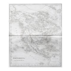
Original Antique Map of North America by Dower, circa 1835
Located in St Annes, Lancashire
Nice map of North America
Drawn and engraved by J.Dower
Published by Orr & Smith. C.1835
Unframed.
Free shipping
Category
1830s English Antique Europe Maps
Materials
Paper
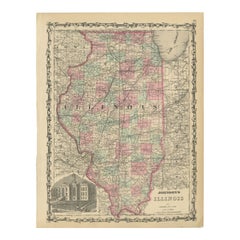
Johnson’s Illinois Map, USA c.1864 – Hand-Colored with Chicago Courthouse View
Located in Langweer, NL
Johnson’s Illinois Map, USA c.1864 – Hand-Colored with Chicago Courthouse View
This is a finely engraved and hand-colored map titled Johnson’s Illinois, published by Johnson and War...
Category
Mid-19th Century American Antique Europe Maps
Materials
Paper
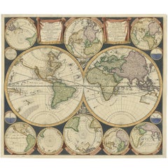
Antique World Map by P. Schenk '1706'
By Peter Schenk
Located in Langweer, NL
Antique map titled 'Diversa Orbis Terrae. Visu Incedente per Coluros Tropicorum, Ambos Ejus Polos, et Parciularis Sphaerae Zenith, in Planum Orthographica Projectio (..) Plat Ontwerp van verscheyde Aert-klooten (..)'. One of the earliest Dutch World Maps to focus on a more modern cartographic style, based on Carel Allard's map of 1696. This map represented a noteworthy shift from the traditional decorative Dutch 17th century maps where the margins would be full of classical mythological...
Category
Early 18th Century Antique Europe Maps
Materials
Paper
$5,094 Sale Price
20% Off
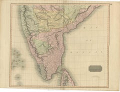
1816 Large Southern Hindostan Map by J. Thomson – New General Atlas
Located in Langweer, NL
Title: 1816 Southern Hindostan Map by J. Thomson – New General Atlas
This map, titled "Southern Hindostan," was published in 1816 as part of J. Thomson’s *New General Atlas*. The ma...
Category
1810s Antique Europe Maps
Materials
Paper
$500 Sale Price
20% Off
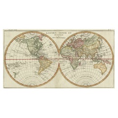
Very Decorative Original Antique Map of the World, Published in France in c.1780
By Rigobert Bonne
Located in Langweer, NL
Antique map titled 'L'Ancien Monde Et Le Nouveau en Deux Hemispheres' - Double hemisphere map of the World, showing the contemporary geographical...
Category
18th Century Antique Europe Maps
Materials
Paper
$726 Sale Price
20% Off
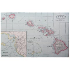
Original Antique Map of Hawaii And Adjacent Islands. C.1900
Located in St Annes, Lancashire
Fabulous map of Hawaii. With a vignette of Honolulu
Original color.
Engraved and printed by the George F. Cram Company, Indianapolis.
Published, C.1900.
Unframed.
Free shipping.
Category
1890s American Antique Europe Maps
Materials
Paper
Rare Antique Map of the Middle East, ca.1690
Located in Langweer, NL
Description: Antique print, untitled.
Two decorative maps on one sheet of the middle east in biblical times. Source unknown, to be determined.
Artists and Engravers: Anonymous...
Category
1690s Antique Europe Maps
Materials
Paper
$339 Sale Price
20% Off
The Highlands and Lowlands of Scotland as Mapped in 1882
Located in Langweer, NL
Title: 1882 Blackie Atlas Maps of Scotland: Northern and Southern Regions
Description: These two maps from the 1882 Blackie Atlas provide a detailed representation of Scotland, spli...
Category
1880s Antique Europe Maps
Materials
Paper
Antique Map of the Kingdoms of Sweden and Norway by Wyld '1845'
Located in Langweer, NL
Antique map titled 'Kingdoms of Sweden and Norway'. Original antique map of the Kingdoms of Sweden and Norway. This map originates from 'An Atlas of the World, Comprehending Separate...
Category
Mid-19th Century Antique Europe Maps
Materials
Paper
$141 Sale Price
40% Off
Antique Map of Bourbon, or Reunion, Colony of France
Located in Langweer, NL
Original antique map titled 'Ile de la Réunion'. This is a fascinating map of the French department of Ile. Bourbon or Reunion. Bourbon, or Reunion, is a volcanic island off the coas...
Category
Mid-19th Century Antique Europe Maps
Materials
Paper
$320 Sale Price
20% Off
WWI Satirical Cartoon Map: 'Kill That Eagle' by J.H. Amschewitz, 1914
Located in Langweer, NL
This fascinating serio-comic map was created by John Henry Amschewitz and published in December 1914, at the beginning of WWI.
Amschewitz was a British born artist who was unable to enlist for war service due to an injury he sustained while working on a mural project in Liverpool. Instead Amschewitz focused on his interests in art and theater, themes which are apparent in this map and even the title itself: European Revue.
The eagle refers of course to Germany, which has its claw on Marianne's bayonet, while its other claw is being pulled by the Russian bear...
Category
1910s Vintage Europe Maps
Materials
Paper
Antique Map of The Regions of Italy and Sicily during the Roman Empire, 1880
Located in Langweer, NL
This map is an original antique engraving titled "ITALIAE REGIONES IIII SICILIA," which translates to "The Regions of Italy and Sicily." This detailed historical map portrays the reg...
Category
1880s Antique Europe Maps
Materials
Paper
$349 Sale Price
20% Off
Large 17th-Century Coronelli Map of Europe with Mythical Islands and Rich Detail
Located in Langweer, NL
Large 17th-Century Coronelli Map of Europe with Mythical Islands and Rich Detail
This exceptional two-sheet map of Europe by Vincenzo Maria Coronelli, published in Venice in 1692,...
Category
1690s Antique Europe Maps
Materials
Paper
Levasseur's 1852 Cartographic Portrait of Gironde: Celebrating the Bordeaux Wine
Located in Langweer, NL
This original hand-colored map is from the "Atlas National Illustré," a work by Victor Levasseur, a French geographer and cartographer known for his richly illustrated maps.
The map is a steel engraving, which was a common and precise method for creating maps at the time. The inclusion of the publisher's name, A. Combette from Paris, and the addresses of the various contributors to the map's creation, like the engravers Laguillermie and Rainaud, adds to the historical context of the piece.
The margins of the map are adorned with detailed illustrations that serve as a visual encyclopedic reference to the region's geography, economy, and notable figures. The use of color along the boundaries makes the map not only a tool for navigation but also an educational resource, providing insights into the department's landscape, economy, and cultural significance.
The text included in the map's design provides statistical information, a map legend, and discussions about the land, local curiosities, notable personalities, products, and commerce, which would have been invaluable for education and reference at the time.
The 'Atlas National Illustré' is celebrated for its combination of cartographic detail and artistic embellishment, making it a valuable cultural artifact. It represents the height of decorative map-making in the 19th century, alongside the works of John Tallis and Archibald Fullarton.
This uploaded image is a detailed and colored map of the Département de la Gironde from Victor Levasseur's "Atlas National Illustré." Similar to the other maps from this series, it features a central map with the title 'Dépt. de la Gironde' at the bottom.
Surrounding the map are decorative vignettes and elements that bring to life the cultural and economic aspects of the Gironde department. On the left, there is likely statistical information about the department and its subdivisions, reflecting the population and administrative details. This is framed by images that may represent the local industries and natural resources, such as wine, which is a central feature of the Bordeaux region located within Gironde.
The right side of the map contains a textual history and descriptions of the region, coupled with portraits of notable figures, possibly historic personages or contributors to the region's cultural and economic development. The illustrations often include agricultural products, symbols of commerce, and scenes of daily life, as well as architectural landmarks.
The presence of wine bottles, barrels, and vineyards in the illustrations would be indicative of the Gironde's prominence in wine production, particularly Bordeaux wines, which are esteemed worldwide. These engravings serve to emphasize the richness of the land and the sophistication of its products.
Maps from this era, especially those by Levasseur, are notable for their combination of art and education, providing a snapshot not only of the geography but also of the societal and economic conditions of the time. The detailed engravings also suggest that this map was as much a decorative piece as it was a functional one, intended for display and reference by those interested in the illustrated region.
The Gironde department in France is renowned for its significant contribution to the wine industry, particularly through the Bordeaux wine region. A bit more about the important places within Gironde and the types of wine the area is known for:
1. **Bordeaux**: The capital city of the department and the heart of the wine region. It's not only an urban center but also a hub for the wine trade.
2. **Médoc**: North of Bordeaux, known for prestigious châteaux and wines like Margaux, Saint-Julien, Pauillac, and Saint-Estèphe.
3. **Saint-Émilion**: East of Bordeaux, recognized for its full-bodied red wines and the picturesque medieval town.
4. **Pomerol**: Also near Saint-Émilion, smaller than its neighbor but equally renowned, particularly for Château Pétrus...
Category
1850s Antique Europe Maps
Materials
Paper
$320 Sale Price
20% Off
Map of Italy and Neighboring Regions by Delamarche – Antique Map, c.1800
Located in Langweer, NL
Antique Map of Italy and Surrounding Regions by Delamarche, circa 1800
This elegant and detailed antique map titled Carte Générale de l’Italie was drawn and engraved by the French g...
Category
Early 1800s French Antique Europe Maps
Materials
Paper
Persia Unveiled: Antique Map of Iran, Afghanistan, and Beyond, 1852
Located in Langweer, NL
The antique map titled 'Royaumes de Perse Herat & Kaboul' is an attractive map of Persia. Here are the key details and features of the map:
1. **Geographic Coverage**:
- The map ...
Category
Mid-19th Century Antique Europe Maps
Materials
Paper
$150 Sale Price
20% Off
Rare 1572 Map of Ancient Rome with Monuments by Ligorio, Braun & Hogenberg
Located in Langweer, NL
Rare 1572 Map of Ancient Rome with Monuments by Ligorio, Braun & Hogenberg
This remarkable 16th-century map, *Urbis Romae Situs cum ils quae adhuc Conspiciuntur Veter. Monumet Rel...
Category
16th Century Antique Europe Maps
Materials
Paper
Antique Map of the Coast of Southern France, 1793
Located in Langweer, NL
Antique map titled '14th Chart of the Coast of France, from Port Vendres to the Petit Rhône'. Original map with later hand coroling of the coast of Southern France.
The "14th Chart of the Coast of France, from Port Vendres to the Petit Rhône" is an antique map that offers a detailed depiction of the southern coast of France, specifically highlighting the Mediterranean coastline. This map, which dates back to 1793, was originally part of "Le Petit Neptune Français; Or, French Coasting Pilot," a publication designed for maritime navigation along the French coastlines.
Key Features of the Map:
1. **Geographic Coverage**:
- The map covers the southern French coastline from Port Vendres in the west to the Petit Rhône in the east.
- It includes notable regions such as Languedoc, the Gulf of Lyon, and parts of Catalonia (Spain).
2. **Notable Places**:
- **Montpellier**: A major city in the Diocese of Montpellier, an important cultural and economic center.
- **Narbonne**: Located in the Diocese of Narbonne, a historical city with Roman heritage.
- **Agde**: Situated in the Diocese of Agde, known for its ancient Greek colony origins.
- **Béziers**: Part of the Diocese of Béziers, another city with deep historical roots dating back to Roman times.
- **Port Vendres**: A critical port near the Spanish border.
- **Catalonia**: Including parts of northeastern Spain, emphasizing the coastal connection between France and Spain.
3. **Dioceses and Regions**:
- The map is marked with various dioceses such as Montpellier, Agde, Narbonne, and Béziers, indicating ecclesiastical boundaries.
- It highlights the broader region of Languedoc, a historical province known for its wine production and medieval history.
4. **Navigational Aids**:
- The map features a compass rose with radiating lines, a common navigational aid in maritime maps...
Category
Late 18th Century Antique Europe Maps
Materials
Paper
$226 Sale Price
20% Off
Large Antique Map of the State of Texas, 1861
Located in Langweer, NL
Antique map titled 'Johnson's New Map of the State of Texas' Large map of Texas, shows railroads, wagon roads, the U.S. Mail Route, rivers, ports, ...
Category
Mid-19th Century American Antique Europe Maps
Materials
Paper
$462 Sale Price
20% Off
Antique Engraving with a Plan of Rhodes, Greece, 1688
Located in Langweer, NL
Description: Antique map, titled: 'Rhodos.' - Plan of Rhodes, Greece. This map originates from 'Nauwkeurige Beschrijving der eilanden in de in de Archipel der Middellantsche Zee', by...
Category
1680s Antique Europe Maps
Materials
Paper
$424 Sale Price
20% Off
Ireland Map – Provincial and County Divisions 1851
Located in Langweer, NL
Ireland Map – Provincial and County Divisions 1851
This fine antique print shows Ireland titled simply “Ireland,” published in 1851 by Justus Perthes in Gotha as part of Adolf Stiel...
Category
Mid-19th Century German Antique Europe Maps
Materials
Paper
Old Map of the Balkans Incl Greece, Turkey, Serbia, Montenegro, Bulgaria, C.1900
Located in Langweer, NL
Antique map titled 'Carte de la presqu-île du Balcan - Karte der Balkan Halbinsel'.
Original antique map of the Balkans including Greece, Turkey, Serbia, Montenegro, Bulgaria and...
Category
Early 1900s Antique Europe Maps
Materials
Paper
$613 Sale Price
20% Off
Rare 1864 Civil War Era Map of Michigan and Wisconsin with Great Lakes Detail
Located in Langweer, NL
Title: Rare 1864 Civil War Era Map of Michigan and Wisconsin with Great Lakes Detail
Description: This beautifully crafted antique map, titled "Johnson's Michigan and Wisconsin," wa...
Category
1860s Antique Europe Maps
Materials
Paper
Large Original Vintage Map of the United Kingdom, circa 1920
Located in St Annes, Lancashire
Great map of The United Kingdom
Unframed
Original color
By John Bartholomew and Co. Edinburgh Geographical Institute
Published, circa 1920
Free shipping.
Category
1920s British Vintage Europe Maps
Materials
Paper
Original Hand-Colored Antique Regional Map of Switzerland, 1753
Located in Langweer, NL
Antique map Switzerland titled 'Territorium Reipublicae liberae Helveticae Scaphusiensis (..)'. Regional map of Switzerland.
Artists and En...
Category
1750s Antique Europe Maps
Materials
Paper
$556 Sale Price
20% Off
Original Antique Map of Arabia and the Red Sea
Located in Langweer, NL
Antique map titled 'Carte de la Coste d'Arabie (..) - Kaart van de Kust van Arabië (..)'. This is a Dutch version, engraved by J. van Schley, of Bellin's map of Arabia and the Red Sea...
Category
Mid-18th Century Antique Europe Maps
Materials
Paper
$443 Sale Price
20% Off
1711 Star Chart of Southern Sky with Mythical Constellations and Exotic Animals
Located in Langweer, NL
1711 Star Chart of the Southern Sky - "Mappa Stellarum Australium quae in Altitudine Poli Borei Graduum"
This beautiful star chart, engraved by Arnold van Westerhout in 1711, shows ...
Category
1710s Antique Europe Maps
Materials
Paper
$1,594 Sale Price
20% Off
Original Antique Map of the American State of Connecticut & Rhode Island, 1903
Located in St Annes, Lancashire
Antique map of Connecticut and Rhode Island
Published By A & C Black. 1903
Original colour
Good condition
Unframed.
Free shipping
Category
Early 1900s English Antique Europe Maps
Materials
Paper
Large Original Antique Map of the Environs of Cork, Ireland, circa 1880
Located in St Annes, Lancashire
Great map of The Environs of Cork
Published circa 1880
Unframed
Free shipping.
Category
1880s Scottish Antique Europe Maps
Materials
Paper
Rare 1757 Jesuit Map of California and Baja, Dedicated to the King of Spain
Located in Langweer, NL
Title: Rare 1757 Jesuit Map of California and Baja, Dedicated to the King of Spain
This rare and detailed map, titled *Carte de la Californie Levee par la Société des Jésuites*, wa...
Category
1750s Antique Europe Maps
Materials
Paper
Large Original Antique Map of the World, Fullarton, circa 1870
Located in St Annes, Lancashire
Great map of the World.
From the celebrated Royal Illustrated Atlas
Lithograph. Original color.
Published by Fullarton, Edinburgh, circa 1870.
Unframed.
Category
1870s Scottish Antique Europe Maps
Materials
Paper
Antique Map of Yemen by Schraembl, 1789
Located in Langweer, NL
Antique map titled 'Karte von dem groessten Theil des Landes Jemen'. Original map of Yemen, this map is the first printed map specifically of Yemen, and t...
Category
Late 18th Century Antique Europe Maps
Materials
Paper
$849 Sale Price
20% Off
Antique Map of Ireland, 1903, with Intricate County Boundaries & Coastal Details
Located in Langweer, NL
Title: Antique Map of Ireland, 1903, with Intricate County Boundaries and Coastal Detail
Description:
This antique map of Ireland, engraved and published in 1903 by the esteemed W. ...
Category
Early 20th Century Europe Maps
Materials
Paper
Political Map of Europe: Early 19th Century, from the 1802 Tardieu Atlas
Located in Langweer, NL
Antique Map Description
Title: Carte Générale et Politique de l'Europe
Publication Details:
- **Atlas Title:** Nouvel Atlas Universel de Géographie Ancienne et Moderne
- **Purpose...
Category
Early 1800s Antique Europe Maps
Materials
Paper
$452 Sale Price
20% Off
Large Antique Map of the East Indies, with Inset of the Philippines
Located in Langweer, NL
Antique map titled 'A Map of the East Indies (..)'. Large antique map of Southeast Asia, India, and part of China, extending to Tibet, the Maladives, Sumatra, part of Borneo, Hainan,...
Category
Late 18th Century Antique Europe Maps
Materials
Paper
$462 Sale Price
20% Off
Original Antique Map or City Plan of Venice, Italy. Circa 1835
Located in St Annes, Lancashire
Nice map of Venice
Drawn and engraved by J.Dower
Published by Orr & Smith. C.1835
Unframed.
Free shipping
Category
1830s English Antique Europe Maps
Materials
Paper
Antique Map of The United States of North America, Pacific States, 1882
Located in Langweer, NL
The map is from the same 1882 Blackie Atlas and focuses on the Pacific States of the United States of America during that period. Here are some details and historical context about t...
Category
1880s Antique Europe Maps
Materials
Paper
$235 Sale Price
20% Off
Historic 1864 Civil War Map of Pennsylvania and New Jersey with Coastal Focus
Located in Langweer, NL
Title: Historic 1864 Civil War Map of Pennsylvania and New Jersey with Coastal Focus
Description: This meticulously crafted antique map, titled "Johnson's Pennsylvania and New Jerse...
Category
1860s Antique Europe Maps
Materials
Paper
Cáceres 1901: Mapping the Crossroads of Extremadura, Western Spain
Located in Langweer, NL
The map depicts the province of Cáceres in Spain, dated 1901. Key features of the map include:
The map shows detailed contour lines indicating the diverse terrain, which includes the northern part of the province being part of the Sistema Central mountain range. Blue lines mark the rivers and larger bodies of water, likely including the Tagus River, which passes through the province. Red lines indicate roads and railways, highlighting the connections within the province and to neighboring areas.
The coat of arms of Cáceres is featured prominently, displaying a castle and a lion, symbols associated with the historical heritage of the region. It is highlighted with a gold coating in the crown.
About the province of Cáceres:
Cáceres is one of the two provinces in the autonomous community of Extremadura, in western Spain, bordering Portugal. The province is known for its extensive natural environments, including part of the Monfragüe National Park, which is a UNESCO-designated Biosphere Reserve, and the Tagus River International Natural Park. The capital city, also named Cáceres, boasts a well-preserved old town with a wealth of Renaissance architecture...
Category
Early 1900s Antique Europe Maps
Materials
Paper
$292 Sale Price
20% Off
Original Antique Hand-colored World Map with or without Frame, '1696'
Located in Langweer, NL
Antique world map titled 'Mappe-Monde dressee sur les Observations de Mrs. de l'Academie Royale des Sciences (..)'. Beautiful original antique world map...
Category
Late 17th Century Antique Europe Maps
Materials
Paper
$4,245 Sale Price
20% Off
Rare 1864 Ohio Civil War Era Map with State Capitol Illustration
Located in Langweer, NL
Title: Johnson's Ohio Antique Map by Johnson and Ward, 1864
Description: This exquisite antique map, titled "Johnson's Ohio," was published in 1864 by Johnson and Ward, a prominent ...
Category
1860s Antique Europe Maps
Materials
Paper
Original Antique Blaeu Map of Karst, Carniola, Istria, and Trieste, circa 1640
Located in Langweer, NL
Blaeu Map of Karst, Carniola, Istria, and Trieste, circa 1640
This is an original antique map titled “Karstia, Carniola, Histria et Windorum Marchia,” published by Willem Blaeu in Amsterdam circa 1640. The map depicts the historical regions of Karst (Karstia), Carniola (modern-day Slovenia), Istria (the peninsula shared by Croatia, Slovenia, and Italy), and the Windic March, a medieval border territory.
The engraving shows detailed place names, rivers, mountains, and settlements across present-day Slovenia, northeastern Italy, and northwestern Croatia. The Gulf of Trieste is prominently illustrated at the lower left, with Trieste labelled and coastal settlements clearly indicated. The Adriatic Sea is elegantly engraved with stippled waters, a compass rose, rhumb lines, and a sailing ship, enhancing its decorative maritime appeal.
In the upper left corner is a beautifully designed cartouche bearing the title within a scrollwork frame with foliage and drapery motifs. The lower left includes a mileage scale in Italian miles and a dedication to Guiljelmus Blaeu excudit, confirming its publication from the Blaeu workshop.
Willem Janszoon Blaeu (1571–1638) was one of the leading Dutch cartographers of the early 17th century, succeeded by his son Joan Blaeu. Their maps were known for their precision, aesthetic engraving, and clarity, making the Blaeu atlases the most prestigious publications of the Dutch Golden Age.
Condition:
Good condition. Strong, clean impression on laid paper with wide margins. Light age toning and faint foxing in blank margins, minor creasing along the original centre fold as issued. No tears or repairs noted. Fully suitable for framing.
Framing tips:
Frame this map in a thin black, walnut, or gilt frame to enhance its historic character. Use an off-white or cream archival mat to highlight the detailed engraving and preserve the sheet edges. UV-protective glazing is recommended to protect the paper and ensure its clarity and integrity over time.
Keywords: Here are short keyword blocks formatted for direct copy-pasting into your website SEO or 1stdibs tags:
karst map, carniola map, istria map, trieste map, blaeu map, willem blaeu,
17th century map, dutch cartography, antique balkan map, slovenia antique map,
croatia antique...
Category
17th Century Dutch Antique Europe Maps
Materials
Paper
Isles of Enchantment: The Balearic Archipelago in 1902
Located in Langweer, NL
The Balearic Islands, Spain, from the year 1902. The title on the map is "ISLAS BALEARES 1902." This map illustrates the Balearic archipelago in the Mediterranean Sea, highlighting t...
Category
Early 1900s Antique Europe Maps
Materials
Paper
$650 Sale Price
20% Off
Rare Antique Map of the Americas with Island California by Danckerts, c.1680
Located in Langweer, NL
Rare Antique Map of the Americas with Island California by Justus Danckerts, ca. 1696
This exceptional antique map titled Novissima et Accuratissima Totius Americae Descriptio per I...
Category
Late 17th Century Dutch Antique Europe Maps
Materials
Paper
Antique Map of Tartary, Also Showing the Great Wall of China
Located in Langweer, NL
Antique map titled 'Carte de Tartarie'. Detailed map of Tartary, consisting of the Eastern part of Russia, Central Asia, China and Korea, first published by Guillaume De L'Isle in 1706. The map extends from the Peninsula of Korea in the east to the Caspian and Black Seas. The Great Wall of China...
Category
Early 18th Century Antique Europe Maps
Materials
Paper
$1,037 Sale Price
20% Off
1877 Satirical Map of the Eastern War: Europe's Powers as Caricatured Characters
Located in Langweer, NL
Title: 1877 Caricature Map of the Eastern War - "Carte de la Guerre en Orient" by H. Demare
Description: This 1877 satirical map, titled "Carte de la Guerre en Orient," was publis...
Category
1870s Antique Europe Maps
Materials
Paper
Antique Map of South Africa by Lowry, 1852
Located in Langweer, NL
Antique map titled 'South Africa'. Two individual sheets of South Africa. This map originates from 'Lowry's table Atlas constructed and engraved from the most recent authorities' by ...
Category
Mid-19th Century Antique Europe Maps
Materials
Paper
$141 Sale Price / set
20% Off
Large Original Antique Map of Massachusetts, USA, circa 1900
Located in St Annes, Lancashire
Fabulous map of Massachusetts
In 2 sheets. They can be joined but I have not done it
Original color
Engraved and printed by the George F. Cram ...
Category
1890s American Antique Europe Maps
Materials
Paper
Antique Map of Spain and Portugal by Barlow, 1809
Located in Langweer, NL
"Antique map titled 'Spain and Portugal from the best Authorities'. Detailed antique map of Spain and Portugal. This map originates from 'The Gen...
Category
19th Century Antique Europe Maps
Materials
Paper
$75 Sale Price
20% Off
Jerusalem and Temple Imaginary Map by Blome, Published London 1689
Located in Langweer, NL
Imaginary Plan of Jerusalem by Blome after Villalpando, 1689
This impressive antique engraving presents an imaginary plan of Jerusalem by Richard Blome, published in 1689. The engra...
Category
Late 17th Century English Antique Europe Maps
Materials
Paper
Antique Map of Arkansas
Located in Langweer, NL
Antique map titled 'Arkansas'. Original antique map of Arkansas, United States. This print originates from 'Encyclopaedia Britannica', Ninth Edition. P...
Category
Late 19th Century Antique Europe Maps
Materials
Paper
$273 Sale Price
20% Off
Antique Map of the Township of Zuidlaren, Drenthe in the Netherlands, 1865
Located in Langweer, NL
Drenthe: Gemeente Zuidlaren, Midlaren, Plankersloot. These scarse detailed maps of Dutch Towns originate from the 'Gemeente-atlas' of Jacob Kuyper. This atlas of all towns in the Net...
Category
19th Century Antique Europe Maps
Materials
Paper
$179 Sale Price
20% Off
Antique Map of Morocco Showing Towns of Marakesh, Taradant and Fez, 1636
Located in Langweer, NL
Antique map titled 'Fezzae et Marocchi regna Africae Celeberrima'. Map of Morocco, showing large fortified towns of Marakesh, Taradante and Fez, towns, mountains, rivers, lakes, etc....
Category
17th Century Antique Europe Maps
Materials
Paper
$1,179 Sale Price
20% Off
Antique Print of the Korte Vijverberg in The Hague, The Netherlands, c.1760
By Georg Balthasar Probst
Located in Langweer, NL
Antique print titled 'Gesicht by de Doelen over de Korte Vyverberg tot Gravenhaghe'. Beautiful view on the Korte Vijverberg, next to the Hofvijver in The Hague. On the right-hand sid...
Category
18th Century Antique Europe Maps
Materials
Paper
Rare Original Map of New Amsterdam (New York) – “Restitutio”, ca. 1674 –
Located in Dronten, NL
An exceptionally rare and original 17th-century engraving of New Amsterdam, now New York City, published by the renowned Amsterdam cartographer Carel (Carolus) Allard around 1674. Kn...
Category
17th Century Dutch Antique Europe Maps
Materials
Paper
Antique Map of the Province Groningen in The Netherlands, c.1680
Located in Langweer, NL
Antique map titled 'Groningae et Omlandiae Dominium vulgo de Provincie van Stadt en Lande'.
Old map of the province of Groningen, the Netherlands. This map originates from 'Germani...
Category
17th Century Antique Europe Maps
Materials
Paper
$462 Sale Price
20% Off
Detailed 1795 Map of the Americas with Exploration Tracks and Nice Cartouche
Located in Langweer, NL
This is a very handsome and rare 1795 map of the Americas titled "Amerique ou Nouveau Continent Dressee sur les Nouvelles Relations Decouvertes et Observations" by Jean Baptiste Noli...
Category
1790s Antique Europe Maps
Materials
Paper
$2,207 Sale Price
20% Off
Antique Map of Asia, Vignette of Benares 'Varanasi' Showing Ganges River, 1892
Located in Langweer, NL
Antique map titled 'Asie'. Color map of Asia. With decorative vignette of Benares (Varanasi) showing Ganges River. This map originates from 'Nouvel Atlas Illustre Geographie Universe...
Category
19th Century Antique Europe Maps
Materials
Paper
$226 Sale Price
20% Off
Palermo – 1620 Braun & Hogenberg Bird’s-Eye Map of Palermo, Sicily
Located in Langweer, NL
Palermo – 1620 Braun & Hogenberg Bird’s-Eye Map of Palermo, Sicily
This beautifully detailed bird’s-eye view of Palermo, Sicily, was created by Georg Braun and Frans Hogenberg aro...
Category
1620s Antique Europe Maps
Materials
Paper
Antique Map of Tracks of Anson's Ships around South America & Cape Horn, 1749
Located in Langweer, NL
Description: Antique map titled 'Kaart van het Zuidelykste Gedeelte van Zuider Amerika (..) - Carte de la Partie Meridionale de l'Amerique Meridionale (..)'.
Detailed chart tracking the route of Capt. George Anson's ship The Centurion in 1745. The chart shows the tracks of Anson's ships around South America & Cape Horn to the Juan Fernandes Islands, with notes on currents and positions.
In 1740 Capt. George Anson (1697-1762) of the Royal Navy, was given command of a squadron of ships. As England was at war with France and Spain, Anson's task was to intercept and capture a Spanish treasure...
Category
1740s Antique Europe Maps
Materials
Paper
$613 Sale Price
20% Off
Recently Viewed
View AllMore Ways To Browse
Antique Buddha Laos
Antique Captains Chest
Antique Crutches
Antique Curved Front Dresser
Antique Dressing Table With 3 Mirrors
Antique Fire Guard Screen
Antique Fire Guards Brass
Antique Fire Markers
Antique Fireplace Coal Basket
Antique Folding Card Table 20th Century
Antique French Lavabo
Antique French Marble Top Server Buffet
Antique German Mugs
Antique Gun Cabinet
Antique Horse Crop
Antique Hubley Cast Iron
Antique Indonesian Ikat
Antique Iron Pot Rack
