Europe Maps
to
4,213
5,472
195
5,471
1
67
33
9
8
3
2
1
1
1
2,869
2,188
414
1
267
14
3
120
4
30
3
3
3
1
5,410
74
35
21
16
685
328
216
139
83
5,472
5,472
5,472
104
59
28
20
15
Item Ships From: Europe
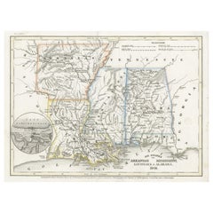
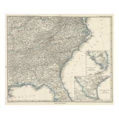
Antique Map of the Southern United States with Inset Map of New Orleans
Located in Langweer, NL
Antique map titled 'Die Staaten von Arkansas Mississippi, Louisiana & Alabama'. Detailed map of the region, which includes the Florida Panhandle. Shows many roads, rivers, forts, etc...
Category
Mid-19th Century Antique Europe Maps
Materials
Paper
$133 Sale Price
20% Off
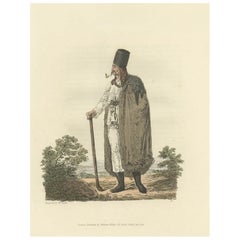
Original Hand-Colored Antique Costume Print of a Peasant from Hungary, 1804
Located in Langweer, NL
Old print of a Hungarian peasant. This print originates from 'The Costume of the Hereditary States of the House of Austria' by William Miller.
Artists and Engravers: Engraved by William Ellis.
Category
Early 1800s Antique Europe Maps
Materials
Paper
$266 Sale Price
20% Off
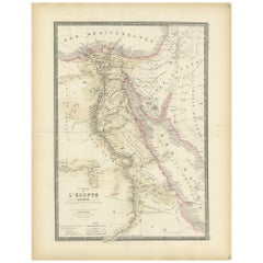
Antique Map of Egypt, '1875'
Located in Langweer, NL
Antique map titled 'Carte des l'Égypte'. Large map of Egypt. This map originates from 'Atlas de Géographie Moderne Physique et Politique' by A. Levasseur....
Category
Late 19th Century Antique Europe Maps
Materials
Paper
$333 Sale Price
30% Off
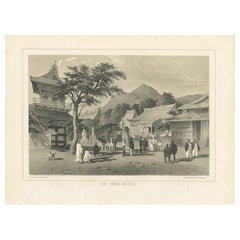
Antique Print of the Chief Temple in Hakodate in Japan, 1856
Located in Langweer, NL
Antique print titled ‘Chief Temple Hakodadi‘. View of the chief temple in Hakodate, Japan. This print originates from 'Narrative of the expedition of an American squadron to the Chin...
Category
19th Century Antique Europe Maps
Materials
Paper
$247 Sale Price
20% Off
Antique Map of Tennessee, Kentucky, Virginia, Alabama, Georgia and Surroundings
Located in Langweer, NL
Antique map of part of the United States showing Alabama, Georgia, North Carolina, South Carolina, Tennessee, Kentucky, Virginia and part of Florida. With inset maps of the southern ...
Category
Mid-19th Century Antique Europe Maps
Materials
Paper
$642 Sale Price
25% Off
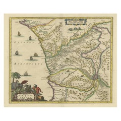
Antique Map of West Africa, focused on the Congo and Angola
Located in Langweer, NL
Original antique map titled 'Regna Congo et Angola'. Decorative 17th Century English map of a portion of West Africa, focused on the Congo and Angola. The map is centered on the Zair...
Category
Late 17th Century Antique Europe Maps
Materials
Paper
$808 Sale Price
20% Off
Large Antique County Map of the East Riding of Yorkshire, England
Located in Langweer, NL
Antique map titled 'A Map of the East Riding of Yorkshire from the best Authorities'. Original old county map of the East Riding of Yorkshire, England. Engraved by John Cary. Origina...
Category
Early 19th Century Antique Europe Maps
Materials
Paper
$266 Sale Price
20% Off
Antique Map of the World in Hemispheres by Keizer & de Lat, 1788
Located in Langweer, NL
Antique map titled 'Schuine Ronde Aard-Bolle waar van 't Middelpunt is Amsterdam (..)'. Interesting double hemisphere world map on polar projections. In North America, there is a large Island of California. Australia and New Zealand are shown with incomplete coastlines. The map contains six smaller astronomical...
Category
Late 18th Century Antique Europe Maps
Materials
Paper
$475 Sale Price
20% Off
Antique Map of Austria- Hungary by Johnston '1909'
Located in Langweer, NL
Antique map titled 'Austria- Hungary'. Original antique map of Austria- Hungary. With inset maps of Vienna, Dalmatia and Herzegovina. This map o...
Category
Early 20th Century Europe Maps
Materials
Paper
$237 Sale Price
20% Off
Leeuwarden Friesland City View – Antique Engraving by Jollain, c.1670
Located in Langweer, NL
Antique Bird’s Eye View of Leeuwarden, Friesland, by Jollain, circa 1670
This rare and decorative antique engraving presents a panoramic bird’s eye view of the fortified city of Lee...
Category
17th Century French Antique Europe Maps
Materials
Paper
$1,641 Sale Price
40% Off
Large Antique County Map of Surrey, England
Located in Langweer, NL
Antique map titled 'A Map of Surry from the best Authorities'. Original old county map of Surrey, England. Engraved by John Cary. Originates from 'New British Atlas' by John Stockdal...
Category
Early 19th Century Antique Europe Maps
Materials
Paper
$266 Sale Price
20% Off
Miniature Terrestrial Globe Newton & Son London, Post 1833, Ante 1858
By Newton and Son
Located in Milano, IT
Miniature Terrestrial Globe
Newton & Son
London, post 1833, ante 1858
Paper, papier-mâché, bronze and wood
It measures: sphere diameter 2.95 in (7.6 cm); diameter of the wooden base 6.02 in (15.3 cm); height 8.36 in (21.24 cm).
Weight: 2,067 lb.
State of conservation: the globe still bears its original paint, but has various small gaps, abrasions and stains on the surface.
The globe is hinged with two pins at the meridian circle, which is in turn inserted perpendicular to the horizon circle; this is supported by four semi-arches connected at the bottom by a small goblet-shaped foot, resting on a wooden bell-shaped base.
Apart from the wooden base, the entire support structure is made of bronze; on the foot there are the scale reproductions of a compass, a telescope and an open book.
The sphere is made of papier-mâché and is covered with twelve printed paper gores.
In the North Pacific Ocean the globe bears a cartouche with the inscription (about 30% of the writing is illegible, but the missing parts can be easily integrated based on the rest):
NEWTON’S
New & Improved
TERRESTRIAL
Globe
Published by Newton & Son
66 Chancery Lane
LONDON
On the globe, much of central Africa is empty and the great lakes Tanganyika and Victoria are not marked (Europeans would begin to explore the area after 1858). Canada is called "British Territory" and Alaska "Russian Territory" (it would become part of the United States in 1867). Australia already bears its modern name (until 1829 it had been called New Holland) and its coasts are completely designed; Tasmania is listed as an island (Matthew Flinders circumnavigated it in 1798). The routes of Cook's various voyages are plotted; both the route followed by Biscoe in 1831 and the "Land of Enderby" which he discovered on the coast of Antarctica, south of Africa, are marked.
Bibliography
P. Van der Krogt, Old Globes...
Category
1840s English Early Victorian Antique Europe Maps
Materials
Bronze
Original Antique Print of the Women of Tonga Tabu, c.1836
Located in Langweer, NL
Antique print titled 'Wohnung der Frauen des Palu'. Old print with a view of the hut of the women of Tonga Tabu. This print originates from 'Entdeckungs, Reise der Franzosischen Corv...
Category
19th Century Antique Europe Maps
Materials
Paper
$247 Sale Price
20% Off
Antique Map of Persia with Dedication Cartouche
Located in Langweer, NL
Antique map titled 'Persia sive Sophorum Regnum'. Original old map of Persia. The map extends from the Eastern Mediteranian to Tacalistan and the Indus River and the Dalanguer Mounta...
Category
Mid-17th Century Antique Europe Maps
Materials
Paper
$1,332 Sale Price
20% Off
Beira Baixa: A Cartographic Portrait of Portugal's Historic Frontier in 1903
Located in Langweer, NL
The uploaded image is a historical map of the Beira Baixa region in Portugal. The map details the topography, including mountain ranges and river systems, as well as the transportati...
Category
Early 1900s Antique Europe Maps
Materials
Paper
$275 Sale Price
20% Off
Mid-19th Century Decorative Map of India with Cultural and Natural Vignettes
Located in Langweer, NL
The Tallis maps, including the one of India, are known for their detailed and ornamental style. They were produced during the mid-19th century, a time when cartographic publishing became as much an art form as a means of geographic representation.
John Tallis & Company, founded by John Tallis, was known for creating maps with elaborate borders and vignettes surrounding the map itself. These maps often included illustrations that depicted scenes representative of the region's culture, significant local wildlife, architectural landmarks, and portraits of indigenous peoples...
Category
1850s Antique Europe Maps
Materials
Paper
$294 Sale Price
20% Off
Original Antique Map of the Island of Dominica in the West Indies, 1794
Located in Langweer, NL
MAP OF THE ISLAND OF DOMINICA for the History of the West Indies, by Bryan Edwards. Esq.
Dominica, an island renowned for its lucrative exports of sugar, cocoa, and coffee, operated...
Category
1790s Antique Europe Maps
Materials
Paper
$228 Sale Price
20% Off
Antique Map of the Coast of Roussillon, France
Located in Langweer, NL
Antique map titled 'Coste de Roussillon depuis Port Vendres, jusqu'au golphe de Rozes'. Original map of the coast of Roussillon, France. This map originates from 'Le Petit Atlas Mari...
Category
Mid-18th Century Antique Europe Maps
Materials
Paper
$323 Sale Price
20% Off
Antique Map of Japan and Korea by Johnston '1909'
Located in Langweer, NL
Antique map titled 'Japan and Korea'. Original antique map of Japan and Korea. With inset maps of the Japanese Empire, Port Arthur, Formosa ,Tokyo and Yoko...
Category
Early 20th Century Europe Maps
Materials
Paper
$333 Sale Price
20% Off
Antique Map of Oceania and the Pacific Ocean, Australia and New Zealand, 1826
Located in Langweer, NL
Antique map of Australia titled 'Karte von Australien'. Old map of Australia and New Zealand. Published in Walch's 'Neuester Schul-Atlas'.
Artists and Engravers: Johann, or Johan...
Category
19th Century Antique Europe Maps
Materials
Paper
$152 Sale Price
20% Off
Old Print of the Garden of L'hotel De L'Orleans, Rue De Provence, France, 1785
Located in Langweer, NL
Antique print titled 'Plan idéal du Jardin et de l'Hotel d'Orléans'. Copper engraving of the garden design for a hotel. This print originates from 'Jardins Anglo-Chinois à la Mode' b...
Category
18th Century Antique Europe Maps
Materials
Paper
$304 Sale Price
20% Off
Antique Map of Tartary and Northeast Asia, c.1750
Located in Langweer, NL
Antique map titled 'Carte de la tartarie occidentale'. An interesting map of Tartary and northeast Asia, from Lake Baykal, Partie du Siberia in the north, Pays des Kalkas at the cent...
Category
18th Century Antique Europe Maps
Materials
Paper
$123 Sale Price
20% Off
Frisia Occidentalis, A Rare Antique Engraving of Friesland, The Netherlands
Located in Langweer, NL
Antique map titled 'Frisia Occidentalis.' - A very decorative map of the Dutch province Friesland, also showing the Wadden islands Terschelling and Ameland. With coats of arms of the...
Category
1620s Antique Europe Maps
Materials
Paper
$2,331 Sale Price
20% Off
Old Engraving of the Bairam Celebration, the Easter of the Muslims, 1737
Located in Langweer, NL
Antique print titled 'Le Bairam ou la Paque des Mahometans'.
Old print of the Bairam celebration, the Easter of the Muslims. Originates from 'Ceremonies et coutumes Religieuses.....
Category
1730s Antique Europe Maps
Materials
Paper
$342 Sale Price
20% Off
Original Antique Map of Ireland- Tipperary and Waterford. C.1840
Located in St Annes, Lancashire
Great map of Tipperary and Waterford
Steel engraving
Drawn under the direction of A.Adlard
Published by How and Parsons, C.1840
Unframed.
Category
1840s English Antique Europe Maps
Materials
Paper
Senex Map of Castile, Leon & La Mancha in The Spanish Heartland, 1714
Located in Langweer, NL
This antique map, titled "A Map of Old & New Castile from the Observations of Rodrigo Mendes Silva and others," depicts the regions of Old Castile and New Castile in Spain, along with the Kingdom of Leon, Estremadura, La Mancha, among others. The map dates back to the early 18th century, a period marked by significant political shifts and territorial changes in Europe, particularly illustrated by the War of the Spanish Succession (1701–1714) that reshaped Spain’s governance and regional boundaries.
The map itself was published in 1714 by John Senex, a prominent English mapmaker, surveyor, globemaker, and geographer of the early eighteenth century. He was apprenticed as a young man to bookseller Robert Clavell and collaborated with notable mapmakers such as Jeremiah Seller and Charles Price. In 1728, Senex's contributions to geography and mapping were recognized when he was elected a Fellow of the Royal Society, an exceptional honor for a mapmaker, underlining his significant role as the Society's engraver and a publisher of maps by Edmund Halley and other notable figures.
John Senex is renowned for his English Atlas, first published in the same year as this map, 1714, and continued to be printed until the 1760s. Following his death in 1740, his widow Mary Senex managed the business until 1755. Afterward, the stock passed to William Herbert and Robert Sayer for maps, and to James Ferguson for globes.
The map serves not just as a geographical record but also as a historical document, reflecting the territorial divisions significant to Spain's political and economic structure at the time. The focus on Old and New Castile underscores their importance during a transformative era in Spanish history.
Here are some potentially significant places and features of this map:
1. **Old Castile (Castilla la Vieja)**: Historically significant as part of the former Kingdom of Castile, this region includes major cities such as Burgos and Valladolid. These cities could be popular search...
Category
Early 18th Century Antique Europe Maps
Materials
Paper
$466 Sale Price
20% Off
Antique Map of the Burgundy Region by Mallet, c.1683
Located in Langweer, NL
Antique map titled 'Royaume de Bourgogne sous la seconde Race des Roys de France'. Detailed miniature map of the Burgundy region, France. Originates from Mallet's 'Description de l'U...
Category
17th Century Antique Europe Maps
Materials
Paper
$73 Sale Price
20% Off
Original Antique Map of the Peninsula of India with Part of Ceylon by Wyld, 1844
Located in Langweer, NL
This extensive map of India, spanning two sheets, draws from Reynell’s original map and incorporates data provided by Sir Archibald Campbell, as well as surveys conducted by Colonel ...
Category
Mid-18th Century Antique Europe Maps
Materials
Paper
$1,141 Sale Price
20% Off
Antique Genealogy Chart of Palatinate & Bavarian Houses with Coats of Arms, 1732
Located in Langweer, NL
Antique print titled 'Genealogie de la Maison Palatine (..)'. Chart of the genealogy of the Palatinate (Die Pfalz) and Bavarian (Baiern) Houses. Shows the coats of arms of both Elect...
Category
18th Century Antique Europe Maps
Materials
Paper
$228 Sale Price
20% Off
Antique Map of Greece and Its Colonies, with Frame Style Border
Located in Langweer, NL
Antique map titled 'La Grèce'. Attractive map of Greece and its Colonies. The map covers from the southern part of Italy, including Sicily, to the western parts of Asia Minor and fro...
Category
Mid-19th Century Antique Europe Maps
Materials
Paper
$161 Sale Price
20% Off
Old Map of the Mughal Empire, Persia in the West to Lake Chimay etc., ca.1685
Located in Langweer, NL
Antique map titled 'L'Empire du Grand Mogol'. Old map of India and Central Asia.
The map extends from Persia in the West to Lake Chimay and the Bay of Bengal...
Category
1680s Antique Europe Maps
Materials
Paper
$304 Sale Price
20% Off
Antique Map of the South Pole by Keizer & de Lat, 1788
Located in Langweer, NL
Antique map titled 'De Zuid Pool, waar in aangetoont werd alle de Nieuwe Landen (..)'. Original antique map of the South Pole including two small inset maps...
Category
Late 18th Century Antique Europe Maps
Materials
Paper
$475 Sale Price
20% Off
Large Antique County Map of Derbyshire, England
Located in Langweer, NL
Antique map titled 'A Map of Derbyshire from the best Authorities'. Original old county map of Derbyshire, England. Engraved by John Cary. Originates from 'New British Atlas' by John...
Category
Early 19th Century Antique Europe Maps
Materials
Paper
$266 Sale Price
20% Off
Antique Lithography Map, Shropshire, English, Framed, Cartography, Victorian
Located in Hele, Devon, GB
This is an antique lithography map of Shropshire. An English, framed atlas engraving of cartographic interest, dating to the mid 19th century and later.
Superb lithography of Shrop...
Category
Mid-19th Century British Victorian Antique Europe Maps
Materials
Wood
Original Rare Antique Print of Two Ruins in Mexico, 1857
Located in Langweer, NL
Two images on one sheet depicting ruins in Mexico. This print originates from 'Die Kunstwerke vom Alterthum bis auf die Gegenwart, oder, Wegweiser durch das ganze Gebiet der bildende...
Category
19th Century Antique Europe Maps
Materials
Paper
Original Antique Engraving of Otoo, King of Tahiti, by Cook, 1803
By James Cook
Located in Langweer, NL
Antique print titled 'Otoo Koning van Otahiti'. Antique print depiciting Otoo, King of Tahiti. Originates from 'Reizen Rondom de Waereld door James Cook (..)'.
Artists and Engrave...
Category
19th Century Antique Europe Maps
Materials
Paper
$228 Sale Price
20% Off
Antique Map of North Africa by Ortelius, c.1600
Located in Langweer, NL
Antique map titled 'Barbariae et Biledulgerid nova descriptio'.
Old map of coastal North Africa and the Mediterranean. The map extends from Morocco and the Sahara to Libya and sh...
Category
17th Century Antique Europe Maps
Materials
Paper
$356 Sale Price
20% Off
Rare Hand-Colored Antique Map of Asia, 1788
Located in Langweer, NL
Antique map titled 'Kaartje van Asia'.
Original antique map of Asia. This map originates from 'Nieuwe Natuur- Geschied- en Handelkundige Zak- en Reisatlas' by N.T. Gravius, 1788....
Category
1780s Antique Europe Maps
Materials
Paper
$589 Sale Price
20% Off
Large Antique County Map of Buckinghamshire, England
Located in Langweer, NL
Antique map titled 'A Map of Buckinghamshire from the best Authorities'. Original old county map of Buckinghamshire, England. Engraved by John Cary. Originates from 'New British Atla...
Category
Early 19th Century Antique Europe Maps
Materials
Paper
$275 Sale Price
20% Off
Old 18th Century Composite Map of Key Caribbean Islands with Descriptive Texts
Located in Langweer, NL
Antique map titled 'Dominia Anglorum in praecipuis Insulis Americae ut sunt Insula S. Christophori, Antegoa, Iamaica, Barbados nec non Insulae Bermudes vel Sommers dictae. Die Englis...
Category
1740s Antique Europe Maps
Materials
Paper
$742 Sale Price
20% Off
Antique Map of Northern Africa by Levasseur, '1875'
Located in Langweer, NL
Antique map titled 'Carte de l'Afrique Septentrionale'. Large map of Northern Africa. This map originates from 'Atlas de Géographie Moderne Physique et...
Category
Late 19th Century Antique Europe Maps
Materials
Paper
$380 Sale Price
20% Off
Antique Map of Celebes 'Sulawesi', Island in Indonesia, 1754
By Jacques-Nicolas Bellin
Located in Langweer, NL
Antique map titled 'Carte De L'Isle Celebes ou Macassar'. Detailed copper engraved map of Celebes (Sulawesi, Indonesia), showing Makassar, which was the most important trading city o...
Category
18th Century Antique Europe Maps
Materials
Paper
$137 Sale Price
20% Off
Rare Sea Chart of the East Frisian Islands or Watten and the North Sea, c.1700
Located in Langweer, NL
Description: Antique map titled 'Paskaarte van de rievier de Elve streckende van Oldenbroek tot Hamburgh.'
Rare and interesting chart of the East Frisian Islands (or Watten) and ...
Category
Early 1700s Antique Europe Maps
Materials
Paper
$1,760 Sale Price
20% Off
Antique Map of Mexico and Central America by Johnson '1872'
Located in Langweer, NL
Antique map titled 'Johnson's Mexico (..)'. Two maps one one sheet showing Mexico and Central America, with inset maps of Tehuantepec and Panama. This map originates from 'Johnson's ...
Category
Late 19th Century Antique Europe Maps
Materials
Paper
$285 Sale Price
20% Off
Rare Antique Engraving of the City of Stockholm, Norway, ca.1720
Located in Langweer, NL
Antique print titled 'Die Königl. Schwedische Haupt und Residenz Stadt Stockholm'. Panoramic view of the city of Stockholm, Sweden. This print originates from the series 'Europe Prac...
Category
18th Century Antique Europe Maps
Materials
Paper
$437 Sale Price
20% Off
Map of the Vietnamese Coast, Centered on Turon Harbor 'Da Nang Area', 1796
Located in Langweer, NL
Antique map titled 'A chart of part of the coast of Cochin-China including Turon Harbour and the Island Callao'.
Detailed map of the Vietnamese Coast, centered on Turon Harbor (D...
Category
1790s Antique Europe Maps
Materials
Paper
$637 Sale Price
20% Off
Antique Map of Coevorden in the Netherlands, 1691
Located in Langweer, NL
Plate 'Covorden.' (Plan of the fortified city of Coevorden, The Netherlands.) This attractive original old antique print / plate originates from: 'Ausführliche und grundrichtige Besc...
Category
17th Century Antique Europe Maps
Materials
Paper
$85 Sale Price
20% Off
Large Antique Map of Guadeloupe and Antigua with Adjacent Isles, 19th Century
Located in Langweer, NL
Title: "Antique Map of Guadeloupe and Antigua with Adjacent Isles, 19th Century"
Source: New General Atlas (circa 1817), published in Edinburgh
Description: This detailed antique m...
Category
Early 19th Century Antique Europe Maps
Materials
Paper
$542 Sale Price
20% Off
Antique Map of Persia by A. Zatta, circa 1785
Located in Langweer, NL
Antique map titled 'L'Impero della Persia diviso ne suoi Stati'. The Empire of Persia divided into its states. Originates from 'Atlante Novissimo, illustrato ed accresciuto sulle oss...
Category
Late 18th Century Italian Antique Europe Maps
Materials
Paper
Original Antique Map of Spain and Portugal, circa 1790
Located in St Annes, Lancashire
Super map of Spain and Portugal
Copper plate engraving by A. Bell
Published, circa 1790.
Unframed.
Category
1790s English Other Antique Europe Maps
Materials
Paper
Antique plan of Ayutthaya, the capital of Siam, Thailand
Located in Langweer, NL
Antique map titled 'Judia, De Hoofd-Stad van Siam'. Antique plan of Ayutthaya, the capital of Siam (Thailand). This print originates from 'Oud en Nieuw Oost-...
Category
Mid-18th Century Antique Europe Maps
Materials
Paper
$941 Sale Price
20% Off
The Illustrated Map of the Var Department from the Atlas National Illustré, 1856
Located in Langweer, NL
This original hand-colored map is from the "Atlas National Illustré," a work by Victor Levasseur, a French geographer and cartographer known for his richly illustrated maps.
The map...
Category
1850s Antique Europe Maps
Materials
Paper
$323 Sale Price
20% Off
Authentic Antique Map of India and Ceylon, '1875'
Located in Langweer, NL
Antique map titled 'Carte générale des Indes'. Large map of India and Ceylon. This map originates from 'Atlas de Géographie Moderne Physique et Politique' by A. Levasseur. Published ...
Category
Late 19th Century Antique Europe Maps
Materials
Paper
$475 Sale Price
20% Off
Detailed Antique Map of the Black Sea, Balkans and Asia Minor
Located in Langweer, NL
Antique map titled 'Nuova Carta del Europa Turchesca (..)'. This is an Italian version of Tirion's detailed map of the Black Sea, Balkans, and Asia Minor. It is embellished with a si...
Category
Mid-18th Century Antique Europe Maps
Materials
Paper
$551 Sale Price
20% Off
1852 Map of Haut-Rhin: An Illustrated Gateway to Alsace's Viticultural Splendors
Located in Langweer, NL
This original hand-colored map is from the "Atlas National Illustré," a work by Victor Levasseur, a French geographer and cartographer known for his richly illustrated maps.
The map...
Category
1850s Antique Europe Maps
Materials
Paper
$323 Sale Price
20% Off
Antique Print of the Dutch Trading Post Deshima in Japan, circa 1738
By Giambattista Albrizzi
Located in Langweer, NL
Antique print titled 'Isoletta Desima abittata Dagli Olandesi nel Giappone secondo la delineazione del Sigr. Voogt'. Bird's-eye view of Deshima (or Dejima) copied from a manuscript b...
Category
18th Century Antique Europe Maps
Materials
Paper
Antique Map of the Coast of France Between Brest and Bayonne
Located in Langweer, NL
Antique map titled 'Carte des Costes de France depuis Brest jusquá Bayone'. Original old map of the coast of France between Brest and Bayonne. This map originates from 'Le Petit Atla...
Category
Mid-18th Century Antique Europe Maps
Materials
Paper
$304 Sale Price
20% Off
Antique Map of the Eastern United States with Inset Map of Texas
Located in Langweer, NL
Antique map titled 'Verein-Staaten von Nord-America mit Ausnahme Florida's und der Westlichen Territorien'. This map extends as far west as Louisiana and only includes the northern p...
Category
Mid-19th Century Antique Europe Maps
Materials
Paper
$513 Sale Price
20% Off
Rare and Early Map of the Seventeen Provinces, Published in circa 1640
Located in Langweer, NL
Antique map titled 'Carte Generale des Dixsept Provinces des Pais Bas'. Rare and Early map of the Seventeen Provinces. The Seventeen Provinces were the Imperial states of the Habsbur...
Category
Mid-17th Century Antique Europe Maps
Materials
Paper
$2,093 Sale Price
20% Off
Antique Map of the City of Visby 'Sweden' by F. Hogenberg, 1598
Located in Langweer, NL
This is a wonderful bird's-eye plan/view of the oldest city in Sweden.
Visby, the largest city on the island of Gotland was an important Viking city and the main centre of the Hanseatic League...
Category
16th Century Antique Europe Maps
Materials
Paper
$2,331 Sale Price
20% Off
Recently Viewed
View AllMore Ways To Browse
Antique Buddha Laos
Antique Captains Chest
Antique Crutches
Antique Curved Front Dresser
Antique Dressing Table With 3 Mirrors
Antique Fire Guard Screen
Antique Fire Guards Brass
Antique Fire Markers
Antique Fireplace Coal Basket
Antique Folding Card Table 20th Century
Antique French Lavabo
Antique French Marble Top Server Buffet
Antique German Mugs
Antique Gun Cabinet
Antique Horse Crop
Antique Hubley Cast Iron
Antique Indonesian Ikat
Antique Iron Pot Rack
