Europe Maps
to
4,227
5,436
241
5,435
1
68
33
9
8
3
2
1
1
1
2,863
2,156
416
1
268
14
3
120
4
30
3
3
3
1
5,374
74
35
21
16
589
310
197
110
79
5,436
5,436
5,436
104
59
28
20
15
Item Ships From: Europe
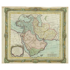
Antique Map of the Middle East with a Large Arabia, 1799
Located in Langweer, NL
Antique map titled 'Perse, Turquie Asiatique et Arabie (..)'. Map of the Middle East with a large Arabia, extending from the Black Sea to the In...
Category
Late 18th Century Antique Europe Maps
Materials
Paper
$1,405 Sale Price
20% Off
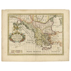
1710 Edward Wells Detailed Ancient Greece Map with Ornate Cartouche
Located in Langweer, NL
"1710 Edward Wells Map of Ancient Greece: A New Map of Antient Greece, Tirana, Morea, Ilyricum, Sicily, and Macedonia"
Description of the Map:
This map, produced around 1710 and en...
Category
1710s Antique Europe Maps
Materials
Paper
$726 Sale Price
20% Off
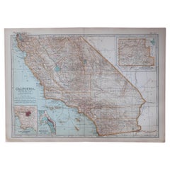
Original Antique Map of the American State of California ( Southern Part ), 1903
Located in St Annes, Lancashire
Antique map of California ( Southern part )
Published By A & C Black. 1903
Original colour
Good condition
Unframed.
Free shipping
Category
Early 1900s English Antique Europe Maps
Materials
Paper
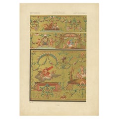
Pl. 91 Antique Print of Decorative Art in the 18th Century by Racinet, 1869
Located in Langweer, NL
Old print of decorative art in the 18th century. This print originates from 'L'Ornement polychrome'. A beautiful work containing about 2000 patterns of all the styles of Art old and ...
Category
19th Century Antique Europe Maps
Materials
Paper
Antique Map of the Province of Navarre with the City of Pamplona, Spain
Located in Langweer, NL
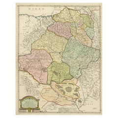
Antique map titled 'Royaume de Navarre (..)'. Decorative map of the province Navarre (Spanish: Navarra) in Northern Spain centered on the city of Pamplona. Published by N. Sanson, 16...
Category
Mid-17th Century Antique Europe Maps
Materials
Paper
$556 Sale Price
20% Off
16th-Century Map of the Ottoman Empire and Near East: Turcici Imperii Descriptio
Located in Langweer, NL
Title: Original 16th-Century Map of the Ottoman Empire and Near East: *Turcici Imperii Descriptio* by Ortelius, 1571
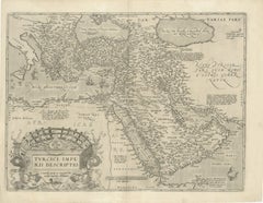
This rare copperplate engraving, Turcici Imperii Descriptio, i...
Category
16th Century Antique Europe Maps
Materials
Paper
1742 Antique Map of the Persian Empire with Detailed Borders and Cartouche
Located in Langweer, NL
Title: 1742 Covens & Mortier Map of the Persian Empire by Guillaume De L'Isle
This remarkable 1742 map, "Carte de Perse," was originally designed by Guillaume De L'Isle, a preemin...
Category
1740s Dutch Antique Europe Maps
Materials
Paper
Authentic 1644 Janssonius Map of the Champagne Region (Campania) in France
Located in Langweer, NL
"1644 Janssonius Map of Champagne, France"
This meticulously detailed original antique map, engraved in 1644, is a work by the esteemed cartographer Johannes Janssonius. It depicts the historic province of Champagne, situated in the northeastern part of France. The map is notable for its high level of detail, with meticulously drawn boundaries, city markers, and river courses. It features a beautifully rendered cartouche adorned with the provincial coat of arms, flanked by classical figures, indicative of the region's cultural significance. In the lower left corner, a pair of cherubs are engaged in surveying, symbolizing the scientific endeavor of cartography. The elaborate compass rose and the scale bar further complement the map's utility and artistic merit.
Champagne is renowned globally for its viticultural heritage, being the birthplace of the eponymous Champagne sparkling wine. The region's unique terroir, with its chalky soil and cool climate, is ideal for the production of the grapes used in champagne-making. The historical significance of Champagne extends beyond winemaking; it has been the site of pivotal battles and royal coronations, which shaped the course of French and European history. This map is not only a navigational tool but also a snapshot of a region rich in history and tradition, an artifact that embodies the geographical and cultural prestige of Champagne.
This description provides a detailed visual and contextual presentation of the map, suitable for a catalog entry, emphasizing both its artistic features and the historical and cultural importance of the Champagne region.
THE WINE AREAS:
The Champagne region, known primarily for its production of the sparkling wine that bears its name, encompasses several important cities and sites of historical and cultural significance:
1. **Reims**: Often considered the unofficial capital of the Champagne region, Reims is renowned for its grand cathedral, Notre-Dame de Reims, where French kings were historically crowned...
Category
1640s Antique Europe Maps
Materials
Paper
$603 Sale Price
20% Off
Antique Map of Ancient Egypt Also Depicting the Nile River and Red Sea, 1845
Located in Langweer, NL
Antique map Egypt titled 'General Karte von Alt Aegypten von A.H. Brué'. Large map of Egypt also depicting the Nile river and Red Sea. Source unknown...
Category
19th Century Antique Europe Maps
Materials
Paper
$235 Sale Price
20% Off
1862 Johnson's Map of the Vicinity of Richmond & Peninsular Campaign, Virginia
Located in Langweer, NL
Title: 1862 Johnson's Map of the Vicinity of Richmond & Peninsular Campaign, Virginia
Description: This 1862 map titled "Johnson's Map of the Vicinity of Richmond and Peninsular Cam...
Category
1860s Antique Europe Maps
Materials
Paper
$301 Sale Price
20% Off
A 19th-Century Map of West Canada with Niagara Falls and Indigenous Scenes
Located in Langweer, NL
Decorative 19th-Century Map of West Canada with Niagara Falls and Indigenous Scenes
This detailed 19th-century map of West Canada, drawn and engraved by J. Rapkin and published by...
Category
1850s Antique Europe Maps
Materials
Paper
Antique 1830 Map of Southern Scotland with Edinburgh, Berwick, Ayr, and Dumfries
Located in Langweer, NL
Title: Antique 1830 Map of Southern Scotland with Edinburgh, Berwick, Ayr, and Dumfries
Description: This 1830 German-language map, titled Britisches Reich – B. Kon Scotland, fo...
Category
1830s Antique Europe Maps
Materials
Paper
Rare Antique Print of the Ruins of Palmyra in Syria, ca.1770
By Georg Balthasar Probst
Located in Langweer, NL
Antique print titled 'Prospetto generalle di Palmira (..)'.
Beautiful view of the ruins of Palmyra, Syria. This is an optical print, also called 'vue optique' or 'vue d'optique',...
Category
18th Century Antique Europe Maps
Materials
Paper
$349 Sale Price
20% Off
Ancient World Map of Europe, Asia & Northern Africa with Ancient Names, 1725
Located in Langweer, NL
Antique map titled 'Geografische Kaarte van de Oude Weereld (..).'
Original antique map of the ancient world depicting Europe, Asia, and northern Africa with ancient place names....
Category
1720s Antique Europe Maps
Materials
Paper
$1,106 Sale Price
24% Off
Antique Map of Denmark by F. de Wit, 1680
Located in Langweer, NL
Antique map titled 'Dania Regnum'. Large, attractive map of Denmark, Sleschwig-Holstein and southern Sweden. Good detail throughout. Embellished with a title cartouche with the Danis...
Category
Late 17th Century Antique Europe Maps
Materials
Paper
$910 Sale Price
20% Off
Miniature Terrestrial Globe Newton & Son London, Post 1833, Ante 1858
By Newton and Son
Located in Milano, IT
Miniature Terrestrial Globe
Newton & Son
London, post 1833, ante 1858
Paper, papier-mâché, bronze and wood
It measures: sphere diameter 2.95 in (7.6 cm); diameter of the wooden base 6.02 in (15.3 cm); height 8.36 in (21.24 cm).
Weight: 2,067 lb.
State of conservation: the globe still bears its original paint, but has various small gaps, abrasions and stains on the surface.
The globe is hinged with two pins at the meridian circle, which is in turn inserted perpendicular to the horizon circle; this is supported by four semi-arches connected at the bottom by a small goblet-shaped foot, resting on a wooden bell-shaped base.
Apart from the wooden base, the entire support structure is made of bronze; on the foot there are the scale reproductions of a compass, a telescope and an open book.
The sphere is made of papier-mâché and is covered with twelve printed paper gores.
In the North Pacific Ocean the globe bears a cartouche with the inscription (about 30% of the writing is illegible, but the missing parts can be easily integrated based on the rest):
NEWTON’S
New & Improved
TERRESTRIAL
Globe
Published by Newton & Son
66 Chancery Lane
LONDON
On the globe, much of central Africa is empty and the great lakes Tanganyika and Victoria are not marked (Europeans would begin to explore the area after 1858). Canada is called "British Territory" and Alaska "Russian Territory" (it would become part of the United States in 1867). Australia already bears its modern name (until 1829 it had been called New Holland) and its coasts are completely designed; Tasmania is listed as an island (Matthew Flinders circumnavigated it in 1798). The routes of Cook's various voyages are plotted; both the route followed by Biscoe in 1831 and the "Land of Enderby" which he discovered on the coast of Antarctica, south of Africa, are marked.
Bibliography
P. Van der Krogt, Old Globes...
Category
1840s English Early Victorian Antique Europe Maps
Materials
Bronze
1889s Antique Celestial Globe Signed Gussoni e Dotti Milano Papier Maché Sphere
Located in Milan, IT
Celestial globe compiled on the Hesi & Gould catalogs by Eng. Pini and published in 1889 by Gussoni & Dotti Milano piazza del Duomo. Sphere in paper mache covered with paper printed by engraving on copper plate and hand watercolored, base in turned and ebonized wood.
Good condition, conservative restoration at the base. Measures: Height 45 cm, inche 17.8, sphere diameter 22 cm 8.7.
Giovanni Gussoni in 1874 bought the business of Antonio Ronchi typographer in Via Unione 5 in Milan, and then moved in 1883 to the shop of the Southern Porticoes in Piazza Duomo. Giovanni Gussoni was followed by his son Vittorio, who on April 16, 1907 sold the company to a collaborator, Giovanni Serra, who continued the business until November 1914.
Man has always wanted to know the world in which he lives and has used all the means available to measure the space that surrounds him to expand his knowledge more and more. The conditions that allowed man to develop models of the world and space were probably realized only after...
Category
1880s Antique Europe Maps
Materials
Paper
Antique Map of North America by Levasseur '1875'
Located in Langweer, NL
Antique map titled 'Carte générale de l'Amérique Septentrionale'. Large map of North America. This map originates from 'Atlas de Géographie Modern...
Category
Late 19th Century Antique Europe Maps
Materials
Paper
$471 Sale Price
20% Off
Copper Engraving with a Panoramic View of Mexico City, 1754
Located in Langweer, NL
Antique print titled 'Nouveau Mexico'.
Copper engraving with a panoramic view of Mexico city. This print originates from 'Histoire générale des voyages, ou nouvelle collection de...
Category
1750s Antique Europe Maps
Materials
Paper
$518 Sale Price
20% Off
Vintage Reproduction 17th Century Map of Europe, American, Cartography, Blaeuw
Located in Hele, Devon, GB
This is a vintage reproduction map of Europe. An American, paper stock cartography print in frame after the work by Blaeuw, dating to the late 20t...
Category
Late 20th Century Central American Mid-Century Modern Europe Maps
Materials
Glass, Wood, Paper
Promised Land of Canaan – Antique Map of Israel with Biblical Scenes, van Jagen
Located in Langweer, NL
Promised Land of Canaan – Antique Map of Israel with Biblical Scenes, van Jagen
This remarkable antique map titled Het beloofde landt Canaan doorwandelt...
Category
1740s Dutch Antique Europe Maps
Materials
Paper
Antique Map of the Netherlands by Petri, 1852
Located in Langweer, NL
Antique map titled 'Het Koninkrijk der Nederlanden'. Map of the Netherlands, with coats of arms of all Dutch provinces. Also includes a small inset map of Luxembourg...
Category
19th Century Antique Europe Maps
Materials
Paper
$134 Sale Price
20% Off
Decorative Antique Print of Garden Architecture by Van Laar, 1802
Located in Langweer, NL
Untitled print of garden architecture. It shows garden buildings, benches and garden decor. This print originates from 'Magazijn van tuin-sieraden'...
Category
19th Century Antique Europe Maps
Materials
Paper
$132 Sale Price
20% Off
Colored wall map of the WORLD
By Chambon
Located in ZWIJNDRECHT, NL
“Mappe Monde, contenant les Parties Connues du Globe Terrestre”
CHAMBON, Gobert-Denis (France, 17.. - 1781)
Paris, Longchamps et Janvier, 1754
Size H. 115 x W. 145 cm.
Gobert-Denis Chambon made copper engraving after the work of Guillaume De L’Isle, published in 1754 by Jean Janvier and S.G. Longschamps.
A huge wall map of the world in two hemispheres printed on two sheets, depicting the Eastern and Western hemispheres supported by two male figures, decorated at the bottom right and left with two celestial hemispheres (boreal and southern) and at the bottom in the middle with an armillary sphere, in addition.
This map is most notable for its depiction of the Sea of Japan labeled "Mer de Corée" and of "Mer de L'Ouest" or Sea of the West - a great sea, easily the size of the Mediterranean, to flow from the then-known Strait of Juan de Fuca...
Category
Mid-18th Century French French Provincial Antique Europe Maps
Materials
Wood, Paper
$28,303 Sale Price
20% Off
Colonial Cartography: The Banda Islands - the Epicenter of the Spice Trade, 1818
Located in Langweer, NL
Antique map titled 'Kaart der Bandasche Eilanden' with a view titled 'Gezigt van het Eiland Neira en de Goening Api'. Rare and attractive map of the Banda Islands with a large view of Banda Neira and Gunung Api. One of 12 maps from ‘Atlas van Overzeesche bezittingen’ (Atlas of Oversea Possessions) by J.S. van den Bosch. J.S. van den Bosch (1780 – 1844), Major General, Knight of the 3rd Class of the Military William Order.
It is a rare and visually appealing representation of the Banda Islands, a group of ten small volcanic islands in the Banda Sea, part of present-day Indonesia.
The map is one of twelve from the “Atlas van Overzeesche bezittingen” (Atlas of Overseas Possessions) by J.S. van den Bosch, who was a Major General and a Knight of the Military William Order. Johannes van den Bosch, who lived from 1780 to 1844, had a significant military and administrative career, including serving as Governor-General of the Dutch East Indies. His works and collections are reflective of the Dutch colonial interest and administration in the region.
The Banda Islands, depicted in this map, are particularly famous for being the sole source of nutmeg and mace before the mid-19th century. Nutmeg was highly valued in European cuisine, as a preservative, and as a medicine. The monopoly on these spices made the Banda Islands extremely important during the age of spice trade, which also led to intense colonial competition and conflict, notably between the Dutch and the British.
The map itself provides a detailed topographical representation of the Banda Islands, possibly with depth soundings and navigational hazards indicated, which would have been essential information for the ships of the Dutch East India Company and other seafarers. The large view of Banda Neira and Gunung Api (literally "Fire Mountain...
Category
Early 19th Century Antique Europe Maps
Materials
Paper
$792 Sale Price
20% Off
Antique Map of Africa by Bordiga Fratelli 'circa 1818'
Located in Langweer, NL
Antique map titled 'Carta dell Africa'. Large and quite scarce Italian map of Africa, reflecting the then-current knowledge of the continent's geography, with large areas left comple...
Category
Early 19th Century Antique Europe Maps
Materials
Paper
$1,698 Sale Price
20% Off
1802 Map of Australasia and the South Pacific - European Exploration Routes
Located in Langweer, NL
1802 Johann Walch Map of Australasia and the South Pacific - European Exploration Routes
This 1802 map by Johann Walch provides a highly detailed view of Australasia and the South P...
Category
Early 1800s Antique Europe Maps
Materials
Paper
$1,698 Sale Price
20% Off
Original Antique Map of the American State of Iowa, 1903
Located in St Annes, Lancashire
Antique map of Iowa
Published By A & C Black. 1903
Original colour
Good condition
Unframed.
Free shipping
Category
Early 1900s English Antique Europe Maps
Materials
Paper
Antique Map of Kentucky
Located in Langweer, NL
Antique map titled 'Kentucky'. Original antique map of Kentucky, United States. This print originates from 'Encyclopaedia Britannica', Ninth E...
Category
Late 19th Century Antique Europe Maps
Materials
Paper
$273 Sale Price
20% Off
Antique Map of the Region of Georgia with Inset Maps of Florida and Texas
Located in Langweer, NL
Antique map of part of the United States showing Alabama, Georgia, North Carolina, South Carolina, Tennessee, Kentucky, Virginia and part of Florida. With inset maps of the southern ...
Category
Late 19th Century Antique Europe Maps
Materials
Paper
$518 Sale Price
50% Off
Pl. 43 Antique Print of Decorative Art in the Middle Ages by Racinet, 1869
Located in Langweer, NL
Old print of decorative art in the Middle Ages. This print originates from 'L'Ornement polychrome'. A beautiful work containing about...
Category
19th Century Antique Europe Maps
Materials
Paper
$68 Sale Price
20% Off
1667 Melchior Tavernier Map of the Patriarchate of Constantinople – Black Sea, G
Located in Langweer, NL
This 1667 map titled "Patriarchatus Constantinopolitani Geographica Descriptio" was crafted by renowned French cartographer Melchior Tavernier, who was a prominent map engraver during the 17th century. This rare and historically significant map focuses on the territories under the ecclesiastical jurisdiction of the Patriarchate of Constantinople, one of the most important centers of the Eastern Orthodox Church.
It covers regions around the Black Sea (Pontus Euxinus), parts of Greece, and adjacent areas in Asia Minor and the Balkans, which were historically vital during the Byzantine and Ottoman Empires. The map is filled with ancient place names, making it a valuable resource for both historical and cartographic enthusiasts.
Key Features:
- Antique ecclesiastical map illustrating the influence of the Orthodox Patriarchate of Constantinople in the 17th century.
- Features beautifully detailed ancient coastlines, rivers, and terrains, providing a comprehensive geographical view of the region.
- Rich with historic place names - like Byzantium, Nicomedia, Nicaea, Cyzicus, Bithynia, Pontus, Macedonia, and Thrace - that date back to the classical era, offering insights into the ancient geography of the eastern Mediterranean.
- A finely engraved strapwork cartouche in the lower right corner with Baroque-style decoration, featuring two putti (cherubic figures) – a hallmark of 17th-century map art.
- The map extends to include the Mediterranean Sea (Mare Mediterraneum) to the south and the Black Sea to the north, highlighting its ecclesiastical and geopolitical significance.
- Original hand coloring may still be present, enhancing the decorative appeal for collectors of antique maps.
This rare map offers a unique perspective on the religious influence and historical geography of the Eastern Mediterranean during the late 17th century. It would appeal to collectors interested in:
- **Byzantine history**
- **Ottoman Empire**
- **Eastern Orthodox Church**
- **Antique cartography...
Category
1660s Antique Europe Maps
Materials
Paper
$735 Sale Price
20% Off
Map of Cape Verde and the Mouth of the River Niger by Coronelli, 1691
Located in Langweer, NL
Map of Cape Verde and the Mouth of the River Niger by Coronelli, 1691
This finely engraved map, titled "Bocche del Fiume Negro et Isole di Capo Verde," was created in 1691 by Vincen...
Category
Late 17th Century Antique Europe Maps
Materials
Paper
Newfoundland and St. Pierre & Miquelon: Early 19th Century French Map
Located in Langweer, NL
The map is titled "Île et Banc de Terre-Neuve avec les Îles St. Pierre et Miquelon", depicting Newfoundland and the French islands of St. Pierre and Miquelon. It is from the Petit Atlas National series.
Features:
- The map is divided into two sections:
1. The left side shows Newfoundland (Terre-Neuve) and its surrounding waters, including important locations such as the Île du Cap Breton and Grand Bank fishing areas.
2. The right side focuses on St. Pierre and Miquelon, a French overseas territory near Newfoundland.
- Hand-colored outlines mark the territories, with color distinctions for the different islands.
- Administrative divisions and key geographic features, such as capes, bays, and towns, are labeled on the map.
Here the text translated:
Here is the translation of the text from French to English:
**NOTICE.**
The islands of St. Pierre and Miquelon, the only remaining French possession in this part of America since the loss of Canada, are located a few miles from the southern coast of Newfoundland, which belongs to the English. Their relatively fertile soil is broken up by hills that give rise to small streams.
**Grande Miquelon**, the northernmost of the two islands, has a circumference of about 9 to 10 leagues. It offers a convenient port for fishing boats.
**Petite Miquelon**, to the south of Grande Miquelon, has a circumference of about 6 leagues. It is well-watered and well-wooded.
**Saint Pierre**, to the south-southwest of the two other islands, presents a somewhat similar appearance but is devoid of trees. Although it is the smallest of the three islands, it is the most important due to the size of its harbor, which can accommodate 30 to 40 ships of various sizes, and because of its favorable coastline for the preparation, preservation, and export of cod. On its eastern coast, at the bottom of a beautiful bay, lies the town of Saint Pierre, the only notable settlement on the three islands. It is the residence of a naval officer who, under the title of Commander, governs the colony.
The permanent population is about 2,000 souls, of which 800 reside in Saint Pierre. However, sailors come to the islands from the coasts of Brittany and Normandy during the cod fishing season on the Grand Banks of Newfoundland and the Gulf of St. Lawrence. In 1833, it was estimated that about 14,000 sailors were employed in this fishery, and the purchase of supplies required by the colony was valued at over one million francs.
---
This translation reflects the original notice describing the French islands of St. Pierre and Miquelon, with details about their geography, population, and economic activities related to the fishing industry.
Historical Context:
- This map is part of a collection meant to showcase France's overseas colonies and territories, including the small but significant St. Pierre and Miquelon, which has been under French control for centuries and was a critical fishing and trading hub.
- The Petit Atlas National series was typically published in the early 19th century, and this map likely dates from the same period, around 1815–1820.
People searching for maps or information about Newfoundland and the French islands of St. Pierre and Miquelon use the following keywords:
1. Newfoundland map...
Category
1820s Antique Europe Maps
Materials
Paper
$150 Sale Price
20% Off
Original Antique Miniature Map of Persia, Published, ca.1601
Located in Langweer, NL
Antique miniature map titled 'Persia'. Small map of Persia published in the Epitome, or pocket-edition of the "Theatrum Orbis Terrarum".
Artists and e...
Category
Early 1600s Antique Europe Maps
Materials
Paper
$509 Sale Price
20% Off
Original Antique Map of Ancient Greece- Boeotia, Thebes, 1787
Located in St Annes, Lancashire
Great map of Ancient Greece. Showing the region of Boeotia, including Thebes
Drawn by J.D. Barbie Du Bocage
Copper plate engraving by P.F T...
Category
1780s French Other Antique Europe Maps
Materials
Paper
Original Antique Map of The Philippines. C.1900
Located in St Annes, Lancashire
Fabulous map of The Philippines
Original color.
Engraved and printed by the George F. Cram Company, Indianapolis.
Published, C.1900.
Unframed.
Free shipping.
Category
1890s American Antique Europe Maps
Materials
Paper
Map of Kingdoms of Castile, León, Galicia, Asturias, Biscay and Navarre in Spain
Located in Langweer, NL
Antique map titled 'Partie Septentrionale de la Couronne de Castille (..)'. Decorative and highly detailed map of Northwestern Spain, including Gallicia...
Category
Mid-18th Century Antique Europe Maps
Materials
Paper
$622 Sale Price
20% Off
Biblical Journeys: Apostle Paul's Voyages and the Israelites' Exodus, 1856
Located in Langweer, NL
Two maps in matting board. From the Pictorial Bible Atlas, published in 1856.
Title for Map 1: Voyages and Travels of Apostle Paul – Illustrated Antique...
Category
1850s Antique Europe Maps
Materials
Paper
Historical Map of Canaan with Insets of Jerusalem and Surrounding Regions, 1880
Located in Langweer, NL
The map titled "CANAAN" depicts the historical region known as Canaan, located in the Levant, which corresponds to modern-day Israel, Palestinian territories, Lebanon, and parts of S...
Category
1880s Antique Europe Maps
Materials
Paper
$349 Sale Price
20% Off
Large Original Antique Map of The Canary Islands. 1894
Located in St Annes, Lancashire
Superb Antique map of The Canary Islands
Published Edward Stanford, Charing Cross, London 1894
Original colour
Good condition
Unframed.
Free shipping
Category
1890s English Antique Europe Maps
Materials
Paper
Antique Map of France at the Beginning of the 17th Century by Zannoni, 1765
By G. A. Rizzi-zannoni
Located in Langweer, NL
Antique map France titled 'Carte pour servir à intelligence de l'Histoire de France (..)'. Beautiful old map of France. This map originates from 'At...
Category
18th Century Antique Europe Maps
Materials
Paper
$150 Sale Price
20% Off
Large Vintage Maps of the United States, in 3 Sections, 1920
Located in St Annes, Lancashire
Great maps of the USA in 3 sections
Unframed
Original color
By John Bartholomew and Co. Edinburgh Geographical Institute
Published, circa 1920
The measurements given is for just...
Category
1920s British Vintage Europe Maps
Materials
Paper
Circa 1691 Frederick de Wit Map: Middle East with Arabia, Persia & More
Located in Langweer, NL
Circa 1691 Frederick de Wit Map: Middle East with Arabia, Persia & More
This exquisite hand-colored map, circa 1691, by Frederick de Wit, illustrates the Middle East, spanning from Turkey and Egypt to Afghanistan, with a detailed representation of the Arabian Peninsula.
The map's detailing in Arabia is based on Nicolas Sanson's influential 1654 map, which was one of the most accurate and detailed depictions of the region up to the mid-seventeenth century.
The decorative title cartouche is richly adorned with images of exotic figures, animals, and a merchant ship, symbolizing the region's historical trade importance. Additionally, a mapmaker is shown working with traditional tools, adding a touch of authenticity to the cartographic art.
This is the fourth state of the map, published between 1691 and 1696. The map measures 21.8 inches in width by 18.5 inches in height, featuring a sharp impression, with minimal staining and a carefully repaired centerfold separation at the bottom.
Keywords:
- Middle East historical map
- Frederick de Wit map
- 17th century maps
- Arabian Peninsula map
- Persia (Iran) map
- Turkey and Egypt map...
Category
1690s Antique Europe Maps
Materials
Paper
$2,311 Sale Price
20% Off
1864 Johnson's Map of the West Indies and Bermuda
Located in Langweer, NL
Title: 1864 Johnson's Map of the West Indies and Bermuda
Description: This is an 1864 map titled "Johnson's West Indies," published by Johnson and Ward. The map provides a detailed ...
Category
1860s Antique Europe Maps
Materials
Paper
$301 Sale Price
20% Off
Antique Map of the Empire of Morocco by Kitchin, c.1760
By Thomas Kitchin
Located in Langweer, NL
Antique map titled 'A Map of the Empire of Morocco Comprehending the Kingdoms of Fez, Morocco'. Original antique map of the kingdoms of Fez, Algiers, Segelmese, Tafilet and Morocco. ...
Category
18th Century Antique Europe Maps
Materials
Paper
$169 Sale Price
20% Off
Original Antique Map of the American State of Illinois ( Northern Part ), 1903
Located in St Annes, Lancashire
Antique map of Illinois ( Northern part )
Published By A & C Black. 1903
Original colour
Good condition
Unframed.
Free shipping
Category
Early 1900s English Antique Europe Maps
Materials
Paper
Asia Minor and Provinces: A Roman Empire Map from Spruner-Menke Atlas, 1880
Located in Langweer, NL
This authentic map of the 19th century, titled "PONTUS ET BITHYNIA, ASIA, LYCIA ET PAMPHYLIA, GALATIA, CAPPADOCIA, SYRIA, CRET, CYPRVS," details the regions of Asia Minor and surrounding territories during the Roman Empire.
The map is interesting for a number of reasons:
1. **Comprehensive Detail**: It covers a wide range of regions that played significant roles in ancient history, from the cultural crossroads of Asia Minor to the strategic island of Cyprus.
2. **Geographical Information**: It includes detailed topographical features such as mountain ranges, river systems, and coastlines, illustrating the complex geography that influenced ancient political and military strategies.
3. **Historical Context**: The map reflects the Roman administrative organization of these provinces, which were critical for trade, military campaigns, and cultural exchange within the empire.
4. **Inset Maps**: The presence of inset maps for Lycia, Ionia, and Asia Minor provides focused details on regions that had substantial historical significance due to their cultural heritage and geopolitical importance.
5. **Latin Labels**: The use of Latin in the map’s labels and descriptions adds to the historical authenticity and would have served as a scholarly reference for 19th-century academics.
6. **Ancient Civilizations**: This area was the cradle of numerous ancient civilizations and the map likely includes cities of ancient Greek...
Category
1880s Antique Europe Maps
Materials
Paper
$349 Sale Price
20% Off
18th-Century Map of the Eastern Roman Empire by Henri Chatelain, c. 1719
Located in Langweer, NL
Title: 18th-Century Map of the Eastern Roman Empire by Henri Chatelain, c. 1719
Description: This intricately detailed map, titled *Nouvelle Carte pour Servir à l'Histoire de l'Empi...
Category
1710s Antique Europe Maps
Materials
Paper
Original 17th-Century Antique Map of Nanjing Province, China – by Blaeu
Located in Langweer, NL
Title: 17th-Century Antique Map of Nanjing Province, China – "Nanking sive Kiangnan" by Blaeu, with Decorative Details
Description: This captivating 17th-century map of Nanjing Pr...
Category
1650s Antique Europe Maps
Materials
Paper
Original Antique Map of the American State of New Jersey, 1903
Located in St Annes, Lancashire
Antique map of New Jersey
Published By A & C Black. 1903
Original colour
Good condition
Unframed.
Free shipping
Category
Early 1900s English Antique Europe Maps
Materials
Paper
Original Antique Map of the American State of Kansas, 1903
Located in St Annes, Lancashire
Antique map of Kansas
Published By A & C Black. 1903
Original colour
Good condition
Unframed.
Free shipping
Category
Early 1900s English Antique Europe Maps
Materials
Paper
Original Antique Map of the American State of Ohio ( Northern Part ), 1903
Located in St Annes, Lancashire
Antique map of Ohio ( Northern part )
Published By A & C Black. 1903
Original colour
Good condition
Unframed.
Free shipping
Category
Early 1900s English Antique Europe Maps
Materials
Paper
Old Map of the Spice Islands, Moluccas by Bellin, Published in 1771
Located in Langweer, NL
Title: 1771 Jacques-Nicolas Bellin Map of the Moluccas, the Spice Islands of Indonesia
Description: This finely engraved eighteenth-century map, titled Carte Particulière des Is...
Category
1770s Antique Europe Maps
Materials
Paper
$188 Sale Price
20% Off
1882 Detailed Map of South America showing Political and Geographical Features
Located in Langweer, NL
This 1882 map of South America, published by Blackie and Son as part of the 'Comprehensive Atlas and Geography of the World,' showcases the continent in remarkable detail. It provide...
Category
1880s Antique Europe Maps
Materials
Paper
Antique Map of Scandinavia: Norway, Sweden and Denmark
Located in Langweer, NL
Antique map titled 'Suède, Norwège & Danemark'. Attractive map of Scandinavia, with Sweden, Norway and Denmark. With an inset map of Iceland and th...
Category
Mid-19th Century Antique Europe Maps
Materials
Paper
$113 Sale Price
20% Off
Antique Map of the Antilles in the Caribbean, '1875'
Located in Langweer, NL
Antique map titled 'Carte des Iles Antilles'. Large map of the Antilles. This map originates from 'Atlas de Géographie Moderne Physique et Politique' by A. Levasseur. Published, 1875.
Category
Late 19th Century Antique Europe Maps
Materials
Paper
$353 Sale Price
40% Off
1690 Frederick de Wit Sea Chart of Hudson Bay, Baffin Bay and Greenland
Located in Langweer, NL
Title: c. 1690 Frederick de Wit Sea Chart of Hudson Bay, Baffin Bay, and Greenland - Engraved by Romeyn de Hooghe
This striking sea chart by Frederick de Wit, titled "Septemtrionali...
Category
1690s Antique Europe Maps
Materials
Paper
Original Antique Map of the American State of New York ( Western Part ) 1903
Located in St Annes, Lancashire
Antique map of New York ( Western Part )
Published By A & C Black. 1903
Original colour
Good condition
Unframed.
Free shipping
Category
Early 1900s English Antique Europe Maps
Materials
Paper
Antique Map of the Eastern Hemisphere by Valk & Chenk '1708'
Located in Langweer, NL
Antique map titled 'Hemispherium Orbis Antiqui, Cumzonis Circulis, Et Sity populorum Diverso'. Decorative example of Andreas Cellarius's map of the Eastern Hemisphere, illustrating with climatic zones ranging from Frigida Borealis to Torrida, with planetary details superimposed. The elaborate border includes fine scrollwork, numerous putti, and additional diagrams showing armillary spheres and climatic zones. Andreas Cellarius was born in 1596 in Neuhausen and educated in Heidelberg. He emigrated to Holland in the early 17th century and 1637 moved to Hoorn, where he became the rector of the Latin School. Cellarius' best known work is his Harmonia Macrocosmica, first issued in 1660 by Jan Jansson, as a supplement to Jansson's Atlas Novus. The work consists of a series of Celestial Charts...
Category
Early 18th Century Dutch Antique Europe Maps
Materials
Paper
$3,980 Sale Price
25% Off
Recently Viewed
View AllMore Ways To Browse
Antique Buddha Laos
Antique Captains Chest
Antique Crutches
Antique Curved Front Dresser
Antique Dressing Table With 3 Mirrors
Antique Fire Guard Screen
Antique Fire Guards Brass
Antique Fire Markers
Antique Fireplace Coal Basket
Antique Folding Card Table 20th Century
Antique French Lavabo
Antique French Marble Top Server Buffet
Antique German Mugs
Antique Gun Cabinet
Antique Horse Crop
Antique Hubley Cast Iron
Antique Indonesian Ikat
Antique Iron Pot Rack
