Europe Maps
to
4,227
5,436
241
5,435
1
68
33
9
8
3
2
1
1
1
2,863
2,156
416
1
268
14
3
120
4
30
3
3
3
1
5,374
74
35
21
16
589
310
197
110
79
5,436
5,436
5,436
104
59
28
20
15
Item Ships From: Europe
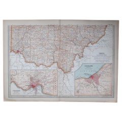
Original Antique Map of the American State of Ohio ( Southern Part ), 1903
Located in St Annes, Lancashire
Antique map of Ohio ( Southern part )
Published By A & C Black. 1903
Original colour
Good condition
Unframed.
Free shipping
Category
Early 1900s English Antique Europe Maps
Materials
Paper
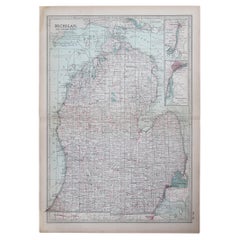
Original Antique Map of the American State of Michigan ( Southern Part ), 1903
Located in St Annes, Lancashire
Antique map of Michigan ( Southern part )
Published By A & C Black. 1903
Original colour
Good condition
Unframed.
Free shipping
Category
Early 1900s English Antique Europe Maps
Materials
Paper
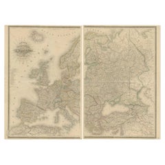
Majestic Map of Europe by Andriveau-Goujon - Complete Continental View - ca.1849
Located in Langweer, NL
Majestic 19th Century Map of Europe by Andriveau-Goujon - Complete Continental View - Circa 1849
This magnificent and intricately detailed map of Europe, titled "Carte Physique et...
Category
1840s Antique Europe Maps
Materials
Paper
$726 Sale Price / set
20% Off
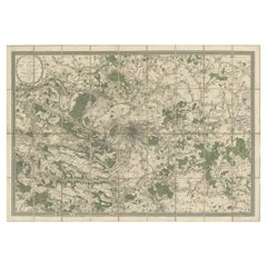
Large Folding Map of Paris, France, on Linen, 36 Segments, Published in 1836
Located in Langweer, NL
Antique map Paris titled 'Carte Topographique des Environs de Paris Nouvelle edition rectifié d'apres les travaux de la Nouvelle Carte De France'.
...
Category
1830s Antique Europe Maps
Materials
Paper
$1,273 Sale Price
20% Off
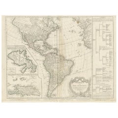
Antique Map of the Americas and West Indies by Robert de Vaugondy, 1778
Located in Langweer, NL
Antique Map of the Americas and West Indies by Robert de Vaugondy, 1778
This detailed antique map titled "Amérique ou Indes Occidentales" was published in 1778 by the renowned Frenc...
Category
Late 18th Century French Antique Europe Maps
Materials
Paper
$1,326 Sale Price
25% Off
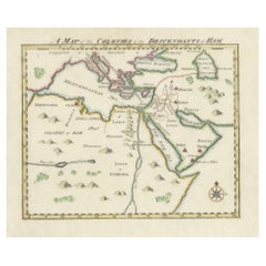
18th-Century Biblical Map of the Colonies of Ham: Africa, Middle East and Beyond
Located in Langweer, NL
This map, titled "A Map of the Colonies of the Descendants of Ham," dates to around 1790. It illustrates regions in Africa, the Middle East, and parts of Europe that were traditional...
Category
1790s Antique Europe Maps
Materials
Paper
$264 Sale Price
20% Off
Original Antique Map of the Western Part of NEW MEXICO & CALIFORNIA
Located in Langweer, NL
Title: "Map of the Western Part of NEW MEXICO and CALIFORNIA According to the Latest Discoveries by the Jesuits and Others"
Description:
This exquisite original Dutch map, titled "...
Category
1760s Antique Europe Maps
Materials
Paper
$1,226 Sale Price
20% Off
1573 Ortelius Map: First to Name California, Spanning Tartary to North America
Located in Langweer, NL
"1573 Abraham Ortelius Map of Tartary, Japan, and Western North America"
Description of the Map:
This is an outstanding example of Abraham Ortelius' map titled "Tartariae Sive Magn...
Category
16th Century Antique Europe Maps
Materials
Paper
$2,264 Sale Price
20% Off
Ornate 1850s Map of South America: A Masterpiece of Exploration & Art by Rapkin
Located in Langweer, NL
Decorative 19th-Century Map of South America by J. Rapkin, Published by J & F Tallis
Description: This beautifully detailed map of South America, drawn and engraved by J. Rapkin a...
Category
1850s Antique Europe Maps
Materials
Paper
Antique Map of America with California as an Island by Homann '1710'
Located in Langweer, NL
This antique map, titled "Totius Americae Septentrionalis et Meridionalis," represents a significant cartographic piece from 1710 by Johann Baptist Homann. Here's a description of this remarkable map:
- Title: Totius Americae Septentrionalis et Meridionalis (...)
- Date: Published in 1710 by Johann Baptist Homann.
Description:
This map is a first edition of Johann Baptiste Homann's map of America, and it is notable for several cartographic features and historical representations:
1. California as an Island...
Category
Early 18th Century Antique Europe Maps
Materials
Paper
$2,211 Sale Price
25% Off
Antique Map of Slavonia, Croatia, Bosnia and Dalmatia by Janssonius, circa 1640
Located in Langweer, NL
Antique Map of Slavonia, Croatia, Bosnia and Dalmatia by Janssonius, circa 1640
This elegant and detailed map titled Sclavonia, Croatia, Bosnia cum Dalmatiae Parte was published by ...
Category
17th Century Dutch Antique Europe Maps
Materials
Paper
1806 John Cary Map of Hindoostan – Detailed British Cartography of India
Located in Langweer, NL
Title: 1806 John Cary Map of Hindoostan – Detailed British Cartography of India
This highly detailed map, titled "A New Map of Hindoostan from the Latest Authorities," was engraved ...
Category
Early 1800s Antique Europe Maps
Materials
Paper
$509 Sale Price
20% Off
1792 Map of Eastern Africa and the Arabian Peninsula by Delisle/Elwe
Located in Langweer, NL
1792 Map of Eastern Africa and the Arabian Peninsula by Delisle/Elwe
This detailed 1792 map, created by Delisle and published by Elwe, depicts northeastern Africa, including Egypt, ...
Category
1790s Antique Europe Maps
Materials
Paper
$622 Sale Price
20% Off
Antique Street Map of the City of Edo 'Modern Tokyo' in Japan
Located in Langweer, NL
Antique map titled 'Plan de Jedo - Platte Grond van Jedo'. A detailed street map of the city of Edo (modern Tokyo) in Japan, originally engraved by Bellin and Schley and reissued for...
Category
Mid-18th Century Antique Europe Maps
Materials
Paper
$273 Sale Price
20% Off
Topographic Map of Mount Sinai Summit – Antique Engraving by Pococke, 1776
Located in Langweer, NL
Topographic Map of Mount Sinai Summit – Antique Engraving by Pococke, 1776
This antique engraving offers a rare and detailed view of the summit plateau of Mount Sinai, titled "Grond...
Category
Late 18th Century Dutch Antique Europe Maps
Materials
Paper
Mount Sinai & St. Catherine's – Antique Map of the Sinai Monasteries, 1776
Located in Langweer, NL
Mount Sinai & St. Catherine's – Antique Map of the Sinai Monasteries, 1776
Description:
This finely engraved antique map depicts the mountainous region of the Sinai Peninsula, focus...
Category
Late 18th Century Dutch Antique Europe Maps
Materials
Paper
Cairo, Babylon & Heliopolis – Antique Map of Ancient Memphis Region, 1776
Located in Langweer, NL
Cairo, Babylon & Heliopolis – Antique Map of Ancient Memphis Region, 1776
This antique map is an 18th-century Dutch engraving showing the region around ancient Memphis, Egypt, inclu...
Category
Late 18th Century Dutch Antique Europe Maps
Materials
Paper
Original Antique Map of the American State of Missouri ( Northern part ), 1903
Located in St Annes, Lancashire
Antique map of Missouri ( Northern Part )
Published By A & C Black. 1903
Original colour
Good condition
Unframed.
Free shipping
Category
Early 1900s English Antique Europe Maps
Materials
Paper
Map of Blaisois by Janssonius, 1633, Decorative Antique Map of Loire Valley
Located in Langweer, NL
Map of Blaisois by Janssonius, 1633, Decorative Antique Map of Loire Valley
This finely detailed and colorfully embellished map titled 'Description du Blaisois' was published in 163...
Category
1630s Antique Europe Maps
Materials
Paper
Antique Map of Part of the United States Including Lower California & Arizona
Located in Langweer, NL
Antique map of part of the United States of America including Lower California, Arizona and part of Mexico. This map was part of a set of six individual sheets with maps of the Unite...
Category
Late 19th Century Antique Europe Maps
Materials
Paper
$415 Sale Price
20% Off
Pl. 12 Antique Print of an Orangery and Garden Plan by Le Rouge, c.1785
Located in Langweer, NL
Antique print titled 'Jardins de Bessingen (..)'. Copper engraving showing a garden plan and orangery (or orangerie). This print originates from 'Jardins A...
Category
18th Century Antique Europe Maps
Materials
Paper
Authentic Antique Map of the Caribbean, Gulf Coast and Central America, 1787
Located in Langweer, NL
Antique map titled 'Les Isles Antilles et le Golfe du Méxique'. Original old map of the Caribbean, Gulf Coast and Central America. With inset map of Bermuda...
Category
Late 18th Century Antique Europe Maps
Materials
Paper
$292 Sale Price
20% Off
Antique Map of The Nile, Egypt, Nubia and Abyssinia and Inset of Jerusalem, 1880
Located in Langweer, NL
Antique map titled 'Égypte Moderne'. Old map of Egypt, Nubia and Abyssinia (Ethiopia), Kordofan and Darfour (parts of Sudan), as well as part of Arabia. With decorative vignette of J...
Category
19th Century Antique Europe Maps
Materials
Paper
Engraving of a Map of Florida, the Gulf Coast, Caribbean & Central America, 1728
Located in Langweer, NL
This exceptional antique map, titled "Nouvelle Carte Marine de Toute les Cotes de l´Amerique" and alternatively known as "Nieuwe groote en seer Curieuse Paskaart van Geheel-WestIndie...
Category
Mid-18th Century Dutch Antique Europe Maps
Materials
Paper
Large Map of Castile's Southern Realms - Granada, Andalusia, and Murcia, 1652
Located in Langweer, NL
This antique map, titled 'Les Etats de la Couronne de Castille', represents the southern regions of the Crown of Castile, specifically the territories of Andalusia, Granada, and Murc...
Category
Mid-17th Century Antique Europe Maps
Materials
Paper
$452 Sale Price
20% Off
Rare Antique Engraving with Three Unique Views of Iran, 1711
Located in Langweer, NL
Antique print titled 'Karavane by het dorp Coraming - Brug over de rivier Kiesilosan - Het Dorp 't Sargabrand'. Old print with three views, two of which unidentified villages in Iran, and a bridge over the Kiesilosan river. This print originates from 'Cornelis de Bruins...
Category
18th Century Antique Europe Maps
Materials
Paper
$320 Sale Price
20% Off
Map of The East Indies with the Route of Capt. William Dampier's Voyage, 1698
Located in Langweer, NL
Antique map titled 'Kaart van Oost Indie'.
Old map of the East Indies. It shows the routes of Captain William Dampier's voyage throughout the regio...
Category
1690s Antique Europe Maps
Materials
Paper
$688 Sale Price
20% Off
Antique Map of Christmas Island by Cook, C.1781
Located in Langweer, NL
Antique map Kiribati titled 'Christmas Island (..)'. Antique map of Christmas Island, also known as Kiritimati. Originates from an edition of Cook's Voyages.
Artists and Engravers: Engraved by Duff.
Condition: Good, some wear and age-related toning. Please study image carefully.
Date: c.1781
Overall size: 27.5 x 21.5 cm.
Image size: 20.5 x 18 cm.
We sell original antique maps to collectors, historians, educators and interior decorators all over the world. Our collection includes a wide range of authentic antique maps...
Category
18th Century Antique Europe Maps
Materials
Paper
$226 Sale Price
20% Off
Antique North America Map, USA, Canada, Mexico, Cartography, Colton, Victorian
Located in Hele, Devon, GB
This is an antique North America map. A USA, framed lithography atlas engraving of the continent by JH Colton, dating to the Victorian period and later, circa 1860.
Fascinating, large framed map...
Category
Mid-19th Century American Victorian Antique Europe Maps
Materials
Paper
Rare Antique Wall-Map of North America: French and Indian War Boundaries, 1793
Located in Langweer, NL
Rare 1793 Map of North America: French and Indian War Boundaries and Historical Notes
This remarkable engraved map of North America, printed in 1793 by Emanuel Bowen and John Gibs...
Category
1790s Antique Europe Maps
Materials
Paper
1683 Alain Manesson Mallet Map of Ancient India, the Ganges, and Taprobane
Located in Langweer, NL
Title: 1683 Alain Manesson Mallet Map of Ancient India, the Ganges, and Taprobane
Description: This finely engraved seventeenth-century map, titled Inde Ancienne à l’Occident du ...
Category
1680s Antique Europe Maps
Materials
Paper
$528 Sale Price
20% Off
Original Antique Map of Ireland- Kerry. C.1840
Located in St Annes, Lancashire
Great map of Kerry
Steel engraving
Drawn under the direction of A.Adlard
Published by How and Parsons, C.1840
Unframed.
Category
1840s English Antique Europe Maps
Materials
Paper
Ornate 1850s Map of the United States: Featuring Iconic Landmarks and Portrets
Located in Langweer, NL
Ornate 1850s Map of the United States: Featuring Iconic Landmarks and Historical Portraits
This decorative 19th-century map of the United States, created by J. Rapkin and publishe...
Category
1850s Antique Europe Maps
Materials
Paper
Beautiful and Rare Original Antique Engraving of a Village in Tonga, 1817
Located in Langweer, NL
Fete donnee au General Dentrecasteaux par Toubau, Roi des Iles des Amis
Original antique engraving showing the party given to General Dentrecasteaux by Toubau, King of the Friendl...
Category
1810s Antique Europe Maps
Materials
Paper
$603 Sale Price
20% Off
Antique Map of the Turkish Empire and Persia, circa 1890
By J. Migeon
Located in Langweer, NL
Antique map Turkish Emprie titled 'Turquie d'Asie et Perse'. Beautiful map depicting the Turkish Empire and Persia. With vignette depicting Damascus. This map originates from 'Nouvel...
Category
19th Century Antique Europe Maps
Materials
Paper
$358 Sale Price
20% Off
Rare Antique Engraving with Views of Qom and Kashan in Iran, 1711
Located in Langweer, NL
Antique print titled 'Kohm - Kasjan'. Old print with two views: one is Qom, the other Kashan. Both are in Iran (then known as Persia). This print originates from 'Cornelis de Bruins...
Category
18th Century Dutch Antique Europe Maps
Materials
Paper
$320 Sale Price
20% Off
Rare North Atlantic and Caribbean Sea Chart: Newfoundland to Venezuela, 1745
Located in Langweer, NL
This impressive map titled "Terra Neuf, en de Custen van Nieu Vranckryck, Nieuw Engeland... Venezuela," published by Louis Renard in 1745, captures the North Atlantic coastline, enco...
Category
1740s Antique Europe Maps
Materials
Paper
Antique Sea Chart of North America by Ottens, circa 1745
Located in Langweer, NL
Antique map titled 'Septemtrionaliora Americae a Groenlandia (..)'. Sea chart of the northern waters of North America, including the coast of Labrador and pa...
Category
Mid-18th Century Antique Europe Maps
Materials
Paper
$3,095 Sale Price
25% Off
Scarce Latin Edition of Guillaume Delisle's 1700 Map of North America
Located in Langweer, NL
Scarce German Edition of Guillaume Delisle's 1700 Map of North America
This beautifully colored and highly detailed map is a rare Latin edition of Guillaume Delisle's influential 17...
Category
Early 1700s Antique Europe Maps
Materials
Paper
$1,839 Sale Price
20% Off
Pl. 50 Antique Print of Decorative Art in the Renaissance Period by Racinet, 1869
Located in Langweer, NL
Old print of decorative art in the Renaissance period. This print originates from 'L'Ornement polychrome'. A beautiful work containing about 2000 patterns of all the styles of Art ol...
Category
19th Century Antique Europe Maps
Materials
Paper
$68 Sale Price
20% Off
Antique Map of the City of Paris by Tirion '1763'
Located in Langweer, NL
Antique map titled 'Nieuwe Kaart der platte Grond van de Stad Parys (..)'. Beautiful city plan of Paris, France. This map originates from 'Nieuwe en Beknopte Hand-Atlas, bestaande in...
Category
Mid-18th Century Antique Europe Maps
Materials
Paper
Map of the Holy Land Divided into 12 Tribes, the Travels of Jesus Christ, 1700
Located in Langweer, NL
Antique map titled 'Het Heylige Land verdeeld in de Twaalf Stammen Israels (..)'.
Decorative and detailed map of the Holy Land divided into 12 Tribes, sh...
Category
Early 1700s Antique Europe Maps
Materials
Paper
$462 Sale Price
20% Off
Bordeaux City View – Braun & Hogenberg Original Woodcut, ca. 1575
Located in Langweer, NL
Bordeaux City View – Braun & Hogenberg Original Woodcut, ca. 1575
Description:
This detailed and highly decorative bird’s-eye view of Bordeaux, titled Bovrdeavx, originates from the...
Category
16th Century German Antique Europe Maps
Materials
Paper
Original Map of the Rhine River in the Holy Roman Empire by Janssonius, c.1645
Located in Langweer, NL
This striking original antique map, titled "Rhenus Fluviorum Europae celeberrimus," showcases the historic Rhine River region, a vital artery of European trade, culture, and history....
Category
Mid-17th Century Dutch Antique Europe Maps
Materials
Paper
German Globe by C. Abel-Klinger, Nuremberg, circa 1860
By C. Abel-Klinger
Located in Milano, IT
Terrestrial globe
Artistic company C. Abel - Klinger
Nuremberg, circa 1860
H cm 31 x 22 cm (12.20 x 8.66 in); sphere 14 cm (5.51 in) in diameter
lb 2.30 (kg 1.04)
State of conservation: good. On the sphere there are slight visible signs of accidental bumping at the poles, as well as on New Guinea and England (vertical and more visible); some ink stains, especially at the South Pole and on the meridian that crosses North America.
The globe is composed of twelve whole gores of printed paper, juxtaposed and glued on a sphere made with a chalky base mixture.
The circle of the meridian, made of brass...
Category
1860s German Other Antique Europe Maps
Materials
Wood, Paper
Original Antique Map of the Roman Empire
Located in Langweer, NL
Antique map titled 'Carte de l'Empire Romain'. Original antique map of the Roman Empire, two sheets joined. Engraved by Pierre Francois Tardieu and published by Edme Mentelle, circa ...
Category
Late 18th Century Antique Europe Maps
Materials
Paper
$650 Sale Price
20% Off
Antique Map of South America by De la Harpe '1780'
Located in Langweer, NL
Antique map titled 'Carte de l'Amerique Méridionale'. Original antique map of South America. Note the 'Laguna de Xarayes' is illustrated as the source of the Paraguay river. The laguna is now known as Pantanal, world's largest tropical wetland area. This map orginates from 'Abrégé de l'histoire générale des Voyages' by J.F. de la Harpe.
Category
Late 18th Century Antique Europe Maps
Materials
Paper
$471 Sale Price
20% Off
Antique Map of the Empire of the Great Mogul
Located in Langweer, NL
Antique map titled 'Magni Mogolis Imperium'. This map depicts the Empire of the Great Mogul in northern India including the region from Iran to Burma. The Indus and Ganges Rivers are...
Category
Late 17th Century Antique Europe Maps
Materials
Paper
$905 Sale Price
20% Off
Antique Map of Germany c.1830 by Thomas Kelly – Hand-Coloured Copper Engraving
Located in Langweer, NL
Antique Map of Germany by Thomas Kelly, London, circa 1830, with hand colouring
Finely engraved map of Germany titled 'Germany', published by Thomas Kelly at 17 Paternoster Row, London, circa 1830. This historical map outlines the German states, duchies, and surrounding regions including parts of Austria, Switzerland, France, Poland, and Bohemia. Borders are hand-coloured by region, and major rivers, mountain ranges, and cities such as Berlin, Hamburg, Frankfurt, and Munich are clearly marked. Engraved by H. Cooper.
This beautifully detailed copperplate engraving features original hand colouring and displays the political divisions of early 19th-century Germany, including Prussia, Bavaria, Saxony, and Württemberg, along with neighboring regions such as Austria, Switzerland, Bohemia, and parts of Poland and France. Major cities like Berlin, Munich, Hamburg, and Frankfurt are clearly marked, as well as rivers, mountain ranges, and regional borders. Engraved by H. Cooper.
A fine historical map ideal for collectors, interior decorators, or anyone with an interest in European history or cartography.
Technique and material: Copperplate engraving, original hand colouring
Condition report : Good condition. Strong impression with hand colour. Small chips and edge wear to upper margin, not affecting image. Light age toning and minor handling marks. Tight on the left and right margins.
Framing tip:
Use a neutral or antique white mat to highlight the engraved detail. A dark wood or classic gilt frame complements the historical aesthetic. UV-filtering glass recommended to protect the original colouring.
Keywords for SEO:
antique map, map of Germany, 1830s map, hand-colored map, Thomas Kelly map, old Germany map, Prussia map...
Category
1830s Antique Europe Maps
Materials
Paper
$179 Sale Price
20% Off
Teruel 1901: A Cartographic Depiction of Heritage and Natural Splendor in Spain
Located in Langweer, NL
Original antique map of Teruel in Spain, with highlighted gold. The province of Teruel, located in the region of Aragon in eastern Spain, is known for several unique features:
1. **Mudejar Architecture**: Teruel is famous for its well-preserved Mudejar architecture, which is a style that is a fusion of Christian and Islamic design. This includes notable examples like the Tower of El Salvador and the Teruel Cathedral, both of which are UNESCO World Heritage sites.
2. **Dinopolis**: It hosts Dinópolis, a paleontological park that is one of the largest of its kind in Europe, featuring dinosaur fossils and interactive...
Category
Early 1900s Antique Europe Maps
Materials
Paper
$283 Sale Price
20% Off
1601 Miniature Map of Southeast Asia & Nova Guinea by Ortelius, Vrients Edition
Located in Langweer, NL
This miniature map of the East Indies and Nova Guinea was created by Abraham Ortelius and published in 1601 as part of the "Epitome" by Giovanni Battista Vrients. It is a finely hand...
Category
Early 1600s Antique Europe Maps
Materials
Paper
Antique Map of Greece by Allard (c.1698)
Located in Langweer, NL
Antique map titled 'Hellas seu Graecia Universa' Detailed map of Greece, with Crete, the Aegean Islands, and part of Turkey. With two cartouches, compass rose and scale. Carolus Alla...
Category
Late 17th Century Antique Europe Maps
Materials
Paper
$924 Sale Price
20% Off
Very Large Double Page Detailed Map of Italy and Surrounding Regions, 1794
Located in Langweer, NL
This is a large (two seperate sheets) and detailed map of Italy, including the southern parts of Germany, Dalmatia, the adjacent countries, and the Illyric Islands. The map is titled...
Category
1790s Antique Europe Maps
Materials
Paper
$1,877 Sale Price / set
20% Off
Map of India and Ceylon with Inset of Calcutta and the Ganges, by Bonne, 1780
Located in Langweer, NL
The map on offer is an antique copperplate engraving of India and Ceylon (Sri Lanka), created by Rigobert Bonne (1727-1794), a prominent French cartographer. Here is a breakdown of t...
Category
1780s Antique Europe Maps
Materials
Paper
$320 Sale Price
20% Off
Antique Bird's-Eye View of Hangzhou (China) by Matthäus Merian, 1638
Located in Langweer, NL
This is an exquisite antique bird's-eye view map of Hangzhou, historically referred to as "Xuntien or Quinzay," from the first edition of Matthäus Merian's publication in 1638. This ...
Category
1630s Antique Europe Maps
Materials
Paper
Rare 1699 Map of the Failed Scottish Colony of Caledonia in Panama
Located in Langweer, NL
Rare 1699 Map of the Failed Scottish Colony of Caledonia in Panama
This scarce and historically fascinating map, titled 'The Scots Settlement in America or New Caledonia A.D. 1699',...
Category
Late 17th Century English Antique Europe Maps
Materials
Paper
Antique Print of the New Garden Room of Hall Barn by Campbell, 1725
Located in Langweer, NL
Antique print titled 'Section of a New Garden Room at Hall Barn (..)'. Plan of the garden room for Hall Barn, near Beaconsfield, Buckinghamshire. This print originates from 'Vitruvius Britannicus...
Category
18th Century Antique Europe Maps
Materials
Paper
$168 Sale Price
20% Off
Antique Map of Venezuela by Montanus, 1671
By Arnoldus Montanus
Located in Langweer, NL
Antique map titled 'Venezuela cum parte Australi Novae Andalusiae'. The map extends from Coquibocoa to the Orinoque River, centered on Bariquicemento and Cape de Curiacao. Large cart...
Category
Mid-17th Century English Antique Europe Maps
Materials
Paper
$566 Sale Price
20% Off
Antique Miniature Map of the Roman Province of Illyricum 'Dalmatia'
By Abraham Ortelius
Located in Langweer, NL
Antique miniature map titled 'Illyricum'. Original small map of Illyricum. The Roman province of Illyricum stretched from the Drilon River (the Drin, in...
Category
Early 17th Century Antique Europe Maps
Materials
Paper
$320 Sale Price
20% Off
Pl. 89 Antique Print of Decorative Art in the 18th Century by Racinet, 1869
Located in Langweer, NL
Old print of decorative art in the 18th century. This print originates from 'L'Ornement polychrome'. A beautiful work containing about 2000 patterns of all the styles of Art old and ...
Category
19th Century Antique Europe Maps
Materials
Paper
Recently Viewed
View AllMore Ways To Browse
Antique Buddha Laos
Antique Captains Chest
Antique Crutches
Antique Curved Front Dresser
Antique Dressing Table With 3 Mirrors
Antique Fire Guard Screen
Antique Fire Guards Brass
Antique Fire Markers
Antique Fireplace Coal Basket
Antique Folding Card Table 20th Century
Antique French Lavabo
Antique French Marble Top Server Buffet
Antique German Mugs
Antique Gun Cabinet
Antique Horse Crop
Antique Hubley Cast Iron
Antique Indonesian Ikat
Antique Iron Pot Rack
