Europe Maps
to
4,227
5,436
241
5,435
1
68
33
9
8
3
2
1
1
1
2,863
2,156
416
1
268
14
3
120
4
30
3
3
3
1
5,374
74
35
21
16
589
310
197
110
79
5,436
5,436
5,436
104
59
28
20
15
Item Ships From: Europe
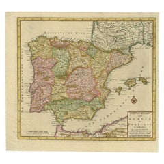
Antique Map of Spain and Portugal by Tirion, c.1760
Located in Langweer, NL
Antique map titled 'Nieuwe Kaart van Spanje en Portugal.' Attractive detailed map showing Spain and Portugal. Including Majorca, Minorca and Ibiza. Title in block-style cartouche wit...
Category
18th Century Antique Europe Maps
Materials
Paper
$254 Sale Price
20% Off
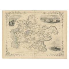
Gateway to the Steppes: Tallis's Masterpiece Map of Indepent Tartary, 1851
Located in Langweer, NL
The map is of "Independent Tartary," a historical region in Central Asia that covered parts of what are now Kazakhstan, Uzbekistan, Turkmenistan, and surrounding areas. The map was p...
Category
1850s Antique Europe Maps
Materials
Paper
$307 Sale Price
20% Off
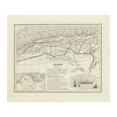
Antique Map of the Region of Algiers, Algeria
Located in Langweer, NL
Antique map titled 'Alger'. This map shows the region of Algiers, Algeria. With a small inset map of the region of Algiers and a decorative vignette with a harbor view. Originates fr...
Category
Mid-19th Century Antique Europe Maps
Materials
Paper
$158 Sale Price
20% Off
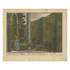
Antique Hand-Colored Print of the Labyrinth of Versailles, c.1720
Located in Langweer, NL
Antique print titled 'Le Serpent à plusieurs Testes: dans le Labyrinte de Versailles'. This print illustrates the fable 'The Snake with several heads' of the labyrinth of Versailles ...
Category
18th Century Antique Europe Maps
Materials
Paper
$73 Sale Price
20% Off
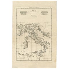
Antique Map of Italy by R. Bonne, circa 1780
Located in Langweer, NL
Beautiful map of Italy, Corsica, Sardinia and Sicily. Highly detailed, showing towns, rivers, some topographical features and political boundaries. Published by R. Bonne, circa 1780.
Category
Late 18th Century French Antique Europe Maps
Materials
Paper
$279 Sale Price
20% Off
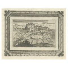
Very Rare Antique Print of the City of Nice in France, c.1700
Located in Langweer, NL
Antique print titled 'Nicaea Civitas'. Original antique print with a view of the city of Nice, France. Rare in this edition. Source unknown, to be determined.
Artists and Engraver...
Category
17th Century Antique Europe Maps
Materials
Paper
$540 Sale Price
20% Off
Antique Map of Java in 4 sheets by Dornseiffen, 1884
Located in Langweer, NL
Detailed map of Java in 4 sheets, with an inset map of Batavia (Jakarta). This map originates from 'Atlas van Nederlandsch Oost- en West-Indie' by Dr. I. Dornseiffen. Published by Se...
Category
Late 19th Century Antique Europe Maps
Materials
Paper
$605 Sale Price
20% Off
Antique Map of the Holy Land, Showing the Location of the Various Tribes
Located in Langweer, NL
Antique map titled 'Judaea seu Terra Sancta quae Hebraeorum sive Israelitarum (..)'. Map of The Holy Land, showing the location of the various tribes, in two kingdoms, Judah and Isra...
Category
Early 18th Century Antique Europe Maps
Materials
Paper
$1,118 Sale Price
20% Off
Rare Engraving with a View of the City of Kom in Egypt
Located in Langweer, NL
This is an original antique print of the city of Kom in Egypt.
Category
Late 18th Century Antique Europe Maps
Materials
Paper
$242 Sale Price
20% Off
Oriental Realms: A Detailed Map of Persia, Afghanistan, and Beloochistan, 1882
Located in Langweer, NL
This historical map from the 1882 atlas published by Blackie & Son is a comprehensive depiction of Persia (modern-day Iran), Afghanistan, and Baluchistan (the region that includes pa...
Category
1880s Antique Europe Maps
Materials
Paper
$288 Sale Price
20% Off
Rare Print of The Factories in Guangzhou, China, 1835
Located in Langweer, NL
Antique print titled 'Factoreries a Canton'.
This print (on india paper) depicts factories in Guangzhou, China. Originates from 'Voyage Autour du Monde par les Mers...
Category
1830s Antique Europe Maps
Materials
Paper
$680 Sale Price
20% Off
Antique Map of the Gulf of Mexico and Caribbean Islands by Tardieu, 1802
Located in Langweer, NL
This is an original antique map titled "Carte du Golfe du Mexique et des Isles Antilles," depicting the Gulf of Mexico and the Caribbean islands. Created by Pierre Antoine Tardieu, t...
Category
Early 1800s Antique Europe Maps
Materials
Paper
$522 Sale Price
20% Off
1821 Thomson Map of Guadeloupe, Marie-Galante and Antigua in the West Indies
Located in Langweer, NL
This map, published in 1821 by John Thomson, showcases Guadeloupe, Marie-Galante, and Antigua from the *West India Islands* collection. Part of Thomson's *New General Atlas*, it prov...
Category
1820s Antique Europe Maps
Materials
Paper
$540 Sale Price
20% Off
Dutch Conquest of Rio Grande, Brazil (1633) Under Prince Frederick Hendrick
Located in Langweer, NL
The image is an engraving titled “VEROVERINGE VAN RIO GRANDE IN BRASIL ANNO 1633.” This historical print depicts the Dutch conquest of Rio Grande in Brazil, known today as Natal, dur...
Category
1690s Antique Europe Maps
Materials
Paper
$512 Sale Price
20% Off
Antique Map of the region of Siberia, Mongolia and Manchuria
Located in Langweer, NL
Antique map titled 'Siberia and Chinese Tartary'. Detailed antique map of the region of Siberia, Mongolia and Manchuria. Engraved by J. & C. Walker. Published 1838.
Category
Mid-19th Century Antique Europe Maps
Materials
Paper
$354 Sale Price
20% Off
Turkey in Asia: Biblical Regions and the Holy Land from The Royal Atlas (1856)
Located in Langweer, NL
This antique map titled "Turkey in Asia (Biblical Regions) The Holy Land and its Borders" comes from "The Royal Illustrated Atlas", which was published in 1856 by A. Fullarton & Co. ...
Category
Mid-19th Century Antique Europe Maps
Materials
Paper
$615 Sale Price
20% Off
Original Antique Plan of the Harbor of Nettuno, Near Rome, by Munster, c.1580
By Sebastian Münster
Located in Langweer, NL
Antique map titled 'Der Statt Neptun (.).' Detailed plan of the Harbor of Nettuno, near Rome, from Munster's Cosmographia, one of the most influential cartographic works of the 16th century.
The antique map titled 'Der Statt Neptun (.),' originating from Munster's renowned Cosmographia, unveils a detailed plan of the Harbor of Nettuno, situated near Rome. This influential cartographic work, crafted in the 16th century, stands as a testament to Munster's mastery in cartography and geographic depiction.
The map meticulously portrays the Harbor of Nettuno, capturing its coastal features, the layout of the harbor, and possibly key landmarks or structures in the vicinity. Munster's expertise in cartography shines through in this intricate representation, offering a visual insight into the strategic maritime site near Rome.
Being part of the Cosmographia, one of the era's most influential cartographic compilations, this map holds historical significance. Munster's work was esteemed for its accuracy and influence in shaping geographic knowledge during the 16th century.
Adorned with Munster's characteristic artistic touches and possibly embellishments, this antique print not only serves as a navigational aid but also stands as a testament to the era's cartographic expertise, preserving the Harbor of Nettuno's significance in the maritime landscape near Rome.
Artists and Engravers: Made by 'Sebastian Munster...
Category
16th Century Antique Europe Maps
Materials
Paper
$307 Sale Price
20% Off
Barbados Island at the Height of the Plantation Economy, Circa 1759
Located in Langweer, NL
Carte de l'Isle de la Barbade by Jacques-Nicolas Bellin (1703–1772), Circa 1759
This rare antique map of Barbados, titled Carte de l'Isle de la Barbad...
Category
1750s Antique Europe Maps
Materials
Paper
$410 Sale Price
20% Off
1874 Map of the United States with Territorial Boundaries
Located in Langweer, NL
Title: 1874 Map of the United States with Territorial Boundaries
Description: This is an 1874 map titled "Map of the United States," showcasing the country during a period of rapid ...
Category
1870s Antique Europe Maps
Materials
Paper
$242 Sale Price
20% Off
Large Original Vintage Map of Sweden and Norway circa 1920
Located in St Annes, Lancashire
Great map of Sweden and Norway
Original color. Good condition
Published by Alexander Gross
Unframed.
Category
1920s English Victorian Vintage Europe Maps
Materials
Paper
Antique Engraving of Persepolis, a City Sacked by Alexander the Great, 1726
Located in Langweer, NL
Antique print titled 'Ruinen van 't Paleis van Darius, gelegen in 't oude Persepolis, door last van Alexander de Groote verbrandt (..)'.
Persepolis was sacked by the troops of Al...
Category
1720s Antique Europe Maps
Materials
Paper
$456 Sale Price
20% Off
Decorative 1864 Civil War Era Map of Indiana with Lake Michigan Detail
Located in Langweer, NL
Title: Rare 1864 Civil War Era Map of Indiana with Lake Michigan Detail
Description: This finely detailed antique map, titled "Johnson's Indiana," was published in 1864 by Johnson a...
Category
1860s Antique Europe Maps
Materials
Paper
Antique Map Illustrating Solar Eclipses by Scherer, C.1703
Located in Langweer, NL
Antique map of an hemisphere and several figures illustrating the position of the earth, moon and sun. Printed for Scherer's 'Atlas Novus' (1702-1710).
Artists and Engravers: Heinrich Scherer (1628-1704) was a Professor of Hebrew, Mathematics and Ethics at the University of Dillingen until about 1680. Thereafter he obtained important positions as Official Tutor to the Royal Princes...
Category
18th Century Antique Europe Maps
Materials
Paper
$205 Sale Price
20% Off
Panoramic Engraved View of the Town of Longvek 'or Lavek' in Cambodia, ca.1726
Located in Langweer, NL
Description: Antique print titled 'Eauweck, Hooft Stad van Cambodia'. Decorative panoramic view of the town of Longvek (or Lavek) in Cambodia. It was the second capital city during t...
Category
1720s Antique Europe Maps
Materials
Paper
$792 Sale Price
20% Off
Pl. 87 Antique Print of Decorative Art in the 18th Century by Racinet, 1869
Located in Langweer, NL
Old print of decorative art in the 18th century. This print originates from 'L'Ornement polychrome'. A beautiful work containing about 2000 patterns of all the styles of Art old and ...
Category
19th Century Antique Europe Maps
Materials
Paper
Original Antique Map of Fez and Morocco
Located in Langweer, NL
Antique map titled 'Karte von Fes und Marócos (..)'. Original old map of Fez (or Fes) and Morocco. Also shows the Strait of Gibraltar. By Friedrich Gottlieb Canzler, published 1799.
Category
Late 18th Century Antique Europe Maps
Materials
Paper
$512 Sale Price
20% Off
Antique Print of Nice Near Villa Venanson Near Nice in France, c.1865
Located in Langweer, NL
Antique print titled 'Nice, vue prise de la Villa Venanson'. View of the city of Nice, near Villa Venanson, France. This print originates from 'Nice Et Savoie, Sites Pittoreques, Mon...
Category
19th Century Antique Europe Maps
Materials
Paper
$428 Sale Price
20% Off
Spectacular View of the Siege of Jerusalem by King Nebuchadnezzar, ca.1730
Located in Langweer, NL
Antique print titled 'Belegering van Jerusalem door Nebucadnezar (..)'.
This original antique print shows the siege of Jerusalem by King Nebucha...
Category
1730s Antique Europe Maps
Materials
Paper
$503 Sale Price
20% Off
Decorative 1850s Map of Eastern Canada and New Brunswick with Historic Vignettes
Located in Langweer, NL
Decorative 1850s Map of Eastern Canada and New Brunswick with Historic Vignettes
This beautifully crafted 19th-century map of Eastern Canada and New Brunswick, drawn and engrave...
Category
1850s Antique Europe Maps
Materials
Paper
Original Antique View of the City of Damietta, Egypt, 1774
Located in Langweer, NL
Antique print, titled: 'Prospect der Stadt Damiat.' - Tab VIII.
View of the city of Damietta, Egypt. From 'Reisebeschreibung von Arabien und anderen umliegenden Landern (1774-1778)...
Category
1770s Antique Europe Maps
Materials
Paper
$344 Sale Price
20% Off
Spectacular 1770 Bird's-Eye View of Dunkirk Harbor by Basset, with 66 Landmarks
Located in Langweer, NL
This engraving, titled *Vue de Dunkerque du coté de la Mer*, is a spectacular bird's-eye view of Dunkirk from the sea, published by Basset around 1770.
It provides a detailed panor...
Category
1770s Antique Europe Maps
Materials
Paper
$456 Sale Price
20% Off
Map of Groningen from The Genealogy of the Illustrious Counts of Nassau (1615)
Located in Langweer, NL
Title: Map of Groningen from "The Genealogy of the Illustrious Counts of Nassau" (1615)
Description: This antique map, titled "Gronenga," offers a detailed depiction of the forti...
Category
1610s Antique Europe Maps
Materials
Paper
$512 Sale Price
20% Off
Antique Map of Saxony, Germany
Located in Langweer, NL
Original antique map titled 'Circulus Saxoniae Superioris'. Original antique map of Saxony, Germany. The cities of Leipzig, Freiburg and many others are highlighted in gold. This map originates from 'Atlas Novus Terrarum Orbis...
Category
Early 18th Century Antique Europe Maps
Materials
Paper
$559 Sale Price
20% Off
1625 Petrus Plancius / Cloppenburg Map of the Holy Land with Biblical Vignettes
Located in Langweer, NL
1625 Petrus Plancius / Johannes Cloppenburg Map of the Holy Land with Biblical Vignettes
This exquisite 1625 map by Petrus Plancius and Johannes Cloppenburg represents the Holy Lan...
Category
1620s Antique Europe Maps
Materials
Paper
The Antient City of Jerusalem and Places Adjacent, Hand-Colored Map, 1699
Located in Langweer, NL
Title: "1699 Hand-Colored Bird's-Eye Plan of Jerusalem with Ancient and Biblical Landmarks"
This beautifully hand-colored, imaginary bird's-eye plan of Jerusalem, published in 1699,...
Category
1690s Antique Europe Maps
Materials
Paper
$242 Sale Price
20% Off
Antique Map of the Island of Tahiti, Polynesia, 1803
Located in Langweer, NL
Antique map Tahiti titled 'Kaart van het Eiland Otahiti'.
Antique map of the Island of Tahiti, Polynesia. Originates from 'Reizen Rondom de Waereld door James Cook (..)'.
Artists...
Category
Early 1800s Dutch Antique Europe Maps
Materials
Paper
Original Antique Map of the Northern Part of Scotland, circa 1640
Located in Langweer, NL
The antique map, titled 'Scotiae pars septentrionalis,' depicts the northern part of Scotland. Crafted by Hondius around 1640, this map is a historical treasure showcasing the geogra...
Category
Mid-17th Century Antique Europe Maps
Materials
Paper
$820 Sale Price
20% Off
Antique Map of The World in Hemispheres by W. G. Blackie, 1859
Located in Langweer, NL
Antique map titled 'The World in Hemispheres with other projections'. Original antique map of The World. This map originates from ‘The Imperial Atlas of Modern Geography’. Published ...
Category
Mid-19th Century Antique Europe Maps
Materials
Paper
$285 Sale Price
30% Off
Saint-Domingue (French Section): 18th Century Map from France Militaire Series
Located in Langweer, NL
This map is titled "St. Domingue (Partie Française)" and is part of the France Militaire series. It focuses on the French portion of Saint-Domingue, which corresponds to modern-day H...
Category
1790s Antique Europe Maps
Materials
Paper
$111 Sale Price
20% Off
Antique Chart of the Passage of Comets in the Southern Sky, circa 1740
Located in Langweer, NL
Antique map titled 'Motus Comtarum in Hemispaerio Australi (..)'. This uncommon chart depicts the passage of comets in the southern sky between the years 1530-1704. Centered on the ecliptic poles and shows the constellation figures based on classical mythology, without showing the stars. The paths of dozens of comets are illustrated, eincluding those sighted by Tycho Brahe...
Category
Mid-18th Century Antique Europe Maps
Materials
Paper
$2,184 Sale Price
25% Off
Old Genealogy Chart of the Rulers of Margraviate Brandenburg in Germany, 1732
Located in Langweer, NL
Antique print titled 'Genealogie de la Maison de Brandebourg (..)'. Genealogy of the rulers of the Margraviate Brandenburg. This print orginates from 'Atlas Historique'.
The Margraviate of Brandenburg (German: Markgrafschaft Brandenburg) was a major principality of the Holy Roman Empire from 1157 to 1806 that played a pivotal role in the history of Germany and Central Europe. Brandenburg developed out of the Northern March founded in the territory of the Slavic Wends. It derived one of its names from this inheritance, the March of Brandenburg (Mark Brandenburg). Its ruling margraves were established as prestigious prince-electors in the Golden Bull...
Category
18th Century Antique Europe Maps
Materials
Paper
$223 Sale Price
20% Off
Large Antique Map of Europe, Showing the Empire of Charlemagne
Located in Langweer, NL
Antique map titled 'Imperium Caroli Magni (..)'. Large antique map of Europe, showing the Empire of Charlemagne in the 8th Century. Engraved by T. Kitchin. Published J. Blair, circa ...
Category
Late 18th Century Antique Europe Maps
Materials
Paper
$428 Sale Price
20% Off
Map of Northern India & Surrounding Regions, incl Kabul, Candahar & Bhutan, 1710
Located in Langweer, NL
Antique map titled 'Magni Mogolis Imperium de Novo Correctum et Divisum Per F. de Witt Amstelodami.'
Map of Northern India and surrounding regions. This includes Kabul and Candah...
Category
1710s Antique Europe Maps
Materials
Paper
$1,137 Sale Price
20% Off
Map of The Italian Peninsula with the islands of Sicily, Sardinia, Corsica, 1880
Located in Langweer, NL
This map, titled "ITALIA, Sicilia, Sardinia, Corsica," represents the Italian Peninsula along with the islands of Sicily, Sardinia, and Corsica. Inset maps offer detailed views of "R...
Category
1880s Antique Europe Maps
Materials
Paper
$344 Sale Price
20% Off
Antique Map of Scandinavia by Van der Aa 'circa 1710'
Located in Langweer, NL
Antique map titled 'Scandinavie Septentrionale' and 'Scandinavie Meridionale'. Copper engraving with two maps on one sheet. The upper map depicts Northern Scandinavia with Norway, Sw...
Category
Early 18th Century Antique Europe Maps
Materials
Paper
$652 Sale Price
20% Off
Map of Rhône: Culture and Commerce in Lyon's Silk and Wine Legacy, 1852
Located in Langweer, NL
This original hand-colored map is from the "Atlas National Illustré," a work by Victor Levasseur, a French geographer and cartographer known for his richly illustrated maps.
The map...
Category
1850s Antique Europe Maps
Materials
Paper
$316 Sale Price
20% Off
Interesting Original Antique Map of South America, 1822
Located in Langweer, NL
Antique map titled 'South America'.
Map of South America with attractive topography, surrounded on three sides by text on the history, geography, and economy of the continent. Sh...
Category
19th Century Antique Europe Maps
Materials
Paper
Original Antique Map of Dresden, Germany by J. Stockdale, 1800
Located in Langweer, NL
Vintage Map of Dresden, Germany by J. Stockdale, 1800
This vintage map titled "A Plan of the City of Dresden" was published by J. Stockdale in Piccadilly, London, in 1800. It provid...
Category
Early 1800s Antique Europe Maps
Materials
Paper
Map of Independent Tartary with Vignettes of the Region's Culture, 1851
Located in Langweer, NL
The map of Independent Tartary is part of the collection by John Tallis & Company, which were unique for their elaborate decorative elements and detailed illustrations.
**The Maker ...
Category
1850s Antique Europe Maps
Materials
Paper
$270 Sale Price
20% Off
Empire of the Parthians: Historical Cartographic Masterpiece by d'Anville, 1819
Located in Langweer, NL
Description:
Ancient map of the Parthian Empire (19th century), original engraving extracted from the atlas of the history of the emperors from 1819, based on the history of the Rom...
Category
1810s Antique Europe Maps
Materials
Paper
$92 Sale Price
20% Off
Antique Engraving of Chinese Costumes, c.1860
Located in Langweer, NL
Antique print titled 'Costume Chinese'. Print of Chinese costumes. Source unknown, to be determined.
Artists and Engravers: Anonymous.
Condition:...
Category
19th Century Antique Europe Maps
Materials
Paper
$83 Sale Price
20% Off
Early Woodcut Bird's Eye View of Rouffach, France, by Sebastian Münster, 1554
Located in Langweer, NL
Early Woodcut Bird's Eye View of Rouffach, France, by Sebastian Münster, 1554
Description: This rare 1554 woodcut is a bird's eye view of Rouffach, a town in the Haut-Rhin departmen...
Category
16th Century Antique Europe Maps
Materials
Paper
Antique Print of the Malabar Coast of India showing the VOC establishments, 1726
Located in Langweer, NL
Dutch print with the title: Platte Grond van t'Fort Tricoen male met de daar aangelegen Pagoods-Berg (Trincomalee, Sri Lanka)
The map is taken from: 'Oud en Nieuw Oost-Indiën' van François Valentyn.
1) Ottens, Frederik (engraver / etcher)
2) Braam, J. van (publisher)
3) Linden, Gerard onder de (publisher)
MALABAR COAST...
Category
1720s Antique Europe Maps
Materials
Paper
$261 Sale Price
20% Off
An Original Antique Mid-17th Century Blaeu Map of Styria in Southeastern Austria
Located in Langweer, NL
This is an antique map of Styria (referred to as “Stiria” or “Steyrmarck”), published by the renowned Dutch cartographer Willem Janszoon Blaeu (often simply “Blaeu”). The first editi...
Category
1640s Antique Europe Maps
Materials
Paper
The World in the Assyrian Empire's Era: A Historical Map, Published in 1880
Located in Langweer, NL
This map from the "Spruner-Menke Atlas Antiquus" is titled "ORBIS TERRARVM regni Assyrii tempore," which translates to "The World at the Time of the Assyrian Kingdom." It depicts the...
Category
1880s Antique Europe Maps
Materials
Paper
$344 Sale Price
20% Off
Antique Map of Champagne and surrounding Regions, France
Located in Langweer, NL
Antique map titled 'Carte de la Champagne et des Pays Voisins (..)'. Detailed map of Champagne and surrounding regions of Chalons and Soissons, Reims,...
Category
Mid-18th Century Antique Europe Maps
Materials
Paper
Beautiful Old Map of Spain and Portugal With Decorative Title Cartouche, ca.1740
Located in Langweer, NL
Antique map Spain titled 'L’Espagne dressée sur la Description qui en a eté faite par Rodrigo Mendez Sylva (..)'.
Beautiful map of Spain with dec...
Category
1740s Antique Europe Maps
Materials
Paper
$1,118 Sale Price
20% Off
Decorative Vintage Print, Dutch Chart of Australia, 1st Edition, 1952
Located in Langweer, NL
The vintage school chart of Australia titled "Australië," created by W. Bakker & H. Rush and published in 1952:
**Title**: Australië
**Creators**: W. Bakker & H. Rush
**Publication ...
Category
Mid-20th Century European Europe Maps
Materials
Canvas
$326 Sale Price
20% Off
Original Antique Map of Greece and part of Turkey
Located in Langweer, NL
Original antique map titled 'La Grece ou partie meridionale de la Turquie d'Europe'. Small map of Greece and part of Turkey. This map originates from 'Le nouveau et curieux Atlas Geo...
Category
Early 18th Century Antique Europe Maps
Materials
Paper
$354 Sale Price
20% Off
Roman Frontiers Engraved: Germania, Raetia, and Noricum, Published in 1880
Located in Langweer, NL
The map, titled "GERMANIA, RAETIA, NORICUM," depicts the regions of Germania, Raetia, and Noricum, which correspond to parts of modern-day Central and Eastern Europe, including areas of Germany, Austria, Switzerland, and the Balkans.
Features of the map include:
1. **Regional Divisions**: The map is divided into the regions of Germania, Raetia, and Noricum, each likely differentiated by color or shading.
2. **Topography**: It details the mountain ranges, rivers, and other geographical features of the region. The Alps, which are central to Raetia, are prominently displayed.
3. **Roman Settlements and Roads**: The map likely marks Roman...
Category
1880s Antique Europe Maps
Materials
Paper
$344 Sale Price
20% Off
Recently Viewed
View AllMore Ways To Browse
Antique Buddha Laos
Antique Captains Chest
Antique Crutches
Antique Curved Front Dresser
Antique Dressing Table With 3 Mirrors
Antique Fire Guard Screen
Antique Fire Guards Brass
Antique Fire Markers
Antique Fireplace Coal Basket
Antique Folding Card Table 20th Century
Antique French Lavabo
Antique French Marble Top Server Buffet
Antique German Mugs
Antique Gun Cabinet
Antique Horse Crop
Antique Hubley Cast Iron
Antique Indonesian Ikat
Antique Iron Pot Rack
