Items Similar to Original Antique Plan of the Harbor of Nettuno, Near Rome, by Munster, c.1580

Want more images or videos?
Request additional images or videos from the seller
1 of 6
Original Antique Plan of the Harbor of Nettuno, Near Rome, by Munster, c.1580
About the Item
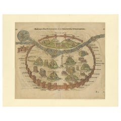
Antique map titled 'Der Statt Neptun (.).' Detailed plan of the Harbor of Nettuno, near Rome, from Munster's Cosmographia, one of the most influential cartographic works of the 16th century.
The antique map titled 'Der Statt Neptun (.),' originating from Munster's renowned Cosmographia, unveils a detailed plan of the Harbor of Nettuno, situated near Rome. This influential cartographic work, crafted in the 16th century, stands as a testament to Munster's mastery in cartography and geographic depiction.
The map meticulously portrays the Harbor of Nettuno, capturing its coastal features, the layout of the harbor, and possibly key landmarks or structures in the vicinity. Munster's expertise in cartography shines through in this intricate representation, offering a visual insight into the strategic maritime site near Rome.
Being part of the Cosmographia, one of the era's most influential cartographic compilations, this map holds historical significance. Munster's work was esteemed for its accuracy and influence in shaping geographic knowledge during the 16th century.
Adorned with Munster's characteristic artistic touches and possibly embellishments, this antique print not only serves as a navigational aid but also stands as a testament to the era's cartographic expertise, preserving the Harbor of Nettuno's significance in the maritime landscape near Rome.
Artists and Engravers: Made by 'Sebastian Munster' after an anonymous artist. Sebastian Munster (1488-1552) was a German cartographer, cosmographer, and Hebrew scholar whose Cosmographia (1544; "Cosmography") was the earliest German description of the world.
Condition: Good, given age. Some crinkles, mainly outside image. General age-related toning and/or occasional minor defects from handling. Please study image carefully.
We sell original antique maps to collectors, historians, educators and interior decorators all over the world. Our collection includes a wide range of authentic antique maps from the 16th to the 20th centuries. Buying and collecting antique maps is a tradition that goes back hundreds of years. Antique maps have proved a richly rewarding investment over the past decade, thanks to a growing appreciation of their unique historical appeal. Today the decorative qualities of antique maps are widely recognized by interior designers who appreciate their beauty and design flexibility. Depending on the individual map, presentation, and context, a rare or antique map can be modern, traditional, abstract, figurative, serious or whimsical. We offer a wide range of authentic antique maps for any budget.
- Creator:Sebastian Münster (Artist)
- Dimensions:Height: 12.6 in (32 cm)Width: 8.15 in (20.7 cm)Depth: 0 in (0.01 mm)
- Materials and Techniques:
- Period:
- Date of Manufacture:C.1580
- Condition:Condition: Good, given age. Some crinkles, mainly outside image. General age-related toning and/or occasional minor defects from handling. Please study image carefully.
- Seller Location:Langweer, NL
- Reference Number:
About the Seller
5.0
Platinum Seller
These expertly vetted sellers are 1stDibs' most experienced sellers and are rated highest by our customers.
Established in 2009
1stDibs seller since 2017
1,928 sales on 1stDibs
Typical response time: <1 hour
- ShippingRetrieving quote...Ships From: Langweer, Netherlands
- Return PolicyA return for this item may be initiated within 14 days of delivery.
More From This SellerView All
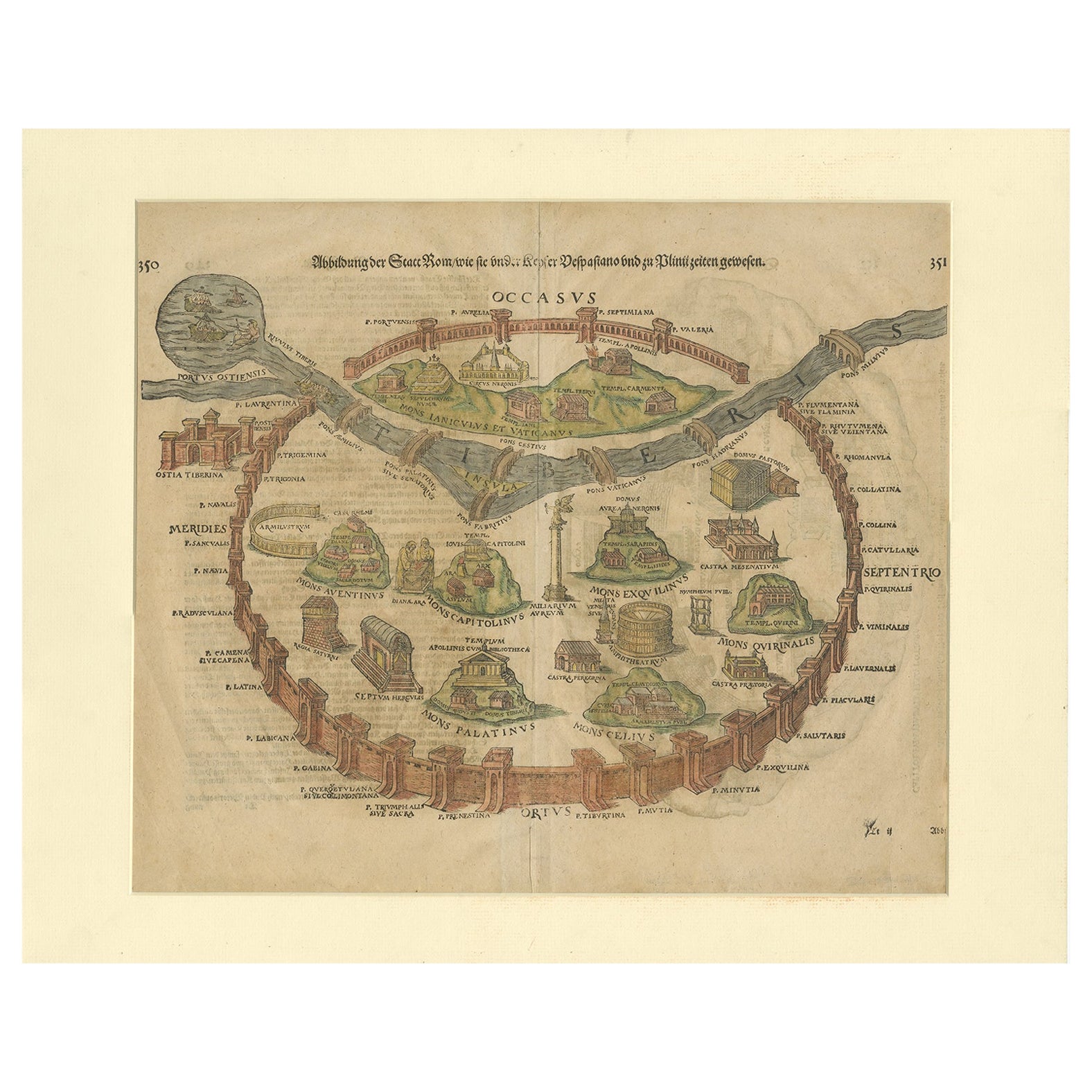
- Antique Print of the City of Rome, Italy by Münster, C.1580Located in Langweer, NLAntique print titled 'Abbildung der Statt Rom/wie sie under Keyser Vespasiano und zu Plinii zeiten gewesen'. Woodcut of ancient Rome. This print originates from Munster's Cosmographi...Category
Antique 16th Century Prints
MaterialsPaper
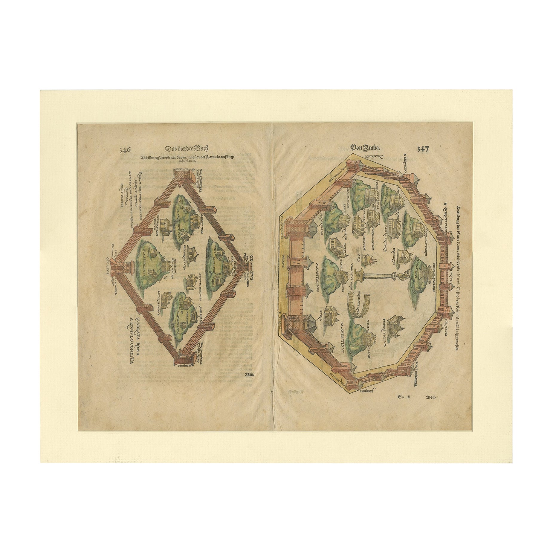
- Antique Print of the City of Rome, Italy by Münster, C.1580Located in Langweer, NLAntique print titled 'Abbildung der Statt Rom/wie sie von Romulo anfänge - Von Italia'. Woodcut of ancient Rome. This print originates from Munster's Cosmographia, one of the most in...Category
Antique 16th Century Prints
MaterialsPaper
- Old Antique Print of the City of Groningen, The Netherlands, by Münster, c.1600By Sebastian MünsterLocated in Langweer, NLAntique print titled 'Groeninga'. View of the city of Groningen, the Netherlands. This map originates from 'Cosmographia' published by Münster. Artists and Engravers: Sebastian Münster...Category
Antique 16th Century Prints
MaterialsPaper
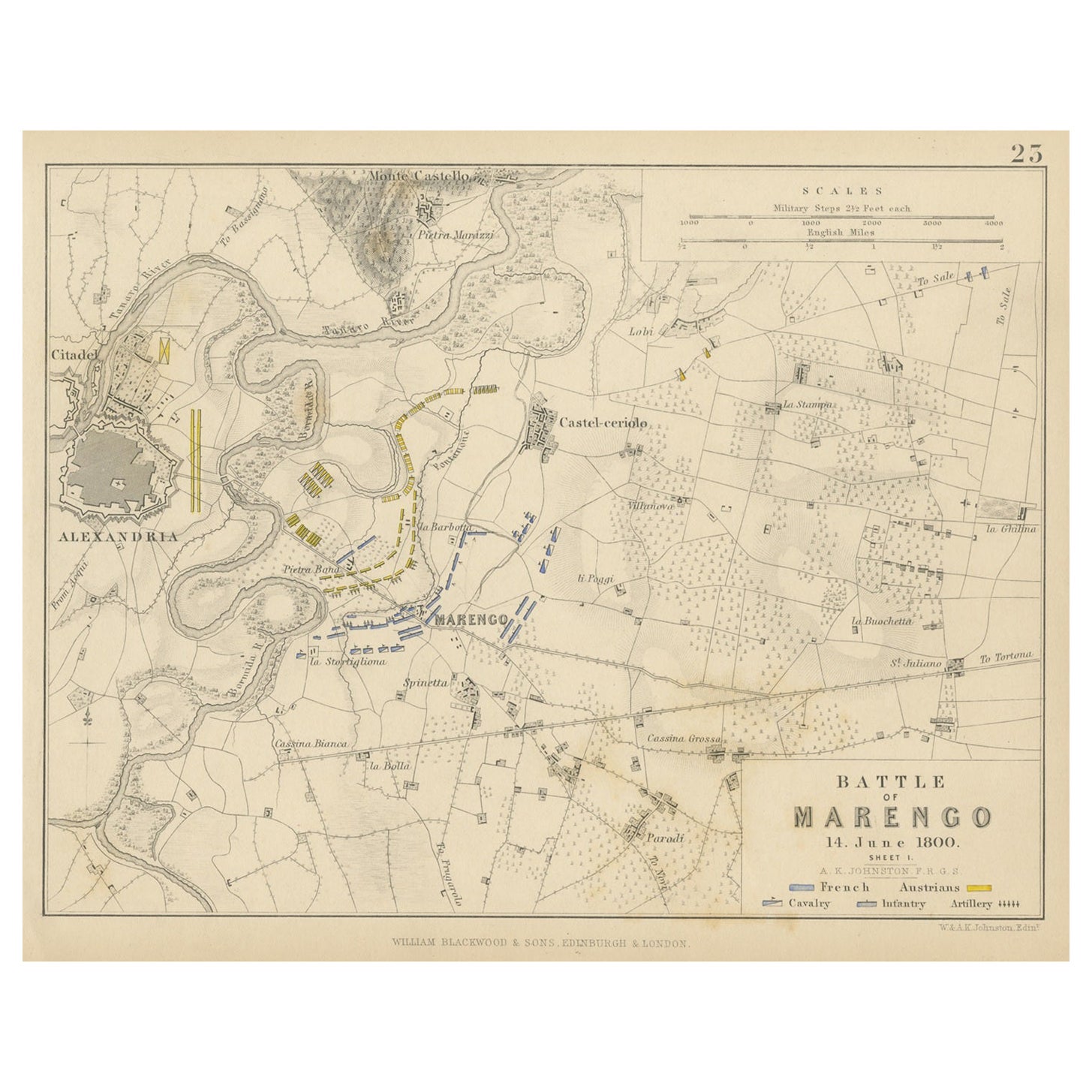
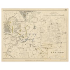
- Antique Plan of the Battle of Marengo, Near Alexandria, Italy, 1852Located in Langweer, NLThis antique battle map, titled "Battle of Marengo 14. June 1800 Sheet I," depicts the plan of the Battle of Marengo. This historic battle took place on Jun...Category
Antique Mid-19th Century Maps
MaterialsPaper
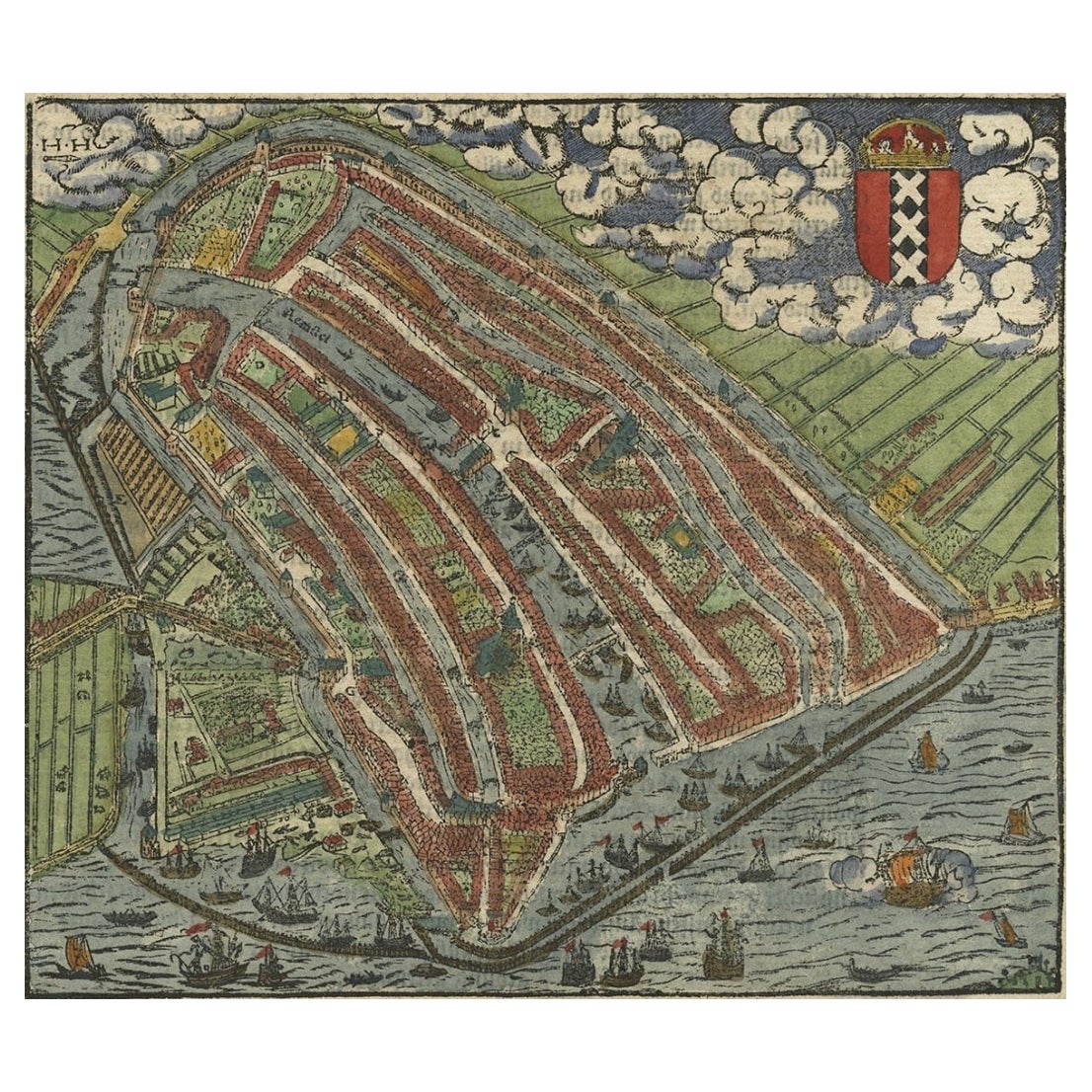
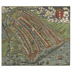
- Old Original Hand-Colored Engraving of a Bird's-eye Plan of Amsterdam, ca.1580Located in Langweer, NLDescription: Antique print, untitled. Bird's-eye plan of Amsterdam portrayed on a sheet of German text. Remarkably detailed for its size, hundreds of individual buildings and hou...Category
Antique 16th Century Maps
MaterialsPaper
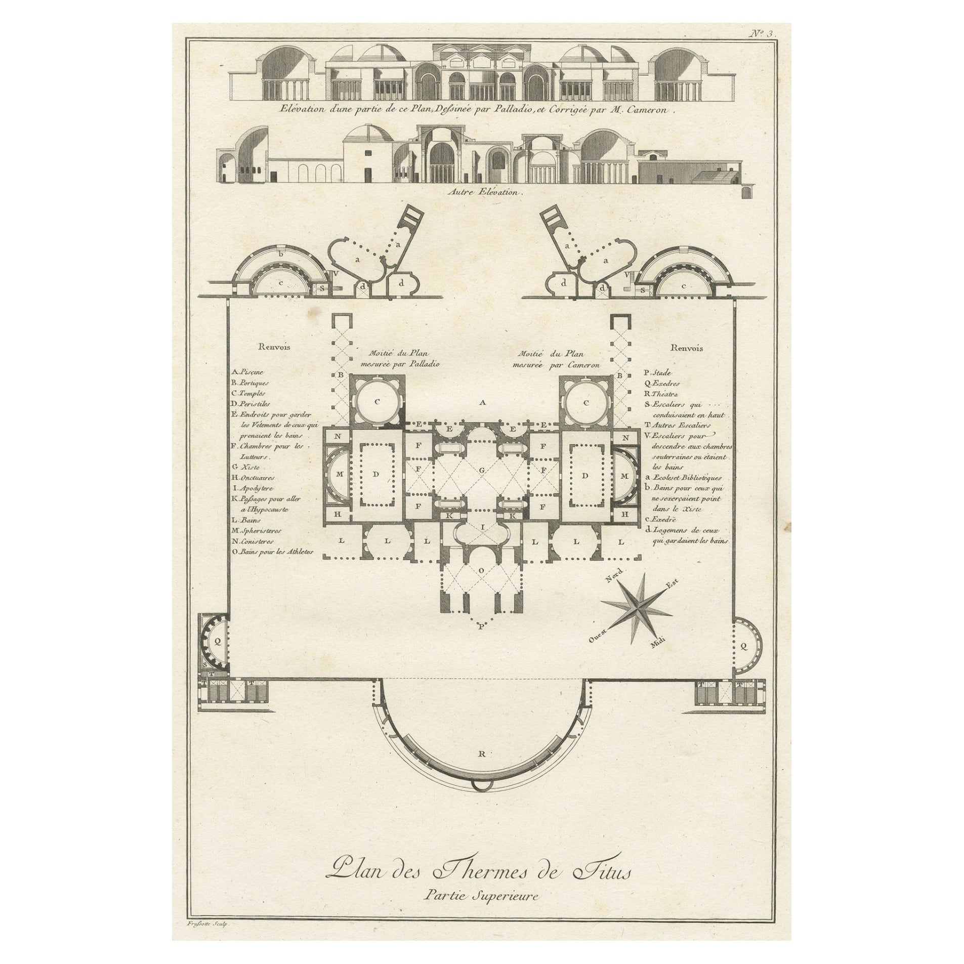
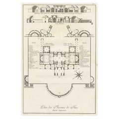
- Antique Plan of the Overground Area of Baths of Emperor Titus, Rome, Italy, 1786Located in Langweer, NLAntique print titled 'Plan des Thermes de Titus Partie Superieure'. Plan of the overground area of the Baths of Titus. The Baths of Titus or Thermae Titi were public baths (Thermae) built in 81 AD at Rome, by Roman emperor Titus...Category
Antique 18th Century Prints
MaterialsPaper
You May Also Like
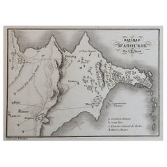
- Original Antique Plan of The Battle of Abukir, Napoleon Bonaparte. Circa 1850Located in St Annes, LancashireGreat battle plan of The Battle of Abukir Drawn by A.M Perrot Steel engraving by Tardieu with original hand colour Unframed. The size given is the paper sizeCategory
Antique 1850s French Maps
MaterialsPaper
- Original Antique City Plan of Milwaukee, USA, 1894By Rand McNally & Co.Located in St Annes, LancashireFabulous colorful map of Milwaukee Original color By Rand, McNally & Co. Published, 1894 Unframed Free shipping.Category
Antique 1890s American Maps
MaterialsPaper
- Original Antique Map / City Plan of Brussels by Tallis, circa 1850Located in St Annes, LancashireGreat map of Brussels. Steel engraving. Published by London Printing & Publishing Co. (Formerly Tallis), C.1850 Free shipping.Category
Antique 1850s English Maps
MaterialsPaper
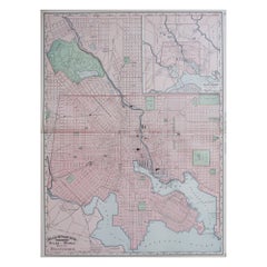
- Large Original Antique City Plan of Baltimore, USA, 1894By Rand McNally & Co.Located in St Annes, LancashireFabulous colorful map of Baltimore Original color By Rand, McNally & Co. Published, 1894 Unframed Free shipping.Category
Antique 1890s American Maps
MaterialsPaper
- Original Antique City Plan of Kansas City, USA. 1894By Rand McNally & Co.Located in St Annes, LancashireFabulous colorful map of Kansas City Original color By Rand, McNally & Co. Published, 1894 Unframed Slightly reduced bottom margin. Free shipping.Category
Antique 1890s American Maps
MaterialsPaper
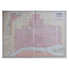
- Large Original Antique City Plan of Detroit, USA, 1894By Rand McNally & Co.Located in St Annes, LancashireFabulous colorful map of Detroit Original color By Rand, McNally & Co. Published, 1894 Unframed Free shipping.Category
Antique 1890s American Maps
MaterialsPaper


Recently Viewed
View AllMore Ways To Browse
Vintage Bartholomews Maps
Old Sicily Map
Antique Maps Of Lithuania
Antique Map Louisiana
Babylon Map
Antique Minnesota Map
Antique Ornamental Map
Jordan Antique Map
La Syrie Antique
Map Lebanon
Map Of Ural
Map Of Washington Dc
Maps Rochester
Queensland Maps
Republic Of Texas Map
Washington Dc Map
Washington Dc Maps
Antique Map Of New Hampshire