Netherlands - More Furniture and Collectibles

to
4,985
7,160
30,713
27,829
6,965
160
35
331
111
55
44
33
21
20
18
17
15
10
7
5
5
3
1
1
3,135
2,501
1,329
195
487
421
152
102
14
62
43
18
110
139
99
23
11
5,675
769
596
217
169
1,441
408
297
220
103
7,160
7,064
7,110
104
59
28
20
18
Item Ships From: Netherlands
Antique Map of Spain and Portugal by Tirion, c.1760
Located in Langweer, NL
Antique map titled 'Nieuwe Kaart van Spanje en Portugal.' Attractive detailed map showing Spain and Portugal. Including Majorca, Minorca and Ibiza. Title in block-style cartouche wit...
Category

18th Century Antique Netherlands - More Furniture and Collectibles

Materials

Paper

Caldelli for Big Ben Cedar Wood Humidor 1970s Italy
Located in Den Haag, NL
Vintage 1970's Caldelli handmade solid cedar wood cigar humidor. Made for Big Ben. Measuring 27cm x 19.5cm x 8cm. Will hold cigars upto 23cm long horizontally, 16.5cm vertically, 2 d...
Category

1970s Italian Mid-Century Modern Vintage Netherlands - More Furniture and Collectibles

Materials

Cedar

Original Antique Map of Trier and Luxembourg by Joan Blaeu, Amsterdam circa 1640
Located in Langweer, NL
Map of Trier and Luxembourg by Joan Blaeu, Amsterdam circa 1640 This beautifully engraved and hand-colored map titled Trevirensis Archiepiscopatus, et Lutzenburgi Ducatus depicts th...
Category

Mid-17th Century Dutch Antique Netherlands - More Furniture and Collectibles

Materials

Paper

Antique Map of Greece and Its Colonies, with Frame Style Border
Located in Langweer, NL
Antique map titled 'La Grèce'. Attractive map of Greece and its Colonies. The map covers from the southern part of Italy, including Sicily, to the western parts of Asia Minor and fro...
Category

Mid-19th Century Antique Netherlands - More Furniture and Collectibles

Materials

Paper

Antique Print of the State Bedroom of Warwick Castle, River Aron, England, c1850
Located in Langweer, NL
Antique print titled 'State Bedroom-Warwick Castle'. Lithograph of the State Bedroom of the famous Warwick Castle in England. Warwick Castle is a medieval castle developed fro...
Category

19th Century Antique Netherlands - More Furniture and Collectibles

Materials

Paper

Käthe Kruse Small Doll, 1970-1980s
Located in Delft, NL
Käthe Kruse small doll, 1970-1980s A Käthe Kruse, Modell Hanne, made in Germany girl with braids in her hair, wears the original blue dress with an apro...
Category

20th Century German Netherlands - More Furniture and Collectibles

Materials

Fabric, Plastic

Pl. 43 Antique Print of Decorative Art in the Middle Ages by Racinet, 1869
Located in Langweer, NL
Old print of decorative art in the Middle Ages. This print originates from 'L'Ornement polychrome'. A beautiful work containing about...
Category

19th Century Antique Netherlands - More Furniture and Collectibles

Materials

Paper

Reference Book Dutch Earthenware -Dubbelgebakken - Plateel in Holland
Located in Amsterdam, Noord Holland
Dutch language but easy to read with google translate on you phone. Interesting book about Dutch earthenware 1876-1940. Plateel ware.
Category

20th Century Netherlands - More Furniture and Collectibles

Materials

Paper

Antique Religion Print of the Seven Sacraments, Eucharist '1913'
Located in Langweer, NL
Large antique print of the seven sacraments. Published by Mosella-Verlag, 1913. This print originates from a series titled 'Kathol. Schulbibelwerk von Dr. Ecker'.
Category

Early 20th Century Netherlands - More Furniture and Collectibles

Materials

Paper

Mid-Century Modern Guillerme & Chambron Bed Frames in Blond Oak, France 1960s
By Guillerme et Chambron
Located in Almelo, NL
Mid-Century Modern Guillerme & Chambron Bed in Solid blond Oak, France 1960s This beautiful bed was made in France in 1960 and has a crafted oak frame with gorgeous sculpted detai...
Category

1960s French Mid-Century Modern Vintage Netherlands - More Furniture and Collectibles

Materials

Oak

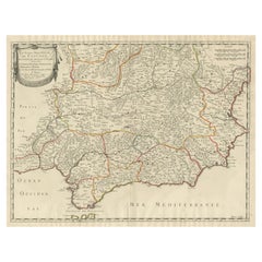
Map of Southern Spain Depicting Castile, Andalusia, Granada, Murcia and Valencia
Located in Langweer, NL
Antique map titled 'Partie Meridionale Des Etats de Castille (..)'. Decorative and highly detailed map of the southern part of Castile, Spain, including a decorative cartouche. Publi...
Category

Mid-18th Century Antique Netherlands - More Furniture and Collectibles

Materials

Paper

Mid-Century Modern Guillerme & Chambron Bed Frame in Solid Oak, France 1960s
By Guillerme et Chambron
Located in Almelo, NL
Mid-Century Modern Guillerme & Chambron Bed in Solid Oak, France 1960s This beautiful bed was made in France in 1960 and has a crafted oak frame with gorgeous sculpted detailing o...
Category

1960s French Mid-Century Modern Vintage Netherlands - More Furniture and Collectibles

Materials

Oak

1645 Blaeu Map of Westmorland, Northern England – Hand Colored, Decorative
Located in Langweer, NL
This map, "Westmoria Comitatus; Anglice Westmorland", was created by the esteemed Dutch cartographer Willem Blaeu and was published around 1645 in 'Le Theatre du Monde ou Nouvel Atlas'. It provides a detailed look at Westmorland, a historic county in northern England, based on John Speed’s earlier map. The map features numerous place names, parks, and estates, including Brigster Park, Colnhead Park, Crosbye, and Midleton, along with a detailed depiction of Windermere (spelled Wynandermere) and the surrounding regions. Additional Features: - Hand-colored map, with vibrant and detailed colors that bring out the topographical and decorative features. - Includes intricate cartouches, such as the royal coat of arms, a decorative title cartouche topped with putti (cherubic figures), and six coats of arms (two left blank). - Depicts the region’s rich landscape, including the rolling hills and mountainous terrain of northern England. - French text on the verso, indicative of the publication period from 1645-1648, part of Blaeu’s highly sought-after atlases. - Map shows precise details of small towns, estates, and parks, such as Brigster Park, Colnhead Park, Crosbye, and Wynandermere (now Windermere Lake). This map would be of particular interest to collectors of English county maps, antique maps of northern England, 17th-century cartography, and the decorative works of Willem Blaeu. Blaeu's maps are renowned for their accuracy, artistic beauty, and historical significance. Keywords: Willem Blaeu, Westmorland map, northern England, 17th-century map, antique map, English county map, John Speed, Windermere, decorative cartography, hand-colored map, rare map, antique cartography...
Category

1640s Antique Netherlands - More Furniture and Collectibles

Materials

Paper

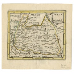
Antique Map of Eastern Persia, 1852
Located in Langweer, NL
Antique map titled 'Eastern Persia'. Original map of Eastern Persia. This map originates from 'Lowry's Table Atlas constructed and engraved from the most recent Authorities' by J.W. ...
Category

Mid-19th Century Antique Netherlands - More Furniture and Collectibles

Materials

Paper

Carlo Mollino Erotico Coat Hook
By Carlo Mollino
Located in Weesp, NL
Erotico coat hook - “Originally designed for the Orengo House, Turin 1949. This edition is from the collection “Homage to Carlo Mollino", 1997. The coat hook will be shipped insur...
Category

1990s Italian Mid-Century Modern Netherlands - More Furniture and Collectibles

Materials

Resin

Old Genealogy Chart of the Rulers of Margraviate Brandenburg in Germany, 1732
Located in Langweer, NL
Antique print titled 'Genealogie de la Maison de Brandebourg (..)'. Genealogy of the rulers of the Margraviate Brandenburg. This print orginates from 'Atlas Historique'. The Margraviate of Brandenburg (German: Markgrafschaft Brandenburg) was a major principality of the Holy Roman Empire from 1157 to 1806 that played a pivotal role in the history of Germany and Central Europe. Brandenburg developed out of the Northern March founded in the territory of the Slavic Wends. It derived one of its names from this inheritance, the March of Brandenburg (Mark Brandenburg). Its ruling margraves were established as prestigious prince-electors in the Golden Bull...
Category

18th Century Antique Netherlands - More Furniture and Collectibles

Materials

Paper

Antique Religion Print of the Presentation of Mary '1913'
Located in Langweer, NL
Large antique print of the presentation of Mary. Published by Mosella-Verlag, 1913. This print originates from a series titled 'Kathol. Schulbibelwerk von Dr. Ecker'.
Category

Early 20th Century Netherlands - More Furniture and Collectibles

Materials

Paper

Original Antique Print of Richard Beauchamp, 5th Earl of Warwick, 1812
Located in Langweer, NL
Antique print titled 'Richard Beuchamp, H.G. Earl of Warwick'. Old print of Richard Beuchamp, 5th Earl of Warwick, standing on a platform within the walls of a castle, wearing armour, a dagger, and garter on his left leg. Originates from 'Selections of the Ancient Costume...
Category

19th Century Antique Netherlands - More Furniture and Collectibles

Materials

Paper

Biblia Cum Concordantijs Veteris & Novi Testamenti & Sacrorum Canonum, 1519
Located in Delft, NL
Biblia cum concordantijs veteris & novi testamenti & sacrorum canonum, 1519 A Bible by auteur Alberto da Castello, printed by Luca-Antonio Giunta, Latin Anno 1519, Venice 27-532-55 pages First alphabetical list- Tabula Tertia, after that comes the 1st full page woodblock plate. This title page in red and black with a surrounded frame in woodcut. Above the page “San Jerome” illustrated and below the page the printers mark “ Giunti’s Mark” from the family of printers in Florentine. The initials L A of Luca-Antonio Giunta. After this page starts a full-page woodcut illustration after that are 3 pages not numbered and then starts numbered page 2 – 532 On page 401 is also a full-page woodcut plate There are ca 345 small woodcuts...
Category

16th Century Italian Antique Netherlands - More Furniture and Collectibles

Materials

Paper

J. Kohle Pforzheim, German 14 Carat White Gold with Akoya Pearls Necklace
Located in Delft, NL
J. Kohle Pforzheim, German 14 Carat white gold with Akoya pearls necklace. 132 Akoya pearls on double strand necklace with 14 Carat white gold closure with Diamond and 5 pearls a...
Category

Mid-20th Century German Netherlands - More Furniture and Collectibles

Materials

Gold

Rare Antique Engraving with Three Unique Views of Iran, 1711
Located in Langweer, NL
Antique print titled 'Karavane by het dorp Coraming - Brug over de rivier Kiesilosan - Het Dorp 't Sargabrand'. Old print with three views, two of which unidentified villages in Iran, and a bridge over the Kiesilosan river. This print originates from 'Cornelis de Bruins...
Category

18th Century Antique Netherlands - More Furniture and Collectibles

Materials

Paper

Antique Engraved Print of the City of Madrid, Capital of Spain, c.1780
Located in Langweer, NL
Antique print titled 'A View of Madrid the Capital of Spain'. View of the city of Madrid, Spain. Shows figures in the foreground, pleasure boats, a bridge, the Royal Palace, parkland...
Category

18th Century Antique Netherlands - More Furniture and Collectibles

Materials

Paper

Map of Independent Tartary with Vignettes of the Region's Culture, 1851
Located in Langweer, NL
The map of Independent Tartary is part of the collection by John Tallis & Company, which were unique for their elaborate decorative elements and detailed illustrations. **The Maker ...
Category

1850s Antique Netherlands - More Furniture and Collectibles

Materials

Paper

Stylish & Practical Mid-Century Modern Wood, Chrome and Blackened Wall Coat Rack
Located in Lisse, NL
Great looking and highly practical 1960s design wall coat rack. This beautifully designed, perfectly executed and highly practical midcentury coat rack could be the ideal piece to...
Category

Mid-20th Century European Mid-Century Modern Netherlands - More Furniture and Collectibles

Materials

Metal, Chrome

Antique Map of the Holy Land, Showing the Location of the Various Tribes
Located in Langweer, NL
Antique map titled 'Judaea seu Terra Sancta quae Hebraeorum sive Israelitarum (..)'. Map of The Holy Land, showing the location of the various tribes, in two kingdoms, Judah and Isra...
Category

Early 18th Century Antique Netherlands - More Furniture and Collectibles

Materials

Paper

Large 1695 Hand-Colored Engraved Map of Gascony (Gascogna), France
Located in Langweer, NL
This map, created by Giacomo Cantelli da Vignola in 1695, represents the "General Government of Guyenne and Gascony" in southwest France. Cantelli da Vignola was a renowned Italian c...
Category

1690s Antique Netherlands - More Furniture and Collectibles

Materials

Paper

French Guiana and Cayenne: Mid-19th Century Map from France Pittoresque Series
Located in Langweer, NL
This map titled "Guyane" is part of the France Pittoresque series and provides a detailed view of French Guiana along with a plan of the city of Cayenne. Features: - The map showcases the broader region of French Guiana, indicating key rivers, settlements, and the coastline along the Atlantic Ocean. - To the left, there's an inset labeled "Plan de la Ville de Cayenne", which shows the street layout, squares, and main buildings of the capital city, Cayenne. This inset provides a more detailed view of the urban area, highlighting its geometric grid layout near the coast. - The larger map outlines geographical features such as rivers (e.g., Oyapock and Maroni), forests, and territories in the surrounding area, including the neighboring Brazilian Empire...
Category

1850s Antique Netherlands - More Furniture and Collectibles

Materials

Paper

Antique Print of King Richard II by Atkinson, 1812
Located in Langweer, NL
Antique print titled 'King Richard the Second betrayed by the Earl of Northumberland'. Old print of King Richard II betrayed by the Earl of Northumberland...
Category

19th Century Antique Netherlands - More Furniture and Collectibles

Materials

Paper

Antique Map of Australia and New Zealand, c.1860
Located in Langweer, NL
Antique map titled 'Australia and New Zealand'. Unusual edition of this map of Australia and New Zealand, on very thin paper and multiple folding lines. Source unknown, to be determi...
Category

19th Century Antique Netherlands - More Furniture and Collectibles

Materials

Paper

Antique Map of Japan and Korea by Johnston '1909'
Located in Langweer, NL
Antique map titled 'Japan and Korea'. Original antique map of Japan and Korea. With inset maps of the Japanese Empire, Port Arthur, Formosa ,Tokyo and Yoko...
Category

Early 20th Century Netherlands - More Furniture and Collectibles

Materials

Paper

Rare Engraving with a View of the City of Kom in Egypt
Located in Langweer, NL
This is an original antique print of the city of Kom in Egypt.
Category

Late 18th Century Antique Netherlands - More Furniture and Collectibles

Materials

Paper

Antique Map of Australia, New Zealand and Oceania by F. von Stülpnagel, 1850
Located in Langweer, NL
Antique map titled 'Australien und Polynesien in Mercators Projection'. A map of Australia, New Zealand and Oceania. This includes Fiji, Tahiti and several other island groups in the...
Category

Mid-19th Century Antique Netherlands - More Furniture and Collectibles

Materials

Paper

Map of Comitatus Marchia et Ravensberg: Historical Counties in Germany, c.1660
Located in Langweer, NL
Antique map titled 'Comitatus Marchia et Ravensberg'. This map depicts two historical counties of the Holy Roman Empire: Marks and Ravensberg. Major cities, towns, mountains, and riv...
Category

Mid-17th Century Antique Netherlands - More Furniture and Collectibles

Materials

Paper

Set of 2 Bedside Tables or Nightstands in the style of Paolo Buffa, Italy 1950's
By Paolo Buffa
Located in Oud Beijerland, NL
Beautiful pair of bedside tables / nightstands in the style of or attributed to Paolo Buffa (1903-1970). They are made in Italy in the 50's. This lovely set is made with passion by...
Category

1950s Italian Mid-Century Modern Vintage Netherlands - More Furniture and Collectibles

Materials

Brass

Original Handcolored Antique Print of a Suit of Armour, '1842'
Located in Langweer, NL
Antique print titled 'A Suit of Armour, in the posession of Sir Samuel Meyrick K.H.'. Old print of a suit of armour. This print originates from 'A critical inquiry into antient armou...
Category

19th Century Antique Netherlands - More Furniture and Collectibles

Materials

Paper

Antique Map of Ancient Egypt Also Depicting the Nile River and Red Sea, 1845
Located in Langweer, NL
Antique map Egypt titled 'General Karte von Alt Aegypten von A.H. Brué'. Large map of Egypt also depicting the Nile river and Red Sea. Source unknown...
Category

19th Century Antique Netherlands - More Furniture and Collectibles

Materials

Paper

Pair of Antique French 19th Century Night Stands Bedside Walnut Marble Bronze
Located in Ijzendijke, NL
Impressive & stunning ! This pair of antique French 19th century night stands / bedside cabinets in Walnut. Amazing quality with inlaid waln...
Category

19th Century French Antique Netherlands - More Furniture and Collectibles

Materials

Marble, Bronze

Antique Map Dedicated to British Merchants Trading to North America, ca.1746
Located in Langweer, NL
Description: Antique map titled 'A New Chart of the Coast of New England, Nova Scotia, New France or Canada, with the islands of Newfoundland, Capte Breton, St John's (..)'. Map stre...
Category

1740s Antique Netherlands - More Furniture and Collectibles

Materials

Paper

Mid Century Magazine Stand in Solid Oak
By Guillerme et Chambron
Located in Tilburg, NL
Mid Century Magazine Stand in Solid Oak. Presumably European, 1960s or 1970s. This is a wonderful and very unusual magazine stand or side table in solid oak. A very decorative free ...
Category

Mid-20th Century European Mid-Century Modern Netherlands - More Furniture and Collectibles

Materials

Oak

Antique & Stunning 19th Century Gilt Bronze Firescreen with Mint Wire Mesh 1880s
Located in Lisse, NL
This Louis 15th Style bronze fire screen has amazing details and it is both marked and numbered. If this beautifully handcrafted, scrolling 19th century firescreen...
Category

Late 19th Century French Louis XV Antique Netherlands - More Furniture and Collectibles

Materials

Metal, Wire, Bronze

Superb pair Mahogany and Leather library steps England
Located in Den Haag, NL
Beautiful pair of Library steps .solid Mahogany .comes with leather steps with embossed gold lining . on the top step some storage . Comes with just the right amount of patine . Go...
Category

1930s English Regency Vintage Netherlands - More Furniture and Collectibles

Materials

Mahogany

Antique Map of the Biblical Land of Canaan by Lindeman, c.1758
Located in Langweer, NL
Antique map titled 'De IIde Landkaart verbeeldende t'Land Kanaan nog bewoond door deszelfs eerste bezitters (..).' - Map of the biblical Land of Canaan. With large title cartouche, c...
Category

18th Century Antique Netherlands - More Furniture and Collectibles

Materials

Paper

Old Hand-Colored Print of Officers and Horses of the Belgium Army, 1833
Located in Langweer, NL
One nicely hand coloured print of an original serie of 23 plates, showing officers and soldiers discussing matters. published in 1833. Rare. From a serie of beautiful lithographed...
Category

1830s Antique Netherlands - More Furniture and Collectibles

Materials

Paper

Antique Map of Flanders 'Belgium' by F. de Wit, circa 1680
Located in Langweer, NL
Antique map titled 'Comitatus Flandriae Tabula, in Lucem Edita'. Large map of Flanders, Belgium. Published by F. de Wit, circa 1680.
Category

Late 17th Century Antique Netherlands - More Furniture and Collectibles

Materials

Paper

Pl. 5 Antique Architecture Print of Various Vases and Other Ornaments by Neuffor
Located in Langweer, NL
Antique print titled 'Pour l'Usage des Poëles'. Old print showing the design of various vases and other ornaments. This print originates from 'Recueil Élémentaire d?Architecture' by ...
Category

18th Century Antique Netherlands - More Furniture and Collectibles

Materials

Paper

Newfoundland and St. Pierre & Miquelon: Uncoloured French Map of circa 1820
Located in Langweer, NL
The map is titled "Île et Banc de Terre-Neuve avec les Îles St. Pierre et Miquelon", depicting Newfoundland and the French islands of St. Pierre and Miquelon. It is from the Petit Atlas National series. Features: - The map is divided into two sections: 1. The left side shows Newfoundland (Terre-Neuve) and its surrounding waters, including important locations such as the Île du Cap Breton and Grand Bank fishing areas. 2. The right side focuses on St. Pierre and Miquelon, a French overseas territory near Newfoundland. - Administrative divisions and key geographic features, such as capes, bays, and towns, are labeled on the map. Historical Context: - This map is part of a collection meant to showcase France's overseas colonies and territories, including the small but significant St. Pierre and Miquelon, which has been under French control for centuries and was a critical fishing and trading hub. - The Petit Atlas National series was typically published in the early 19th century, and this map likely dates from the same period, around 1815–1820. Here the text transalated: Here is the translation of the text from French to English: --- **NOTICE.** The islands of St. Pierre and Miquelon, the only remaining French possession in this part of America since the loss of Canada, are located a few miles from the southern coast of Newfoundland, which belongs to the English. Their relatively fertile soil is broken up by hills that give rise to small streams. **Grande Miquelon**, the northernmost of the two islands, has a circumference of about 9 to 10 leagues. It offers a convenient port for fishing boats. **Petite Miquelon**, to the south of Grande Miquelon, has a circumference of about 6 leagues. It is well-watered and well-wooded. **Saint Pierre**, to the south-southwest of the two other islands, presents a somewhat similar appearance but is devoid of trees. Although it is the smallest of the three islands, it is the most important due to the size of its harbor, which can accommodate 30 to 40 ships of various sizes, and because of its favorable coastline for the preparation, preservation, and export of cod. On its eastern coast, at the bottom of a beautiful bay, lies the town of Saint Pierre, the only notable settlement on the three islands. It is the residence of a naval officer who, under the title of Commander, governs the colony. The permanent population is about 2,000 souls, of which 800 reside in Saint Pierre. However, sailors come to the islands from the coasts of Brittany and Normandy during the cod fishing season on the Grand Banks of Newfoundland and the Gulf of St. Lawrence. In 1833, it was estimated that about 14,000 sailors were employed in this fishery, and the purchase of supplies required by the colony was valued at over one million francs. --- This translation reflects the original notice describing the French islands of St. Pierre and Miquelon, with details about their geography, population, and economic activities related to the fishing industry. People searching for maps or information about Newfoundland and the French islands of St. Pierre and Miquelon use the following keywords: 1. Newfoundland map...
Category

1820s Antique Netherlands - More Furniture and Collectibles

Materials

Paper

Newfoundland and St. Pierre & Miquelon: Early 19th Century French Map
Located in Langweer, NL
The map is titled "Île et Banc de Terre-Neuve avec les Îles St. Pierre et Miquelon", depicting Newfoundland and the French islands of St. Pierre and Miquelon. It is from the Petit Atlas National series. Features: - The map is divided into two sections: 1. The left side shows Newfoundland (Terre-Neuve) and its surrounding waters, including important locations such as the Île du Cap Breton and Grand Bank fishing areas. 2. The right side focuses on St. Pierre and Miquelon, a French overseas territory near Newfoundland. - Hand-colored outlines mark the territories, with color distinctions for the different islands. - Administrative divisions and key geographic features, such as capes, bays, and towns, are labeled on the map. Here the text translated: Here is the translation of the text from French to English: **NOTICE.** The islands of St. Pierre and Miquelon, the only remaining French possession in this part of America since the loss of Canada, are located a few miles from the southern coast of Newfoundland, which belongs to the English. Their relatively fertile soil is broken up by hills that give rise to small streams. **Grande Miquelon**, the northernmost of the two islands, has a circumference of about 9 to 10 leagues. It offers a convenient port for fishing boats. **Petite Miquelon**, to the south of Grande Miquelon, has a circumference of about 6 leagues. It is well-watered and well-wooded. **Saint Pierre**, to the south-southwest of the two other islands, presents a somewhat similar appearance but is devoid of trees. Although it is the smallest of the three islands, it is the most important due to the size of its harbor, which can accommodate 30 to 40 ships of various sizes, and because of its favorable coastline for the preparation, preservation, and export of cod. On its eastern coast, at the bottom of a beautiful bay, lies the town of Saint Pierre, the only notable settlement on the three islands. It is the residence of a naval officer who, under the title of Commander, governs the colony. The permanent population is about 2,000 souls, of which 800 reside in Saint Pierre. However, sailors come to the islands from the coasts of Brittany and Normandy during the cod fishing season on the Grand Banks of Newfoundland and the Gulf of St. Lawrence. In 1833, it was estimated that about 14,000 sailors were employed in this fishery, and the purchase of supplies required by the colony was valued at over one million francs. --- This translation reflects the original notice describing the French islands of St. Pierre and Miquelon, with details about their geography, population, and economic activities related to the fishing industry. Historical Context: - This map is part of a collection meant to showcase France's overseas colonies and territories, including the small but significant St. Pierre and Miquelon, which has been under French control for centuries and was a critical fishing and trading hub. - The Petit Atlas National series was typically published in the early 19th century, and this map likely dates from the same period, around 1815–1820. People searching for maps or information about Newfoundland and the French islands of St. Pierre and Miquelon use the following keywords: 1. Newfoundland map...
Category

1820s Antique Netherlands - More Furniture and Collectibles

Materials

Paper

Interesting Antique Engraving of the World in Hemispheres with 6 Diagrams, 1788
Located in Langweer, NL
Antique map titled 'De Nieuwe en Ouden oppervlakke en doorzigtkundige Aardrykes Bollen (..)'. Twin hemispheres surrounded by six diagrams showing various divisions of the globe. Cali...
Category

Late 18th Century Antique Netherlands - More Furniture and Collectibles

Materials

Paper

Detailed Antique Map of Santa Domingo, Puerto Rico, Eastern Bahamas, ca. 1780
Located in Langweer, NL
Description: Antique map titled 'L'Isle De St. Domingue, et celle De Porto-Rico.' Detailed map of Santa Domingo, Puerto Rico, etc. Includes substanti...
Category

1780s Antique Netherlands - More Furniture and Collectibles

Materials

Paper

Guadeloupe and Dependencies: 19th Century French Map and Inset of Pointe-à-Pitre
Located in Langweer, NL
This map titled "La Guadeloupe et ses Dépendances" (Guadeloupe and its Dependencies) is from a Petit Atlas National series, focusing on the French Caribbean islands of Guadeloupe, Ma...
Category

1820s Antique Netherlands - More Furniture and Collectibles

Materials

Paper

Pl. 87 Antique Print of Decorative Art in the 18th Century by Racinet, 1869
Located in Langweer, NL
Old print of decorative art in the 18th century. This print originates from 'L'Ornement polychrome'. A beautiful work containing about 2000 patterns of all the styles of Art old and ...
Category

19th Century Antique Netherlands - More Furniture and Collectibles

Materials

Paper

Large and Unique Gothic Revival Colored & Glazed Ceramic Pietà Sculpture / Group
Located in Lisse, NL
One of a kind and all handcrafted sculpture. As many of you will know, the Pietà, depicts the body of Jesus on the lap of mother Mary after the crucifixion. Over the years we have seen this famous biblical scene portrayed in all kinds of materials, but this is the first time we have seen it in glazed and partially colored ceramic. The artist whom created this unique sculpture perfectly captured the sadness and despair of Mary and the disciples by her side. The care with which they are touching and holding the body of Christ also shows their love and affection for Jesus. Anyone who has ever lost a soul mate or a loved that really meant the world to them has an idea of what Mary and the disciples are going through here. If you appreciate this unique religious art sculpture...
Category

Early 20th Century European Gothic Revival Netherlands - More Furniture and Collectibles

Materials

Ceramic

Decorative Antique Map of Cyprus and Asia Minor by Christoph Weigel, Circa 1720
Located in Langweer, NL
Title: Asiae Peninsula sive Asia Intra Taurum by Christoph Weigel, Circa 1720 – Decorative Antique Map of Cyprus and Asia Minor Description: Thi...
Category

1720s Antique Netherlands - More Furniture and Collectibles

Materials

Paper

19th Century Brass and Gold Watch-Key with Citrine stone
Located in Delft, NL
19th century Brass and Gold Watch-Key with Citrine stone A brass watch key , gold-plated with yellow Citrine stone. The Citrine stone is cut in diamond facet shaped pattern. This gi...
Category

19th Century Dutch Antique Netherlands - More Furniture and Collectibles

Materials

Gold, Brass

Antique Map of the City of London by Balbi '1847'
Located in Langweer, NL
Antique map titled 'London'. Original antique map of the city of London. This map originates from 'Abrégé de Géographie (..)' by Adrien Balbi. Published 1847.
Category

Mid-19th Century Antique Netherlands - More Furniture and Collectibles

Materials

Paper

Old Lithograph of Bullfighting with The Bull Tossing The Picador & Horse, 1852
Located in Langweer, NL
Antique print titled 'The Bull tossing the Picador and Horse'. Old lithograph showing a bullfighting scene. Artists and Engravers: Made after an ...
Category

1850s Antique Netherlands - More Furniture and Collectibles

Materials

Paper

Map of Ancient Gaul & Roman Provinces: Early 19th Century - 1802 Tardieu Atlas
Located in Langweer, NL
### Antique Map Description **Title:** La Gaule et Ses Grandes Dignités Romaines au Temps des Empereurs **Publication Details:** - **Atlas Title:** Nouvel Atlas Universel de Géogra...
Category

Early 1800s Antique Netherlands - More Furniture and Collectibles

Materials

Paper

Mid-19th Century Decorative Map of India with Cultural and Natural Vignettes
Located in Langweer, NL
The Tallis maps, including the one of India, are known for their detailed and ornamental style. They were produced during the mid-19th century, a time when cartographic publishing became as much an art form as a means of geographic representation. John Tallis & Company, founded by John Tallis, was known for creating maps with elaborate borders and vignettes surrounding the map itself. These maps often included illustrations that depicted scenes representative of the region's culture, significant local wildlife, architectural landmarks, and portraits of indigenous peoples...
Category

1850s Antique Netherlands - More Furniture and Collectibles

Materials

Paper

Procession banner with Maria and Child
Located in 'S-HERTOGENBOSCH, NL
Procession banner from the German pilgrimage site Kevelaar (near the Dutch boarder). The banner, in blue, red and beige silk with brocade, hangs from a wood carved and gilded pendant...
Category

1880s German Gothic Revival Antique Netherlands - More Furniture and Collectibles

Materials

Brocade, Canvas, Silk, Giltwood

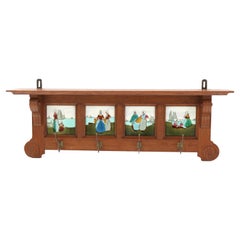
Art Deco Amsterdamse School Coat Rack by L.O.V. Oosterbeek, 1920s
By L.O.V. Oosterbeek
Located in Amsterdam, NL
Magnificent and rare Art Deco Amsterdamse School coat rack. Design by L.O.V. Oosterbeek. Striking Dutch design from the 1920s. Solid oak with original decorative satinwood details. S...
Category

1920s Dutch Art Deco Vintage Netherlands - More Furniture and Collectibles

Materials

Oak, Satinwood

Read More

Medal-Worthy Memorabilia from Epic Past Olympic Games

Get into the games! These items celebrate the events, athletes, host countries and sporting spirit.

Ahoy! You’ve Never Seen a Collection of Sailor Art and Kitsch Quite Like This

French trendsetter and serial collector Daniel Rozensztroch tells us about his obsession with objects related to seafaring men.

39 Incredible Swimming Pools

It's hard to resist the allure of a beautiful pool. So, go ahead and daydream about whiling away your summer in paradise.

Pamela Shamshiri Shares the Secrets behind Her First-Ever Book and Its Effortlessly Cool Interiors

The sought-after designer worked with the team at Hoffman Creative to produce a monograph that beautifully showcases some of Studio Shamshiri's most inspiring projects.

Moroccan Artworks and Objects Take Center Stage in an Extraordinary Villa in Tangier

Italian writer and collector Umberto Pasti opens the doors to his remarkable cave of wonders in North Africa.

Montecito Has Drawn Royalty and Celebrities, and These Homes Are Proof of Its Allure

Hollywood A-listers, ex-pat aristocrats and art collectors and style setters of all stripes appreciate the allure of the coastal California hamlet — much on our minds after recent winter floods.

Whaam! Blam! Pow! — a New Book on Pop Art Packs a Punch

Publishing house Assouline and writer Julie Belcove have teamed up to trace the history of the genre, from Roy Lichtenstein, Andy Warhol and Yayoi Kusama to Mickalene Thomas and Jeff Koons.
The Sparkling Legacy of Tiffany & Co. Explained, One Jewel at a Time

A gorgeous new book celebrates — and memorializes — the iconic jeweler’s rich heritage.

Recently Viewed

View All