Items Similar to Two Men in Civilian & Military Outfit from Cochinchine or Southern Vietnam, 1830

Want more images or videos?
Request additional images or videos from the seller
1 of 5
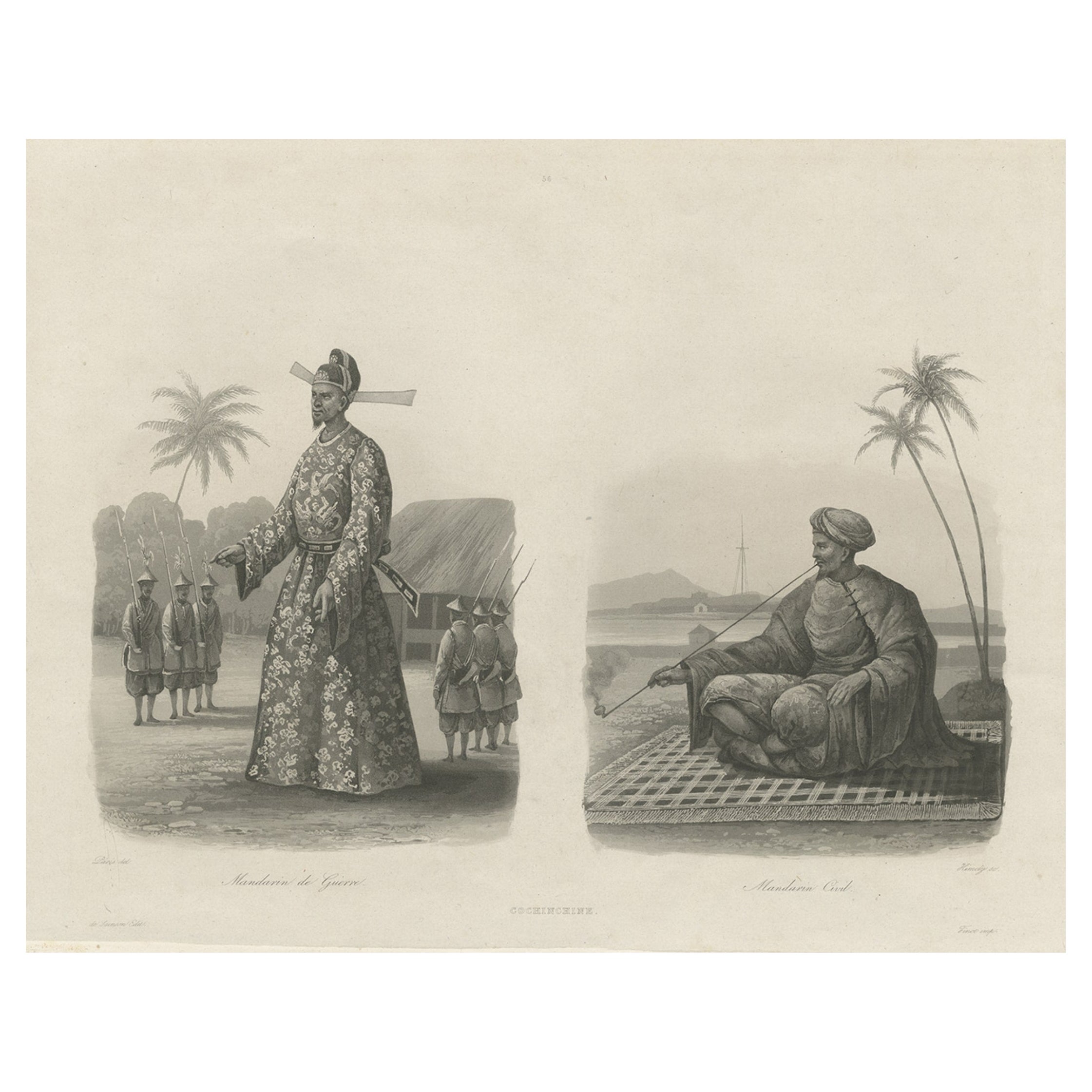
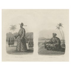
Two Men in Civilian & Military Outfit from Cochinchine or Southern Vietnam, 1830
About the Item
Antique print titled 'Cochinchine'. Two portaits of Vietnamese men one showing in military attire and the second in civilian dress.
Cochinchina or Cochin-China is a historical exonym for part of Vietnam, depending on the contexts. Sometimes it referred to the whole of Vietnam, but it was commonly used to refer to the region south of the Gianh River. In the 17th and 18th centuries, Vietnam was divided between the Tr?nh lords to the north and the Nguy?n lords to the south. The two domains bordered each other on the Son–Gianh River. The northern section was called Tonkin by Europeans, and the southern part, Ðàng Trong, was called Cochinchina by most Europeans and Quinam by the Dutch.
Originates from the series 'Voyage autour du monde par les mers de l'Inde et de la Chine de la corvette de sa Majeste La Favorite'.
Artists and engravers: After a drawing by Barthelmey Lauvergne who travelled on the corvette La Favorite commanded by Captain Cyrille Pierre Theodore Laplace (1793-1875) who circumnavigated the world between 1829-1832.
- Dimensions:Height: 13.19 in (33.5 cm)Width: 17.92 in (45.5 cm)Depth: 0 in (0.02 mm)
- Materials and Techniques:
- Period:
- Date of Manufacture:circa 1830
- Condition:Wear consistent with age and use. Condition: Good, printed on india paper. Some foxing and small repairs from earlier framing, but mostly outside the image. . Please study image carefully.
- Seller Location:Langweer, NL
- Reference Number:
About the Seller
5.0
Platinum Seller
These expertly vetted sellers are 1stDibs' most experienced sellers and are rated highest by our customers.
Established in 2009
1stDibs seller since 2017
1,922 sales on 1stDibs
Typical response time: <1 hour
- ShippingRetrieving quote...Ships From: Langweer, Netherlands
- Return PolicyA return for this item may be initiated within 14 days of delivery.
More From This SellerView All
- Antique Print of Vietnamese Men, c.1830Located in Langweer, NLAntique print titled 'Cochinchine'. Two portaits of Vietnamese men one showing in military attire and the second in civilian dress. Originates from the series 'Voyage autour du monde par les mers...Category
Antique 19th Century Prints
MaterialsPaper
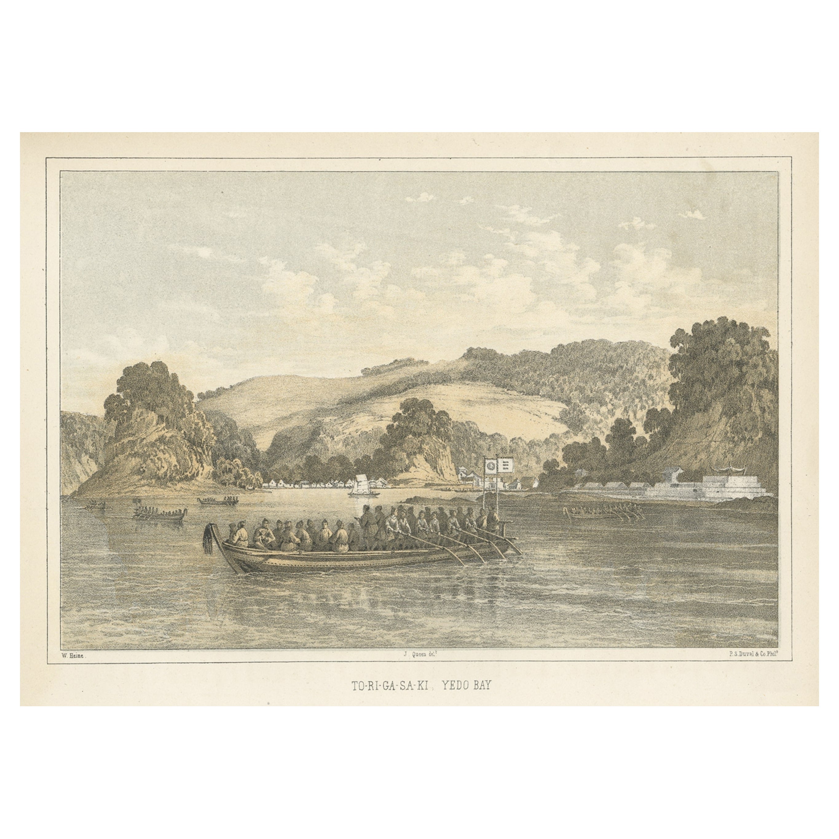
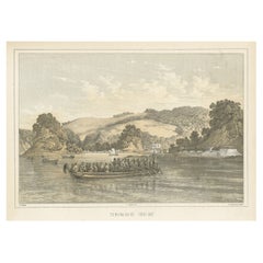
- Antique Print of Tokyo Bay 'or Edo Bay', Located in Southern Kantō, Japan, 1856Located in Langweer, NLAntique print titled 'To-Ri-Ga-Sa-Ki, Yedo Bay'. View of Tokyo Bay (or Edo Bay), a bay located in the southern Kanto region of Japan, and spans the coasts of Tokyo, Kanagawa Prefectu...Category
Antique 1850s Maps
MaterialsPaper
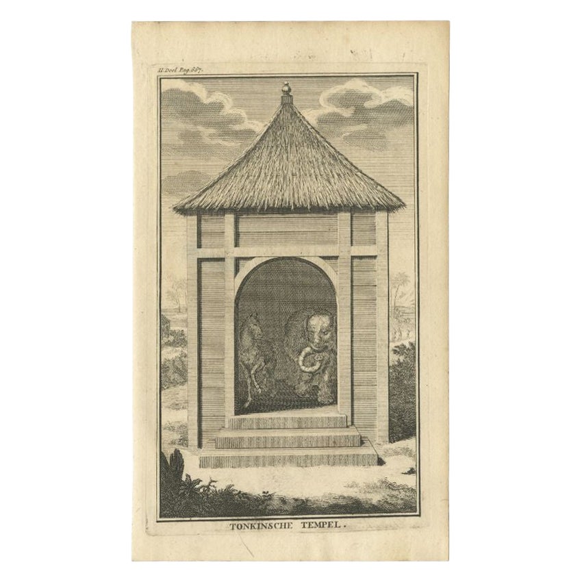
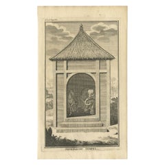
- Original Antique Engraving of a Tonkin Temple in Asia 'Vietnam', 1739Located in Langweer, NLAntique print titled 'Tonkinsche Tempel'. Old print depicting a Tonkin/Vietnam temple. This print originates from 'Hedendaagsche Historie, of tegenwoordige staat van alle volkeren (....Category
Antique 18th Century Prints
MaterialsPaper
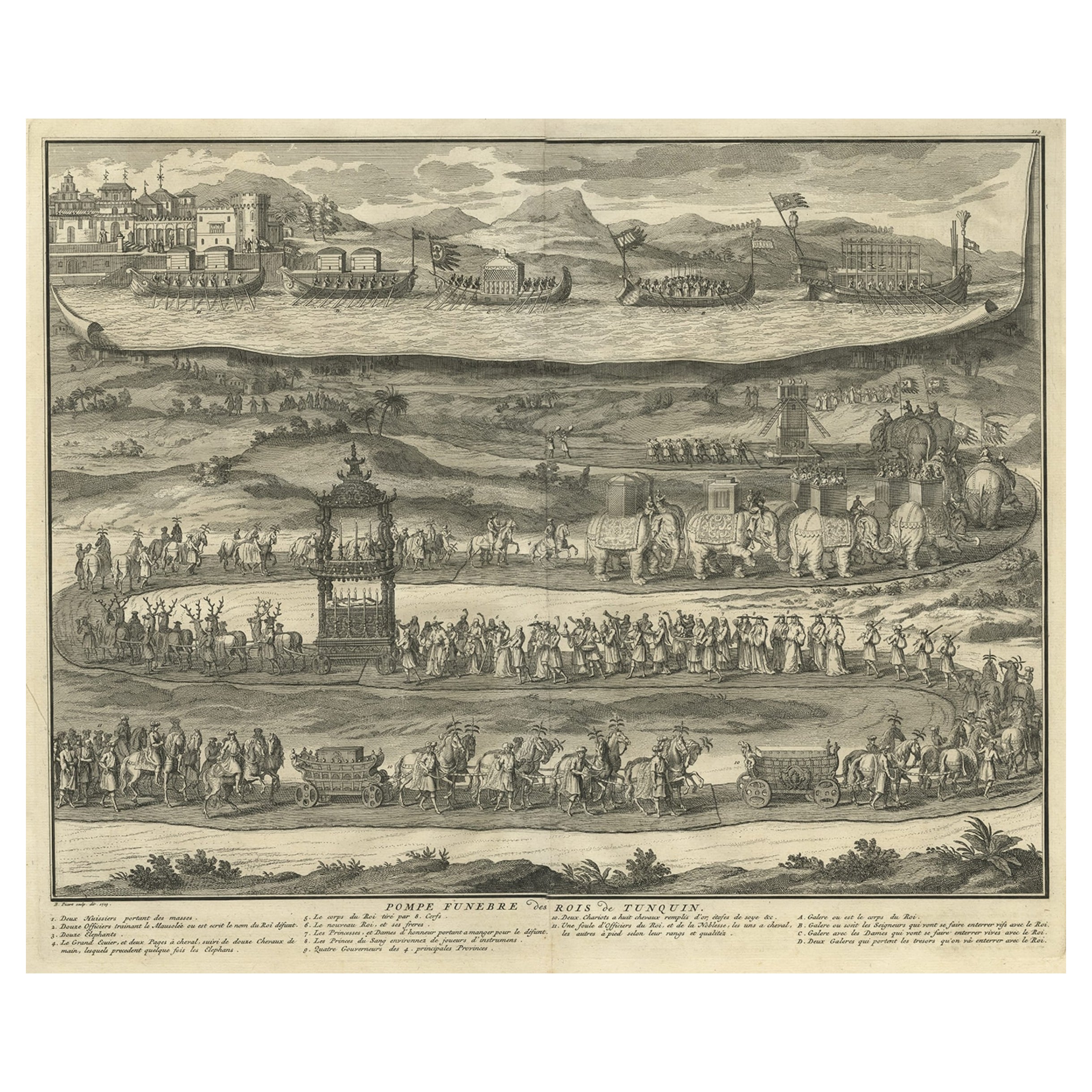
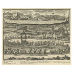
- Antique Print of a Funeral Procession of the Kings of Vietnam or Tonkin, 1725Located in Langweer, NLDescription: Antique print, titled: 'Pompe Funebre des Rois de Tunquin' - This plate shows a funeral procession of the Kings of Vietnam (formerTunquin or Tonk...Category
Antique 1720s Religious Items
MaterialsPaper
- Original Antique Map of Southern Asia, Published in 1833Located in Langweer, NLAntique map titled 'Carte de l'Inde'. Detailed map extending from India in the west to Vietnam and the Malay Peninsula in the east. This map originates from 'Atlas universel de geogr...Category
Antique Mid-19th Century Maps
MaterialsPaper
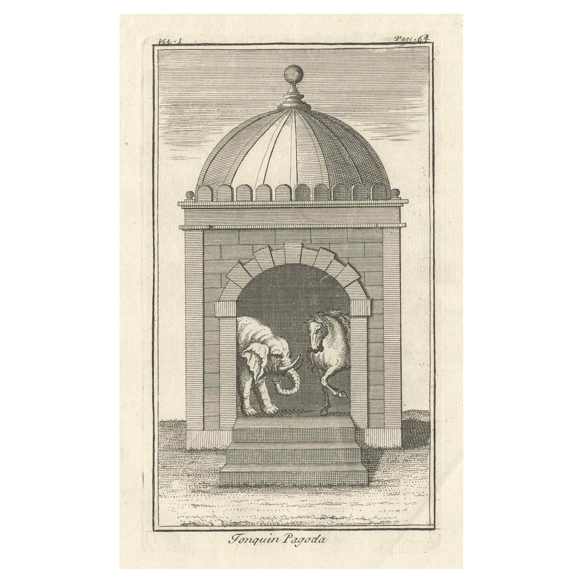
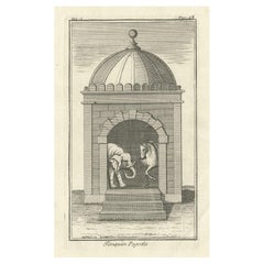
- Antique Copper Engraved Print of a View of a Pagoda in Tonkin, Vietnam, 1739Located in Langweer, NLDescription: Antique print titled 'Tonquin Pagoda'. View of a pagoda in Tonkin, Vietnam. This print originates from 'Modern History: Or, the Present State of All Nations (..)...Category
Antique 1730s Religious Items
MaterialsPaper

You May Also Like
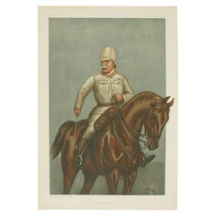
- Vanity Fair, Military Print, the Cavalry DivisionBy Godfrey Douglas GilesLocated in Oxfordshire, GBVanity fair military print 'the Cavalry Division' after G.D.G. A chromolithograph military print published 12th July, 1900, by Vincent Brooks, Day & S...Category
20th Century British Sporting Art Prints
MaterialsPaper
- Hand Colored 17th Century Visscher Map "Hollandiae" Southern HollandBy Nicolaes Visscher IILocated in Alamo, CAA hand colored 17th century map of the southern portions of Holland by Nicolaus (Nicolas) Visscher II entitled "Hollandiae pars Meridionalis, vulgo Zuyd-Holland", published in Amsterdam in 1678. The map shows the region between Breda, Heusden, Gornichem, Gouda, Dordrecht, and Willemstad. It includes a decorative cartouche in the lower left corner. The map is presented in an attractive maple colored wood frame with gold trim and a fabric mat. The Visscher family were one of the great cartographic families of the 17th century. Begun by Claes Jansz Visscher...Category
Antique Early 18th Century Dutch Maps
MaterialsPaper
- Original Antique Map of South America, circa 1830Located in St Annes, LancashireGreat map of South America Copper plate engraving Published by Butterworth, Livesey & Co., circa 1830 Unframed.Category
Antique Early 1800s English Other Maps
MaterialsPaper
- Southern Greece: A Large 17th C. Hand-colored Map by Sanson and JaillotBy Nicolas SansonLocated in Alamo, CAThis large original hand-colored copperplate engraved map of southern Greece and the Pelopponese Peninsula entitled "La Moree Et Les Isles De Zante, Cefalonie, Ste. Marie, Cerigo & C...Category
Antique 1690s French Maps
MaterialsPaper
- Southern & Eastern Europe: A Large 17th C. Hand-colored Map by Sanson & JaillotBy Nicolas SansonLocated in Alamo, CAThis large hand-colored map entitled "Estats de L'Empire des Turqs en Europe, ou sont les Beglerbeglicz our Gouvernements" was originally created by Nicholas Sanson d'Abbeville and t...Category
Antique 1690s French Maps
MaterialsPaper
- The Kingdom of Naples and Southern Italy: A Hand-Colored 18th Century Homann MapBy Johann Baptist HomannLocated in Alamo, CA"Novissima & exactissimus Totius Regni Neapolis Tabula Presentis Belli Satui Accommo Data" is a hand colored map of southern Italy and the ancient Kingdom of Naples created by Johann...Category
Antique Early 18th Century German Maps
MaterialsPaper


Recently Viewed
View AllMore Ways To Browse
Antique For Men
Military Dress
Border Print Dress
18th Century Military
Military China
Vietnam Antiques
Theodore Antiques
Antique Chinese Divider
Vietnamese Antique
Antique Vietnamese
Antique Vietnamese Furniture
Vietnamese Antique Furniture
Chinese Wall Divider
1875 Dresses
Dutch Military
L Chinese Dress
Dress Circa 1875
Voyage Dress