Netherlands Maps
to
4,202
5,081
5,472
200
5,080
1
2,804
1,969
307
1
179
6
68
3
3
3
2
5,075
8
6
2
1
355
113
81
77
45
5,081
5,081
5,081
104
59
20
14
13
Item Ships From: Netherlands
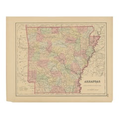
Arkansas Map by Colton, USA Published c.1864 – Hand-Colored County Map
Located in Langweer, NL
Arkansas Map by Colton, USA Published c.1864 – Hand-Colored County Map
This is a finely engraved and hand-colored map titled Arkansas, published by G.W. & C.B. Colton & Co. in New Y...
Category
Mid-19th Century American Antique Netherlands Maps
Materials
Paper
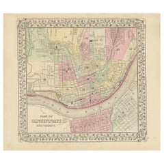
Plan of Cincinnati Map, USA c.1870 – Hand-Colored Street Plan with Wards
Located in Langweer, NL
Plan of Cincinnati Map, USA c.1870 – Hand-Colored Street Plan with Wards
This is a finely engraved and hand-colored street plan titled Plan of Cincinnati and Vicinity, published in ...
Category
Mid-19th Century American Antique Netherlands Maps
Materials
Paper
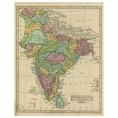
Antique Map of Hindustan, or India
Located in Langweer, NL
Antique map titled 'Hindoostan, or India'. Original antique map of India (Hindustan) and Sri Lanka (Ceylon). Engraved by Russell. Published by Nuttall, Fisher & Co, 1814.
Category
Early 19th Century Antique Netherlands Maps
Materials
Paper
$275 Sale Price
20% Off
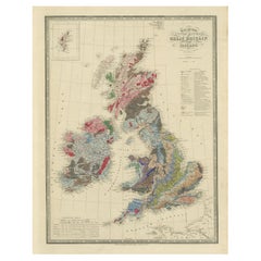
Beneath the Surface: James Wyld's 1844 Geological Map of the British Isles
Located in Langweer, NL
This superb original geological map of the United Kingdom of Great Britain and Ireland by James Wyld, produced in 1844, is a remarkable Victorian artifact.
Description:
Explore th...
Category
1840s Antique Netherlands Maps
Materials
Paper
$855 Sale Price
20% Off
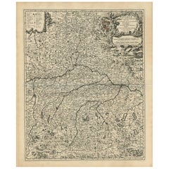
Antique Map of Bavaria with many details, Germany
Located in Langweer, NL
Antique map titled 'Bavariae Circulus atq Electoratus tam cum Adiacentibus quam insertis Regionibus (..)'. Dutch map of Bavaria, showing the many cities, towns, and other features of...
Category
Late 17th Century Antique Netherlands Maps
Materials
Paper
$627 Sale Price
20% Off
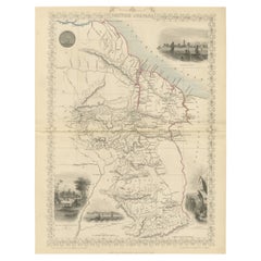
A Tallis Map of British Guiana with Colonial Vignettes and Other Landmarks, 1851
Located in Langweer, NL
This Tallis map of British Guiana (now known as Guyana) is a richly decorated document, much like other maps from the esteemed cartographic publisher John Tallis & Company. The firm,...
Category
1850s Antique Netherlands Maps
Materials
Paper
$275 Sale Price
20% Off
Antique Map of Egypt and the Nile River
Located in Langweer, NL
Antique map titled 'Egypten nach dem Zustand der alten Zeit vorgestellt'. This uncommon and richly detailed map of Egypt features hundreds of place names along the Nile. The Sinai Pe...
Category
Mid-18th Century Antique Netherlands Maps
Materials
Paper
$323 Sale Price
20% Off
Attack Plan of Douay Fortress, France, 1710 Siege – Brussels c.1720 Map
Located in Langweer, NL
Attack Plan of Douay Fortress, France, 1710 Siege – Brussels c.1720 Map
This engraved military map shows the detailed plan of attacks on the fortress city of Douay (Douai) in northe...
Category
Early 18th Century French Antique Netherlands Maps
Materials
Paper
Antique Map of Juan Fernandez Island and Cumberland Bay, Chile - c. '1749'
Located in Langweer, NL
Antique map titled 'Plan de la Côte du N.E. de l 'Ile de Juan Fernandes - Schets van den Noord-Oost kant van het eiland Juan Fernandes '. This map depicts the northeast coast of the ...
Category
Mid-18th Century Antique Netherlands Maps
Materials
Paper
$190 Sale Price
20% Off
Minnesota and Dakota Map – Johnson, Hand-Colored, USA c.1864
Located in Langweer, NL
Johnson’s Minnesota and Dakota Map, USA c.1864 – Hand-Colored Territorial Map
Description:
This is a finely engraved and hand-colored map titled Johnson’s Minnesota and Dakota, pub...
Category
Mid-19th Century American Antique Netherlands Maps
Materials
Paper
Antique Map of Peru in South America by Blaeu, circa 1645
Located in Langweer, NL
Antique map titled 'Peru'. Original antique map of Peru. With cartouche, compass rose, ships and two sea-monsters. Published by W. Blaeu, circa 1645.
Category
Mid-17th Century Antique Netherlands Maps
Materials
Paper
$669 Sale Price
24% Off
Johnson’s Mexico Map with Tehuantepec Inset, USA c.1864 – Hand-Colored
Located in Langweer, NL
Johnson’s Mexico Map with Tehuantepec Inset, USA c.1864 – Hand-Colored
This is a finely engraved and hand-colored map titled Johnson’s Mexico, published by Johnson and Ward in New Y...
Category
Mid-19th Century American Antique Netherlands Maps
Materials
Paper
1728 Map of Batavia Castle & City, Java – Van der Aa after 1669
Located in Langweer, NL
1728 Map of Batavia Castle & City, Java – Van der Aa after 1669
This is an original antique copperplate engraving titled “Plan de la Ville et du Château de Batavia en l’Isle de Iava...
Category
Early 18th Century Dutch Antique Netherlands Maps
Materials
Paper
Johnson’s Australia Map, USA Published c.1864 – Decorative Hand-Colored Map
Located in Langweer, NL
Johnson’s Australia Map, USA Published c.1864 – Decorative Hand-Colored Map
This is a finely engraved and hand-colored map titled Johnson’s Australia published by Johnson and Ward i...
Category
Mid-19th Century American Antique Netherlands Maps
Materials
Paper
Egypt and Lower Nubia, 1903 - Historical Map Highlighting Nile and Red Sea
Located in Langweer, NL
Egypt and Lower Nubia, 1903 - Historical Map Highlighting Nile and Red Sea
This beautifully detailed map titled "Egypt, Arabia Petraea, and Lower Nubia" was engraved, printed, and p...
Category
Early 20th Century Netherlands Maps
Materials
Paper
Very Large Hand-Drawn View of St Iago Cape Verde, by Frederici, 1783
Located in Amsterdam, NL
Johann Christian Friderici [= Frederici] (Heldburg 1766 - Cape Town 1804)
Prospect van het eyland, en de rheede van St. Iago. Geteekend van Johann Christian Friderici / Verbeelding van de inwoonders op St Iago
(View of the island, and the roadstead of St. Iago. Drawn by Johann Christian Friderci / Depiction of the inhabitants on St Iago)
?Porto Praia, Cape Verde...
Category
Late 18th Century Cape Verdean Dutch Colonial Antique Netherlands Maps
Materials
Paper
Old Map of Herefordshire 1844 – Hereford Leominster Ross-on-Wye Kington Bromyard
Located in Langweer, NL
Title:
Old Map of Herefordshire by Samuel Lewis 1844 – Hereford Leominster Ross-on-Wye Kington Bromyard
Description:
This 1844 map of Herefordshire was drawn and engraved for Samuel Lewis’ Topographical Dictionary of England. It features major towns including Hereford, Leominster, Ross-on-Wye, Kington, and Bromyard. The map shows roads, rivers, topographical features, and surrounding counties such as Shropshire, Gloucestershire, and Monmouthshire. Hand-colored borders outline the county and a decorative compass rose enhances its historical charm.
Condition:
The map is in good antique condition with light even toning and wide margins. The engraving is sharp and the hand coloring remains bright. There are no tears or significant blemishes.
Framing suggestions:
Use an ivory or soft beige acid-free mat to complement the aged paper. A dark wood, antique gold, or soft black frame will bring out the map's classic style. UV-protective glass is recommended to preserve color and detail. A fine choice for traditional interiors, libraries, or heritage-themed décor.
Keywords:
Herefordshire map 1844 Samuel Lewis antique...
Category
1840s Antique Netherlands Maps
Materials
Paper
$180 Sale Price
20% Off
Map of the Southeastern USA and Atlantic States – Vintage 1903 Geography
Located in Langweer, NL
Map of the Southeastern USA and Atlantic States – Vintage 1903 Geography
This original engraved map, titled “United States of North America (South Eastern Sheet) with the Atlantic S...
Category
Early 20th Century Netherlands Maps
Materials
Paper
Old Map of Anatolia, part of modern-day Turkey, Armenia and Syria, 1745
Located in Langweer, NL
Title: "Kaartje van Natolie en Syrie opgesteld door de Hr. Lucas en de Hr. Guil de L'Isle en andere auteuren"
The title "Kaartje van Natolie en Syrie opgesteld door de Hr. Lucas en...
Category
1740s Antique Netherlands Maps
Materials
Paper
$418 Sale Price
20% Off
Antique Map of the German Empire, 1903, Northern Portion with Coastal and Inland
Located in Langweer, NL
Title: Antique Map of the German Empire, 1903, Northern Portion with Coastal and Inland Detail
Description:
This antique map, titled "Empire of Germany (Northern Portion)," was engr...
Category
Early 20th Century Netherlands Maps
Materials
Paper
Antique Map of Denmark and German Empire Regions, 1903, Intricate and Colorful
Located in Langweer, NL
Title: Antique Map of Denmark and German Empire Regions, 1903, Intricate and Colorful
Description:
This antique map, titled "Denmark with North West Portions of the German Empire," ...
Category
Early 20th Century Netherlands Maps
Materials
Paper
Antique Map of Lotharingia (Lorraine) by Danckerts, c. 1700 – Hand-Colored
Located in Langweer, NL
Antique Map of Lotharingia (Lorraine) by Theodorus Danckerts circa 1700 Hand-Colored
This beautifully detailed antique map of Lotharingia, now the Lorraine region in northeastern ...
Category
Early 1700s Antique Netherlands Maps
Materials
Paper
Antique Map of the Mediterranean Sea and Surroundings by Keizer & de Lat, 1788
Located in Langweer, NL
Antique map titled 't Wester Deel van de Middelandse Zee (..)'. Uncommon original antique map of the Mediterranean Sea and surroundings. This map originates from 'Nieuwe Natuur- Gesc...
Category
Late 18th Century Antique Netherlands Maps
Materials
Paper
$332 Sale Price
20% Off
Orignal Hand-Colored Antique Map of Chili by W. Blaeu, 1658
By Willem Blaeu
Located in Langweer, NL
Very decorative antique map of Chili published by W. Blaeu, 1658. This map depicts Chile from Copiapo southward to the island of Chiloé with ships and sea monsters adorning the sea. ...
Category
Mid-17th Century Antique Netherlands Maps
Materials
Paper
$889 Sale Price
20% Off
1726 Map of Bengal by Van der Aa after Valentijn – Dutch East Indies
Located in Langweer, NL
1726 Map of Bengal by Van der Aa after Valentijn – Dutch East Indies
This is an original antique map titled “Nieuwe Kaart van ’t Koninryk van Bengale,” published by Pieter van der Aa in Leiden in 1726. The map depicts the Kingdom of Bengal and surrounding regions, based on earlier work by François Valentijn, a Dutch East India Company (VOC) official and historian whose extensive writings on Asia were among the most important early European sources.
The engraving covers the Bengal region (modern-day Bangladesh and West Bengal, India), showing detailed river systems including the Ganges and its distributaries flowing into the Gulf of Bengal. Major towns, cities, and kingdoms are labelled in Dutch, such as Orixa (Orissa), Arracan, Tipera (Tripura), and Cos Assam (Assam). Mountain ranges are represented pictorially with stylised hachured peaks, while fertile plains are indicated with field patterns, adding visual texture to the map.
In the upper right is an elegant title cartouche with dedication to VOC officials, referencing Mathijs van den Broecke, a director in Bengal, and Johannes Lennep. A compass rose is positioned at the bottom, enhancing its decorative maritime appeal, with north oriented to the right as typical for Dutch maps of Asian regions in this period.
Pieter van der Aa (1659–1733) was a prolific publisher known for compiling maps from earlier explorers and engravers into elegant and collectible volumes. His works remain valued for their historical significance, decorative artistry, and connection to VOC trade networks and colonial history.
Condition:
Good condition. Strong impression with later hand colouring. Light age toning, faint foxing mainly in margins, and some creasing along original fold lines as issued. Fully suitable for framing.
Framing tips:
Frame this map in a slim gilt or dark wood frame to highlight its decorative hand colouring. Use an off-white archival mat to accentuate the engraving and protect the edges. UV-protective glazing is recommended to maintain colour vibrancy and paper integrity.
Keywords block for your listing:
bengal map...
Category
Early 18th Century Dutch Antique Netherlands Maps
Materials
Paper
Relief Atlas Map of South America by Hachette – Antique French Map c.1883
Located in Langweer, NL
Antique Map of South America – Physical Relief Map by Hachette, c.1883
Description:
This antique map titled “Amérique du Sud” was published circa 1883 by Hachette in Paris as part o...
Category
Late 19th Century French Antique Netherlands Maps
Materials
Paper
Antique Map of Peru by van der Aa, 'circa 1720'
Located in Langweer, NL
Antique map titled 'Le Perou, Grand Pays de l Amerique Meridionale (..)'. Decorative map of Peru including portions of Ecuador and northern Chile and Boliv...
Category
Early 18th Century Antique Netherlands Maps
Materials
Paper
$713 Sale Price
20% Off
Map of Haute-Garonne France with Toulouse and Garonne River by Vuillemin, c.1850
Located in Langweer, NL
Map of Haute-Garonne France with Toulouse and Garonne River by Vuillemin, 19th c
Description:
This finely engraved 19th-century map of the department of Haute-Garonne, located in so...
Category
Mid-19th Century French Antique Netherlands Maps
Materials
Paper
Antique Map of South America by Wyld, circa 1850
By J. Wyld
Located in Langweer, NL
Beautiful folding map of South America titled 'Colombia Prima or South America Drawn from the Large Map in Eight Sheets by Louis Stanislas D ' Arcy Delarochette'. Three insets in the...
Category
Mid-19th Century British Antique Netherlands Maps
Materials
Paper
$1,379 Sale Price
20% Off
Isle de Ladrones: Early 18th-Century Map of the Mariana Islands by F. Bernard
Located in Langweer, NL
Isle de Ladrones: Early 18th-Century Map of the Mariana Islands by F. Bernard
This intriguing copper engraving depicts the *Isle de Ladrones*, now known as the Mariana Islands, situated in the western Pacific Ocean. The map was published around 1722 in Amsterdam by F. Bernard as part of the influential travel compilation *Recueil des voyages qui ont servi a ...*. The map offers a simplistic yet stylized portrayal of the island, emphasizing its rugged and mountainous terrain, dotted with sparse vegetation and hills.
The term *Isle de Ladrones* (Islands of Thieves) was given by the Spanish explorer Ferdinand Magellan in 1521 during his circumnavigation of the globe, as his crew encountered thefts from the native Chamorro people. The name later changed to *Mariana Islands* when they were named after Queen...
Category
1720s Antique Netherlands Maps
Materials
Paper
$142 Sale Price
20% Off
Antique Map of Indiana by Johnson, 1872
Located in Langweer, NL
Antique map titled 'Johnson's Indiana'. Original map of Indiana. This map originates from 'Johnson's New Illustrated Family Atlas of the World' by A.J. ...
Category
Late 19th Century Antique Netherlands Maps
Materials
Paper
$178 Sale Price
40% Off
Antique 1830 Map of Ulster, Ireland with Armagh, Down, Antrim, Donegal, Tyrone
Located in Langweer, NL
Title: Antique 1830 Map of Ulster, Ireland with Armagh, Down, Antrim, Donegal, and Tyrone
Description: This 1830 German-language map, titled Britisches Reich – C. Kon: Ireland, ...
Category
1830s Antique Netherlands Maps
Materials
Paper
1616 Bertius Map of Sumatra, Singapore and the Straits of Malacca
Located in Langweer, NL
Title: "1616 Bertius Map of Sumatra and the Straits of Malacca"
Description: This is an exquisite 1616 original antique map by Petrus Bertius, titled "Sumatra Insula," showcasing Su...
Category
Early 17th Century Antique Netherlands Maps
Materials
Paper
$799 Sale Price
20% Off
Antique Map of North America – Physical Relief Map by Hachette c.1883
Located in Langweer, NL
Antique Map of North America – Physical Relief Map by Hachette c.1883
Description:
This antique map titled “Amérique du Nord” was published around 1883 by E. Hachette in Paris as pa...
Category
Late 19th Century French Antique Netherlands Maps
Materials
Paper
Relief Atlas Map of Asia by Hachette – Antique French Map, circa 1883
Located in Langweer, NL
Antique Map of Asia – Relief Atlas Map by Hachette, circa 1883
Description:
This antique map titled “Asie” was published by Hachette in Paris around 1883 and originates from their e...
Category
Late 19th Century French Antique Netherlands Maps
Materials
Paper
Antique Map of Asia by Johnston '1909'
Located in Langweer, NL
Antique map titled 'Asia'. Depicting China, Japan, Indonesia, India, Arabia and more. This map originates from the ‘Royal Atlas of Modern Geography’. Published by W. & A.K. Johnston,...
Category
Early 20th Century Netherlands Maps
Materials
Paper
$237 Sale Price
20% Off
Old Antique Print of a Peasant of Upper Carniola, Slovenia, Eastern Europe, 1804
Located in Langweer, NL
Old print of a peasant of upper Carniola, Slovenia.
This print originates from 'The Costume of the Hereditary States of the House of Austria' by William Miller.
Artists and engravers: Engraved by William Ellis.
Category
Early 1800s Antique Netherlands Maps
Materials
Paper
$266 Sale Price
20% Off
Hand-Colored Map of Westphalia – Copper Engraving by Ottens, Amsterdam c.1720
Located in Langweer, NL
Hand-Colored Map of Westphalia – Copper Engraving by Ottens, Amsterdam c.1720
This striking early 18th-century map titled *Nova Ducatus Westphaliae Tabula accurate descripta et in S...
Category
Early 17th Century European Antique Netherlands Maps
Materials
Paper
Antique Print of a Jacobite Pincushion and a Silk Purse by Gibb, 1890
Located in Langweer, NL
Antique print titled 'Jacobite Pincushion - Silk Purse'. Chromolithographic plate originating from 'The Royal House of Stuart. Illustrated By a Series of Forty Plates in Colours Draw...
Category
19th Century Antique Netherlands Maps
Materials
Paper
$80 Sale Price
20% Off
Rare 1770 Bellin Map of Sumatra with Stunning Decorative Cartouches
Located in Langweer, NL
Title: 1750 Bellin Map of Sumatra with Decorative Cartouches
This exquisite 18th-century map of Sumatra, drawn by Jacques-Nicolas Bellin around 1750, is a testament to the artistr...
Category
1770s Antique Netherlands Maps
Materials
Paper
Beautiful Large Scale Map of Spain and Portugal Published by Herman Moll in 1711
Located in Langweer, NL
Title: A New and Exact Map of Spain & Portugal
Author: Herman Moll
Date: 1711
Medium: Hand-colored copperplate engraving
Herman Moll (c. 1654-1732) was one of the most important London mapmakers in the first half of the eighteenth century. Moll was probably born in Bremen, Germany, around 1654. He moved to London to escape the Scanian Wars. His earliest work was as an engraver for Moses Pitt on the production of the English Atlas, a failed work which landed Pitt in debtor's prison. Moll also engraved for Sir Jonas Moore, Grenville Collins, John Adair, and the Seller & Price firm. He published his first original maps in the early 1680s and had set up his own shop by the 1690s.
Moll's work quickly helped him become a member of a group which congregated at Jonathan's Coffee House at Number 20 Exchange Alley, Cornhill, where speculators met to trade stock. Moll's circle included the scientist Robert Hooke...
Category
1710s Antique Netherlands Maps
Materials
Paper
$2,378 Sale Price
20% Off
Antique Map of Hungary and Transylvania by Isaak Tirion, Amsterdam c.1740
Located in Langweer, NL
Poland Map 1740s – Nieuwe Kaart van het Koninryk Poolen by Isaak Tirion
This finely engraved and attractively hand-colored map of the Kingdom of Poland was published by Isaak Tirion...
Category
Mid-18th Century Dutch Antique Netherlands Maps
Materials
Paper
Islands of Fire and Whispers: The Canary Islands in 1902
Located in Langweer, NL
This is a authentic historical map of the Canary Islands, specifically the "1A HOJA" or first sheet, from the year 1902. The title on the map is "ISLAS CANARIAS 1902." This map featu...
Category
Early 1900s Antique Netherlands Maps
Materials
Paper
$352 Sale Price
20% Off
Extremely Large Hand-Drawn Manuscript Map of Surinam, 1830, History of Slavery
Located in Amsterdam, NL
A unique large hand-drawn map of Surinam by Albrecht Helmut Hiemcke (German, 1760-1839)
?
'Colonie Surinaame', 1830
A large hand-drawn and coloured map of the colony of Suri...
Category
Mid-19th Century Surinamer Antique Netherlands Maps
Materials
Paper
Original Antique Map of Muscovy or Russia by Isaak Tirion, Amsterdam circa 1740
Located in Langweer, NL
Map of Muscovy or Russia by Isaak Tirion, Amsterdam circa 1740
Description:
This beautifully engraved and delicately hand-colored map titled "Nieuwe Kaart van Muskovië of Rusland" w...
Category
Mid-18th Century Dutch Antique Netherlands Maps
Materials
Paper
Map of the Mozambique and Tanzania Coast & Inset Map of Anjouan Island, ca.1700
Located in Langweer, NL
Antique map titled 'Carte particuliere des Costes de l'Afrique'.
Depicts the coasts of Mozambique and Tanzania. With an inset map of Anjouan Island.
Artists and engravers: Pub...
Category
Early 1700s Antique Netherlands Maps
Materials
Paper
$608 Sale Price
20% Off
Antique Map of Gelderland, Largest Province of The Netherlands, c.1870
Located in Langweer, NL
Antique map titled 'De Provincie Gelderland'.
Map of the province of Gelderland, the Netherlands. This map originates from 'F. C. Brugsma's Atlas van het Koninkrijk der Nederland...
Category
19th Century Antique Netherlands Maps
Materials
Paper
$104 Sale Price
20% Off
Map of Corsica France with Ajaccio and Napoleon Portraits, 19th Century
Located in Langweer, NL
Map of Corsica France with Ajaccio and Napoleon Portraits, 19th Century
Description:
This finely engraved 19th-century map of Corsica, the Mediterranean island region of France, was...
Category
Mid-19th Century French Antique Netherlands Maps
Materials
Paper
Barcelona 1901: A Cartographic Portrait of Catalonia's Capital Province
Located in Langweer, NL
This orignal antique map is a historical depiction of the province of Barcelona from 1901.
It showcases the varied terrain of the province, with the Serra de Collserola ridge near the city of Barcelona and the Pyrenees to the north. The map includes the coastline along the Mediterranean Sea, indicating Barcelona's position as a coastal province. Blue lines indicate rivers, such as the Llobregat and Besòs, which are significant features in the province's geography. Dotted lines may signify the borders of the province within Catalonia.
The coat of arms of Barcelona, highlighted with gold, is prominently displayed, featuring the Cross of Saint George (Cruz de Sant Jordi), the patron saint of Catalonia, and the red and yellow bars which are a symbol of the Aragonese and Catalan heritage.
About the province of Barcelona:
The province of Barcelona is part of the autonomous community of Catalonia in northeastern Spain. It is the most economically significant region of Catalonia, playing a crucial role in the country's economy due to its port, manufacturing, and service industries. The city of Barcelona is the capital and the second most populous city in Spain, known for its rich cultural heritage, architecture by Antoni Gaudí, such as the Sagrada Família, and its influential art scene. The province enjoys a Mediterranean climate and features diverse landscapes from the beaches along the coast to the mountains in the interior. Barcelona is also known for its vibrant festivals, cuisine, fashion, and sports, particularly football, being home to FC Barcelona...
Category
Early 1900s Antique Netherlands Maps
Materials
Paper
$627 Sale Price
20% Off
Original Antique Map of the Province of Utrecht, the Netherlands, ca.1720
Located in Langweer, NL
Antique map titled ‘Tabula Nova Provinciae Ultrajectinae (..)’.
Original antique map of the province of Utrecht, the Netherlands. It shows the region of Amsterdam, Utrecht, Gouda, ...
Category
1720s Antique Netherlands Maps
Materials
Paper
$751 Sale Price
20% Off
Map of Cher France with Bourges, Sancerre Vineyards and Engraved Vignettes, 1850
Located in Langweer, NL
Map of Charente-Inférieure France with La Rochelle and Coastal Vineyards, 19th c
Description:
This decorative 19th-century map of the former department of Charente-Inférieure, now k...
Category
Mid-19th Century French Antique Netherlands Maps
Materials
Paper
Colorful 1915 Road Map of Oregon with Portland Inset & Index – Geographical Pub.
Located in Langweer, NL
Colorful 1915 Road Map of Oregon with Portland Inset & Index – Geographical Pub.
Description:
This vibrant and information-rich folding map of Oregon, titled "Premier Series Oregon"...
Category
1910s Vintage Netherlands Maps
Materials
Paper
Mount Sinai & St. Catherine's – Antique Map of the Sinai Monasteries, 1776
Located in Langweer, NL
Mount Sinai & St. Catherine's – Antique Map of the Sinai Monasteries, 1776
Description:
This finely engraved antique map depicts the mountainous region of the Sinai Peninsula, focus...
Category
Late 18th Century Dutch Antique Netherlands Maps
Materials
Paper
Map of Côtes-du-Nord France with Saint-Brieuc and Brittany Coastline, c.1850
Located in Langweer, NL
Map of Côtes-du-Nord France with Saint-Brieuc and Brittany Coastline, 19th c
Description:
This elegant 19th-century map of Côtes-du-Nord, the historic name for what is now known as ...
Category
Mid-19th Century French Antique Netherlands Maps
Materials
Paper
Historic Map of Missouri and Kansas Showing Railroads and Frontier Trails, 1864
Located in Langweer, NL
Antique 1864 Map of Missouri and Kansas by Johnson and Ward
Description:
This finely detailed and vibrantly hand-colored map of Missouri and Kansas, publ...
Category
1860s Antique Netherlands Maps
Materials
Paper
1902 Murcia: A Cartographic Snapshot of Spain's Southeastern Province
Located in Langweer, NL
The map represents the province of Murcia, Spain, as it was in 1902. Here's an overview of its characteristics:
- **Geography**: It displays the varied terrain of Murcia, from the c...
Category
Early 1900s Antique Netherlands Maps
Materials
Paper
$323 Sale Price
20% Off
Lleida 1902: A Cartographic Perspective of Catalonia's Gateway to the Pyrenees
Located in Langweer, NL
The map for sale shows the province of Lleida, located in the western part of Catalonia, Spain, as of 1902. Here are the key features depicted on the map:
- **Topography**: The map ...
Category
Early 1900s Antique Netherlands Maps
Materials
Paper
$285 Sale Price
20% Off
1902 Cartographic View of Salamanca: The Golden Province of Spain
Located in Langweer, NL
This map showcases the province of Salamanca in the year 1902. Salamanca is located in the autonomous community of Castile and León in western Spain. It is bordered by the provinces ...
Category
Early 1900s Antique Netherlands Maps
Materials
Paper
$262 Sale Price
35% Off
Castellón de la Plana 1901: A Cartographic Perspective of the Valencian Coast
Located in Langweer, NL
The authentic map depicts the province of Castellón de la Plana, often referred to simply as Castellón, situated in the eastern part of Spain in the Valencian Community, and the map ...
Category
Early 1900s Antique Netherlands Maps
Materials
Paper
$399 Sale Price
20% Off
Original Copper Engraving of Koroni 'or Corone', Greece, 1688
Located in Langweer, NL
Antique print titled 'Das Aussehen der Stadt und Vestung Coron von der Seit des Auffgang'.
Copper engraving of Koroni (or Corone), Greece. This print originates from 'Ruhm-belorb...
Category
1680s Antique Netherlands Maps
Materials
Paper
$247 Sale Price
20% Off
Recently Viewed
View AllMore Ways To Browse
Flemish Cabinets 17th Century
Fox Figurine
Fox Hunt Plate
French Art Deco Rosewood Buffet
French Bulldog Gold
French Louis Xvi Enfilade
French Provincial Antique Dresser
French Provincial Furniture Antique Dresser
French Zinc Bar
Frog Figurine
Georgian Mahogany Longcase Clock
German Folding Trolley
Glass And Brass Fireplace Screen
Glass Nude Woman Sculpture
Glass Parrots
Glass Poodle
Gothic Corbel
Granite Pagoda
