Netherlands Maps
to
4,202
5,098
5,489
200
5,097
1
2,804
1,986
307
1
179
6
68
3
3
3
2
5,092
9
7
2
1
372
129
81
77
46
5,098
5,098
5,098
104
59
20
14
13
Item Ships From: Netherlands
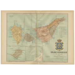
Islands of Fire and Whispers: The Canary Islands in 1902
Located in Langweer, NL
This is a authentic historical map of the Canary Islands, specifically the "1A HOJA" or first sheet, from the year 1902. The title on the map is "ISLAS CANARIAS 1902." This map featu...
Category
Early 1900s Antique Netherlands Maps
Materials
Paper
$351 Sale Price
20% Off
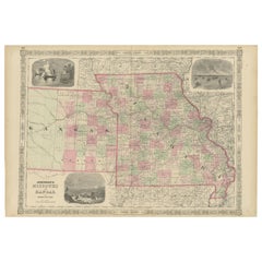
Historic Map of Missouri and Kansas Showing Railroads and Frontier Trails, 1864
Located in Langweer, NL
Antique 1864 Map of Missouri and Kansas by Johnson and Ward
Description:
This finely detailed and vibrantly hand-colored map of Missouri and Kansas, publ...
Category
1860s Antique Netherlands Maps
Materials
Paper
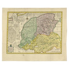
Antique Map of Friesland by Van Krevelt, 1787
Located in Langweer, NL
Antique map titled 'Nieuwe Kaart van Friesland behoorende tot het Vaderlandsch Woordenboek van Jacobus Kok'. Original antique map of the province of Friesland, the Netherlands. This ...
Category
18th Century Antique Netherlands Maps
Materials
Paper
$436 Sale Price
20% Off
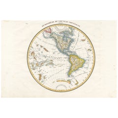
Antique Map of the Western Hemisphere by Lapie, France, circa 1830
Located in Langweer, NL
Antique Map of the Western Hemisphere by Lapie, France, circa 1830
This beautifully engraved and delicately hand-colored map, titled Hémisphère du Nouveau Continent (Ouest), depict...
Category
1830s Antique Netherlands Maps
Materials
Paper
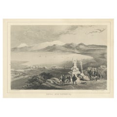
Antique Print of Hakodate from Telegraph Hill in Oshima, Hokkaido, Japan
Located in Langweer, NL
Antique print titled ‘Hakodadi from Telegraph Hill’. View of Hakodate, a city and port located in Oshima Subprefecture, Hokkaido, Japan. This print originates from 'Narrative of the ...
Category
19th Century Antique Netherlands Maps
Materials
Paper
$209 Sale Price
20% Off
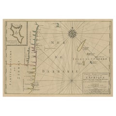
Map of the Mozambique and Tanzania Coast & Inset Map of Anjouan Island, ca.1700
Located in Langweer, NL
Antique map titled 'Carte particuliere des Costes de l'Afrique'.
Depicts the coasts of Mozambique and Tanzania. With an inset map of Anjouan Island.
Artists and engravers: Pub...
Category
Early 1700s Antique Netherlands Maps
Materials
Paper
$608 Sale Price
20% Off
Antique Map of Gelderland, Largest Province of The Netherlands, c.1870
Located in Langweer, NL
Antique map titled 'De Provincie Gelderland'.
Map of the province of Gelderland, the Netherlands. This map originates from 'F. C. Brugsma's Atlas van het Koninkrijk der Nederland...
Category
19th Century Antique Netherlands Maps
Materials
Paper
$104 Sale Price
20% Off
Large Antique Map of Egypt and the Nile Delta by Wyld, 1854
Located in Langweer, NL
Antique map titled 'Lower Egypt and the adjacent desert, with a part of Palestine to which has been addes the nomenclature of the Roman age by L.S. de la Rochette'. Map of Egypt and ...
Category
19th Century Antique Netherlands Maps
Materials
Paper
$956 Sale Price
30% Off
Barcelona 1901: A Cartographic Portrait of Catalonia's Capital Province
Located in Langweer, NL
This orignal antique map is a historical depiction of the province of Barcelona from 1901.
It showcases the varied terrain of the province, with the Serra de Collserola ridge near the city of Barcelona and the Pyrenees to the north. The map includes the coastline along the Mediterranean Sea, indicating Barcelona's position as a coastal province. Blue lines indicate rivers, such as the Llobregat and Besòs, which are significant features in the province's geography. Dotted lines may signify the borders of the province within Catalonia.
The coat of arms of Barcelona, highlighted with gold, is prominently displayed, featuring the Cross of Saint George (Cruz de Sant Jordi), the patron saint of Catalonia, and the red and yellow bars which are a symbol of the Aragonese and Catalan heritage.
About the province of Barcelona:
The province of Barcelona is part of the autonomous community of Catalonia in northeastern Spain. It is the most economically significant region of Catalonia, playing a crucial role in the country's economy due to its port, manufacturing, and service industries. The city of Barcelona is the capital and the second most populous city in Spain, known for its rich cultural heritage, architecture by Antoni Gaudí, such as the Sagrada Família, and its influential art scene. The province enjoys a Mediterranean climate and features diverse landscapes from the beaches along the coast to the mountains in the interior. Barcelona is also known for its vibrant festivals, cuisine, fashion, and sports, particularly football, being home to FC Barcelona...
Category
Early 1900s Antique Netherlands Maps
Materials
Paper
$627 Sale Price
20% Off
Original Antique Map of the Province of Utrecht, the Netherlands, ca.1720
Located in Langweer, NL
Antique map titled ‘Tabula Nova Provinciae Ultrajectinae (..)’.
Original antique map of the province of Utrecht, the Netherlands. It shows the region of Amsterdam, Utrecht, Gouda, ...
Category
1720s Antique Netherlands Maps
Materials
Paper
$750 Sale Price
20% Off
Antique Map of the City of Goch by Blaeu, 1649
Located in Langweer, NL
Antique map titled 'Gochum vernacule Goch'. Old map of the city of Goch, Germany. This map originates from 'Novum Ac Magnum Theatrum Urbium Belgicæ Liberæ ac Foederatæ' by J. Blaeu. ...
Category
17th Century Antique Netherlands Maps
Materials
Paper
$402 Sale Price
20% Off
Original Antique Map of Munich, Germany by J. Stockdale, 1800
Located in Langweer, NL
Title: Vintage Map of Munich, Germany by J. Stockdale, 1800
This vintage map, titled "A Plan of the City of Munich," was published by J. Stockdale in Piccadilly, London, in 1800. Th...
Category
Early 1800s Antique Netherlands Maps
Materials
Paper
1902 Murcia: A Cartographic Snapshot of Spain's Southeastern Province
Located in Langweer, NL
The map represents the province of Murcia, Spain, as it was in 1902. Here's an overview of its characteristics:
- **Geography**: It displays the varied terrain of Murcia, from the c...
Category
Early 1900s Antique Netherlands Maps
Materials
Paper
$323 Sale Price
20% Off
Lleida 1902: A Cartographic Perspective of Catalonia's Gateway to the Pyrenees
Located in Langweer, NL
The map for sale shows the province of Lleida, located in the western part of Catalonia, Spain, as of 1902. Here are the key features depicted on the map:
- **Topography**: The map ...
Category
Early 1900s Antique Netherlands Maps
Materials
Paper
$285 Sale Price
20% Off
Castellón de la Plana 1901: A Cartographic Perspective of the Valencian Coast
Located in Langweer, NL
The authentic map depicts the province of Castellón de la Plana, often referred to simply as Castellón, situated in the eastern part of Spain in the Valencian Community, and the map ...
Category
Early 1900s Antique Netherlands Maps
Materials
Paper
$399 Sale Price
20% Off
Hand-Colored 1750 Plan of Batavia, Colonial Jakarta, Indonesia by Jacques Bellin
Located in Langweer, NL
Hand-Colored 1750 Plan of Batavia, Colonial Jakarta by Jacques Bellin
This finely detailed mid-18th century plan presents the fortified city of Batavia, now Jakarta, the capital of ...
Category
Mid-18th Century Antique Netherlands Maps
Materials
Paper
Map of the Persian Empire circa 1750 by Tirion – Hand-Colored Dutch Map
Located in Langweer, NL
Map of the Persian Empire circa 1750 by Tirion – Hand-Colored Dutch Map
This finely detailed antique map titled "Nieuwe Kaart van 't Ryk van Persie" (New Map of the Empire of Persia...
Category
1750s Dutch Antique Netherlands Maps
Materials
Paper
Java and Bali with Borneo Coast – 18th Century French Colonial Map
Located in Langweer, NL
Java and Bali with Borneo Coast – 18th Century French Colonial Map
This original copperplate engraved map titled "Deuxième Carte des Isles de la Sonde" offers a rare and valuable 18...
Category
Mid-18th Century French Antique Netherlands Maps
Materials
Paper
Old Map of Arabian Peninsula and Canaan, Highlighting Biblical Territories, 1750
Located in Langweer, NL
This antique map, titled "Terre de Chanaan ou Terre Promise a Abraham," is a finely detailed copper-engraved map created around 1750 by Delamarche in Paris, based on earlier works by...
Category
1750s French Antique Netherlands Maps
Materials
Paper
Original Copper Engraving of Koroni 'or Corone', Greece, 1688
Located in Langweer, NL
Antique print titled 'Das Aussehen der Stadt und Vestung Coron von der Seit des Auffgang'.
Copper engraving of Koroni (or Corone), Greece. This print originates from 'Ruhm-belorb...
Category
1680s Antique Netherlands Maps
Materials
Paper
$247 Sale Price
20% Off
Map of Batavia’s Surroundings with Early Reference to Jakarta, Indonesia, c.1770
Located in Langweer, NL
Map of Batavia’s Surroundings with Early Reference to Jakarta, circa 1770
Description:
This finely engraved map titled "Carte des Environs de Batavia" offers a compelling and histor...
Category
Late 18th Century Dutch Antique Netherlands Maps
Materials
Paper
Map of Drôme France with Valence and Rhône Valley Wine Region, 19th Century
Located in Langweer, NL
Map of Drôme France with Valence and Rhône Valley Wine Region, 19th Century
Description:
This beautifully engraved 19th-century map of the Drôme department in southeastern France wa...
Category
Mid-19th Century French Antique Netherlands Maps
Materials
Paper
British Island Group Map 1695 – Morden’s Smaller Islands of the British Ocean
Located in Langweer, NL
British Island Group Map 1695 – Morden’s Smaller Islands of the British Ocean
This rare and decorative late 17th-century map titled "The Smaller Islands in the British Ocean" was en...
Category
Late 17th Century English Antique Netherlands Maps
Materials
Paper
1698 Mercator Ptolemaic Map of Asia East of the Ganges
Located in Langweer, NL
**Catalogue Description:**
**Title:** Tab. XI. Asiae, comprehendens Indiam extra Gangem.
**Description:**
This is an exquisite Ptolemaic map depicting Asia east of the Ganges, ti...
Category
1680s Antique Netherlands Maps
Materials
Paper
$893 Sale Price
20% Off
Historic Map of Poland and Lithuania – Tirion Edition c.1740
Located in Langweer, NL
Poland Map 1740s – Nieuwe Kaart van het Koninryk Poolen by Isaak Tirion
This finely engraved and attractively hand-colored map of the Kingdom of Poland was published by Isaak Tirion...
Category
Mid-18th Century Antique Netherlands Maps
Materials
Paper
Topographical and Administrative Cartography of Segovia in Spain, 1902
Located in Langweer, NL
An original old map of the province of Segovia from the year 1902. Segovia is a historic area located in the central part of Spain, northwest of Madrid. Known for its rich history, a...
Category
Early 1900s Antique Netherlands Maps
Materials
Paper
$275 Sale Price
20% Off
Antique Map of the Brazil Railway Company, '1912'
Located in Langweer, NL
Antique map titled 'Brazil Railway Company'. This folding map is attached to the booklet titled 'The Brazil Railway Company'. It is a memorandum by A. H. A. Knox-Little, who was the ...
Category
Early 20th Century Netherlands Maps
Materials
Paper
$142 Sale Price
20% Off
Antique Town Plan of Emden ‘Germany’ by Braun & Hogenberg, 1597
Located in Langweer, NL
Antique map titled 'Embdena (..)'. Old, antique bird's-eye view plan of Emden, Germany. This bird's-eye view from the southwest over the Dollart shows Emden, which developed from a trading settlement in the 7th/8th centuries into a city as late as late 14th century. In 1494 it was granted staple rights, and in 1536 the harbour was extended. In the mid-16th century Emden's port was thought to have the most ships in Europe. Its population then was about 5,000, rising to 15,000 by the end of the 16th century. The Ems flowed directly under the city walls, but its course was changed in the 17th century by the construction of a canal. Emden has canals within its city limits, a typical feature of Dutch towns, which also enabled the extension of the harbour. Emden's first herring company was founded in 1553, and in 1595 Emden was created a Free Imperial City under the protection of Holland.
Published by Braun...
Category
16th Century Antique Netherlands Maps
Materials
Paper
Map of Sevilla Province, 1901: A Depiction of The Spanish Cultural Heartland
Located in Langweer, NL
The print for sale here depicts a historical map of the province of Sevilla (Seville) from the year 1901. Sevilla is located in the southern part of Spain and is part of the autonomo...
Category
Early 1900s Antique Netherlands Maps
Materials
Paper
$266 Sale Price
30% Off
Bonne Map of Philippines, Formosa, Siam, Indochina & South China, 1780
Located in Langweer, NL
Bonne Map of Philippines, Formosa, Siam, Indochina & South China, 1780
Les Isles Philippines, celle de Formose, le Sud de la Chine, les Royaumes de Tunkin, de Cochinchine, de Cambog...
Category
1780s Antique Netherlands Maps
Materials
Paper
$275 Sale Price
20% Off
18th Century Antique Engraving of the Southern Hemisphere by G. de L'Isle
By Guillaume De L'Isle
Located in Langweer, NL
Antique map titled 'Hemisphere Meridional pour voir plus distinctement Les Terres Australes'. Hemispherical map of the southern hemisphere centered on ...
Category
Late 18th Century Antique Netherlands Maps
Materials
Paper
17th Century Map of Southern Portugal by Sanson – Hand-Colored, 1679
Located in Langweer, NL
17th Century Map of Southern Portugal by Sanson – Hand-Colored, 1679
This stunning 1679 map of Portugal offers a captivating glimpse into the past, showcasing the country's geograph...
Category
Late 17th Century French Antique Netherlands Maps
Materials
Paper
Huesca 1901: A Geographic Overview of Aragon's Northern Frontier in Spain
Located in Langweer, NL
The map provided is of the province of Huesca, located in the northeastern part of Spain, within the autonomous community of Aragon, as of the year 1901. Here are some of the key fea...
Category
Early 1900s Antique Netherlands Maps
Materials
Paper
$304 Sale Price
20% Off
Antique Map of North America by Johnston, 1882
By Alexander Keith Johnston
Located in Langweer, NL
Antique map titled 'North America'.
Old map of North America. This map originates from 'The Royal Atlas of Modern Geography, Exhibiting, in a Series of Entirely Original and Authen...
Category
19th Century Antique Netherlands Maps
Materials
Paper
Antique Map of the Northeast USA - Vibrant 1903 Cartographic Detail
Located in Langweer, NL
Map of the Northeastern United States of North America, 1903
This striking antique map titled “United States of North America (North Eastern Sheet)” was created by the renowned Scot...
Category
Early 20th Century Netherlands Maps
Materials
Paper
Antique Map of the Kamchatka Peninsula by Bellin, 1757
By J. Laurent
Located in Langweer, NL
Antique map titled 'Carte du Kamtchatka'. Antique map of the Kamchatka Peninsula. The map includes the island of Ouiakous Atch ou Anfinogen, Schoumctchou, and Sirinki ou Dilkon. Orig...
Category
18th Century Antique Netherlands Maps
Materials
Paper
$155 Sale Price
20% Off
1859 Classic Map of France: Blackie's Imperial Geographic Masterpiece
Located in Langweer, NL
The "Antique Map of France" from 'The Imperial Atlas of Modern Geography', published in 1859 by W. G. Blackie, is a historically valuable cartographic work that offers a comprehensiv...
Category
Mid-19th Century Antique Netherlands Maps
Materials
Paper
$222 Sale Price
25% Off
Antique Map of Turkey in Asia (Asia Minor and Transcaucasia), 1903
Located in Langweer, NL
Antique Map of Turkey in Asia (Asia Minor and Transcaucasia), 1903, with Intricate Provincial Borders
This antique map, titled "Turkey in Asia (Asia Minor) and Transcaucasia," was e...
Category
Early 20th Century Netherlands Maps
Materials
Paper
Antique Map of Monroe County 'Ohio' by Titus '1871'
Located in Langweer, NL
Antique map titled 'Monroe'. Original antique map of Monroe, Ohio. This map originates from 'Atlas of Preble County Ohio' by C.O. Titus. Published 1871.
Category
Late 19th Century Antique Netherlands Maps
Materials
Paper
$237 Sale Price
20% Off
Rare Original Antique Ptolemy Map of Ceylon, Present Day Sri Lanka
Located in Langweer, NL
Original antique map titled 'Tab XII Asiae Taprobanam (..)'. For this map of Toprobana (Sri Lanka), Ptolemy drew on the accounts of travelers and sailors and though the information was secondhand and often inaccurate, it represented the most advanced account of the world's geography at that time. This map depicts the island with the typical misconceptions of the period with the enlarged island straddling the Equator and nearly divided by a ridge of mountains. A small part of India is incorrectly shown in the northeast corner of the map and a spurious coastline labeled Gangem fills the upper right corner. The stipple engraved sea contains an oriental ship...
Category
Late 17th Century Antique Netherlands Maps
Materials
Paper
$731 Sale Price
20% Off
Pl. X Villa au Vésinet, Chabat, c.1900
Located in Langweer, NL
Antique print titled 'Villa au Vésinet (Seine et Oise) Mr. Héret Architecte'. This print depicts the design of a villa in France. Originates from 'La Brique et La Terre Cuite' by P. ...
Category
20th Century Netherlands Maps
Materials
Paper
$114 Sale Price
20% Off
Antique Map of Eastern Seram, Part of the Maluku Island in East Indonesia, 1726
Located in Langweer, NL
Antique map titled 'De Landvoogdy van Amboina met de elf onderhoorige Eylanden.' Detailed map of the eastern part of Seram in Indonesia, part of the Maluku islands. Map of the southe...
Category
18th Century Antique Netherlands Maps
Materials
Paper
$427 Sale Price
20% Off
Original Spanish Brabant map with Brussels, Louvain and Antwerp quarters, c.1684
Located in Langweer, NL
Spanish Brabant map with Brussels, Louvain, and Antwerp quarters, c.1690
Description:
This richly detailed antique map depicts the historical region of Spanish Brabant, focusing on ...
Category
Late 17th Century French Antique Netherlands Maps
Materials
Paper
Antique Map of the Region of Charolais by Janssonius, 1657
By Johannes Janssonius
Located in Langweer, NL
Antique map 'Les environs de L'Estang de Longpendu, comprenant une grande partie du Comté de Charolois'. Decorative map of the Charolais region. This map originates from 'Atlas Novus...
Category
Mid-17th Century Antique Netherlands Maps
Materials
Paper
$498 Sale Price
20% Off
Antique Print of Hakodate from Snow Peak in Japan, 1856
Located in Langweer, NL
Antique print titled ‘View of Hakodadi from Snow Peak’. View of Hakodate, a city and port located in Oshima Subprefecture, Hokkaido, Japan. This print origin...
Category
19th Century Antique Netherlands Maps
Materials
Paper
$209 Sale Price
20% Off
Map of Ardennes France with Sedan and Military History by Vuillemin, c.1850
Located in Langweer, NL
Map of Ardennes France with Sedan and Military History by Vuillemin, 19th c
Description:
This detailed and decorative 19th-century map of the Ardennes department in northeastern Fra...
Category
Mid-19th Century French Antique Netherlands Maps
Materials
Paper
Antique Map of Pannonia and Illyria by Cluver, 1685
Located in Langweer, NL
Antique map titled 'Pannonia et Illyricum.' Charming miniature map of Pannonia and Illyria, from the pocket atlas 'Introductionis in Universam Geographiam tam Veterem quam novam .. A...
Category
17th Century Antique Netherlands Maps
Materials
Paper
$166 Sale Price
20% Off
Antique Map of Africa by Johnston (1909)
Located in Langweer, NL
Antique map titled 'Africa'. Original antique map of Africa. This map originates from the ‘Royal Atlas of Modern Geography’. Published by W. & A....
Category
Early 20th Century Netherlands Maps
Materials
Paper
$237 Sale Price
20% Off
Map of Switzerland by Justus Danckerts, Hand-Colored Engraving ca. 1690
Located in Langweer, NL
Map of Switzerland by Justus Danckerts, Hand-Colored Engraving ca. 1690
This detailed and attractively hand-colored antique map titled *Helvetiae Rhaetiae et Valesiae, nec non parti...
Category
Late 17th Century Antique Netherlands Maps
Materials
Paper
Original 1882 Map of Arabia, Red Sea & Persian Gulf
Located in Langweer, NL
This print is a historically significant map titled "Arabia, the Red Sea, and the Persian Gulf," originally published in 1882 as part of the 'Comprehensive Atlas and Geography of the...
Category
1880s Antique Netherlands Maps
Materials
Paper
$332 Sale Price
20% Off
Map of Aude France with Carcassonne and Languedoc Vineyards, 19th Century
Located in Langweer, NL
Map of Aude France with Carcassonne and Languedoc Vineyards, 19th Century
Description:
This elegant 19th-century map of Aude, a department in southern France along the Mediterranean...
Category
Mid-19th Century French Antique Netherlands Maps
Materials
Paper
Map of Eure France with Evreux, Poussin and Normandy Countryside, 19th Century
Located in Langweer, NL
Map of Eure France with Evreux, Poussin and Normandy Countryside, 19th Century
Description:
This 19th-century engraved map of the Eure department in the Normandy region of northern ...
Category
Mid-19th Century French Antique Netherlands Maps
Materials
Paper
Map of Ariège France with Foix and Pyrenees Landscape by Vuillemin, 19th c
Located in Langweer, NL
Map of Ariège France with Foix and Pyrenees Landscape by Vuillemin, 19th c
Description:
This beautifully detailed 19th-century map of the Ariège department in southwestern France wa...
Category
Mid-19th Century French Antique Netherlands Maps
Materials
Paper
Map of Charente France with Cognac Region and Château de La Rochefoucauld, 1850
Located in Langweer, NL
Map of Charente France with Cognac Region and Château de La Rochefoucauld, 19th c
Description:
This richly illustrated 19th-century map of the Charente department in southwestern Fr...
Category
Mid-19th Century French Antique Netherlands Maps
Materials
Paper
1782 Map of the East Indies – India, Siam, Philippines, Java, Borneo, Ganges
Located in Langweer, NL
1782 Bayly Map of the East Indies – India, Siam, Philippines, Java, Borneo, Ganges
This finely engraved and vibrantly hand-colored map titled 'A New Map of the East Indies' was dr...
Category
1780s Antique Netherlands Maps
Materials
Paper
$313 Sale Price
20% Off
Map of Hautes-Alpes France with Gap and Alpine Scenery by Vuillemin, c.1850
Located in Langweer, NL
Map of Hautes-Alpes France with Gap and Alpine Scenery by Vuillemin
Description:
This elegant 19th-century map of the Hautes-Alpes department in southeastern France was created by A...
Category
Mid-19th Century French Antique Netherlands Maps
Materials
Paper
Map of Zurich and Basel Region by Mercator, Uncolored Engraving c.1600
Located in Langweer, NL
Map of Zurich and Basel Region by Mercator, Uncolored Engraving c.1600
This original uncolored copperplate engraving, titled *Zurichgow et Basiliensis Provincia*, was created by the...
Category
Early 17th Century Antique Netherlands Maps
Materials
Paper
Map of Aveyron France with Rodez, Millau and Wine Routes, 19th Century
Located in Langweer, NL
Map of Aveyron France with Rodez, Millau and Wine Routes, 19th Century
Description:
This detailed and decorative 19th-century map of Aveyron, a department in southern France, was dr...
Category
Mid-19th Century French Antique Netherlands Maps
Materials
Paper
Detailed Antique Map of Slavonia, the Region in Eastern Croatia, ca.1745
Located in Langweer, NL
Antique map titled 'Tabula Geographica exhibens Regnum Sclavoniae.'
Detailed map of Slavonia, the region in eastern Croatia. Map is dated shortly after the Peace of Belgrade sign...
Category
1740s Antique Netherlands Maps
Materials
Paper
$617 Sale Price
20% Off
Antique Map of England and Wales, 1903, with Detailed Counties and Railways
Located in Langweer, NL
Title: Antique Map of England and Wales, 1903, with Detailed Counties and Railways
Description:
This beautifully detailed antique map, titled "England and Wales," was engraved and p...
Category
Early 20th Century Netherlands Maps
Materials
Paper
Recently Viewed
View AllMore Ways To Browse
Flemish Cabinets 17th Century
Fox Figurine
Fox Hunt Plate
French Art Deco Rosewood Buffet
French Bulldog Gold
French Louis Xvi Enfilade
French Provincial Antique Dresser
French Provincial Furniture Antique Dresser
French Zinc Bar
Frog Figurine
Georgian Mahogany Longcase Clock
German Folding Trolley
Glass And Brass Fireplace Screen
Glass Nude Woman Sculpture
Glass Parrots
Glass Poodle
Gothic Corbel
Granite Pagoda
