Items Similar to Antique Map of Eastern Seram, Part of the Maluku Island in East Indonesia, 1726

Want more images or videos?
Request additional images or videos from the seller
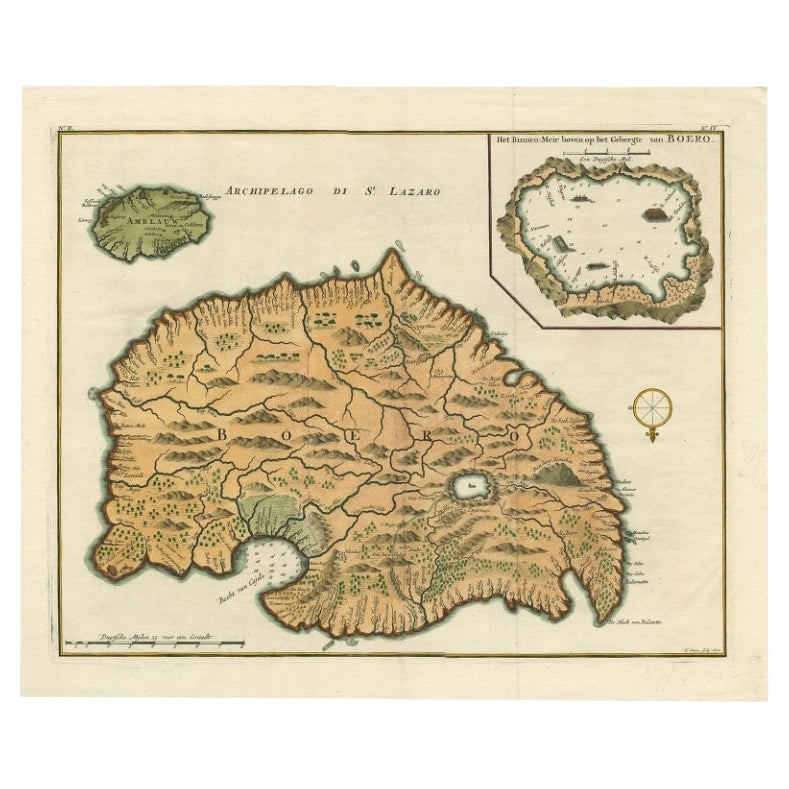
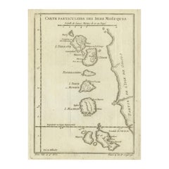
Antique Map of Eastern Seram, Part of the Maluku Island in East Indonesia, 1726
About the Item
Antique map titled 'De Landvoogdy van Amboina met de elf onderhoorige Eylanden.' Detailed map of the eastern part of Seram in Indonesia, part of the Maluku islands. Map of the southern part of Seram with the city of Lonthoir. From the monumental: ""Oud en Nieuw Oost-Indiën (..)"" by François Valentyn / Valentijn, published in 1724-1726. VOC.
Artists and Engravers: The author François Valentijn (1666-1727), was a Dutch missionary, worked at Amboina from 1684 to 1694 and 1705 to 1713 and traveled extensively in the VOC's lands.
Condition: Very good, given age. Original fold as issued. Three tiny pinholes in print, reinforced using contemporary paper backed with acid free archival tape. General age-related toning and/or occasional minor defects from handling. Please study image carefully.
Date: 1726
Overall size: 38.9 x 31 cm.
Image size: 37.6 x 29.5 cm.
We sell original antique maps to collectors, historians, educators and interior decorators all over the world. Our collection includes a wide range of authentic antique maps from the 16th to the 20th centuries. Buying and collecting antique maps is a tradition that goes back hundreds of years. Antique maps have proved a richly rewarding investment over the past decade, thanks to a growing appreciation of their unique historical appeal. Today the decorative qualities of antique maps are widely recognized by interior designers who appreciate their beauty and design flexibility. Depending on the individual map, presentation, and context, a rare or antique map can be modern, traditional, abstract, figurative, serious or whimsical. We offer a wide range of authentic antique maps for any budget.
- Dimensions:Height: 12.21 in (31 cm)Width: 15.32 in (38.9 cm)Depth: 0 in (0.01 mm)
- Materials and Techniques:
- Period:
- Date of Manufacture:1726
- Condition:
- Seller Location:Langweer, NL
- Reference Number:
About the Seller
5.0
Platinum Seller
These expertly vetted sellers are 1stDibs' most experienced sellers and are rated highest by our customers.
Established in 2009
1stDibs seller since 2017
1,949 sales on 1stDibs
Typical response time: <1 hour
- ShippingRetrieving quote...Ships From: Langweer, Netherlands
- Return PolicyA return for this item may be initiated within 14 days of delivery.
More From This SellerView All
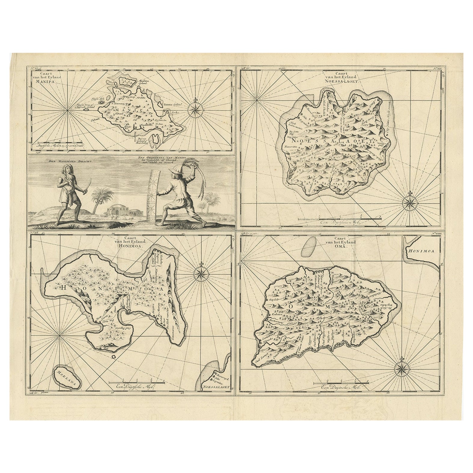
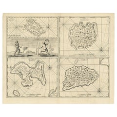
- Antique Map of Manipa and Other Maluku Islands, Indonesia, 1726Located in Langweer, NLAntique map titled 'Caart van het Eyland Manipa, Noessa-Laoet, Honimoa, Oma. Der Manipesen dracht, een Orangkaya van Manipa.' Four maps of islands and two figures in native dress...Category
Antique 18th Century Maps
MaterialsPaper
- Antique Map of Ambelau and Buru Island, Maluku or Moluccas in Indonesia, 1726Located in Langweer, NLAntique map titled 'Boero - Amblauw (..).' Detailed map of the Island Ambelau and Buru, Maluku Islands, Indonesia, by Francois Valentyn. With an inset of the lake on the Buru mountai...Category
Antique 18th Century Maps
MaterialsPaper
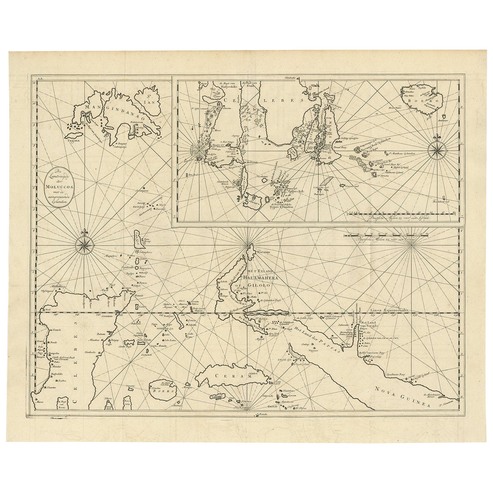
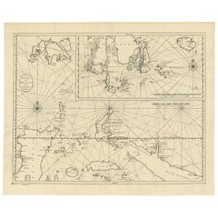
- Large Antique Detailed Map of a Part of the Spice Islands, Indonesia, 1726Located in Langweer, NLAntique matitled 'De Landvoogdy der Moluccos met de aangrenzende Eylanden'. Large detailed map of a part of the Spice Islands. It includes Baru (Boero), Ambon, Seram and part of Ma...Category
Antique 1720s Maps
MaterialsPaper
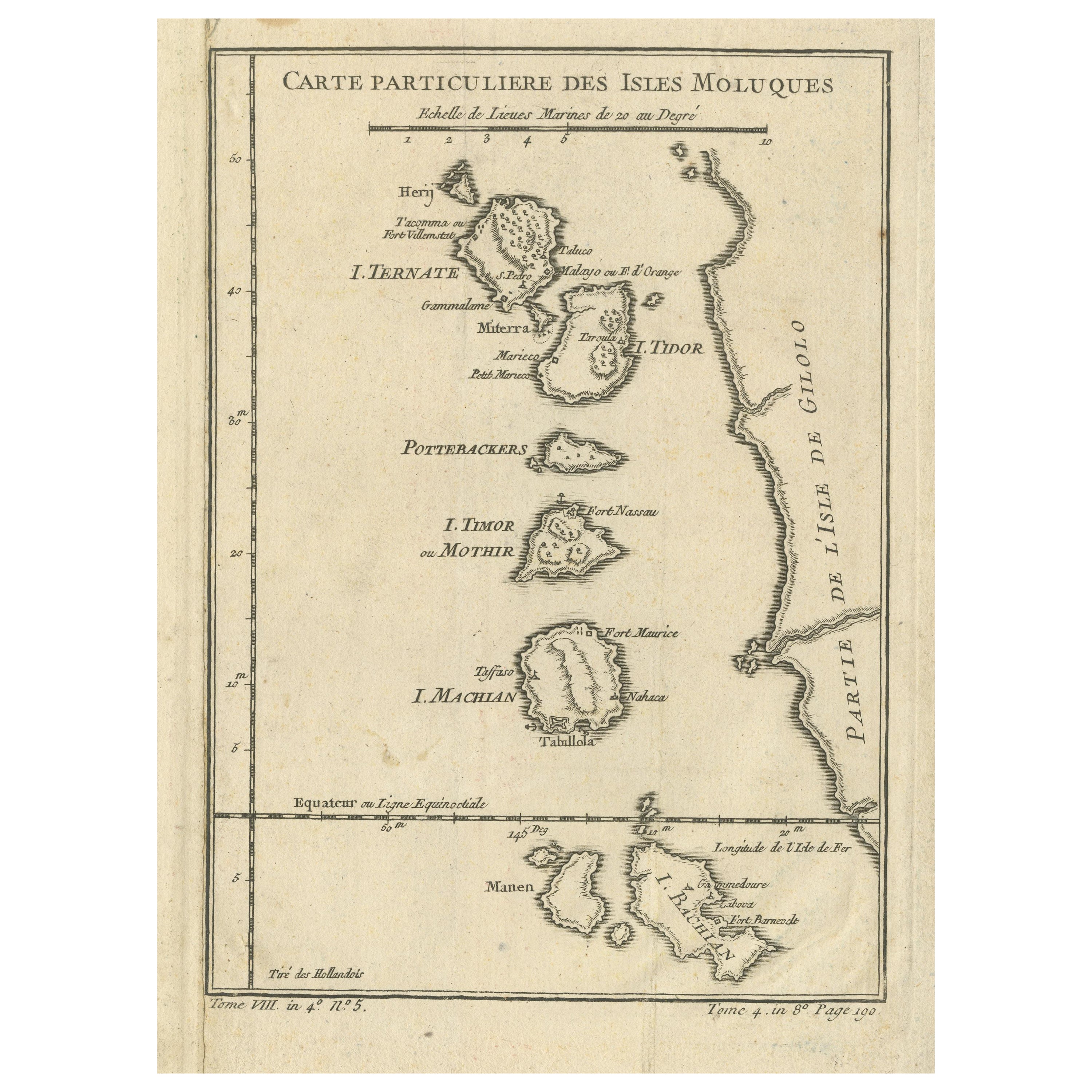
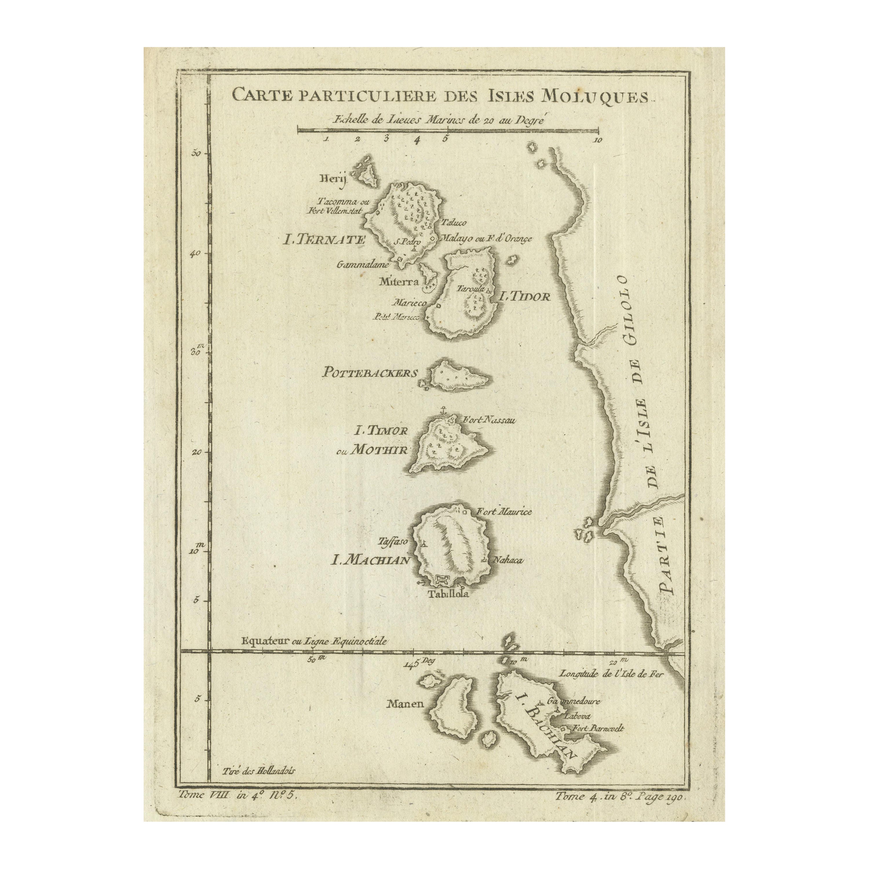
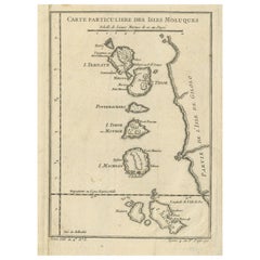
- Antique Map of the Maluku Islands or Moluccas, IndonesiaLocated in Langweer, NLAntique map titled 'Carte Particuliere des Isles Moluques'. This map depicts the islands of Herij, Ternate, Tidor, Pottebackers, Timor, Machian and Bachian. The Moluccan islands were...Category
Antique Mid-18th Century Maps
MaterialsPaper
- Original Antique Map of the Maluku Islands or Moluccas, IndonesiaLocated in Langweer, NLAntique map titled 'Carte Particuliere des Isles Moluques'. This map depicts the islands of Herij, Ternate, Tidor, Pottebackers, Timor, Machian and Bachian. The Moluccan islands were...Category
Antique Mid-18th Century Maps
MaterialsPaper
- Antique Map of the Island of Borneo in Asia (Indonesia), 1726Located in Langweer, NLAntique map titled 'Kaart van het Eyland Borneo'. Early map of the island of Borneo. This map originates from 'Oud en Nieuw Oost-Indiën' by F. Valentijn. Artists and Engravers: Fran...Category
Antique 18th Century Maps
MaterialsPaper


You May Also Like
- 1868 Map of the Upper Part of the Island of Manhattan Above 86th StreetBy Wm. Rogers Mfg. Co.Located in San Francisco, CAThis wonderful piece of New York City history is over 150 years old. It depicts 86th street and above. It was lithographed by WC Rogers and company. It was made to show what was the Battle of Harlem during the Revolutionary war...Category
Antique 1860s American American Colonial Maps
MaterialsPaper
- Original Antique Map of Indonesia, 1861Located in St Annes, LancashireGreat map of Indonesia Drawn and engraved by Edward Weller Original color Published in The Weekly Dispatch Atlas, 1861 Repairs to minor e...Category
Antique 1860s English Victorian Maps
MaterialsPaper

- 1854 Map of Massachusetts, Connecticut and Rhode Island, Antique Wall MapLocated in Colorado Springs, COThis striking wall map was published in 1854 by Ensign, Bridgman & Fanning and has both full original hand-coloring and original hardware. This impression is both informative and highly decorative. The states are divided into counties, outlined in red, green, and black, and subdivided into towns. Roads, canals, and railroad lines are prominently depicted, although they are not all labeled. The mapmakers also marked lighthouses, banks, churches, and prominent buildings, with a key at right. The map is an informative and comprehensive overview of the infrastructural development of New England prior to the Civil War. Physical geographies depicted include elevation, conveyed with hachure marks, rivers and lakes. The impression features an inset map of Boston...Category
Antique 19th Century American Maps
MaterialsPaper
- East German MapBy VEB Hermann HaackLocated in Baltimore, MDA brilliantly colourful map of the Leipzig, Karl Marx Stadt and Dresden area in the former German Democratic Republic by VEB Hermann Haack of Gotha.Category
Vintage 1970s German Maps
- 1844 Map "Russia in Eurpoe, Part II to Part VIII", 7 Maps Ric.r023Located in Norton, MA1844 Map "Russia in Eurpoe, Part II to Part VIII" 7 Maps Ric.r023 Fine, original, steel-engraved Map of Russia in Europe Part II t oPart VIII, by the Society for the Diffusion of Useful Knowledge. Detailed map of the regions to the northeast of Moscow. Including Arkhangel, Vologda, Viatka, Perm, Olonetz, Iaroslavl. The SDUK began its map publishing project under the leadership of Captain Francis Beaufort R.N. in 1829, and published the maps in parts, haltingly, over the next 15 years, completing the series in 1844, finally permitting the publication of a whole atlas. Many of the maps were actually drawn by Beaufort, who at the time was the Hydrographer to the Royal Navy, and all were closely supervised by him. J. & C. Walker worked closely with Beaufort in engraving the maps. Finely engraved, carefully researched, the maps set...Category
Antique 19th Century Unknown Maps
MaterialsPaper
- Original Antique Map of South East Asia, Arrowsmith, 1820Located in St Annes, LancashireGreat map of South East Asia Drawn under the direction of Arrowsmith Copper-plate engraving Published by Longman, Hurst, Rees, Orme and Brown, 1820 Unframed.Category
Antique 1820s English Maps
MaterialsPaper


Recently Viewed
View AllMore Ways To Browse
18th Century Indonesia
18th Century Indonesian
Indonesia Map
Antique Map Indonesia
Antique Maps Indonesia
Voc Antique
Dutch Voc
Antique Elfs
Elf Antique
Antique Furniture Long Island
Antique Map London
Antique London Maps
Antique London Map
London Antique Maps
London Antique Map
London Map Antique
Antique Maps London
Ship Map