Netherlands Maps
to
4,202
5,098
5,489
200
5,097
1
2,804
1,986
307
1
179
6
68
3
3
3
2
5,092
9
7
2
1
372
129
81
77
46
5,098
5,098
5,098
104
59
20
14
13
Item Ships From: Netherlands
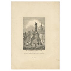
Antique Print of the Statue of Joan of Arc by Knight, 1835
Located in Langweer, NL
Antique print titled 'Statue of the Maid of Orleans at Rouen'. Old print of the statue of Joan of Arc in Rouen, France. This print originates from 'One...
Category
19th Century Antique Netherlands Maps
Materials
Paper
$80 Sale Price
20% Off
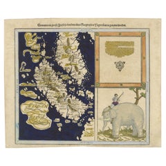
Renaissance Mapping of Sumatra: Featuring Singapore in Münster’s Woodcut, c.1590
Located in Langweer, NL
Description: Antique map titled 'Sumatra ein grosse Insel / so von den alten Geographen Taprobana genennt worden'. Beautiful map of Sumatra and the southern part of Malaysia, with Si...
Category
16th Century Antique Netherlands Maps
Materials
Paper
$1,378 Sale Price
20% Off
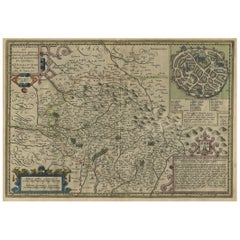
Original Very Old Hand-Colored Map of Limousin or Limoges, France, ca.1600
Located in Langweer, NL
Antique map titled 'Totius Lemovici et Confinium (..).' -
A handsome and detailed map of Limousin/Limoges, prepared by the well-known engraver, Petrus Kaerius. With an insert view ...
Category
Early 1600s Antique Netherlands Maps
Materials
Paper
$1,330 Sale Price
20% Off
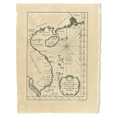
Antique Map of the Coast of China by Bellin, 1752
By Jacques-Nicolas Bellin
Located in Langweer, NL
Antique map titled 'Carte des Costes de Cochinchine, Tunquin et Partie de celles de Chine'. Detailed map of the region from the Cambodia River to Macao, along the coast of China.
...
Category
18th Century Antique Netherlands Maps
Materials
Paper
$104 Sale Price
20% Off
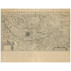
Map of Lake Geneva and Surroundings by Hondius, Geneva Region, circa 1612
Located in Langweer, NL
Map of Lake Geneva and Surroundings by Hondius, Geneva Region, 1606
This rare and intricately engraved map, titled *Chorographica Tabula Lacus Lemanni Locorumque Circumiacentium*, w...
Category
Early 17th Century Dutch Antique Netherlands Maps
Materials
Paper
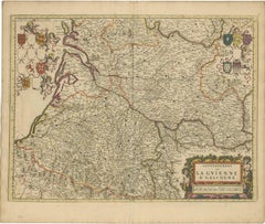
Gascogne and Guyenne Map - Hand-Colored 17th-Century Engraving by De Wit, c.1688
Located in Langweer, NL
Title: Gascogne and Guyenne Map - Hand-Colored 17th-Century Engraving by Frederik De Wit c. 1688
Description: This remarkable map, "Gouvernement de la Guyenne & Gascogne," captures ...
Category
1680s Antique Netherlands Maps
Materials
Paper
Map of Saintonge and Aunis with Cognac and Rochefort, France - 1665 Original
Located in Langweer, NL
Map of Saintonge and Aunis, with Charente Coast and Cognac, 1665
This beautifully hand-colored antique map, titled *Xaintonge, avec Le Pays D’Avlnis* (Saintonge, with the Country of...
Category
1660s Antique Netherlands Maps
Materials
Paper
Antique Map of North America by A & C. Black, 1870
Located in Langweer, NL
Antique map titled 'North America'. Original antique map of North America. This map originates from ‘Black's General Atlas of The World’. Published by A & C. Black, 1870.
Category
Late 19th Century Antique Netherlands Maps
Materials
Paper
$261 Sale Price
20% Off
Detailed Original Antique Plan of the City and Fort of Malacca, Malaysia, 1764
Located in Langweer, NL
Description: Antique map titled 'Plan de la Ville et Forteresse de Malaca'. Detailed plan of the city and fort of Malacca on the southern Malay Peninsula, commanding the strategic st...
Category
1760s Antique Netherlands Maps
Materials
Paper
$180 Sale Price
20% Off
Antique Architectural Print of a New Design for Robert Walpole, England, 1725
Located in Langweer, NL
Antique print titled 'This New Design of my Invention, is most humbly inscrib'd to the Rt. Honble Robert Walpole (..)'.
Old print depicting a new de...
Category
18th Century Antique Netherlands Maps
Materials
Paper
$418 Sale Price
20% Off
Map of Western United States 1903 – Railroads, State Borders, and Terrain
Located in Langweer, NL
Map of Western United States 1903 – Railroads, State Borders, and Terrain
This beautifully engraved map titled "United States of North America (Western Sheet)" was created by Keith ...
Category
Early 20th Century Netherlands Maps
Materials
Paper
Venetian Trade Routes in the Levant – Antique Map by Pieter van der Aa, ca.1720
Located in Langweer, NL
Venetian Trade Routes in the Levant – Antique Map by Pieter van der Aa, Early 18th Century
This finely engraved map, published by Pieter van der Aa in Leiden, provides a detailed d...
Category
1720s Antique Netherlands Maps
Materials
Paper
Explore North America in 1903 - Intricately Detailed Antique Map
Located in Langweer, NL
North America, 1903 - A Colorful Historical Map with Detailed Borders
This attractive map of North America was engraved, printed, and published by W. & A.K. Johnston in 1903. A wond...
Category
Early 20th Century Netherlands Maps
Materials
Paper
Antique Map of Central Asia - Featuring the Caspian Sea and Silk Road Regions
Located in Langweer, NL
Antique Map of Central Asia, 1903, Featuring the Caspian Sea and Silk Road Regions
This antique map, titled "Central Asia," was engraved and published in 1903 by W. & A.K. Johnston ...
Category
Early 20th Century Netherlands Maps
Materials
Paper
Map of the West India Islands and Central America – Colorful 1903 Engraving
Located in Langweer, NL
Map of the West India Islands and Central America – Colorful 1903 Engraving
This vibrant engraved map, titled "West India Islands and Central America," was created by Keith Johnston...
Category
Early 20th Century Netherlands Maps
Materials
Paper
Early Map of Sydney with Botany Bay, Port Jackson & Broken Bay, Australia, 1802
Located in Langweer, NL
Interesting chart of the three harbours of Botany Bay, Port Jackson, and Broken Bay showing the ground cultivated by the colonists. In the early days of the settlement in Australia t...
Category
Early 1800s Antique Netherlands Maps
Materials
Paper
$1,073 Sale Price
20% Off
Map of United States Central Sheet 1903 – Railroads, States, and Topography
Located in Langweer, NL
Map of United States Central Sheet 1903 – Railroads, States, and Topography
This is a finely engraved and beautifully colored map titled "United States of North America (Central She...
Category
Early 20th Century Netherlands Maps
Materials
Paper
Detailed Original Old Map of the Southern Region of the Kingdom of Algiers 1773
Located in Langweer, NL
Antique map titled 'Kaart van het Zuidelyk Gedeelte van het Ryk Algiers'.
Old map of the southern region of the Kingdom of Algiers, Algeria. Originates from the first Dutch edito...
Category
18th Century Antique Netherlands Maps
Materials
Paper
Canada Dominion Map 1903 - A Detailed View of Eastern Canada and Newfoundland
Located in Langweer, NL
North America, 1903 - A Colorful Historical Map with Detailed Borders
This attractive map of North America was engraved, printed, and published by W. & A.K. Johnston in 1903. A wond...
Category
Early 20th Century Netherlands Maps
Materials
Paper
Antique Map of the Isthmus of Mount Athos by Choiseul-Gouffier, 1809
Located in Langweer, NL
Antique map titled 'Plan de l'Isthme du Mont Athos'. Old map of the isthmus of Mount Athos, a mountain and peninsula in northeastern Greece and an important centre of Eastern Orthodox monasticism. This map originates from 'Voyage pittoresque de la Grèce' by M.G.F.A. de Choiseul...
Category
19th Century Antique Netherlands Maps
Materials
Paper
$122 Sale Price
20% Off
Fine Engraving Depicting an Officer's Mess in the Low Countries, 'Holland', 1754
Located in Langweer, NL
Title on Page (Dutch and French): CORPS DE GARDE van Hollandsche Officiers / Corps de Garde des Officiers Hollandois". Amst., 1754.
Fine engraving depicting an officer's mess by J. Punt and P. Tanjé after a painting by C. Troost, with coat of arms engraved in lower margin and dedication to G. Braamcamp ("beminnaar der schilderkonst").
Waiting room with reading, smoking and card playing officers. Right, one of them studies a map of the Netherlands. On the wall a coat of arms with the Dutch lion. At the bottom of the margin the coat of arms and an assignment to Gerrit Braamcamp, who had the original painting in his collection.
Cornelis Troost...
Category
1750s Antique Netherlands Maps
Materials
Paper
$427 Sale Price
20% Off
Early Woodcut Map of Swabia and Bavaria in Germany, 1628
Located in Langweer, NL
Title: Early Woodcut Map of Swabia and Bavaria, 16th Century
This early woodcut map titled "Schwaben und Bayernlande / Darbey auch begreiffen der Oenwaldt / Nordgaw / etc." provides...
Category
1620s Antique Netherlands Maps
Materials
Paper
Original 17th-Century Antique Map of Henan (Honan) Province, China – by Blaeu
Located in Langweer, NL
17th-Century Antique Map of Henan Province, China – "Honan" by Blaeu, with Detailed Cartography and Artistic Cartouches
Description: This exceptional 17th-century map of Henan Province, historically referred to as "Honan," was created by Johannes Blaeu and published in 1655 as part of the *Novus Atlas Sinensis*. Henan, located in central China, is known as the cradle of Chinese...
Category
1650s Antique Netherlands Maps
Materials
Paper
Cartographic Treasures: A Journey Through the Gascogne and Guyenne Regions, 1680
Located in Langweer, NL
The antique map titled "Gouvernement de La Guienne & Gascogne" depicts the region of Gascogne and Guyenne, known for their wine production, in France.
This map is a rare edition, u...
Category
Late 17th Century Antique Netherlands Maps
Materials
Paper
$712 Sale Price
20% Off
Abyssinia and Upper Nubia, 1903 - Detailed Map of the Horn of Africa Region
Located in Langweer, NL
Title: Abyssinia and Upper Nubia, 1903 - Detailed Map of the Horn of Africa Region
This fascinating map titled "Abyssinia and Upper Nubia" was engraved, printed, and published by W....
Category
Early 20th Century Netherlands Maps
Materials
Paper
Antique Map of Persia and Afghanistan, 1903, with Delicate Pastel Borders
Located in Langweer, NL
Title: Antique Map of Persia and Afghanistan, 1903, with Delicate Pastel Borders and Detailed Topography
Description:
This antique map, titled "Persia and Afghanistan," was engraved...
Category
Early 20th Century Netherlands Maps
Materials
Paper
1885 Shinsen Tokyo Zenzu: Rare Meiji-Era Map of Tokyo by Sakai Kinzaburo
Located in Langweer, NL
Title: Detailed Edo Period Map of Tokyo (Edo), Featuring Neighborhoods and Landmarks
This beautifully detailed patina rich map, titled "Shinsen Tokyo Zenzu" (Newly Selected Complete...
Category
1880s Antique Netherlands Maps
Materials
Paper
Antique Map of the German Empire, 1903, with Intricate Provincial Boundaries
Located in Langweer, NL
Title: Antique Map of the German Empire, 1903, with Intricate Provincial Boundaries
Description:
This antique map, titled "Empire of Germany (Southern Portion)," was engraved and pu...
Category
Early 20th Century Netherlands Maps
Materials
Paper
Antique Map Showing the Locations of Native American Tribes in 1899
Located in Langweer, NL
Antique map titled 'Map showing the Indian Reservations within the Limits of the United States'. Large folding map of the United States showing the Indian Reservations. The present m...
Category
Late 19th Century Antique Netherlands Maps
Materials
Paper
$617 Sale Price
20% Off
Antique Map of the City of Batavia by Van der Aa 'c.1730'
Located in Langweer, NL
Antique map titled 'Plan de la Ville et du Chateau de Batavia en l'Isle de Iava - Ware affbeeldinge wegens het Casteel ende Stadt Batavia gelegen op groot Eylant Java'. Detailed plan...
Category
Mid-18th Century Antique Netherlands Maps
Materials
Paper
$1,140 Sale Price
20% Off
Rare 1670 Map of Tartary by Richard Blome after Sanson, Hand-colored Engraving
Located in Langweer, NL
Rare 1670 Map of Tartary by Richard Blome after Sanson, hand-colored engraving
This striking and highly decorative map, titled *A Generall Mapp of the Kingdome of Tartaria*, was pub...
Category
1670s Antique Netherlands Maps
Materials
Paper
Old German Antique Map of Iran and Arabia, 1866
Located in Langweer, NL
Antique map titled 'Vorder-Asien oder Iran, Turan, Arabien, Kleinasien und die Kaukasus Länder'. Large map centered on Iran. It shows the area from Turkey to Mumbai in India. Include...
Category
19th Century Antique Netherlands Maps
Materials
Paper
$237 Sale Price
20% Off
Antique Engraved Map of the Friendly Islands or Tonga, ca.1785
Located in Langweer, NL
Antique map titled 'Carte des Isles des Amis'.
Map of the Friendly Islands / Tonga. The Tongan people first encountered Europeans in 1616 when the Dutch vessel Eendracht, captain...
Category
1780s Antique Netherlands Maps
Materials
Paper
$304 Sale Price
20% Off
Antique Map of South Australia, New South Wales, Victoria and Queensland, 1903
Located in Langweer, NL
Title: Antique Map of South Australia, New South Wales, Victoria, and Queensland, 1903
Description:
This antique map, titled "South Australia, New South Wales, Victoria, and Queensl...
Category
Early 20th Century Netherlands Maps
Materials
Paper
Orense in Depth: A 1902 Topographical Map of Galicia's Mountainous Province
Located in Langweer, NL
The map is a detailed cartographic representation of the province of Orense (Ourense in Galician), located in the northwest of Spain, as it was in 1902. Here's a brief description an...
Category
Early 1900s Antique Netherlands Maps
Materials
Paper
$294 Sale Price
20% Off
Antique Map of Spain and Portugal, 1903, Regional Boundaries and Coastal Detail
Located in Langweer, NL
Antique Map of Spain and Portugal, 1903, Featuring Regional Boundaries and Coastal Detail
Description: This antique map, titled "Spain & Portugal," was engraved and published in 190...
Category
Early 20th Century Netherlands Maps
Materials
Paper
Antique Map of European Russia, 1903, with Colorful Provincial Boundaries
Located in Langweer, NL
Title: Antique Map of European Russia, 1903, with Colorful Provincial Boundaries
Description:
This antique map, titled "European Russia," was engraved and published in 1903 by W. & ...
Category
Early 20th Century Netherlands Maps
Materials
Paper
Antique Celestial Star Map – Northern & Southern Hemispheres, 1860
Located in Langweer, NL
Antique Celestial Star Map – Northern & Southern Hemispheres, Andriveau-Goujon 1860
This elegant antique celestial chart, published in Paris in 1860 by the noted French cartographer...
Category
Mid-19th Century French Antique Netherlands Maps
Materials
Paper
Antique Map of Turkey in Europe, 1903, with Delicate Pastel Coloration
Located in Langweer, NL
Title: Antique Map of Turkey in Europe, 1903, with Delicate Pastel Coloration
Description:
This antique map, titled "Turkey in Europe," was engraved and published in 1903 by the dis...
Category
Early 20th Century Netherlands Maps
Materials
Paper
Antique Map of Switzerland and the Alps of Savoy & Piedmont, 1903 Edition
Located in Langweer, NL
Title: Antique Map of Switzerland and the Alps of Savoy & Piedmont, 1903, with Intricate Topographical Detail
Description:
This beautifully engraved antique map, titled "Switzerland...
Category
Early 20th Century Netherlands Maps
Materials
Paper
Antique Map of Southern England & Wales, 1903, with Coastal Details and Railways
Located in Langweer, NL
Title: Antique Map of Southern England and Wales, 1903, with Coastal Details and Railways
Description:
This detailed antique map, titled "England and Wales (Southern Sheet I)," was ...
Category
Early 20th Century Netherlands Maps
Materials
Paper
Antique Map of Northern Scotland, 1903, with Intricate Coastal Features
Located in Langweer, NL
Title: Antique Map of Northern Scotland and Islands, 1903, with Intricate Coastal Features
Description:
This striking antique map, titled "Scotland (Northern Sheet I)," was engraved...
Category
Early 20th Century Netherlands Maps
Materials
Paper
Antique Map of Southern Scotland, 1903, with Coastal and Inland Details
Located in Langweer, NL
Title: Antique Map of Southern Scotland, 1903, with Coastal and Inland Details
Description:
This exquisite antique map, titled "Scotland (Southern Sheet I)," was engraved and publis...
Category
Early 20th Century Netherlands Maps
Materials
Paper
Original 1806 Engraved Map of Asia and Surrounding Regions by John Cary
Located in Langweer, NL
The map titled "A New Map of Asia, From the Latest Authorities" was published in 1806. It is a detailed and comprehensive depiction of the continent of Asia, extending from Europe and the Arabian Peninsula in the west to Japan and the Pacific Islands in the east, and from the Arctic regions in the north to parts of New Holland (Australia) and the Indian Ocean in the south.
The map is finely engraved, with political boundaries delineated using color to distinguish different empires, kingdoms, and colonial possessions of the time. Key geographical features such as mountain ranges, rivers, and major cities are clearly marked. It also includes significant maritime routes and islands across the Indian and Pacific Oceans, reflecting the global trade and exploration activities of the early 19th century.
Notable Features:
- Asia is represented with its vast and diverse regions, including the extensive Russian Empire in the north, the Ottoman Empire in the west, the Qing Dynasty's control over China, and the Mughal Empire's influence in India, which is under increasing British control.
- India is shown with its numerous princely states, many of which are under British influence or control.
- Southeast Asia includes the colonial possessions of European powers, particularly the Dutch East Indies, Spanish Philippines...
Category
Early 1800s English Antique Netherlands Maps
Materials
Paper
$750 Sale Price
20% Off
Antique Map of Asia and the East Indies and Korea as a Peninsula, ca.1660
Located in Langweer, NL
Antique map titled 'Asiae nova delineatio'. Decorative map of Asia and the East Indies. The map shows Korea as a peninsula. In China the Great Wall is depicted, as well as a long str...
Category
17th Century Antique Netherlands Maps
Materials
Paper
$2,375 Sale Price
20% Off
Antique Map of the City of Verdun by Merian, c.1650
Located in Langweer, NL
Antique map titled 'Verdun'. Orginal antique map of Verdun, a small city in the Meuse department in Grand Est in northeastern France. This map originates from 'Topographia Germaniae'...
Category
17th Century Antique Netherlands Maps
Materials
Paper
$56 Sale Price
20% Off
Antique Map of the Northwestern Coast of Spain
Located in Langweer, NL
Antique map titled 'Gallaecia Regnum'. Original old map of the northwestern coast of Spain, extending from the Asturias de Oviedo region and Aviles in the Northeast to Bayona and the...
Category
Mid-17th Century Antique Netherlands Maps
Materials
Paper
$551 Sale Price
20% Off
Antique Map of the West-Frisian part of independent Friesland by Halma, 1718
Located in Langweer, NL
Antique map Friesland titled 'ars I. Frisiae Liberae quae Westfresia post eluviones seculi XIII (..)'. Old map of the West-Frisian part of the independent Friesland, the Netherlands ...
Category
18th Century Antique Netherlands Maps
Materials
Paper
Old Map of the Great Lakes and Upper Mississippi Valley, Northern America, c1780
Located in Langweer, NL
Antique map titled 'Partie Occidentale du Canada'.
A fine example of Rigobert Bonne and Guilleme Raynal's 1780 map of the Great Lakes and upper Mississippi Valley.
A map of c...
Category
1780s Antique Netherlands Maps
Materials
Paper
$784 Sale Price
20% Off
Antique Dutch Map of the Twelve Tribes of Israel – After Ezekiel, circa 1730
Located in Langweer, NL
Antique Dutch Map of the Twelve Tribes of Israel – After Ezekiel, circa 1730
This uncommon early 18th-century Dutch map is titled "Ontwerp en Erfdeeling van’t Land Kanaan, volgens h...
Category
Early 18th Century Dutch Antique Netherlands Maps
Materials
Paper
Antique Print of the Fortress at the Nile 'Damietta, Egypt' by C. Niebuhr, 1774
Located in Langweer, NL
Antique print titled 'Castelle an dem Ausflus des Nîls nicht weit von Damiât'. Translated: 'Fort at the estuary of the Nile near Damietta, Egypt'. This print originates from 'Reisebe...
Category
Late 18th Century Antique Netherlands Maps
Materials
Paper
$133 Sale Price
20% Off
Turkey in Asia – Antique Ottoman Empire Map by John Tallis, ca. 1851
Located in Langweer, NL
Turkey in Asia – Antique Ottoman Empire Map by John Tallis, ca. 1851
This decorative 19th-century map titled "Turkey in Asia" was published by John Tallis & Company around 1851. Eng...
Category
Mid-19th Century English Antique Netherlands Maps
Materials
Paper
Antique Map of the Queen Charlotte Islands, Haida Gwaii
Located in Langweer, NL
Antique map titled 'Isles de la Reine Charlotte (..)'. Original old map of the Queen Charlotte Islands, based upon the explorations of James Cook, Juan Perez, and other contemporary European explorers. The map shows only partial coastal detail along the north end of the main island, and includes two insets of navigable bays and depth measurements.
Now called Haida Gwaii, after the local native population, the islands situated off Canada’s coast, south of Vancouver played an important role in the late 18th and early 19th century maritime...
Category
Late 18th Century Antique Netherlands Maps
Materials
Paper
$275 Sale Price
20% Off
Konstantinopel – Panoramic View of Istanbul by François Halma, 1705
Located in Langweer, NL
Konstantinopel – Panoramic View of Istanbul by François Halma, 1705
This engaging hand-colored engraving of “Konstantinopel” offers a sweeping panoramic view of 18th-century Istanbu...
Category
Early 18th Century Dutch Antique Netherlands Maps
Materials
Paper
Antique Map of the Province of Gelderland, the Netherlands, c.1690
Located in Langweer, NL
Antique map titled 'Ducatus Geldriae novissima descriptio'. Map of Gelderland, The Netherlands. Shows many cities (like Arnhem, Nijmegen, Eindhoven, Zutphen, Zwolle, etc), roads, riv...
Category
17th Century Antique Netherlands Maps
Materials
Paper
$474 Sale Price
20% Off
Byzantium Nunc Constantinopolis – Braun & Hogenberg View of Istanbul, 1572
Located in Langweer, NL
Byzantium Nunc Constantinopolis – Braun & Hogenberg View of Istanbul, Cologne, 1572
This iconic 16th-century bird’s-eye view titled “Byzantium Nunc Constantinopolis” presents the ci...
Category
16th Century German Antique Netherlands Maps
Materials
Paper
Constantinople – Panoramic Engraving by Matthäus Merian the Elder, 1635
Located in Langweer, NL
Constantinople – Panoramic Engraving by Matthäus Merian the Elder, Frankfurt, 1635
This finely detailed copperplate engraving presents a sweeping bird’s-eye view of Constantinople (...
Category
Early 17th Century German Antique Netherlands Maps
Materials
Paper
Antique Map of Utrecht in The Netherlands, 1883
Located in Langweer, NL
Antique map titled 'Utrecht'. Map of Utrecht, a province of the Netherlands. This map originates from 'Atlas van Nederland volgens de nieuwe spelregels' by J. Kuyper.
Artists and En...
Category
19th Century Antique Netherlands Maps
Materials
Paper
$209 Sale Price
20% Off
Constantinople – Panoramic Hand-Colored Engraving, Augsburg, circa 1720
Located in Langweer, NL
Constantinople – Panoramic Hand-Colored Engraving, Augsburg, circa 1720
This panoramic hand-colored engraving presents a sweeping bird’s-eye view of Constantinople (modern-day Istan...
Category
Early 18th Century German Antique Netherlands Maps
Materials
Paper
Constantinople (Istanbul) – City View by Werner and Gläser, Augsburg ca.1730
Located in Langweer, NL
Constantinople (Istanbul) – Panoramic City View by Werner and Gläser, Augsburg c.1730
This striking hand-colored copper engraving offers a grand panoramic view of Constantinople (mo...
Category
Early 18th Century German Antique Netherlands Maps
Materials
Paper
Recently Viewed
View AllMore Ways To Browse
Flemish Cabinets 17th Century
Fox Figurine
Fox Hunt Plate
French Art Deco Rosewood Buffet
French Bulldog Gold
French Louis Xvi Enfilade
French Provincial Antique Dresser
French Provincial Furniture Antique Dresser
French Zinc Bar
Frog Figurine
Georgian Mahogany Longcase Clock
German Folding Trolley
Glass And Brass Fireplace Screen
Glass Nude Woman Sculpture
Glass Parrots
Glass Poodle
Gothic Corbel
Granite Pagoda
