Maps on Sale
to
4,210
18
4,233
1
3
2
2
1
1
1
1
2,334
1,667
232
1
130
12
1
67
1
3
4
2
4,224
10
8
7
7
143
41
37
32
27
4,234
4,234
4,234
104
55
18
13
11
Sale Items
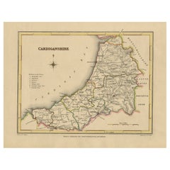
Old Map of Cardiganshire by Lewis 1844 – Aberystwyth Cardigan Tregaron Lampeter
Located in Langweer, NL
Old Map of Cardiganshire by Samuel Lewis 1844 – Aberystwyth Cardigan Tregaron Lampeter
This antique 1844 map of Cardiganshire was drawn and engraved ...
Category
Antique 1840s Maps
Materials
Paper
$228 Sale Price
20% Off
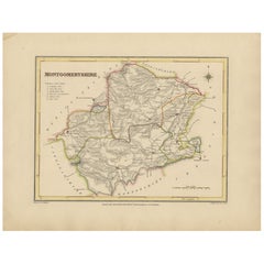
Old Map of Montgomeryshire by 1844 – Welshpool Llanidloes Newtown Machynlleth
Located in Langweer, NL
Title: Old Map of Montgomeryshire by Samuel Lewis 1844 – Welshpool Llanidloes Newtown Machynlleth
Description: This 1844 map of Montgomeryshire was engraved for Samuel Lewis’ Topographical Dictionary of Wales. It highlights principal towns such as Welshpool, Llanidloes, Newtown, and Machynlleth, with rivers, roads, and hill shading showing the region's terrain. The hand-colored borders mark the administrative divisions, and a decorative compass rose and union reference chart are included.
Condition:
The map is in good condition with light age toning and wide clean margins. The engraving is clear and the original hand coloring remains vibrant. No tears or major imperfections are present.
Framing suggestions:
An acid-free mat in ivory or soft beige will complement the aged paper tone. A dark wood, black, or antique gold frame will suit the historic style. UV-protective glass is recommended to preserve the colors. A beautiful display piece for those with ties to mid-Wales or an interest in antique cartography.
Keywords:
Montgomeryshire map 1844 Samuel Lewis antique...
Category
Antique 1840s Maps
Materials
Paper
$228 Sale Price
20% Off
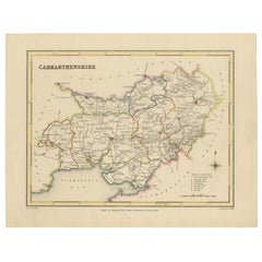
Map of Carmarthenshire 1844 – Carmarthen Llandeilo Llanelli Laugharne Llandovery
Located in Langweer, NL
Title: Old Map of Carmarthenshire by Samuel Lewis 1844 – Carmarthen Llandeilo Llanelli Laugharne Llandovery
Description: This detailed 1844 map of Carmarthenshire was drawn and engraved for Samuel Lewis’ Topographical Dictionary of Wales. It highlights major towns such as Carmarthen, Llandeilo, Llanelli, Laugharne, and Llandovery. The county's roads, rivers, and hilly terrain are finely engraved and shaded, while original hand coloring outlines the administrative divisions. The map includes a compass rose and a reference to the seven unions within the county.
Condition:
The map is in very good antique condition with minimal age toning and wide clean margins. The engraving is crisp and the hand coloring remains bright and accurate. There are no tears or major defects.
Framing suggestions:
A cream or soft beige acid-free mat will complement the aged paper and hand coloring. Frame in dark wood, antique gold, or a muted black to highlight the historical character. Use UV-protective glass to preserve the colors. Suitable for traditional interiors, libraries, or as a heritage gift.
Keywords:
Carmarthenshire map 1844 Samuel Lewis antique...
Category
Antique 1840s Maps
Materials
Paper
$228 Sale Price
20% Off
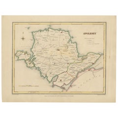
Old Map of Anglesey 1844 – Beaumaris Holyhead Llanerchymedd Amlwch Llangefni
Located in Langweer, NL
Title: Old Map of Anglesey by Samuel Lewis 1844 – Beaumaris Holyhead Llanerchymedd Amlwch Llangefni
Description: This antique 1844 map of Anglesey was drawn and engraved for Samuel ...
Category
Antique 1840s Maps
Materials
Paper
$209 Sale Price
20% Off
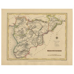
Old Map of Merionethshire by Lewis, 1844: Barmouth, Bala, Harlech, Dolgelley
Located in Langweer, NL
Old Map of Merionethshire by Samuel Lewis 1844 – Barmouth Bala Harlech Dolgelley
Description: This finely engraved hand-colored map of Merionethshire was published in 1844 for Samu...
Category
Antique 1840s Maps
Materials
Paper
$228 Sale Price
20% Off
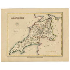
Old Map of Carnarvonshire 1844 – Caernarfon Bangor Pwllheli Beaumaris Bay
Located in Langweer, NL
Title: Old Map of Carnarvonshire by Samuel Lewis 1844 – Caernarfon Bangor Pwllheli Beaumaris Bay
Description: This antique map of Carnarvonshire was published in 1844 for Samuel Lewis’ Topographical Dictionary of Wales. It features major towns and landmarks including Caernarfon, Bangor, Pwllheli, and the scenic Beaumaris Bay. The map shows shaded terrain, rivers, and coastal outlines, with hand-colored borders dividing the county’s various unions. A decorative compass rose and a reference key add historical detail and charm.
Condition:
The map is in very good condition with some light age toning and clean margins. The engraved lines are sharp and the original hand coloring remains bright and clear. There are no visible tears or major imperfections.
Framing suggestions:
Use an ivory, cream, or light tan acid-free mat to complement the aged paper and colored borders. Choose a frame in dark wood, black with a soft finish, or antique gold to enhance the historical appeal. UV-protective glass is recommended. A striking piece for a study, hallway, or as a gift for those with North Welsh heritage or an interest in vintage maps.
Keywords:
Carnarvonshire map 1844 Samuel Lewis antique...
Category
Antique 1840s Maps
Materials
Paper
$228 Sale Price
20% Off
Set of 2 Antique Maps of Scotland by W. G. Blackie, 1859
Located in Langweer, NL
Antique map titled 'Scotland'. Original antique map of Scotland. This map originates from ‘The Imperial Atlas of Modern Geography’. Published by W. G. Blackie, 1859.
Category
Antique Mid-19th Century Maps
Materials
Paper
$309 Sale Price / set
35% Off
Antique Print of the Yamuna River in India, 1839
Located in Langweer, NL
Antique print titled 'Die Quelle des Jumna'. View of the Yamuna river, India. This print originates from 'Meyer´s Universum oder Abbildung und Beschreibung des Sehenswerthesten und M...
Category
Antique 19th Century Prints
Materials
Paper
$104 Sale Price
20% Off
Antique Map of the Bukhari Region by Van Schley, 1758
Located in Langweer, NL
Antique map titled 'Carte de la petite Bukharie et pays voisins.' Original antique map of the Bukhari (Sinkiang in north-western China) and neighboring countries. While these maps by...
Category
Antique 18th Century Maps
Materials
Paper
$141 Sale Price
20% Off
Detailed Antique Map of the Region of Malwa in India, 1833
Located in Langweer, NL
Antique map titled 'India VI'. Old steel engraved map of the region of Malwa showing great detail.
Artists and Engravers: Engraved by J. & C. Walker. Published under the superint...
Category
Antique 19th Century Maps
Materials
Paper
$276 Sale Price
20% Off
Antique Map of the Banda Islands and the Route of Abel Tasman, Indonesia, 1726
Located in Langweer, NL
Antique print Indonesia with an image on each side. The first image depicts Ontong Java, one of the largest atolls on earth. On verso: antique map of the Banda Islands. With the rout...
Category
Antique 1720s Maps
Materials
Paper
$402 Sale Price
24% Off
Old Copper Engraving of the Siege of Syracuse, Sicily, Italy, Published, ca.1740
Located in Langweer, NL
Antique print titled 'Syracuse, Assiégée par les Atheniens'.
Old print of the siege of Syracuse, Sicily, Italy. Source unknown, to be determined.
The siege of Syracuse by the...
Category
Antique 1740s Maps
Materials
Paper
$266 Sale Price
20% Off
Antique Map of Gaasterland in Friesland, the Netherlands, 1718
Located in Langweer, NL
Antique map titled 'Gaasterland. De zevende Grietenije van de Zevenwolden (..)'. Original antique map of Gaasterland, Friesland, the Netherlands. Originates from 'Uitbeelding van de ...
Category
Antique 18th Century Maps
Materials
Paper
$619 Sale Price
20% Off
Original Antique Print of the Waterfall of Saint-Leu in France, 1776
Located in Langweer, NL
Antique print titled 'Vue de Rocher, Temple et Cascade de St. Leu'. Copper engraving showing the rocks, temple and waterfall of Saint-Leu. This print originates from 'Jardins Anglo-C...
Category
Antique 18th Century Prints
Materials
Paper
$330 Sale Price
11% Off
Old Map of Cook's Discovery and Charting of the East Coast of Australia, 1803
Located in Langweer, NL
Antique map titled 'Kaart van Nieuw Zuid Wales of de Oostlyke Kust van Nieuw Holland ontdekt en onderzogt door den Luitenant J. Cook met het Schip de Endeavour in het Jaar 1770'.
...
Category
Antique Early 1800s Maps
Materials
Paper
$1,668 Sale Price
20% Off
Antique Map of Russia in Asia by Lowry, c.1865
Located in Langweer, NL
Antique map titled 'Russia in Asia, E Sheet'. Old map of Russia originating from the 'Weekly Dispatch Atlas'. Artists and Engravers: Engraved by J.W. Lowry.
Artist: Engraved by J....
Category
Antique 19th Century Maps
Materials
Paper
$84 Sale Price
20% Off
Antique Map of the Franekeradeel Township by Behrns, 1861
Located in Langweer, NL
Antique map titled 'Gemeente Franekeradeel'. Old map depicting the Franekeradeel township including cities and villages like Franeker, Midlum, Hitsum, Schalsum, Dongjum, Peins and Ac...
Category
Antique 19th Century Maps
Materials
Paper
$84 Sale Price
20% Off
Antique Map of the German Empire by Migeon, 1880
Located in Langweer, NL
Antique map titled 'Empire d'Allemagne'. Old map of Germany. With decorative vignette of Mainz. This map originates from 'Géographie Universelle Atlas-Migeon' by J. Migeon.
Artist...
Category
Antique 19th Century Maps
Materials
Paper
$104 Sale Price
20% Off
Antique Print of a Statue of Niobe by Knight, 1835
Located in Langweer, NL
Antique print titled 'Statue of Niobe'. Old print of a statue of Niobe. Made after a statue by Piranesi. This print originates from 'One Hundred and Fifty Wood Cuts selected from the...
Category
Antique 19th Century Prints
Materials
Paper
$69 Sale Price
20% Off
Rare Map of St. Louis on the Island of Hispaniola 'Santa Domingo', 1748
Located in Langweer, NL
Description: Antique map titled 'A New & Exact Planof the Harbour of Port Louis (..)'.
Scarce early plan of the Harbor of St. Louis on the Island of Hispaniola (Santa Domingo), showing the the harbor at the time it was taken by Admiral Knowles in March 1748. Charles Knowles (1704 – 1777) was an officer of the Royal Navy, who saw service during the War of Jenkins' Ear, the War of the Austrian Succession, and the Seven Years War. He also briefly served with the Imperial Russian Navy...
Category
Antique 1740s Maps
Materials
Paper
$333 Sale Price
20% Off
Antique Map of the Crimean Peninsula and Sevastopol by W. G. Blackie, 1859
Located in Langweer, NL
Antique map titled 'The Crimea'. Original antique map of the Crimean Peninsula, Black Sea and Sevastopol. This map originates from ‘The Imperial Atlas of Modern Geography’. Published...
Category
Antique Mid-19th Century Maps
Materials
Paper
$166 Sale Price
20% Off
Antique Print of the City of Hukoen in China, 1668
By Johannes Nieuhof
Located in Langweer, NL
Antique print China titled 'Hukoen of ou Hukeu'. Old print depicting a view on the Chinese city of Hukoen with its ramparts. This print originates ...
Category
Antique 17th Century Prints
Materials
Paper
$276 Sale Price
20% Off
Antique Map of Oceania by Levasseur, circa 1860
Located in Langweer, NL
Antique map titled 'Carte générale de l'Océanie'. Large map of Oceania including New Zealand, Australia, Polynesia, Micronesia and the East Indies. This map originates from 'Atlas Un...
Category
Antique Mid-19th Century Maps
Materials
Paper
$238 Sale Price
20% Off
Antique Optica Print of Huis ten Bosch, The Netherlands, c.1760
By Georg Balthasar Probst
Located in Langweer, NL
Antique print titled 'Gesigt van het Huys de Oranje Zaal'. View of Huis ten Bosch, a royal palace in The Hague, the Netherlands. This is an optical print, also called 'vue optique' o...
Category
Antique 18th Century Prints
Materials
Paper
$276 Sale Price
20% Off
Antique Map of the German Empire by Johnston, 1882
By Alexander Keith Johnston
Located in Langweer, NL
Antique map titled 'Empire of Germany'. Old map of the German Empire with an inset map of Berlin and Potsdam. This map originates from 'The Royal Atlas o...
Category
Antique 19th Century Maps
Materials
Paper
$209 Sale Price
20% Off
Antique Print of Rome by Daumont, c.1770
By Daumont
Located in Langweer, NL
Antique print titled 'Vue d'Optique representant Rome dans sa Splendeur Ancienne (..)'. Optical print representing Rome in its ancient splendour. This is an optical print, also calle...
Category
Antique 18th Century Prints
Materials
Paper
$419 Sale Price
20% Off
Antique Map of Haute-Garonne ‘France’ by V. Levasseur, 1854
Located in Langweer, NL
Antique map titled 'Dépt. de la Hte. Garonne'. Map of the French department of Haute-Garonne, France. This area of France produces the delicious but lesser known Buzet wines, and ten...
Category
Antique Mid-19th Century Maps
Materials
Paper
$171 Sale Price
20% Off
Antique Map of the Vermandois Region 'Picardy' in France by Janssonius, C.1640
Located in Langweer, NL
Antique map titled 'Vermandois'. Old map of the Vermandois region, France. Vermandois was a French County that appeared in the Merovingian period. Its na...
Category
Antique 17th Century Maps
Materials
Paper
$419 Sale Price
20% Off
Antique Print of Mount Sinai in Egypt, 1773
Located in Langweer, NL
Antique print titled 'Gezigt van de Berg Sinai uit de haven van Tor'. Old print depicting Mount Sinai and the rock of Meriba. Originates from the first Dut...
Category
Antique 18th Century Prints
Materials
Paper
$343 Sale Price
20% Off
Antique Map of the Region of Grave by Orlers, 1615
Located in Langweer, NL
Antique map of the region of Grave, also including Cuijk and Ravestein. This map originates from 'La genealogie des illustres Comtes de Nassau' by Jan Jansz. Orlers.
Artists and E...
Category
Antique 17th Century Maps
Materials
Paper
$152 Sale Price
20% Off
Antique Map of South America ‘North’ by A.K. Johnston, 1865
Located in Langweer, NL
Antique map titled 'South America, Northern Sheet'. Depicting Guiana, Ecuador, Brazil, Bolivia the Amazones and more. This map originates from the ‘Royal Atlas of Modern Geography’ b...
Category
Antique Mid-19th Century Maps
Materials
Paper
$262 Sale Price
20% Off
Antique Print of Batavia 'Jakarta' in the Dutch East Indies in Asia, 1705
Located in Langweer, NL
Antique print Indonesia titled 'Batavia'. Beautiful view of Batavia, Indonesia. This print originates from 'Algemeene weereld-beschryving, nae de rechte verdeeling der landschappen (...
Category
Antique 18th Century Prints
Materials
Paper
$514 Sale Price
20% Off
Old Map of Turkmenistan, Uzbekistan, Afghanistan, Tajikistan, Kyrgyzstan, 1757
Located in Langweer, NL
Antique map titled 'Kort over det Lille Bukarie og de naest graensende Lande. af Engelske Skribentere ved N. Bellin Ingenieur ved Marinen efter Söe Etaten'.
Map of present-day Turkmenistan, Uzbekistan, Afghanistan, Tajikistan, Kyrgyzstan including part of China. Originates from 'Almindelig histoirie over reiser til lands og bands (..)'. This 17 volume set is a translation of Collection of voyages and travels edited by Awnsham and John Churchill and Thomas Osborne...
Category
Antique 1750s Maps
Materials
Paper
$305 Sale Price
20% Off
Antique Map of the Moluques Islands, Part of Indonesia, circa 1750
Located in Langweer, NL
Map of the Moluques (also known as the Moluccas, Moluccan Islands or simply Maluku). Depicts the islands of Herij, Ternate, Tidor, Pottebackers, Timor, Machian and Bachian.
Category
Antique Mid-18th Century Maps
Materials
Paper
$200 Sale Price
20% Off
Antique Map of Russia from the Baltic to the Black Sea by Sharpe, 1849
Located in Langweer, NL
Antique map titled 'Western Russia from the Baltic to the Euxine'. Old map of Western Russia from the Baltic to the Black Sea. This map originates from 'Sharpe's Corresponding Atlas ...
Category
Antique 19th Century Maps
Materials
Paper
$90 Sale Price
20% Off
Antique Map of the Region of Saintonge by Janssonius, 1657
By Johannes Janssonius
Located in Langweer, NL
Antique map of France titled 'La Saintonge vers le Septentrion avecq le Pays d'Aulnis'. Decorative map of the Saintonge region. Includes Ile de Re, Ile d'Oleron and the cities of Nio...
Category
Antique 17th Century Maps
Materials
Paper
$405 Sale Price
20% Off
Antique Map of the City of Franeker by Bast, 1598
Located in Langweer, NL
Antique map titled 'Franeker'. Very rare and early map of the city of Franeker, Friesland. With decorative cartouche and Dutch legend. Artists and Engravers: Pieter Bast (1550-1605) ...
Category
Antique 16th Century Maps
Materials
Paper
$1,067 Sale Price
20% Off
Antique Map of the Siege of Syracuse, Sicilia, Italy, 'ca.1675'
Located in Langweer, NL
Antique map titled 'Syracus beseeged by the Athenians.' This original uncommon antique map shows the siege of Syracuse, Italy, by the Athenians. Key top left.
The siege of Syracus...
Category
Antique 1670s Maps
Materials
Paper
$705 Sale Price
20% Off
Antique Map of Winchester, Eldorado & Orangeburg, 1871
Located in Langweer, NL
Antique map titled 'Winchester, Eldorado, Orangeburg'. Original antique map of villages and communities of Ohio. This map originates from 'Atlas of Preble County Ohio' by C.O. Titus....
Category
Antique Late 19th Century Maps
Materials
Paper
$238 Sale Price
20% Off
Antique Print View of Tula, the Sheffield of Russia, Near Moscow, Russia, 1811
Located in Langweer, NL
Antique print titled 'View of Tula, the Sheffield of Russia, in the approach from Moscow'. View of Tula, Russia. This print originates from 'Travels in Various Countries of Europe, A...
Category
Antique 19th Century Prints
Materials
Paper
$133 Sale Price
20% Off
Antique Map of Japan by J.N. Bellin, 1752
Located in Langweer, NL
Bellin's wonderfully detailed map of Japan from the atlas of Prevost d'Exiles' influential collection of travel narratives, Histoire Generale des Voyages. Considered the best general...
Category
Antique Mid-18th Century Maps
Materials
Paper
$438 Sale Price
20% Off
Antique Print of the Americans in a Boat in Uraga, Yedo Bay in Japan, 1856
Located in Langweer, NL
Antique print titled ‘View of Uraga, Yedo Bay'. View of Uraga, Japan. This print originates from 'Narrative of the expedition of an American squadron to the China seas and Japan, per...
Category
Antique 19th Century Prints
Materials
Paper
$171 Sale Price
20% Off
Antique Print of the City of Jiangxi, formerly romanized as Kiangsi, China, 1668
By Johannes Nieuhof
Located in Langweer, NL
Antique print China titled 'Kiangsi'. Old print depicting a view on the Chinese city of Kiangsi with its ramparts. Behind the city wall a pagoda can be seen. This print originates fr...
Category
Antique 17th Century Prints
Materials
Paper
$381 Sale Price
20% Off
Antique Plan of the Forts and Town of St. Yago in the Cape Verde Islands, 1747
By Jakob van der Schley
Located in Langweer, NL
Antique map titled 'Plan de la Ville et des Forts de St. Yago - Grondtekening van de Stad en Forten van St. Iago'. Plan of the Forts and Town of St. Yago in the Cape Verde Islands. T...
Category
Antique 18th Century Maps
Materials
Paper
$228 Sale Price
20% Off
Antique Print of Mount Carmel, a Coastal Mountain Range in Northern Israel, 1837
Located in Langweer, NL
German Antique print titled 'Aussischt vom Berge Carmel'. View of Mount Carmel, also known in Arabic as Mount Mar Elias. Originates from 'Meyers Universum...
Category
Antique 19th Century Prints
Materials
Paper
$123 Sale Price
20% Off
Antique Handcolored Print of the City Hall of Amsterdam, The Netherlands, c.1780
Located in Langweer, NL
Antique print titled 'Maison de Ville d'Amsterdam (..) - 't Stadhuys van Amsteldam (..)'. View of the city hall of Amsterdam. Source unknown, to be determined. Published circa 1780.
...
Category
Antique 18th Century Prints
Materials
Paper
$228 Sale Price
20% Off
Antique Print of Canoes of Unalaska by Cook, 1803
By James Cook
Located in Langweer, NL
Antique print Alaska titled 'Kanos van Oonalashka'. Antique print depicting two canoes of Unalaska. Originates from 'Reizen Rondom de Waereld door James Coo...
Category
Antique 19th Century Prints
Materials
Paper
$228 Sale Price
20% Off
Antique Map of Belgium and the Netherlands by Johnston, 1882
By Alexander Keith Johnston
Located in Langweer, NL
Antique map titled 'Belgium and the Netherlands'. Old map of Belgium and the Netherlands. This map originates from 'The Royal Atlas of Modern Geography, Exhibiting, in a Series of En...
Category
Antique 19th Century Maps
Materials
Paper
$100 Sale Price
20% Off
Rare Old Lithograph of the Assault of a Fort in Borneo, Indonesia, ca.1850
Located in Langweer, NL
Incredible action view of a rare German lithograph showing a massive assault on Fort Claurang in Borneo.
Published by Hartwich, A. Hölzer and TH. Lemke in Berlin around 1850.
...
Category
Antique 1850s Arms, Armor and Weapons
Materials
Paper
$905 Sale Price
20% Off
Antique Print of the Waterfall of Saint-Leu in France, 1776
Located in Langweer, NL
Antique print titled 'Vue de la deuxieme cascade de St. Leu'. Copper engraving showing the waterfall of Saint-Leu. This print originates from 'Jardins Anglo-Chinois à la Mode' by Geo...
Category
Antique 18th Century Prints
Materials
Paper
$305 Sale Price
20% Off
Antique Map of Friesland by Guicciardini, 1613
Located in Langweer, NL
Antique map titled 'Frisia Occidenta.' (Map of the province of Friesland, the Netherlands.) This original old antique print / plate originates from the scarse French edition of 'Desc...
Category
Antique 17th Century Maps
Materials
Paper
$266 Sale Price
20% Off
Antique Print of the City of Nangan in Fujian, China, 1668
Located in Langweer, NL
Antique print China titled 'Nangan'. Old print depicting a view on the city of Nangan with its ramparts and a Pagoda. This print originates from the Latin edition of Nieuhof's work t...
Category
Antique 17th Century Prints
Materials
Paper
$381 Sale Price
20% Off
Antique Map of Asia with Additional Country Information, c. 1749
Located in Langweer, NL
Antique map titled 'L'Asie divisée en ses principaux Empires et Royaumes'. Detailed map of Asia, with a large table on the right side, providing information about the various major c...
Category
Antique 18th Century Maps
Materials
Paper
$1,716 Sale Price
20% Off
Antique Map of the Region of Loudun and Mirebeau by Janssonius, c.1650
By Johannes Janssonius
Located in Langweer, NL
Antique map 'Loudunois Laudunum - Mirebalais'. Decorative map of the region of Loudun and Mirebeau, France. It shows the city of Moncontour, Loudun, Mirebeau and more.
Artists ...
Category
Antique 17th Century Maps
Materials
Paper
$346 Sale Price
20% Off
Antique Map of the Region of Gaasterland, Friesland, The Netherlands, 1664
Located in Langweer, NL
Antique map titled 'De Grietenie van Gaesterlandt (..)'. Map of the region of Gaasterland in Friesland, the Netherlands. This region includes the villages of Balk, Sloten, Wyckel and...
Category
Antique 17th Century Maps
Materials
Paper
$114 Sale Price
20% Off
Antique Map of Overijssel by Colom, 1635
Located in Langweer, NL
Antique map titled 'Ditio Trans-Isulana'. Original antique map of the province of Overijssel, the Netherlands. This map originates from 'Vyerige Colom verthonende de 17 Nederlandsche...
Category
Antique 17th Century Maps
Materials
Paper
$209 Sale Price
20% Off
Antique Map of the North-West Frontier by Stanford, 1895
By E. Stanford
Located in Langweer, NL
Antique map titled 'Stanford's Sketch Map of the North West Frontier of India from Peshawar to the Pamirs'. Linen backed folding map of the North-West Frontier of India from Peshawar...
Category
Antique Late 19th Century Maps
Materials
Linen, Paper
$858 Sale Price
20% Off
Interesting Map of the Thousand Islands in the Bay of Batavia 'Jakarta', ca.1740
Located in Langweer, NL
A single unfolded page border colored engraved map, printed no. 107 in top corner. This same map is found as plate 107 in Atlas Universelle aus dem Jahre 1787 by Philippe de Pretot b...
Category
Antique 1740s Maps
Materials
Paper
$324 Sale Price
20% Off
Antique Map of The Dutch Township Rauwerderhem, 1861
Located in Langweer, NL
Antique map titled 'Gemeente Rauwerderhem'. Old map depicting the Rauwerderhem township including cities and villages like Deersum, Poppingawier, Rauwerd and Irnsum. This map orginat...
Category
Antique 19th Century Maps
Materials
Paper
$114 Sale Price
20% Off
Antique Map of Bantam, Jakarta and Cirebon by Van den Bosch '1818'
Located in Langweer, NL
Antique map titled 'Kaart van het Ryk van Bantam, Jacatra, Cheribon op het Eiland Java'. Rare and attractive map of the three most easterly provinces of Java (Bantam, Jakarta and Cir...
Category
Antique Early 19th Century Maps
Materials
Paper
$1,144 Sale Price
20% Off
Recently Viewed
View AllMore Ways To Browse
Statutes And Sculptures
Swedish Gustavian Glass Cabinet
Swiss Chalet Chairs
Tea Cup Art Nouveau
Tea Cup Holder
Teak Buddha
Teak Gentlemans
Thomasville Hollywood Regency
Thomire Clock
Three Legged Vessel
Three Tier Serving Trays
Tibet Earring
Tibetan Antique Cabinet
Tiffany And Co China
Tiffany Blue Rims
Tiffany Sterling Ice Tea Spoons
Torchiere Sculpture
Tortoise Christian Dior
