Maps on Sale
- Terms & Conditions
The Design Lover's Sale
Enjoy up to 60% off this marvelous selection of furniture, decor, fine jewelry, fashion and more.

to
2,406
18
2,429
1
2
2
1
1
1
1
1,485
857
87
1
33
13
2
9
1
1
4
2
1
2,422
11
8
7
5
47
13
11
6
6
2,430
2,430
2,430
54
53
18
11
11
Sale Items
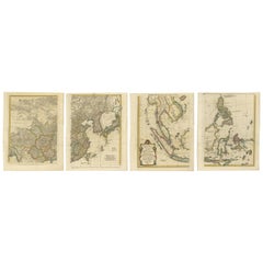
Set of Four Original Antique Maps of Asia by Bolton & Seale, circa 1770
Located in Langweer, NL
Set of four antique maps of Asia:
1) Asia plate 6, Part of China, Tibet and Tartary
2) Asia plate 2, Japan, Corea, the Monguls and part of China
3) As...
Category
Antique Late 18th Century Maps
Materials
Paper
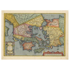
Antique Map of Greece from Ortelius's Theatrum Orbis Terrarum, 1595
Located in Langweer, NL
Original antique map titled "Graecia Sophiani." This is a very detailed and decorative engraved map, with two decorative cartouches and a hand-colored initial on the verso, from Abra...
Category
Antique 16th Century Maps
Materials
Paper
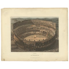
Set of 5 Antique Prints of Ancient Buildings in Rome and its Vicinity, 1844
Located in Langweer, NL
Beautiful set off of 5 aquatint prints of old Rome, Italy, including the popular view of the Coliseum.
Matthew Dubourg (active 1786 – 1838)
From "Views of the Remains of Ancient Bu...
Category
Antique Mid-19th Century European Prints
Materials
Paper
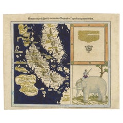
Renaissance Mapping of Sumatra: Featuring Singapore in Münster’s Woodcut, c.1590
Located in Langweer, NL
Description: Antique map titled 'Sumatra ein grosse Insel / so von den alten Geographen Taprobana genennt worden'. Beautiful map of Sumatra and the southern part of Malaysia, with Si...
Category
Antique 16th Century Maps
Materials
Paper
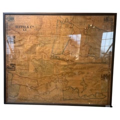
Framed Mid-19th Century Wall Map of Long Island, the Hamptons
Located in Sag Harbor, NY
A Framed museum quality find. This large wall map dates to the mid-1800s. Detailed inset maps of, Sag Harbor, East Hampton, Amagansett, Shelter Island and most villages in Long Island. It also has agriculture stats for 1855. Detailed prints of homes on Scuttle Hole in Bridgehampton as well as several other detailed prints. Lists of businesses, distance tables and railroad schedules and stops. The total amount of detailed information about Suffolk County Long Island is staggering. A unique rare New York map...
Category
Antique Mid-19th Century American Maps
Materials
Linen, Paper
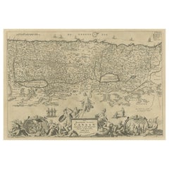
Antique Map of Israel Filled with Biblical Scenes, Published in 1748
Located in Langweer, NL
Antique map Holy Land titled 'Het beloofde landt Canaan doorwandelt van onsen Saligmaker Jesu Christo neffens zyne Apostelen'.
Antique map of Israel ...
Category
Antique 1740s Maps
Materials
Paper
Large 1693 Maritime Map of Irish Sea, West Coasts of Ireland, England, Scotland
Located in Langweer, NL
This is a historical sea chart titled "Carte Generale des Costes d'Irlande, et des Costes Occidentales d'Angleterre avec une Partie de celles d'Ecosse," which translates to "General Map of the Coasts of Ireland and the Western Coasts of England with a Part of Scotland."
The map was first published in 1693 in the atlas "La Neptune Francois," created by Jaillot and published by Pieter Mortier in Amsterdam. This initiative was started by the French minister Colbert to improve maritime navigation.
Details of the Map:
1. **Geographical Coverage:**
- The map primarily focuses on the Irish coast.
- It also includes the west coast of England and Wales.
- Parts of the west coast of Scotland are also depicted.
2. **Inset Map:**
- There is a detailed inset map showing the area around Chester and the course of the River Dee.
3. **Features:**
- **Depth Soundings:** The Irish Sea is detailed with depth soundings to assist in navigation.
- **Coastal Towns and Islands:** Numerous coastal towns, islands, and geographical features are indicated.
- **Rhumb Lines:** The map includes extensive rhumb lines, which are lines used by navigators to plot a straight-line course.
- **Key:** There is a key describing the quality of the terrain along the coast, important for navigators to understand the nature of the coastal landscape.
4. **Labels and Annotations:**
- **Coastal Settlements:** Ports, forts, and villages along the coast are labeled.
- **Geographical Features:** Islands and other significant features are marked.
5. **Artistic and Practical Elements:**
- The map is printed on thick paper and is hand-colored, reflecting contemporary coloring techniques.
- Detailed lines and soundings are included to help ships navigate around the numerous small islands and narrow inlets safely.
6. **Historical Context:**
- The map was part of a significant French maritime project aimed at improving navigation and charting European waters more accurately.
- It reflects the high level of cartographic skill and knowledge of the late 17th century.
This map would have been a valuable tool for mariners of the time, providing them with crucial information about the coastal features, depth soundings, and safe passage routes around the complex coastlines of Ireland, England, and Scotland.
About the Makers and the Atlas
**1. Alexis-Hubert Jaillot (1632-1712):**
- **Background:** Jaillot was a prominent French cartographer and publisher in the 17th century. He was known for his detailed and accurate maps and atlases.
- **Work:** He collaborated with other notable cartographers of his time and played a key role in improving and publishing detailed maps. Jaillot's work was characterized by its precision and artistic quality.
- **Contribution:** He was instrumental in the creation of "La Neptune Francois," a maritime atlas aimed at improving French naval navigation.
**2. Pieter Mortier (1661-1711):**
- **Background:** Mortier was a Dutch engraver, publisher, and mapmaker based in Amsterdam. He was well-known for his high-quality prints and maps.
- **Work:** Mortier published several important atlases and maps, often collaborating with other cartographers and engravers. His work was recognized for its detailed craftsmanship and accuracy.
- **Contribution:** Mortier published "La Neptune Francois" in Amsterdam, making significant contributions to maritime navigation by providing highly detailed sea charts.
About the Atlas "La Neptune Francois":
**1. Purpose:**
- The atlas was created as part of an initiative led by Jean-Baptiste Colbert, the French minister of finance under King Louis XIV. The goal was to enhance the accuracy and availability of maritime charts for French naval and commercial vessels.
- "La Neptune Francois" was designed to be a comprehensive and detailed reference for navigators, covering various European waters with a focus on the French coast and adjacent regions.
**2. Content:**
- The atlas includes a series of sea charts, each providing detailed information on coastal regions, depth soundings, rhumb lines, and other navigational aids.
- The maps were printed on high-quality paper and hand-colored, reflecting the artistic standards of the time.
**3. Historical Significance:**
- "La Neptune Francois" was a landmark in the history of cartography, representing a significant advancement in the accuracy and detail of maritime maps...
Category
Antique 1690s Maps
Materials
Paper
Antique Map of Persia with Dedication Cartouche
Located in Langweer, NL
Antique map titled 'Persia sive Sophorum Regnum'. Original old map of Persia. The map extends from the Eastern Mediteranian to Tacalistan and the Indus River and the Dalanguer Mounta...
Category
Antique Mid-17th Century Maps
Materials
Paper
Antique plan of Ayutthaya, the capital of Siam, Thailand
Located in Langweer, NL
Antique map titled 'Judia, De Hoofd-Stad van Siam'. Antique plan of Ayutthaya, the capital of Siam (Thailand). This print originates from 'Oud en Nieuw Oost-...
Category
Antique Mid-18th Century Maps
Materials
Paper
1684 Mallet Map of Amazon River & Kingdom of Amazons – Hand Colored, Miniature
Located in Langweer, NL
This map, titled 'Royaume des Amazones', was created by Alain Manesson Mallet and published in 1684 in a German edition of *Beschreibung des Gantzen Welt-Kreisses*, a renowned work d...
Category
Antique 1680s Maps
Materials
Paper
17th Century Nautical Chart of Skagerrak and Øresund by Johannes van Keulen
Located in Langweer, NL
This map titled *Pascaret van Schager-Rack de Bælt en de Sondt* was created by the prominent Dutch cartographer Johannes van Keulen and published in Amsterd...
Category
Antique Late 17th Century Maps
Materials
Paper
Antique Map of China, Korea, Japan and the Northern Philippines, circa 1780
Located in Langweer, NL
Antique map titled 'Carte de l'Empire de la Chine de la Tartarie Chinoise, et du Royaume de Corée'. Interesting and detailed map of China, Korea, Japan and the Northern Philippines. ...
Category
Antique Late 18th Century Maps
Materials
Paper
Antique Engraving of Malaysia, Brunei, Singapore, Java, Borneo, Sumatra, c.1750
Located in Langweer, NL
Nice decorative and detailed map from the Gulf of Siam and Mindoro to Timo, Java and Sumatra Borneo and Roy de Siam. Large compass rose and nice cartouche.
Title: Carte des Isles ...
Category
Antique Mid-18th Century Maps
Materials
Paper
Antique Map of South America by Philip & Son, 1875
Located in Langweer, NL
Antique map titled 'South America'. Old map of South America. Source unknown, to be determined.
Artists and Engravers: George Philip (1800–1882) was a cartographer, map publisher...
Category
Antique 19th Century Maps
Materials
Paper
Antique Map of the Dusky Bay or Dusky Sound of New Zealand by Captain Cook, 1803
Located in Langweer, NL
Antique map New Zealand titled 'Schets van de Donkere Baai in Nieuw Zeeland 1773'.
Antique map of the Dusky Bay/Dusky Sound of New Zealand....
Category
Antique Early 1800s Maps
Materials
Paper
Vincenzo Coronelli's Colored Map of the New World Western Hemisphere Framed 47"
By Vincenzo Coronelli
Located in Dayton, OH
A Framed Reproduction of Coronelli's Map of the New World, Attributed to Trevor James Company. The map shows the Western Hemisphere including the discoveries made by Abel Tasman in A...
Category
20th Century Maps
Materials
Paper
Bird's-Eye View of Blâmont in Lorraine by Braun and Hogenberg, 1597
Located in Langweer, NL
Title: Bird's-Eye View of Blâmont in Lorraine by Braun and Hogenberg, 1597
This copperplate engraving, published in 1597 by Braun and Hogenberg, depicts a bird's-eye view of the t...
Category
Antique 16th Century Maps
Materials
Paper
Mercator's Ptolemaic Map of Ancient Assyria, Media, and Persia
Located in Langweer, NL
This map, "Asiae I Tab:", features the region corresponding to modern-day Iran and Iraq, intricately depicted in Gerard Mercator's edition of Claudius Ptolemy's "Tabulae Geographicae...
Category
Antique 16th Century Maps
Materials
Paper
Captain Cook's Encampment in Australia where The Endeavour was Beached, 1803
Located in Langweer, NL
Antique print Australia titled 'Gezigt van de Rivier Endeavour op de Kust van Nieuw-Holland'.
View of an encampent on the shore of the Endeavour river on the coast of Australia where the Endeavour boat was beached. Originates from 'Reizen Rondom de Waereld door James Cook (..)'.
HMS Endeavour was a British Royal Navy research vessel that Lieutenant James Cook commanded to Australia and New Zealand on his first voyage of discovery from 1768 to 1771.
She was launched in 1764 as the collier Earl of Pembroke, with the Navy purchasing her in 1768 for a scientific mission to the Pacific Ocean and to explore the seas for the surmised Terra Australis Incognita or "unknown southern land". Commissioned as His Majesty's Bark Endeavour, she departed Plymouth in August 1768, rounded Cape Horn and reached Tahiti in time to observe the 1769 transit of Venus across the Sun. She then set sail into the largely uncharted ocean to the south, stopping at the islands of Huahine, Bora Bora, and Raiatea west of Tahiti to allow Cook to claim them for Great Britain. In September 1769, she anchored off New Zealand, becoming the first European vessel to reach the islands since Abel Tasman's Heemskerck 127 years earlier.
In April 1770, Endeavour became the first European ship to reach the east coast of Australia, with Cook going ashore at what is now known as Botany Bay. Endeavour then sailed north along the Australian coast. She narrowly avoided disaster after running aground on the Great Barrier Reef, and Cook had to throw her guns overboard to lighten her. Endeavour was beached on the Australian mainland for seven weeks to permit rudimentary repairs to her hull. Resuming her voyage, she limped into port in Batavia in October 1770, her crew sworn to secrecy about the lands that they had visited. From Batavia Endeavour continued westward, rounded the Cape of Good Hope on 13 March 1771 and reached the English port of Dover on 12 July, having been at sea for nearly three years.
The ship was largely forgotten after her Pacific voyage, spending the next three years hauling troops and cargo to and from the Falkland Islands. She was renamed in 1775 after being sold into private hands, and used to transport timber from the Baltic. Rehired as a British troop transport during the American War of Independence, she was finally scuttled in a blockade of Narragansett Bay, Rhode Island in 1778. Historical evidence indicates the ship was sunk just north of Goat Island in Newport Harbor, along with four other British transports.
Relics from Endeavour are displayed at maritime museums worldwide, including an anchor and six of her cannon. A replica of Endeavour was launched in 1994 and is berthed alongside the Australian National Maritime Museum in Sydney Harbour. The NASA Space Shuttle...
Category
Antique Early 1800s Prints
Materials
Paper
Antique Map of West Canada by Tallis 'c.1850'
Located in Langweer, NL
Antique map titled 'West Canada'. Original antique map of West Canada, with decorative vignettes titled Kingston and Falls of Niagara. This map originates from 'The History and Topog...
Category
Antique Mid-19th Century Maps
Materials
Paper
Large European 1930's Nautical Map Reader Magnifying Glass
Located in Haddonfield, NJ
This European set of two nautical magnifying glass map-readers are quite unusual and rarely found. It is fully encased in it's heavy wooden and metal enforced box. Hailing from betwe...
Category
Vintage 1930s German Industrial Nautical Objects
Materials
Metal
Old World Map Featuring Captain Cook's Exploration Routes and Polar Views, 1787
Located in Langweer, NL
1786 World Map with Polar Projections - "Globo Terrestre" by Giovanni Maria Cassini
This 1786 map titled "Globo Terrestre" by Giovanni Maria Cassini offers a fascinating and detai...
Category
Antique 1860s Maps
Materials
Paper
Roman Italy and Provinces: A Cartographic Snapshot, 1880
Located in Langweer, NL
The map titled "ITALIA, Gallia Cisalpina, Sicilia, Sardinia, Corsica" focuses on Italy and its surrounding regions during Roman times. It offers a detailed depiction of the Italian peninsula, the Po Valley (Gallia Cisalpina), and the islands of Sicily, Sardinia, and Corsica.
Produced as part of the "Spruner-Menke Atlas Antiquus" by Karl Spruner von Merz and edited by Theodorus Menke, this map reflects the 19th-century European scholarship on ancient geography and history.
The period represented is likely during the Roman Republic or early Roman Empire, suggested by the level of detail in regions like Latium and Campania, which were central to Roman culture and power. This era was marked by Roman expansion and consolidation of the Italian peninsula, as well as the Punic Wars, which led to Roman dominance over the Mediterranean.
What makes this map interesting is its:
1. **Rich Detail**: The map delineates the intricate network of Roman roads, cities, and colonies, showing the infrastructure that facilitated Roman administration and control.
2. **Strategic Locations**: It identifies strategic locations like harbors and passes, crucial for trade and military campaigns.
3. **Geographic Accuracy**: It reflects the geographical knowledge of the time, with an accurate representation of the topography that shaped the development of these regions.
4. **Cultural and Historical Sites**: Insets of important sites like Syracuse offer a closer look at places of historical significance.
5. **Educational Purpose**: The map was designed to aid in the study of Roman history, providing a visual tool for understanding the ancient world...
Category
Antique 1880s Maps
Materials
Paper
Antique Map of Independent Tartary by W. G. Blackie, 1859
Located in Langweer, NL
Antique map titled 'Turkestan or Independent Tartary'. Original antique map of Turkestan or Independent Tartary. This map originates from ‘The Imperial Atlas of Modern Geography’. Pu...
Category
Antique Mid-19th Century Maps
Materials
Paper
Antique Print of the City of Rome, Italy by Münster, C.1580
Located in Langweer, NL
Antique print titled 'Abbildung der Statt Rom/wie sie under Keyser Vespasiano und zu Plinii zeiten gewesen'. Woodcut of ancient Rome. This print originates from Munster's Cosmographi...
Category
Antique 16th Century Prints
Materials
Paper
Antique Map of the City of Paris by Tirion '1763'
Located in Langweer, NL
Antique map titled 'Nieuwe Kaart der platte Grond van de Stad Parys (..)'. Beautiful city plan of Paris, France. This map originates from 'Nieuwe en Beknopte Hand-Atlas, bestaande in...
Category
Antique Mid-18th Century Maps
Materials
Paper
Rare Antique Engraving with Three Unique Views of Iran, 1711
Located in Langweer, NL
Antique print titled 'Karavane by het dorp Coraming - Brug over de rivier Kiesilosan - Het Dorp 't Sargabrand'. Old print with three views, two of which unidentified villages in Iran, and a bridge over the Kiesilosan river. This print originates from 'Cornelis de Bruins...
Category
Antique 18th Century Prints
Materials
Paper
Ancient Italy: Regions and Rome in the Roman Empire, Published in 1880
Located in Langweer, NL
This print is an original detailed map titled "ITALIAE REGIONES I VII VIII IX XI," representing the regions of ancient Italy.
Key Features of the Print:
1. **Regional Demarcations...
Category
Antique 1880s Maps
Materials
Paper
Circa 1691 Frederick de Wit Map: Middle East with Arabia, Persia & More
Located in Langweer, NL
Circa 1691 Frederick de Wit Map: Middle East with Arabia, Persia & More
This exquisite hand-colored map, circa 1691, by Frederick de Wit, illustrates the Middle East, spanning from Turkey and Egypt to Afghanistan, with a detailed representation of the Arabian Peninsula.
The map's detailing in Arabia is based on Nicolas Sanson's influential 1654 map, which was one of the most accurate and detailed depictions of the region up to the mid-seventeenth century.
The decorative title cartouche is richly adorned with images of exotic figures, animals, and a merchant ship, symbolizing the region's historical trade importance. Additionally, a mapmaker is shown working with traditional tools, adding a touch of authenticity to the cartographic art.
This is the fourth state of the map, published between 1691 and 1696. The map measures 21.8 inches in width by 18.5 inches in height, featuring a sharp impression, with minimal staining and a carefully repaired centerfold separation at the bottom.
Keywords:
- Middle East historical map
- Frederick de Wit map
- 17th century maps
- Arabian Peninsula map
- Persia (Iran) map
- Turkey and Egypt map...
Category
Antique 1690s Maps
Materials
Paper
Antique Map of Switzerland by J. Tallis, circa 1851
Located in Langweer, NL
A decorative and detailed mid-19th century map of Switzerland which was drawn and engraved by J. Rapkin (vignettes by A. H. Wray & J. B. Allen) and published in John Tallis's Illustr...
Category
Antique Mid-19th Century Maps
Materials
Paper
Decorative Antique Print of Nice Near Mont Boron in France, c.1865
Located in Langweer, NL
Antique print titled 'Nice, vue prise de l'extremité du Mont Boron'. View of the city of Nice, near Mont Boron, France. This print originates from 'Nice Et Savoie, Sites Pittoreques,...
Category
Antique 19th Century Prints
Materials
Paper
Antique Map of South Sweden 'Scandinavia' by F. de Wit, 1680
Located in Langweer, NL
Antique map titled 'Accurata Scaniae, Blekingae et Hallandiae Descriptio per F. de Wit Amstelodami'. This map shows South Sweden with an inset of Halmstad and vicinity. Contemporary ...
Category
Antique Late 17th Century Maps
Materials
Paper
1667 Melchior Tavernier Map of the Patriarchate of Constantinople – Black Sea, G
Located in Langweer, NL
This 1667 map titled "Patriarchatus Constantinopolitani Geographica Descriptio" was crafted by renowned French cartographer Melchior Tavernier, who was a prominent map engraver during the 17th century. This rare and historically significant map focuses on the territories under the ecclesiastical jurisdiction of the Patriarchate of Constantinople, one of the most important centers of the Eastern Orthodox Church.
It covers regions around the Black Sea (Pontus Euxinus), parts of Greece, and adjacent areas in Asia Minor and the Balkans, which were historically vital during the Byzantine and Ottoman Empires. The map is filled with ancient place names, making it a valuable resource for both historical and cartographic enthusiasts.
Key Features:
- Antique ecclesiastical map illustrating the influence of the Orthodox Patriarchate of Constantinople in the 17th century.
- Features beautifully detailed ancient coastlines, rivers, and terrains, providing a comprehensive geographical view of the region.
- Rich with historic place names - like Byzantium, Nicomedia, Nicaea, Cyzicus, Bithynia, Pontus, Macedonia, and Thrace - that date back to the classical era, offering insights into the ancient geography of the eastern Mediterranean.
- A finely engraved strapwork cartouche in the lower right corner with Baroque-style decoration, featuring two putti (cherubic figures) – a hallmark of 17th-century map art.
- The map extends to include the Mediterranean Sea (Mare Mediterraneum) to the south and the Black Sea to the north, highlighting its ecclesiastical and geopolitical significance.
- Original hand coloring may still be present, enhancing the decorative appeal for collectors of antique maps.
This rare map offers a unique perspective on the religious influence and historical geography of the Eastern Mediterranean during the late 17th century. It would appeal to collectors interested in:
- **Byzantine history**
- **Ottoman Empire**
- **Eastern Orthodox Church**
- **Antique cartography...
Category
Antique 1660s Maps
Materials
Paper
Antique Map of South America by De la Harpe '1780'
Located in Langweer, NL
Antique map titled 'Carte de l'Amerique Méridionale'. Original antique map of South America. Note the 'Laguna de Xarayes' is illustrated as the source of the Paraguay river. The laguna is now known as Pantanal, world's largest tropical wetland area. This map orginates from 'Abrégé de l'histoire générale des Voyages' by J.F. de la Harpe.
Category
Antique Late 18th Century Maps
Materials
Paper
Rare 1681 Map of Batavia: Detailed Dutch Colonial Era Cartography, 1681
Located in Langweer, NL
The map of Batavia (modern-day Jakarta) from 1681, attributed to Frederick de Wit holds significant historical importance for several reasons:
Historical Context
1. Colonial Era: This map dates back to the Dutch colonial era when Batavia served as the administrative and commercial hub of the Dutch East India Company (VOC). The VOC was a powerful trading entity that played a crucial role in the global spice trade and colonization in Southeast Asia.
2. Strategic Importance: Batavia was strategically located on the northwestern coast of Java, providing the Dutch with a critical base for their maritime operations. The city became the center of Dutch political and military control in the region.
Cartographic Significance
1. Detailed Urban Layout: The map meticulously details the layout of Batavia, including its fortifications, canals, streets, and significant buildings. This level of detail provides insights into the urban planning and architectural styles of the period.
2. Military Engineering: The fortifications shown on the map illustrate the advanced military engineering techniques used by the Dutch to protect their valuable colony. The walls, bastions, and moats indicate the strategic considerations taken to defend against potential invasions.
3. Maritime Activity: The depiction of ships in the harbor highlights Batavia's role as a major maritime center. The VOC's fleets were essential for trade routes connecting Europe, Africa, and Asia, making Batavia a crucial node in global commerce.
Artistic and Cultural Value
1. Artistic Elements: The decorative elements, such as the lion holding a shield and the intricate cartouches, reflect the artistic trends of Dutch Golden Age cartography. These embellishments were not only informative but also served to display the cartographer's skill and the map's prestige.
2. Cultural Exchange: Maps like this one provide evidence of cultural exchange between the Dutch and the indigenous populations of Java. The blending of Dutch and local influences can be seen in various aspects of the map and the architecture of the city.
Rarity and Preservation
1. Rarity: Maps from the 17th century, especially those in good condition, are relatively rare and highly valued by collectors and historians. Each map provides a unique snapshot of historical geography and urban development.
2. Preservation of History: This map serves as a historical document, preserving knowledge about Batavia's cityscape, infrastructure, and colonial governance. It helps historians and scholars understand the socio-economic and political dynamics of the period.
Conclusion
The map of Batavia from 1681 is special due to its detailed depiction of one of the most important colonial cities in Southeast Asia during the Dutch Golden Age. It reflects the strategic, economic, and cultural significance of Batavia, serving as a valuable resource for understanding the history of Dutch colonialism and its global impact. The map's artistry and precision make it an important artifact in the history of cartography.
---------------
The map is an original and historical map of Batavia (present-day Jakarta) on the island of Java, dated 1681. There are several details to consider when evaluating its origins and possible authorship:
1. **Style and Detail**: The intricate details and style are reminiscent of maps created by Frederick de Wit, a prominent Dutch cartographer and engraver of the 17th century. He was known for his detailed city maps and sea charts.
2. **Lack of Signature**: The absence of "F. de Wit, Excudit" could indicate either an omission or a different engraver. However, it is essential to note that some maps from that period were reproduced or copied by other engravers and cartographers. This was not uncommon, as map-making was a collaborative effort, and copies of popular maps were frequently made.
3. **Map Characteristics**:
- The depiction of ships and the detailed fortifications are typical of Dutch cartography in the late 17th century.
- The decorative elements, such as the lion holding a shield, are also characteristic of Dutch map engravers.
4. **Other Possible Engravers**: While Frederick de Wit is a strong candidate, other notable Dutch engravers from that period include Joan Blaeu and Willem Janszoon Blaeu. They also produced highly detailed maps and could potentially be the creators or inspirers of this map.
To determine the precise authorship, you might consider:
- **Comparing** this map with other confirmed works of Frederick de Wit and his contemporaries to identify stylistic similarities and differences.
- **Historical Records**: Consulting historical records or publications related to Dutch cartography in the 17th century might provide more context or even direct references to this particular map.
If you have access to additional details or higher-resolution images of specific sections, it might help further pinpoint the map's origin and authorship.
-------------
Frederick de Wit (1629–1706) was a prominent Dutch cartographer, engraver, and publisher known for his detailed and decorative maps, atlases, and globes. He played a significant role in the Dutch Golden Age of cartography, contributing to the wealth of geographic knowledge and artistic achievement during this period. Here are key aspects of his life and work:
### Biography
- **Early Life**: Frederick de Wit was born in Gouda, Netherlands, in 1629. Little is known about his early years, but he moved to Amsterdam, the epicenter of Dutch cartography, in the mid-17th century.
- **Career Beginnings**: De Wit began his career as an engraver and publisher, initially producing maps that were reissues of earlier works by other cartographers, such as Joan Blaeu and Willem Janszoon Blaeu.
### Contributions to Cartography
- **Mapmaking**: De Wit was known for his meticulous attention to detail and artistic flair. He produced a wide range of maps, including world maps, regional maps, city plans, and maritime charts...
Category
Antique 1680s Maps
Materials
Paper
Antique Map of Venezuela by Montanus, 1671
By Arnoldus Montanus
Located in Langweer, NL
Antique map titled 'Venezuela cum parte Australi Novae Andalusiae'. The map extends from Coquibocoa to the Orinoque River, centered on Bariquicemento and Cape de Curiacao. Large cart...
Category
Antique Mid-17th Century English Maps
Materials
Paper
Antique Map of Prussia by Blaeu, circa 1635
By Willem Blaeu
Located in Langweer, NL
Antique map titled 'Prussiae Nova Tabula'. Rare early edition of Blaeu's map of Prussia, embellished with a gorgeous large format cartouche, compass ros...
Category
Antique Mid-17th Century Maps
Materials
Paper
Original Antique Map of Canaan, Armenia, Syria, Mesopotamia and Arabia, 1709
Located in Langweer, NL
Antique map titled 'Descriptio Paradisi et Terrae Canaan'.
Original antique map of Canaan, Armenia, Syria, Mesopotamia and Arabia. It displays the Middle East from the eastern Mediterranean Sea to the Persian Gulf...
Category
Antique Early 1700s Maps
Materials
Paper
Old German Antique Map of Iran and Arabia, 1866
Located in Langweer, NL
Antique map titled 'Vorder-Asien oder Iran, Turan, Arabien, Kleinasien und die Kaukasus Länder'. Large map centered on Iran. It shows the area from Turkey to Mumbai in India. Include...
Category
Antique 19th Century Maps
Materials
Paper
Antique Map of the Savoy and Piedmont Regions, Centered on Torino, ca.1735
Located in Langweer, NL
Antique map titled 'Ducatus Sabaudiae, Principatus Pedemontium et ducatis Montisferrati (..).'
Map of the Savoy and Piedmont regions, centered on Torino. The map coverage extends...
Category
Antique 1730s Maps
Materials
Paper
1825 Buchon Map of Puerto Rico & Virgin Islands with Detailed Colonial History
Located in Langweer, NL
This map of Puerto Rico and the Virgin Islands, published by Jean Alexandre Buchon in 1825, offers a unique look at the Caribbean during a time of E...
Category
Antique 1820s Maps
Materials
Paper
Antique Map of Persia, Georgia and Kazakhstan, ca.1780
Located in Langweer, NL
Antique map titled 'Carte de la Perse, de la Georgie, et de la Tartarie Independante'.
Map of Persia, Georgia and Kazakhstan. This map shows current days Georgia, Iran, Irak, Kaz...
Category
Antique 1780s Maps
Materials
Paper
Hand-Colored Map of West India Islands: St. Christopher's, St. Lucia and Nevis
Located in Langweer, NL
This map, titled "West India Islands," was published by John Thomson & Co. in 1821 as part of *Thomson's New General Atlas.* The map offers detailed depictions of three key islands i...
Category
Antique 1820s Maps
Materials
Paper
Antique Map of The United States of North America, Pacific States, 1882
Located in Langweer, NL
The map is from the same 1882 Blackie Atlas and focuses on the Pacific States of the United States of America during that period. Here are some details and historical context about t...
Category
Antique 1880s Maps
Materials
Paper
1802 Map of Australasia and the South Pacific - European Exploration Routes
Located in Langweer, NL
1802 Johann Walch Map of Australasia and the South Pacific - European Exploration Routes
This 1802 map by Johann Walch provides a highly detailed view of Australasia and the South P...
Category
Antique Early 1800s Maps
Materials
Paper
Rare Hand-Colored Antique Map of Asia, 1788
Located in Langweer, NL
Antique map titled 'Kaartje van Asia'.
Original antique map of Asia. This map originates from 'Nieuwe Natuur- Geschied- en Handelkundige Zak- en Reisatlas' by N.T. Gravius, 1788....
Category
Antique 1780s Maps
Materials
Paper
Antique Map of the United States of North America, c.1882
Located in Langweer, NL
Antique map titled 'United States of North America'. Old map of the United States of North America. This map originates from 'The Royal Atlas of Modern Geography, Exhibiting, in a Se...
Category
Antique 1880s Maps
Materials
Paper
1930s AM Radio Map of US, Canada, Cuba, Mexico – Stations & Frequencies
Located in Langweer, NL
Title: 1930s Lewis Bros. Limited Detailed Radio Station Map of the United States and Canada – AM Stations, Call Signs, Frequencies, Vintage Advertising
Detailed Description: This v...
Category
Vintage 1930s Maps
Materials
Paper
Historical Large Map of Kyoto, Japan (1905) - Published by Kobayashi
Located in Langweer, NL
Old map of Kyoto, Japan. Published by Kobayashi, 1905.
This is an old map of Kyoto, Japan, published by Kobayashi in 1905. The map showcases a detailed layout of Kyoto during the ea...
Category
Early 20th Century Maps
Materials
Paper
Original Antique Map of the Western Part of NEW MEXICO & CALIFORNIA
Located in Langweer, NL
Title: "Map of the Western Part of NEW MEXICO and CALIFORNIA According to the Latest Discoveries by the Jesuits and Others"
Description:
This exquisite original Dutch map, titled "...
Category
Antique 1760s Maps
Materials
Paper
Vintage Oversized New York City Lower Manhattan 1840s Map Print
Located in Dayton, OH
Vintage late 20th century reproduction print of New York City featuring lower Manhattan in 1840.
Category
Late 20th Century Victorian Maps
Materials
Paper
Antique Print of Hanseatic City of Lübeck in Northern Germany by Merian, c.1650
Located in Langweer, NL
Antique print titled 'Lubecca, Lübeck'. A bird's eye view of Lubeck, the northern German city in Schleswig-Holstein. This print originates from 'Topographia Saxoniae Inferioris'.
Ar...
Category
Antique 17th Century Prints
Materials
Paper
Map of French Colonies in the Americas: St. Martin, French Guiana and St. Pierre
Located in Langweer, NL
This is an intricately detailed map from 1852 titled *Colonies Françaises en Amérique*, depicting several key French colonies in the Americas.
The map focuses on regions such as Fr...
Category
Antique 1850s Maps
Materials
Paper
Antique Map of America by Vaugondy, 1778
Located in Langweer, NL
Antique map titled 'Amerique ou Indes Occidentales (..)'. Vaugondy's map of America, pre-dating information from any of the Cook Voyages. The NW Coast of Amer...
Category
Antique Late 18th Century Maps
Materials
Paper
Navigating the Spice Trade: A Maritime Chart of the Banda Sea, 1799
Located in Langweer, NL
This original antique map is an 18th-century nautical chart by Laurie & Whittle, a well-known British firm that was involved in the publication of maps, charts, and maritime books. ...
Category
Antique Late 18th Century Maps
Materials
Paper
Large 1695 Hand-Colored Engraved Map of Gascony (Gascogna), France
Located in Langweer, NL
This map, created by Giacomo Cantelli da Vignola in 1695, represents the "General Government of Guyenne and Gascony" in southwest France. Cantelli da Vignola was a renowned Italian c...
Category
Antique 1690s Maps
Materials
Paper
Old Map of the Chinese Empire and Japan, 1882
Located in Langweer, NL
An original antique map titled "The Chinese Empire and Japan," dating from an 1882 atlas by Blackie & Son. It is a color map with geographical features such as mountain ranges, river...
Category
Antique 1880s Maps
Materials
Paper
Map of Polynesia Highlighting Cultural Landscapes and Maritime Activities, 1851
Located in Langweer, NL
John Tallis & Company was a London-based map publisher that flourished during the 19th century. Their maps, characterized by elaborate borders and decorative vignettes, are some of t...
Category
Antique 1850s Maps
Materials
Paper
