Maps on Sale
to
4,213
18
4,236
1
3
2
2
1
1
1
1
2,336
1,669
231
1
129
12
1
66
1
3
4
2
4,227
10
8
7
7
127
35
32
29
27
4,237
4,237
4,237
104
56
18
13
11
Sale Items
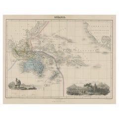
Old Map of the Oceans Around Australia, Indonesia and New Zealand, 1880
Located in Langweer, NL
Antique map titled 'Océanie'.
Old map of the oceans around Australia, Indonesia and New Zealand. With vignettes of people from Polynesia and the old monument Laparouse. This map ...
Category
Antique 1880s Maps
Materials
Paper
$209 Sale Price
20% Off
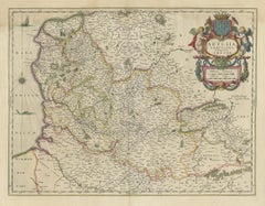
Antique Map of Artois in the North of France by Famous Mapmaker Blaeu, c.1640
Located in Langweer, NL
Antique map titled 'Artesia Comitatus Artois'. Map of Artois or Artesia, France. Artois is former province located in the northwestern part of France, boarding Belgium (Flanders) on ...
Category
Antique 17th Century Maps
Materials
Paper
$456 Sale Price
20% Off
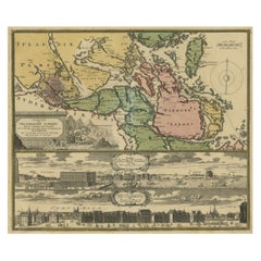
Original Old Map East of Stockholm, the Island Ljusterö and Värmdö, Sweden, 1720
Located in Langweer, NL
Antique map titled 'Accurate Carte der Upländischen Scheren mit der Situation und Gegend umb die Konigle Schwedisch Haupt und Residentz Stadt Stockholm.'
Map of the area east of ...
Category
Antique 1720s Maps
Materials
Paper
$1,094 Sale Price
20% Off
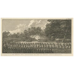
De Natsche – Ceremony for the King's Son, Tonga c.1795
Located in Langweer, NL
De Natsche – Ceremony for the King's Son, Tonga c.1795
This antique print depicts a grand ceremony held in honour of the son of the King of Tonga, known as the Natsche, in the villa...
Category
Antique Early 1800s European Prints
Materials
Paper
$561 Sale Price
20% Off
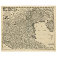
Antique Map of the Region of Venice, Italy by F. De Wit, circa 1700
Located in Langweer, NL
Antique map of the Dominion of Venice, extending from Stato di Milano and Genoa to Istria. Including Lake Garda, Venice and Istria.
Category
Antique Early 18th Century Maps
Materials
Paper
$561 Sale Price
20% Off
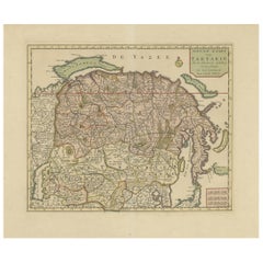
Antique Map of Siberia and Chinese Tartary, Incl Nova Zembla, ca.1732
Located in Langweer, NL
Antique map of Tartary titled 'Nieuwe Kaart van Tartarie na de alderlaatste ondekking int ligt gebracht tot Amsterdam door Isaak Tirion'.
Map op Siberia and Chinese tartary. In t...
Category
Antique 1730s Maps
Materials
Paper
$818 Sale Price
20% Off
Antique Map of Denmark and Southern Sweden, c.1658
Located in Langweer, NL
Antique map titled 'Royaume de Danemarq.' Map centered on Sjaelland and covers all of Denmark and part of southern Sweden where a dramatic title cartouche obscures the interior. Sour...
Category
Antique 17th Century Maps
Materials
Paper
$256 Sale Price
20% Off
Antique Map of the German Empire by Levasseur, '1875'
Located in Langweer, NL
Antique map titled 'Carte générale de l'Europe Centrale (..)'. Large map of the German Empire. This map originates from 'Atlas de Géographie Moderne Phys...
Category
Antique Late 19th Century Maps
Materials
Paper
$380 Sale Price
20% Off
Old Map of the Western Part of Central Europe, c.1680
Located in Langweer, NL
Antique map titled 'Carta nova accurate del Passagio et strada dalli Paesi Bassi'. Old map of the western portion of Central Europe. Oriented to the Northeast.
Artists and Engrav...
Category
Antique 17th Century Maps
Materials
Paper
$356 Sale Price
20% Off
Antique Map of the Prussian Monarchy by Levasseur, '1875'
Located in Langweer, NL
Antique map titled 'Carte générale de la Monarchie Prussienne (..)'. Large map of the Prussian Monarchy. This map originates from 'Atlas de Géographie Moderne Physique et Politique' ...
Category
Antique Late 19th Century French Maps
Materials
Paper
$333 Sale Price
30% Off
Antique Genealogy Chart of the Landgraviate Hessen-Kassel, Germany, 1732
Located in Langweer, NL
Antique print titled 'Genealogie de la Maison de Hesse Cassel'. Chart of the genealogy of the Landgraviate Hessen-Kassel / Hesse-Cassel. This includes the coats of arms of both Hesse-Cassel and Hesse-Darmstadt. This print orginates from 'Atlas Historique'.
The Landgraviate of Hesse-Kassel (German: Landgrafschaft Hessen-Kassel), spelled Hesse-Cassel during its entire existence, was a state in the Holy Roman Empire that was directly subject to the Emperor. The state was created in 1567 when the Landgraviate of Hesse was divided upon the death of Philip I, Landgrave of Hesse. His eldest son William IV inherited the northern half of the Landgraviate and the capital of Kassel. The other sons received the Landgraviate of Hesse-Marburg, the Landgraviate of Hesse-Rheinfels and the Landgraviate of Hesse-Darmstadt.
During the Napoleonic reorganisation of the Empire in 1803, the Landgrave of Hesse-Kassel was elevated to an Electorate and Landgrave William IX became an Imperial Elector. Many members of the Hesse-Kassel House served in the Danish military gaining high ranks and power in the Oldenburg realm due to the fact that many Landgraves were married to Danish princesses...
Category
Antique 18th Century Prints
Materials
Paper
$247 Sale Price
20% Off
Antique Map of the Kingdom of Sweden and Norway by Keizer & de Lat, 1788
Located in Langweer, NL
Antique map titled 't Koninkryk van Zweden en Noorwegen'. Uncommon original antique map of the Kingdom of Sweden and Norway. This map originates from 'Nieuwe Natuur- Geschied- en Han...
Category
Antique Late 18th Century Maps
Materials
Paper
$333 Sale Price
20% Off
Antique Map of Scandinavia by Van der Aa 'circa 1710'
Located in Langweer, NL
Antique map titled 'Scandinavie Septentrionale' and 'Scandinavie Meridionale'. Copper engraving with two maps on one sheet. The upper map depicts Northern Scandinavia with Norway, Sw...
Category
Antique Early 18th Century Maps
Materials
Paper
$666 Sale Price
20% Off
Antique Map of Landes ‘France’ by V. Levasseur, 1854
By Victor Levasseur
Located in Langweer, NL
Antique map titled 'Dépt. des Landes'. Map of the French department Landes, France. This area is known for its production of Chalossais, a white cow cheese with a gentle, acidic edge...
Category
Antique Mid-19th Century Maps
Materials
Paper
$171 Sale Price
20% Off
Antique Map of Siberia by Levasseur '1875'
Located in Langweer, NL
Antique map titled 'Carte de la Russie d'Asie Sibérie'. Large map of Siberia. This map originates from 'Atlas de Géographie Moderne Physique et Politique' by A. Levasseur. Published ...
Category
Antique Late 19th Century Maps
Materials
Paper
$380 Sale Price
20% Off
Antique Map of the City of Jerusalem by N. Visscher, 1702
Located in Langweer, NL
Antique map titled 'Die Heylige en Wytvermaerde stadt Jerusalem Eerst Genaemt Salem, Genesis 14 vers 18'. This map originates from 'Biblia. Ouden ende Nieuwen Testaments (..)'. Publi...
Category
Antique Early 18th Century Maps
Materials
Paper
$3,282 Sale Price
20% Off
South Sweden Map with Inset of Halmstad – Antique Map by Frederik de Wit, c.1680
Located in Langweer, NL
South Sweden Map with Inset of Halmstad – Antique Map by Frederik de Wit, c.1680
This richly detailed antique map titled Accurata Scaniae, Blekingae et Hallandiae Descriptio present...
Category
Antique Late 17th Century Dutch Maps
Materials
Paper
$803 Sale Price
20% Off
Antique Map of Prussia by Blaeu, circa 1635
By Willem Blaeu
Located in Langweer, NL
Antique map titled 'Prussiae Nova Tabula'. Rare early edition of Blaeu's map of Prussia, embellished with a gorgeous large format cartouche, compass ros...
Category
Antique Mid-17th Century Maps
Materials
Paper
$685 Sale Price
20% Off
Antique Map of Spain, Mauritia and Africa by H. Kiepert, circa 1870
By Heinrich Kiepert
Located in Langweer, NL
Antique map titled 'Hispania, Mauretania et Africa'. This map originates from 'Atlas Antiquus. Zwölf Karten zur Alten Geschichte' by H. Kiepert. Published in Berlin, circa 1870.
Category
Antique Late 19th Century Maps
Materials
Paper
$142 Sale Price
20% Off
Topographical and Infrastructure Map of the Province of Valencia, 1901
Located in Langweer, NL
A historical map of the province of Valencia, dated 1901. The map includes intricate details such as topographical features, with mountain ranges and river systems prominently marked...
Category
Antique Early 1900s Maps
Materials
Paper
$494 Sale Price
20% Off
Mid-Century World Map Globe Table Light or Lamp
Located in Miami, FL
Good quality world map globe lamp.
If you are looking for stylish and beautiful quality item to upgrade your interior (whether at home or in your office) then this Parisian globe...
Category
Mid-20th Century French Mid-Century Modern Table Lamps
Materials
Chrome
$595 Sale Price
57% Off
English Mahogany Wooden Folio Stand, Map and Document Holder, circa 1820
Located in Hamilton, Ontario
Regency era mahogany wood folio stand rack, map, poster, document holder used in a library, office or den, circa 1820. Folds out to six positions ...
Category
Antique Early 19th Century English Regency Magazine Racks and Stands
Materials
Wood
$5,200 Sale Price
20% Off
Antique Map of Mecklenburg-Vorpommern in Germany by J.B. Homann, c.1720
Located in Langweer, NL
Antique Map of Mecklenburg-Vorpommern by J.B. Homann, c.1720
Old colored antique map of Mecklenburg-Vorpommern by Johann Baptist Homann. This stunning map, titled "Ducatus Meklenbur...
Category
Antique 1720s Maps
Materials
Paper
$513 Sale Price
20% Off
Antique World Map with Astronomical Spheres by Pierre Mortier, Amsterdam, c.1700
Located in Langweer, NL
Antique World Map with Astronomical Spheres by Pierre Mortier, Amsterdam, circa 1700
This fascinating antique world map titled "Carte générale du monde, ou description du monde terr...
Category
Antique 17th Century French Maps
Materials
Paper
$874 Sale Price
25% Off
18th Century Original Dutch Map of Martinique in The West Indies by Isaak Tirion
Located in Langweer, NL
This is an 18th-century Dutch map of Martinique, titled *Het Westindisch Eiland Martinique*. The map was produced by Isaak Tirion, a renowned Dutch cartographer and publisher known for his precise and beautifully crafted maps. The cartouche in the lower left corner, adorned with decorative elements, adds to the aesthetic appeal of the map.
### Key Features:
- Martinique: The map offers detailed topographical information of the island, including mountains, rivers, and settlements.
- Geographical Details: Locations such as Fort Royal, Bay de St. Pierre, and Point de Cloche are marked, showcasing significant features of the island.
- Cartouche: The ornate cartouche, featuring tropical plants, reflects the importance of the island's agricultural production during the colonial period, particularly its sugar plantations.
This map captures Martinique during its time as a French colony and provides valuable insight into the island’s layout and strategic significance in the Caribbean. The attention to coastal detail highlights the importance of Martinique as a hub of maritime activity.
The map’s combination of aesthetic elegance and cartographic precision makes it a remarkable piece for collectors and those interested in Caribbean colonial...
Category
Antique 1760s Maps
Materials
Paper
$418 Sale Price
20% Off
Map of Comitatus Marchia et Ravensberg: Historical Counties in Germany, c.1660
Located in Langweer, NL
Antique map titled 'Comitatus Marchia et Ravensberg'. This map depicts two historical counties of the Holy Roman Empire: Marks and Ravensberg. Major cities, towns, mountains, and riv...
Category
Antique Mid-17th Century Maps
Materials
Paper
$418 Sale Price
20% Off
Decorative Antique Print of Nice Near Mont Boron in France, c.1865
Located in Langweer, NL
Antique print titled 'Nice, vue prise de l'extremité du Mont Boron'. View of the city of Nice, near Mont Boron, France. This print originates from 'Nice Et Savoie, Sites Pittoreques,...
Category
Antique 19th Century Prints
Materials
Paper
$437 Sale Price
20% Off
Cartographic Heritage: The 1901 Map of the Vizcaya Province in Spain
Located in Langweer, NL
This is a historical map of the province of Vizcaya (Biscay) in Spain, dated 1901. The title on the map is "VIZCAYA. 1901." It shows the topographical details of the region with cont...
Category
Antique Early 1900s Maps
Materials
Paper
$304 Sale Price
20% Off
Map of Choromandel & Malabar, Incl Kerala, Tamil Nadu & Part of Sri Lanka, 1726
Located in Langweer, NL
Antique map titled 'Nieuwe kaart van Choromandel ende Malabar.'
Original antique map of Southern India documenting the VOC's areas of influence. Included is Kerala, Tamil Nadu...
Category
Antique 1720s Maps
Materials
Paper
$815 Sale Price
30% Off
Antique Map of the French Coast at Boulogne and Picardy
Located in Langweer, NL
Antique map titled 'Les Costes du Boulenois et de la Picardie'. Map of the French coast at Boulogne and Picardy. Left a large wind rose. Part of a bundled collection of plans of batt...
Category
Antique Early 18th Century Maps
Materials
Paper
$466 Sale Price
20% Off
Antique Map of the of the Course of the Albis River 'or Elbe River'
By Johannes Janssonius
Located in Langweer, NL
Antique map titled 'Albis Fluvius Germaniae celebris A Fontiubus Ad Ostia, Cum Fluminibus ab utroque latere in illum fluenibus descriptus'. Detailed map of the course of the Albis Ri...
Category
Antique Mid-17th Century Maps
Materials
Paper
$570 Sale Price
20% Off
Original Old Map of Northeastern Greece & Northwestern Turkey, Published in 1661
Located in Langweer, NL
This small map was engraved by Petrus Kaerius and is based on Ortelius' map of the same title. It covers the ancient region of Thrace, present-day European Turkey and part of Greece....
Category
Antique 1660s Maps
Materials
Paper
$399 Sale Price
20% Off
Antique Print of the Chinese City of Anhing by Nieuhof, 1668
By Johannes Nieuhof
Located in Langweer, NL
Antique print China titled 'Anhing'. Old print depicting a view on the Chinese city of Anhing with its ramparts. This print originates from the Latin editio...
Category
Antique 17th Century Prints
Materials
Paper
$323 Sale Price
20% Off
Large Antique Map of Delfland by Cruquius, 1712
Located in Langweer, NL
Map no. 20 of a large wall map of Delfland, The Netherlands. The map covers the region of Pijnacker with a large compass rose with allegorical figures a...
Category
Antique 18th Century Maps
Materials
Paper
$704 Sale Price
20% Off
Scare Map of Canaan, with Portraits of the Apostles of Matheaus and Others
Located in Langweer, NL
Antique map titled 'Geographische Beschreibung des Belobten Landes Canaan (..)'. Scarce map of Canaan, with portraits of the Apostles of Matheaus, S. Marcus, S. Lucas, S. Johannes. With Christ in lower part. The map extends along the coast of the eastern Mediterranean. Published by Georg Andreas...
Category
Antique Late 17th Century Maps
Materials
Paper
$418 Sale Price
20% Off
Large Antique County Map of Somersetshire, England
Located in Langweer, NL
Antique map titled 'A Map of Somersetshire from the best Authorities'. Original old county map of Somersetshire, England. Engraved by John Cary. Originates from 'New British Atlas' b...
Category
Antique Early 19th Century Maps
Materials
Paper
$304 Sale Price
20% Off
Large Antique County Map of Essex, England
Located in Langweer, NL
Antique map titled 'A Map of Essex from the best Authorities'. Original old county map of Essex, England. Engraved by John Cary. Originates from 'New Brit...
Category
Antique Early 19th Century Maps
Materials
Paper
$294 Sale Price
20% Off
Large Antique County Map of Northamptonshire, England
Located in Langweer, NL
Antique map titled 'A Map of Northamptonshire from the best Authorities'. Original old county map of Northamptonshire, England. Engraved by John Cary. Originates from 'New British At...
Category
Antique Early 19th Century Maps
Materials
Paper
$266 Sale Price
20% Off
Large Antique County Map of Ruthlandshire, England
Located in Langweer, NL
Antique map titled 'A Map of Ruthlandshire from the best Authorities'. Original old county map of Ruthlandshire, England. Engraved by John Cary. Originates from 'New British Atlas' b...
Category
Antique Early 19th Century Maps
Materials
Paper
$266 Sale Price
20% Off
Large Antique County Map of Cumberland, England
Located in Langweer, NL
Antique map titled 'A Map of Cumberland from the best Authorities'. Original old county map of Cumberland, England. Engraved by John Cary. Originates...
Category
Antique Early 19th Century Maps
Materials
Paper
$152 Sale Price
20% Off
Original Antique Map of the Southern Coast of France by Janssonius, 1657
By Johannes Janssonius
Located in Langweer, NL
Antique map of France titled 'Comté et Gouvernement de Provence'. Decorative map of the southern coast of France. This map originates from 'Atlas Novus,...
Category
Antique 17th Century Maps
Materials
Paper
$685 Sale Price
20% Off
Observatory & Spakaia Church, Beryozovo, Demyanskoye, Tyumen Oblast in Russia
Located in Langweer, NL
Antique print titled 'Vue de l'Observatoire et de l 'Eglise de Spaskaia (..)'. Copper engraving of the Observatory and the Church of Spakaia at Beryozovo on the North side. Below, a ...
Category
Antique 18th Century Prints
Materials
Paper
$275 Sale Price
20% Off
Antique Map of the Old World Projection, Entitled Orbis Terrarum Ad Mentem, 1825
Located in Langweer, NL
Antique map titled 'Orbis Terrarum ad Mentem (..)'. Old map of the world originating from 'Atlas der Oude Wereld'.
Artists and Engravers: Published by C. Ph. Funke and W. van Boe...
Category
Antique 19th Century Maps
Materials
Paper
$209 Sale Price
20% Off
Antique Map of a Hemisphere by Scherer, c.1703
Located in Langweer, NL
Antique map depiciting a horizon/hemisphere. Printed for Scherer's 'Atlas Novus' (1702-1710).
Artists and Engravers: Heinrich Scherer (1628-1704) was a Professor of Hebrew, Mathematics and Ethics at the University of Dillingen until about 1680. Thereafter he obtained important positions as Official Tutor to the Royal Princes...
Category
Antique 18th Century Maps
Materials
Paper
$180 Sale Price
20% Off
Antique Map Depiciting a Horizon or Hemisphere c.1703
Located in Langweer, NL
Antique map depiciting a horizon/hemisphere. Printed for Scherer's 'Atlas Novus' (1702-1710).
Artists and Engravers: Heinrich Scherer (1628-1704) was a Professor of Hebrew, Mathematics and Ethics at the University of Dillingen until about 1680. Thereafter he obtained important positions as Official Tutor to the Royal Princes...
Category
Antique 18th Century Maps
Materials
Paper
$180 Sale Price
20% Off
Antique Print of a Porphyry Vase by Sandberg, c.1864
Located in Langweer, NL
Antique print titled 'Porphyr Vas'. View of the giant Porphyry vase of Rosendal Palace, a Swedish palace pavilion located on Djurgården, an island in central Stockholm. This print or...
Category
Antique 19th Century Prints
Materials
Paper
$64 Sale Price
20% Off
Antique Map of the Region of Bourbon by Janssonius, 1657
Located in Langweer, NL
Antique map of France titled 'Borbonium Ducatus - Bourbonnois'. Decorative map of the Bourbon region. This map originates from 'Atlas Novus, Sive Theatrum Orbis Orbis Terrarum: In qu...
Category
Antique 17th Century Maps
Materials
Paper
$392 Sale Price
20% Off
Antique Print of the 'Korenbeurs' in Amsterdam, c.1760
Located in Langweer, NL
Antique print titled 'Gezicht van de Nieuwe Koren-Beurs tot Amsterdam - Vue de la Nouvelle Bourse (..)'.
Optical print of the 'Korenbeurs' in Amsterdam, the Netherlands. The Korenbeurs (""grain bourse"") was a 17th-century commodity market in Amsterdam where grain was traded. The building stood on the banks of the Amstel, on the western side (Nieuwezijde) of the Damrak. It was directly south of the Oude Brug bridge, on a spot now occupied by the former stock and commodity exchange Beurs van Berlage...
Category
Antique 18th Century Prints
Materials
Paper
$342 Sale Price
20% Off
Antique Print of the Rokin Canal in Amsterdam, The Netherlands, c.1765
Located in Langweer, NL
Antique print titled 'Gezigt langs het Rokin op de Nieuwe-Zyds-Kapel en Beurs'. Original antique print of the 'Rokin' canal in Amsterdam, the Netherlands. Published circa 1765.
Ar...
Category
Antique 18th Century Prints
Materials
Paper
$228 Sale Price
20% Off
Large Antique Map of the Region of Berry, Nivernois & Bourbonnais, France, 1753
Located in Langweer, NL
Antique map titled 'Gouvernements généraux du Berry, du Nivernois et du Bourbonois'.
Large, original antique map of the region of Berry, Nivernois and Bourbonnais, France. Featur...
Category
Antique 1750s Maps
Materials
Paper
$532 Sale Price
20% Off
Original Old Map of St Kitts, Antigua, Bermuda, Barbados, and Jamaica, ca.1745
Located in Langweer, NL
Antique map titled 'Dominia Anglorum in praecipuis Insulis Americae ut sunt Insula S. Christophori, Antegoa, Iamaica, Barbados nec non Insulae Bermudes vel Sommers dictae. Die Englis...
Category
Antique 1740s Maps
Materials
Paper
$1,379 Sale Price
20% Off
Antique Map of France at the End of the Ministry of Cardinal Richelieu, 1765
By G. A. Rizzi-zannoni
Located in Langweer, NL
Antique map France titled 'Etat du Domaine à la fin du Ministère du Cardinal de Richelieu (..)'. Beautiful old map of France. This map originates fr...
Category
Antique 18th Century Maps
Materials
Paper
$140 Sale Price
20% Off
Antique Map of France with Beautiful Title Cartouche and Border, c.1740
Located in Langweer, NL
Antique map titled 'La France suivant les nouvelles Observations de Messrs de l'Academie Royale des Sciences etc.'. Rare map of France with beautiful title cartouche and decorative b...
Category
Antique 18th Century Maps
Materials
Paper
$428 Sale Price
20% Off
Old Map of Gloucestershire by Samuel Lewis 1844 – Gloucester, Cheltenham, Bristo
Located in Langweer, NL
Title: Old Map of Gloucestershire by Samuel Lewis 1844 – Gloucester Cheltenham Bristol Cirencester Tewkesbury
Description:
This antique 1844 map of Gloucestershire was engraved for Samuel Lewis’ Topographical Dictionary of England. It includes major towns such as Gloucester, Cheltenham, Bristol, Cirencester, and Tewkesbury. Roads, rivers, and topographical details are finely engraved, with hand-colored borders marking the county boundaries. The map also shows neighboring counties including Herefordshire, Somerset, Wiltshire, and Oxfordshire. A decorative compass rose completes the elegant composition.
Condition:
The map is in good condition with slight age toning and wide clean margins. The engraved lines remain sharp and the original hand coloring is well preserved. Folding line as issued. No tears or stains are visible.
Framing suggestions:
Use an acid-free mat in ivory or light beige to complement the map’s aged tone. A dark wood, black, or antique gold frame will enhance the historic style. UV-protective glass is recommended for long-term preservation. Ideal for display in a home library, study, or office with a classic interior.
Keywords:
Gloucestershire map 1844 Samuel Lewis antique...
Category
Antique 1840s Maps
Materials
Paper
$180 Sale Price
20% Off
Antique Map of the Kingdom of Denmark by Wyld '1845'
Located in Langweer, NL
Antique map titled 'Kingdom of Denmark'. Original antique map of the Kingdom of Denmark. This map originates from 'An Atlas of the World, Comprehending Separate Maps of its Various C...
Category
Antique Mid-19th Century Maps
Materials
Paper
$154 Sale Price
35% Off
Antique Map of Australia by Levasseur, '1875'
Located in Langweer, NL
Antique map titled 'Carte générale de l'Australie'. Large map of Australia. This map originates from 'Atlas de Géographie Moderne Physique et Politiq...
Category
Antique Late 19th Century Maps
Materials
Paper
$416 Sale Price
30% Off
Antique Map of the Region of Aiguillon by Janssonius, 1657
By Johannes Janssonius
Located in Langweer, NL
Antique map 'Le Duche d'Aiguillon'. Decorative map of the Aiguillon region, France. Located at the confluence of the Lot and Garonne rivers. The map is based on the cartography of Pi...
Category
Antique Mid-17th Century Maps
Materials
Paper
$523 Sale Price
20% Off
Antique Map of the Djati 'teak wood' Forest Near Rembang, Java by Stemler, 1875
By Stemler
Located in Langweer, NL
Antique map titled 'Overzichtskaart van de Djatibosschen in de Residentie Rembang, Java.' This scarce map shows the Djati (teak) Forest on the indonesian island of Java. Originates f...
Category
Antique 19th Century Maps
Materials
Paper
$256 Sale Price
20% Off
Sweden & Norway – Antique Map of Scandinavia with Stockholm Inset, 1865
Located in Langweer, NL
Sweden & Norway – Antique Map of Scandinavia with Stockholm Inset, 1865
This finely detailed antique map titled Sweden & Norway (Scandinavia) offers a comprehensive 19th-century vie...
Category
Antique Mid-19th Century English Maps
Materials
Paper
$261 Sale Price
20% Off
1773 Map of Persia, Gujarat & Malabar Coasts – Arabia to India, Hand-Colored
Located in Langweer, NL
1773 Bellin map of Persia, Gujarat and Malabar coasts with Arabia and Maldives
Description:
This finely engraved and delicately hand-colored 18th-century map titled Kaart van de Kusten van Persië, Guzaratte en Malabar was produced by the eminent French cartographer Jacques-Nicolas Bellin and engraved by Jakob van der Schley. It was published in 1773 in Amsterdam by E. van Harrevelt and D. Changuion, as part of a Dutch edition of Bellin’s maritime atlas focused on the East Indies and the Indian Ocean.
The map presents the coastline bordering the Arabian Sea, extending from the Persian Gulf and parts of the Arabian Peninsula to the shores of Gujarat and the Malabar Coast in southwestern India. It provides a detailed representation of the coastlines of Persia (modern-day Iran), the western coast of India, and a portion of southern Arabia including the Oman Peninsula. Coastal towns, rivers, ports, and geographical landmarks are clearly labeled, including prominent trading centers like Surat, Goa, Calicut, Cochin, and Cape Comorin (now Kanyakumari).
Additionally, the map shows the Laccadive Islands (Laka Dives) and the Maldives (Maldivische Eilanden), with attention to navigational details such as shoals, sandbanks, and anchor points. A large compass rose and clear latitude and longitude markings enhance its utility as a navigational aid.
A highly decorative title cartouche at lower left features maritime iconography such as sea creatures, a fountain, and shells. An inset legend beneath the map provides explanations in Dutch for the symbols used to indicate bays, capes, ports, forts, islands, and towns.
This is a copperplate engraving printed on laid paper with full original hand coloring. It retains its original fold lines as issued. The condition is generally good, with minor age toning and a few light spots in the margins. No repairs or restoration are visible. The paper is strong, and the impression remains crisp and clear.
This historical map is a significant and attractive example of 18th-century European cartography, especially valued for its depiction of maritime trade regions and coastal geography during the age of exploration and colonial expansion.
To frame this 1773 Bellin map attractively and safely:
- Use acid-free matting in a neutral tone like cream or antique white
- Consider double matting with a subtle inner color that complements the map
- Choose a simple wooden frame in walnut, cherry, or aged oak for a classic look
- Use UV-protective glass or acrylic to prevent fading
- For a full display, consider float mounting to show the edges and fold lines
- Allow 2 to 3 inch mat margins to balance the composition and enhance presentation
Keywords:
Bellin map 1773, van der Schley, Persia coast map, Gujarat map, Malabar map...
Category
Antique 1780s Maps
Materials
Paper
$323 Sale Price
20% Off
Recently Viewed
View AllMore Ways To Browse
Statutes And Sculptures
Swedish Gustavian Glass Cabinet
Swiss Chalet Chairs
Tea Cup Art Nouveau
Tea Cup Holder
Teak Buddha
Teak Gentlemans
Thomasville Hollywood Regency
Thomire Clock
Three Legged Vessel
Three Tier Serving Trays
Tibet Earring
Tibetan Antique Cabinet
Tiffany And Co China
Tiffany Blue Rims
Tiffany Sterling Ice Tea Spoons
Torchiere Sculpture
Tortoise Christian Dior
