Maps on Sale
to
4,213
18
4,236
1
3
2
2
1
1
1
1
2,336
1,669
231
1
129
12
1
66
1
3
4
2
4,227
10
8
7
7
127
35
32
29
27
4,237
4,237
4,237
104
56
18
13
11
Sale Items
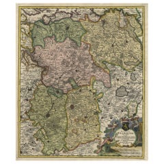
Map of Duchy of Brabant Centered on Fortress of Louvain or Leuven, Belgium, 1720
Located in Langweer, NL
Antique map titled 'Ducatus Brabantiae Nova Tabula in qua Lovanii Bruxellarum March S. Impreii Sylvae Ducis et Merchliniae Dominia.'
This fully engraved copperplate map...
Category
Antique 1720s Maps
Materials
Paper
$932 Sale Price
20% Off
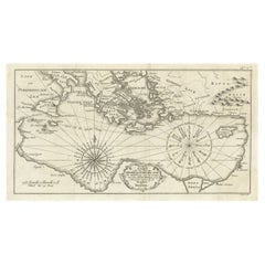
Old Dutch Map of the Region Around the Mediterranean Sea, 1773
Located in Langweer, NL
Antique map titled 'Kaart van een Deel der Middelandsche Zee (..)'.
Old map of the region around the Mediterranean Sea. Originates from the first Dutch editon of an interesting t...
Category
Antique 1770s Maps
Materials
Paper
$342 Sale Price
20% Off
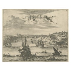
Bird's Eye View of Dabhol as Seen from the Sea, North of Goa, India, 1727
Located in Langweer, NL
Antique print titled 'De Bay ende Stadt Dabul'.
Bird's eye view of Dabhol as seen from the sea. The city is situated on the Vashishti river, north of Goa in India, on the Malabar...
Category
Antique 1720s Maps
Materials
Paper
$513 Sale Price
20% Off
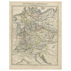
Antique Map of Germany and Switzerland from an Old Dutch School Atlas, c.1873
Located in Langweer, NL
Antique map titled 'Deutschland en Zwitserland'. Old map depicting Germany and Switzerland. This map originates from 'School-Atlas van alle Deelen der Aarde'. Artists and Engravers: ...
Category
Antique 19th Century Maps
Materials
Paper
$104 Sale Price
20% Off
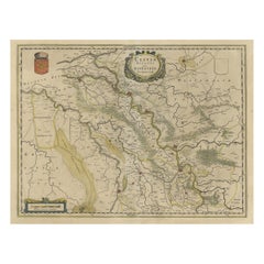
Map of the Duchy Clivia & Ravestein, Brabant in The Netherlands & Germany, 1635
Located in Langweer, NL
Antique map titled 'Clivia Ducatus et Ravestein Dominium.'
Map of the Duchy Clivia and Ravestein, part of Brabant in The Nethe...
Category
Antique 1630s Maps
Materials
Paper
$713 Sale Price
20% Off
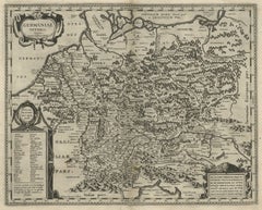
Original Rare Antique Map of the Ancient German Empire in Northern Europe, c1650
Located in Langweer, NL
Antique map titled 'Germaniae Veteris typus.'
Map of the ancient German Empire in Northern Europe, based upon an earlier map by Ortelius. Extends fr...
Category
Antique 1650s Maps
Materials
Paper
$627 Sale Price
20% Off
Old Hand-Colored Engraving of a Farmer's Wife from Fribourg, Switzerland, c.1860
Located in Langweer, NL
Antique costume print titled 'Fribourg'.
This print depicts a farmer's wife from Fribourg, Switzerland. Source unknown, to be determined.
Artists and Engravers: Anonymous.
Category
Antique 1860s Prints
Materials
Paper
$266 Sale Price
20% Off
Antique Map of Seram, Boero and the Banda Islands by Van den Bosch '1818'
Located in Langweer, NL
Antique map titled 'Kaart der Ambonsche Eilanden'. Rare and attractive map of the islands of Seram, Boero and the Banda Islands. Includes a nice view of the Island of Seram. One of 1...
Category
Antique Early 19th Century Maps
Materials
Paper
$1,141 Sale Price
20% Off
Map of Russia with Vignettes of the Neoskoi Prospect, St. Petersburg, ca.1851
Located in Langweer, NL
Antique map titled 'Russia in Europe'.
Map of European Russia. Showing vignettes of the Neoskoi Prospect, St. Petersburg, Polish Captives on their way to Siberia, a Russian Bear...
Category
Antique 1850s Maps
Materials
Paper
$275 Sale Price
20% Off
Nicely Framed View of Muiden Castle, the Netherlands, 1858
Located in Langweer, NL
Antique print titled 'Muiden'. View of Muiden Castle, the Netherlands. This print originates from 'Het koningrijk der Nederlanden voorgesteld in eene reeks van 136 naar de natuur get...
Category
Antique 1850s Prints
Materials
Paper
$466 Sale Price
20% Off
Antique Map of the Harbour of Tongatabu, One of the Tonga Islands, 1803
Located in Langweer, NL
Antique map Tonga titled 'Kaart van de Haven van Tongataboo'.
Antique map of the harbour of Tongatabu, one of the Tonga Islands. Originates from 'Reizen Rondom de Waereld door Ja...
Category
Antique Early 1800s Maps
Materials
Paper
$342 Sale Price
20% Off
Framed View of the Brouwersgracht in Amsterdam, the Netherlands, 1708
Located in Langweer, NL
Antique print titled 'Societatis Indiae Occident (..) - West Indisch Huys op Raapenburg (..)'.
Despite the title suggesting this print is a view of the West-Indisch House in Amst...
Category
Antique Early 1700s Maps
Materials
Paper
$409 Sale Price
20% Off
Steel Engraving of Shimoda, a Port Located in Shizuoka Prefecture, Japan, C.1840
Located in Langweer, NL
Antique print titled 'Simoda in Japan'.
Steel engraving of Shimoda, a city and port located in Shizuoka Prefecture, Japan. Originates from 'Meyers Univer...
Category
Antique 1840s Maps
Materials
Paper
$123 Sale Price
20% Off
Original Antique Map of the Rhine, South and North of Strasbourg, Germany, 1608
Located in Langweer, NL
Antique map titled 'Argentoratensis agri descriptio'.
Original antique map of the Rhine, both south and north of Strasbourg, based on Daniel Specklin's three-sheet map of the Elz...
Category
Antique Early 1600s Maps
Materials
Paper
$304 Sale Price
20% Off
Original Copper Engraving of the Northeast Coast of Australia, 1803
Located in Langweer, NL
Antique map Australia titled 'Kaart van een gedeelte van de Kust van Nieuw Zuid Wales van Kwelling Kaap tot de Endeavour-Straat door Luit. J. Cook'.
A chart of the northeast coast...
Category
Antique Early 1800s Maps
Materials
Paper
$846 Sale Price
20% Off
Antique Map of Northern Europe and European Russia, ca.1780
Located in Langweer, NL
Antique map titled 'Le Nord de L'Europe, Contenant Le Danemark, La Norwege; La Suede et La Laponie avec la Majeure Partie de al Russie Europeenne.'
Map of Northern Europe and Eur...
Category
Antique 1780s Maps
Materials
Paper
$180 Sale Price
20% Off
Old Print of the Governor-General's Residence in Batavia, Indonesia, 1739
Located in Langweer, NL
Antique print titled 'Ein Prospect Sr. Hoch-Edelheit des Herrn Gen: Gouverneurs Hoff und Wohnhausses in dem Castel Batavia wie dasselbe von innen anzusehen'.
Old print with a view of the Governor-General's residence in Batavia. This print originates from from 'Allerneuester Geographische- und Topographischer Schau-platz, von Africa und Ost-Indien'.
Artists and Engravers: Johann Wolfgang Heydt, a German artist who worked for the Dutch East India...
Category
Antique 1730s Prints
Materials
Paper
$742 Sale Price
20% Off
Old Sea Chart of the Tenasserim area, Myanmar 'Burma' in South East Asia, c.1790
Located in Langweer, NL
Antique map titled 'Coast of Tenasserim.'
Sea chart of the Tenasserim area, Myanmar in South East Asia. Source unknown, to be determined.
Artists and Engravers: Anonymous.
Category
Antique 1790s Maps
Materials
Paper
$704 Sale Price
20% Off
Detailed Antique Map of the Province of Overijssel in the Netherlands, ca.1700
Located in Langweer, NL
Antique map titled 'La Seigneurie d'Over-Yssel subdivisee en Trois Parties, Sallant, Twente, et Drente.'
Detailed map of the province of Overijssel in the Netherlands. From Jaill...
Category
Antique Early 1700s Maps
Materials
Paper
$704 Sale Price
20% Off
Original Old Bird's-Eye View Plan of Sint-Winoksbergen or Bergen in France, 1649
Located in Langweer, NL
Antique map titled 'Berga Sti Winoci.' - Bird's-eye view plan of Sint-Winoksbergen in France, with key to locations and coats of arms. Text in Dutch on verso. This plan originates from the famous city Atlas: 'Toneel der Steeden' published by Joan Blaeu...
Category
Antique 1640s Maps
Materials
Paper
$1,379 Sale Price
20% Off
Print of Pleasure Gardens of the Governor-General of Batavia, Indonesia, ca.1744
Located in Langweer, NL
Antique print titled 'Ein Prospect aus Sr. Hoch-Edelheit des Herrn General-Gouverneurs Lust oder Spiel-Haus nach der Werff, dem Vier Kand und der Baum Wachters Häusgen in Batavia gez...
Category
Antique 1740s Prints
Materials
Paper
$742 Sale Price
20% Off
Old Map of the Gulf of Bothnia, the Northernmost Arm of the Baltic Sea, 1759
Located in Langweer, NL
Antique map titled 'Carte du Golphe de Bothnie'.
Original antique map of the Gulf of Bothnia, the northernmost arm of the Baltic Sea. It is situated between Finland's west coast ...
Category
Antique 1750s Maps
Materials
Paper
$228 Sale Price
20% Off
View of the Church of Cortona, a Town and Comune Arezzo, in Tuscany, Italy, 1800
Located in Langweer, NL
Antique print titled 'Veduta della Chiesa ed Episcopio di Cortona'.
View of the church of Cortona, a town and comune in the province of Arezzo, in Tuscany, Italy. Source unknown,...
Category
Antique Early 1800s Maps
Materials
Paper
$304 Sale Price
20% Off
Antique Print of the House of Richard Rooth The Elms, in Surrey, England, 1717
Located in Langweer, NL
Antique print titled 'The Elevation of Richard Rooth his House at Epsom in Surrey (..)'.
Elevation of the house of Richard Rooth, The Elms. This print ori...
Category
Antique 18th Century Prints
Materials
Paper
$323 Sale Price
20% Off
Antique Print of Garden Kiosks by Le Rouge, c.1785
Located in Langweer, NL
Antique print titled 'Differens Kiosques par Halfpenny'. Copper engraving showing various garden kiosks. This print originates from 'Jardins Anglo-Chinois à la Mode' by Georg Louis l...
Category
Antique 18th Century Prints
Materials
Paper
$304 Sale Price
20% Off
Old View of the Queen Charlotte's Islands 'Santa Cruz Islands, Solomon', 1774
Located in Langweer, NL
Antique map titled 'Cote Septentrional de la plus grande des Isles de la Reine Charlotte (..)'.
Map and coastal view of the islands within the Queen Charlotte's Islands (Santa Cruz Islands...
Category
Antique 1770s Maps
Materials
Paper
$342 Sale Price
20% Off
Antique Map of Frisian Cities Sloten, Ylst, Workum and Hindelopen by Blaeu, 1652
Located in Langweer, NL
Antique print titled 'Slooten - Ylst - Worcum - Hinloopen'. Three plans and a bird's eye view on one sheet. The plans show the Frisian cities Sloten, IJlst, Workum and the view shows...
Category
Antique 1650s Maps
Materials
Paper
$1,094 Sale Price
20% Off
Antique Map of the Region of Elbogen & Eger, Czech Republic & Hungary, 1742
Located in Langweer, NL
Antique map titled 'Repraesentatio Geographica Circuli Egerani, nec non Elnbogensis : in quo simul viae Egeranae in Thermas Carolinas distincta delineatio conspicitur (..)'.
Orig...
Category
Antique 1740s Maps
Materials
Paper
$513 Sale Price
20% Off
Large Panoramic View of Eisenerz, an Old Mining Town in Styria, Austria, c.1650
Located in Langweer, NL
Description: Antique print titled 'Der weyt berümpte Marckt und Bergwerck Eysenärtz im Hertzogtum Steyer'.
Large panoramic view of Eisenerz, an old mining town in the Austrian st...
Category
Antique 1650s Maps
Materials
Paper
$694 Sale Price
20% Off
Antique Print of Ornamental Decorations of Door & Ceiling of a Paris Hotel, 1877
Located in Langweer, NL
Antique print titled 'Antichambre. Hotel rue du Faubg. St. Honore No. 131. a Paris. Face du cote de la Porte et Plafond. Par M. M. Croiseau et Letrosne, architectes et Denuelle, pein...
Category
Antique 19th Century Prints
Materials
Paper
$133 Sale Price
20% Off
Decorative Antique Map of the Dutch Province of Noord-Brabant, ca.1640
Located in Langweer, NL
Antique map titled 'Quarta pars Brabantiae cujus Sylvaducis Willebordus vanderBurgt desrib'.
Highly detailed original antique map of the province of Noord-Brabant, the Netherlands. It shows the cities of 's-Hertogenbosch, Eindhoven and surroundings. Includes a decorative cartouche, 6 coats of arms, topped by winged cherubs and two larger coats of arms...
Category
Antique 1640s Maps
Materials
Paper
$2,616 Sale Price
20% Off
Antique Map of Two Cities in the Province of Shanxi or Chensi, China, 1748
By Jacques-Nicolas Bellin
Located in Langweer, NL
Antique map China titled ‘Villes de la Province de Chensi’. Interesting set of two local town plans of ""Si-Ngan-Fu: Capitale."" and ""Tchang Lan, Ou...
Category
Antique 18th Century Maps
Materials
Paper
$294 Sale Price
20% Off
Original Old Copper Engravings of Seals of Lubeck, Stavoren, Amsterdam etc. 1767
Located in Langweer, NL
Antique print titled ‚Zegel der stad Lubek (..)’.
Seals of the city of Lubeck and others: Stavoren, Amsterdam (8x), van Amstel, Persijn (..). This print originates from ‘Amsterda...
Category
Antique 1760s Prints
Materials
Paper
$323 Sale Price
20% Off
Antique Map of Egypt, Arabia Petraea and Lower Nubia by Johnston '1909'
Located in Langweer, NL
Antique map titled 'Egypt, Arabia Petraea and Lower Nubia'. Original antique map of Egypt, Arabia Petraea and Lower Nubia. With inset maps of Alexandriam Cairo and the Suez Canal...
Category
Early 20th Century Maps
Materials
Paper
$223 Sale Price
24% Off
Original Old China Map, From Korea and the Sea of Japan to Teypin Island, 1803
Located in Langweer, NL
Antique map titled 'China, Contains 15 Subject Provinces Including the 2 Islands of Hainan, Formosa and the Tributary Kingdoms of Corea, Tonkin'.
Old map depicting China, extendi...
Category
Antique Early 1800s Maps
Materials
Paper
$523 Sale Price
20% Off
Beautiful Antique Map of Southeastern France with Decorative Cartouche, ca.1790
Located in Langweer, NL
Antique map titled 'Languedoc, Dauphiné, Province'.
Beautiful antique map of Southeastern France with decorative cartouche. Map includes topographical detail as well as a referen...
Category
Antique 1790s Maps
Materials
Paper
$361 Sale Price
20% Off
Antique Map of Menaldumadeel, Township in Friesland, The Netherlands, 1868
Located in Langweer, NL
Antique map titled 'Provincie Friesland - Gemeente Menaldumadeel'.
Map of the township of Menaldumadeel including Menaldum, Deinum, Boxum and many other villages. This map originat...
Category
Antique 19th Century Maps
Materials
Paper
$117 Sale Price
20% Off
Rare Engraving of Dutch and Danish Forts on the West African Gold Coast, 1744
Located in Langweer, NL
Antique print, titled: 'The Dutch Fort Croevecoeur (…).'
A four panel plate showing forts on the West African Gold Coast, Ghana; a) The Dutch Fort Croevecoeur at Accra, b) The Danish Fort Christiaenburgh at Accra, c) Cape Ruygehoeck or Duyvelsbergh, d) The Prospect of the Village and Coast of Lay, the mount Redonda being at NNE. Ussher Fort is a fort in Accra, Ghana. It was built by the Dutch in 1649 as Fort Crevecoeur. From: "A Collection of Voyages and Travels" published by John and Awnsham Churchill in London in 1744.
Artists and Engravers: Made by 'Johannes Kip' after 'A. Churchill'. Johannes Kip (b Amsterdam, 1653; d London, 1722). Dutch draughtsman, engraver and dealer, active in England. He was a pupil of Bastiaen Stopendaal (1636–1707) from 1668 to 1670. His earliest dated engravings are of 1672 (e.g. the Siege of Groningen , Hollstein, no. 4), and he supplied numerous plates for books published from that date onwards. His work brought him into contact with the court of William of Orange and in 1686 he produced six plates depicting William of Orange, his Wife and Attendants near The Hague (Hollstein, no. 5). Shortly after the Glorious Revolution of 1688 Kip followed the court to England. After settling in Westminster, he worked extensively for London publishers, engraving works after Francis Barlow, Caius Gabriel Cibber (e.g. Interior of the Danish Church in London , 1697; Hollstein, no. 6) and other London-based artists. His engravings were principally destined for book illustrations. The work for which Kip is best remembered is his large corpus...
Category
Antique 1740s Maps
Materials
Paper
$428 Sale Price
20% Off
Copper Engraving of Kamchadal Men from Kamchatka, Russia, 1770
Located in Langweer, NL
Description: Antique print titled 'Habillemens des Kamtchadals'. Copper engraving of Kamchadal men. This print originates from volume 19 of 'Histoire generale des voyages (..)' by Antoine Francois Prevost d'Exile.
Artists and Engravers: Published by Panckoucke.
The Kamchadals inhabit Kamchatka, Russia. The name "Kamchadal" was applied to the descendants of the local Siberians and aboriginal peoples (the Itelmens, Ainu, Koryaks and Chuvans) who assimilated with the Russians. The descendants of the mixed-blood Russian settlers in 18th-19th century are called Kamchadals these days. The Kamchadals speak Russian with a touch of local dialects of the aboriginal languages of Kamchatka. The Kamchadals engage in fur trading...
Category
Antique 1770s Prints
Materials
Paper
$323 Sale Price
20% Off
Original Antique Engraving of a Horse Race at a Japanese Racing Track, 1669
Located in Langweer, NL
Description: Antique print, titled: 'Japansche Ren-baanen.' -
View of a race at a Japanese (horse) racing track. A man runs beside a horse (the horse's rein in his hand). A man w...
Category
Antique 1660s Prints
Materials
Paper
$428 Sale Price
20% Off
Antique Map of South America by J. Cook (1775)
Located in Langweer, NL
Antique map titled 'Kaart van het Zuidlyk Eind van Amerika'. Map of the sourthern part of South America, focusing on Cook's tracks around the Cape Horn and Tierra del Fuego in 1775. ...
Category
Antique Late 18th Century Maps
Materials
Paper
$561 Sale Price
20% Off
Detailed Original Antique Map of the Picardy Region of France, 1657
Located in Langweer, NL
Antique map of France titled 'Picardia vera et inferior'.
Detailed map of the Picardy region of France. This map originates from 'Atlas Novus, Sive Theatrum Orbis Orbis Terrarum:...
Category
Antique 1650s Maps
Materials
Paper
$466 Sale Price
20% Off
Charming Map of Northeastern Spain with the Areas of Pamplona & Valladolid, 1634
Located in Langweer, NL
Antique map titled 'Biscaia, Guipiscoa, Navarra et Asturias de Santillana'.
Charming map of Northeastern Spain with the areas of Pamplona and Valladolid. This map originates from...
Category
Antique 1630s Maps
Materials
Paper
$418 Sale Price
20% Off
Beautiful Hand-Coloured Miniature Map of the Island of Java, Indonesia, ca.1702
Located in Langweer, NL
Antique map of Java titled‚ Iava Maior‘.
Beautiful hand-coloured miniature map of the island of Java. This map originates from ‘Recueil des Voyages qui ont servi a l'etablissemen...
Category
Antique Early 1700s Maps
Materials
Paper
$451 Sale Price
20% Off
Map of Winter Harbour on Melville Island, Australia by Parry's Expedition, 1821
Located in Langweer, NL
Antique print titled 'Survey of Winter Harbour Melville Island, June 1820'.
Chart of the bay or harbor on Melville Island where William Parry's expedit...
Category
Antique 1820s Maps
Materials
Paper
$247 Sale Price
20% Off
Old Hand-Colored Print With a View of the Louvre, France, ca.1885
Located in Langweer, NL
Antique print titled 'Anischt des Louvre mit seinen Galerien, in Paris'.
Old print with a view of the Louvre, France. This print originates from a German illustrated newsletter, pu...
Category
Antique 1880s Maps
Materials
Paper
$409 Sale Price
20% Off
Antique Print of a New Building Design in Dorset, England by Campbell, 1717
Located in Langweer, NL
Antique print titled 'The Elevation of one end of a new design for a person of quality in Dorset-Shire (..)'.
View of new building design in Dorset (formerly known as Dorsetshire...
Category
Antique 18th Century Prints
Materials
Paper
$399 Sale Price
20% Off
Old Map of Spain and Portugal, with an Inset Map of the Region of Madrid, 1846
Located in Langweer, NL
Antique map titled 'Kingdom of Spain and Portugal'.
Old map of Spain and Portugal, with an inset map of the region of Madrid. This map originates from 'A New Universal Atlas Cont...
Category
Antique 1840s Maps
Materials
Paper
$209 Sale Price
20% Off
Old Map of Persia, incl the Caspian Sea and Part of the Arabian Peninsula, 1726
Located in Langweer, NL
Antique map of Persia. It covers from the Gulf of Suez eastward to Ahmedabad (Amadabad) in modern day western India.
This map, centered on Persia, includes the Caspian Sea and part of the Arabian...
Category
Antique 1720s Maps
Materials
Paper
$1,046 Sale Price
20% Off
Original Hand-Colored Antique Map of Artois or Artesia, France, ca.1650
Located in Langweer, NL
Antique map titled 'Artesia Comitatus Artois'.
Map of Artois or Artesia, France. Artois is former province located in the northwestern part of France, boarding Belgium (Flanders)...
Category
Antique 1650s Maps
Materials
Paper
$323 Sale Price
20% Off
Rare Antique Map of Friesland in Roman Times, Published 1778
Located in Langweer, NL
Antique map titled 'Carte de la Frise, entre les Embouchures du Rhin & de l'Eems, ij compris l'isle Bataves, dressée selon leur ancienne position le Gouvernement des Romains & des Fr...
Category
Antique 18th Century Maps
Materials
Paper
$903 Sale Price
20% Off
Nice Hand-Colored Plan by Blaeu of Bolsward in Friesland, the Netherlands, 1652
Located in Langweer, NL
Antique print, titled: 'Bolswaert' - (Town plan of Bolsward).
Plan of Bolsward in Friesland, the Netherlands. A cartouche and two coats of arms. From the town atlas 'Toneel der S...
Category
Antique 1650s Maps
Materials
Paper
$1,094 Sale Price
20% Off
Old Original Miniature View of the Skyline of Miaco 'Kyoto, Japan', 1683
Located in Langweer, NL
Antique print titled 'De l'Asie Figure XXV, Miaco'.
Miniature view of the skyline of Miaco (Kyoto, Japan). This print originates from 'Description de l'Univers', published 1683.
...
Category
Antique 1680s French Maps
Materials
Paper
$228 Sale Price
20% Off
Antique Map of the Region of Paris ‘France’ by H. Heirs, circa 1720
Located in Langweer, NL
Antique map titled 'Agri Parisiensis Tabula particularis, qua maxima Pars Insulae Franciae (..)'. Incredibly detailed map showing everything from tiny villages to forests, farmland, ...
Category
Antique Early 18th Century Maps
Materials
Paper
$1,046 Sale Price
20% Off
Antique Map of Sweden and Norway by Johnston (1909)
Located in Langweer, NL
Antique map titled 'Sweden and Norway'. Original antique map of Sweden and Norway. With inset maps of Christiania and Stockholm. This map originates from...
Category
Early 20th Century Maps
Materials
Paper
$237 Sale Price
20% Off
Antique Engraving of Tinian, an Island of the Northern Mariana Islands, 1757
Located in Langweer, NL
Antique print titled 'Vue de la Rde de Tinian
Gezigt van de Rheede van Tinian (..)'. Views of the south-west side of the island of Tinian and a view of the anchorage of Tinian, w...
Category
Antique 1750s Prints
Materials
Paper
$342 Sale Price
20% Off
Old Print of a Partridge in Front of The Walled City of Azemmour, Morocco, c1630
Located in Langweer, NL
Antique print, titled: 'Azaamurum.' - Caption in the top reads: 'Foenerari iniustum est'.
A partridge in the foreground, with the walled city (Azemmour...
Category
Antique 1630s Maps
Materials
Paper
$275 Sale Price
20% Off
Old Print with a View on the City & Castle of Batavia 'Jakarta', Indonesia, 1668
Located in Langweer, NL
Antique print Indonesia titled ‘La ville de Batavie. De Stadt Batavia. Chateau de Batavia. ‘t Casteel van Batavia’.
Antique print with a view on the city of Djakarta, Indonesia. ...
Category
Antique 1660s Prints
Materials
Paper
$456 Sale Price
20% Off
Antique Decorative County Map of Lincolnshire, England, 1804
Located in Langweer, NL
Antique county map of Lincolnshire first published circa 1800 Cities illustrated include Grantham, Spalding, Boston, and Market Raisin.
Charles Smith was a cartographer working in...
Category
Antique Early 1800s Maps
Materials
Paper
$309 Sale Price
20% Off
Antique County Map of Derbyshire, England, 1804
Located in Langweer, NL
Antique county map of Derbyshire first published, circa 1800. Villages, towns, and cities illustrated include Chesterfield, Wirksworth, Derby, and ...
Category
Antique Early 1800s Maps
Materials
Paper
$309 Sale Price
20% Off
Recently Viewed
View AllMore Ways To Browse
Statutes And Sculptures
Swedish Gustavian Glass Cabinet
Swiss Chalet Chairs
Tea Cup Art Nouveau
Tea Cup Holder
Teak Buddha
Teak Gentlemans
Thomasville Hollywood Regency
Thomire Clock
Three Legged Vessel
Three Tier Serving Trays
Tibet Earring
Tibetan Antique Cabinet
Tiffany And Co China
Tiffany Blue Rims
Tiffany Sterling Ice Tea Spoons
Torchiere Sculpture
Tortoise Christian Dior
