Maps on Sale
to
4,213
18
4,236
1
3
2
2
1
1
1
1
2,336
1,669
231
1
129
12
1
66
1
3
4
2
4,227
10
8
7
7
127
35
32
29
27
4,237
4,237
4,237
104
56
18
13
11
Sale Items
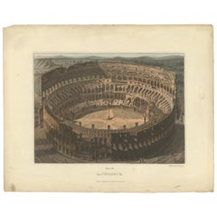
Set of 5 Antique Prints of Ancient Buildings in Rome and its Vicinity, 1844
Located in Langweer, NL
Beautiful set off of 5 aquatint prints of old Rome, Italy, including the popular view of the Coliseum.
Matthew Dubourg (active 1786 – 1838)
From "Views of the Remains of Ancient Bu...
Category
Antique Mid-19th Century European Prints
Materials
Paper
$875 Sale Price
30% Off
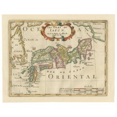
Antique Map of Japan and Korea by Sanson, 'c.1690'
Located in Langweer, NL
Antique map titled 'Les Iles du Iapon (..)'. Original antique map, with beautiful (later) hand coloring, of Japan and the Island of Corey (Korea). Uncommon edition, with '234' at top...
Category
Antique Late 17th Century Maps
Materials
Paper
$951 Sale Price
20% Off
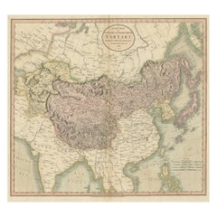
Antique Map of Chinese and Independent Tartary, Korea and Japan, 1806
Located in Langweer, NL
Antique map titled 'A New Map of Chinese & Independent Tartary'. Beautiful map of Chinese Tartary, Korea and Japan.
Artists and Engravers: John Cary (1755-1835) was a British car...
Category
Antique 19th Century Maps
Materials
Paper
$333 Sale Price
20% Off
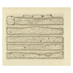
Antique Map Made After a Roman Papyrus Travel Map, Known as Peutinger Map, 1773
Located in Langweer, NL
Old Dutch engraving with title: 'Romeinsche Reis Kaart van K. Peutinger'.
Rare antique map based on the original 'Peutinger' map, the map has the shape of papyrus scrolls. Originat...
Category
Antique 18th Century Maps
Materials
Paper
$428 Sale Price
20% Off
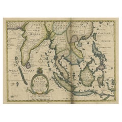
Antique Map of Southeast Asia from Persia to the Timor Island, 1712
Located in Langweer, NL
Antique map titled 'A New Map of the East Indies'.
Old map covering all of Southeast Asia from Persia to the Timor Island, inclusive of the modern day nations of India, Ceylon, T...
Category
Antique 1710s Maps
Materials
Paper
$751 Sale Price
20% Off
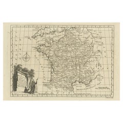
Original Copper Engraved Map of France
Located in Langweer, NL
Antique map titled 'New and Accurate Map of France from the latest improvements'. Original copper engraved map of France. Engraved by T. Bowen, published circa 1771.
Category
Antique Late 18th Century Maps
Materials
Paper
$323 Sale Price
20% Off
Antique Print of Alexandria in Egypt, 1698
Located in Langweer, NL
Antique print with two views of Alexandria, Egypt. This print originates from 'Reizen van Cornelis de Bruyn, door de vermaardste deelen van Klein Asia, de eylanden Scio, Rhodus, Cypr...
Category
Antique 17th Century Prints
Materials
Paper
$228 Sale Price
20% Off
Rare Hand-Colored Antique Map of Tartary, China and Korea, ca.1741
Located in Langweer, NL
Antique map titled 'A General Map of Eastern and Western Tatary, commonly call'd Tartary; drawn from the Particular Maps of the Jesuit Missionaries'.
Rare antique map of Tartary, C...
Category
Antique 1740s Maps
Materials
Paper
$2,616 Sale Price
20% Off
Antique Planisphere with Constellations by Bion, 1751
Located in Langweer, NL
Antique map titled 'Planisphere Celeste'. Planisphere with various constellations. This map originates from 'L'Usage des globes célestes et terrestres et des sphères (..)' by N. Bion...
Category
Antique Mid-19th Century Maps
Materials
Paper
$190 Sale Price
20% Off
Print of Various Ceremonies 'Marriage, Funeral, Baptism, Magic' of Finland, 1726
Located in Langweer, NL
Antique print titled 'Mariage des Lapons (..)'.
Old print of various ceremonies (marriage, funeral, baptism, magic) of Finland. This print originates from 'Ceremonies et costumes...
Category
Antique 1720s Prints
Materials
Paper
$323 Sale Price
20% Off
Antique Map of the Northwestern Netherlands, incl Texel and Vlieland, ca.1741
Located in Langweer, NL
Antique print, titled: 'Tabula Comitatus Hollandiae in Praefecturas sua distributa; cui adjuncta est Provinc. Ultraiectina et maxima pars Geldriae summo studio delin. Et aeri incidit...
Category
Antique 1740s Maps
Materials
Paper
$894 Sale Price
20% Off
Antique Map of South America by Lowry, 1852
Located in Langweer, NL
Antique map titled 'South America'. Original map of South America. This map originates from 'Lowry's Table Atlas constructed and engraved from the most recent authorities' by J.W. Lo...
Category
Antique Mid-19th Century Maps
Materials
Paper
$142 Sale Price
20% Off
Pl. 40 Antique Print of Decorative Art in the Middle Ages by Racinet, 1869
Located in Langweer, NL
Old print of decorative art in the Middle Ages. This print originates from 'L'Ornement polychrome'. A beautiful work containing about...
Category
Antique 19th Century Prints
Materials
Paper
$69 Sale Price
20% Off
Antique Map of the North Pole by V.M. Coronelli, circa 1692
By Vincenzo Coronelli
Located in Langweer, NL
Globe gore by Vincenzo Maria Coronelli shows the North Pole with the coasts of Canada, Greenland, Scandinavia and Siberia, and is decorated with pictorial scenes of bear, seal and wh...
Category
Antique Late 17th Century Maps
Materials
Paper
$1,332 Sale Price
20% Off
Antique Map of Scotland With an Inset Map of the Shetland Islands, 1854
Located in Langweer, NL
Stunning Map of Scotland that will look beautiful in any setting framed on the wall.
Description: Large Antique map titled 'Scotland with its Islands, drawn from the Topographical surveys...
Category
Antique 1850s Maps
Materials
Paper
$1,189 Sale Price
20% Off
Hand Colored Antique Map of the Department of Seine Et Marne, France
By Victor Levasseur
Located in Langweer, NL
Antique map titled 'Dépt. de Seine et Marne'. map of the French department of Seine Et Marne, France. This region produces a wide variety of wines and h...
Category
Antique Mid-19th Century Maps
Materials
Paper
$323 Sale Price
20% Off
Antique Map of Switzerland by J. Tallis, circa 1851
Located in Langweer, NL
A decorative and detailed mid-19th century map of Switzerland which was drawn and engraved by J. Rapkin (vignettes by A. H. Wray & J. B. Allen) and published in John Tallis's Illustr...
Category
Antique Mid-19th Century Maps
Materials
Paper
$261 Sale Price
20% Off
Antique Map of Italy and Corsica, c.1860
Located in Langweer, NL
Antique map titled 'North & Central Italy and the Island of Corsica'.
Old map of North and Central Italy, and the island of Corsica. With an inset map of the region of Rome. Orig...
Category
Antique 19th Century Maps
Materials
Paper
$104 Sale Price
20% Off
Original Antique Map of Africa
Located in Langweer, NL
Antique map titled 'Afrika'. Original antique map of Africa, drawn by Van Beusekom. Published by 'Seyffardt's Boekhandel' in Amsterdam, circa 1870.
Category
Antique Late 19th Century Maps
Materials
Paper
$323 Sale Price
20% Off
Antique Print of the Death of Emperor Cubo at Kyoto, Japan, ca. 1725
By Pieter Van Der Aa
Located in Langweer, NL
Antique print titled 't Vermoorden vande Keyser Cubus. / Massacre de l'Empereur Cubo, dans Meaco.' Engraving of the killing of Emperor Cubo at Kyoto, Japan. The city Kyoto was known ...
Category
Antique 18th Century Prints
Materials
Paper
$875 Sale Price
20% Off
Antique Map of Oceania by Levasseur, '1875'
Located in Langweer, NL
Antique map titled 'Carte générale de l'Océanie'. Large map of Oceania. This map originates from 'Atlas de Géographie Moderne Physique et Politique' by A. Levasseur. Published 1875.
Category
Antique Late 19th Century Maps
Materials
Paper
$237 Sale Price
60% Off
Antique Map of the United States of North America, c.1882
Located in Langweer, NL
Antique map titled 'United States of North America'. Old map of the United States of North America. This map originates from 'The Royal Atlas of Modern Geography, Exhibiting, in a Se...
Category
Antique 1880s Maps
Materials
Paper
$333 Sale Price
20% Off
Antique Map of Brazil Extending South to the Mouth of the Rio de la Plata
Located in Langweer, NL
Antique map titled 'Carte du Brésil'. ?Beautiful map of Brazil extending south to the mouth of the Rio de la Plata and Buenos-Aires in Argentina. Published by Tardieu, 1821.
Pier...
Category
Antique Early 19th Century Maps
Materials
Paper
$228 Sale Price
20% Off
Antique Map of New Zealand by G.F. Cram, 'circa 1906'
Located in Langweer, NL
Antique map titled 'New Zealand'. Large map of New Zealand with a small legend of the Chatham Islands. On the verso, a map of the North Polar regions and a map of Tasmania can be fou...
Category
20th Century Maps
Materials
Paper
$333 Sale Price
20% Off
Antique Map of Australia and New Zealand, c.1860
Located in Langweer, NL
Antique map titled 'Australia and New Zealand'. Unusual edition of this map of Australia and New Zealand, on very thin paper and multiple folding lines. Source unknown, to be determi...
Category
Antique 19th Century Maps
Materials
Paper
$133 Sale Price
20% Off
Antique Map of the Balkans with Coat of Arms
Located in Langweer, NL
Antique map titled 'Tavola Nuova di Schiavonia'. Ruscelli's map of the Balkans, with a coat of arms. The mountains are represented, river systems are shown in detail, and cities, towns and ports denoted throughout this 16th century map. A number of islands in the Adriatic Sea are also shown. This map originates from 'Espositione & introduttioni universali di Gir. Ruscelli sopra tutta la Geografia di Tolomeo (..)' published by Girolamo Ruscelli, 1561.
Girolamo Ruscelli (1500-1566) was a cartographer, humanist, and scholar from Tuscany. Ruscelli was a prominent writer and editor in his time, writing about a wide variety of topics including the works of Giovanni Boccaccio and Francesco Petrarch, Italian language, Italian poetry, medicine, alchemy, and militia. One of his most notable works was a translation of Ptolemy...
Category
Antique 16th Century Maps
Materials
Paper
$418 Sale Price
20% Off
Rare Antique Engraving of the City of Copenhagen, Denmark, ca.1720
Located in Langweer, NL
Antique print titled 'Copenhagen. Die Königl. Residenz und Haupt Stadt in Dänemark'. Panoramic view of the city of Copenhagen, Denmark. This print, most likely, originates from the s...
Category
Antique 18th Century Prints
Materials
Paper
$437 Sale Price
20% Off
Antique Map of Belgium and Northern France by F. de Wit, circa 1680
Located in Langweer, NL
Antique map titled 'Belgii Regii Accuratissima Tabula Pluribus Locis Recens Emen'. Large map of Belgium and Northern France. Published by F. de Wit, circa 1680.
Category
Antique Late 17th Century Maps
Materials
Paper
$618 Sale Price
20% Off
Antique Plan of Philippeville in Wallonia, Belgium, 1769
Located in Langweer, NL
Antique map titled 'Philippe-Ville'. Plan of Philippeville in Wallonia, Belgium. This print originates from volume 3 of 'Les Delices des Pays-Bas ou description geographique et histo...
Category
Antique 18th Century Maps
Materials
Paper
$114 Sale Price
20% Off
Antique Map of the Biblical Land of Canaan by Lindeman, c.1758
Located in Langweer, NL
Antique map titled 'De IIde Landkaart verbeeldende t'Land Kanaan nog bewoond door deszelfs eerste bezitters (..).' - Map of the biblical Land of Canaan. With large title cartouche, c...
Category
Antique 18th Century Maps
Materials
Paper
$190 Sale Price
20% Off
Antique Map of Persia, Georgia and Kazakhstan, ca.1780
Located in Langweer, NL
Antique map titled 'Carte de la Perse, de la Georgie, et de la Tartarie Independante'.
Map of Persia, Georgia and Kazakhstan. This map shows current days Georgia, Iran, Irak, Kaz...
Category
Antique 1780s Maps
Materials
Paper
$494 Sale Price
20% Off
Antique Map of Britain in Roman Times
Located in Langweer, NL
Antique map titled 'Britannia Romana collected from Ptolemy (..)'. Map of Britain in Roman times drawn from several sources, including the works of Ptolemy and The Itinerary of the E...
Category
Antique Early 19th Century Maps
Materials
Paper
$466 Sale Price
20% Off
Large Antique County Map of Wiltshire, England, 1805
Located in Langweer, NL
Antique map titled 'A Map of Wiltshire from the best Authorities'. Original old county map of Wiltshire, England. Engraved by John Cary. Originates from 'New British Atlas' by John S...
Category
Antique Early 19th Century Maps
Materials
Paper
$218 Sale Price
20% Off
Large Antique County Map of Leicestershire, England, 1805
Located in Langweer, NL
Explore Leicestershire's Past: Antique Map by John Cary
Step into the history of Leicestershire, England, with this original old county map engraved by the renowned cartographer Joh...
Category
Antique Early 19th Century Maps
Materials
Paper
$218 Sale Price
20% Off
Antique Print of the State Bedroom of Warwick Castle, River Aron, England, c1850
Located in Langweer, NL
Antique print titled 'State Bedroom-Warwick Castle'.
Lithograph of the State Bedroom of the famous Warwick Castle in England.
Warwick Castle is a medieval castle developed fro...
Category
Antique 19th Century Prints
Materials
Paper
$532 Sale Price
20% Off
Antique Map of the Low Countries by Ortelius, 1584
By Abraham Ortelius
Located in Langweer, NL
Antique map titled 'Belgii Veteris Typus'. Beautiful map of the Low Countries, extending to the English Channel and part of Britain. This map originates from Ortelius' 'Theatrum Orbi...
Category
Antique 16th Century Maps
Materials
Paper
$561 Sale Price
20% Off
Antique Print of Hanseatic City of Lübeck in Northern Germany by Merian, c.1650
Located in Langweer, NL
Antique print titled 'Lubecca, Lübeck'. A bird's eye view of Lubeck, the northern German city in Schleswig-Holstein. This print originates from 'Topographia Saxoniae Inferioris'.
Ar...
Category
Antique 17th Century Prints
Materials
Paper
$371 Sale Price
20% Off
Large Antique County Map of Hertfordshire, England
Located in Langweer, NL
Antique map titled 'A Map of Hartfordshire from the best Authorities'. Original old county map of Hertfordshire, England. Engraved by John Cary. Originates from 'New British Atlas' b...
Category
Antique Early 19th Century Maps
Materials
Paper
$266 Sale Price
20% Off
Large Antique County Map of the West Riding of Yorkshire 'South Part', England
Located in Langweer, NL
Antique map titled 'A Map of the South Part of the West Riding of Yorkshire from the best Authorities'. Original old county map of the south part of the West Riding of Yorkshire, Eng...
Category
Antique Early 19th Century Maps
Materials
Paper
$266 Sale Price
20% Off
Antique Map of Deventer in the Netherlands, 1691
Located in Langweer, NL
Plate 'Devendr.' (Plan of the fortified city of Deventer, The Netherlands.) This attractive original old antique print / plate originates from: 'Aus...
Category
Antique 17th Century Maps
Materials
Paper
$123 Sale Price
20% Off
Antique Genealogy Chart of the House of Wurttemberg in Germany, 1732
Located in Langweer, NL
Antique print titled 'Genealogie de la Maison de Wirtemberg (..)'. Genealogy of the House Wurttemberg. This print orginates from 'Atlas Historique'.
The House of Württemberg is a...
Category
Antique 18th Century Prints
Materials
Paper
$247 Sale Price
20% Off
Antique Map of South Australia by Tallis, 1851
By Thomas Kitchin
Located in Langweer, NL
Antique map Australia titled 'Part of South Australia'. Decorative map of part of South Australia, surrounded by illustrations of Adelaide, natives on a catamaran, an Australian dog and a nymphicus bird illustrated. Originates from 'The Illustrated Atlas, And Modern History Of The World Geographical, Political, Commercial & Statistical, Edited By R. Montgomery Martin'. Published; John Tallis London, New York, Edinburgh & Dublin. 1851. Drawn and Engraved by J. Rapkin. Artists and Engravers: John Tallis (1817-1876) was a British map...
Category
Antique 19th Century Maps
Materials
Paper
$214 Sale Price
20% Off
Old Map of the Moluccas, Known as the Famous Spice Islands, Indonesia, ca.1730
Located in Langweer, NL
Antique map titled 'Insularum Moluccarum Nova Descriptio.'
Old map of the Moluccas. The famous Spice Islands, the cornerstone of the Dutch trading empire in the East Indies throughout the 17th Century, is the focus of this exquisite map. Similar to Blaeu's map, except that it extends further south...
Category
Antique 1730s Maps
Materials
Paper
$656 Sale Price
20% Off
Steel Engraved Map of Part of the Bengal Presidency 'India & Bangladesh', 1831
Located in Langweer, NL
Antique map titled 'India Bengal Presidency'. Old steel engraved map of part of the Bengal Presidency. The Bengal Presidency (1757–1912), later reorganized as the Bengal Province (19...
Category
Antique 1830s Maps
Materials
Paper
$352 Sale Price
20% Off
Antique Map of England by Mercator/Hondius, circa 1600
Located in Langweer, NL
Antique map titled 'Westmorlandia, Lancastria, Caernvan, Denbigh, Flint, Merionidh, Dalopia cum issulis Mania et Anglesey'. Original antique map of England...
Category
Antique 16th Century Maps
Materials
Paper
$903 Sale Price
20% Off
Antique Print of Büdingenin Germany by Braun & Hogenberg, 1617
Located in Langweer, NL
Antique map titled 'Bingen'. Bird's eye-view of Büdingen, Germany. The view shows a city surrounded by vineyards and well fortified with walls and moats. On the right is the castle w...
Category
Antique 17th Century Prints
Materials
Paper
$275 Sale Price
20% Off
Antique Map of the City of Dordrecht by Braun & Hogenberg, c.1581
Located in Langweer, NL
Antique map titled 'Dordrecht'. Map of the city of Dordrecht, the Netherlands. Bird's-eye plan view of the city, with many ships and two coats of arms in upper corners. This map orig...
Category
Antique 16th Century Maps
Materials
Paper
$399 Sale Price
20% Off
Antique Map of the City of London by Balbi '1847'
Located in Langweer, NL
Antique map titled 'London'. Original antique map of the city of London. This map originates from 'Abrégé de Géographie (..)' by Adrien Balbi. Published 1847.
Category
Antique Mid-19th Century Maps
Materials
Paper
$190 Sale Price
20% Off
Large Antique County Map of Northumberland, England
Located in Langweer, NL
Antique map titled 'A Map of Northumberland from the best Authorities'. Original old county map of Northumberland, England. Engraved by John Cary. Originates from 'New British Atlas'...
Category
Antique Early 19th Century Maps
Materials
Paper
$228 Sale Price
20% Off
Large Antique County Map of Huntingdonshire, England
Located in Langweer, NL
Antique map titled 'A Map of Huntingdonshire from the best Authorities'. Original old county map of Huntingdonshire, England. Engraved by John Cary. Originates from 'New British Atla...
Category
Antique Early 19th Century Maps
Materials
Paper
$218 Sale Price
20% Off
Original Antique Ptolemaic Map of the Region of Thailand and Malaysia
Located in Langweer, NL
Antique map titled 'Tabula Asiae XI'. Based on the interpretations of Solinus and Munster, this Ptolemaic map covers the region roughly of Thailand and Malaysia. An oddly shaped (Mal...
Category
Antique 16th Century Maps
Materials
Paper
$542 Sale Price
20% Off
Antique Map of Africa by Claude Buy de Mornas '1761'
Located in Langweer, NL
Antique map titled 'Afrique'. Original antique map of Africa flanked with descriptions containing geographical information about the area. This map originates from 'Atlas Methodique ...
Category
Antique Mid-18th Century Maps
Materials
Paper
$475 Sale Price
20% Off
Antique Map of Southern Sweden by Covens & Mortier, 'circa 1720'
Located in Langweer, NL
Antique map titled 'Regni Gothiae (..)'. Detailed map of South Sweden. Embellished with beautiful title cartouche with scale and coats of arms. Published in Amsterdam by Covens & Mor...
Category
Antique Early 18th Century Maps
Materials
Paper
$903 Sale Price
20% Off
Large Antique County Map of Durham, England
Located in Langweer, NL
Antique map titled 'A Map of Durham from the best Authorities'. Original old county map of Durham, England. Engraved by John Cary. Originates from 'New ...
Category
Antique Early 19th Century Maps
Materials
Paper
$247 Sale Price
20% Off
Antique Map of Eastern Persia, 1852
Located in Langweer, NL
Antique map titled 'Eastern Persia'. Original map of Eastern Persia. This map originates from 'Lowry's Table Atlas constructed and engraved from the most recent Authorities' by J.W. ...
Category
Antique Mid-19th Century Maps
Materials
Paper
$95 Sale Price
20% Off
Antique Print of Moscow During the Fire of Moscow in Napoleon Wars, Russia, 1845
Located in Langweer, NL
Antique print titled 'Moscau am 20 September'. Original antique print of Moscow, during the Fire of Moscow, 1812. This print originates from 'Der Feldzug von 1812' by Friedrich Stege...
Category
Antique 19th Century Prints
Materials
Paper
$133 Sale Price
20% Off
Antique Map of Western States, Michigan, Wisconsin, Iowa by A & C. Black, 1870
Located in Langweer, NL
Antique map titled 'Western States, Michigan, Wisconsin, Minnesota, Iowa with portions of Illinois & Indiana'. Original antique map of Western States, Michigan, Wisconsin, Minnesota,...
Category
Antique Late 19th Century Maps
Materials
Paper
$166 Sale Price
20% Off
Antique Print of a Ruin of the Kew Gardens in London, England, c.1785
Located in Langweer, NL
Antique print titled 'Ruin de Kew vuë par le Nord'.
Copper engraving of a ruin of the Kew gardens. This print originates from 'Jardins Anglo-Chinois à la Mode' by Georg Louis le Rouge. Artists and Engravers: The work of Le Rouge is considered the most important engraved work concerning the history of European gardens during the 18th century.
Kew Gardens is a botanic garden in southwest London that houses the "largest and most diverse botanical and mycological collections in the world". Founded in 1840, from the exotic garden at Kew Park, its living collections includes some of the 27,000 taxa curated by Royal Botanic Gardens, Kew, while the herbarium, one of the largest in the world, has over 8.5 million preserved plant...
Category
Antique 18th Century Prints
Materials
Paper
$361 Sale Price
20% Off
Set of 2 Antique Maps of the United States by W. G. Blackie, 1859
Located in Langweer, NL
Antique map titled 'The United States of North America, Atlantic States and Valley of the Mississippi'. Original antique map of the United States of North America, Atlantic States an...
Category
Antique Mid-19th Century Maps
Materials
Paper
$380 Sale Price / set
20% Off
Antique Print of Cairo and Joseph's Well in Egypt, 1698
Located in Langweer, NL
Untitled antique print with a view of the city of Cairo in Egypt and Joseph's Well in Cairo. This print originates from 'Reizen van Cornelis de Bruyn, door de vermaardste deelen van ...
Category
Antique 17th Century Prints
Materials
Paper
$161 Sale Price
20% Off
Recently Viewed
View AllMore Ways To Browse
Statutes And Sculptures
Swedish Gustavian Glass Cabinet
Swiss Chalet Chairs
Tea Cup Art Nouveau
Tea Cup Holder
Teak Buddha
Teak Gentlemans
Thomasville Hollywood Regency
Thomire Clock
Three Legged Vessel
Three Tier Serving Trays
Tibet Earring
Tibetan Antique Cabinet
Tiffany And Co China
Tiffany Blue Rims
Tiffany Sterling Ice Tea Spoons
Torchiere Sculpture
Tortoise Christian Dior
