Maps on Sale
to
4,213
18
4,236
1
3
2
2
1
1
1
1
2,336
1,669
231
1
129
12
1
66
1
3
4
2
4,227
10
8
7
7
127
35
32
29
27
4,237
4,237
4,237
104
56
18
13
11
Sale Items
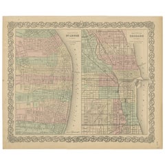
Antique Map of St. Louis and Chicago
Located in Langweer, NL
Antique map titled 'The City of St. Louis Missouri - The City of Chicago Illinois'. Dual map on single page showing St. Louis and Chicago. Finely produ...
Category
Antique Mid-19th Century Maps
Materials
Paper
$142 Sale Price
20% Off
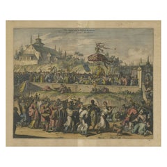
Original Copper Engraving with View of the Palace and Chinese Emperor, ca.1700
Located in Langweer, NL
Title: "The Station used by the great Mandaryns Staetsie der groote Mandarijns / The Station used by the great Mandaryns Staetsie der groote Mandarijns. 1665.
The richly illustrat...
Category
Antique Early 1700s Prints
Materials
Paper
$228 Sale Price
20% Off
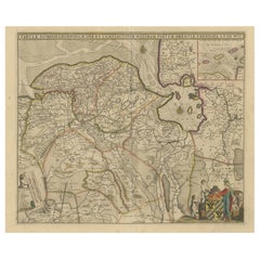
Antique Map of Groningen with Contemporary Hand Coloring
Located in Langweer, NL
Antique map titled 'Tabulae dominii Groeningae quae et complecititur maximam partem Dreniae Emendata a F. de Wit'. Original antique map of the province of Groningen, the Netherlands....
Category
Antique Late 17th Century Maps
Materials
Paper
$627 Sale Price
20% Off
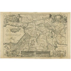
Antique Map of the Holy Land by Keur, 1748
Located in Langweer, NL
Antique Map Holy Land titled 'De Gelegentheyd van t'Paradys ende t'Landt Canaan, Mitsgaders d'eerst bewoonde Landen der Patriarchen'. Includes five decorative vignettes, including No...
Category
Antique 18th Century Maps
Materials
Paper
$331 Sale Price
20% Off
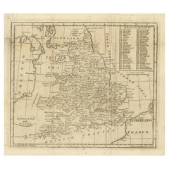
Antique Map of England and Wales, with References to the Counties
Located in Langweer, NL
Antique map titled 'England and Wales'. Original antique map of England and Wales, with references to the counties. Source unknown, to be determined. Published circa 1820.
Category
Antique Early 19th Century Maps
Materials
Paper
$133 Sale Price
20% Off
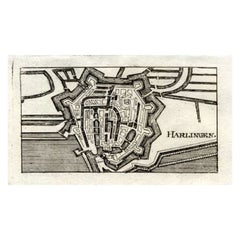
Antique Map of Harlingen, Harbour City in the Netherlands, 1691
Located in Langweer, NL
Plate 'Harlingen.' (Plan of the city of Harlingen, The Netherlands.) This attractive original old antique print / plate originates from: 'Ausführliche und grundrichtige Beschreibung ...
Category
Antique 17th Century Maps
Materials
Paper
$133 Sale Price
20% Off
Large Antique County Map of Cambridgeshire, England
Located in Langweer, NL
Antique map titled 'A Map of Cambridgeshire from the best Authorities'. Original old county map of Cambridgeshire, England. Engraved by John Cary. Originates from 'New British Atlas'...
Category
Antique Early 19th Century Maps
Materials
Paper
$218 Sale Price
20% Off
Large Antique County Map of Lincolnshire, England
Located in Langweer, NL
Antique map titled 'A Map of Lincolnshire from the best Authorities'. Original old county map of Lincolnshire, England. Engraved by John Cary. Originates from 'New British Atlas' by ...
Category
Antique Early 19th Century Maps
Materials
Paper
$275 Sale Price
20% Off
Large Antique Map of the British Isles, with inset of the Orkneys and Shetlands
Located in Langweer, NL
Antique map titled 'A Map of Great Britain and Ireland (..)'. Large antique map of the British Isles, with part of the French and Dutch coasts, and an inset of the Orkneys and Shetla...
Category
Antique Late 18th Century Maps
Materials
Paper
$608 Sale Price
20% Off
Large Antique County Map of Worcestershire, England
Located in Langweer, NL
Antique map titled 'A Map of Worcestershire from the best Authorities'. Original old county map of Worcestershire, England. Engraved by John Cary. Originates from 'New British Atlas'...
Category
Antique Early 19th Century Maps
Materials
Paper
$218 Sale Price
20% Off
Large Antique County Map of Westmorland, England
Located in Langweer, NL
Antique map titled 'A Map of Westmoreland from the best Authorities'. Original old county map of Westmorland, England. Engraved by John Cary. Originates from 'New British Atlas' by J...
Category
Antique Early 19th Century Maps
Materials
Paper
$266 Sale Price
20% Off
Antique Map of the Night Skies of the Northern and Southern Hemispheres, 1880
Located in Langweer, NL
Antique world map titled 'Planisphère en Céleste'.
This map depicts the night skies of both the northern and southern hemispheres. This map originates from 'Géographie Universell...
Category
Antique 1880s Maps
Materials
Paper
$275 Sale Price
20% Off
Antique Map of China and Korea incl Formosa and Hainan, by Janssonius, ca.1650
Located in Langweer, NL
Antique map titled 'Imperii Sinarum Nova Descriptio'. Beautiful map of China and Korea, much detail troughout the map. Including the Islands of Formosa (Taiwan) and Hainan. The Great...
Category
Antique 17th Century Maps
Materials
Paper
$2,806 Sale Price
20% Off
Antique Map of Flanders 'Belgium' by F. de Wit, circa 1680
Located in Langweer, NL
Antique map titled 'Comitatus Flandriae Tabula, in Lucem Edita'. Large map of Flanders, Belgium. Published by F. de Wit, circa 1680.
Category
Antique Late 17th Century Maps
Materials
Paper
$570 Sale Price
20% Off
Detailed Map of New Zealand Showing the Route of Capt. Cook's First Voyage, 1803
Located in Langweer, NL
Antique map New Zealand titled 'De Rivier de Theems en Mercurius Baai in Nieuw Zeeland'. Detailed map of New Zealand showing the route of Capta...
Category
Antique 19th Century Maps
Materials
Paper
$618 Sale Price
20% Off
Pl. 4 Antique Print of Various Elements of the Kew Gardens by Le Rouge, c.1785
Located in Langweer, NL
Antique print titled 'Vue du Lac, de l'Orangerie et du Temple d'Eole à Kew (..)'. Copper engraving showing the lake, orangery, temple and pagoda of the Kew gardens. This print origin...
Category
Antique 18th Century Prints
Materials
Paper
$133 Sale Price
20% Off
Original Antique Engraving of Otago by Cook, 1803
By James Cook
Located in Langweer, NL
Antique print titled 'Otago Bevelhebber van het Eiland Amsterdam'. Antique print depicting Otago, commander of the Island Amsterdam. Originates from 'Reizen Rondom de Waereld door James Cook...
Category
Antique 19th Century Prints
Materials
Paper
$228 Sale Price
20% Off
Antique Print of Villefranche in the Nice and Savoy Region of France, c.1865
Located in Langweer, NL
Antique print titled 'Villefranche près de Nice'. Original antique print of Villefranche near Nice, France. This print originates from 'Nice Et Savoie, Sites Pittoreques, Monuments, ...
Category
Antique 19th Century Prints
Materials
Paper
$437 Sale Price
20% Off
Rare Original Antique View in Old Colours of Villefranche in France, c.1860
Located in Langweer, NL
Antique print titled 'Villefranche'. View of Villefranche near Nice, France. Source unknown, to be determined.
Artists and Engravers: Published by Lemercier, Paris.
Condition: ...
Category
Antique 19th Century Prints
Materials
Paper
$304 Sale Price
20% Off
Original Antique Hand-Colored Optica Print of the Hague, C.1760
Located in Langweer, NL
Antique print titled 'Vue de la Haye en Hollande - Prospect von Gravenhag in Holland'. Beautiful view of The Hague, the Netherlands. This is an optical print, also called 'vue optiqu...
Category
Antique 18th Century Prints
Materials
Paper
$342 Sale Price
20% Off
Map of Australia, New Zealand, Part of China, Japan and Southeast Asia, 1857
Located in Langweer, NL
German Antique map titled 'Australien'. Map of Australia, New Zealand, part of China, Japan and Southeast Asia. In the upper right is a bit of the California coast by San Francisco. ...
Category
Antique 19th Century Maps
Materials
Paper
$666 Sale Price
20% Off
German Antique Map of Australia and New Zealand, 1857
Located in Langweer, NL
Antique map Australia titled 'Festland von Australien und benachbarte Inseln'. Detailed map of Australia and New Zealand, including excellent det...
Category
Antique 19th Century Maps
Materials
Paper
$237 Sale Price
20% Off
Antique Map of Northern Italy by F. de Wit, 1690
Located in Langweer, NL
A very decorative map centered on Genua, and including the towns of Milan, Torino, Parma, Cremona, etc. Decorative title cartouche upper right, five putti holding the arms of the reg...
Category
Antique Late 17th Century Maps
Materials
Paper
$523 Sale Price
20% Off
Het Huis Rechteren, Christ, 1846
Located in Langweer, NL
Het huis Rechteren.' (Rechteren Castle.) This Castle is situated in the province of Overijssel in Dalfsen. The castle was built in the 14th century by Herman van Voorst. Other well k...
Category
Antique 19th Century Prints
Materials
Paper
$74 Sale Price
20% Off
Antique Map of The Harbour of Acapulco in Mexico, 1749
Located in Langweer, NL
Description: Antique map titled 'Plan van de Haven van Acapulco (..) - Plan du Port d'Acapulco (..)'. Original antique map of the Port of Acapulco on the coast of Mexico in the South...
Category
Antique 1740s Maps
Materials
Paper
$342 Sale Price
20% Off
Beautiful Antique Map of the French Coast, from St. Valeri to Dieppe, 1720
Located in Langweer, NL
Antique map France titled 'Les Embouchures de la Somme et de Bresle Riv. ou est St. Valeri, Eu et Dieppe'.
Beautiful map of the French coast, fr...
Category
Antique 1720s Maps
Materials
Paper
$850 Sale Price
35% Off
Antique Map of Independent Tartary by W. G. Blackie, 1859
Located in Langweer, NL
Antique map titled 'Turkestan or Independent Tartary'. Original antique map of Turkestan or Independent Tartary. This map originates from ‘The Imperial Atlas of Modern Geography’. Pu...
Category
Antique Mid-19th Century Maps
Materials
Paper
$237 Sale Price
20% Off
Original Engraved Portrait of Louis II, King of Hungary, Croatia & Bohemia, 1615
Located in Langweer, NL
Antique portrait titled 'Lodovicus D.G. (..)'.
Portrait of Louis II, King of Hungary, Croatia and Bohemia. This print originates from 'Tooneel der keysere...
Category
Antique 1610s Prints
Materials
Paper
$275 Sale Price
20% Off
Antique French Map of Hungary with Decorative Title Cartouche, c.1730
Located in Langweer, NL
Antique map titled 'La Hongrie suivant les Nouvelles Observations (..)'. Antique map of Hungary with decorative title cartouche. Artists and Engravers: ...
Category
Antique 18th Century Maps
Materials
Paper
$361 Sale Price
20% Off
Antique Map of the East Indies by Janssonius, c.1644
By Johannes Janssonius
Located in Langweer, NL
Antique map titled 'India quae Orientalis dicitur, et Insulae adiacentes'. Old map of the East Indies and Southeast Asia showing the area between India in the West and parts of Japan...
Category
Antique 17th Century Maps
Materials
Paper
$2,521 Sale Price
20% Off
Antique Map of Australia, New Zealand and Oceania by F. von Stülpnagel, 1850
Located in Langweer, NL
Antique map titled 'Australien und Polynesien in Mercators Projection'. A map of Australia, New Zealand and Oceania. This includes Fiji, Tahiti and several other island groups in the...
Category
Antique Mid-19th Century Maps
Materials
Paper
$183 Sale Price
30% Off
Antique Print of two Chinese Village Pau Ing Hyen with Windmills, China, 1748
Located in Langweer, NL
Antique print titled 'Village Flottant - Ville de Pau Ing Hyen avec ses Moulins a Vent'. View of two Chinese villages. This print originates from Prevo...
Category
Antique 18th Century Prints
Materials
Paper
$171 Sale Price
20% Off
Original Antique Sea Chart of the Coastline from England to Gibraltar, ca.1700
Located in Langweer, NL
Antique map titled 'A Chart of the Sea-Coast from England to the Streights.'
Original antique map showing the European coastline from the South of England (and North of France) to ...
Category
Antique Early 1700s Maps
Materials
Paper
$903 Sale Price
20% Off
Stunning Bird's-Eye View Plan of Hasselt by Blaeu in The Netherlands, 1649
Located in Langweer, NL
Antique print, titled: 'Hasselt.'
Bird's-eye view plan of Hasselt in The Netherlands. With key to locations and coats of arms. Text in Dutch on verso. This plan originates from the famous city Atlas: 'Toneel der Steeden' published by Joan Blaeu...
Category
Antique 1640s Maps
Materials
Paper
$1,094 Sale Price
20% Off
Antique Chart with Isomagnetic Lines by Black, 1854
Located in Langweer, NL
Antique map titled 'A Chart of Magnetic Curves of Equal Variation'. Chart with isomagnetic lines on continents, except for North America. This map orginates from 'General Atlas Of Th...
Category
Antique 19th Century Prints
Materials
Paper
$126 Sale Price
20% Off
Nice Antique Print of a Breton Cow, a French Cattle Breed from Brittany, 1862
Located in Langweer, NL
Antique print titled 'Vache Bretonne' - This rare plate shows a Breton Cow, a French cattle breed from Brittany. From: 'Les Races bovines au concours universel agricole de Paris en 1...
Category
Antique 1860s Prints
Materials
Paper
$304 Sale Price
20% Off
Original Antique Engraving of a Sea Chart of the Western Mediterranean, ca.1650
Located in Langweer, NL
Antique map titled 'Pascaerte van 't westlyckste deel vande Middelandsche-Zee (..)'.
Sea chart of the Western Mediterranean. The map extends from the Straits of Gibralter to Italy ...
Category
Antique 1650s Maps
Materials
Paper
$1,189 Sale Price
20% Off
Antique Map of North and Central Italy and the Island of Corsica, c.1860
Located in Langweer, NL
Antique map titled 'North & Central Italy and the Island of Corsica'.
Old map of North and Central Italy, and the island of Corsica. With an inset map of the region of Rome. Orig...
Category
Antique 19th Century Maps
Materials
Paper
$294 Sale Price
20% Off
Antique Map of Portugal by Nolin '1704'
Located in Langweer, NL
Antique map titled 'Le Royaume de Porutgal divisé en cinq grandes Provinces (..)'. Rare and very decorative map of Portugal. It shows the territory of ...
Category
Antique Early 18th Century Maps
Materials
Paper
$808 Sale Price
20% Off
Print of Leopold I, Holy Roman Emperor, King of Hungary, Croatia & Bohemia, 1695
Located in Langweer, NL
Antique print, titled: 'Leopoldus Romanorum Imperator Semper Augustus.'
This original antique plate shows a portrait of Leopold I (9 June 1640 – 5 May 1705), he was Holy Roman Emperor...
Category
Antique 1690s Prints
Materials
Paper
$304 Sale Price
20% Off
Old Hand-Colored Print with a View of Marseille, France, ca.1885
Located in Langweer, NL
Antique print titled 'Marseille aus der Vogelschau'.
Old print with a view of Marseille, France. This print originates from a German illustrated newsletter, published circa 1885.
...
Category
Antique 1850s Maps
Materials
Paper
$342 Sale Price
20% Off
Original Antique Engraving of the Mighty Imperial Osaka Castle in Japan, 1669
Located in Langweer, NL
Antique print, titled: 'Afbeeldinge vant Maghtich Keyserlyck Casteel Osacca geleegen int groot Ryck Jappan besuyden de Stadt Osacce inde provinsie Qioo.' - ('Image of the Mighty Imperial Castle Osaka').
A bird's eye view of Osaka Castle, Japan. Arnoldus Montanus' "Gedenkwaerdige Gesantschappen der Oost-Indische Maatschappy in 't Vereenigde Nederland aan de Kaisaren van Japan […]. Amsterdam: Jacob Meurs, 1669.
Artists and Engravers: Made by an anonymous engraver after 'Arnoldus Montanus'.
Condition: Very good, given age. Original middle fold, as issued. Some faint browning of the margin edges. A few small spots in the margins (from paper making...
Category
Antique 1660s Maps
Materials
Paper
$903 Sale Price
20% Off
Print of a Fortified Mosque and of Nobility in Aceh, Sumatra, Indonesia, 1874
Located in Langweer, NL
Antique print Indonesia titled 'Een versterkte Missigit' and 'Atchineezen'. Antique print depicting two scenes in Indonesia. Originates from 'De Oorlog tusschen Nederland en Atchin' ...
Category
Antique 19th Century Prints
Materials
Paper
$247 Sale Price
20% Off
Colourful Antique Map of England and Wales Divided in Counties, 1854
Located in Langweer, NL
Antique map titled 'A Map Shewing the Places in England & Wales Sending Members to Parliament with the numbers returned, divisions of counties and population, places of county electi...
Category
Antique 19th Century Maps
Materials
Paper
$618 Sale Price
20% Off
Antique Map of Denmark with Schleswig-Holstein and the South of Sweden, c.1750
Located in Langweer, NL
Antique map titled 'General Charte von Konigreich Daenemark nebst dem Herzogthum Holstein.' Denmark with Schleswig-Holstein and the southern coast of Sweden. The large title cartouch...
Category
Antique 18th Century Maps
Materials
Paper
$352 Sale Price
20% Off
Antique Map of Cook's Strait in New Zealand, 1803
Located in Langweer, NL
Antique map New Zealand titled 'Kaart van Cooks Straat in Nieuw Zeeland'. Antique map of Cook's Strait in New Zealand. Originates from 'Reizen ...
Category
Antique 19th Century Maps
Materials
Paper
$618 Sale Price
20% Off
Rare Antique Miniature Map of Pakistan, India and Cambaia, ca.1618
Located in Langweer, NL
Old 17th century miniature antique map of 'Cambaia' , from the 1616 edition of Jadocus Hondius Atlas by Petrus Bertius.
Original copperplate engraving with hand coloring.
Carto...
Category
Antique 17th Century Maps
Materials
Paper
$371 Sale Price
20% Off
Two Antique Genealogy Charts of the Royal House of France, Coats of Arms, 1732
Located in Langweer, NL
Antique print titled 'Nouvelle Carte Genealogique de la Maison Royale de France (..)'. Set of two prints depicting a genealogical chart of the Royal ...
Category
Antique 18th Century Prints
Materials
Paper
$523 Sale Price / set
20% Off
Antique Map of China, Korea, Japan and the Northern Philippines, circa 1780
Located in Langweer, NL
Antique map titled 'Carte de l'Empire de la Chine de la Tartarie Chinoise, et du Royaume de Corée'. Interesting and detailed map of China, Korea, Japan and the Northern Philippines. ...
Category
Antique Late 18th Century Maps
Materials
Paper
$285 Sale Price
20% Off
Antique Map of Martinique with Title Cartouche Garnished with Sugar Cane, c.1760
Located in Langweer, NL
Antique map titled 'Het Westindisch Eiland Martenique'. Decorative map of Martinique filled with good detail of roads, topography, soundings, villages, windmills, and plantations. Th...
Category
Antique 18th Century Maps
Materials
Paper
$884 Sale Price
20% Off
Antique Map of South America by Johnston '1909'
Located in Langweer, NL
Antique map titled 'South America, Southern Sheet'. Depicting Chile, Argentina, Brazil, Patagonia, the Falkland Island and more. With inset maps of Valparaiso, Rio de Janeiro and Bue...
Category
Early 20th Century Maps
Materials
Paper
$237 Sale Price
20% Off
Antique Map of the Netherlands by Guicciardini, 1582
Located in Langweer, NL
Antique map titled 'Hollandiae Cattorum Regionis Typus'. Early copper engraving of the Netherlands in the 2nd state, numbered 30 bottom right. This map originates from 'Description d...
Category
Antique 16th Century Maps
Materials
Paper
$566 Sale Price
20% Off
Antique Genealogy Chart of the Margraviates and Baden-Durlach, Germany, 1732
Located in Langweer, NL
Antique print titled 'Genealogie de la Maison de Baden (..)'. Chart of the genealogy of the Margraviates Baden-Baden and Baden-Durlach. This print orginates from 'Atlas Historique'. ...
Category
Antique 18th Century Prints
Materials
Paper
$266 Sale Price
20% Off
Colorful and Decorative Miniature Map of India, Ceylon by Bertius 1616
Located in Langweer, NL
Old 17th century miniature antique map of India - Ceylon from the 1616 edition of Jadocus Hondius Atlas by Petrus Bertius. Original copperplate engraving with hand coloring.
Carto...
Category
Antique 17th Century Maps
Materials
Paper
$371 Sale Price
20% Off
Antique Map of Belgium by J. Tallis, circa 1851
Located in Langweer, NL
A highly decorative and detailed mid-19th century map of Belgium which was drawn and engraved by J. Rapkin (vignettes by J. Marchant and J. B. Allen) an...
Category
Antique Mid-19th Century Maps
Materials
Paper
$237 Sale Price
20% Off
Antique Map of New Zealand and Tasmania, 1904
Located in Langweer, NL
This large antique map is taken from; 'Andrees Allgemeiner Handatlas in 126 Haupt-Und 139 Nebenkarten', Bielefeld; Leipzig: Velhagen & Klasing 1899. Andrees Allgemeiner Handatlas was...
Category
20th Century Maps
Materials
Paper
$85 Sale Price
20% Off
Antique Map of the Region of Verona 'Italy' by Ortelius, circa 1584
Located in Langweer, NL
Antique map titled 'Veronae Urbis Terratorium'. Original antique map of the Verona region, Italy. Centered on Verona, and including Mantua, and Lago de Garda. Published by A. Orteliu...
Category
Antique Late 19th Century Maps
Materials
Paper
$856 Sale Price
20% Off
Antique Map of Arabia by Tardieu '1843'
Located in Langweer, NL
Antique map titled 'Arabie'. Attractive small map of Arabia. This map originates from 'Dictionnaire Universel de Geographie Moderne' 4th Edition, by A.Pe...
Category
Antique Mid-19th Century Maps
Materials
Paper
$190 Sale Price
20% Off
Antique Print of Oedidee, a Native from Bora Bora, 1803
Located in Langweer, NL
Antique print titled 'Oedidee Jongman van Bolabola'.
Antique print of Oedidee, a native from Bora Bora. Originates from 'Reizen Rondom de Waereld door James Cook (..)'.
Artis...
Category
Antique Early 1800s Maps
Materials
Paper
$171 Sale Price
20% Off
Antique Map of the Region of Poitou by Ortelius, circa 1600
Located in Langweer, NL
Antique map titled 'Poictou'. Original antique map of the region of Poitou, a former province of west-central France whose capital city was Poitiers. Published by A. Ortelius, circa ...
Category
Antique Early 17th Century Maps
Materials
Paper
$570 Sale Price
20% Off
Recently Viewed
View AllMore Ways To Browse
Statutes And Sculptures
Swedish Gustavian Glass Cabinet
Swiss Chalet Chairs
Tea Cup Art Nouveau
Tea Cup Holder
Teak Buddha
Teak Gentlemans
Thomasville Hollywood Regency
Thomire Clock
Three Legged Vessel
Three Tier Serving Trays
Tibet Earring
Tibetan Antique Cabinet
Tiffany And Co China
Tiffany Blue Rims
Tiffany Sterling Ice Tea Spoons
Torchiere Sculpture
Tortoise Christian Dior
