Entertainment Prints and Multiples

to
33
203
170
86
44
29
Overall Width
to
Overall Height
to
198
40
21
2
1
1
1
1
28
26
25
20
17
186
156
159
31
1
4
19
48
34
11
20
4
3
70
371
154
7
596
39,941
21,026
14,362
13,004
11,551
9,254
8,125
6,020
4,352
3,853
3,719
3,674
3,656
3,500
3,330
3,310
2,787
2,736
2,676
184
175
120
115
21
25
307
359
114
Art Subject: Entertainment
Carte Pour Servir a l'Histoire Philosophique.. - Etching by Rigobert Bonne- 1780
Located in Roma, IT
Etching on paper. From Guillaume-Thomas Raynal, Histoire philosophique et politique des établissemens et du commerce des Européens dans les deux Indes, Geneva 1780. This interestin...
Category

1780s Modern Figurative Prints

Materials

Etching

Accuratissima Totius Asiae Tabula - Etching by Frederick de Wit - 1680 ca
Located in Roma, IT
This double-page etching with contemporary coloring, entitled Accuratissima totius Asiae Tabula, was realized by the cartographer Frederick de Wit for the famous Atlas published in A...
Category

1680s Modern Figurative Prints

Materials

Etching

Christo-New York, Central Park 'The Gates XXIII' 2004 Vintage
By Javacheff Christo
Located in Brooklyn, NY
This rare exhibition poster features an early drawing by Christo titled "The Gates XXIII," depicting the view from Central Park West with the Dakota in the background. The drawing wa...
Category

Early 2000s Contemporary Prints and Multiples

Materials

Offset

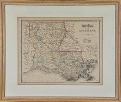
Louisiana: A Framed 19th Century Map by O.W. Gray
Located in Alamo, CA
This framed 19th century map of the Louisiana territory was published in "Gray's Atlas of the United States with General Maps of the World, accompanied by Descriptions Geographical, Historical, Scientific and Statistica" published in 1873 in Philadelphia by O.W. Gray and Son and Stedman, Brown and Lyon. It is a highly detailed map of Louisiana...
Category

1870s Landscape Prints

Materials

Engraving

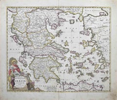
Accurata totius Archipelagi et Graeciae...- Etching by Frederick de Wit - 1680ca
Located in Roma, IT
This double-page etching with contemporary coloring, entitled Accurata totius Archipelagi et Graeciae Universae Tabula, was realized by the cartographer Frederick de Wit for the famo...
Category

1680s Modern Figurative Prints

Materials

Etching

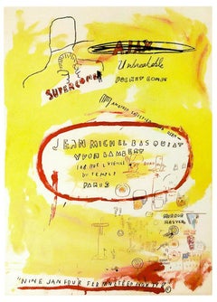
Supercomb (Exhibition Poster)
Located in Englishtown, NJ
Supercomb created by Jean Michel Basquiat for his exhibition in Paris 1988. Ultra vibrant colors with many interesting details of images and text combined in Basquiat's easily recogn...
Category

21st Century and Contemporary Contemporary Prints and Multiples

Materials

Lithograph

Toulouse-Lautrec, Composition, TLautrec (after)
Located in Fairfield, CT
Medium: Lithograph and stencil on vélin paper Year: 1946 Paper Size: 13 x 17 inches Inscription: Signed in the plate and unnumbered, as issued Notes: From the folio, TLautrec, 1946. ...
Category

1940s Post-Impressionist Figurative Prints

Materials

Lithograph

Circa 1920 travel poster by Pollacchi for Compagnie Générale Transatlantique
Located in PARIS, FR
The circa 1920 travel poster by Pollacchi for Compagnie Générale Transatlantique, promoting Auto-circuits in North Africa, is a captivating example of early 20th-century travel adver...
Category

1920s Prints and Multiples

Materials

Linen, Lithograph, Paper

AMERICA
Located in Santa Monica, CA
IMPORTANT AMERICAN MAP - ONE OF THE FIRST TO SHOW CALIFORNIA as an ISLAND JOHN SPEED (1552-1629) AMERICA - With Those Known Parts In That Unknown Worlde (sic), 1626-(76) (Burden 217 iv/iv) Engraving, uncolored. Engraved by Abraham Goos and published by Thomas Basset and Richard Chiswell - 4th state of 4 in 1676 15 1/8 x 20 1/2” From “A Prospect of the Most Famous Parts of the World”. Generally good condition. A repaired split in lower centerfold. This is the most common version of this important map...
Category

1620s Old Masters Landscape Prints

Materials

Engraving

AMERICA
AMERICA
$4,000 Sale Price
52% Off
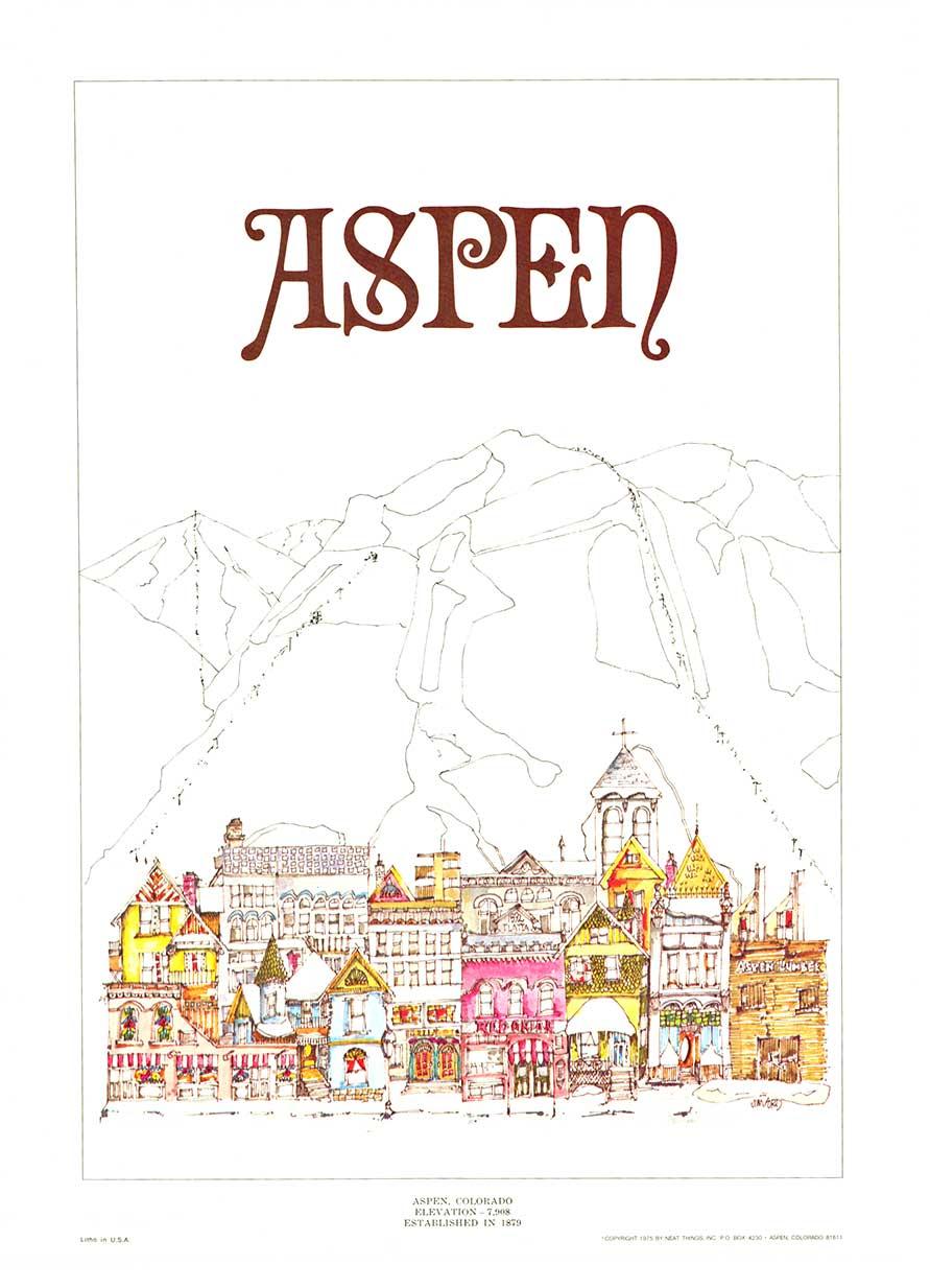
Original 1975 Aspen, Colorado vintage town and Rocky Mountains poster
Located in Spokane, WA
Original Aspen Colorado town and mountain scene printed in 1975. Artist: Jim Ford. This poster is archivally linen-backed in excellent condition, Grade A, and ready to frame. No...
Category

1970s American Modern Landscape Prints

Materials

Offset

PERU
Located in Santa Monica, CA
JOHANNES JANSSON (1588 - 1664) PERU, engraving with early coloring. Platemark 15 1/8 x 19 3/8 inches, sheet 17 x 20 1/2 A nice example of one of the earliest maps of Peru. From the ...
Category

1630s Old Masters Landscape Prints

Materials

Engraving

Accuratissima Galliae Tabula - Etching by Frederick de Wit - 1680ca
Located in Roma, IT
This double-page etching with contemporary coloring, entitled Accuratissima Galliae Tabula [...], was realized by the cartographer Frederick de Wit for the famous Atlas published in ...
Category

1680s Modern Figurative Prints

Materials

Etching

16th c. woodcut map - Tabula Asiae Vlll
Located in Santa Monica, CA
SEBASTIAN MUNSTER (1488-1652) ASIAE TABVLA Vlll 1540 (45) Woodcut from Munster's edition of Geographia Universalis, Basel, Henri Petri. 1545 edit...
Category

16th Century Old Masters Landscape Prints

Materials

Woodcut

Dania Regnum - Etching by Frederick de Wit - 1680 ca
Located in Roma, IT
This double-page etching with contemporary coloring, entitled Dania Regnum [...], was realized by the cartographer Frederick de Wit for the famous Atlas published in Amsterdam in ca....
Category

1680s Modern Figurative Prints

Materials

Etching

Original Northwest Orient and Trans World Airlines vintage travel poster
Located in Spokane, WA
Original poster: NORTHWEST ORIENT AIRLINES, TRANS WORLD AIRLINES poster. Description There’s a New Way Around the World / Northwest Orient Airlines – Trans World Airlines. Circa 1...
Category

1950s American Modern Landscape Prints

Materials

Lithograph

Novissima et Accuratissima Totius.. - Etching by Frederick de Wit - 1680ca
Located in Roma, IT
This double-page etching with contemporary coloring, entitled Novissima et Accuratissima totius Italiae, Corsicae et Sardiniae, was realized by the cartographer Frederick de Wit for ...
Category

1680s Modern Figurative Prints

Materials

Etching

Novissima et Accuratissima... - Etching by Frederick de Wit - 1680 ca
Located in Roma, IT
This double-page etching with contemporary coloring, entitled Novissima et Accuratissima Septentrionalis ac Meridionalis Americae, was realized by the cartographer Frederick de Wit f...
Category

1680s Modern Figurative Prints

Materials

Etching

New College, Oxford engraving by Pieter van der Aa after David Loggan
Located in London, GB
Pieter van der Aa (1659-1733), after David Loggan (1634–1692) New College, Oxford Engraving 12 x 16 cm An eighteenth-century view of Le College Neuf (New College), engraved by Piete...
Category

Early 18th Century Realist Prints and Multiples

Materials

Engraving

Original 100 Years of the Red Cross World Map vintage planisphere poster
Located in Spokane, WA
This is a vintage poster titled "Realisation de la Ligue de la Croix-Rouge, Geneva," commemorating one hundred years of the Red Cross from 1863 to 1963. Due to its folds, the poster ...
Category

1960s American Modern Landscape Prints

Materials

Lithograph

illustrated map of Morocco created in 1950 by Delaye
Located in PARIS, FR
Beautiful illustrated map of Morocco created in 1950 by Delaye. Main roads, car tracks, railroads are represented. This illustrated map is printed by P...
Category

1950s Prints and Multiples

Materials

Lithograph, Paper

Original North Coast Wine Country California vintage vineyard travel poster
Located in Spokane, WA
Original North Coast Wine Country California vintage vineyard travel poster. The artist Earl Thollander. Size 24.25” x 30”. Archival linen backed in good condition. Grade A- A repaired tear along the bottom was restored during linen backing and is inconspicuous. Celebrate Your Passion for Wine: Show off your love for wine culture while honoring California's North Coast’s rich history as one of the world’s premier wine regions. This poster represents the artistry and heritage behind each glass of wine you enjoy. Capture the Essence of California Wine Culture in 1975 Transport yourself to the golden era of wine-making with this authentic vintage 1975 North Coast Wine Country poster, a must-have for those who love wine, history, and timeless art. Featuring a design that exudes classic California vineyard...
Category

1970s American Modern Landscape Prints

Materials

Lithograph

Colombia Comercio Triangular, Pop Art Screenprint by Ana Mercedes Hoyos
Located in Long Island City, NY
Artist: Ana Mercedes Hoyos, Colombian (b. 1942) Title: Colombia Comercio Triangular Year: 2005 Edition: 75 Medium: Screenprint, signed and numbered in pencil Size: 22 x 30 in. (55.8...
Category

Early 2000s Contemporary Figurative Prints

Materials

Screen

Totius Africae Accuratissima Tabula - Etching by Frederick de Wit - 1680 ca
Located in Roma, IT
This double-page etching with contemporary coloring, entitled Totius Africae Accuratissima Tabula, was realized by the cartographer Frederick de Wit for the famous Atlas published in...
Category

1680s Modern Figurative Prints

Materials

Etching

Union Pacific West vintage fun map railroad travel poster
Located in Spokane, WA
Original “The Union Pacific West fun map, archivally linen backed in very good condition. Ready to frame. This was initially folded, and the fold marks were ...
Category

1960s American Modern Landscape Prints

Materials

Offset

WORLD MAP - Planisphaerium Terrestre Sive Terrarum Orbis... 1696
By Carel Allard
Located in Santa Monica, CA
CAREL ALLARD (1648 – 1709) PLANISPHAERIUM TERRESTRE SIVE TERRARUM ORBIS… 1696 (Shirley 578) Engraving, 20 ½ x 23 ½”, sheet 21 x 24 1/8". A stunning double hemisphere World Map...
Category

17th Century Old Masters Landscape Prints

Materials

Engraving

Persiae, Armeniae, Natoliae et Arabiae Descriptio per Frederick deWit 1666 map
Located in Paonia, CO
Map of Persiae, Armeniae, Natoliae et Arabiae Descriptio per F de Wit 1688 engraving from: Atlas Contractus Orbis Terrarum Praecipuas ac Novissimas Complectens Tabulas. Amsterdam, N. Visscher, 1656-77. (Koeman III, Vis5-8) This highly decorative map of the Middle East is by the Dutch engraver, publisher, and map seller...
Category

1660s Realist Landscape Prints

Materials

Engraving

Direccion de Hidrografia... - Etching by Tomàs Gozàlez - 1802
Located in Roma, IT
Etching on paper realized, among the others, by Tomàs Gozàlez. From Juan Corradi, Descubrimiento y conquista de la América o Compendio de la historia general del Nuevo Mundo, Madrid...
Category

Early 1800s Modern Figurative Prints

Materials

Etching

1956 original Air France poster “Réseau Aérien Mondial” (World Air Network)
Located in PARIS, FR
This 1956 original Air France poster, titled “Réseau Aérien Mondial” (World Air Network), is a stunning example of mid-century airline advertising. Designed at a time when air travel...
Category

1950s Prints and Multiples

Materials

Lithograph, Paper

Caimanes I, (Caymans I) (Estado III, VII/XIV)
Located in San Francisco, CA
Francisco Toledo Caimanes I (Caymans I), not dated Lithograph Unframed dimensions: 17 x 20.5 inches Framed dimensions: 26.5 x 33 inches Edition: Estado III, VII/XIV
Category

Late 20th Century Contemporary Animal Prints

Materials

Lithograph

Original "The Chateaux of the Loire, Go by Train" vintage poster
Located in Spokane, WA
Original vintage poster: The Chateaux of the Loire, Go By Train, artist J. Jacquelin, size: 24" x 39", year: 1956. Original vintage European travel poster...
Category

1950s American Impressionist Landscape Prints

Materials

Lithograph

New Map of the Terraqueous Globe - WORLD MAP - CALIFORNIA AS AN ISLAND
By Edward Wells
Located in Santa Monica, CA
EDWARD WELLS (British 1667- 1727) A NEW MAP of the TERRAQUEOUS GLOBE - according to the latest Discoveries and most general Divisions of it into CONTINENTS and OCEANS, 1700-01 (Shirley 609) Engraved by Michael Burghers, Oxford. Hand-colored, Platemark 14 1/4 x 20 1/8 inches. Central cartouche flanked by figures representing the continents with dedication to William, Duke of Gloucester...
Category

Early 1700s Old Masters Landscape Prints

Materials

Engraving

Antique Map - Gallia - Etching by Johannes Janssonius - 1650s
Located in Roma, IT
Antique Map - Gallia is an antique map realized in 1650 by Johannes Janssonius (1588-1664). The Map is Hand-colored etching, with coeval watercoloring. Good conditions with slight ...
Category

1650s Modern Figurative Prints

Materials

Etching

Circa 1950 original poster by Luc-Marie Bayle for TAI - World map
By Lue Marie Bayle
Located in PARIS, FR
This circa 1950 original poster, created by Luc-Marie Bayle, celebrates the global reach of TAI (Transports Aériens Intercontinentaux), one of France’s pioneering airline companies. ...
Category

1950s Prints and Multiples

Materials

Paper, Lithograph

1950 illustrated map Italy, Land of Saints and Sanctuaries
Located in PARIS, FR
In 1950, a highly detailed and artistically illustrated map titled Italie Terre de Saints et de Sanctuaires (Italy, Land of Saints and Sanctuaries) was published in Témoignage Chréti...
Category

1950s Prints and Multiples

Materials

Lithograph, Linen, Paper

Hercule - Etching by Jean François Poletnich - 18th Century
Located in Roma, IT
Hercule is an etching realized by Jean François Poletnich in 18th Century. Good conditions. The artwork is depicted through confident strokes.
Category

18th Century Old Masters Figurative Prints

Materials

Etching

Bermuda: An Early 17th Century Hand-colored Map by Henricus Hondius
By Henricus Hondius
Located in Alamo, CA
This attractive and interesting map of Bermuda by Henricus Hondius in 1633 is entitled "Mappa Aestivarum Insularum, Alias Barmudas". It is based on a ...
Category

Early 17th Century Old Masters Landscape Prints

Materials

Engraving

Chateau Valeri, French chateau, garden estate plan, mid 17th century engraving
Located in Melbourne, Victoria
'Chateau Valeri' Copper-line engraving by Matthaeus Merian. From 'Topographia Galliae', a fine series of engravings of 17th-century French landscapes, gardens, buildings and citie...
Category

Mid-18th Century Rococo Landscape Prints

Materials

Engraving

The plan of St. Martin's Church, St. Martin in the Fields
Located in Middletown, NY
London: Society of Antiqauries London, 1744. Engraving on buff wove paper with a large heraldic watermark with Strasbourg lily with a crown and shied and the letters LVG, 9 1/2 x 14 ...
Category

Mid-18th Century English School Landscape Prints

Materials

Handmade Paper, Engraving

Antique Map - Mare Pacificum - Etching by Johannes Janssonius - 1650s
Located in Roma, IT
Mare Pacificum is an antique map realized in 1650 by Johannes Janssonius (1588-1664). The Map is Hand-colored etching, with coeval watercolorang. Good conditions with slight foxing...
Category

1650s Modern Figurative Prints

Materials

Etching

Epirus Albania - Etching by Johannes Janssonius - 1650s
Located in Roma, IT
Epirus Albania is an ancient map realized in 1650 by Johannes Janssonius (1588-1664). Good conditions. From Atlantis majoris quinta pars, Orbem maritimum [Novus Atlas, volume V: ca...
Category

1650s Modern Figurative Prints

Materials

Etching

Antique French Copper Engraving - Horse Stables
Located in Houston, TX
Crisp antique copper engraving of a unique floor plan of French horse stables from Recueil d'Architecture, 1780. Original artwork on paper displayed on a...
Category

1780s Interior Prints

Materials

Ink, Paper

After Robert Motherwell-Juilliard School Dedication Vintage
Located in Brooklyn, NY
This original poster was published in 1969 by the Lincoln Center to announce the grand opening of the Juilliard School. According to the Lincoln Center Posters book (pages 16 & 17), ...
Category

20th Century Contemporary Prints and Multiples

Materials

Lithograph

Tabula Indiae Orientalis - Etching by Frederick de Wit - 1680ca
Located in Roma, IT
This double-page etching with contemporary coloring, entitled Tabula Indiae orientalis, was realized by the cartographer Frederick de Wit for the famous Atlas published in Amsterdam ...
Category

1680s Modern Figurative Prints

Materials

Etching

Amstelredam - Etching by Johannes Janssonius - 1650s
Located in Roma, IT
Amstelredam is an ancient map realized in 1650 by Johannes Janssonius (1588-1664). Good conditions. From Atlantis majoris quinta pars, Orbem maritimum [Novus Atlas, volume V: carte...
Category

1650s Modern Figurative Prints

Materials

Etching

Wonderground Map of London by MacDonald 'Max' Gill c. 1924 original poster
Located in London, GB
To see our other original vintage posters and views of London (including original paintings), scroll down to "More from this Seller" and below it click on "See all from this Seller" ...
Category

1920s Modern Landscape Prints

Materials

Lithograph

Original Societe Nationale des Chemin Map France, 1953 vintage poster on linen
Located in Spokane, WA
Original French vintage travel poster: "FRANCE, Société Nationale des Chemins de Fer Français." Printed in France by the French National Railroads. Original linen-backed poster; read...
Category

1950s American Modern Landscape Prints

Materials

Lithograph

Orbis Terrarum - Etching by Johannes Janssonius - 1650s
Located in Roma, IT
Antique Map - Orbis Terrarum is an antique map realized in 1650 by Johannes Janssonius (1588-1664). The Map is Hand-colored etching, with coeval watercoloring. Good conditions with...
Category

1650s Modern Figurative Prints

Materials

Etching

S.Juan de Puerto Rico - Etching by Johannes Janssonius - 1650s
Located in Roma, IT
S.Juan de Puerto Rico is an ancient map realized in 1650 by Johannes Janssonius (1588-1664). Good conditions. From Atlantis majoris quinta pars, Orbem maritimum [Novus Atlas, volum...
Category

1650s Modern Figurative Prints

Materials

Etching

Archipelagus Septentrionalis - Etching by Johannes Janssonius - 1650s
Located in Roma, IT
Archipelagus Septentrionalis is an ancient map realized in 1650 by Johannes Janssonius (1588-1664). Good conditions. From Atlantis majoris quinta pars, Orbem maritimum [Novus Atlas...
Category

1650s Modern Figurative Prints

Materials

Etching

Electric Donjon, Surrealist Etching from Brodsky and Utkin: Projects 1981 - 1990
Located in Long Island City, NY
Artist: Alexander Brodsky and Ilya Utkin, Russian (1955 - ) Title: Electric Donjon from Brodsky and Utkin: Projects 1981 - 1990 Year: 1990 Medium: Etching on German Rag paper, signed...
Category

1990s Conceptual Interior Prints

Materials

Etching

John Speede, Map of the County of Surrey, described and divided into hundreds
Located in London, GB
To see our other views and maps of England - including London, Oxford and Cambridge, scroll down to "More from this Seller" and below it click on "See all from this Seller" - or send us a message if you cannot find the view you want. John Speed/Speede (1551/2-1629) The County of Surrey Described and Divided into Hundreds Engraving with later hand colouring and text to the reverse.  Dated to c.1650 36 x 49 cm Probably the most famous early English mapmaker, John Speed's early life is somewhat of an enigma. He is believed to have trained as a rolling-press printer, but he was at heart an historian granted a sinecure in the Customs House by Queen Elizabeth to indulge his passion, later becoming a Fellow of the Society of Antiquaries. His first maps were historical, of the Holy Land 'Canaan as it was Possessed both in Abraham and Israels Dayes' and of England and Ireland recording 'all their Civill Warres since the Conquest'. In 1611 he published his 'Hostory of Great Britaine' which he regarded as his magnum opus, but it was the companion atlas 'Theatre of the Empire of Great Britaine' that - as the first printed atlas of Great Britain - sealed his reputation. William Rogers engraved the first map, 'the County Palatine of Chester' in about 1600, but following his untimely death the task of engraving was passed to Jodocus Hondius of Amsterdam. By 1612 the atlas was complete, the maps famed for their decorative elements. Many have town plans - Britain's first series of such plans - and descriptive text was printed to the reverse until the 1676 edition. Later printings (up until 1770) were issued without this text. By 1627 it has become a part of a world atlas 'Prospect of the Most Famous Parts of the World'. During the 17th century the plates passed through the hands of a series of publishers, the 1676 edition of Thomas Bassett and Richard Chiswell being regarded as its high point with the inclusion for the first time of a series of important maps. For the first half of the eighteenth century they were firmly established in the hands of the Overton family. This particular edition originally featured in The Theatre Of The Empire Of Great Britaine. It features attractive inset views of the long-since destroyed Richmond...
Category

17th Century Realist Landscape Prints

Materials

Engraving

Map of Lucca - Etching by Pierre Mortier - Early 18th Century
Located in Roma, IT
Map of Lucca is an etching realized by Pierre Mortier in the early 18th Century Good condition.
Category

Early 18th Century Modern Figurative Prints

Materials

Etching

St John's College, Oxford 1675 engraving by David Loggan
Located in London, GB
To see our other views of Oxford and Cambridge, scroll down to "More from this Seller" and below it click on "See all from this seller" - or send us a message if you cannot find the ...
Category

1670s Realist Landscape Prints

Materials

Engraving

Queens' College, Cambridge, engraving by David Loggan
Located in London, GB
David Loggan (1634 - 1692) Queens' College, Cambridge Engraving 37 x 45 cm An eighteenth-century view of Queens', Cambridge, engraved by David Loggan, the noted engraver, draughtsm...
Category

18th Century Realist Prints and Multiples

Materials

Engraving

Ancient Map-Poli Arctici (Map of the Poles)-Etching by Johannes Janssonius-1650s
Located in Roma, IT
Poli Arctici is an ancient map realized in 1650 by Johannes Janssonius (1588-1664). The Map is a Hand-colored etching, with coeval watercoloring. Good conditions with slight foxing...
Category

1650s Modern Figurative Prints

Materials

Etching

Jesus College, Oxford engraving by David Loggan
Located in London, GB
To see our other views of Oxford and Cambridge, scroll down to "More from this Seller" and below it click on "See all from this Seller" - or send us a message if you cannot find the view you want. David Loggan (1634 - 1692) Jesus College...
Category

17th Century Prints and Multiples

Materials

Engraving, Etching

Untitled - Lithograph by Ossi Czinner - 1980
Located in Roma, IT
Lithographyon Magnani-Pescia paper. Paper size 50cmx70cm, work size 41cmx62cm. Excellent condition, no defects. Artist's note on the print "retouché à la main" . OSSI CZINNER - Cen...
Category

1980s Contemporary Figurative Prints

Materials

Lithograph

Ancient Map - Zeilan - Etching by Johannes Janssonius - 1650s
Located in Roma, IT
Ancient Map - Zeilan is an ancient map realized in 1650 by Johannes Janssonius (1588-1664). The Map is Hand-colored etching, with coeval watercoloring. ...
Category

1650s Modern Figurative Prints

Materials

Etching

1944 original map Les vins de Champagne – Vignobles du Bar-Séquanais
Located in PARIS, FR
The 1944 original map "Atlas de la France Vinicole – Les vins de Champagne – Vignobles du Bar-Séquanais et du Bar-sur-Aubois", created by Louis Larmat and printed by Dorel in Paris, ...
Category

1940s Prints and Multiples

Materials

Lithograph, Paper

Pisces - Etching by Charles De la Haye - 18th Century
Located in Roma, IT
Pisces is an original etching artwork on paper realized by Charles De la Haye after Andrea Stech, in the 18th century. Signed on the plate on the lower. Good...
Category

18th Century Modern Figurative Prints

Materials

Etching

Recently Viewed

View All