Maps
to
4,243
5,459
195
5,659
3
75
35
18
14
6
5
5
4
4
3
1
1
2,927
2,257
475
3
290
34
10
126
10
37
9
2
5
4
3
3
5,572
123
55
34
32
719
326
213
148
136
5,662
5,662
5,662
104
59
28
21
15
Maps For Sale
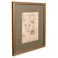
Antique Coaching Road Map, South Devon, English, Framed, Cartography, Georgian
Located in Hele, Devon, GB
This is an antique coach road map of South Devon. An English, framed lithograph engraving of regional interest, dating to the early 18th century and later.
Delightful early 18th cen...
Category
Early 18th Century British Georgian Antique Maps
Materials
Wood
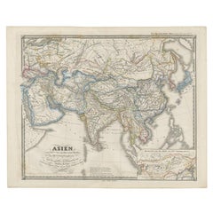
Old Map of Asia Depicting Asia in the 6th through the 9th Centuries, ca. 1855
Located in Langweer, NL
Antique map Asia titled 'Asien vom VIten bis in die erste Haelfte des IXten Jahrhundert’s Zeit der grossfen Ausdehnung des Ralifen Reiches; des Reiche...
Category
19th Century Antique Maps
Materials
Paper
$235 Sale Price
20% Off
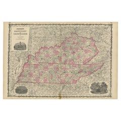
Civil War Era Map of Kentucky and Tennessee with Scenic Insets, Published 1864
Located in Langweer, NL
Rare 1864 Civil War Era Map of Kentucky and Tennessee with Scenic Insets
Description: This stunning antique map, titled "Johnson's Kentucky and Tennessee," was published in 1864 by ...
Category
1860s Antique Maps
Materials
Paper
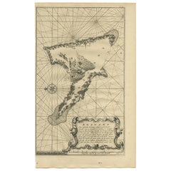
Antique Map of Anjouan Island by Valentijn, 1726
By F. Valentijn
Located in Langweer, NL
Antique map titled 'Anzuany'. This map depicts the island of Anjouan, one of the Comoros islands situated between Madagascar and Africa. The map is oriented with north to the left wi...
Category
Early 18th Century Dutch Antique Maps
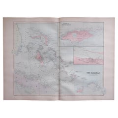
Large Original Antique Map of The Bahamas. 1894
Located in St Annes, Lancashire
Superb Antique map of The Bahamas
Published Edward Stanford, Charing Cross, London 1894
Original colour
Good condition
Unframed.
Free shipping
Category
1890s English Antique Maps
Materials
Paper
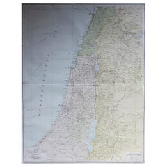
Large Original Vintage Map of Israel, circa 1920
Located in St Annes, Lancashire
Great map of Israel
Original color.
Good condition
Published by Alexander Gross
Unframed.
Category
1920s English Edwardian Vintage Maps
Materials
Paper
Large Original Antique Map of New York State ( Northern ), USA, C.1900
Located in St Annes, Lancashire
Fabulous map of Northern New York
Original color.
Engraved and printed by the George F. Cram Company, Indianapolis.
Published, C.1900.
Unframed.
Repairs to minor edge tears
Fr...
Category
1890s American Antique Maps
Materials
Paper
Antique Map of the Region Around the Baltic Sea by Cordier, c.1670
Located in Langweer, NL
Antique map titled 'Illyricum Orientis: In quo Partes II Moesia et Thracia'. Engraved map of the area west of the Baltic Sea, present day Bulgaria, Romania, and Turkey. The map is ba...
Category
17th Century Antique Maps
Materials
Paper
Historic 1864 Civil War Map of Georgia and Alabama with Coastal Focus
Located in Langweer, NL
Title: Historic 1864 Civil War Map of Georgia and Alabama with Coastal Focus
Description: This intricately detailed antique map, titled "Johnson's Georgia and Alabama," was publishe...
Category
1860s Antique Maps
Materials
Paper
Antique Print of the Feeding Chair of King James VI by Gibb, 1890
Located in Langweer, NL
Antique print titled 'Feeding Chair of King James VI'. Chromolithographic plate originating from 'The Royal House of Stuart. Illustrated By a Series of F...
Category
19th Century Antique Maps
Materials
Paper
$80 Sale Price
20% Off
Antique Print of Hagley Hall in Worcestershire, England, ca.1770
Located in Langweer, NL
Antique print titled 'Principal Front of Hagley'. Main facade of Hagley Hall, Worcestershire.
Hagley Hall is a Grade I listed 18th-century house in Hagley, Worcestershire, the ho...
Category
18th Century Antique Maps
Materials
Paper
$585 Sale Price
20% Off
Original Antique Map of the American State of Idaho & Wyoming, 1903
Located in St Annes, Lancashire
Antique map of Idaho and Wyoming
Published By A & C Black. 1903
Original colour
Good condition
Unframed.
Free shipping
Category
Early 1900s English Antique Maps
Materials
Paper
Antique Map of Germany by Johnston '1909'
Located in Langweer, NL
Antique map titled 'Empire of Germany'. Original antique map of Germany. With inset maps of Frankfurt and Munich. This map originates from the ‘...
Category
Early 20th Century Maps
Materials
Paper
$235 Sale Price
20% Off
Original Antique Map of South America. C.1780
Located in St Annes, Lancashire
Great map of South America
Copper-plate engraving
Published C.1780
Two small worm holes to left side of map
Unframed.
Category
Early 1800s English Georgian Antique Maps
Materials
Paper
The History of the Royal Canadian Mounted Police, Published in 1966
Located in Langweer, NL
This rare pictorial map by Peter R. Furse celebrates the history of the Royal Canadian Mounted Police. It was produced with the cooperation of the RCMP, as acknowledged in an elegant...
Category
1960s Vintage Maps
Materials
Paper
$850 Sale Price
20% Off
Old Map of the Kingdom of Tonga, Also Known as the Friendly Islands, ca.1780
Located in Langweer, NL
Antique print, titled: 'Carte des Isles des Amis.'
Map of the Kingdom of Tonga, also known as the Friendly Islands, and one of the last hereditary monarchies. Cook named this gro...
Category
1780s Antique Maps
Materials
Paper
$245 Sale Price
20% Off
Hand-Colored 17th-Century Map of Orléanais in France by Frederik De Wit c. 1688
Located in Langweer, NL
Title: Hand-Colored 17th-Century Map of Orléanais by Frederik De Wit c. 1688
Description: This beautifully crafted map, "Gouvernement General du Pays Orléanois," illustrates the Orl...
Category
1680s Antique Maps
Materials
Paper
Old Print of the Town Hall of Batavia 'Jakarta' in the Dutch East Indies, 1770
Located in Langweer, NL
Antique optical print titled 'Prospect des Rathhauses in Batavia (..)'. View of the town hall of Batavia, Indonesia. This is an optical print, also cal...
Category
18th Century Antique Maps
Materials
Paper
$500 Sale Price
20% Off
Antique Map of the Eastern Hemisphere by Lapie, France, circa 1830
Located in Langweer, NL
Antique Map of the Eastern Hemisphere by Lapie, France, circa 1830
This finely engraved and hand-colored antique map, titled Hémisphère de l'ancien continent (Eastern Hemisphere), w...
Category
1830s Antique Maps
Materials
Paper
Antique Map of the Nassau Region in Western Germany
Located in Langweer, NL
Antique map titled 'Nassovia Principatus (..)'. Detailed map of the Nassau region in western Germany between Koblenz, Hadamar, Giessen, Frankfurt and Mainz. The map is filled with in...
Category
Early 18th Century Antique Maps
Materials
Paper
$623 Sale Price
20% Off
Grand Map of Europe by Frederick de Wit, Circa 1690: A Baroque Era Masterpiece.
Located in Langweer, NL
This is an attractive historical map of Europe created by Frederick de Wit, published around 1690. Here's a detailed description of the map and additional context about its creation:...
Category
Late 17th Century Dutch Antique Maps
Materials
Paper
Antique Map of the Arabian Peninsula by Bonne 'c.1780'
Located in Langweer, NL
Antique map titled 'Carte de l'Arabie, du Golfe Persique, et de la Mer Rouge (..)'. Original antique map of the Arabian Peninsula, including the horn...
Category
Late 18th Century Antique Maps
Materials
Paper
$519 Sale Price
20% Off
Utrecht city plan
Located in UTRECHT, UT
“Platte grond der Stad Utrecht vertonende alle Gragten, Straaten, Stegen, Gangen, Markten, en plaatsen der openbare Gebouwen”, engraving published by Johannes van Schoonhoven in Amst...
Category
1770s Dutch Other Antique Maps
Materials
Paper
$3,838
Antique 1882 Map of Venezuela, Colombia (New Granada), and Ecuador
Located in Langweer, NL
Title: 1882 Map of Venezuela, Colombia (New Granada), and Ecuador
This map from 1882 provides a detailed representation of Venezuela, the United States of Colombia (historically ref...
Category
1880s Antique Maps
Materials
Paper
Ancient Course of the Ganges: A First Ptolemaic Map of India by Mercator, c.1584
Located in Langweer, NL
This remarkable map, titled "Asiae X Tab:", is a significant historical artifact that represents the convergence of knowledge and craftsmanship from two of the most esteemed figures in the history of geography and cartography.
Created by Gerard Mercator and based on the geographical insights of Claudius Ptolemy, this map is part of the rare first issue published in Brussels in 1578.
The map itself meticulously delineates the region between the Indus and Ganges rivers, an area of immense historical and geographical importance. It is an excellent representation of Ptolemy's second-century geographical data, which was fundamental in shaping the modern principles of mapmaking. Mercator, renowned for his precision and dedication to adhering closely to Ptolemy's original intentions, showcases this commitment through the detailed depiction of this significant Asian landscape.
This edition stands out not only for its historical accuracy but also for its artistic execution. Gerard Mercator, who was also an innovator in the use of the italic hand for map lettering, first introduced this style in his "Literarum latinarum" in 1540. The use of italics in this map enhances its legibility and aesthetic appeal, which became a hallmark of the finest sixteenth and seventeenth-century Dutch maps, largely attributed to Mercator’s influence.
The map measures 13 ½ x 18 inches and features fine hand coloring, which has been preserved in almost excellent condition alttough there some browning due to age. As a splendid example of the first issue from Mercator’s definitive edition of Ptolemy’s "Geographia", it not only serves as a testament to the rich history of geographical exploration but also stands as a beacon of the enduring legacy of its makers, shaping the future of cartographic design and precision.
The map "Asiae X Tab:", focusing on the region between the Indus and Ganges rivers, highlights several areas and cities of historical and geographical importance that are likely of interest to scholars, historians, and collectors. Here are key locations depicted on the map:
1. **Indus River**: As one of the major rivers of Asia and a cradle of ancient civilizations like the Indus Valley Civilization, the Indus River holds significant historical importance.
2. **Ganges River**: Another crucial river not just for its cultural and religious significance in India, but also as a vital geographic feature in ancient and medieval maps...
Category
16th Century Antique Maps
Materials
Paper
$1,077 Sale Price
20% Off
Antique Map of Trincomalee and Tambalagam Bay, 1758
Located in Langweer, NL
Antique map titled 'Bay de Trinquemale'. Map of Trincomalee and Tambalagam Bay in Sri Lanka. While these maps by Van Schley after Bellin were initially made for 'Histoire Generale de...
Category
18th Century Antique Maps
Materials
Paper
$170 Sale Price
20% Off
Original Antique Map of the American State of Arizona & New Mexico, 1903
Located in St Annes, Lancashire
Antique map of Arizona and New Mexico
Published By A & C Black. 1903
Original colour
Good condition
Unframed.
Free shipping
Category
Early 1900s English Antique Maps
Materials
Paper
Old Map of the Russian Empire, with English Language Text, Ca.1820
Located in Langweer, NL
Antique map titled 'Geographical, Statistical and Historical Map of Russia'.
Old map of the Russian Empire, encompassed on three sides by English language text. Originates from L...
Category
1820s Antique Maps
Materials
Paper
$510 Sale Price
20% Off
Western Roman Empire Map: British Isles & Gaul - 1802 Tardieu Atlas
Located in Langweer, NL
Antique Map Description and title: "Partie Occidentale de l'Empire Romain ou du Monde connu des Anciens d'Après d'Anville"
Publication Details:
- **Atlas Title:** Nouvel Atlas Univ...
Category
Early 1800s Antique Maps
Materials
Paper
$415 Sale Price
20% Off
Antique Map of the Netherlands by Brugsma, 1864
Located in Langweer, NL
Antique map titled 'Het Koningrijk der Nederlanden'. Map of the Netherlands. This map originates from 'F. C. Brugsma's Atlas van het Koninkrijk ...
Category
19th Century Antique Maps
Materials
Paper
$93 Sale Price
20% Off
1802 German Map of Kashmir and Surrounding Regions by Weimar, Based on Gentil
Located in Langweer, NL
Title: 1802 German Map of Kashmir and Surrounding Regions by Weimar, Based on Gentil
Description: This rare and finely detailed antique map, titled Charte von Kaschemir, was pub...
Category
Early 1800s Antique Maps
Materials
Paper
Old Map of the Western Region of the Kingdom of Algiers, Algeria, 1773
Located in Langweer, NL
Antique map titled 'Kaart van het Westelyk Gedeelte van het Ryk van Algiers'.
Old map of the western region of the Kingdom of Algiers, Algeria. Originates from the first Dutch ed...
Category
1770s Antique Maps
Materials
Paper
$359 Sale Price
20% Off
Beautiful Decorative Hand-Colored Antique Map of West Canada, 1851
Located in Langweer, NL
Description: Antique map of Canada titled 'West Canada'.
With decorative vignettes titled Kingston and Falls of Niagara. Originates from 'The Illustrated Atlas, And Modern History Of The World Geographical, Political, Commercial & Statistical, Edited By R. Montgomery Martin'. Published; John Tallis London, New York, Edinburgh & Dublin. 1851.
Drawn and Engraved by J. Rapkin.
Artists and Engravers: John Tallis (1817-1876) was a British map...
Category
1850s Antique Maps
Materials
Paper
$897 Sale Price
20% Off
Old German Map of the United States, Central America and the West Indies, c.1870
Located in Langweer, NL
Antique map titled 'Westindien, Mittelamerica und Vereinigte Staten'. Old map of the United States, Central America and the West Indies. This map originates from 'H. Kiepert's Kleine...
Category
19th Century Antique Maps
Materials
Paper
1601 Miniature Map of Southeast Asia & Nova Guinea by Ortelius, Vrients Edition
Located in Langweer, NL
This miniature map of the East Indies and Nova Guinea was created by Abraham Ortelius and published in 1601 as part of the "Epitome" by Giovanni Battista Vrients. It is a finely hand...
Category
Early 1600s Antique Maps
Materials
Paper
Old Engraving of The Catching of Horses on Jafnapatnam, Ceylon 'Sri Lanka', 1672
Located in Langweer, NL
Antique print, titled: 'Paardevangst op Jafnapatnam' - This plate shows the catching of horses on Jafnapatnam. The province of Jaffna , and specially the fort at Jaffnapatnam were th...
Category
1670s Antique Maps
Materials
Paper
$500 Sale Price
20% Off
Hand-Colored Map of Delfland by Hendrik de Leth, 1740 – Delft & The Hague
Located in Langweer, NL
Hand-Colored Map of Delfland by Hendrik de Leth, 1740 – Delft & The Hague
This beautifully preserved antique map titled "Nieuwe Gemeete Kaert van Delfland" was engraved by Hendrik d...
Category
1740s Antique Maps
Materials
Paper
Antique Map of the Mediterranean and the Persian Gulf by Danckerts, c.1718
Located in Langweer, NL
Antique map titled 'De Gelegentheyt Van't Paradys en 't Landt Canaan.' Dutch Bible map covering the region between the Mediterranean and the Persian Gulf, f...
Category
18th Century Antique Maps
Materials
Paper
$387 Sale Price
20% Off
1750 Bellin Map of the Red River (Tonkin River) and Hanoi, Vietnam
Located in Langweer, NL
Title: 1750 Bellin Map of the Red River and Hanoi, Vietnam
Description: This finely engraved eighteenth-century French map, titled Carte du Cours de la Riviere de Tunquin, was created by the renowned cartographer Jacques-Nicolas Bellin and published in 1750. It depicts the course of the Red River, historically referred to as the Tonkin River, from Hanoi, labeled as Cacho, Ville Capitale du Tunquin, to the Gulf of Tonkin, labeled as Baye de Tunquin. Bellin’s work was based on navigational surveys by an English explorer, as stated in the title, reflecting the growing European interest in Southeast Asia during the early colonial period.
The Red River Delta was a crucial region for trade and agriculture, forming the backbone of Vietnam’s economic and cultural history. The river originates in China and flows through northern Vietnam, passing through Hanoi before emptying into the Gulf of Tonkin. This map captures the strategic importance of the river, as it served as a major trade route for goods and a point of interest for European navigators, merchants, and missionaries seeking access to Indochina.
The map includes numerous geographical details. Hanoi is prominently labeled as the capital of Tonkin, a historical term used by Europeans to describe northern Vietnam. The surrounding settlements, islands, and tributaries are carefully marked, illustrating the intricate network of waterways that characterized the region. Notable features include Île de la Potterie, referring to a location known for ceramic production, and various sandbanks and fortified locations along the river.
A decorative compass rose is placed in the upper left corner, reinforcing the map’s navigational purpose. The scale of measurement is provided in French leagues, labeled as Grandes Lieues...
Category
1750s Antique Maps
Materials
Paper
Antique Map of East Asia by Coronelli, circa 1690
Located in Langweer, NL
Antique map of East Asia showing New Holland and parts of Van Diemens Land and New Zealand. This map is the right hand part of a two sheet map, but is complete on its own. This map o...
Category
Late 17th Century Antique Maps
Materials
Paper
$2,226 Sale Price
35% Off
Original Antique Map of the American State of Oklahoma, 1903
Located in St Annes, Lancashire
Antique map of Oklahoma
Published By A & C Black. 1903
Original colour
Good condition
Unframed.
Free shipping
Category
Early 1900s English Antique Maps
Materials
Paper
Rare Antique English SeaChart of Bali, Lombok, Floris, Borneo, Celebes etc, 1711
Located in Langweer, NL
Antique map titled 'A Large Draught from Benjar on the Island of Borneo To Macasser on the Island of Celebes Shewing the Streight of Bally with the Islands to the Eastward thereof.' ...
Category
1710s Antique Maps
Materials
Paper
$2,315 Sale Price
20% Off
Antique Map of Europe in the Year 800 and 1500, Published in 1842
Located in Langweer, NL
Antique map titled 'Carte de l'Europe'. Two maps of Europe. The upper map depicts Europe in the year 800, the lower map depicts Europe in 1500. This map originates from 'Atlas univer...
Category
19th Century Antique Maps
Materials
Paper
$377 Sale Price
20% Off
European Turkey Map – Detailed Balkan Ottoman Provinces 1858
Located in Langweer, NL
European Turkey and Greece Map – Balkans and Ionian Islands 1857
This detailed antique print shows “Die Europäische Türkei, Griechenland und die Ionische...
Category
Mid-19th Century German Antique Maps
Materials
Paper
European Turkey and Greece Map – Balkans and Ionian Islands 1857
Located in Langweer, NL
European Turkey and Greece Map – Balkans and Ionian Islands 1857
This detailed antique print shows “Die Europäische Türkei, Griechenland und die Ionische...
Category
Mid-19th Century German Antique Maps
Materials
Paper
Greece Map – Kingdom of Greece and Ionian Islands 1847
Located in Langweer, NL
Greece Map – Kingdom of Greece and Ionian Islands 1847
This elegant antique print shows the Kingdom of Greece titled “Königreich Griechenland und die Ionischen Inseln” meaning “King...
Category
Mid-19th Century German Antique Maps
Materials
Paper
Large Original Vintage Map of South Africa, circa 1920
Located in St Annes, Lancashire
Great map of South Africa
Original color.
Good condition / repair to a minor edge tear middle bottom
Published by Alexander Gross
Unframed.
...
Category
1920s English Edwardian Vintage Maps
Materials
Paper
Europe Map – Political Divisions and Borders, Published in 1858
Located in Langweer, NL
Europe Map – Political Divisions and Borders 1858
This fine antique print shows Europe with its political divisions titled “Europa zur Übersicht der politischen Verhältnisse” meanin...
Category
Mid-19th Century German Antique Maps
Materials
Paper
Europe Map – Rivers, Watersheds and Elevation, Published in 1857
Located in Langweer, NL
Europe Map – Rivers, Watersheds and Elevation 1857
This beautiful antique print shows Europe with its river systems and watershed regions, titled “Europa zur Übersicht der Flussgebi...
Category
Mid-19th Century German Antique Maps
Materials
Paper
Arctic Polar Map – North Pole and Russian Empire Regions 1857
Located in Langweer, NL
Arctic Polar Map – North Pole and Russian Empire Regions 1857
This remarkable antique print shows the Arctic titled “Polar-Karte enthaltend die Länder und Meere am Nord-Pol” meaning...
Category
Mid-19th Century German Antique Maps
Materials
Paper
World Map – Mercator Projection with Global Sea Routes, Published in 1857
Located in Langweer, NL
World Map – Mercator Projection with Global Sea Routes 1857
This attractive antique print shows a world map titled “Planiglob in Mercators Projection zur Übersicht der Erdfläche und...
Category
Mid-19th Century German Antique Maps
Materials
Paper
Antique Map of the Region of Tokyo and Nagasaki in Japan, 1922
Located in Langweer, NL
Antique map of Japan titled 'Japan - Environs of Tokio & Nagasaki'. Old map of Japan, includes inset maps of Tokyo, Nagasaki and surroundings. This map or...
Category
20th Century Maps
Materials
Paper
$170 Sale Price
20% Off
Solar System Map – Planetary Orbits and Data Chart, Published in 1857
Located in Langweer, NL
Solar System Map – Planetary Orbits and Data Chart 1857
This antique print shows a detailed diagram of the solar system titled “Planeten-System der Sonne” meaning “Planetary System ...
Category
Mid-19th Century German Antique Maps
Materials
Paper
Visible Side of the Moon Map – Detailed Lunar Crater Chart, Published in 1858
Located in Langweer, NL
Visible Side of the Moon Map – Detailed Lunar Crater Chart 1858
This fascinating antique print shows the visible side of the moon with incredible precision and detail. It depicts th...
Category
Mid-19th Century German Antique Maps
Materials
Paper
Antique Map of Russia and Surroundings by Stieler, 1874
Located in Langweer, NL
Antique map titled 'Nord- & Mittal-Asien, Ubersicht des Russischen Reiches.' A map of Russia in scale 1:20.000.000. The depicted area spans from Iran and Sweden in the left edge of t...
Category
19th Century Antique Maps
Materials
Paper
$66 Sale Price
20% Off
Interesting Map of Great Britain and Northern Europe with various Illustrations
Located in Langweer, NL
Antique map titled 'Itinera Varia Auctoris'. Very interesting map of Great Britain and Northern Europe. The map shows Edwards' journeys between 1716-1730 to study his beloved birds a...
Category
Mid-18th Century Antique Maps
Materials
Paper
$415 Sale Price
20% Off
Antique Map of North America by Johnston, 1882
Located in Langweer, NL
Antique map titled 'North America'.
Old map of North America. This map originates from 'The Royal Atlas of Modern Geography, Exhibiting, in a Series of Entirely Original and Authen...
Category
19th Century Antique Maps
Materials
Paper
Barados and St Christopher or St Kitts and Nevis Islands in the Caribbean, 1748
Located in Langweer, NL
This original map, a copperplate engraving by Le Rouge, presents two significant areas in the Caribbean. Titled "Isle St. Christophle une des Antilles aux anglois" and "La Barbade. d...
Category
Mid-18th Century Antique Maps
Materials
Paper
$340 Sale Price
20% Off
Antique Map of the Brazil Railway Company, '1912'
Located in Langweer, NL
Antique map titled 'Brazil Railway Company'. This folding map is attached to the booklet titled 'The Brazil Railway Company'. It is a memorandum by A. H. A. Knox-Little, who was the ...
Category
Early 20th Century Maps
Materials
Paper
$141 Sale Price
20% Off
Detailed Antique Map of the Region of Gujarat and Mumbai in India, C.1825
Located in Langweer, NL
Antique map titled 'No. 93 Guzerate, Chandeish et Aurungabad'. Detailed map of the region of Gujarat and the region of Mumbay. Originates from 'Atlas Universel' by P.M. Vandermaelen....
Category
19th Century Antique Maps
Materials
Paper
$463 Sale Price
20% Off
Recently Viewed
View AllMore Ways To Browse
Antique Wellington Chests
Antonio Cassi Ramelli
Archimede Seguso Birds
Art Deco Coasters
Art Deco Footballer
Art Deco Music Cabinet
Art Deco Waterfall Bedroom Furniture
Art Deco Waterfall Bedroom
Art Deco Whisky
Art Foulard
Art Nouveau Sunflower
Arts And Crafts Silver Coffee Pot
Asian Pink Bowl
Avesn Vase
Baccarat Carafe
Bakelite Bird
Bakelite Cocktail Picks
Bamboo Ikebana Vase
