Maps
to
4,237
5,489
200
5,694
3
75
35
18
14
9
6
5
4
4
3
1
1
2,936
2,283
475
3
290
34
10
126
10
37
9
2
5
4
3
3
5,607
128
60
35
32
791
345
232
171
153
5,697
5,697
5,697
104
59
28
21
15
Maps For Sale
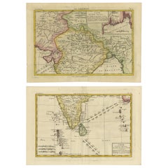
18th Century Cartographic Depiction of Upper India and Ceylon, 1835
Located in Langweer, NL
An exquisite set of two maps, 'Carte de la Partie Superieure De L'Inde en de Cadu Gange,' masterfully crafted by the renowned 18th-century French cartographer, Charles Marie Rigobert...
Category
1830s Antique Maps
Materials
Paper
$418 Sale Price
20% Off
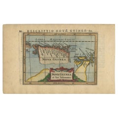
Antique Miniature Map of New Guinea by Bertius, '1618'
Located in Langweer, NL
Antique miniature map titled 'Nova Guinea et Ins. Salomonis'. Rare miniature map of New Guinea (Solomon Islands). This map originates from 'Tabularum Geo...
Category
Early 17th Century Antique Maps
Materials
Paper
$617 Sale Price
20% Off
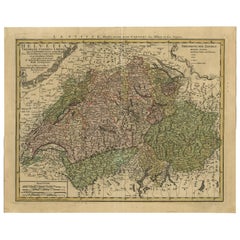
Antique Map of Switzerland by J.B. Homann, 1751
Located in Langweer, NL
Decorative example of Homann's map of Switzerland, with decorative cartouche and the coat of arms of each of the 13 Cantons.
Category
Mid-18th Century Antique Maps
Materials
Paper
$560 Sale Price
20% Off
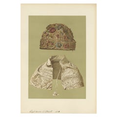
Antique Print of a Cap and Lace Collar by Gibb, 1890
Located in Langweer, NL
Antique print titled 'Skull-Cap of King Charles I - Lace Collar'. Chromolithographic plate originating from 'The Royal House of Stuart. Illustrated By a Series of Forty Plates in Col...
Category
19th Century Antique Maps
Materials
Paper
$80 Sale Price
20% Off
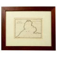
1844 French Nautical Portolano of Port De Chichimé Natolie by Antoine Roux
By Antoine Roux
Located in Milan, IT
Antique portolano, nautical map of Port De Chichimé Natolie engraved on a copper plate by Antoine Roux, Marseille France 1844, from his work Recueil des principaux plans des ports et...
Category
1840s French Antique Maps
Materials
Paper
Rare Hand-Colored Antique Map of the Bassora 'Basra' Region in Iraq, 1680
Located in Langweer, NL
Description: Antique map titled 'Delineato Regionis Bassora cum Angis uminibus et Isulis.'
Map of the Bassora (Basra) region, Iraq.
Artists and Engravers: Made by 'Olfert Dapper' ...
Category
1680s Antique Maps
Materials
Paper
$1,093 Sale Price
20% Off
1847 Amerique Septentrionale Framed Map
Located in Stamford, CT
1847 Amerique Septentrionale Framed Map Illustrated by Raimond Bonheur. As found framed condition.
Category
1840s American American Classical Antique Maps
Materials
Glass, Wood, Paper
Antique Map of Southern Italy by J. Tallis, circa 1851
Located in Langweer, NL
Decorative and detailed mid-19th century map of Southern Italy which was drawn and engraved by John Rapkin (vignettes by A. H. Wray and J. Rogers...
Category
Mid-19th Century Antique Maps
Materials
Paper
$261 Sale Price
20% Off
Antique Map of the Department De Tarn, 'France' by v. Levasseur, c. 1852
Located in Langweer, NL
Antique map titled 'Dépt Du Tarn'. Map of the French department of Du tarn, France.
This area produces a variety of traditional wines, including Cahors, Mauzac, Loin de l’Oeil an...
Category
Mid-19th Century French Antique Maps
Materials
Paper
$213 Sale Price
20% Off
Antique Map of Silesia centered on Glogau
Located in Langweer, NL
Antique map titled 'Ducatus Silesiae Glogani vera delineatio'. This decorative map shows the Odra River valley based on the Silesian cartographer, Jonas Scultetus. The map is oriente...
Category
Mid-17th Century Antique Maps
Materials
Paper
$646 Sale Price
20% Off
Rare Antique Map of the Region of Franekeradeel, The Netherlands 1664
Located in Langweer, NL
Antique map titled 'De Grietenije van Franeker deel (..)'. Map of the Grietenij of Franekeradeel, Friesland, The Netherlands. Multiple cartouches, key and coat of arms. Originates fr...
Category
17th Century Antique Maps
Materials
Paper
$116 Sale Price
20% Off
Large Original Antique Map of Morocco. Edward Weller, 1861
Located in St Annes, Lancashire
Great map of Morocco
Lithograph engraving by Edward Weller
Original colour
Published, 1861
Unframed
Good condition.
Category
1860s English Victorian Antique Maps
Materials
Paper
Beautiful Antique Print of Inhabitants of Tonga Tabu, C.1836
Located in Langweer, NL
Antique print titled 'Tonga-Tabu'. Old print depicting various inhabitants of Tonga Tabu. This print originates from 'Entdeckungs, Reise der Franzosischen Corvette Astrolabe Unternomen auf Befehl Konig Karls...
Category
19th Century Antique Maps
Materials
Paper
Chile Coast Bay Map – Antique 1749 Chart by Anson from Voyage Around the World
Located in Langweer, NL
Antique map titled 'Plan van een Baai en Haven aan de Kust van Chili (..) - Plan d'une Baye de la Côte du Chili (..)'. Original antique map of a bay on the coast of Chile discovered ...
Category
18th Century Antique Maps
Materials
Paper
Mercator's Ptolemaic Map of the Holy Land, Cyprus and Syria, circa 1580
Located in Langweer, NL
Antique map titled 'Asiae IIII Tab'. Beautiful map of Mercator's Ptolemaic map of the Holy Land, Cyprus, Syria, etc. Originates from Mercator's 'Geograph...
Category
16th Century Antique Maps
Materials
Paper
$655 Sale Price
20% Off
Antique Map of the British Isles According to the Geography of the Roman Empire
Located in Langweer, NL
Antique map titled 'Insulae Britannicae'. Interesting map of Britain, Scotland, and Ireland. It shows a rudimentary outline of the islands according to the geography of the Roman Emp...
Category
Late 18th Century Antique Maps
Materials
Paper
$171 Sale Price
20% Off
Large Original Antique Map of New York State( Southern ), USA, C.1900
Located in St Annes, Lancashire
Fabulous map of Southern New York . With a vignette of Lower Manhattan
Original color.
Engraved and printed by the George F. Cram Company, Indianapolis.
Published, C.1900.
Unfram...
Category
1890s American Antique Maps
Materials
Paper
Large Original Antique Map of Nebraska, USA, 1894
Located in St Annes, Lancashire
Fabulous map of Nebraska
Original color
By Rand, McNally & Co.
Published, 1894
Unframed
Some slight restoration to the Gosper / Furnas area. Seen in the last image
Free shipping.
Category
1890s American Antique Maps
Materials
Paper
Antique Print of Batavia 'Jakarta', in the Dutch East Indies, 1744
Located in Langweer, NL
Two views on one plate titled 'A Prospect of The Town of Batavia (and) A View of the Citadel of Batavia'. Beautiful views of Batavia (Jakarta), Indonesia. The upper view shows the ci...
Category
18th Century Antique Maps
Materials
Paper
$209 Sale Price
20% Off
Antique Map of Central Africa, 1903, With Colonial Territories Explorers Routes
Located in Langweer, NL
Antique Map of Central Africa, 1903, Featuring Colonial Territories and Explorers’ Routes
This antique map, titled "Central Africa," was engraved and published in 1903 by W. & A.K. ...
Category
Early 20th Century Maps
Materials
Paper
Biblical Map of the Region from the Mediterranean through the Persian Gulf, 1720
Located in Langweer, NL
Antique map titled 'Carte de la Situation du Paradis Terrestre, Et des Pais Habitez par les Patriarches Dressee pour bien entendre l'Histoire Sainte, Par Messire Pierre Daniel Huet.'
This interesting map covers the region from the Mediterranean through the Persian Gulf. Detail is omitted in favor of Biblical depictions including the Sermon on the Mount...
Category
1720s Antique Maps
Materials
Paper
$456 Sale Price
20% Off
Hibernia Regnum Map by Carel Allard, 1700: Hand-Colored Provinces of Ireland
Located in Langweer, NL
This is a historical map of Ireland created by Carel Allard around 1700, titled "Hibernia Regnum in Quatuor Provincias Ultoniam, Connaciam, Lageniam, et Momoniam". The map is hand-colored and engraved. It includes two large decorative cartouches. The map is part of an atlas by Carel Allard, an Amsterdam-based cartographer.
Here are the detailed points about the map:
Maker: Carel Allard - a prominent Dutch cartographer and publisher from Amsterdam.
Atlas: Source Atlas - Likely part of an atlas published by Carel Allard, but specific title of the atlas isn't mentioned.
Interesting Features
1. Decorative Cartouches: The map features two large, ornate cartouches. One in the upper left depicts a classical figure and British Royal arms...
Category
Early 1700s Antique Maps
Materials
Paper
$1,996 Sale Price
30% Off
Antique Map of The Dutch Smallingerland Township, 1861
Located in Langweer, NL
Antique map titled 'Gemeente Smallingerland'. Old map depicting the Smallingerland township including cities and villages like Eernewoude, Oudega, Boornbergum, Opeinde and Drachten. ...
Category
19th Century Antique Maps
Materials
Paper
$95 Sale Price
20% Off
Two Impressive Huge Midcentury World Map Wall Globes, 95" Diameter, 1950s
Located in Vienna, AT
We proudly offer this outstanding pair of very large wall-mounted modernist globes / world maps with an incredible diameter of 95 inches each. Unique one-of-a-kind sculptures depicti...
Category
Mid-20th Century Austrian Mid-Century Modern Maps
Materials
Aluminum, Iron
Antique Map of Chile, La Plata and Part of Bolivia by A & C. Black, 1870
Located in Langweer, NL
Antique map titled 'Chili, La Plata & Bolivia'. Original antique map of Chile, La Plata and Part of Bolivia. This map originates from ‘Black's General Atlas o...
Category
Late 19th Century Antique Maps
Materials
Paper
$144 Sale Price
30% Off
Large Original Vintage Map of Japan, circa 1920
Located in St Annes, Lancashire
Great map of Japan
Unframed
Original color
By John Bartholomew and Co. Edinburgh Geographical Institute
Published, circa 1920
Free shipping.
Category
1920s British Vintage Maps
Materials
Paper
Antique Map of the Brazilian Coast by A. Van Krevelt
Located in Langweer, NL
Uncommon edition of this accurate map of part of Brazil, from San Salvador till Rio de Janeiro and S.Paulo. In lower right engraved "29b." Originates from 'Atlas Portatif pour servir...
Category
Late 18th Century Brazilian Antique Maps
Materials
Paper
$229 Sale Price
22% Off
Original Antique Map of Brecknockshire, Wales
Located in Langweer, NL
Antique map titled 'Brecknoc comitaus pars olim silurum'. Original old map of Brecknockshire, Wales. Engraved by R. Vaughan after Christopher Saxton. Published circa 1640.
Category
Mid-17th Century Antique Maps
Materials
Paper
$418 Sale Price
20% Off
Antique Hemisphere Map of the World 'Two on One Sheet' by Levasseur, '1875'
Located in Langweer, NL
Antique map titled 'Mappemonde projetée sur l'Horizon de Paris et de son Antipode - Mappemonde sur la projection polaire'. Large map with two hemisphere world maps...
Category
Late 19th Century Antique Maps
Materials
Paper
$326 Sale Price
44% Off
Antique Map of Nisari, Le Simie, Carchi Elimoia and Piscopia, Greece, 1687
Located in Langweer, NL
Antique map titled 'Carchi Elimoia, Nisari, Le Simie, Piscopia.' Sheet with four maps on one page showing Nisyros, Simi and other islands, Greece. Source unknown, to be determined. A...
Category
17th Century Antique Maps
Materials
Paper
$399 Sale Price
20% Off
Early French Nautical Chart of the Northern Coast of of Java, Indonesia, C.1850
Located in Langweer, NL
Antique map titled Carte de la côte Nord de Java.
Early French nautical chart of the northern coast of the island of Java, Indonesia. It includes Ci...
Category
1850s Antique Maps
Materials
Paper
$1,093 Sale Price
20% Off
Antique Map of the Province of Constantine, Algeria by Migeon, 1880
Located in Langweer, NL
Antique map titled 'Province de Constantine'. Old map of the province of Constantine, Algeria. The Department of Constantine existed from 1848 to 1962 and was one of the three admini...
Category
19th Century Antique Maps
Materials
Paper
$99 Sale Price
20% Off
Antique Map of Haute Marne ‘France’ by V. Levasseur, 1854
Located in Langweer, NL
Antique map titled 'Dépt. de la Hte. Marne'. Map of the French department of Haute Marne, France. This department is part of the Champagne region, where the world-famous sparkling wi...
Category
Mid-19th Century Antique Maps
Materials
Paper
$171 Sale Price
20% Off
Antique Map of Part of the Bombay Presidency in India, 1831
Located in Langweer, NL
Antique map titled 'India III Bombay Presidency'. Old steel engraved map of part of the Bombay Presidency. The Bombay Presidency, also known as Bombay and Sind from 1843 to 1936 and ...
Category
19th Century Antique Maps
Materials
Paper
$275 Sale Price
20% Off
Antique Print of Althorp, Previous Home of Lady Diana Spencer in England, 1725
Located in Langweer, NL
Antique print titled 'Althrop in Northamptonshire (..)'.
Old engraving of Althorp, Northamptonshire.
Althorp is a Grade I listed stately home and estate in the civil parish of Althorp, in West Northamptonshire, England of about 13,000 acres (5,300 ha). By road it is about 6 miles (9.7 km) northwest of the county town of Northampton and about 75 miles (121 km) northwest of central London, situated between the villages of Great Brington and Harlestone. It has been held by the prominent aristocratic Spencer family for more than 500 years, and has been owned by Charles Spencer, 9th Earl Spencer since 1992. It was also the home of Lady Diana Spencer...
Category
18th Century Antique Maps
Materials
Paper
$548 Sale Price
44% Off
Antique Print of Bantam, Java, Indonesia by De Bry, c.1610
Located in Langweer, NL
Untitled print of Bantam, former city and sultanate of Java, Indonesia. It lay near the site of the present-day city of Banten, on Banten Bay, at the extreme northwest of the island....
Category
17th Century Antique Maps
Materials
Paper
$361 Sale Price
20% Off
16th Century Antique Map of Ven Framed in Gold
Located in Haddonfield, NJ
Ven (older Swedish spelling Hven), is a Swedish island in the Öresund strait laying between Skåne, Sweden and Zealand and Denmark. The island was historically under Danish rule. Dani...
Category
16th Century Danish Baroque Antique Maps
Materials
Wood, Paper
Map of Ireland: Early 19th Century - from the 1802 Tardieu Atlas
Located in Langweer, NL
Antique Map Description
**Title:** Carte d'Irlande
**Publication Details:**
- **Atlas Title:** Nouvel Atlas Universel de Géographie Ancienne et Moderne
- **Purpose:** For the Nouve...
Category
Early 1800s Antique Maps
Materials
Paper
$418 Sale Price
20% Off
Antique Map of Lower Saxony by Clouet, 1787
Located in Langweer, NL
Antique map titled 'Basse Saxe'. Antique map of Lower Saxony, Germany. Originates from 'Geographie moderne avec une introduction' by J.B.L. Clouet.
Category
Late 18th Century Antique Maps
Materials
Paper
$285 Sale Price
20% Off
Antique Map: Carte du Détroit du Sond with Copenhagen Inset, 1693
Located in Langweer, NL
Antique Map: Carte du Détroit du Sond with Copenhagen Inset, Jaillot/Mortier, 1693
This rare and striking antique map, titled *Carte du détroit du Sond contenant les costes de l’Is...
Category
Late 17th Century Antique Maps
Materials
Paper
$2,138 Sale Price
20% Off
Original Antique Map of Leros and Kalimnos, and other islands, Greece, 1687
Located in Langweer, NL
Antique map titled 'Lero, Calamo, Zanara e Levita, Amorgo.'
heet with four maps on one page showing the islands Leros, Kalimnos, and other islands, Greece. Source unknown, to be de...
Category
17th Century Antique Maps
Materials
Paper
$522 Sale Price
20% Off
Battle of Wimpfen, 1622: Engraving by Matthäus Merian (ca. 1645)
Located in Langweer, NL
Title: Battle of Wimpfen, 1622: Engraving by Matthäus Merian (ca. 1645)
Description: This antique copper engraving, created by the renowned Swiss-German engraver Matthäus Merian aro...
Category
1640s Antique Maps
Materials
Paper
$323 Sale Price
20% Off
1738 Map of the Philippines & Eastern Indonesia: Spice Islands by Tirion
Located in Langweer, NL
1738 Map of the Philippines & Eastern Indonesia: Spice Islands by Tirion/Albrizzi
This beautifully hand-colored map from circa 1738, created by Tirion and Albrizzi, showcases the Philippines and the eastern part of Indonesia, reflecting the Dutch colonial interests in the region.
The map features a detailed representation of the numerous islands, including the renowned Spice or Banda Islands, pivotal to the Dutch spice trade.
Key regions include the Philippines (Isole Filippine), the Mariana Islands (Ladrones), with Guam, the Caroline and Palau Islands (Nieuwe Fillippynsche Eilenden), the Moluccas (Moluccos) known as the Spice Islands, the eastern tip of Java and Borneo, and a portion of Papua New Guinea.
Measuring 12.8 inches wide by 11.1 inches high, the map is in excellent condition with a crisp impression, slight foxing, and minor printer's creases, printed on a bright sheet with a lion watermark.
Keywords:
- Philippines historical map
- Eastern Indonesia map...
Category
1730s Antique Maps
Materials
Paper
Antique Map of the Northern Part of South America by Fullarton, 1855
Located in Langweer, NL
Antique map titled 'South American States, New Granada & Venezuela'. Detailed map of the northern part of South America. With a small inset map of Panama. Originates from the 'Royal ...
Category
19th Century Antique Maps
Materials
Paper
$123 Sale Price
20% Off
Antique Map of the Region of Rilland and Maire, Zeeland, the Netherlands, 1866
Located in Langweer, NL
Antique map titled 'Provincie Zeeland - Gemeente Rilland en Maire'. Original antique map of the region of Rilland en Maire, the Netherlands. This map originates from the 'Gemeente-At...
Category
19th Century Antique Maps
Materials
Paper
Map of French Guiana: 19th Century Atlas National Depiction of Guyane Française
Located in Langweer, NL
The map is titled "Guyane Française" (French Guiana) and is part of the Atlas National series. Here are the key details:
Features:
- The map focuses on French Guiana, a French overs...
Category
1890s Antique Maps
Materials
Paper
$114 Sale Price
20% Off
Antique Engravings of Japan incl a Map and the Arrival of the Dutch, 1732
Located in Langweer, NL
Original antique print titled 'Succession des Empereurs du Japon avec une Description de Meurtre de l'Empereur Cubo et la Reception des Ambassadeurs Hollandois en ce Pays la'. It sho...
Category
18th Century Antique Maps
Materials
Paper
Old Antique Print of Fort Noordwijk, Batavia 'Jakarta, Indonesia', 1739
Located in Langweer, NL
Antique print titled 'Ein Prospect des Forts Nortweijck, wie sich dasselbe wan man von Jacatra komt, mit seiner Gegend präsentiret'.
Old print of Fort Noordwijk, Batavia (Jakarta)....
Category
1730s Antique Maps
Materials
Paper
$741 Sale Price
20% Off
Original Antique Map of Peru with Regions Outlined in Color
Located in Langweer, NL
Antique map titled 'Carte du Pérou'. This map of Peru and the surrounding region shows excellent detail of the river systems and mountain ranges in the are...
Category
Early 19th Century Antique Maps
Materials
Paper
$247 Sale Price
20% Off
Original Antique Map of South Dakota by Rand McNally, circa 1900
Located in St Annes, Lancashire
Fabulous monochrome map with red outline color
Original color
By Rand, McNally & Co.
Published, circa 1900
Unframed
Minor edge tears.
Category
Early 1900s American Edwardian Antique Maps
Materials
Paper
Antique Map of New Zealand, 1903, Featuring the North and South Islands and Alps
Located in Langweer, NL
Title: Antique Map of New Zealand, 1903, Featuring the North and South Islands and the Southern Alps
Description:
This antique map, titled "New Zealand," was engraved and published ...
Category
Early 20th Century Maps
Materials
Paper
Antique Map of Australia, 1903, with Colonial Divisions and Detailed Topography
Located in Langweer, NL
Title: Antique Map of Australia, 1903, with Colonial Divisions and Detailed Topography
Description: This antique map, titled "Australia," was engraved and published in 1903 by W. & ...
Category
Early 20th Century Maps
Materials
Paper
Early San Francisco View by Henry Firks Printed by W.H. Jones in 1849
Located in San Francisco, CA
A tinted lithographic view of San Francisco, made during the gold rush, showing a panoramic view of the bay's waterfront from the south along Montgomery Street to Telegraph Hill. The...
Category
Mid-19th Century American Victorian Antique Maps
Materials
Paper
Antique Map of Oceania, 1903, Featuring the Pacific Islands and Australasia
Located in Langweer, NL
Title: Antique Map of Oceania, 1903, Featuring the Pacific Islands and Australasian Region
Description:
This antique map, titled "Oceania," was engraved and published in 1903 by W. ...
Category
Early 20th Century Maps
Materials
Paper
Antique Map of Dutch & Belgium Provinces Limburg, Namen and Ardennes, ca.1635
Located in Langweer, NL
Antique print, titled: 'Leodiensis Dioecesis.'
Detailed map including the Dutch and Belgium provinces Limburg and the Belgium province of Namen and Ardennes. Exquisitely engraved...
Category
1630s Antique Maps
Materials
Paper
$617 Sale Price
20% Off
Antique Map of Northern India, Featuring Boundaries & Himalayan Detail, 1903
Located in Langweer, NL
Antique Map of Northern India, 1903, Featuring Provincial Boundaries and Himalayan Detail
This antique map, titled "India (Northern Sheet)," was engraved and published in 1903 by W....
Category
Early 20th Century Maps
Materials
Paper
Antique Map of Asia with Intricate Provincial Boundaries, Published in 1903
Located in Langweer, NL
Title: Antique Map of Asia, 1903, with Intricate Provincial Boundaries and Coastal Features
Description:
This antique map, titled "Asia," was engraved and published in 1903 by the r...
Category
Early 20th Century English Maps
Materials
Paper
18th Century Antique Conrad Lotter Septentrionalis Meridionalis American Maps
Located in Dayton, OH
Pair of rare hand colored maps from the 1770's, depicting "America Septentrionalis" (North America), engraved by Georg Friedrich Lotter and America Meridionalis (South America), engr...
Category
18th Century Antique Maps
Materials
Paper
$2,400 Sale Price
20% Off
Rare Antique Map of 'Barbarie' or Northern Africa, 1655
Located in Langweer, NL
Antique map titled 'Partie de la Coste de Barbarie en Africque ou sont les Royaumes de Tunis et Tripoli et Pays Circomvoisins'. This map depicts North Africa with Malta and originate...
Category
17th Century Antique Maps
Materials
Paper
Antique Map of the World in two sheets, 1852
Located in Langweer, NL
Antique map titled 'The World on Mercator's Projection'. Two individual sheets of the world. This map originates from 'Lowry's table Atlas constructed and engraved from the most rece...
Category
Mid-19th Century Antique Maps
Materials
Paper
$237 Sale Price / set
20% Off
Recently Viewed
View AllMore Ways To Browse
Antique Wellington Chests
Antonio Cassi Ramelli
Archimede Seguso Birds
Art Deco Coasters
Art Deco Footballer
Art Deco Music Cabinet
Art Deco Waterfall Bedroom Furniture
Art Deco Waterfall Bedroom
Art Deco Whisky
Art Foulard
Art Nouveau Sunflower
Arts And Crafts Silver Coffee Pot
Asian Pink Bowl
Avesn Vase
Baccarat Carafe
Bakelite Bird
Bakelite Cocktail Picks
Bamboo Ikebana Vase
