Items Similar to Antique Map of Boulogne-sur-Mer by Bellin '1764'
Want more images or videos?
Request additional images or videos from the seller
1 of 5
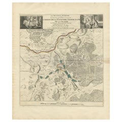
Antique Map of Boulogne-sur-Mer by Bellin '1764'
$139.82
$174.7820% Off
£105.45
£131.8220% Off
€120
€15020% Off
CA$193.32
CA$241.6520% Off
A$216.55
A$270.6920% Off
CHF 113.74
CHF 142.1720% Off
MX$2,633.16
MX$3,291.4520% Off
NOK 1,440.31
NOK 1,800.3820% Off
SEK 1,367.24
SEK 1,709.0520% Off
DKK 913.52
DKK 1,141.9020% Off
About the Item
Antique map titled 'Plan de la Ville de Boulogne'. Original antique map of Boulogne-sur-Mer, France. This map originates from 'Le petit atlas maritime: recueil de cartes et plans des quatre parties du monde' by J.N. Bellin. Published 1764.
- Dimensions:Height: 12.6 in (32 cm)Width: 8.67 in (22 cm)Depth: 0.02 in (0.5 mm)
- Materials and Techniques:
- Period:
- Date of Manufacture:1764
- Condition:General age-related toning. Minor wear, blank verso. Please study image carefully.
- Seller Location:Langweer, NL
- Reference Number:Seller: BG-12834-91stDibs: LU3054323733922
About the Seller
5.0
Recognized Seller
These prestigious sellers are industry leaders and represent the highest echelon for item quality and design.
Platinum Seller
Premium sellers with a 4.7+ rating and 24-hour response times
Established in 2009
1stDibs seller since 2017
2,517 sales on 1stDibs
Typical response time: <1 hour
- ShippingRetrieving quote...Shipping from: Langweer, Netherlands
- Return Policy
Authenticity Guarantee
In the unlikely event there’s an issue with an item’s authenticity, contact us within 1 year for a full refund. DetailsMoney-Back Guarantee
If your item is not as described, is damaged in transit, or does not arrive, contact us within 7 days for a full refund. Details24-Hour Cancellation
You have a 24-hour grace period in which to reconsider your purchase, with no questions asked.Vetted Professional Sellers
Our world-class sellers must adhere to strict standards for service and quality, maintaining the integrity of our listings.Price-Match Guarantee
If you find that a seller listed the same item for a lower price elsewhere, we’ll match it.Trusted Global Delivery
Our best-in-class carrier network provides specialized shipping options worldwide, including custom delivery.More From This Seller
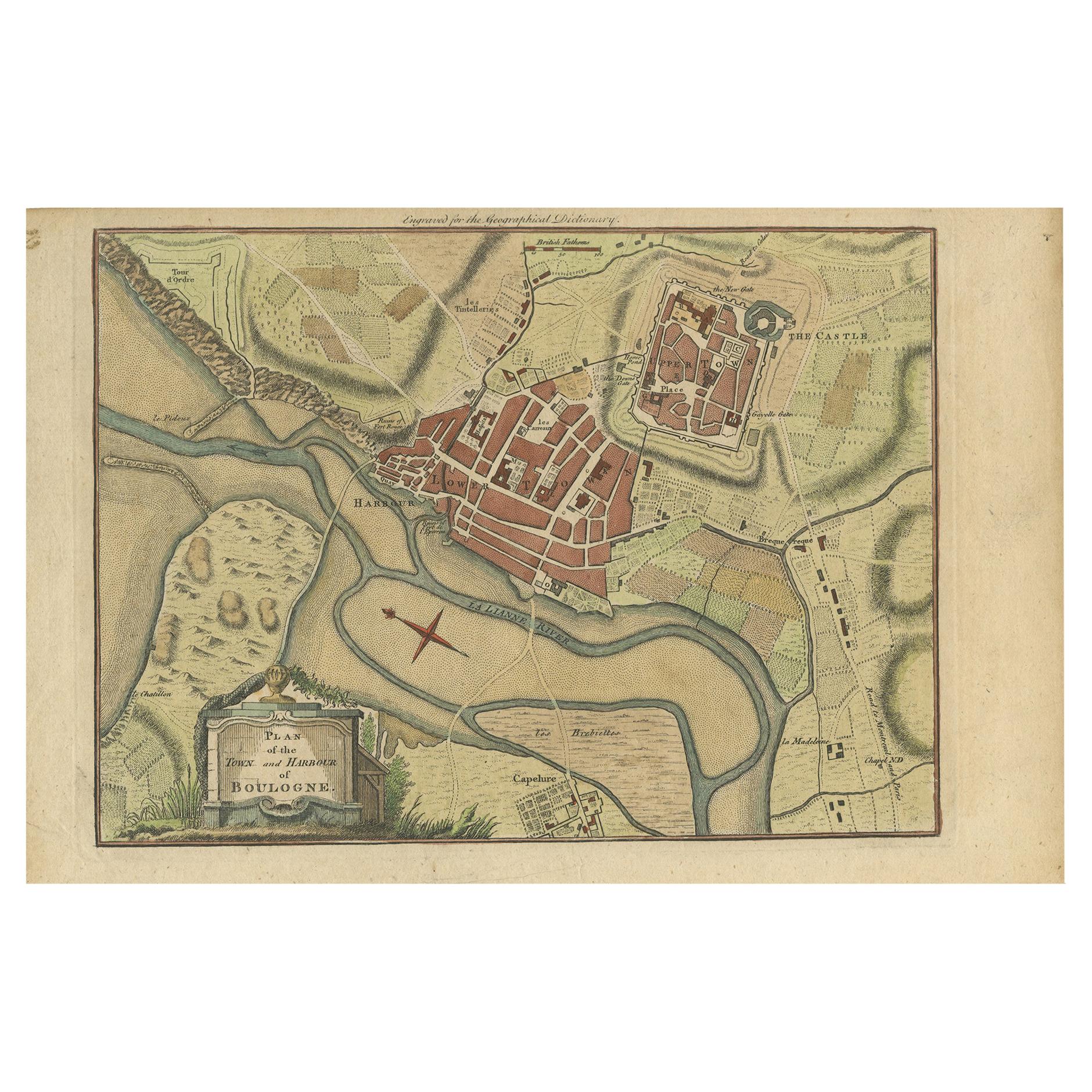
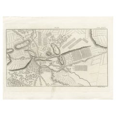
View AllAntique Plan of the Town and Harbour of Boulogne-sur-Mer by Barrow 'c.1760'
Located in Langweer, NL
Antique map titled 'Plan of the Town and Harbour of Boulogne'. Original antique plan of the town and harbour of Boulogne-sur-Mer, France. This map originates from John Barrow...
Category
Antique Mid-18th Century Maps
Materials
Paper
$139 Sale Price
20% Off
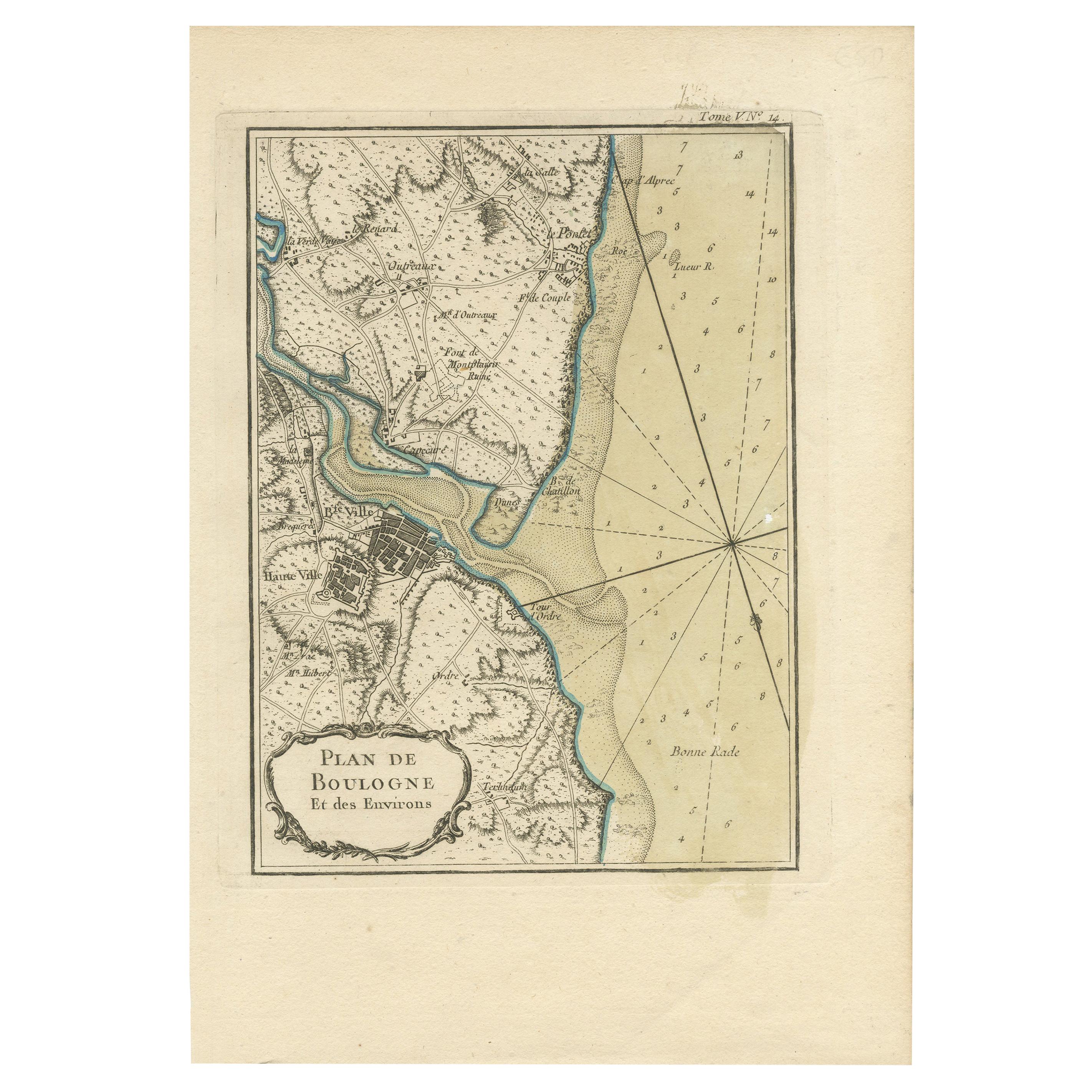
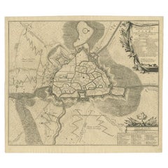
Antique Map of the Region of Boulogne-sur-Mer by Bellin '1764'
Located in Langweer, NL
Antique map titled 'Plan de Boulogne et des Environs'. Original antique map of the region of Boulogne-sur-Mer, France. This map originates from 'Le petit atlas maritime: recueil de c...
Category
Antique Mid-18th Century Maps
Materials
Paper
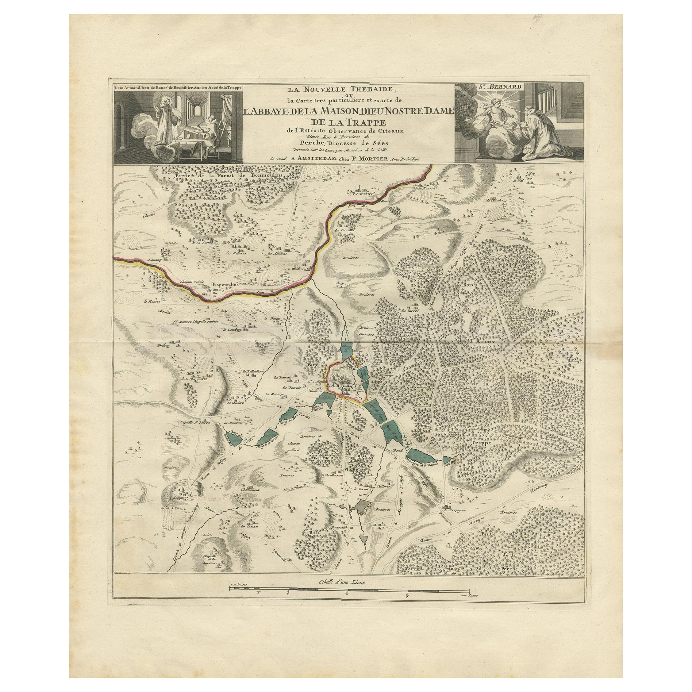
Antique Map of the Area around the Abbey in Soligny-la-Trappe 'c.1710'
Located in Langweer, NL
Antique map titled 'La nouvelle Thebaide ou la Carte tres particuliere et exacte de l'Abbaye de la Maison Dieu Nostre Dame de la Trappe (..)'. Rare, original map of the area around t...
Category
Antique Early 18th Century Maps
Materials
Paper
$745 Sale Price
20% Off
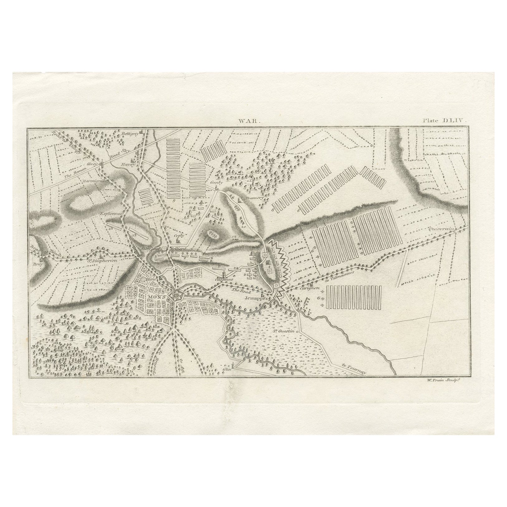
Antique War Map of the Region of Mons 'Bergen', Belgium, circa 1810
Located in Langweer, NL
Antique print titled 'Plate DLIV War'. Old print depicting a war map of the region of Mons (Bergen), Belgium. This print originates from 'Encyclopedia Britannica'.
Artists and En...
Category
Antique 19th Century Prints
Materials
Paper
$121 Sale Price
20% Off
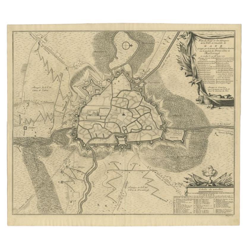
Antique Map of the Siege of Gent by Dumont, 1729
By Dumont
Located in Langweer, NL
Antique map titled 'Plan of the Siege and Attacks of the City and Citadel of Ghent'. Large map depicting the siege of the Belgian city of Gent in 1708 during the war of the Spanish S...
Category
Antique 18th Century Maps
Materials
Paper
$312 Sale Price
20% Off
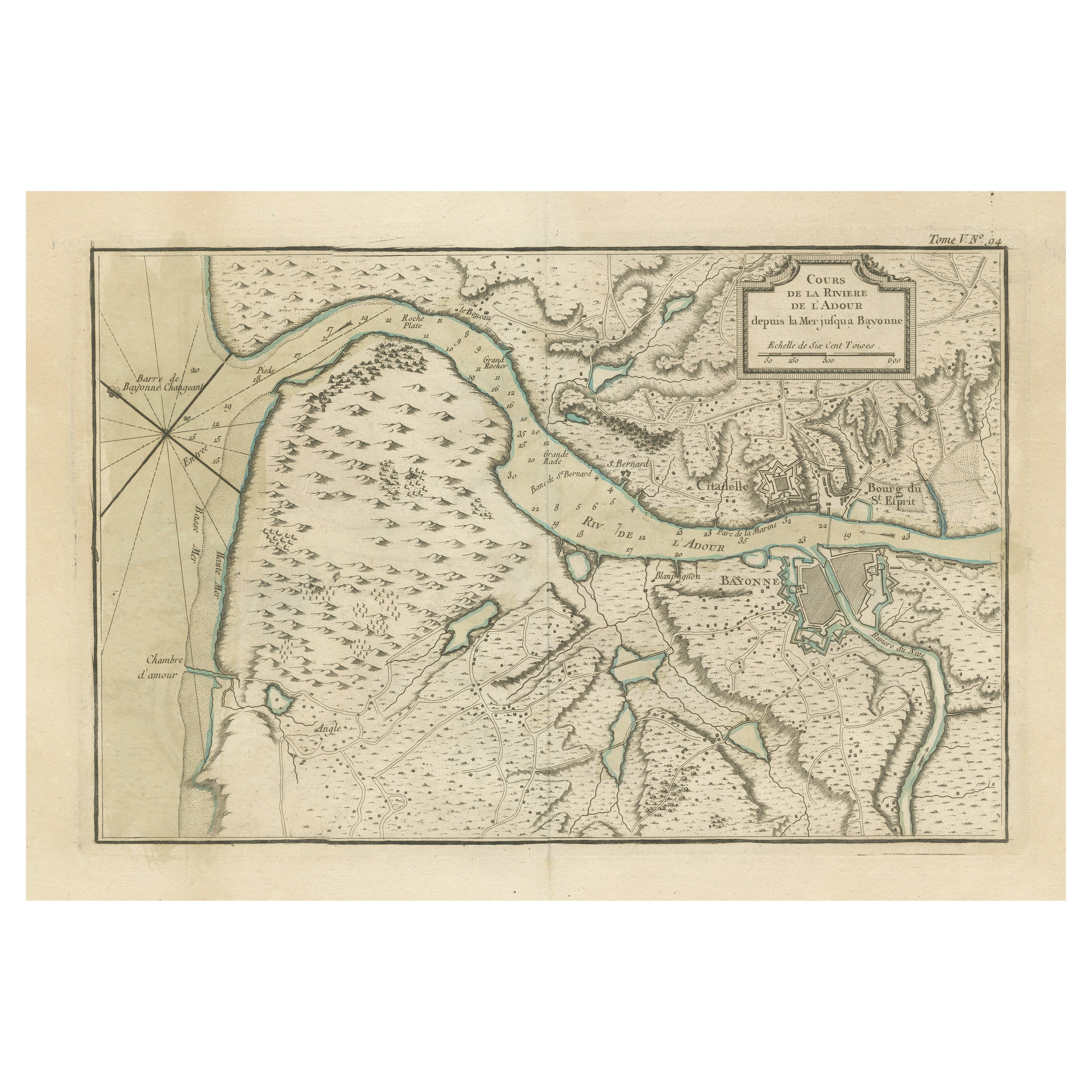
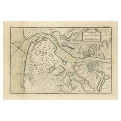
Antique Map of the Adour River, Near Bayonne, France
Located in Langweer, NL
Antique map titled 'Cours de la riviere de l'Adour depuis la mer jusqua Bayonne'. Original old map of the Adour river, near Bayonne, France. This map originates from 'Le Petit Atlas ...
Category
Antique Mid-18th Century Maps
Materials
Paper
$316 Sale Price
20% Off
You May Also Like
1771 Bonne Map of Poitou, Touraine and Anjou, France, Ric.a015
Located in Norton, MA
1771 Bonne Map of Poitou,
Touraine and Anjou, France
Ric.a015
1771 Bonne map of Potiou, Touraine and Anjou entitled "Carte des Gouvernements D'Anjou et du Saumurois, de la Touraine, du Poitou,du Pays d'aunis, Saintonge?Angoumois,"
Carte des gouvernements d'Anjou et du Saumurois, de la Touraine, du Poitou, du Pays d'Aunis, Saintonge-Angoumois. Projettee et assujettie au ciel par M. Bonne, Hyd. du Roi. A Paris, Chez Lattre, rue St. Jacques a la Ville de Bord(ea)ux. Avec priv. du Roi. 1771. Arrivet inv. & sculp., Atlas moderne ou collection de cartes sur toutes...
Category
Antique 17th Century Unknown Maps
Materials
Paper

Original Antique Map or City Plan of Geneva, Switzerland. Circa 1835
Located in St Annes, Lancashire
Nice map of Geneva
Drawn and engraved by J.Dower
Published by Orr & Smith. C.1835
Unframed.
Free shipping
Category
Antique 1830s English Maps
Materials
Paper

1752 Vaugoundy Map of Flanders : Belgium, France, and the Netherlands, Ric.a002
Located in Norton, MA
Large Vaugoundy Map of Flanders:
Belgium, France, and the Netherlands
Colored -1752
Ric.a002
Description: This is a 1752 Didier Robert de Vaugondy map of Flanders. The map de...
Category
Antique 17th Century Unknown Maps
Materials
Paper

Antique Town Plan Map, Poole, English, Framed Cartography, Georgian, Circa 1780
Located in Hele, Devon, GB
This is an antique town plan map of Poole in Dorset. An English, framed atlas engraving, dating to the 18th century and later.
Fascinating cartography with annotated streets and pl...
Category
Antique Late 18th Century British George III Maps
Materials
Glass, Wood, Paper

17th Century Toulouse, Savve, Sommieres Topographical Map by Iohan Peeters
Located in New York, NY
Fine topographical 17th century map of Toulouse, Savve and Sommieres by Iohan Peeters
Beautiful engraving of the capital of France's Occitanie Region, Toulouse, called La Ville Rose- the Pink City, for the terracotta bricks used in its many buildings, giving the city a distinct apricot-rose hue. An important cultural and educational center, the city's residents included Nobel Prize winners and world renown artists- Henri de Toulouse-Lautrec, Henri Martin, Jean-Auguste-Dominique Ingres, Antonin Mercie, Alexandre Falguiere and more recently Cyril Kongo...
Category
Antique 17th Century Dutch Maps
Materials
Paper

Original Antique Map or City Plan of Rome, Italy. Circa 1835
Located in St Annes, Lancashire
Nice map of Rome
Drawn and engraved by J.Dower
Published by Orr & Smith. C.1835
Unframed.
Free shipping
Category
Antique 1830s English Maps
Materials
Paper

More Ways To Browse
Antique Mediterranean Map
Map Of Great Britain
Antique Map New York
Antique Wine Maps
Antique Map Of The South Of France
Antique Maps Of Greece
Large Framed Maps
Java Map
Antique Marine Maps
Antique Indian Maps
West Africa Map
Antique Maps Of Wales
Antique Map Denmark
Antique Mining
Antique World Globe Map
Antique Oregon
Hemispheres Map
Map New Holland