Items Similar to Antique Map of Friesland with Four Coats of Arms, 1664

Want more images or videos?
Request additional images or videos from the seller
1 of 5
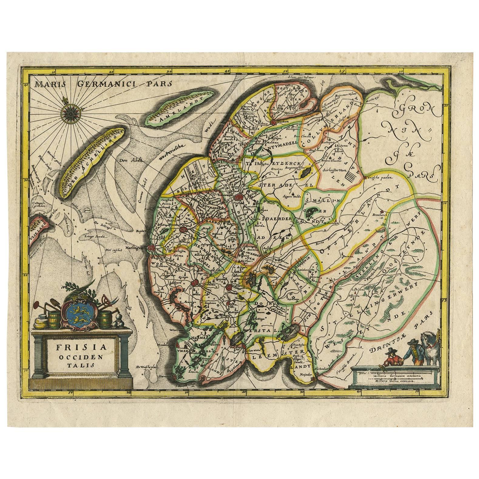
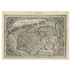
Antique Map of Friesland with Four Coats of Arms, 1664
$1,389.85
$1,737.3120% Off
£1,034.65
£1,293.3120% Off
€1,160
€1,45020% Off
CA$1,903.74
CA$2,379.6820% Off
A$2,117.38
A$2,646.7220% Off
CHF 1,105.63
CHF 1,382.0420% Off
MX$25,766.23
MX$32,207.7820% Off
NOK 14,120.56
NOK 17,650.7020% Off
SEK 13,242.60
SEK 16,553.2520% Off
DKK 8,830.68
DKK 11,038.3420% Off
Shipping
Retrieving quote...The 1stDibs Promise:
Authenticity Guarantee,
Money-Back Guarantee,
24-Hour Cancellation
About the Item
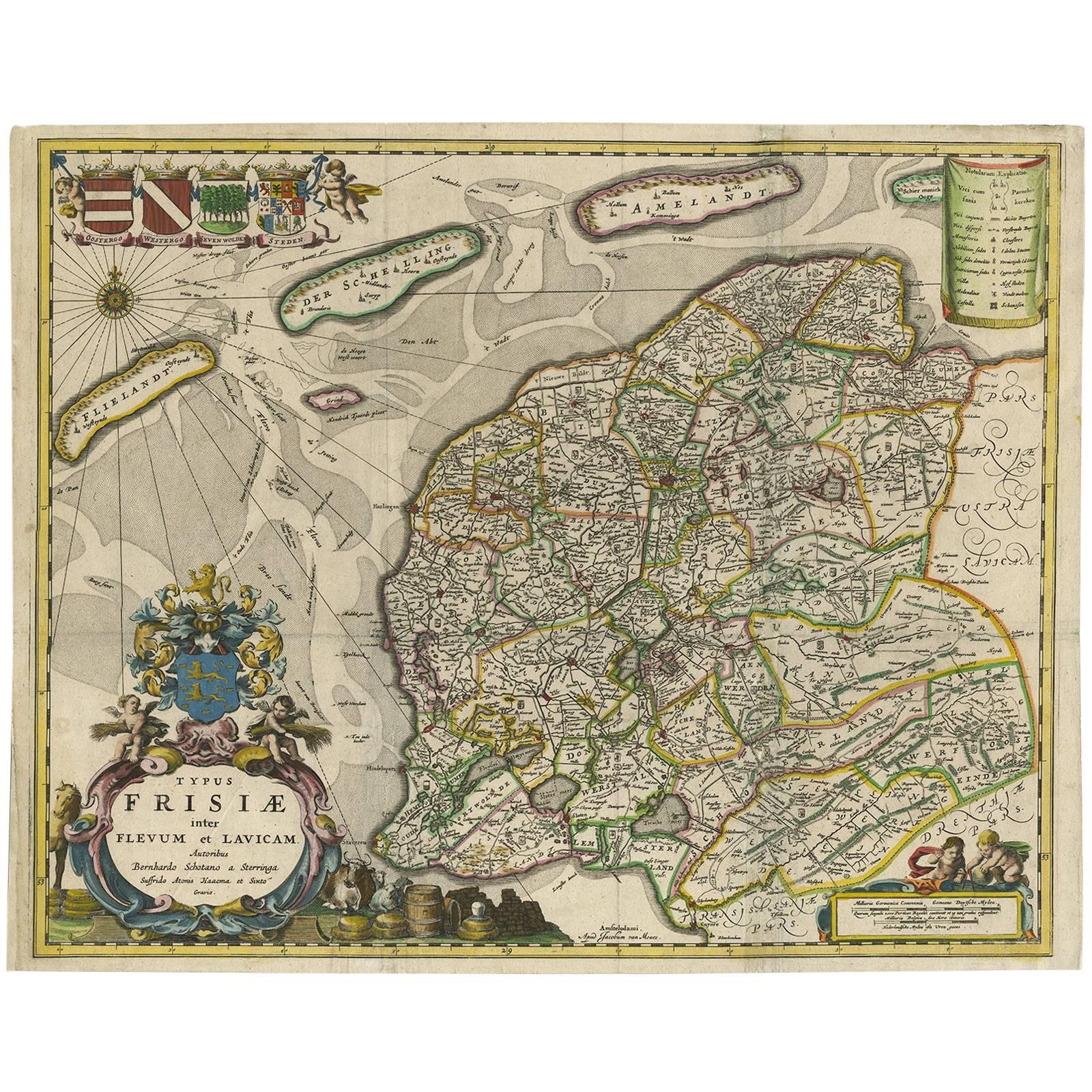
Antique map titled 'Typus Frisiae inter Fevum et Lavicam'. Original antique map of the province of Friesland, the Netherlands. Also shows the Wadden islands Vlieland, Terschelling and Ameland and part of Schiermonnikoog. With a decorative cartouche with two putti, livestock and cheese and milk barrels. Four coats of arms in the top left corner. Third state, originating from: 'Beschrijvinge van de Heerlyckheydt van Frieslandt'. Published 1664. Artists and Engravers: Cartographers: Bernardus Schotanus a Sterringa, Sjoerd Aetesz Haackma and Sytse Gravius.
Artist: Cartographers: Bernardus Schotanus a Sterringa, Sjoerd Aetesz Haackma and Sytse Gravius.
Condition: Very good, given age. Original middle fold, as issued but flattened out in the image area. Some small stains and creases in the margins. Two tiny tears in the top margin. Blank verso. General age-related toning and/or occasional minor defects from handling. Please study scan carefully.
Date: 1664
Overall size: 59.3 x 50.4 cm.
Image size: 52.6 x 42.4 cm.
We sell original antique maps to collectors, historians, educators and interior decorators all over the world. Our collection includes a wide range of authentic antique maps from the 16th to the 20th centuries. Buying and collecting antique maps is a tradition that goes back hundreds of years. Antique maps have proved a richly rewarding investment over the past decade, thanks to a growing appreciation of their unique historical appeal. Today the decorative qualities of antique maps are widely recognized by interior designers who appreciate their beauty and design flexibility. Depending on the individual map, presentation, and context, a rare or antique map can be modern, traditional, abstract, figurative, serious or whimsical. We offer a wide range of authentic antique maps for any budget.
- Dimensions:Height: 19.85 in (50.4 cm)Width: 23.35 in (59.3 cm)Depth: 0 in (0.01 mm)
- Materials and Techniques:
- Period:
- Date of Manufacture:1664
- Condition:
- Seller Location:Langweer, NL
- Reference Number:Seller: PCT-566541stDibs: LU3054326282382
About the Seller
5.0
Recognized Seller
These prestigious sellers are industry leaders and represent the highest echelon for item quality and design.
Platinum Seller
Premium sellers with a 4.7+ rating and 24-hour response times
Established in 2009
1stDibs seller since 2017
2,508 sales on 1stDibs
Typical response time: <1 hour
- ShippingRetrieving quote...Shipping from: Langweer, Netherlands
- Return Policy
Authenticity Guarantee
In the unlikely event there’s an issue with an item’s authenticity, contact us within 1 year for a full refund. DetailsMoney-Back Guarantee
If your item is not as described, is damaged in transit, or does not arrive, contact us within 7 days for a full refund. Details24-Hour Cancellation
You have a 24-hour grace period in which to reconsider your purchase, with no questions asked.Vetted Professional Sellers
Our world-class sellers must adhere to strict standards for service and quality, maintaining the integrity of our listings.Price-Match Guarantee
If you find that a seller listed the same item for a lower price elsewhere, we’ll match it.Trusted Global Delivery
Our best-in-class carrier network provides specialized shipping options worldwide, including custom delivery.More From This Seller
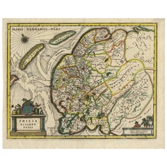
View AllAntique Map of Friesland 'The Netherlands' by B. Schotanus, 1664
By B. Schotanus
Located in Langweer, NL
Hand-colored map of the Dutch province Friesland. Also shows the Wadden islands Vlieland, Terschelling and Ameland and a part of Schiermonnikoog. With a decorative cartouche with two...
Category
Antique Late 17th Century Maps
Materials
Paper
$1,605 Sale Price
9% Off
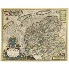
Antique Map of Friesland, The Netherlands, 1638
Located in Langweer, NL
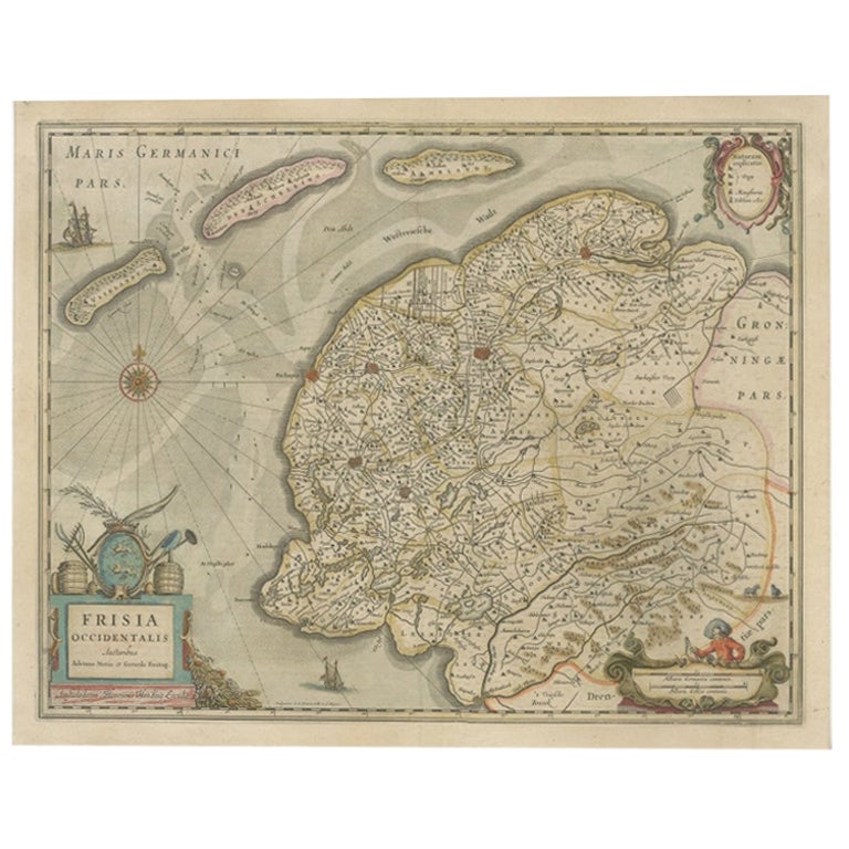
Antique map titled 'Frisia Occidentalis'.
Original antique map of Friesland, the Netherlands. First state, originating from 'Atlantis novi pars secunda' published 1638.
Artis...
Category
Antique 17th Century Maps
Materials
Paper
$455 Sale Price
20% Off
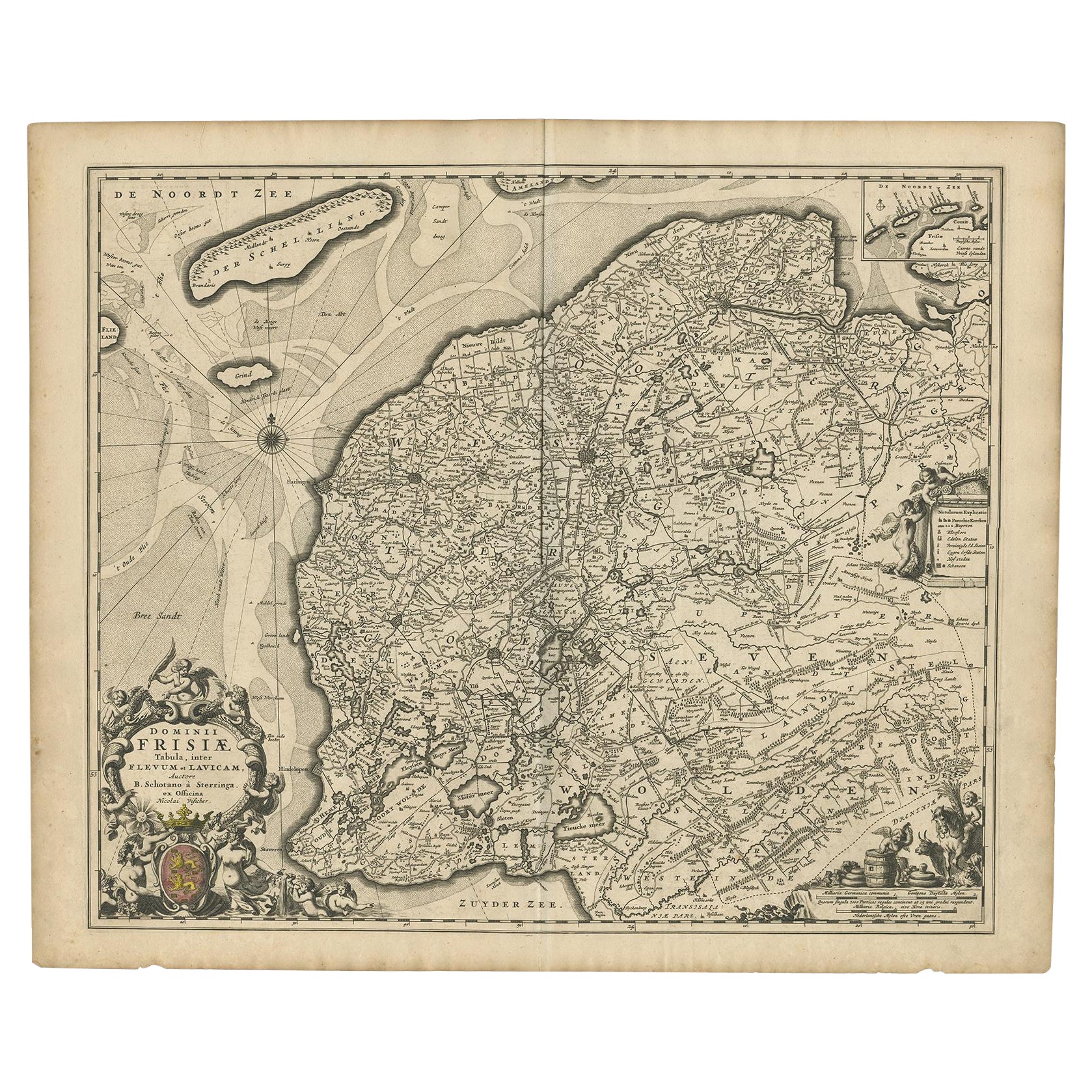
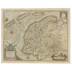
Beautiful First State Map of Friesland, the Netherlands, c.1665
Located in Langweer, NL
Antique map titled 'Dominii Frisiae Tabula, inter Flevum et Lavicam'. Beautiful first state map of Friesland, the Netherlands. With small inset map of the Frisian Wadden islands Vlie...
Category
Antique 17th Century Maps
Materials
Paper
$838 Sale Price
20% Off
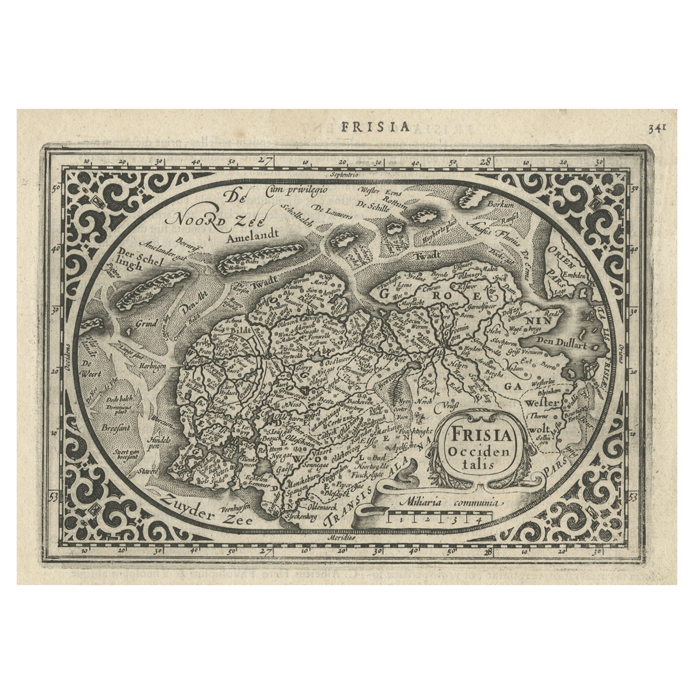
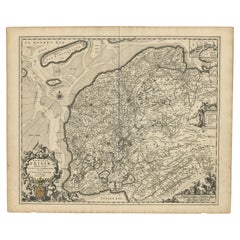
Antique Map of Friesland and Groningen, Provinces of the Netherlands, 1628
Located in Langweer, NL
Antique map Friesland titled 'Frisia Occidentalis'. Small, decorative map of the province of Friesland, the Netherlands. Second state, out of three, originating from 'Atlas Minor' by...
Category
Antique 17th Century Maps
Materials
Paper
$335 Sale Price
20% Off
Original Antique Hand-Colored Map of Friesland by C. Merian, 1659
Located in Langweer, NL
This is a hand-colored engraving of the province of Friesland in the Netherlands, created by the Swiss-born engraver and artist Matthäus Merian (1593–1650) and included in "Topograph...
Category
Antique Mid-17th Century Maps
Materials
Paper
Antique Map of The Dutch Province of Groningen by De Wit, c.1680
Located in Langweer, NL
Antique map titled 'Tabulae dominii Groeningae quae et complecitur maximam partem Drentiae Emendata'.
Old map of the province of Groningen, the Netherlands. With an inset map of th...
Category
Antique 17th Century Maps
Materials
Paper

$689 Sale Price
20% Off
You May Also Like
1643 Willem&Joan Blaeu Map NW Flanders "Flandriae Teutonicae Pars Prientalior
Located in Norton, MA
1643 Willem and Joan Blaeu map of northwest Flanders, entitled
"Flandriae Teutonicae Pars Prientalior,"
Ric0012
" Authentic" - Map of the northwest Fl...
Category
Antique 17th Century Dutch Maps
Materials
Paper

1635 Willem Blaeu Map of Northern France"Comitatvs Bellovacvm" Ric.a08
Located in Norton, MA
1635 Willem Blaeu map of northern France, entitled.
"Comitatvs Bellovacvm Vernacule Beavvais,"
Colored
Ric.a008
“COMITATVS BELLOVACVM…” Amsterdam: W...
Category
Antique 17th Century Unknown Maps
Materials
Paper

1640 Willem Blaeu Map Entitled "Contado di molise et principato vltra, " Ric.a003
By Willem Blaeu
Located in Norton, MA
1640 Willem Blaeu map entitled
"Contado di molise et principato vltra,"
Colored
Ric. a003
Measures: 38 x 49.6 cm and wide margins
DBLAEU.
Cou...
Category
Antique 17th Century Dutch Maps
Materials
Paper

1620 Map of Artois Entitled "Artesia Comitatvs Artois, " by Bleau, Ric.a012
Located in Norton, MA
1640 map of Artois entitled
"Artesia Comitatvs Artois,"
by Bleau
Colored
A-012.
Detailed map of the northern province of Artois, France on the border with Belgium. Feature...
Category
Antique 17th Century Dutch Maps
Materials
Paper

Prussia, Poland, N. Germany, Etc: A Hand-colored 17th Century Map by Janssonius
By Johannes Janssonius
Located in Alamo, CA
This is an attractive hand-colored copperplate engraved 17th century map of Prussia entitled "Prussia Accurate Descripta a Gasparo Henneberg Erlichensi", published in Amsterdam by Joannes Janssonius in 1664. This very detailed map from the golden age of Dutch cartography includes present-day Poland, Latvia, Lithuania, Estonia and portions of Germany. This highly detailed map is embellished by three ornate pink, red, mint green and gold...
Category
Antique Mid-17th Century Dutch Maps
Materials
Paper

1630 Pierre Petit map "Description du Gouvernement de la Capelle" Ric0010
Located in Norton, MA
1630 Pierre Petit map entitled
"Description du Gouvernement de la Capelle,"
Ric0010
Pierre Petit was the son of a minor provincial official in Montluçon. The town, in the Auver...
Category
Antique 17th Century Dutch Maps
Materials
Paper

More Ways To Browse
Relief Map
Antique Map Of Venice
Antique Map Of Georgia
Antique Nautical Charts
Hand Painted Antique Map
Antique Maps New Zealand
Antique Maps Persia
Map Railroad
Mariner Furniture
Vintage Glass Map
Antique Furniture Cyprus
Antique Linen Map
Caribbean Colonial Furniture
Antique Maps West Indies
California Island Map
Pirate Antique
Map Of Holy Land
Antique Blackwood Furniture