European Maps
to
105
589
128
722
2
69
35
13
12
4
3
2
1
1
1
1
1
325
288
109
2
82
16
2
47
1
30
1
4
2
1
661
99
46
21
14
724
332
218
148
140
724
724
724
11
10
9
7
5
Place of Origin: European
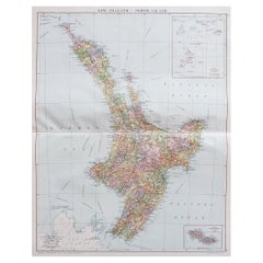
Large Original Vintage Map of New Zealand, North Island, circa 1920
Located in St Annes, Lancashire
Great map of North Island, New Zealand
Original color.
Good condition / minor foxing to right edge
Published by Alexander Gross
Unframed.
Category
1920s Edwardian Vintage European Maps
Materials
Paper
Antique French Map of Asia Including China Indoneseia India, 1783
Located in Amsterdam, Noord Holland
Very nice map of Asia. 1783 Dedie au Roy.
Additional information:
Country of Manufacturing: Europe
Period: 18th century Qing (1661 - 1912)
Condition: Overall Condition B (Good Used)...
Category
18th Century Antique European Maps
Materials
Paper
$648 Sale Price
20% Off
17th Century Nicolas Visscher Map of Southeastern Europe
Located in Hamilton, Ontario
A beautiful, highly detailed map of southeastern Europe by Nicolas Visscher. Includes regions of Northern Italy (showing the cities Bologna, Padua, and Venice), Bohemia, Austria (sho...
Category
17th Century Antique European Maps
Materials
Paper
$1,350 Sale Price
38% Off
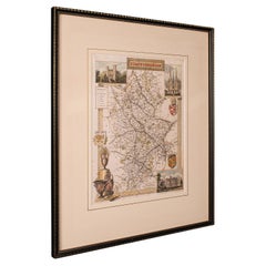
Antique County Map, Staffordshire, English, Framed Litho, Cartography, Victorian
Located in Hele, Devon, GB
This is an antique lithography map of Staffordshire. An English, framed atlas engraving of cartographic interest, dating to the mid 19th century and later.
Superb lithography of St...
Category
Mid-19th Century Victorian Antique European Maps
Materials
Glass, Wood, Paper
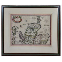
Northern Scotland: A 17th Century Hand-colored Map by Mercator
By Gerard Mercator
Located in Alamo, CA
This is a framed hand-colored 17th century map of Northern Scotland by Gerard Mercator entitled "Scotiae pars Septentrionalis", published in Amsterdam in 1636. It is a highly detailed map of the northern part of Scotland, with the northwest Highlands and the cities Inverness and Aberdeen, as well as the Orkney Islands and the Hebrides. There is a decorative title cartouche in the upper left corner.
The map is presented in an antiqued brown wood...
Category
1630s Antique European Maps
Materials
Paper
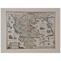
Greece, "Graeciae Antiquae"" A 17th Century Hand-colored Map by Sanson
By Nicolas Sanson
Located in Alamo, CA
This is an original 17th century hand colored copperplate engraved map of Greece entitled "Graeciae Antiquae Tabula Hanc Geographicam" by Nicolas d'Abbeville Sanson, engraved and pub...
Category
Mid-17th Century Antique European Maps
Materials
Paper
Captain Cook's Exploration of Tahiti 18th C. Hand-Colored Map by Bellin
By Jacques-Nicolas Bellin
Located in Alamo, CA
This beautiful 18th century hand-colored copper plate engraved map is entitled "Carte de l'Isle de Taiti, par le Lieutenant J. Cook" was created by Jacques Nicolas Bellin and publish...
Category
Mid-18th Century Antique European Maps
Materials
Paper
Shetland Islands Sea Chart – Antique Nautical Map by Ottens Brother c.1745
Located in Langweer, NL
Shetland Islands Sea Chart – Antique Nautical Map by Ottens Brothers, c.1740s
This striking antique nautical chart titled Nieuwe Paskaard van Hitland… presents the Shetland Islands ...
Category
1740s Antique European Maps
Materials
Paper
$1,179 Sale Price
20% Off
Antique Map of Gallia and Germania on one Sheet, c.1703
Located in Langweer, NL
Antique map depicting France (Gallia) and Germany (Germania). Printed for Scherer's 'Atlas Novus' (1702-1710).
Artists and Engravers: Heinrich Scherer (1628-1704) was a Professor o...
Category
Early 18th Century Antique European Maps
Materials
Paper
$226 Sale Price
20% Off
Denmark & German Empire – Antique Map by A.K. Johnston, 1882 Atlas Edition
Located in Langweer, NL
Denmark & German Empire – Antique Map by A.K. Johnston, 1882 Atlas Edition
This detailed antique map titled Denmark with North-West portion of the German Empire comprising Schleswig...
Category
19th Century Antique European Maps
Materials
Paper
$226 Sale Price
20% Off
Antique County Map, Lancashire, English, Framed Lithography, Cartography, C.1860
Located in Hele, Devon, GB
This is an antique lithography map of Lancashire. An English, framed atlas engraving of cartographic interest, dating to the mid 19th century and later.
Superb lithography of Lanca...
Category
Mid-19th Century Victorian Antique European Maps
Materials
Glass, Wood, Paper
Antique County Map of Cheshire, Dutch, Framed, Cartography, Janssonius, C.1660
Located in Hele, Devon, GB
This is an antique county map of Cheshire. A Dutch, framed atlas engraving by Johannes Janssonius, dating to the 17th century and later.
A treat for the collector or county native,...
Category
Mid-17th Century Charles II Antique European Maps
Materials
Glass, Wood, Paper
Antique 1803 Italian Map of Asia Including China Indoneseia India
Located in Amsterdam, Noord Holland
Antique 1803 Italian Map of Asia Including China Indoneseia India
Very nice map of Asia. 1803.
Additional information:
Type: Map
Country of Manufacturing: Europe
Period: 19th centu...
Category
19th Century Antique European Maps
Materials
Paper
$584 Sale Price
20% Off
Sweden & Adjacent Portions of Scandinavia: A Hand-Colored 18th C. Map by Homann
By Johann Baptist Homann
Located in Alamo, CA
This hand-colored map of Sweden and adjacent portions of Scandinavia entitled "Regni Sueciae in Omnes suas Subjacentes Provincias accurate divisi Tabula Generalis" was created by Joh...
Category
1720s Antique European Maps
Materials
Paper
Antique Map of New South Wales by Tallis, circa 1851
Located in Langweer, NL
Antique map titled 'New South Wales'. Decorative and detailed map of New South Wales which was drawn and engraved by J. Rapkin (vignettes by H. Warren ...
Category
Mid-19th Century Antique European Maps
Materials
Paper
$330 Sale Price
20% Off
Plan of Vänersborg, Sweden – Antique Map by Merian, c.1680 Theatrum Europaeum
Located in Langweer, NL
Plan of Vänersborg, Sweden – Antique Map by Merian, c.1680 Theatrum Europaeum
Antique map titled 'Grundtriss und Situation von der Statt und Vöstung Wennersburg'. This early coppe...
Category
Late 17th Century Antique European Maps
Materials
Paper
$283 Sale Price
20% Off
Antique Print of the Coast of Dabhol 'India', 1726
By F. Valentijn
Located in Langweer, NL
Antique print titled 'De Kust van Dabul'. Antique print of the coastline near Dabhol in India. This print originates from 'Oud en Nieuw Oost-Indiën' by F. Valentijn.
Category
Early 18th Century Antique European Maps
Materials
Paper
$339 Sale Price
23% Off
Antique Map of Malabar Coast by Valentijn, 1726
By F. Valentijn
Located in Langweer, NL
Untitled sea chart of the coast of Malabar, India. This print originates from 'Oud en Nieuw Oost-Indiën' by F. Valentijn.
Category
Early 18th Century Antique European Maps
Materials
Paper
$424 Sale Price
20% Off
Antique Map of Asia by Sanson, circa 1705
By Nicolas Sanson
Located in Langweer, NL
Dutch edition of Sanson's map of Asia. Shows a large, dramatic version of Terre de Jesso, drawn from the discoveries of the Maarten de Vries expedition of 1643.
Category
Early 18th Century Antique European Maps
Materials
Paper
$377 Sale Price
20% Off
Antique Map of South America by G. Anson, 1749
Located in Langweer, NL
Antique map titled 'Kaart van het Zuidelykste Gedeelte van Zuider Amerika (..) - Carte de la Partie Meridionale de l'Amerique Meridionale (..)'. Detailed chart tracking the route of Capt. George Anson's ship The Centurion in 1745. The chart shows the tracks of Anson's ships around South America & Cape Horn to the Juan Fernandes Islands, with notes on currents and positions. This map originates from 'Reize rondsom de Werreld (..)' by George Anson, published 1749.
In 1740 Capt. George Anson (1697-1762) of the Royal Navy, was given command of a squadron of ships. As England was at war with France and Spain, Anson's task was to intercept and capture a Spanish treasure...
Category
Mid-18th Century Antique European Maps
Materials
Paper
Antique Map Normandy 'France' by Homann Heirs, Published in c.1740
By Homann Heirs
Located in Langweer, NL
Antique map France titled 'Normannia Galliae celebris Provincia in terras suas Ballisiatus (..)'.
Decorative regional map of Normandy, France, circa ...
Category
Mid-18th Century Antique European Maps
Materials
Paper
$754 Sale Price
5% Off
Antique Coastal Map of Sumatra by De La Haye, circa 1780
Located in Langweer, NL
Antique map titled 'Carte de la Côte Occidentale de l'Isle Sumatra'. Sea chart of the part of the south-western coast of Sumatra with the Nassau (Nias) and Fortune isles. Engraved by...
Category
Late 18th Century Antique European Maps
Materials
Paper
$377 Sale Price
20% Off
Antique Map of France by Van Baarsel (c.1820)
Located in Langweer, NL
'Frankrijk naar de nieuwste bepalingen meerendeels gevolgd naar Lapie'. Beautiful map of France with an inset map of the island of Corsica. Includes a table with reference to the dep...
Category
Early 19th Century Antique European Maps
Materials
Paper
17th Century Hand Colored Map of the Liege Region in Belgium by Visscher
By Nicolaes Visscher II
Located in Alamo, CA
An original 17th century map entitled "Leodiensis Episcopatus in omnes Subjacentes Provincias distincté divisusVisscher, Leodiensis Episcopatus" by Nicolaes Visscher II, published in Amsterdam in 1688. The map is centered on Liege, Belgium, includes the area between Antwerp, Turnhout, Roermond, Cologne, Trier and Dinant.
This attractive map is presented in a cream-colored mat measuring 30" wide x 27.5" high. There is a central fold, as issued. There is minimal spotting in the upper margin and a tiny spot in the right lower margin, which are under the mat. The map is otherwise in excellent condition.
The Visscher family were one of the great cartographic families of the 17th century. Begun by Claes Jansz Visscher...
Category
Late 17th Century Antique European Maps
Materials
Paper
1850 Old French Map Depicting the Entire Earth's Surface Divided into Two Parts
Located in Milan, IT
Map depicting the entire earth's surface divided into two parts corresponding to the two hemispheres and showing the Arctic to Antarctic polar circle, the tropics of Cancer and Capri...
Category
Mid-19th Century Antique European Maps
Materials
Glass, Wood, Paper
Antique Lithography Map, County Durham, English, Framed Cartography, Victorian
Located in Hele, Devon, GB
This is an antique lithography map of County Durham. An English, framed atlas engraving of cartographic interest, dating to the mid 19th century and later.
Superb lithography of Cou...
Category
Mid-19th Century Mid-Century Modern Antique European Maps
Materials
Wood
St. Christophe 'St. Kitts' Island: An 18th Century Hand-colored Map by Bellin
By Jacques-Nicolas Bellin
Located in Alamo, CA
Jacques Bellin's copper-plate map of the Caribbean island of Saint Kitts entitled "Carte De De l'Isle St. Christophe Pour servir á l'Histoire Genle. des V...
Category
Mid-18th Century Antique European Maps
Materials
Paper
Hand-Colored Map of the Holy Land Divided Among the Twelve Tribes, c.1720
Located in Langweer, NL
Hand-Colored Map of the Holy Land Divided Among the Twelve Tribes, c.1720
This striking antique map, titled "Iudaea seu Palaestina ob Sacratissima Redemtoris Vestigia Hodie Dicta Te...
Category
Early 18th Century Antique European Maps
Materials
Paper
Antique Map of Alexander the Great's Empire & Campaigns, de Vaugondy, 1753
Located in Langweer, NL
Antique Map of Alexander the Great's Empire & Campaigns, de Vaugondy, 1753
This rare and elegantly engraved map, titled "Antiquor Imperiorum Tabula, in qua Prae Caeteris, Macedonicu...
Category
Mid-18th Century Antique European Maps
Materials
Paper
17th Century Hand-Colored Map of a Region in West Germany by Janssonius
By Johannes Janssonius
Located in Alamo, CA
This attractive highly detailed 17th century original hand-colored map is entitled "Archiepiscopatus Maghdeburgensis et Anhaltinus Ducatus cum terris adjacentibus". It was published ...
Category
Mid-17th Century Antique European Maps
Materials
Paper
Antique Lithography Map, Northamptonshire, English, Framed Cartography, C.1860
Located in Hele, Devon, GB
This is an antique lithography map of Northamptonshire. An English, framed atlas engraving of cartographic interest, dating to the mid 19th century...
Category
Mid-19th Century Victorian Antique European Maps
Materials
Wood
Antique Lithography Map, Cumbria, English, Framed Cartography Interest, Georgian
Located in Hele, Devon, GB
This is an antique lithography map of Cumbria. An English, framed engraving of cartographic interest, dating to the early 18th century and later.
...
Category
Early 18th Century Georgian Antique European Maps
Materials
Wood
"Nova Barbariae Descriptio", a 17th Century Hand-Colored Map of North Africa
By Johannes Janssonius
Located in Alamo, CA
This original attractive 17th century hand-colored map of North Africa entitled "Nova Barbariae Descriptio" by Johannes Janssonius was published in Paris in 1635. It includes the Med...
Category
Mid-17th Century Antique European Maps
Materials
Paper
17th Century Hand-Colored Map of Southeastern England by Mercator and Hondius
By Gerard Mercator
Located in Alamo, CA
A 17th century copperplate hand-colored map entitled "The Sixt Table of England" by Gerard Mercator and Jodocus Hondius, published in Amsterdam in 1635 in 'Cosmographicall Descriptio...
Category
Mid-17th Century Antique European Maps
Materials
Paper
Africa: A Large 17th Century Hand-Colored Map by Sanson and Jaillot
By Nicolas Sanson
Located in Alamo, CA
This large original hand-colored copperplate engraved map of Africa entitled "L'Afrique divisee suivant l'estendue de ses principales parties ou sont distingues les uns des autres, L...
Category
1690s Antique European Maps
Materials
Paper
Italy, Sicily, Sardinia, Corsica and Dalmatian Coast: A 17th Century Dutch Map
By Theodorus Danckerts
Located in Alamo, CA
This hand colored 17th century Dutch map entitled "Novissima et Accuratissima totius Italiae Corsicae et Sardiniae Descriptio" by Theodore Danckerts depicts the Italian Peninsula in ...
Category
Late 17th Century Antique European Maps
Materials
Paper
Dutch Map and City Plan of La Roche-sur-Foron, France, 17th Century Hand Colored
By Coenraet Decker
Located in Alamo, CA
"Rupes Allobrogum vulgo La Roche" by Dutch engraver Coenraet Decker (1650-1685) is from the atlas Theatrum Statuum Regiae Celestudinis Sabaudiae Ducis, published in 1682. This richly...
Category
Late 17th Century Antique European Maps
Materials
Paper
Super Rare Antique French Map of Chine and the Chinese Empire, 1780
Located in Amsterdam, Noord Holland
Super Rare Antique French Map of Chine and the Chinese Empire, 1780
Very nice map of Asia. 1780 Made by Bonne.
Additional information:
Type: Map
...
Category
18th Century Antique European Maps
Materials
Paper
$584 Sale Price
32% Off
Southeastern Ireland: A 17th Century Hand Colored Map by Mercator and Hondius
By Gerard Mercator
Located in Alamo, CA
A 17th century copperplate hand-colored map entitled "The Second Table of Ireland, Udrone" by Gerard Mercator and Jodocus Hondius, published in Amsterdam in 1635 in 'Cosmographicall ...
Category
Mid-17th Century Antique European Maps
Materials
Paper
French Framed Copper Engraved Hand Colored Map of Carolina & Georgia, Circa 1757
Located in Charleston, SC
French copper engraved hand colored map of Carolina & Georgia matted under glass with a painted frame, mid-18th century
Category
1750s Louis XV Antique European Maps
Materials
Glass, Wood, Paint, Paper
Plymouth, England: A Hand-Colored 17th Century Sea Chart by Captain Collins
By Captain Greenvile Collins
Located in Alamo, CA
This hand-colored sea chart of the area around Plymouth, England from "Great Britain's Coasting Pilot. Being a New and Exact Survey of the Sea-Coast of England", first published in 1...
Category
Late 17th Century Antique European Maps
Materials
Paper
Hand-Colored 18th Century Homann Map of the Black Sea, Turkey and Asia Minor
By Johann Baptist Homann
Located in Alamo, CA
An attractive original early 18th century hand-colored map of the Black Sea and Turkey entitled "Carte de L'Asie Minevre ou de la Natolie et du Pont Evxin Tiree des Voyages et des Ob...
Category
Early 18th Century Antique European Maps
Materials
Paper
Hand-Colored 18th Century Homann Map of Denmark and Islands in the Baltic Sea
By Johann Baptist Homann
Located in Alamo, CA
An 18th century copper plate hand-colored map entitled "Insulae Danicae in Mari Balthico Sitae utpote Zeelandia, Fionia, Langelandia, Lalandia, Falstria, Fembria Mona" created by Joh...
Category
Early 18th Century Antique European Maps
Materials
Paper
Scandinavia & Portions of Eastern Europe: 18th Century Hand-Colored Homann Map
By Johann Baptist Homann
Located in Alamo, CA
An early 18th century hand-colored copper-plate map entitled "Regni Sueciae in omnes suas Subjacentes Provincias accurate divisi Tabula Generalis" by Johann Baptist Homann (1663-1724...
Category
Early 18th Century Antique European Maps
Materials
Paper
South America: Hand-colored 18th Century Framed Map by Thomas Jefferys
By Thomas Jefferys
Located in Alamo, CA
This detailed hand-colored map of South America by Thomas Jefferys was published in London in 1750. The map shows countries, early colonial possessions, towns, rivers, mountains, and...
Category
Mid-18th Century Antique European Maps
Materials
Paper
Map Devonshire Richard Creighton J&C Walker Sculp Samuel Lewis
Located in BUNGAY, SUFFOLK
Devonshire drawn by Richard Creighton with reference to the Unions
Artist Richard Creighton
Engraved by J&C Walker Sculp
Published in Samuel Lewis Topographical Dictionary 1831, a...
Category
19th Century Victorian Antique European Maps
Materials
Paper
Four 18th Century Engraved and Hand-Colored Maps by Weigel
By Christoph Weigel
Located in Copenhagen, K
Small collection of four engraved maps of Italy, Balkan and of Central Asia.
Two are of Italy, one Corsica and Northern Italy and the other of the Southern Italian boot...
Category
18th Century Antique European Maps
Materials
Paper
1633 map, entitled "La douche de Berry, " Original Hand Colored Ric.0005
Located in Norton, MA
1633 map, entitled
"La douche de Berry,"
Hand Colored
Ric.0005
Description:
1633 map, entitled "La douche de Berry,"
Dimension: Paper: 23.3" W x 20.3" H (59 cm W x 51.7 cm H) ; ...
Category
17th Century Antique European Maps
Materials
Paper
1714 Henri Chatelain "Nouvelle Carte Des Etatas Du Grand.Duc De Mos Moscovie Eur
Located in Norton, MA
A 1714 Henri Chatelain map, entitled
"Nouvelle Carte Des Etatas Du Grand Duc De Moscovie En Europe,"
Ricb001
Henri Abraham Chatelain (1684-1743) was a Huguenot pastor of Parisi...
Category
Early 18th Century Antique European Maps
Materials
Paper
1654 Joan Blaeu Map the Sutherland, Scotland, Entitled "Southerlandia, "Ric0007
Located in Norton, MA
1654 Joan Blaeu map of the
Sutherland, Scotland, entitled
"Southerlandia,"
Hand Colored
Ric0007
Description:
Lovely map centered on Sedan and D...
Category
17th Century Antique European Maps
Materials
Paper
1640 Joan Bleau Map Entitled"Diocecese de rheims et le pais de rethel, " Eic.a011
Located in Norton, MA
1640 Joan Bleau map entitled
"Diocecese de rheims et le pais de rethel,"
Ric.a011
OAN BLAEU
Diocecese de Rheims, et le pais de Rethel.
Handcolored engraving, c.1640.
...
Category
17th Century Antique European Maps
Materials
Paper
1627 Map Entitled "Loudunois, " Signed on the Back, Ric.a013
Located in Norton, MA
1627 map entitled
"Loudunois,"
Signed on the Back
Ric.a013
cartography close up double-page hand-colored elevated view no person print hand-tinted hilly close-up early 17th-...
Category
17th Century Antique European Maps
Materials
Paper
1656 Jansson Map Metz Region of France Entitled "Territorium Metense" Ric0014
Located in Norton, MA
1656 Jansson map Metz Region of France entitled "Territorium Metense."
Ric0014
" Authentic" - Map of the historical region surrounding Metz, in Lorraine, France.
Oriented with ...
Category
17th Century Antique European Maps
Materials
Paper
Hampshire County, Britain/England: A Map from Camden's" Britannia" in 1607
By John Norden
Located in Alamo, CA
An early hand-colored map of Britain's Hampshire county, published in the 1607 edition of William Camden's great historical description of the British Isles, "Britannia". This map was drawn by cartographer John Norden (c. 1547-1625) and engraved by William Hole (active 1607-1624) and William Kip...
Category
Early 17th Century Antique European Maps
Materials
Paper
Dartmouth, England: A Hand-Colored 17th Century Sea Chart by Captain Collins
By Captain Greenvile Collins
Located in Alamo, CA
This hand-colored sea chart of the area around Dartmouth, England is from "Great Britain's Coasting Pilot. Being a New and Exact Survey of the Sea-Coast of England", first published ...
Category
Late 17th Century Antique European Maps
Materials
Paper
Large Framed Map of the Mediterranean
Located in Queens, NY
Large map/chart chart of The Mediterranean and the Grecian Archipelago showing Italy, Sardinia, Corsica, part of France, etc. in a black frame.
Category
20th Century Mid-Century Modern European Maps
Matthaus Seutter, Framed 1730 Color Engraving Map of "Belgium Fonderatum"
Located in Bridgeport, CT
Label on verso. From Grosser Atlas. The name Belgium comes from the ancient designation "Gallis Belgica". Figural decoration upper left. M. Seutter was a famed German mapmaker in the...
Category
18th Century Renaissance Antique European Maps
Materials
Brass
Antique Map of Principality of Monaco
By Antonio Vallardi Editore
Located in Alessandria, Piemonte
ST/619 - "Old Geographical Atlas of Italy - Topographic map of ex-Principality of Monaco" -
ediz Vallardi - Milano -
A somewhat special edition ---
Category
Late 19th Century Other Antique European Maps
Materials
Paper
Northwest Coast and Isle of Man Map
Located in Cheshire, GB
Greenville Collins Northwest Coast and Isle of Man. hand coloured chart, encased in an ebonised frame.
Dimensions
Height 26.5 Inches
Width 30 Inches
Depth 1 Inches
Category
Early 20th Century European Maps
Materials
Paper
$517 Sale Price
20% Off
Framed 1731 Color Engraving, Map of Rotterdam by Matthaus Seutter, "Roterodami"
Located in Bridgeport, CT
"Roterodami". Seutter (1678-1757) was an important German 18th century map maker. Bird's eye view of the city above with full details, neoclassi...
Category
18th Century Renaissance Antique European Maps
Materials
Glass, Wood, Paper
Recently Viewed
View AllMore Ways To Browse
Antique Wellington Chests
Antonio Cassi Ramelli
Archimede Seguso Birds
Art Deco Coasters
Art Deco Footballer
Art Deco Music Cabinet
Art Deco Waterfall Bedroom Furniture
Art Deco Waterfall Bedroom
Art Deco Whisky
Art Foulard
Art Nouveau Sunflower
Arts And Crafts Silver Coffee Pot
Asian Pink Bowl
Avesn Vase
Baccarat Carafe
Bakelite Bird
Bakelite Cocktail Picks
Bamboo Ikebana Vase


