18th Century and Earlier Maps
to
2,341
2,863
110
2,976
26
12
1
1
2,976
2,230
476
3
290
34
10
126
9
37
9
2
5
4
3
3
2,962
30
20
3
3
325
124
77
62
48
2,976
2,976
2,976
63
24
16
13
13
Period: 18th Century and Earlier
Northern Schleswig and Haderslev Map by Johannes Mejer and Johannes Blaeu, 1662
Located in Langweer, NL
The map shows the Duchy of Schleswig, which spans the area between the North Sea coast, Kolding, and Flensburg. The maps were originally published by Johannes Mejer in the regional a...
Category
Antique 18th Century and Earlier Maps
Materials
Paper
$528 Sale Price
20% Off
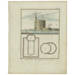
Antique Print of the Fortress at the Nile 'Damietta, Egypt' by C. Niebuhr, 1774
Located in Langweer, NL
Antique print titled 'Castelle an dem Ausflus des Nîls nicht weit von Damiât'. Translated: 'Fort at the estuary of the Nile near Damietta, Egypt'. This print originates from 'Reisebe...
Category
Antique 18th Century and Earlier Maps
Materials
Paper
$132 Sale Price
20% Off
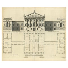
Antique Architectural Print of a New Design for Robert Walpole, England, 1725
Located in Langweer, NL
Antique print titled 'This New Design of my Invention, is most humbly inscrib'd to the Rt. Honble Robert Walpole (..)'.
Old print depicting a new de...
Category
Antique 18th Century and Earlier Maps
Materials
Paper
$415 Sale Price
20% Off
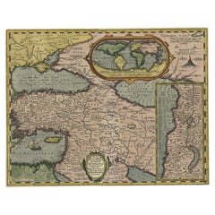
Scarce Antique Map of the Middle East, Surrounded by Latin Text, 1624
Located in Langweer, NL
Antique map titled 'Lumen Historium per Orientem (..).'
Scarce map of the Middle East, surrounded by Latin text. The two insets show Israel and an oval world map. This map (from the last edition of Ortelius Theatri Orbis Terrarum Parergon, 1624) was engraved by Franciscus Hareio. Later, this map was copied by Hornius for his World Atlas (1653).
Artists and Engravers: Franciscus Haraeus (Latinised form of Franciscus Verhaer; also known as Frans Verhaer), (Utrecht 1555? - Leuven, 11 January 1631), was a Dutch theologian, historian, and cartographer. He is best known for his history (from a Catholic point of view) of the Dutch Revolt...
Category
Antique 18th Century and Earlier Maps
Materials
Paper
$896 Sale Price
20% Off
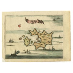
Antique Map of the Island of Psara by Dapper, 1688
Located in Langweer, NL
Antique map titled 'Sara.' Map of Psara ( Psyra or Ipsera) Island (North East Aegean Islands), Greece. This map originates from 'Nauwkeurige Beschrijving der eilanden in de Archipel ...
Category
Antique 18th Century and Earlier Maps
Materials
Paper
$141 Sale Price
20% Off
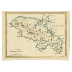
Martinique Map by Rigobert Bonne – French Antique Map, c.1768
Located in Langweer, NL
Map of Martinique by Rigobert Bonne, circa 1768
This is a detailed antique map of Martinique titled “Isle de la Martinique,” engraved by Rigobert Bonne around 1768 for the Atlas Encyclopédique. Bonne, a renowned French hydrographer and successor to Bellin, is celebrated for his scientifically precise and elegantly engraved maps.
The map shows Martinique with its mountainous interior, rivers, and settlements labelled, including Fort Royal, Fort St. Pierre, Le Marin, and Le Prêcheur. Coastal features, bays, and capes are marked, along with anchorages important for maritime navigation in the 18th century. The depiction includes relief shown pictorially, characteristic of Bonne’s cartographic style, enhancing both geographic understanding and aesthetic appeal.
This copperplate engraving retains original hand colouring outlining the coastlines in delicate blue and brown tones, typical for the period. It served as a key reference for scholars, navigators, and colonial administrators during France’s colonial presence in the Caribbean.
Condition:
Good condition overall. A strong impression with bright, original hand-colour outlines. General age toning, faint offsetting, and a vertical fold as issued in the atlas. Margins ample all around for framing.
Framing suggestions:
This historic Caribbean map...
Category
French Antique 18th Century and Earlier Maps
Materials
Paper
Map of Martinique, Guadeloupe, Marie-Galante, Désirade & Saintes by Bonne, 1788
Located in Langweer, NL
Map of Martinique, Guadeloupe, Marie-Galante, Désirade & Saintes by Bonne, 1788
This fine antique map, titled *Isle de la Martinique, Isles de la Guadeloupe, de Marie Galante, de la...
Category
French Antique 18th Century and Earlier Maps
Materials
Paper
1758 Bellin Map of Guadeloupe and Marie-Galante – Caribbean Islands
Located in Langweer, NL
Thank you for noting the correct date on the map. Here is your **updated plain text catalog listing**:
---
**Title (under 80 characters):**
1758 Bellin Map of Guadeloupe and Marie-Galante – Caribbean Islands
**Description:**
Original antique map titled *Carte de l’Isle de la Guadeloupe* by Jacques Nicolas Bellin, engraved for the *Histoire Générale des Voyages*, published in Paris in 1758.
This finely engraved copperplate map depicts the French Caribbean island of Guadeloupe, showing its distinctive butterfly-shaped division into Basse-Terre and Grande-Terre. The surrounding smaller islands include Marie-Galante (bottom right) and Les Saintes. The map details numerous place names, parishes, rivers, bays, mountains, and anchorages. A decorative rococo title cartouche graces the upper right corner, complemented by a scale bar cartouche in the upper left.
Jacques Nicolas Bellin (1703-1772) served as Hydrographer to the King and was one of the most prominent French cartographers of the 18th century, producing maps noted for their accuracy, elegance, and clarity. This map was created for the influential *Histoire Générale des Voyages* by Abbé Prévost.
Condition report:
Excellent condition. Strong and clean impression on fine laid paper with wide margins. Original hand coloring in outline and wash, highlighting coastlines and cartouches. Minor age toning at edges; verso blank.
Framing suggestion:
Frame with a classic gold or dark wood moulding and a neutral cream archival mat to emphasize the fine engraving and delicate color washes. Museum glass is recommended to preserve this 18th-century Caribbean map...
Category
French Antique 18th Century and Earlier Maps
Materials
Paper
Antique Hand-Colored Map of Western Russia and Ukraine, c.1680
Located in Langweer, NL
Description: Antique map titled 'Novissima et Accuratissima Totius Russiae vulgo Muscoviae Tabula'.
Antique map of Western Russia and Ukraine, published by Justus Danckerts. The ma...
Category
Antique 18th Century and Earlier Maps
Materials
Paper
$707 Sale Price
20% Off
Utrecht city plan
Located in UTRECHT, UT
“Platte grond der Stad Utrecht vertonende alle Gragten, Straaten, Stegen, Gangen, Markten, en plaatsen der openbare Gebouwen”, engraving published by Johannes van Schoonhoven in Amst...
Category
Dutch Other Antique 18th Century and Earlier Maps
Materials
Paper
$3,832
Old Map of the Arabian Peninsula with Parts of Egypt, Sudan, Eritrea & Ethiopia
Located in Langweer, NL
"Carte de l'Arabie, du Golfe Persique, et de la Mer Rouge, avec l'Egypte, la Nubie et l'Abissinie", Bonne, Rigobert
Subject: Arabia
Period: 1780 (circa)
Publication: Atlas de Toutes...
Category
Antique 18th Century and Earlier Maps
Materials
Paper
$358 Sale Price
20% Off
Original Antique Map showing Southern India, Northern Sri Lanka & Malabar, 1652
Located in Langweer, NL
Antique map titled 'Presqu'Isle de l'Inde deca le Gange (..)'.
Old map showing the southern part of India, including the northern part of Sri Lanka. With inset map of Southern India (Malabar). This map covers the subcontinent from the Bay of Bengal and the Gulf of Cambay to Ceylon. The Mogul Empire can be found in the north. Further south...
Category
Antique 18th Century and Earlier Maps
Materials
Paper
$622 Sale Price
20% Off
Antique Architecture Print of a Composite Portico by Neufforge, c.1770
Located in Langweer, NL
Antique print titled 'Plan et Elevation d'un Portique Composite (..)'. Old print showing the design of a Composite portico. This print originates from 'Recueil Élémentaire d?Architec...
Category
Antique 18th Century and Earlier Maps
Materials
Paper
Map of Constantinople, Bosphorus, the Coasts of Greece and the Archipelago, 1785
Located in Langweer, NL
This is a large 1785 map titled "Carte de la Ville de Constantinople et du Bosphore de Thrace", which includes detailed maps of Constantinople (modern-day Is...
Category
Antique 18th Century and Earlier Maps
Materials
Paper
$2,311 Sale Price
20% Off
Map of Saint Helena Island: Early 18th-Century Copper Engraving by F. Bernard
Located in Langweer, NL
Map of Saint Helena Island: Early 18th-Century Copper Engraving by F. Bernard
This rare and beautifully detailed copper engraving of Saint Helena Island dates from around 1722 and...
Category
Antique 18th Century and Earlier Maps
Materials
Paper
$141 Sale Price
20% Off
Brazil Coastline Map – Broenner Carte du Bresil, 1772 Captaincies
Located in Langweer, NL
Carte du Bresil Map, Broenner Krefeld 1772 – Brazil Coastline Captaincies
This is an engraved map titled Carte du Bresil Prem. Partie, published in Krefeld (Germany) by J.J. Broenne...
Category
French Antique 18th Century and Earlier Maps
Materials
Paper
Antique Map of Lower Saxony by Clouet, 1787
Located in Langweer, NL
Antique map titled 'Basse Saxe'. Antique map of Lower Saxony, Germany. Originates from 'Geographie moderne avec une introduction' by J.B.L. Clouet.
Category
Antique 18th Century and Earlier Maps
Materials
Paper
$283 Sale Price
20% Off
Antique Map of France by Covens & Mortier, c.1730
Located in Langweer, NL
Antique map titled 'Nova regni Galliae (..) La France'. Old map of France with large decorative title cartouche. With great detail.
Artists and Engravers: Pieter und David Mortie...
Category
Antique 18th Century and Earlier Maps
Materials
Paper
$613 Sale Price
20% Off
Antique Map of Romania and Bulgaria Centered on the Danube River
Located in Langweer, NL
Antique map titled 'Vetus descriptio Daciarum nec non Moesiarum'. Impressive map of the area of Romania and Bulgaria centered on the Danube River. The map is based on Ortelius' map o...
Category
Antique 18th Century and Earlier Maps
Materials
Paper
$650 Sale Price
20% Off
16th Century Antique Map of Ven Framed in Gold
Located in Haddonfield, NJ
Ven (older Swedish spelling Hven), is a Swedish island in the Öresund strait laying between Skåne, Sweden and Zealand and Denmark. The island was historically under Danish rule. Dani...
Category
Danish Baroque Antique 18th Century and Earlier Maps
Materials
Wood, Paper
Detailed Decorative Antique Map of the Coast of Malabar and Coromandel, India
Located in Langweer, NL
Antique map titled 'Carte des Côtes de Malabar et de Coromandel'. Finely engraved map of the southern part of India, first issued in 1723 by acclaimed French mapmaker Guillaume De L’Isle. It focuses on trade routes within India, as well as the Coromandel and Malabar Coasts...
Category
Antique 18th Century and Earlier Maps
Materials
Paper
$1,132 Sale Price
20% Off
Detailed 1720s Map – Siege of Douay and Lines of Circumvallation, France
Located in Langweer, NL
Detailed 1720s Map – Siege of Douay and Lines of Circumvallation, France
This engraved map shows the detailed fortifications and surrounding region of Douay (Douai) in northern Fran...
Category
French Antique 18th Century and Earlier Maps
Materials
Paper
Original Antique Map of Turkey, Asia Minor and Cyprus
Located in Langweer, NL
Antique map titled 'Natoliae sive Asia Minor'. Original old map of Turkey, Asia Minor and Cyprus. Includes a decorative cartouches, sailing ship, sea mon...
Category
Antique 18th Century and Earlier Maps
Materials
Paper
$792 Sale Price
20% Off
Batavia Market Scenes & Government House – Antique Prints VOC Period, c.1780
Located in Langweer, NL
Batavia Views – Government House and Market Scenes, circa 1780
This is an original late 18th-century engraving featuring two detailed views of Batavia (now Jakarta, Indonesia) under...
Category
Dutch Antique 18th Century and Earlier Maps
Materials
Paper
Isle de Ladrones: Early 18th-Century Map of the Mariana Islands by F. Bernard
Located in Langweer, NL
Isle de Ladrones: Early 18th-Century Map of the Mariana Islands by F. Bernard
This intriguing copper engraving depicts the *Isle de Ladrones*, now known as the Mariana Islands, situated in the western Pacific Ocean. The map was published around 1722 in Amsterdam by F. Bernard as part of the influential travel compilation *Recueil des voyages qui ont servi a ...*. The map offers a simplistic yet stylized portrayal of the island, emphasizing its rugged and mountainous terrain, dotted with sparse vegetation and hills.
The term *Isle de Ladrones* (Islands of Thieves) was given by the Spanish explorer Ferdinand Magellan in 1521 during his circumnavigation of the globe, as his crew encountered thefts from the native Chamorro people. The name later changed to *Mariana Islands* when they were named after Queen...
Category
Antique 18th Century and Earlier Maps
Materials
Paper
$141 Sale Price
20% Off
Rare Hand-Colored Map of Franche-Comté and Burgundy by Frederik De Wit c. 1688
Located in Langweer, NL
Title: Rare Hand-Colored Map of Franche-Comté and Burgundy by Frederik De Wit c. 1688
Description: This stunning 17th-century map, titled "Comitatus Burgundiae vulgo La Franche Comt...
Category
Antique 18th Century and Earlier Maps
Materials
Paper
Antique Map of Cities Nanking and Suzhou in the Jiangsu Region, China, c.1758
Located in Langweer, NL
Antique map titled 'Plan de l' Enceinte de la Ville de Nan-King ou Kyang-Ning-Fou et plan de la ville de Su-Tcheou-Fou.' A map of the city of Nanking or Nanjing. A second map shows S...
Category
Antique 18th Century and Earlier Maps
Materials
Paper
$226 Sale Price
20% Off
Map Holy Promise Land Canaan Richard Palmer Richard Blome 1687 Joseph Moxon
Located in BUNGAY, SUFFOLK
Canaan comonly called the Holy Land or the Land of Promise, being the Possesion of the Israelites & travelled through by Our Lord & Saviour Iesus Christ and his Apostles. Engraven by Richard Palmer for Richard Blome. 1687
Blome, Richard, 1641-1705. London. 283 x 452 mm. Copperplate.
Probably from an English Bible...
Category
British Baroque Antique 18th Century and Earlier Maps
Materials
Paper
Rare Small Antique Map of the Persian Empire, 1692
Located in Langweer, NL
Antique map titled 'Perse'. Small engraved map of the Persian Empire, decorated with a simple cartouche and armorial shield. This map originates from 'L'Atlas en Abrege, ou Nouvelle ...
Category
Antique 18th Century and Earlier Maps
Materials
Paper
Antique Map of South America by Conder, c.1775
Located in Langweer, NL
Antique map titled 'South America agreeable to the most approved maps and charts'. Rare map of South America depicting Chili, La Plata, Paraguay, Brazil, Peru, the Amazon and surroun...
Category
Antique 18th Century and Earlier Maps
Materials
Paper
$327 Sale Price
20% Off
Beautiful Antique Handcolored Map of Switzerland with 33 Coats of Arms, ca.1705
Located in Langweer, NL
Antique map Switerzland titled 'La Suisse Divisee en ses Treze Cantons, ses Alliez & ses Sujets (..)'.
Beautiful map of Switzerland with 33 coats of arms. The map is dedicated to t...
Category
Antique 18th Century and Earlier Maps
Materials
Paper
$1,509 Sale Price
20% Off
Old Map of North India From Kandahar East to Burma 'Pegu' and South to Goa, 1776
Located in Langweer, NL
Description: Antique map titled 'Indes Iere Feuille'.
Old map of northern India. Covers the subcontinent from Kandahar east as far as Burma (Pegu) and south to just past Goa. Names...
Category
Antique 18th Century and Earlier Maps
Materials
Paper
$349 Sale Price
20% Off
Antique Map of the Province of Zeeland, The Netherlands by Coronelli, 1692
Located in Langweer, NL
Antique map titled 'Contado di Zelanda'. Beautiful map of the Dutch province of Zeeland. With the islands of Walcheren, Schouwen-Duiveland, Noord-Beveland, Zuid-Beveland, Tholen and ...
Category
Antique 18th Century and Earlier Maps
Materials
Paper
$632 Sale Price
20% Off
Johannes Janssonius' 17th-Century Map of the Duchy of Bremen in Germany
Located in Langweer, NL
The map titled "Ducatus olim Episcopatus Bremensis et ostiorum Albis et Visurgis Fluviorum novissima Descriptio" by Johannes Janssonius provides a rich historical and geographical il...
Category
Antique 18th Century and Earlier Maps
Materials
Paper
$726 Sale Price
20% Off
Antique Map of The Nile, Egypt and the Red Sea by Bachiene, 1765
Located in Langweer, NL
Antique map titled 'De XIde Landkaart verbeeldende Egypte en de Woestyne der Schelf-Zee (..).' Map of Biblical Egypt and the Red Sea. With title cartouche, compass rose and scale. Th...
Category
Antique 18th Century and Earlier Maps
Materials
Paper
$165 Sale Price
20% Off
Old Ptolemaic Map of the Region Between the Persian Gulf and Caspian Sea, 1598
Located in Langweer, NL
"Tabula Asiae V", Ptolemy/Ruscelli
Subject: Persia - Iran
Period: 1598 (published)
Publication: Geografia di Claudio Tolomeo Allessadrino…
Claudius Ptolemy was a mathematician, ast...
Category
Antique 18th Century and Earlier Maps
Materials
Paper
$377 Sale Price
20% Off
Old Map of the Kingdoms of Fez, Algiers, Segelmese, Tafilet and Morocco, ca.1760
Located in Langweer, NL
Antique map titled 'A Map of the Empire of Morocco Comprehending the Kingdoms of Fez, Morocco'.
Original antique map of the kingdoms of Fez, Algiers, Segelmese, Tafilet and Moroc...
Category
Antique 18th Century and Earlier Maps
Materials
Paper
Antique Map of Manchuria and the Northeast Portion of Tartary
Located in Langweer, NL
Antique map titled 'Carte de la Tartarie Orientale (..)'. Detailed map of Manchuria and the Northeast portion of Tartary, including Sagallan Anga Hata--Isle de la Bouche...
Category
Antique 18th Century and Earlier Maps
Materials
Paper
$273 Sale Price
20% Off
Blaeu Map of Ottoman Balkans – Walachia Bulgaria Romania, circa 1665
Located in Langweer, NL
Blaeu Map of Ottoman Balkans – Walachia Bulgaria Romania, circa 1665
This is an original hand-coloured antique map titled “Walachia, Servia, Bulgaria, Romania,” published by Joan Bl...
Category
Dutch Antique 18th Century and Earlier Maps
Materials
Paper
17th Century Blaeu Map – Ottoman Balkans: Walachia, Bulgaria, Romania, ca. 1650
Located in Langweer, NL
Blaeu Map of Walachia, Servia, Bulgaria, Romania, circa 1640
This is an original antique map titled “Walachia, Servia, Bulgaria, Romania,” published by Joan Blaeu in Amsterdam betwe...
Category
Dutch Antique 18th Century and Earlier Maps
Materials
Paper
Japanese Isles Map by Mallet, 1683 – Decorative Miniature Map
Located in Langweer, NL
1683 Map of Japan Isles by Mallet – Decorative Miniature Map
This is an original antique map titled “Isles du Japon,” created by Alain Manesson Mallet and published in Paris in 1683...
Category
French Antique 18th Century and Earlier Maps
Materials
Paper
Original Antique Map of the Road from Bristol to Weymouth
Located in Langweer, NL
Antique map titled 'The Road from Bristol to Weymouth (..)'. Original antique map of the road from Bristol to Weymouth. Plate 60 from Ogilby's 'Britannia', the first road atlas of En...
Category
Antique 18th Century and Earlier Maps
Materials
Paper
$207 Sale Price
20% Off
Early Woodcut Map of Franconia and Surrounding Regions, 1628
Located in Langweer, NL
Title: Early Woodcut Map of Franconia and Surrounding Regions, 1628
Franconia (Franckenlande) is a region in Germany. Historically, Franconia was a significant part of the Holy Roma...
Category
Antique 18th Century and Earlier Maps
Materials
Paper
1732 Henri Chatelain Map of the Holy Land Divided Among the Tribes of Israel
Located in Langweer, NL
Title: 1732 Henri Chatelain Map of the Holy Land Divided Among the Tribes of Israel
This exquisite 18th-century map by Henri Chatelain, published in 1732, offers a detailed depict...
Category
Antique 18th Century and Earlier Maps
Materials
Paper
Cartographic Depiction of Flensburg and Surrounding Territories, Anno 1648
Located in Langweer, NL
Title: Landtcarte Vonn dem Ambte Flensborg, ohne Nordgoeßherde. Anno 1648.
Description:
This exquisitely detailed and old coloured map of Flensburg was crafted by the noted cartogr...
Category
German Antique 18th Century and Earlier Maps
Materials
Paper
$1,169 Sale Price
20% Off
Physical & Political Map of Switzerland: Late 18th Century - Mentelle Atlas
Located in Langweer, NL
Antique Map with Title: 'Carte Physique et Politique de la Suisse'
**Publication Details:**
- **Atlas Title:** Nouvel Atlas Universel de Géographie Ancienne et Moderne
- **Purpose:...
Category
Antique 18th Century and Earlier Maps
Materials
Paper
$500 Sale Price
20% Off
Antique Map of New England and Eastern Canada by Homann Heirs, circa 1755
Located in Langweer, NL
Antique map titled 'Partie Orientale de la Nouvelle France ou du Canada (..)'. Original antique map of New England and Eastern Canada made a...
Category
Antique 18th Century and Earlier Maps
Materials
Paper
$1,768 Sale Price
25% Off
Historical Map of Northern Europe and Russia - Engraved for I. Harrison, 1788
Located in Langweer, NL
Historical Map of Northern Europe and Russia - Engraved for I. Harrison, 1788
This impressive historical map titled A New Map of Europe Containing Denmark, Norway, Sweden and Russ...
Category
Antique 18th Century and Earlier Maps
Materials
Paper
$792 Sale Price
20% Off
Old Original Hand-Colored Engraving of Various Apples, 1758
Located in Langweer, NL
Antique print depicting apple variaties including the Pigeon of Passe Pomme, Rode Herfst- of Winter Calville, Witte Ribbert of Ribling, Winter Parmain Pepping, Paasch Appel, Wyker Pe...
Category
Antique 18th Century and Earlier Maps
Materials
Paper
$301 Sale Price
20% Off
A Stunning 1744 Bowen Map: South East Germany & Queen of Hungary’s Dominions
Located in Langweer, NL
Title: A New and Correct Map of the South East part of Germany, 1744
This map by Emanuel Bowen, dating to around 1744, beautifully captures the southeastern part of Germany. The det...
Category
Antique 18th Century and Earlier Maps
Materials
Paper
Pl. 1 Antique Print of the Stowe House by Le Rouge, 1776
Located in Langweer, NL
Antique print titled 'Chateau de Stowe, du Coté des Jardins'. Copper engraving showing the garden side of the Stowe House. This print originates from 'Jard...
Category
Antique 18th Century and Earlier Maps
Materials
Paper
Antique Map of Greece, Turkey and surroundings with original coloring
Located in Langweer, NL
Antique map titled 'Nieuwe Kaart van Europisch Turkyen na de alderlaatste ontdekking in t licht gebracht'. Antique map of Greece with Crete and Cyprus, Turkey and the Black Sea. Publ...
Category
Antique 18th Century and Earlier Maps
Materials
Paper
$650 Sale Price
20% Off
Antique Print of the House of Roger Hudson by Campbell, 1725
Located in Langweer, NL
Antique print titled 'The Elevation of Roger Hudson Esqr. his house at Sunbury (..)'. Old engraving of the house of Roger Hudson in Sunbury. This print originates from 'Vitruvius Bri...
Category
Antique 18th Century and Earlier Maps
Materials
Paper
Very Attractive Handcolored Antique Plan of Cochin in India, 1744
Located in Langweer, NL
Antique map titled 'The City of Cochin (..).' Plan of Cochin, Malabar Coast, India, during the attack by Admiral van Goens in 1663. This map was published in 'The True and Exact Desc...
Category
Antique 18th Century and Earlier Maps
Materials
Paper
$792 Sale Price
20% Off
Antique Map of the Queen Charlotte Islands, Haida Gwaii
Located in Langweer, NL
Antique map titled 'Isles de la Reine Charlotte (..)'. Original old map of the Queen Charlotte Islands, based upon the explorations of James Cook, Juan Perez, and other contemporary European explorers. The map shows only partial coastal detail along the north end of the main island, and includes two insets of navigable bays and depth measurements.
Now called Haida Gwaii, after the local native population, the islands situated off Canada’s coast, south of Vancouver played an important role in the late 18th and early 19th century maritime...
Category
Antique 18th Century and Earlier Maps
Materials
Paper
$273 Sale Price
20% Off
Original Map of the East Indies Including Sumatra, Java, Borneo & Malaysia, 1747
Located in Langweer, NL
Antique map titled 'Carte des Isles Java, Sumatra, Borneo (..) - Kaart van de Eilanden van Iava, Sumatra, Borneo (..)'.
Map of the East Indies including Sumatra, Java, Borneo and...
Category
Antique 18th Century and Earlier Maps
Materials
Paper
$424 Sale Price
20% Off
Antique Print of the House of John Waller by Campbell, 1725
Located in Langweer, NL
Antique print titled 'The Elevation of Iohn Waller Esqr. his house in Beaconsfield in Buckinghamshire (..)'. Old engraving of the house of John Waller in Beaconsfield. This print ori...
Category
Antique 18th Century and Earlier Maps
Materials
Paper
Antique Map of Gloucestershire by Camden, c.1607
Located in Langweer, NL
Antique map titled 'Glocestriae comitatus olim sedes Dobunorum'. Map of Gloucestershire, England. This map originates from Camden?s 'Britannia' ...
Category
Antique 18th Century and Earlier Maps
Materials
Paper
$226 Sale Price
20% Off
Authentic Old Map of Sumatra, Malaysia and Singapore, 1745
Located in Langweer, NL
Title: "Kaartje van't Eiland Sumatra en de Maleidse Kust gelegen na de stelling van de G. de L'Isle"
Published by Jacob Keizer and by Jan de Lat
Creator: Keizer, Jacob, active 1706...
Category
Antique 18th Century and Earlier Maps
Materials
Paper
$452 Sale Price
20% Off
Historical Map of the Duchy of Lauenburg by Johann Baptist Homann - Circa 1720
Located in Langweer, NL
Historical Map of the Duchy of Lauenburg by Johann Baptist Homann - Circa 1720
This splendid historical map titled Ducatus Lauemburgicus is a highly detailed and beautifully engra...
Category
Antique 18th Century and Earlier Maps
Materials
Paper
$509 Sale Price
20% Off

