18th Century and Earlier Maps
to
2,336
2,869
64
2,936
26
12
1
1
2,936
2,283
475
3
290
34
10
126
10
37
9
2
5
4
3
3
2,922
30
20
3
3
307
111
81
53
52
2,936
2,936
2,936
59
21
13
12
12
Period: 18th Century and Earlier
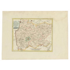
Antique Map of the Region of Bolsward and Sneek by Von Reilly, 1791
Located in Langweer, NL
Antique map titled 'Der Provinz Westergo drey mittlere Grietenyen mit der Stadt Bolsward und Sneek'. Map of the region of Bolsward and Sneek, Friesland, the Netherlands. This map org...
Category
Antique 18th Century and Earlier Maps
Materials
Paper
$145 Sale Price
20% Off
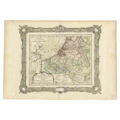
Antique Map of the Netherlands by Zannoni, 1765
Located in Langweer, NL
Antique map titled 'Carte Historique, Geographique et Militaire des Campagnes de Louis XIV dans les Pays Bas (..)'. Beautiful old map of the Netherlands...
Category
Antique 18th Century and Earlier Maps
Materials
Paper
$209 Sale Price
20% Off
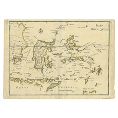
Antique Map of the Maluku Islands by Le Rouge, c.1750
By George Louis Le Rouge
Located in Langweer, NL
Antique map Moluccas/Spice Islands titled 'Isles Moluques'. Detailed map of the famous Spice Islands (Maluku Islands or the Moluccas). Includes also Sulawesi, Bali, Timor, part of Bo...
Category
Antique 18th Century and Earlier Maps
Materials
Paper
$150 Sale Price
20% Off
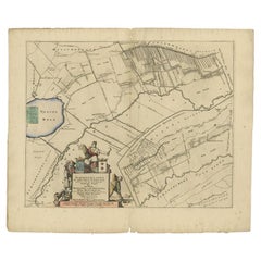
Antique Map of the Schoterland Township, Friesland by Halma, 1718
Located in Langweer, NL
Antique map Friesland titled 'Schooterlandt de Vijfde Grietenije van de Sevenwolden (..)'. Old map of Friesland, the Netherlands. This map depicts the region of Schoterland and inclu...
Category
Antique 18th Century and Earlier Maps
Materials
Paper
$318 Sale Price
20% Off
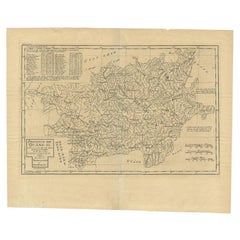
Antique Map of the Province of Quang-Si by Du Halde, 1738
Located in Langweer, NL
Antique map titled 'Province XIII Quang-Si. Drawn on the spot by ye Peres de Tartre & Cordoso in the year 1714'. Old map of the Chinese province Quang-Si. Originates from the Edward ...
Category
Antique 18th Century and Earlier Maps
Materials
Paper
$246 Sale Price
20% Off
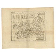
Antique Map of the Province of Quey-Chew by Du Halde, 1738
Located in Langweer, NL
Antique map titled 'Province XV Quey-Chew drawn on the spot by the Peres Fridelli and Regis in the year 1716'. Old map of the Chinese province Quey-Chew. Originates from the Edward C...
Category
Antique 18th Century and Earlier Maps
Materials
Paper
$246 Sale Price
20% Off
Antique Map of the Old Land of Batavia and Friesland by Halma, 1718
Located in Langweer, NL
Antique map Friesland titled 'Descriptio veteris Agri Batavi et Frisii (..)'. Old map of Friesland, the Netherlands. This map depicts the old land of Batavia and Friesland. Originate...
Category
Antique 18th Century and Earlier Maps
Materials
Paper
$242 Sale Price
20% Off
Antique Map of the Region Between the Caspian and the Sea of China by Toms, 1799
Located in Langweer, NL
Antique map titled 'Scythia et Serica'. Old map of the region between the Caspian and the Sea of China. Originates from 'Geographia Antiqua (..)'.
Artists and Engravers: Engraved ...
Category
Antique 18th Century and Earlier Maps
Materials
Paper
$132 Sale Price
20% Off
Antique Map of the Old Land of Batavia and Friesland by Halma, 1718
Located in Langweer, NL
Antique map Friesland titled 'Descriptio veteris Agri Batavi et Frisii (..)'. Old map of Friesland, the Netherlands. This map depicts the old land of Batavia and Friesland. Originate...
Category
Antique 18th Century and Earlier Maps
Materials
Paper
$218 Sale Price
20% Off
Antique Map of the Old Land of Batavia and FriesLand, The Netherlands, 1697
Located in Langweer, NL
Antique map Friesland titled 'Descriptio veteris Agri Batavi et Frisii (..)'. Old map of Friesland, the Netherlands. Depicts the old land of Batavia and Friesland. This map originate...
Category
Antique 18th Century and Earlier Maps
Materials
Paper
$179 Sale Price
20% Off
Antique Map of the Netherlands and Belgium by Lapie, 1842
Located in Langweer, NL
Antique map titled 'Carte des Royaumes de Belgique et de Hollande'. Map of the Netherlands and Belgium. This map originates from 'Atlas universel de géographie ancienne et moderne (....
Category
Antique 18th Century and Earlier Maps
Materials
Paper
$274 Sale Price
20% Off
Antique Map of the Province of Overijssel by Keizer & De Lat, 1788
Located in Langweer, NL
Antique map titled 'Seigneurie d'Over-Ysel'. Uncommon antique map of the province of Overijssel, the Netherlands. This map originates from 'Nieuwe Natuur- Geschied- en Handelkundige ...
Category
Antique 18th Century and Earlier Maps
Materials
Paper
Antique Map of the Region Between the Black and Caspian Sea by Cellarius, 1731
Located in Langweer, NL
Antique map titled 'Bosporus, Maeotis, Iberia, Albania, et Sarmatia Asiatica.' Map of the region between the Black and Caspian Seas in early Sarmatian time...
Category
Antique 18th Century and Earlier Maps
Materials
Paper
$166 Sale Price
20% Off
Antique Map of the Region of Achtkarspelen by Schotanus, 1664
Located in Langweer, NL
Antique map titled 'De Grietenije van Achtkerspelen (..)'. Map of the Grietenij of Achtkarspelen, Friesland, The Netherlands. Multiple cartouches, key and coat of arms. Originates fr...
Category
Antique 18th Century and Earlier Maps
Materials
Paper
Antique Map of the Region of Dantumadeel by Schotanus, 1664
Located in Langweer, NL
Antique map titled 'De Grietenye van Dantumadeel (..)'. Map of the Grietenij of Dantumadeel, Friesland, The Netherlands. Originates from "Beschrijvinge ende nieuwe caerten van de Hee...
Category
Antique 18th Century and Earlier Maps
Materials
Paper
Antique Map of the Mouth of the Chiang River by Bellin, 1764
Located in Langweer, NL
Antique map titled ‘Carte de la Baye d'Hocsieu et des Entrees de la Riviere de Chang, Dans la Province de Fokyen en Chine’. This impressive map or sea chart d...
Category
Antique 18th Century and Earlier Maps
Materials
Paper
$237 Sale Price
20% Off
Antique Map of the Province of Groningen by Keizer & De Lat, 1788
Located in Langweer, NL
Antique map titled 'Groningen en Ommelanden'. Uncommon antique map of the province of Groningen, the Netherlands. This map originates from 'Nieuwe Natuur- Geschied- en Handelkundige ...
Category
Antique 18th Century and Earlier Maps
Materials
Paper
Antique Map of the Region of Schwarzburg by Schreiber, 1749
By Schreiber
Located in Langweer, NL
Antique map titled 'Die Südliche Fürstenthum Schwartzburg (..)'. Map of the region of Schwarzburg, Germany. This map originates from 'Atlas Selectus von allen Konigreichen und Lander...
Category
Antique 18th Century and Earlier Maps
Materials
Paper
$88 Sale Price
20% Off
Antique Map of the Rauwerderhem Township, Friesland by Halma, 1718
Located in Langweer, NL
Antique map Friesland titled 'Rauwerderhem de Elfde Grietenije van Ooster Goo (..)'. Old map of Friesland, the Netherlands. This map depicts the region of Rauwerderhem and includes c...
Category
Antique 18th Century and Earlier Maps
Materials
Paper
$313 Sale Price
20% Off
Antique Map of the Region of Bolsward and Sneek by Von Reilly, 1791
Located in Langweer, NL
Antique map titled 'Der Provinz Westergo drey mittlere Grietenyen mit der Stadt Bolsward und Sneek'. Map of the region of Bolsward and Sneek, Friesland, the Netherlands. This map org...
Category
Antique 18th Century and Earlier Maps
Materials
Paper
$150 Sale Price
20% Off
Antique Map of the Province of Groningen by Blaeu, 1635
Located in Langweer, NL
Antique map titled 'Groninga Dominium.' A map of the Dutch province Groningen. This includes the Wadden islands Schiermonnikoog, Rottumeroog (Rottumerplaat) and Borkum. With compass ...
Category
Antique 18th Century and Earlier Maps
Materials
Paper
$558 Sale Price
20% Off
Antique Map of the Region of Dantumadeel, Friesland, The Netherlands, 1664
Located in Langweer, NL
Antique map titled 'De Grietenije van Dantuma deel (..)'. Map of the Grietenij of Dantumadeel, Friesland, The Netherlands. Multiple cartouches, key and coat of arms. Originates from ...
Category
Antique 18th Century and Earlier Maps
Materials
Paper
$185 Sale Price
20% Off
Antique Map of the Region of Plauen by Schreiber '1749'
By Schreiber
Located in Langweer, NL
Antique map titled 'Die Aemter Plauen und Pausa (..)'. Map of the region of Plauen, Germany. This map originates from 'Atlas Selectus von allen Konigreichen und Landern der Welt' by ...
Category
Antique 18th Century and Earlier Maps
Materials
Paper
$88 Sale Price
20% Off
Antique Map of the Region of Aire-sur-L'Adour by Janssonius, 1657
Located in Langweer, NL
Antique map of France titled 'L'Evesche d'Aire'. Decorative map of the Aire-sur-L'Adour region, a commune in the Landes department in Nouvelle-Aquitaine in southwestern France. This ...
Category
Antique 18th Century and Earlier Maps
Materials
Paper
$325 Sale Price
20% Off
Antique Map of the Old Land of Batavia and FriesLand by Halma, 1718
Located in Langweer, NL
Antique map Friesland titled 'Descriptio veteris Agri Batavi et Frisii (..)'. Old map of Friesland, the Netherlands. This map depicts the old land of Batavia and Friesland. Originate...
Category
Antique 18th Century and Earlier Maps
Materials
Paper
Antique Map of the South-Western Coast of Sumatra by De la Haye, c.1780
Located in Langweer, NL
Antique map titled 'Carte de la Côte Occidentale de l'Isle Sumatra'. Sea chart of the part of the south-western coast of Sumatra with the Nassau (Nias) and Fortune isles.
Artists ...
Category
Antique 18th Century and Earlier Maps
Materials
Paper
$384 Sale Price
20% Off
Antique Map of the Province of Zeeland by Keizer & De Lat, 1788
Located in Langweer, NL
Antique map titled 'Comitatus Zelandiae'. Uncommon antique map of the province of Zeeland, the Netherlands. This map originates from 'Nieuwe Natuur- Geschied- en Handelkundige Zak- e...
Category
Antique 18th Century and Earlier Maps
Materials
Paper
Antique Map of the Region of Voigtsberg by Schreiber, 1749
By Schreiber
Located in Langweer, NL
Antique map titled 'Das Amt Voigtsberg (..)'. Map of the region of Voigtsberg, Germany. This map originates from 'Atlas Selectus von allen Konigreichen und Landern der Welt' by Johan...
Category
Antique 18th Century and Earlier Maps
Materials
Paper
$88 Sale Price
20% Off
Antique Map of the Ooststellingwerf Township Friesland by Halma, 1718
Located in Langweer, NL
Antique map titled 'Stellingwerf Oost-Eynde, de negende Grietenije van de Sevenwolden'. This regional map of the Oost Stellingwerf Grietenij, part of the Province of Friesland, The N...
Category
Antique 18th Century and Earlier Maps
Materials
Paper
$369 Sale Price
20% Off
Antique Map of the Old Lands of FriesLand by Halma, 1718
Located in Langweer, NL
Antique map Friesland titled 'Descriptio Agri Frisii (..)'. Old map of Friesland, the Netherlands. This map depicts the old lands of Friesland. Originates from 'Uitbeelding van de He...
Category
Antique 18th Century and Earlier Maps
Materials
Paper
$242 Sale Price
20% Off
Antique Map of the Region of Cambrai in France, c.1630
Located in Langweer, NL
Antique map titled 'l'Archevesche de Cambray'. Decorative map of the region of Cambrai, France. Includes the cities of Cambrai, Valencienes, Douai, and Bouchain.
Artists and Engrav...
Category
Antique 18th Century and Earlier Maps
Materials
Paper
Antique Map of the Province of Friesland by Keizer & De Lat, 1788
Located in Langweer, NL
Antique map titled 'Friesland'. Uncommon antique map of the province of Friesland, the Netherlands. This map originates from 'Nieuwe Natuur- Geschied- en Handelkundige Zak- en Reisat...
Category
Antique 18th Century and Earlier Maps
Materials
Paper
$209 Sale Price
20% Off
Antique Map of the Pacific Ocean by Anson, 1765
Located in Langweer, NL
Antique map titled 'Carte de la Mer du Sud ou Mer Pacifique - Kaart van de Zuyd-Zee of stille oceaan (..)'. Nautical chart of the Pacific Ocean depicting the trade routes used by Spanish Galleons from Acapulco in Mexico to Manila in the Philippines. In particular this chart depicts the voyages of the Spanish Nostra Seigniora de Cabadonga and the British Navy Commodore George Anson. Anson succeed in capturing the Spanish treasure...
Category
Antique 18th Century and Earlier Maps
Materials
Paper
$936 Sale Price
20% Off
Antique Map of the Region of Franekeradeel, Friesland, The Netherlands, 1664
Located in Langweer, NL
Antique map titled 'De Grietenije van Franeker deel (..)'. Map of the Grietenij of Franekeradeel, Friesland, The Netherlands. Multiple cartouches, key and coat of arms. Originates fr...
Category
Antique 18th Century and Earlier Maps
Materials
Paper
$185 Sale Price
20% Off
Antique Map of the Dongeradeel Township in Friesland, The Netherlands, 1718
Located in Langweer, NL
Antique map Friesland titled 'Donger Deel West Zyde der Pasens (..)'. Old map of Friesland, the Netherlands. This map depicts the region of Dongeradeel and includes cities and villag...
Category
Antique 18th Century and Earlier Maps
Materials
Paper
Antique Map of the City of Harlingen by Janssonius, c.1657
Located in Langweer, NL
Antique map titled ‘Harlingen‘. This map depicts the city of Harlingen (Friesland, The Netherlands). Published by J. Janssonius, Amsterdam, c.1657.
Artists and Engravers: Johannes...
Category
Antique 18th Century and Earlier Maps
Materials
Paper
$369 Sale Price
20% Off
Antique Map of the Coromandel Peninsula, 1754
Located in Langweer, NL
Antique map titled 'A map of Coromandel shewing the Seat of War on that coast'. Rare map of Coromandel printed for the London Magazine.
Artists and Engr...
Category
Antique 18th Century and Earlier Maps
Materials
Paper
$113 Sale Price
20% Off
Antique Map of the City of Ypres by Beaulieu, 1729
Located in Langweer, NL
Antique map titled 'Plan de la Ville d'Ipren/Plan der Stadt Ipren'. Map of the city of Ieper/Ypres in Belgium. This map originates from 'Histoire Militaire du Prince Eugene de Savoye...
Category
Antique 18th Century and Earlier Maps
Materials
Paper
$211 Sale Price
20% Off
Antique Map of the City of Sneek by Blaeu, 1652
Located in Langweer, NL
Antique map titled: 'Sneeck.' Bird's-eye view plan of Sneek, Friesland, The Netherlands. From a Latin edition of the town atlas 'Toneel der Steden', published by Joan Blaeu, Amsterda...
Category
Antique 18th Century and Earlier Maps
Materials
Paper
$330 Sale Price
20% Off
Antique Map of the Coast of Guinea, Africa, c.1780
Located in Langweer, NL
Antique map Africa titled 'Carte de la Haute et de la Basse Guinée'. Map of the Coast of Guinea, Africa. Represents modern day Liberia, Ivory Coast, Ghana, Nigeria, Cameroon, Gabon, Congo, and Equatorial Guinea...
Category
Antique 18th Century and Earlier Maps
Materials
Paper
$151 Sale Price
20% Off
Antique Map of the City of Zutphen by Guicciardini, 1612
Located in Langweer, NL
Antique map Zutphen titled 'Zutphen'. This map depicts the city of Zutphen, Gelderland, The Netherlands. Originates from 'Beschryvinghe van alle de Neder-landen anderssins ghenoemt N...
Category
Antique 18th Century and Earlier Maps
Materials
Paper
$178 Sale Price
20% Off
Antique Map of the City of Leeuwarden by Harrewijn, 1743
Located in Langweer, NL
Antique map titled 'La Ville de Lewarde'. Old map of the city of Leeuwarden, Friesland. Originates from 'Les Délices des Pays-Bas' by Widow Foppens.
Artists and Engravers: Engrav...
Category
Antique 18th Century and Earlier Maps
Materials
Paper
$116 Sale Price
20% Off
Antique Map of the City of Franeker by Janssonius, 1657
Located in Langweer, NL
Antique map titled ‘Franekera‘. This map depicts the city of Franeker (Friesland, The Netherlands). Published by J. Janssonius, Amsterdam, 1657.
Artists and Engravers: Johannes Jans...
Category
Antique 18th Century and Earlier Maps
Materials
Paper
Antique Map of the City of Gorinchem by Merian, c.1659
Located in Langweer, NL
Antique map titled 'Gorckum'. This print depicts the city of Gorinchem (or Gorcum/Gorkum, The Netherlands). This print originates from 'Topographia Germaniae Inferioris (..)'.
Art...
Category
Antique 18th Century and Earlier Maps
Materials
Paper
$128 Sale Price
20% Off
Antique Map of the Coast of Juan Fernandez by Van Schley, 1757
Located in Langweer, NL
Antique map titled 'Cote du Nord Est de l'Isle de Juan Fernandez (..).' Map of the Chilean South Pacific archipelago of the Juan Fernandez Islands. This island was made famous by Dan...
Category
Antique 18th Century and Earlier Maps
Materials
Paper
$135 Sale Price
20% Off
Antique Map of the City of Oudewater by Merian, 1659
Located in Langweer, NL
Antique map titled 'Oudewater'. Plan of the city of Oudewater, the Netherlands. This map originates from 'Topographia Germania Inferioris' by C. Merian, 1659.
Artists and Engraver...
Category
Antique 18th Century and Earlier Maps
Materials
Paper
$90 Sale Price
20% Off
Antique Map of the City of Sint-Maartensdijk by Smallegange, c.1696
Located in Langweer, NL
Antique map titled 'St. Maertensdyk'. Original antique map of the city of Sint-Maartensdijk, the Netherlands. Source unknown, to be determined.
Artists and Engravers: Published b...
Category
Antique 18th Century and Earlier Maps
Materials
Paper
$156 Sale Price
20% Off
The Cape Verde Islands Coast Antique Engraving by Van Schley, 1747
Located in Langweer, NL
Antique map titled ‘Carte Exacte de la cote du Cap Verd (..) - Naauwkeurige Kaart van de Kust van Kabo Verde (..)'. Original antique map of the coast of the Cape Verde Islands. This ...
Category
Antique 18th Century and Earlier Maps
Materials
Paper
$99 Sale Price
20% Off
Antique Map of the City of Roermond by Guicciardini, 1613
Located in Langweer, NL
Antique map titled ‚Ruremunda Gelriae Opp‘. Plan of Roermond in the province of Limburg, The Netherlands, Holland. This map originates from the 1613 edition of 'Discrittione di tutti...
Category
Antique 18th Century and Earlier Maps
Materials
Paper
$211 Sale Price
20% Off
Antique Map of the Coast of Artois by Janssonius, 1657
Located in Langweer, NL
Antique map of France titled 'Descriptio Boloniae, Pontieu'. Detailed map of the coast of Artois featuring the fortified cities of St. Valery-sur-Somme, Le Crotoy, Rue, Estaples, and...
Category
Antique 18th Century and Earlier Maps
Materials
Paper
$304 Sale Price
20% Off
Antique Map of Spain and Portugal by Bowles, c.1780
Located in Langweer, NL
"Antique map titled 'Bowles's New Pocket Map of the Kingdom of Spain and Portugal according to De Lisle'. Large and detailed map of Spain and Portugal. Artists and Engravers: Made by 'Thomas & Carington Bowles' after an anonymous artist. Thomas Bowles, born around 1712, was map publisher and seller in London...
Category
Antique 18th Century and Earlier Maps
Materials
Paper
$375 Sale Price
20% Off
Antique Map of the City of Zutphen, c.1650
Located in Langweer, NL
Antique map titled 'Zutphen'. Uncommon original antique map of the city of Zutphen, the Netherlands. Source unknown, to be determined.
Artists and Engravers: Anonymous.
Conditi...
Category
Antique 18th Century and Earlier Maps
Materials
Paper
$222 Sale Price
20% Off
Antique Map of the Dongeradeel Township 'Friesland' by Halma, 1718
Located in Langweer, NL
Antique map Friesland titled 'Donger Deel West Zyde der Pasens (..)'. Old map of Friesland, the Netherlands. This map depicts the region of Dongeradeel and includes cities and villag...
Category
Antique 18th Century and Earlier Maps
Materials
Paper
$364 Sale Price
20% Off
Antique Map of the Danube River and Surroundings by Homann Heirs, c.1730
By Homann Heirs
Located in Langweer, NL
Antique map titled 'Danubii Fluminus (a fontibus prope Doneschingam usq Posonium urbem defignati) Pars Superior, in qua Suevia, Bavaria, Asutria, Stiria, Carinthia, Carniola, Tyrolis...
Category
Antique 18th Century and Earlier Maps
Materials
Paper
$399 Sale Price
20% Off
Antique Map of Southeastern France by Vaugondy, c.1790
Located in Langweer, NL
"Antique map titled 'Languedoc, Dauphiné, Province'. Beautiful antique map of Southeastern France with decorative cartouche. Map includes topographical detail as well as a reference ...
Category
Antique 18th Century and Earlier Maps
Materials
Paper
$152 Sale Price
20% Off
Antique Map of the City of Oldenzaal by Orlers, 1615
Located in Langweer, NL
Antique map depicting the Siege of Oldenzaal, the Netherlands. The Siege of Oldenzaal was a short siege that took place during the Eighty Years' War and the Anglo–Spanish War by a Du...
Category
Antique 18th Century and Earlier Maps
Materials
Paper
$174 Sale Price
20% Off
Antique Map of the City of Leeuwarden by Merian, 1659
Located in Langweer, NL
Antique map titled 'Leurwaerden'. This print depicts the city of Leeuwarden (Friesland, The Netherlands). This print originates from 'Topographia Germaniae Inferioris (..)' by C. Mer...
Category
Antique 18th Century and Earlier Maps
Materials
Paper
$140 Sale Price
20% Off
Handcolored Rare Map of Leeuwarden, Capital of Friesland, The Netherlands, 1622
Located in Langweer, NL
Antique map titled 'Leeuwerden de Hooftstadt van Vrieslandt'. Rare and old map of the city of Leeuwarden, Friesland.
Artists and Engravers: Published by Pieter Feddes van Harlingen...
Category
Antique 18th Century and Earlier Maps
Materials
Paper
Antique Map of the City of Tiel by Blaeu, 1649
Located in Langweer, NL
Antique map titled 'Tyel'. Beautiful map of the city of Tiel, The Netherlands. With a coat of arms and key of various locations. Originates from 'Toneel der Steeden' published by Joa...
Category
Antique 18th Century and Earlier Maps
Materials
Paper
$568 Sale Price
20% Off
Antique Map of the City of Leeuwarden and Franeker by Braun & Hogenberg, 1580
Located in Langweer, NL
Antique map titled 'Lewardum Occidentlis Frisiae Opp: 1580, Franicher Nobiliu hominum, in Frisia Occidentali, ut plurimum saedes'. This sheet contains two very detailed bird’s-eye pl...
Category
Antique 18th Century and Earlier Maps
Materials
Paper
$308 Sale Price
20% Off
