18th Century Maps
to
1,511
1,883
17
1,902
26
1
1
2,970
2,280
474
3
290
34
10
126
10
37
9
2
5
4
3
3
1,889
19
11
3
1
214
78
52
51
35
1,902
1,902
1,902
21
13
12
11
11
Period: 18th Century
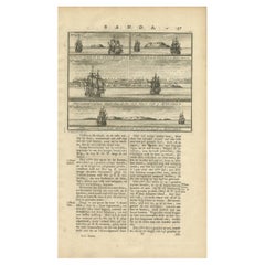
Views of Amsterdam, Middelburg and Pylsteerten Island, Indonesia, 1726
Located in Langweer, NL
Antique print from an old Dutch publication of a VOC mission to nowadays Indonesia titled 'Pylsteerten Eyland als het O.N.O. 6 Mylen van u is ; Pylsteerten Eyland als het O.Z.O. 3 Mylen van u is ; Aldus vertoond t'Eyland Amsterdam als het Oost Noort Oost 3 Mylen van u is ; Aldus vertoond't Eyland Middelburg als het Oost ten Zuyde 4 Mylen van u is'. Views of Amsterdam...
Category
Antique 18th Century Maps
Materials
Paper
$152 Sale Price
20% Off
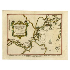
Antique Map of the Bay Near Huchou Island by Van Schley, 1758
Located in Langweer, NL
Antique map titled 'Carte de la Baye d' Hocsieu et des entrees de la Riviere de Chang situees dans la Province de Foyken.' Original antique map of the bay nea...
Category
Antique 18th Century Maps
Materials
Paper
$164 Sale Price
20% Off
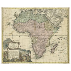
Antique Map of Africa, Cartouche with Elephant Tusks and Horned Serpent, 1737
Located in Langweer, NL
Antique map of Africa titled 'Africa Secundum Legitimas Projectionis Stereographicae regulas (..)'.
Johann Matthias Haas' revision of J.B. Homann's 1715 map of Africa, augmented to include important cartographic developments as recorded by Guillaume Delisle and D'Anville. The map presents a fairly accurate picture without most of the fictitious lakes and rivers of previous cartography, focusing on the known coastal regions of the continent, leaving the interior blank or marked Terra Incognito. Egypt, Nubia and Abyssinia are shown as distinct entities, Lake Nyasa is shown as Lac Marawi, and the Congo is located. The Dutch settlements of Castell Batov and Stellenbosch are shown at the Cape. The most striking feature of the map is the large title cartouche that is framed by elephant tusks and a horned serpent. In the foreground is a scene of natives negotiating with European traders, surrounded by indigenous animals. In the background is a view of Table Bay...
Category
Antique 18th Century Maps
Materials
Paper
$934 Sale Price
20% Off
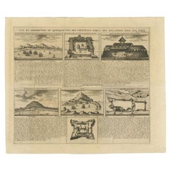
Antique Print of Forts and Views of the East Indies by Chatelain (1719)
Located in Langweer, NL
Antique print titled 'Vue et Description de Quelques-Uns des Principaux Forts des Hollandois dans les Indes'. Interesting sheet with seven detailed views illustrating the most import...
Category
French Antique 18th Century Maps
Materials
Paper
$408 Sale Price
30% Off
Old Map of Ancient Rome Illustrating Major Monuments and the Seven Hills, c.1704
Located in Langweer, NL
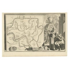
Antique map Rome titled 'Omnia Romanae cedant Miracula Terrae (..)'. Map of Ancient Rome Illustrating Major Monuments and the Seven Hills. This map or...
Category
Antique 18th Century Maps
Materials
Paper
$362 Sale Price
20% Off
Antique French Map of Asia with Original Border Colouring, c.1785
Located in Langweer, NL
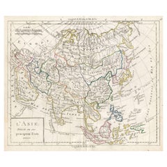
Antique map titled 'L'Asie divisee en ses principaux Etats.' (Map of Asia and its principal states). This map originates from an Atlas by Didier Robert de Vaugondy or his successor D...
Category
Antique 18th Century Maps
Materials
Paper
$114 Sale Price
20% Off
Antique Map of the Roadstead of Bantam by Van der Aa, 1725
Located in Langweer, NL
Antique map titled 'La rade de Bantam'. (The roadstead of Bantam.) This map shows the Indonesian city of Banten / Bantam on Java, Indonesia and its roadstead. With compass rose and s...
Category
Antique 18th Century Maps
Materials
Paper
$250 Sale Price
20% Off
Antique Map of South America by Tirion, c.1765
Located in Langweer, NL
Antique map titled 'Kaart van het Onderkoningschap van Peru zig uitstrekkende: over Chile, Paraguay en andere Spaansche Landen als ook van Brazil en verdere Bezittingen van Portugal ...
Category
Antique 18th Century Maps
Materials
Paper
$331 Sale Price
20% Off
Rare Antique Map of Part of Europe and Africa by Scherer, C.1703
Located in Langweer, NL
Antique map with two figures. The upper figures showing part of Europe and Africa. Below a chart. Printed for Scherer's 'Atlas Novus' (1702-1710). Artists and Engravers: Heinrich Sch...
Category
Antique 18th Century Maps
Materials
Paper
Map of Amersfoort and Surroundings by Covens & Mortier, published in 1747
Located in Langweer, NL
Map of Amersfoort and Surroundings by Covens & Mortier, published in 1747
Hand-coloured copper engraving titled *Carte Particulière des Environs de Amersfoort*, created by Jean Cove...
Category
Antique 18th Century Maps
Materials
Paper
$228 Sale Price
20% Off
Homann Heirs Map of France – Antique Hand-Colored, circa 1745
Located in Langweer, NL
Antique map titled 'Gallia Postarum geographice designata in qua Cursus Postarum Secundum Statum (..)'. Unusual postal map of France, with coat of arms. Very detailed map showing all...
Category
German Antique 18th Century Maps
Materials
Paper
$381 Sale Price
20% Off
Antique Print of a Cottage in an English Garden by Le Rouge, c.1785
Located in Langweer, NL
Antique print titled 'Exterieur de la Chaumiere du Jardin Anglais'.
Copper engraving of a cottage in an English garden. This print originates from '...
Category
Antique 18th Century Maps
Materials
Paper
$352 Sale Price
20% Off
Antique Map of Seram Island by Keizer & De Lat, c.1747
Located in Langweer, NL
Antique map titled 'Kaart van het eiland Ceram'. Rare and uncommon map of Seram Island, Indonesia. One of the earliest separately printed maps of the island. Artists and Engravers: P...
Category
Antique 18th Century Maps
Materials
Paper
$217 Sale Price
20% Off
Antique Map of the Region of Orleans by Homann Heirs, c.1760
By Homann Heirs
Located in Langweer, NL
Antique map titled 'Novissima Totius Aureliani Generalitatis (..) - Nouvelle Carte du Gouvernement General et Militaire d'Orleans (..).' Detailed map by Rizzi Zononi covering the vic...
Category
Antique 18th Century Maps
Materials
Paper
$214 Sale Price
20% Off
Antique Map of the Province of Noord-Holland by Keizer & De Lat, 1788
Located in Langweer, NL
Antique map titled 'La Nord Hollande (..)'. Uncommon antique map of the province of Noord-Holland, the Netherlands. This map originates from 'Nieuwe Natuur- Ge...
Category
Antique 18th Century Maps
Materials
Paper
Antique Map of the Region of Pasuruan, Java, Indonesia, 1726
Located in Langweer, NL
"Map of the region around Pasuruan. It shows the location of rice fields, the village Bangil, as well as three places named Pagger (also Pagar), a cluster of buildings surrounded by a bamboo fence. The location of a earthen wall with pallisade and small cannons...
Category
Antique 18th Century Maps
Materials
Paper
Pl. 3 Antique Print of a Winter Garden by Le Rouge, c.1785
Located in Langweer, NL
Antique print titled 'Coupe du nouveau Berceau ou Jardin d'Hiver (..)'. Copper engraving showing a winter garden. This print originates from 'Jardins Anglo-Chinois à la Mode' by Geor...
Category
Antique 18th Century Maps
Materials
Paper
Antique Map of the Banda Islands in Indonesia by Valentijn, 1726
Located in Langweer, NL
Antique map Indonesia titled 'Kaart der Zuyd-Wester Eylanden van Banda'. Map of the islands in the southwestern part of the Banda Sea including ...
Category
Dutch Antique 18th Century Maps
Materials
Paper
$476 Sale Price
20% Off
Antique Map of Southern Brazil and Uruguay by Bonne, c.1780
Located in Langweer, NL
"Antique map titled 'Carte de la Partie Meridional du Bresil avec les Possessions Espagnoles Voisines Qui en Sont a l'Ouest.' Map of southern Brazil and present-day Uruguay from Port...
Category
Antique 18th Century Maps
Materials
Paper
$133 Sale Price
20% Off
Antique Map of the Bukhari Region by Van Schley, 1758
Located in Langweer, NL
Antique map titled 'Carte de la petite Bukharie et pays voisins.' Original antique map of the Bukhari (Sinkiang in north-western China) and neighboring countries. While these maps by...
Category
Antique 18th Century Maps
Materials
Paper
$141 Sale Price
20% Off
Antique Map of the Banda Islands and the Route of Abel Tasman, Indonesia, 1726
Located in Langweer, NL
Antique print Indonesia with an image on each side. The first image depicts Ontong Java, one of the largest atolls on earth. On verso: antique map of the Banda Islands. With the rout...
Category
Antique 18th Century Maps
Materials
Paper
$402 Sale Price
24% Off
Old Copper Engraving of the Siege of Syracuse, Sicily, Italy, Published, ca.1740
Located in Langweer, NL
Antique print titled 'Syracuse, Assiégée par les Atheniens'.
Old print of the siege of Syracuse, Sicily, Italy. Source unknown, to be determined.
The siege of Syracuse by the...
Category
Antique 18th Century Maps
Materials
Paper
$266 Sale Price
20% Off
Original Antique Engraving of the Admiralty Islands 'Bismarck Archipelago', 1774
Located in Langweer, NL
Antique print titled 'Trois Vues des Isles de l'Amirauté (..)'. Several coastal views of the Admiralty Islands. Originates from 'Geschichte der See-Reisen und Entdeckungen im Süd-Mee...
Category
Antique 18th Century Maps
Materials
Paper
Antique Map of Gaasterland in Friesland, the Netherlands, 1718
Located in Langweer, NL
Antique map titled 'Gaasterland. De zevende Grietenije van de Zevenwolden (..)'. Original antique map of Gaasterland, Friesland, the Netherlands. Originates from 'Uitbeelding van de ...
Category
Antique 18th Century Maps
Materials
Paper
$619 Sale Price
20% Off
Original Antique Print of the Waterfall of Saint-Leu in France, 1776
Located in Langweer, NL
Antique print titled 'Vue de Rocher, Temple et Cascade de St. Leu'. Copper engraving showing the rocks, temple and waterfall of Saint-Leu. This print originates from 'Jardins Anglo-C...
Category
Antique 18th Century Maps
Materials
Paper
$330 Sale Price
11% Off
Antique Print of the Monuments of Herculaneum by Bayardi, 1762
Located in Langweer, NL
Antique print originating from 'Le Antichita di Ercolano Esposte'. A vast survey of the bronzes, statues, wall-paintings, and monuments of Herculaneum. This monumental work was the f...
Category
Antique 18th Century Maps
Materials
Paper
Rare Map of St. Louis on the Island of Hispaniola 'Santa Domingo', 1748
Located in Langweer, NL
Description: Antique map titled 'A New & Exact Planof the Harbour of Port Louis (..)'.
Scarce early plan of the Harbor of St. Louis on the Island of Hispaniola (Santa Domingo), showing the the harbor at the time it was taken by Admiral Knowles in March 1748. Charles Knowles (1704 – 1777) was an officer of the Royal Navy, who saw service during the War of Jenkins' Ear, the War of the Austrian Succession, and the Seven Years War. He also briefly served with the Imperial Russian Navy...
Category
Antique 18th Century Maps
Materials
Paper
$333 Sale Price
20% Off
Antique Optica Print of Huis ten Bosch, The Netherlands, c.1760
Located in Langweer, NL
Antique print titled 'Gesigt van het Huys de Oranje Zaal'. View of Huis ten Bosch, a royal palace in The Hague, the Netherlands. This is an optical print, also called 'vue optique' o...
Category
Antique 18th Century Maps
Materials
Paper
$276 Sale Price
20% Off
Antique Print of Rome by Daumont, c.1770
By Daumont
Located in Langweer, NL
Antique print titled 'Vue d'Optique representant Rome dans sa Splendeur Ancienne (..)'. Optical print representing Rome in its ancient splendour. This is an optical print, also calle...
Category
Antique 18th Century Maps
Materials
Paper
$419 Sale Price
20% Off
Antique Print of Mount Sinai in Egypt, 1773
Located in Langweer, NL
Antique print titled 'Gezigt van de Berg Sinai uit de haven van Tor'. Old print depicting Mount Sinai and the rock of Meriba. Originates from the first Dut...
Category
Antique 18th Century Maps
Materials
Paper
$343 Sale Price
20% Off
Old Map Guiana, Columbia Venezuela, Andalusia in South America by Bonne, c.1780
Located in Langweer, NL
Antique map titled 'Carte du Nouv. Rme. de Grenade, de la Nou'le Andalousie, et de la Guyane, avec les pays Limitrophes qui en sont au sud'.
Detailed map covering part of South Ame...
Category
Antique 18th Century Maps
Materials
Paper
Antique Print of the West Front of Cholmondeley Hall by Campbell, 1717
Located in Langweer, NL
Antique print titled 'The West Prospect of Cholmondeley Hall (..)'. Elevation of the west front of Cholmondeley Hall, seat of the Earl of Cholmondeley. This print originates from 'Vitruvius Britannicus...
Category
Antique 18th Century Maps
Materials
Paper
Antique Print of Batavia 'Jakarta' in the Dutch East Indies in Asia, 1705
Located in Langweer, NL
Antique print Indonesia titled 'Batavia'. Beautiful view of Batavia, Indonesia. This print originates from 'Algemeene weereld-beschryving, nae de rechte verdeeling der landschappen (...
Category
Antique 18th Century Maps
Materials
Paper
$514 Sale Price
20% Off
Old Map of Turkmenistan, Uzbekistan, Afghanistan, Tajikistan, Kyrgyzstan, 1757
Located in Langweer, NL
Antique map titled 'Kort over det Lille Bukarie og de naest graensende Lande. af Engelske Skribentere ved N. Bellin Ingenieur ved Marinen efter Söe Etaten'.
Map of present-day Turkmenistan, Uzbekistan, Afghanistan, Tajikistan, Kyrgyzstan including part of China. Originates from 'Almindelig histoirie over reiser til lands og bands (..)'. This 17 volume set is a translation of Collection of voyages and travels edited by Awnsham and John Churchill and Thomas Osborne...
Category
Antique 18th Century Maps
Materials
Paper
$305 Sale Price
20% Off
Antique Map of the Moluques Islands, Part of Indonesia, circa 1750
Located in Langweer, NL
Map of the Moluques (also known as the Moluccas, Moluccan Islands or simply Maluku). Depicts the islands of Herij, Ternate, Tidor, Pottebackers, Timor, Machian and Bachian.
Category
Antique 18th Century Maps
Materials
Paper
$200 Sale Price
20% Off
Antique Map of Japan by J.N. Bellin, 1752
Located in Langweer, NL
Bellin's wonderfully detailed map of Japan from the atlas of Prevost d'Exiles' influential collection of travel narratives, Histoire Generale des Voyages. Considered the best general...
Category
Antique 18th Century Maps
Materials
Paper
$438 Sale Price
20% Off
Antique Plan of the Forts and Town of St. Yago in the Cape Verde Islands, 1747
Located in Langweer, NL
Antique map titled 'Plan de la Ville et des Forts de St. Yago - Grondtekening van de Stad en Forten van St. Iago'. Plan of the Forts and Town of St. Yago in the Cape Verde Islands. T...
Category
Antique 18th Century Maps
Materials
Paper
$228 Sale Price
20% Off
Antique Handcolored Print of the City Hall of Amsterdam, The Netherlands, c.1780
Located in Langweer, NL
Antique print titled 'Maison de Ville d'Amsterdam (..) - 't Stadhuys van Amsteldam (..)'. View of the city hall of Amsterdam. Source unknown, to be determined. Published circa 1780.
...
Category
Antique 18th Century Maps
Materials
Paper
$228 Sale Price
20% Off
Antique Print of the Waterfall of Saint-Leu in France, 1776
Located in Langweer, NL
Antique print titled 'Vue de la deuxieme cascade de St. Leu'. Copper engraving showing the waterfall of Saint-Leu. This print originates from 'Jardins Anglo-Chinois à la Mode' by Geo...
Category
Antique 18th Century Maps
Materials
Paper
$305 Sale Price
20% Off
Antique Map of Asia with Additional Country Information, c. 1749
Located in Langweer, NL
Antique map titled 'L'Asie divisée en ses principaux Empires et Royaumes'. Detailed map of Asia, with a large table on the right side, providing information about the various major c...
Category
Antique 18th Century Maps
Materials
Paper
$1,716 Sale Price
20% Off
Interesting Map of the Thousand Islands in the Bay of Batavia 'Jakarta', ca.1740
Located in Langweer, NL
A single unfolded page border colored engraved map, printed no. 107 in top corner. This same map is found as plate 107 in Atlas Universelle aus dem Jahre 1787 by Philippe de Pretot b...
Category
Antique 18th Century Maps
Materials
Paper
$324 Sale Price
20% Off
Antique Map of Kerguelens Island Coast in the Indian Ocean by Cook, 1785
By James Cook
Located in Langweer, NL
Antique print titled 'Kerguelen's Land (..)'. Antique map of Kerguelens island coast, known today as the Desolation islands. Originates from 'Voyage to the Pacific Ocean, undertaken ...
Category
Antique 18th Century Maps
Materials
Paper
Rare Print of the Pearl Bastion of Castle Batavia in the Dutch East Indies, 1770
Located in Langweer, NL
Antique print titled 'Prospect von der Bastion Perl langst der Courtine des Castells Batavia / Vue de la Bastion Perl de Batavie.' View of the Parel Bastion (Pearl Bastion) of Castle...
Category
Antique 18th Century Maps
Materials
Paper
$505 Sale Price
20% Off
Antique Print of a Cave in Saint-leu-taverny in France C.1785
Located in Langweer, NL
Antique print titled 'Vüe dessinée dans l'intérieur de la Grotte de St. Leu Taverni'. Copper engraving showing a cave in Saint-Leu-Taverny. This print originates from 'Jardins Anglo-...
Category
Antique 18th Century Maps
Materials
Paper
$324 Sale Price
20% Off
Antique Map of the Coast of North and East Asia by Diderot, 1751
Located in Langweer, NL
Map 3: 'Nouvelle Representation des Cotes Nord et Est de L'Asie'. (New map of the coast of North and East Asia.) Three maps on one sheet. Depicting three maps centered on mainland Ch...
Category
Antique 18th Century Maps
Materials
Paper
$209 Sale Price
20% Off
Antique Print of the Region of the Hayes river, Northern Manitoba, Canada, 1759
Located in Langweer, NL
Two images on one sheet titled 'Quartier d'Hyver dans la Riviere de Hayes' and 'Maison de Montagu'. The Dobbs Galley (William Moor) and California (Francis Smith...
Category
Antique 18th Century Maps
Materials
Paper
Pl. 4 Antique Print of a French Garden Summer House by Schübler, c.1724
Located in Langweer, NL
Antique print titled 'Ein Frantzösches Sommer Haus zu Ende eines Lust Gartens (..)'. Copper engraving showing a French garden summer house. This print originates from a series of gar...
Category
Antique 18th Century Maps
Materials
Paper
$88 Sale Price
20% Off
Antique Print of the Gardens at Cape of Good Hope by Van Schley, 1756
Located in Langweer, NL
Antique print titled 'Jardin de la Compagnie au Cap de Bonne Esperance, Compagnies Tuyn aan de Kaap de Goede Hoop'. This print depicts the Gardens at Cape of Good Hope (VOC). This pr...
Category
Antique 18th Century Maps
Materials
Paper
$157 Sale Price
20% Off
Pl. 5 Antique Print of a Garden Pavilion by Schübler, c.1724
Located in Langweer, NL
Antique print titled 'Ein ansehliches neu Invertirtes Lust und Somer Haus (..)'. Copper engraving showing a garden pavilion. This print originates from...
Category
Antique 18th Century Maps
Materials
Paper
$88 Sale Price
20% Off
Antique Map of Part of Southern Asia by Bonne, c.1780
Located in Langweer, NL
Antique map titled 'Carte de la Partie Superieure de l'Inde en deca du Gange. Comprise entre la Cote du Concan et celle d'Orixa, avec l'Empire du Mogol, le Bengale, le R. d'Asham, pa...
Category
Antique 18th Century Maps
Materials
Paper
$119 Sale Price
20% Off
Decorative Original Antique Panoramic View of Atjeh on Sumatra, Indonesia, 1756
Located in Langweer, NL
Antique print titled 'Achem - Atsjien'.
Decorative panoramic view of Atjeh on Sumatra, Indonesia. On this engraving a pagode like building is visible in the background. In the fo...
Category
Antique 18th Century Maps
Materials
Paper
$314 Sale Price
20% Off
Pl. 11 Antique Print of Garden Fountains by Le Rouge, c.1785
Located in Langweer, NL
Antique print titled 'Projet de Fontaine (..)'. Copper engraving of fountain designs. This print originates from 'Jardins Anglo-Chinois à la Mode' by Georg Louis le Rouge. Artists an...
Category
Antique 18th Century Maps
Materials
Paper
Antique Map of Asia by Guthrie, 1787
Located in Langweer, NL
Antique map titled 'Asia from the best Authorities'. Old map of the Asian continent. This map originates from 'A New Geographical, Historical and Commercial Grammar; and Present State of the several Kingdoms of the World' 10th ed. by W. Guthrie.
Artists and Engravers: Published by Ch.Dilly; GGJ...
Category
Antique 18th Century Maps
Materials
Paper
$138 Sale Price
20% Off
Antique Map of the Kingdom of Bohemia by Keizer & de Lat, 1788
Located in Langweer, NL
Antique map titled 't Koninkryk Bohemen (..)'. Uncommon original antique map of the Kingdom of Bohemia. This map originates from 'Nieuwe Natuur- Geschied- en Handelkundige Zak- en Re...
Category
Antique 18th Century Maps
Materials
Paper
$333 Sale Price
20% Off
Antique Map of Southeast Asia by Dussy, 1778
Located in Langweer, NL
"Antique map titled 'Indostan presqu'isles de l'Inde, Chine, Tartarie Independante.' - A map of Asia: Hindustan, India and China. This map originates from 'Nouvel Atlas Portatif dest...
Category
Antique 18th Century Maps
Materials
Paper
$209 Sale Price
20% Off
Antique Print of Ospizio Apostolico di San Michele by De Rossi, c.1710
Located in Langweer, NL
Antique print titled 'Fianco delle Carceri per Correzzione della Giouentu poste à S. Michele à Ripa'. Old print of the Ospizio di San Michele a Ripa Grande (Hospice of St Michael) or...
Category
Antique 18th Century Maps
Materials
Paper
Antique Map of Northern India by Bonne, 1780
Located in Langweer, NL
Antique map titled 'Carte de la partie Supérieure de l'Inde (..)'. A fine example of Rigobert Bonne and Guilleme Raynal?s 1780 map of northern India. Covers the northern part of Indi...
Category
Antique 18th Century Maps
Materials
Paper
Antique Map of France under the Reign of Charles VII by Zannoni, 1765
Located in Langweer, NL
Antique map France titled 'La France sous le Règne de Charles VII (..)'.
Beautiful old map of France. This map originates from 'Atlas Historique de la ...
Category
Antique 18th Century Maps
Materials
Paper
$151 Sale Price
20% Off
Antique Map of the Maluku Islands by Van der Aa, 1714
Located in Langweer, NL
Antique Map Moluccas titled 'Les Isles Moluques'. Rare map of the Spice Islands made after a map engraved by Pieter van den Keere and published in the 1628 edition of the Mercator At...
Category
Antique 18th Century Maps
Materials
Paper
$189 Sale Price
20% Off
Rare Authentic Engraved Map of Large Part of Indonesia by Stavorinus, 1779
Located in Langweer, NL
Antique map titled 'Carte de la Navigation de Batavia a Amboina'. Rare chart of Indonesia including Borneo, Java, Celebes, Ceram and more. This map originates from 'Voyage par le Cap...
Category
Antique 18th Century Maps
Materials
Paper
$704 Sale Price
20% Off
